(ENG-ITA) Swe(ea)t MTB #23 - [Photos by voiceoff]
Session 22 - 17 July

I start this new week with a slightly different program, I want to experiment with a different activity. Sunday I will understand if this idea was good or not. The two previous weeks I have always started with a long but less intense session (with more limited altimetric difficulties). Then continuing the following days facing harder climbs, and I ended up finding myself on Friday or Saturday particularly tired. This time I want to try to do the reverse. So I decided to start with a climb that I had never even experienced in previous years: the ascent of Tres Coas. In Sardinian it means "Three Tails", but don't ask me where this name comes from, I haven't the faintest idea.
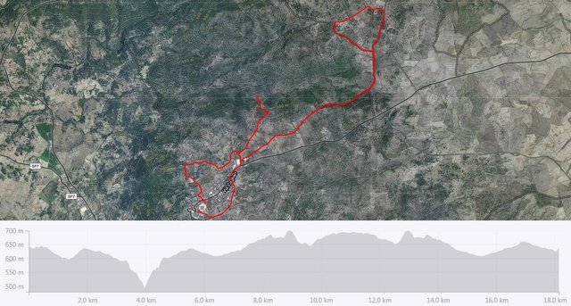
You can see the "V" in the altimetric profile, and you can also understand how hard it can be. I did not even get to the end, I had a little fear, then looking on the map I saw that continued for another 400 meters (and probably another 50 meters in altitude - minimum - to be overcome). However, we can say that the piece I did as a first approach can be considered sufficient. We are talking about almost a kilometer of climb with the first 500 meters very hard: slopes that often exceed 30%. Basically you have to throw yourself on the handlebars otherwise the front wheel comes off the ground... I'm not kidding!
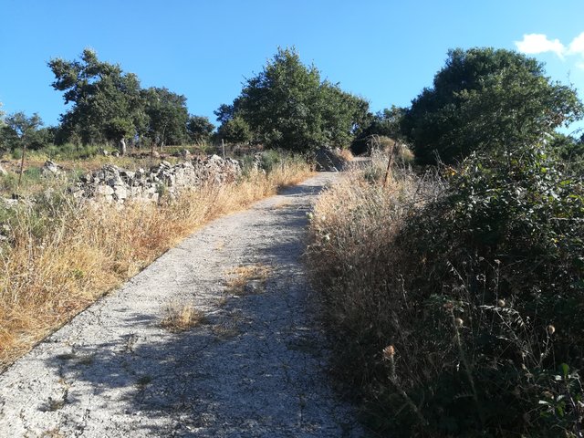
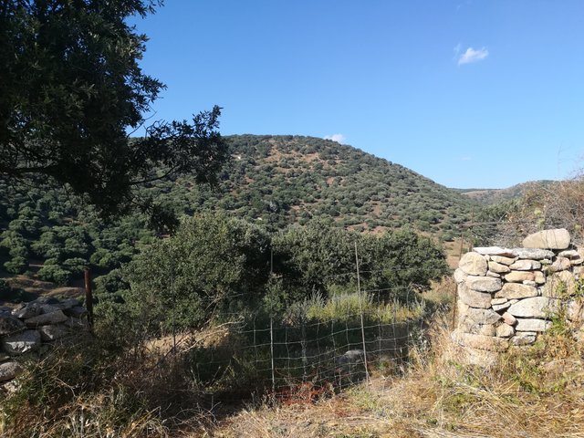
In the end I was almost disappointed, in the sense that maybe I could even do it all, but that's okay, surely I'll go down again this week and I'll certainly try to climb it all. For the rest it was a quiet session, I really enjoyed it so much so that I also forgot to take some more photos. The two you see below are two souvenirs from Tres Coas.
Km: 18.13;
Difference in altitude: 492 m.;
Time: 1 hour and 33 minutes.
Difference in altitude: 492 m.;
Time: 1 hour and 33 minutes.
[TOT 2018]
Km: 433.97;
Difference in altitude: 9151 m.;
Time: 36 hours and 50 minutes.
Km: 433.97;
Difference in altitude: 9151 m.;
Time: 36 hours and 50 minutes.

Inizio questa nuova settimana con un programma leggermente diverso, voglio sperimentare un'attività differente e vedere di capire domenica se sarà stata una buona idea o meno. Le due settimane precedenti ho sempre iniziato con una sessione lunga ma meno intensa per quanto riguarda le difficoltà altimetriche per poi continuare le giornate successive affrontando salite più dure, e ho finito per ritrovarmi poi, il venerdì o il sabato, particolarmente stanco. Questa volta voglio provare a fare l'inverso. Ho quindi pensato di iniziare con una salita che non avevo mai provato neppure gli anni precedenti: la salita di Tres Coas. In sardo significa "Tre Code", ma non chiedetemi da dove provenga questo nome, non ne ho la più pallida idea.
Potete notare la "V" nel profilo altimetrico, e potete anche intuire quanto possa essere "croccante". Il bello è che non sono neanche arrivato fino in fondo, ho avuto un po' di paura, poi guardando sulla mappa ho visto che continuava per altri 400 metri (e probabilmente altri 50 metri di dislivello - minimo - da superare). Possiamo comunque dire che il pezzetto che ho fatto come primo approccio può essere considerato sufficiente. Stiamo parlando di quasi un chilometro di salita con i primi 500 metri molto duri: pendenze che spesso superano anche il 30%. Praticamente bisogna buttarsi sul manubrio altrimenti la ruota di davanti si stacca da terra, non sto scherzando!
Alla fine sono quasi rimasto deluso, nel senso che forse avrei anche potuto farla tutta, ma va bene così, sicuramente ci proverò nuovamente questa settimana, con l'intento di arrivare fino in fondo. Per il resto è stata una sessione tranquilla, me la sono proprio goduta tant'è vero che ho anche dimenticato di scattare qualche foto in più. Le due che vedete sono due ricordini di Tres Coas.
Km: 18,13;
Dislivello: 492 m.;
Tempo: 1 ora e 33 minuti.
Dislivello: 492 m.;
Tempo: 1 ora e 33 minuti.
[TOT 2018]
Km: 433,97;
Dislivello: 9151 m.;
Tempo: 36 ore e 50 minuti.
Km: 433,97;
Dislivello: 9151 m.;
Tempo: 36 ore e 50 minuti.

Road and Landscape
Here the previous posts:
00, 01, 02, 03, 04, 05, 06, 07, 08, 09, 10, 11, 12, 13, 14, 15, 16, 17, 18, 19, 20, 21, 22.


Da noi c'è una salita leggendaria che si chiama "S'atziada cagamidoi" e si capisce benissimo da dove proviene il nome! lol
ahah... anche da noi esiste qualche nome un po' più "pittoresco"... la più famosa è quella di "poddigh'in culu" :DDD
I remember climbing once with my bike carrying all my gear in the back. I also had to lean forward just to keep the wheel on the ground. But that was just from the extra weight. I can't imagine how steep in must be to need that on a bare bike.
You have to try something like that! :D
You got a 100% upvote from @steemactivities