(ENG-ITA) Swe(ea)t MTB #16 - [Photos by voiceoff]
Session 15 - 3 July
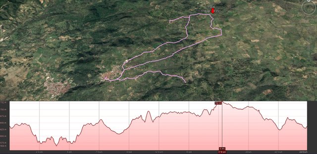
Riding under the sun with 30°C is not too recommendable but you know, sometimes you can not resist. Today, not by chance, I wanted to start the session with the ups and downs of Zurados because for a few kilometers it is possible to shelter among the branches of the cork oak tree that you are crossing. It goes down to 560 meters up to the small bridge on a small river and then go back towards the 660 of the town. The hope was to find, once returned, less prohibitive weather conditions and the idea must say that it worked, but only up to a certain point.
In any case, after these first 7.5 kilometers, I headed east, crossing rather well-known routes. The original intention was to make a small additional tour of about ten kilometers and then return home. During the journey, however, I met a couple of friends who were doing their training and I decided to join them, so I followed them and the session has lengthened a few kilometers compared to what I had planned. I felt pretty fit so I welcomed their invitation.
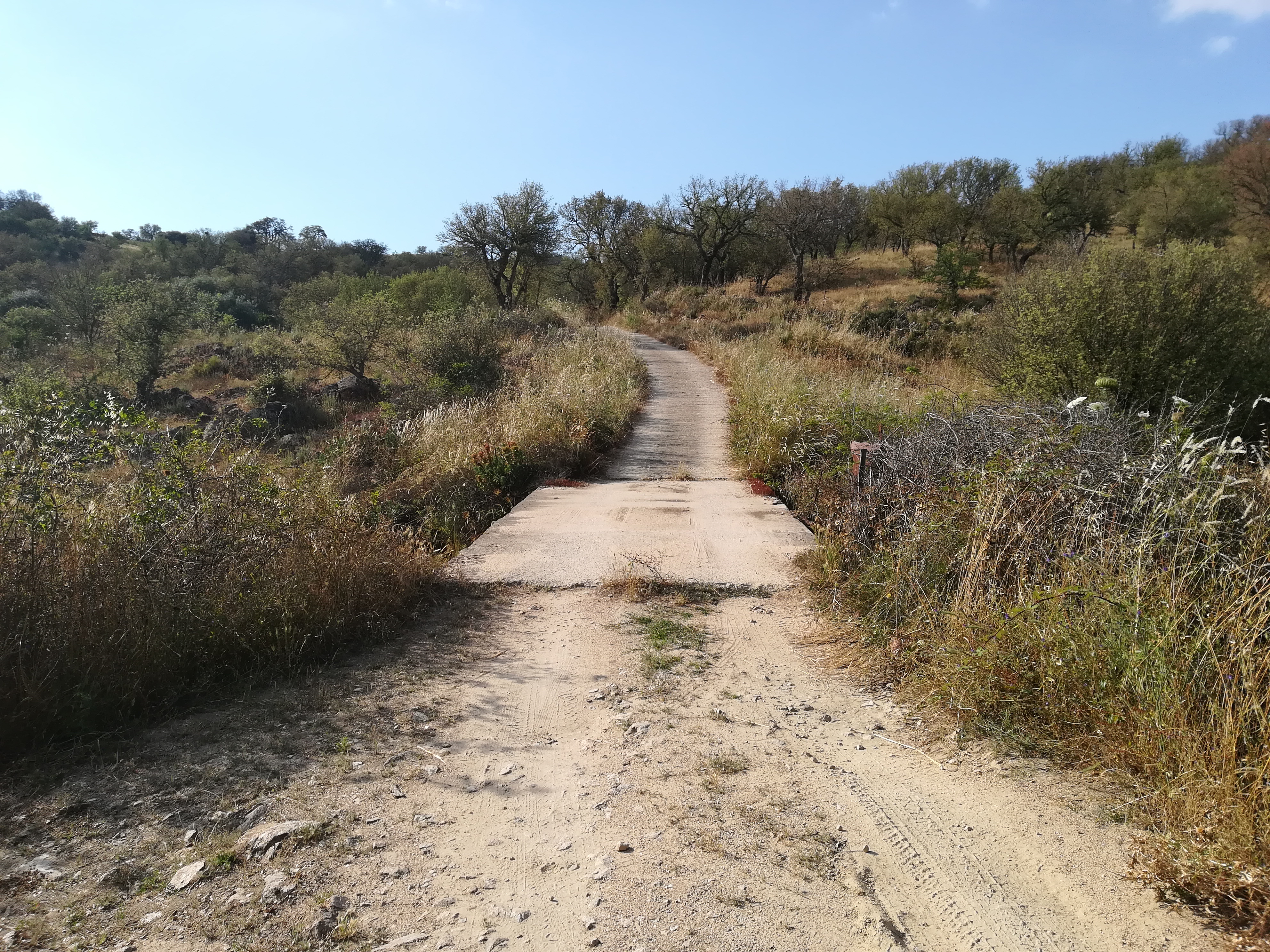
Unfortunately, the application I use to record the track has left me without realizing it so I had to rebuild everything later. Below, however, the report and a single photo taken on the bridge that I said before.
In any case, after these first 7.5 kilometers, I headed east, crossing rather well-known routes. The original intention was to make a small additional tour of about ten kilometers and then return home. During the journey, however, I met a couple of friends who were doing their training and I decided to join them, so I followed them and the session has lengthened a few kilometers compared to what I had planned. I felt pretty fit so I welcomed their invitation.
Unfortunately, the application I use to record the track has left me without realizing it so I had to rebuild everything later. Below, however, the report and a single photo taken on the bridge that I said before.
Km: 24.87;
Difference in altitude: 587 m.;
Time: 2 hours and 0 minutes.
Difference in altitude: 587 m.;
Time: 2 hours and 0 minutes.
[TOT 2018]
Km: 287.34;
Difference in altitude: 5964 m.;
Time: 25 hours and 39 minutes.
Km: 287.34;
Difference in altitude: 5964 m.;
Time: 25 hours and 39 minutes.

Pedalare sotto il sole con 30°C non è pratica troppo raccomandabile ma si sa, a volte non si riesce a resistere. Quest'oggi non a caso ho voluto iniziare la sessione con il saliscendi di Zurados visto che per alcuni chilometri è possibile ripararsi fra le fronde del boschetto di sughere che si sta attraversando. Si scende verso i 560 metri fino al piccolo ponte su un fiumiciattolo per poi tornare indietro e risalire verso i 660 del paese. La speranza era quella di trovare, una volta rientrato, condizioni climatiche meno proibitive e l'idea devo dire che ha funzionato, ma solo fino a un certo punto.
In ogni caso dopo questi primi 7,5 chilometri mi sono diretto verso est, attraversando percorsi ormai abbastanza noti. L'intenzione originaria era quella di fare un piccolo giro aggiuntivo di una decina di chilometri per poi tornare a casa. Durante il percorso ho però incontrato un paio di amici che facevano il loro allenamento e ho deciso di unirmi a loro, così li ho seguiti e la sessione si è allungata di qualche chilometro rispetto a quello che avevo preventivato. Mi sentivo abbastanza in forma quindi ho accolto di buon grado il loro invito.
Purtroppo l'applicazione che uso per registrare la traccia mi ha abbandonato senza che mi accorgessi quindi ho dovuto ricostruire tutto dopo. Di seguito comunque il resoconto e una sola foto scattata sul ponticello che dicevo prima.
Km: 24,87;
Dislivello: 587 m.;
Tempo: 2 ore e 0 minuti.
Dislivello: 587 m.;
Tempo: 2 ore e 0 minuti.
[TOT 2018]
Km: 287,34;
Dislivello: 5964 m.;
Tempo: 25 ore e 39 minuti.
Km: 287,34;
Dislivello: 5964 m.;
Tempo: 25 ore e 39 minuti.
Road and landscape
Here the previous posts:
00, 01, 02, 03, 04, 05, 06, 07, 08, 09, 10, 11, 12, 13, 14, 15.
upvote for me please? https://steemit.com/news/@bible.com/2sysip
Congratulations, Your Post Has Been Added To The Steemit Worldmap!
Author link: http://steemitworldmap.com?author=voiceoff
Post link: http://steemitworldmap.com?post=eng-ita-swe-ea-t-mtb-16-photos-by-voiceoff
Want to have your post on the map too?