(ENG-ITA) Swe(ea)t MTB #11 - Diary of a sportsman in half [Photos by voiceoff]
Session 10 - June 5th


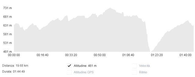
Today I wanted to try the first real obstacle of a certain difficulty: the ascent of Sa Nughe (The Walnut). A madness! Honestly I did not remember it so hard and terrible. From the altimetric profile it is not noticed but in reality it is divided into three steps (and what is in the middle is certainly not in the plain). In terms of slope I believe that the first segment is the most deadly: a hundred meters constantly above 20% (with peaks that reach 30%) but we do it "quietly", we are only at the beginning. The gradient soften for about fifty meters, up to the second step and we are again on 20% (if not beyond), for two hundred meters, and here there is no way: if you are not really trained you put your foot down! From here it becomes like an odyssey that lasts about ten minutes (they are only ten but I assure you that when you are there, they seem much more). The third segment is perhaps the simplest, were it not for the last 30 meters: when you are almost happy because it's almost done you find yourself pedaling on a spike that really breaks your legs. It is the last jolt fortunately. Basically I made a brutal effort!
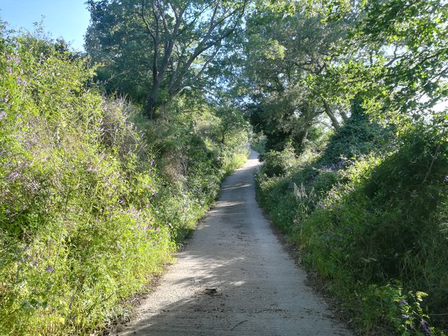
The problem of this climb is not only the slope but also the concrete road surface, that particularly rough cement where the wheels seem to literally stick, and each pedal stroke costs twice the effort.
The problem of this climb is not only the slope but also the concrete road surface, that particularly rough cement where the wheels seem to literally stick, and each pedal stroke costs twice the effort.
Oggi ho voluto provare il primo vero ostacolo di un certo spessore: la salita di Sa Nughe (La Noce). Una pazzia! Sinceramente non la ricordavo così dura. Dal profilo altimetrico non si nota ma in realtà è divisa in tre massacranti gradoni (e quello che sta fra l'uno e l'altro non è certo in pianura). A livello di pendenza credo che il primo spezzone sia il più micidiale: un centinaio di metri costantemente sopra il 20% (con punte che sfiorano il 30%) ma ce la si fa "tranquillamente", siamo solo all'inizio. Le pendenze si addolciscono per una cinquantina di metri, fino al secondo gradone e siamo nuovamente sul 20% (se non oltre), per duecento metri circa, e qua non c'è verso: se non siete davvero allenati il piede a terra lo mettete! Da qui in poi diventa una sorta di odissea che dura una decina di minuti (sono solo dieci ma vi assicuro che quando siete là sembrano molti di più). Il terzo spezzone è forse il più semplice, non fosse per gli ultimi 30 metri: quando siete lì quasi felici perché è quasi fatta vi ritrovate a pedalare su uno spuntone che veramente spezza le gambe. E' l'ultimo sussulto per fortuna. Praticamente ho fatto una fatica bestiale!
Il problema di questa salita non è solo la pendenza ma anche il fondo stradale in cemento, di quel cemento particolarmente ruvido dove le ruote sembrano letteralmente appiccicarsi, e ogni pedalata costa il doppio della fatica.
Il problema di questa salita non è solo la pendenza ma anche il fondo stradale in cemento, di quel cemento particolarmente ruvido dove le ruote sembrano letteralmente appiccicarsi, e ogni pedalata costa il doppio della fatica.
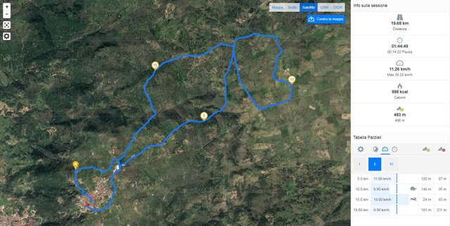
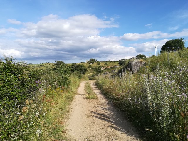
What else to say? This time I was rejected but I think I can do it sooner or later, to do it all in one breath. Below some photos and the report of the day.
Che altro dire? Questa volta sono stato respinto ma conto di riuscirci prima o poi, a farla tutta d'un fiato. Di seguito alcune foto e il resoconto della giornata.

Km: 19.68;
Difference in altitude: 483 m.;
Time: 1 hour and 45 minutes.
Difference in altitude: 483 m.;
Time: 1 hour and 45 minutes.
Km: 19,68;
Dislivello: 483 m.;
Tempo: 1 ora e 45 minuti.
Dislivello: 483 m.;
Tempo: 1 ora e 45 minuti.
[TOT 2018]
Km: 171.58;
Difference in altitude: 3523 m.;
Time: 16 hours and 22 minutes.
Km: 171.58;
Difference in altitude: 3523 m.;
Time: 16 hours and 22 minutes.
[TOT 2018]
Km: 171,58;
Dislivello: 3523 m.;
Tempo: 16 ore e 22 minuti.
Km: 171,58;
Dislivello: 3523 m.;
Tempo: 16 ore e 22 minuti.

The road

00, 01, 02, 03, 04, 05, 06, 07, 08, 09, 10.


Sembra un bel posto in mezzo alla natura! Ma che fatica!!! Io in salita potrei morire, ricordo anni fa che mi veniva da piangere in alcuni tratti quando facevo più giri nelle colline venete 🙈
eheh... XC è così. Il bello è che è molto vario. Ad esempio ci sono anche dei single trek che probabilmente a te piacerebbero molto :)
Magari il prossimo giro ci passo per fare qualche foto!
Il bello delle salite è il ritorno no?
Vale sempre questa regola..
insomma... a volte le discese sono talmente ripide che ti si seccano le braccia a forza di frenare :D
Congratulations, Your Post Has Been Added To The Steemit Worldmap!
Author link: http://steemitworldmap.com?author=voiceoff
Post link: http://steemitworldmap.com?post=eng-ita-swe-ea-t-mtb-11-diary-of-a-sportsman-in-half-photos-by-voiceof
Want to have your post on the map too?
STOP