Peak 16: Mt. Talinis (Cuernos de Negros)
Cuernos de Negros
Situated at the lower portion of Negros Oriental, Mt. Talinis is specifically located between Dauin and Valencia City with entry and exit points at Brgy. Bediao and Brgy. Apolong, respectively. With an altitude of 1,903 meters above sea level, this high mountain is second only to Mt. Kanlaon. Still, it reaches the clouds.
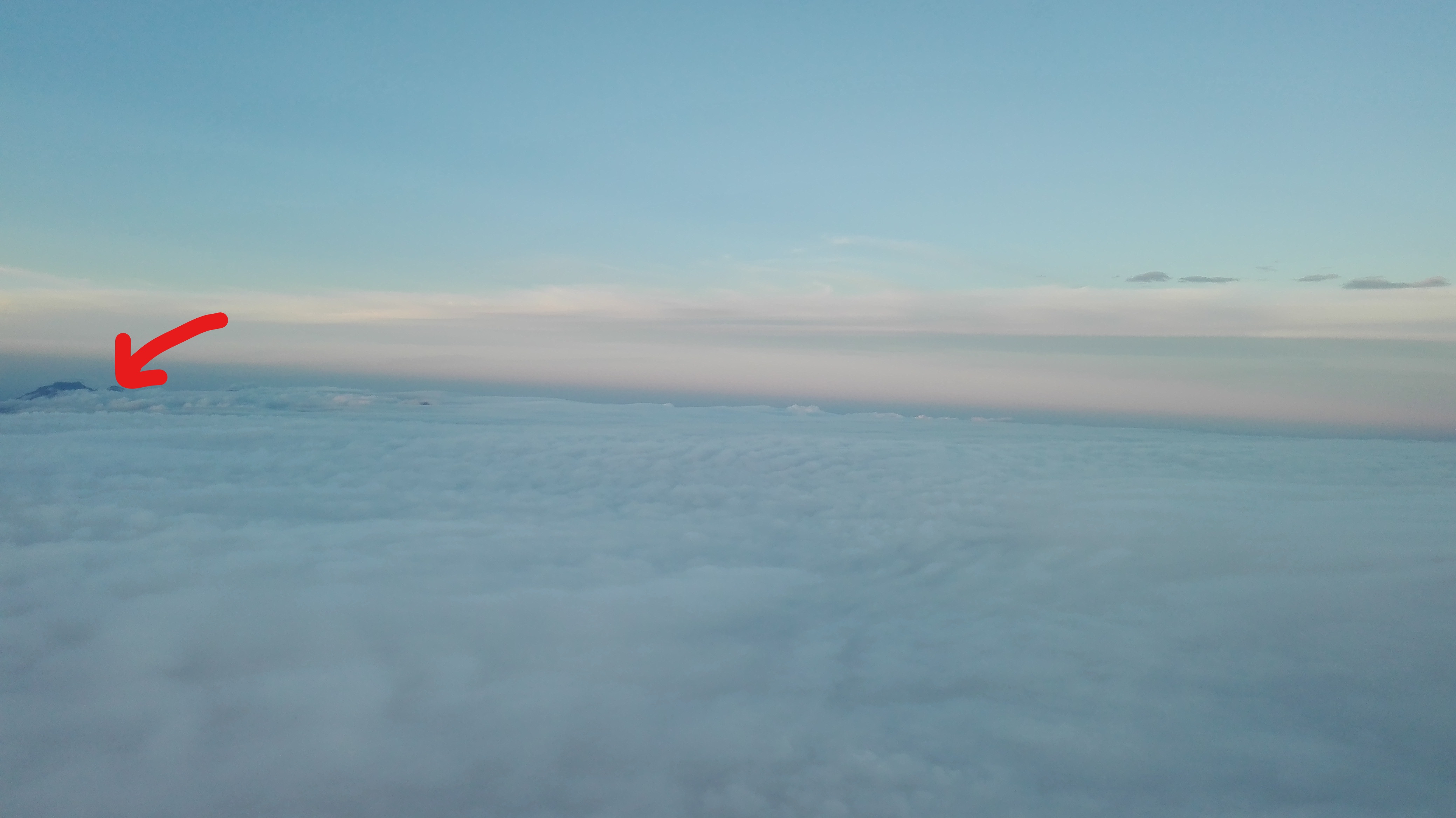
Mt. Talinis is popularly known as "Cuernos de Negros" which was derived from the mountains' horn-like peaks, the most prominent of which are Talinis, Cuernos de Negros, Guinsayawan, Yagumyum Peak and Guintabon Dome. As a part of the Negros Volcanic Belt, Cuernos de Negros is listed as a potentially active volcano that is evident in the scattered hot springs, several solfataras and steam vents around the mountain.
The invitation was sent and I packed up, ready to go.
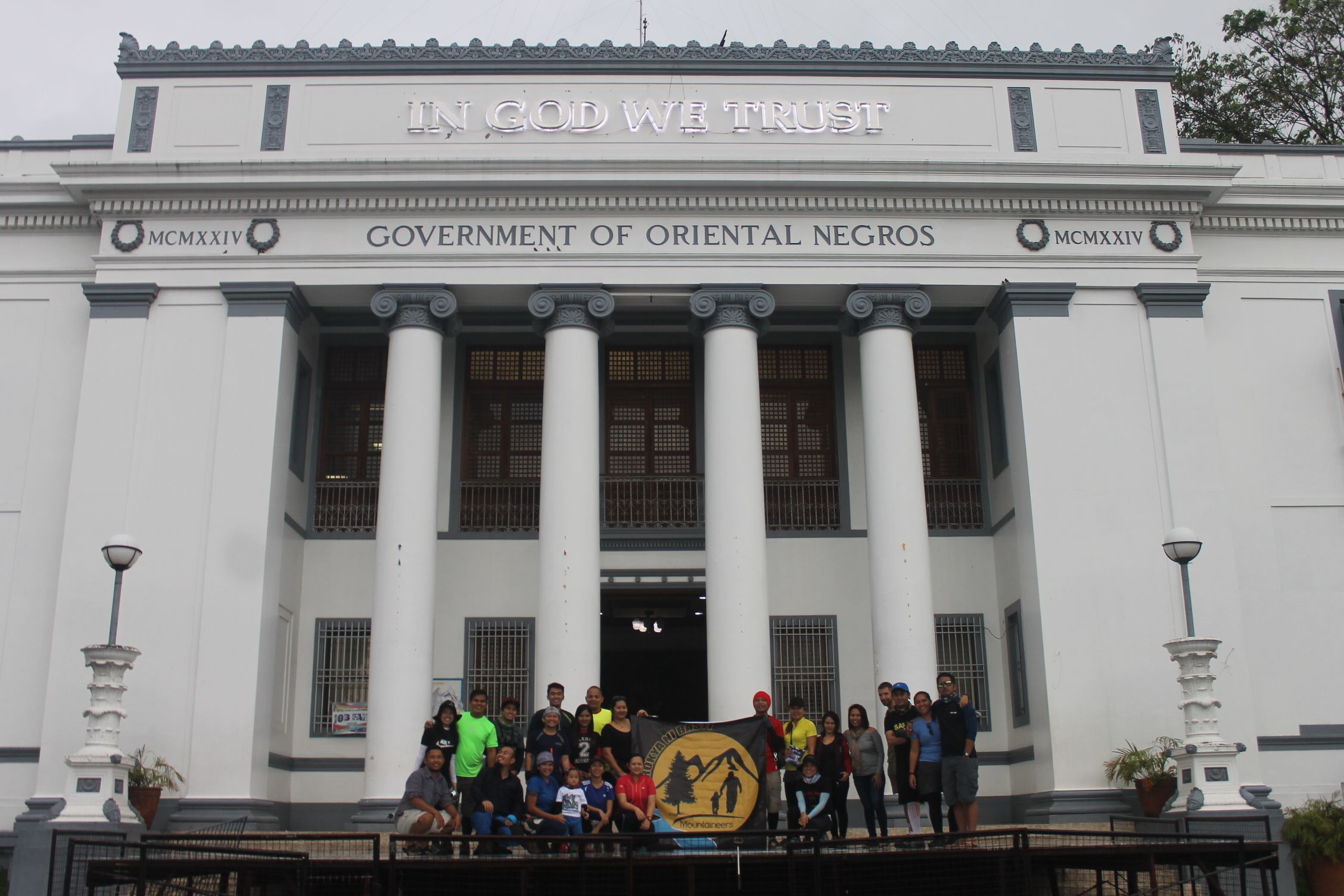
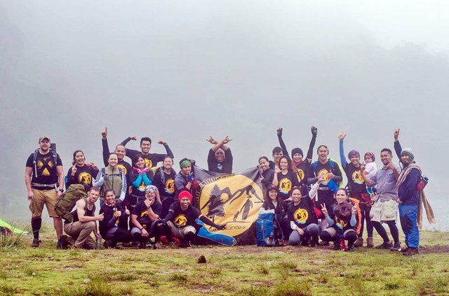
As soon as I climbed down from Mt. Ulap last year with my mentor in my internship (Exploration Department), Sir Rhodel Sarande and his family, he readily invited me to climb Mt. Talinis by February. *(See my post about my Mt. Ulap climb here.) With other friends, we created the mountaineering group, Parokya ni Basti. We were the pioneer members. Sir Ahrdo Malicay, my another mentor in my internship (Mine Geology Department), is our president while sir Rhodel was the expedition leader. There were also non-mountaineers who were invited, thus, an orientation was conducted before the climb. The basics of climbing were discussed, do's and don'ts, the things-to-bring, food assignment and the tent-grouping. We climbed Mt. Talinis on the 24th of February 2017 and came down on the 25th.
The Highlights
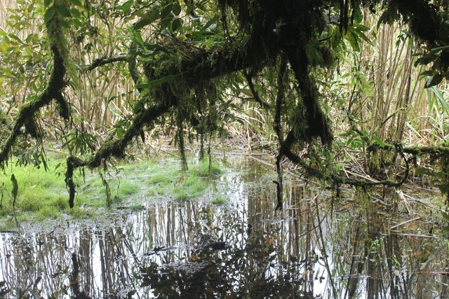
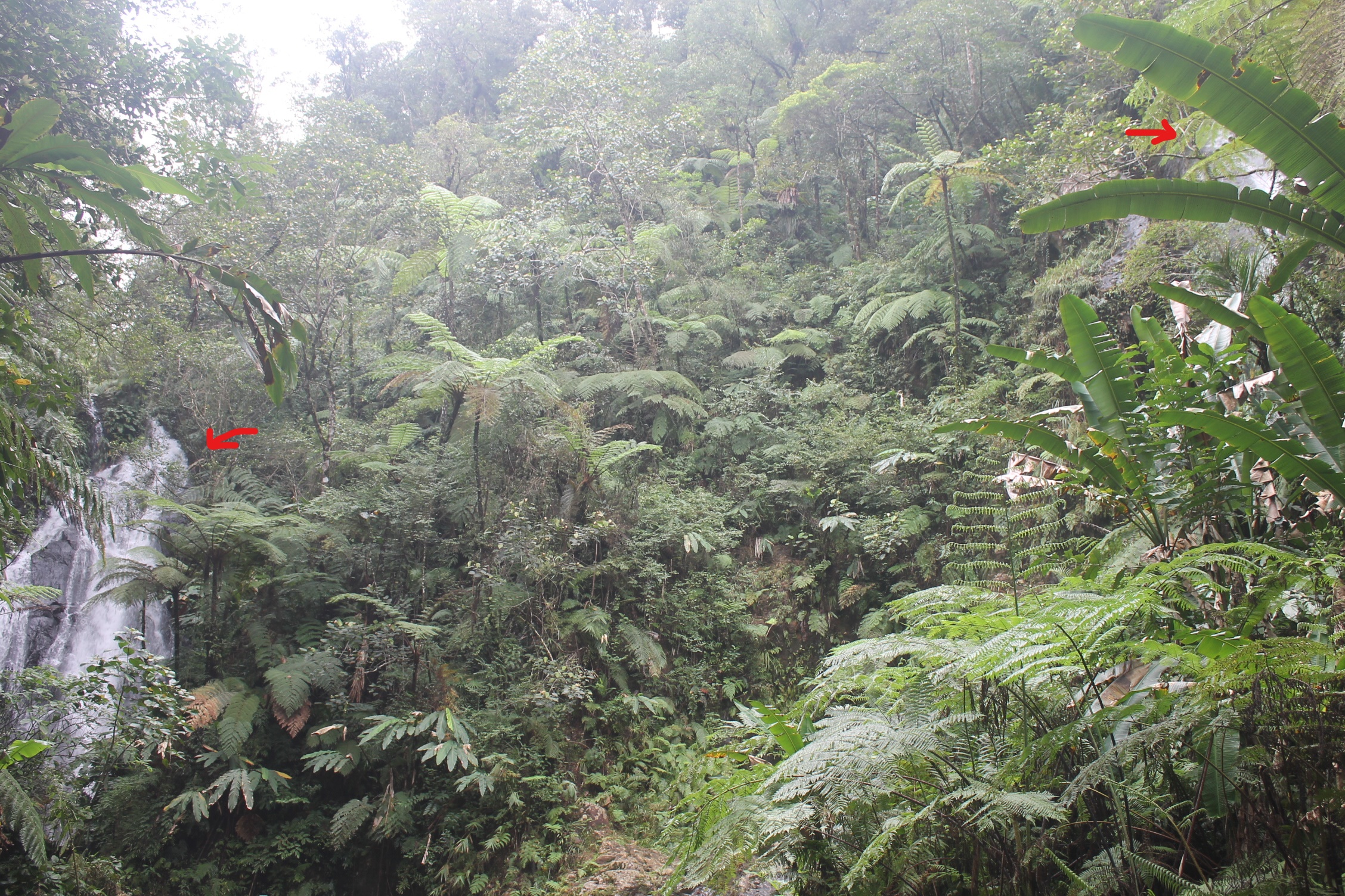
The Mossy Forest
Because I've climbed before, I could compare the Mt. Talinis' trail to other mountains. And I thought, the mossy forest of the Cuernos de Negros is similar to Mt. Makiling's. The thick, mossy forest that seemed untouched is found right before reaching Lake Yagumyum and continues to Lake Nailig. Some of the trail are apparently unseen or hidden (if not pointed by the guides) because of fallen trees and wild plants covering the path. We had to either climb above the log blocking the trail or crawl under it.
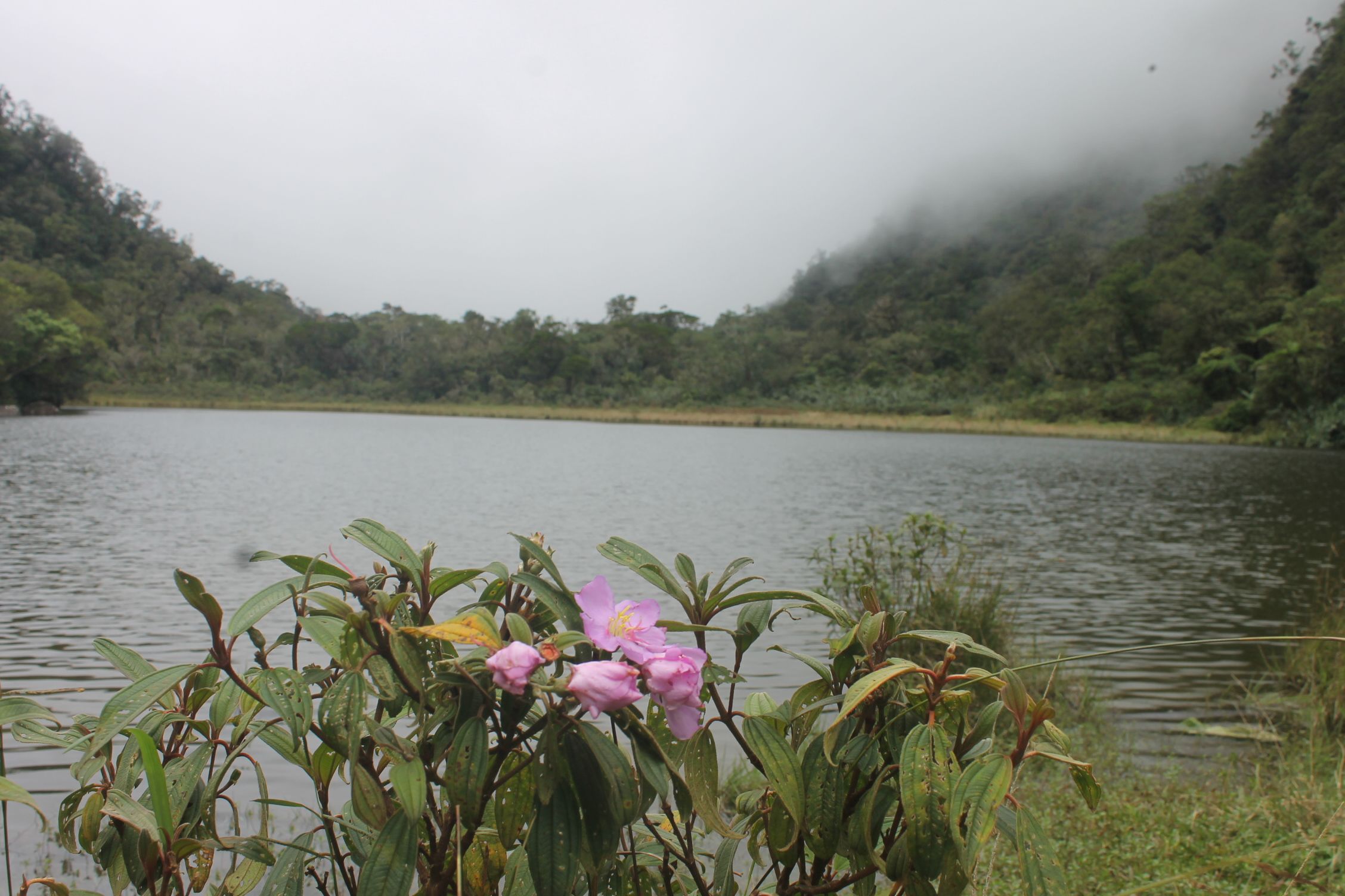
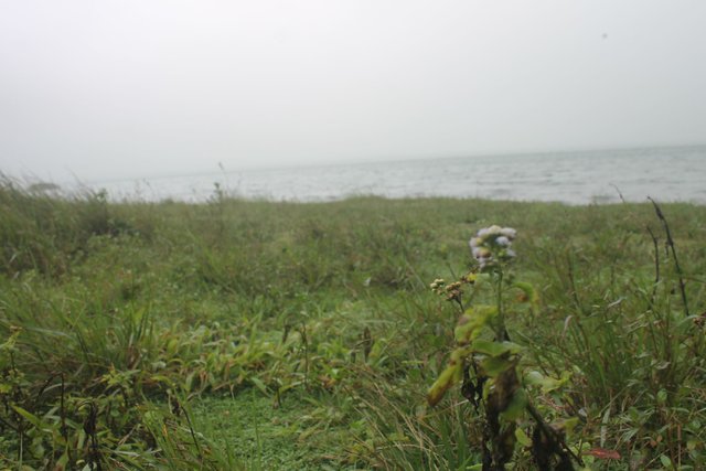
The Lakes
The water sources are both Yagumyum and Nailig Lakes though, the latter is more preferred. We had our lunch in the first and camped at the latter. Swimming in the lakes is prohibited. Drinking the water from these lakes is like drinking water that came out straight from the refrigerator.
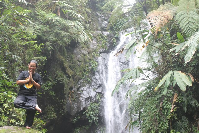
The Waterfalls
Mt. Talinis is also famous for its magnificent waterfalls. At the last stop, Ms. Babor's house, the Twin Falls is a 15-30 minute walk.

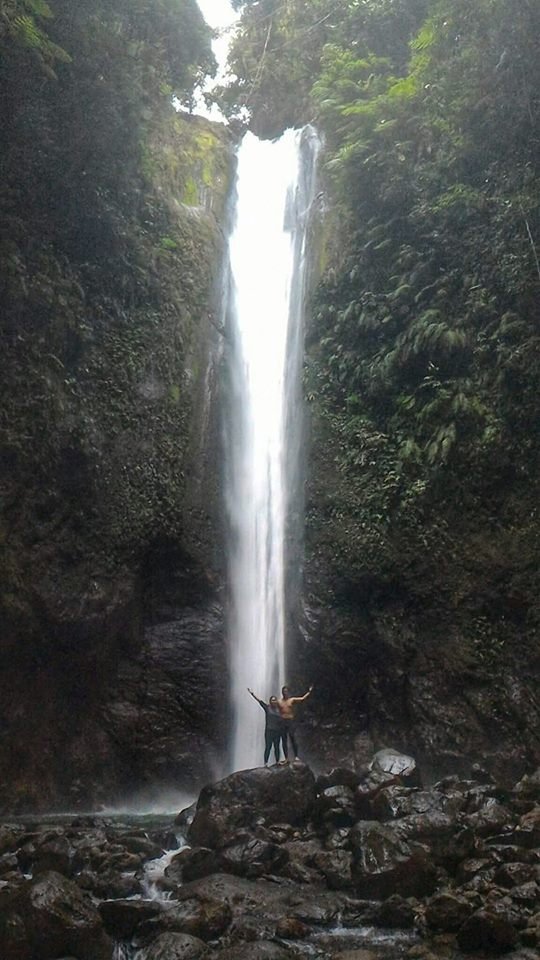
Another famous water falls in Mt. Talinis is the Casororo Falls which can be reached without climbing the mountain. It's found at the foot of the mountain. It's entry point is at the exit point of Mt. Talinis and is a 1-2 hour trek.
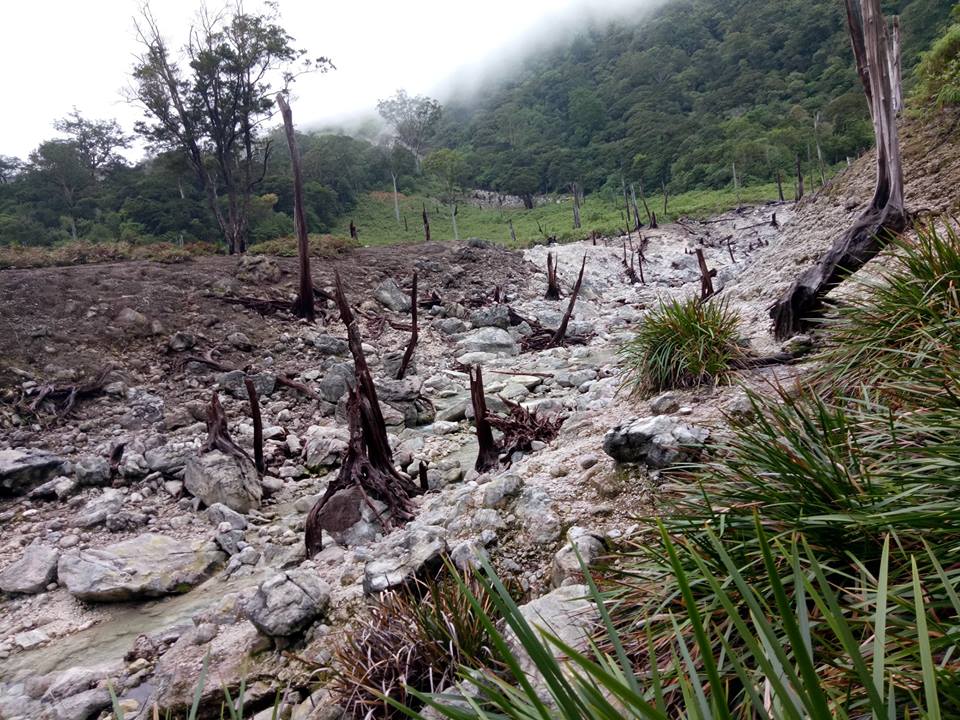
The Solfatara
Solfatara is a geologic term meaning "a volcanic crater emitting only sulfurous and other gases." This part of Mt. Talinis is also called the Sulfuric River. Once you smell rotten eggs, that's a sulfur vent or solfatara right under your nostrils.
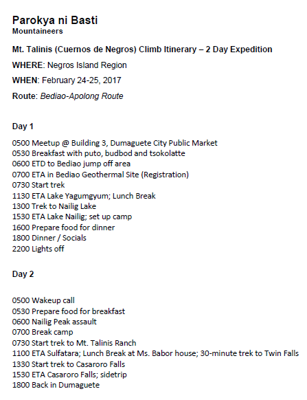
The Itinerary
Beware of the enchanted.
I will never forget my Mt. Talinis climb.
I was the one holding the camera so I thought I had to be the pacer of the group in order to take photos. (But I actually like advancing from others because I get easily tired when I trek slowly. And I seem to always want to poop. It's bad. I know.) I also always want to catch up with the one in front of me, hence, leaving the ones behind me way, way far. Thus, more than often, I trek alone. On the way to the campsite, I've been alone on the trail as well as on the descent and I never met someone going the opposite direction.
When we got back to the city, we talked about how fun the climb was. Everybody was happily sharing until ate Marese talked about how slow she was on the trail and how difficult it was for her. She was complimenting me about how I seemed to be not getting tired in hiking when the topic was diverted into "the things" she saw on the trail. She and ate Gail were sweepers meaning they are at the end. Almost always. On the way up and on the way down.
I had cold shivers down my spine when she told us about how she saw a human-like figure in white, kneeling in front of a huge tree near the Sulfur River. She wasn't sure if it was a man or a woman. I was actually thankful and terrified. I was glad that she told us late when we're already in the city. But I was terrified because I stopped right before the Sulfur River. I actually dropped my tall pack in the trail, made my way toward the tall bushes away from the path, took cover near the trees and peed. It was just a minute. Or maybe less. I didn't know I was near the Sulfur River until I reached it. I immediately thought of how my path was too many times obstructed with a freshly cut off branch when I was walking alone on a track separating into two trails. (Obstruction on a trail often means wrong way, but I look for signs carefully before proceeding. I just think that I won't be lost in that mountain.) I told them about it. Then, ma'am Laarni mentioned that she remembered seeing footprints going the opposite direction. I actually saw them, too and told her how I thought, I was the only one who noticed. Even now, my hairs are on end whenever I thought about how close I might have been on whatever or whoever that was.
Ate Marese continued talking about the bizarre things she saw during the climb. On one of the trails, ascending Mt. Talinis where we needed to crawl under a fallen log, she said that she clearly saw water there and she hesitated going under. It was when ate Gail told her that it was dry that she crawled to follow the others.
Because Mt. Talinis is unspoiled by "facebook mountaineers" and "mountourists", the mountain is home to humongous trees which might also be home to enchanted beings known in the Philippines as "engkanto". I still haven't seen it with my own eyes but I believe they exist. I believe there's another world besides ours. It's okay if you don't but the next time you climb a mountain, be careful. Some, "Tabi-tabi po. Tabi-tabi po." won't kill you.
"Tabi-tabi po. Tabi-tabi po" refers to Filipino superstitions - particularly when someone is entering a locale where ghosts and goblins may be living. It is a way of saying “excuse me” or “pardon me” when entering or passing a territory where these creatures inhabit for fear there will be unforgiving consequences if the creatures are not acknowledged or given respect. It can also be translated as “move to the side, sir”. (Source)
Photo Credits to: Jennifer Manubay, Valery Pascobello
Peak 14: Mt. Lumot
Peak 13: Mt. Tibig
Peak 12: Kibungan Circuit
Peak 11: Cinco Picos
Peak 10: Mt. Makiling
Peak 9: Mt. Kalugong
Peak 8: Mt. Romelo
Peak 7: Mt. Batulao
Peak 6: Mt. Manabu
Peak 5: Mt. Daguldol
Peak 4: Mt. Tapulao
Peak 3: Mt. Maculot
Peak 2: Pico De Loro
Peak 1: Mt. Pulag
Peak 0: Mt. Taal
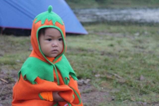
Little Climber
Wow!!! Seems like a great trip. We have waterfalls up here too. You've inspired me to go see them. Thank you 😊
Ps. please tag #steemph so the rest of the family can find you.
Thank you @bearone. I updated my post and tagged #steemph. Are you from the north?
Thank you @krizia <3 I'm actually up in the Blue Mountains in Australia heheh
Nice.My uncle lives in Perth. It's far from you, though. I plan to go there in two years. I want to work in Australia. It's my dream.
Congratulations @krizia! You have completed some achievement on Steemit and have been rewarded with new badge(s) :
Click on any badge to view your own Board of Honor on SteemitBoard.
For more information about SteemitBoard, click here
If you no longer want to receive notifications, reply to this comment with the word
STOPThank you for Using #promo-steem tag, Promote steemit by inviting your friends and your family!