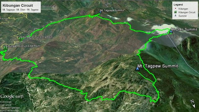
Peak 12: Kibungan Circuit: Mt. Tagpaya, Mt. Otén, Mt. Tagpéw
Kibungan Circuit
The mountains Mt. Tagpaya, Mt. Otén and Mt. Tagpéw comprises Kibungan Circuit. As the name suggests, it's a loop, a closed loop of the three mountains in Cordilleras connected by an awesome trail. The circuit is settled at the Cordilleras in Kibungan, Benguet near the other famous mountains found in the neighboring towns such as Mt. Pulag located in Kabayan and Bokod, Benguet, and Bakun Trio: Mts. Tenglawan, Kabunian, and Lobo in nestled in Bakun, Benguet.
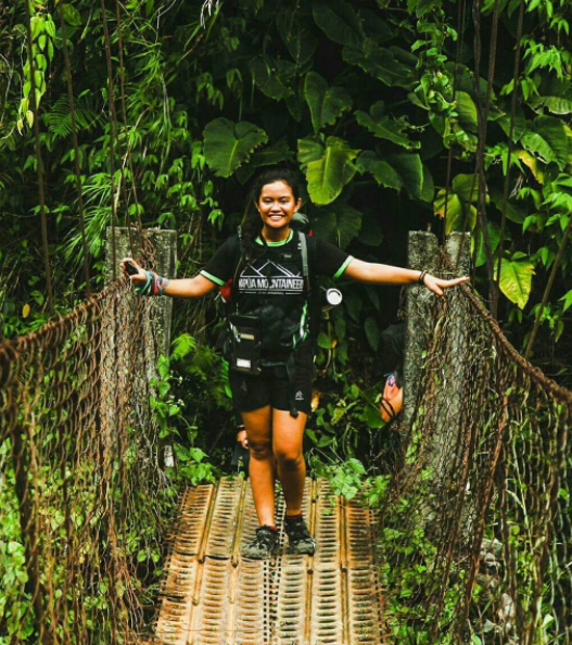
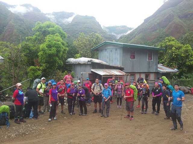
I climbed Kibungan Circuit last year, April 2016 from the 8th to 13th with the MITMC. It was the club's induction climb for the batch 26 and my second induction climb (being my induction as the first).
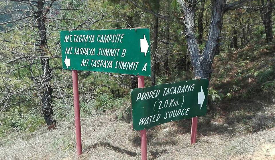
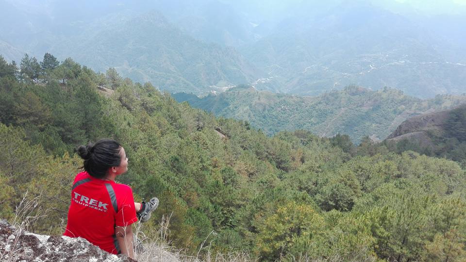
Mt. Tagpaya
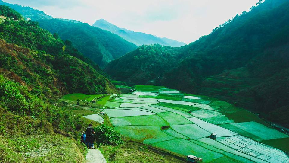
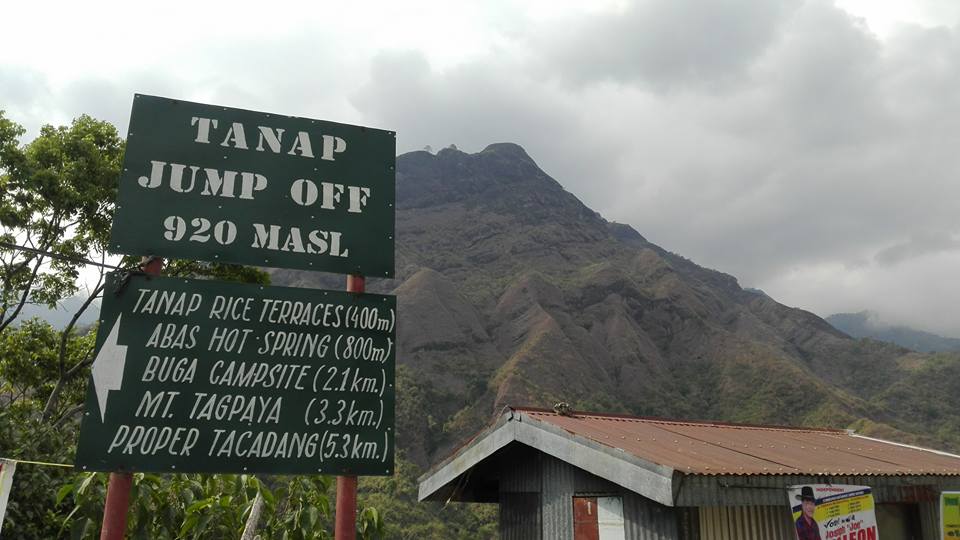
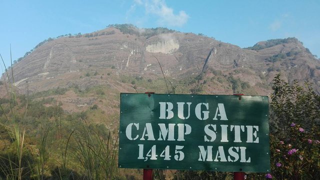
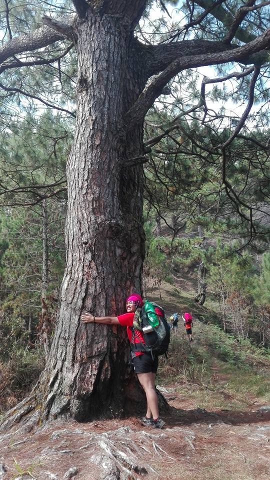
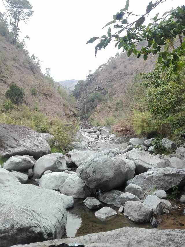
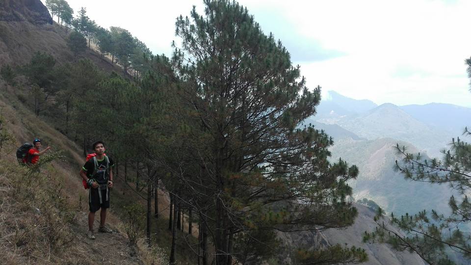
Mt. Tagpaya has an altitude of 1,820 meters above sea level. This is the first mountain usually hiked first in the Kibungan circuit. The trek starts at the roadside of the Tanap jump-off, passing by rice paddies, then, crossing Tanap river via a hanging bridge and going past a lot of steep assaults. The group would also get past the Palpalay-yen pine forest but we weren't able to appreciate it because it's almost nighttime when we arrived at the Buga Campsite at 1400 masl. There was a nearby water source a few paces from the campsite.
At first, I thought, the campsite was and wasn't really spacious until I saw the other campsites the next day. And I have to add, though it was Benguet and we were at 1,000+ masl, the weather that day was so hot.
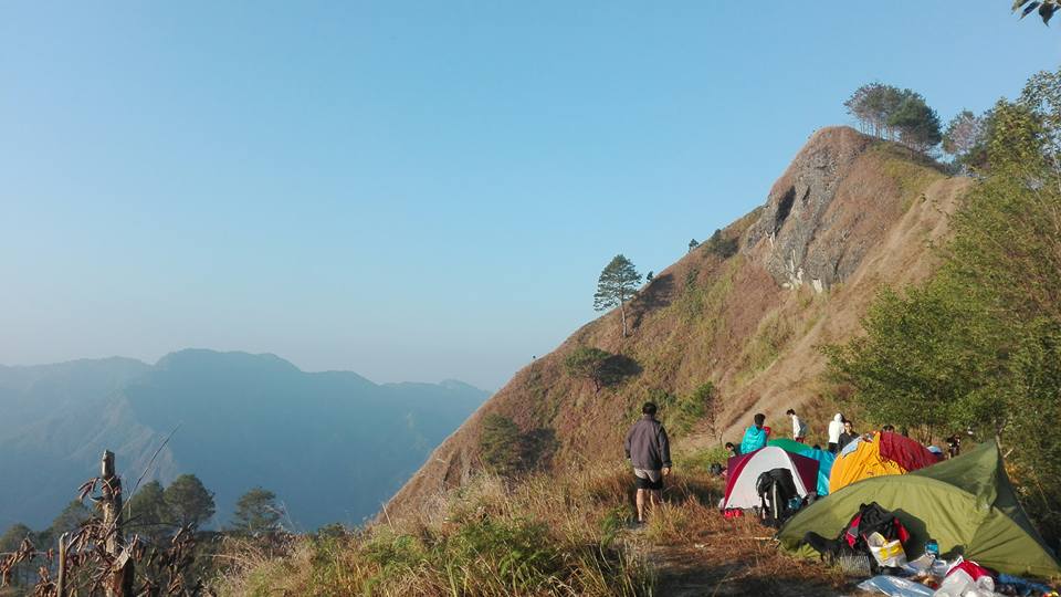
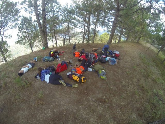
The group were able to get to Mt. Tagpaya's peak on the next day getting through amazing pine tree forests and the second Mt. Tagpaya campsite; the widest campsite of all. I was with the leading team so we got the peak all to ourselves. The western side of the mountain leads to Ilocos Sur and La Union. We went back down the campsite and ate our lunch.
Mt. Otén
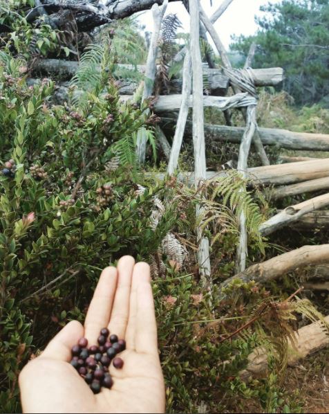
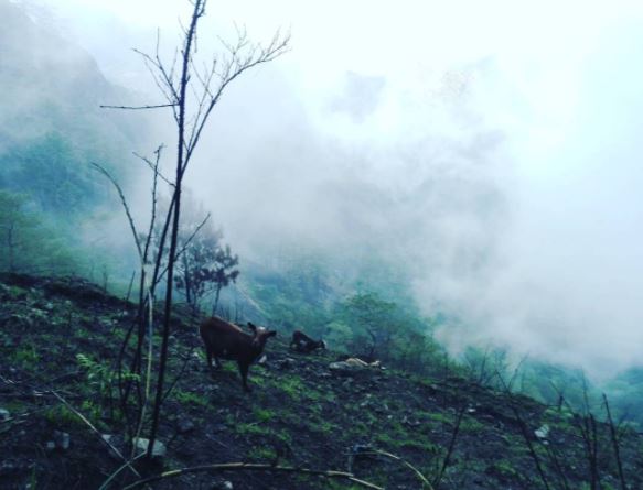
With an elevation of 1,875 meters above sea level, Mt. Otén was covered in clouds but graced us with a little clearing. Pine trees on ridges are found on the trail and a few burned hills probably because of either kaingin or forest fire. The assaults are still steep and the trails are located at near edge positions. We stopped by the Oldest Pine Tree, Tangongtongaw and proceeded on our way to the summit. Wild berries called "otén" (the term which the mountain was named after) are scattered around the mountain and they were actually delicious.
I loved it! We even saw the sweeping team at the other side of the mountain. They were so far away, yet, one could hear their voices on our side.
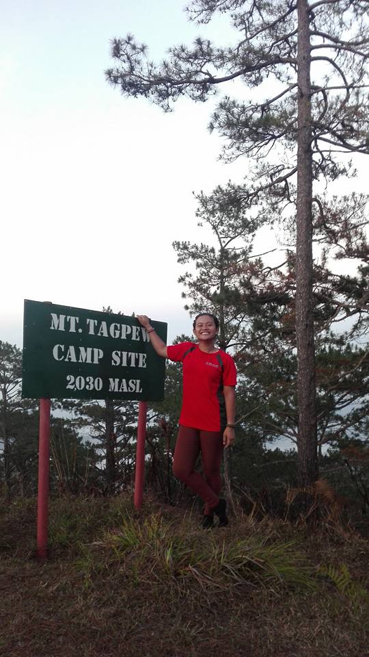
Mt. Tagpéw
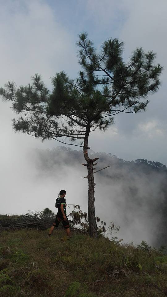
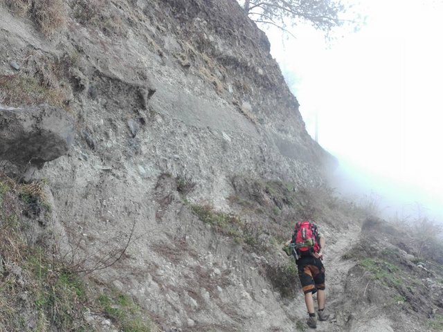
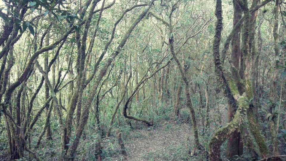
Mt. Tagpéw rises to 2,105 meters high but unfortunately, we were not able to hike to the summit. Descending Mt. Otén, the weather was colder but it was still hot that's why it was a surprise to suddenly be greeted by fog. Mountain goats were also around the mountain. This was by far the shortest but most difficult trail and coldest campsite for me.
The seemingly endless assault 60-80 degrees was exhausting, only to reach the top to another entry; the start of the mossy forest and find out that the trail isn't the end.
Neil, Haggeo and I were together at first but Neil went on ahead. He just disappeared in the fog in the assault earlier that time of day. We didn't have a guide with us because he was the trail head. Haggeo and I doubted our way inside the mossy forest because it seemed like we were descending the mountain already so we kept on whistling; waiting for response from the front and the back of the group but nothing. We kept walking, though. Our only clue from the guide was that the water source can be passed by before the campsite. I became certain of our way when I spotted the black, plastic, water pipe. I knew the water source is near.
Hiking down the second mountain and climbing the 60-80 degrees assault to the third mountain, I realized that the trail is a great one; a perfect combination of easy, average and difficult. The mountain's climate is really stunning from really hot (Tagpaya's trail) to cold (Otén's trail), then colder (Tagpew's campsite) to hot again (down to exit point). This was so far, my favorite trail!
When we thought arriving at the village was the end of it, we were so mistaken.
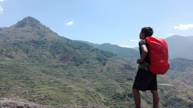
The trail didn't end in Mt. Tagpéw. It was a long way back to the road side. If I only took pictures, I could show you how the katutubo (indigenous people) harvested their crops, how beautiful the vegetables were and how friendly the people were. I asked our guide early that day how to say "good morning" in Kankanaey (the dialect in Kibungan) with the proper pronunciation and greeted everyone with a "Mapteng ja agsapa".
And of course, the trademark of the mountains in Benguet are present, namely:
1. Ridges of Pine Trees
2. Rice Terraces
3. Mossy Forests
4. Villages
Peak 11: Cinco Picos
Peak 10: Mt. Makiling
Peak 9: Mt. Kalugong
Peak 8: Mt. Romelo
Peak 7: Mt. Batulao
Peak 6: Mt. Manabu
Peak 5: Mt. Daguldol
Peak 4: Mt. Tapulao
Peak 3: Mt. Maculot
Peak 2: Pico De Loro
Peak 1: Mt. Pulag
Peak 0: Mt. Taal
Little Climber
Mt. Oten is little weird name, if your a Filipino or Filipino speaker.
It's actually weird for the Bisaya and those who understand the dialect. I actually laughed when I heard the name for the first time. But because of the accent of the Kankanaey, it's not pronounced as the "oten" of Cebuano but rather "otoen", almost "oton" but with stress on "o".
This place looks like a dream! I would love to do be here.
You should visit the Philippines @bitdollar! You are very much welcome here. If I'm not mistaken, I only spent less than 90$ in climbing there; transportation and climbing fees, food and vices included.
Wow I am trying to figure out a place to visit now. I am in Toronto, so was considering the usual Caribbean, as it is close. Will have to look into this, I love green!! :D
Oh. You love green? How about blue? The islands in the Philippines are basically blue and green. 😁 You really should visit.
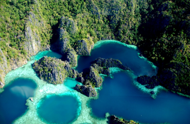
Coron, Palawan
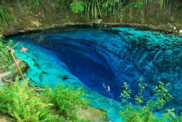
Hinatuan Enchanted River, Surigao del Sur
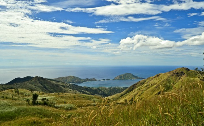
Cinco Picos, Zambales
Mt. Apo, Davao
Well done! We're you supposed to be leading?
Yes, tita. I was with the trail lead team. Thank you po.
Looked fun Krizia...ever been to discord???
I'm in discord, tita. I've been talking to a few Filipino steemians there. Are you a member of the PAL and Steemit Philippines?
Steemit Philippines yes..say hello.
Lola.Imma
Hahaha. I just opened my discord app, tita. It's amazing that there are still a lot of people awake.
Madame nagbabantay ;)
Hayun o! Sarap naman diyan sa mga napuntahan mo!