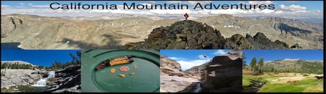
High Sierra Adventures - North Lake to South Lake Loop
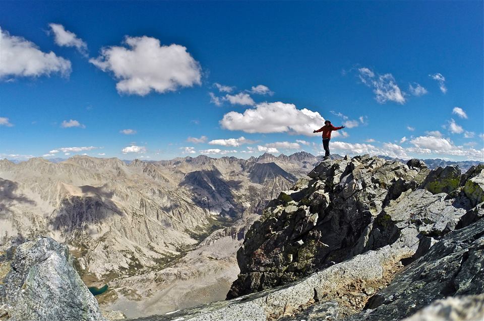
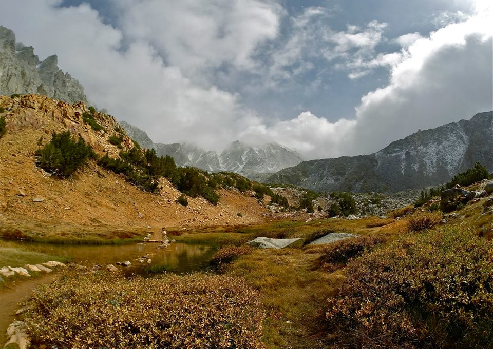
I drove up highway 395 to Bishop and up Bishop creek to join my mom and my cousin for an 8 day backpacking adventure starting from the North lake trailhead and ending at the South lake trailhead. We started out hiking up the north fork of Bishop creek to Piute pass through some really amazing fall color. The aspens were just glowing yellow and orange! We dropped our backpacks at the pass and headed cross country across Humphreys basin and then made the long climb up to the summit Mt. Emerson(13,204')! After enjoying the incredible views from the summit we headed back down to Piute pass and picked up our packs and crossed over to the other side of Humphreys basin and found a great spot to setup our first camp at the very impressive Muriel lake. Some clouds were moving in and gave us some little snow flurries and some distant thunder which made for a pleasant first evening.
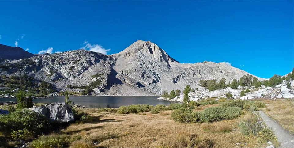
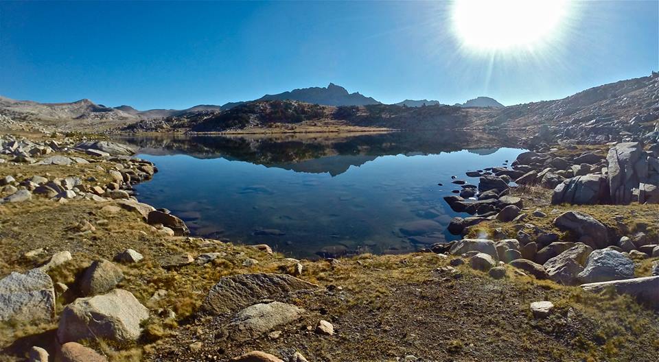
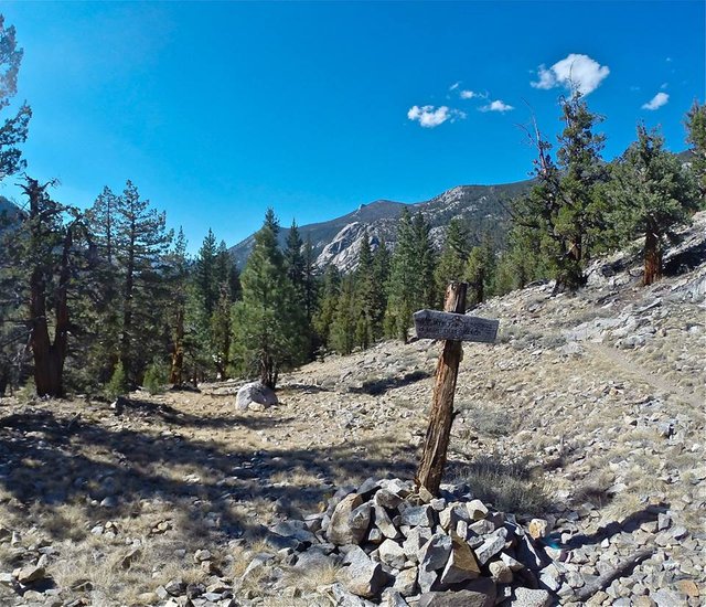
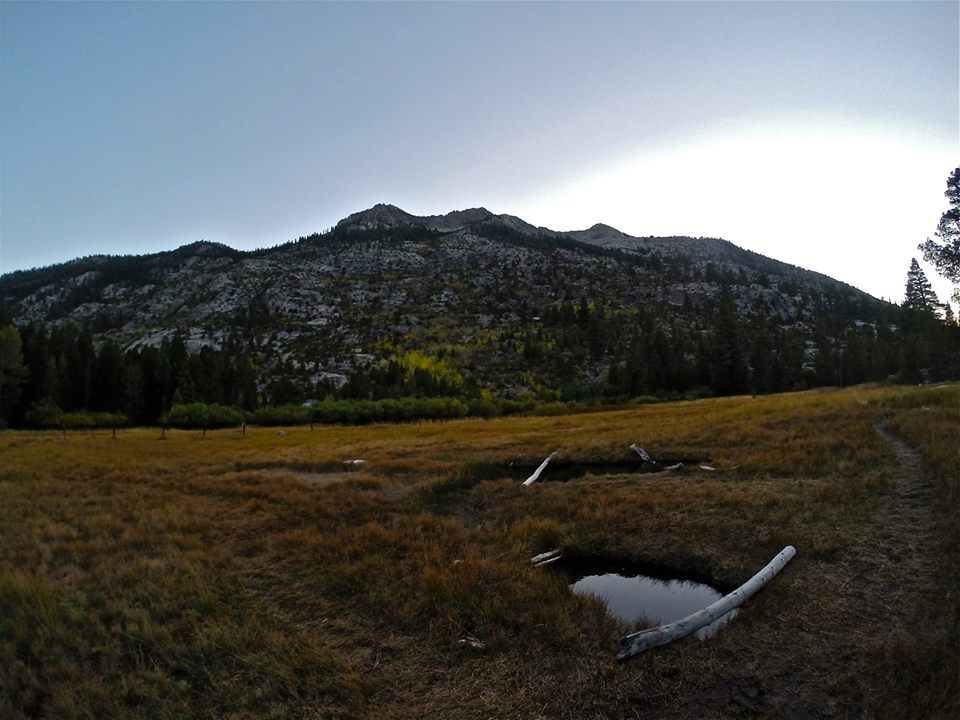
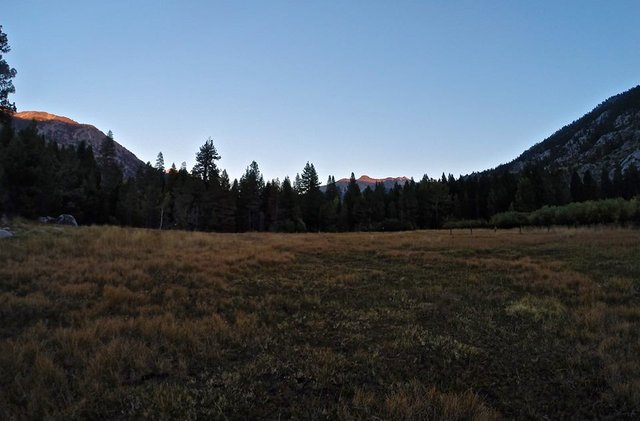
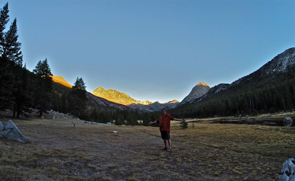
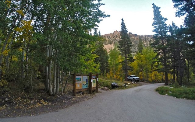 North lake trailhead
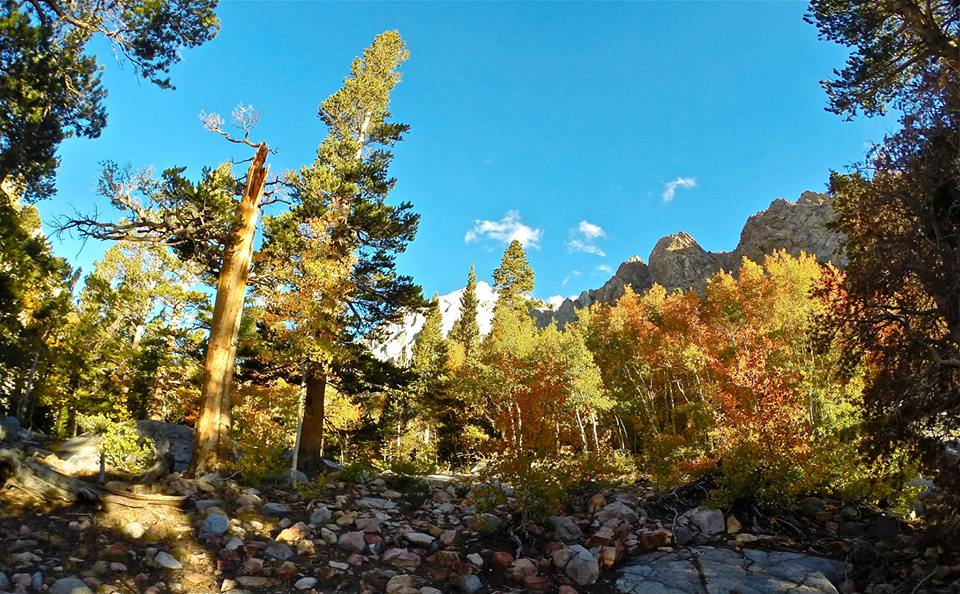
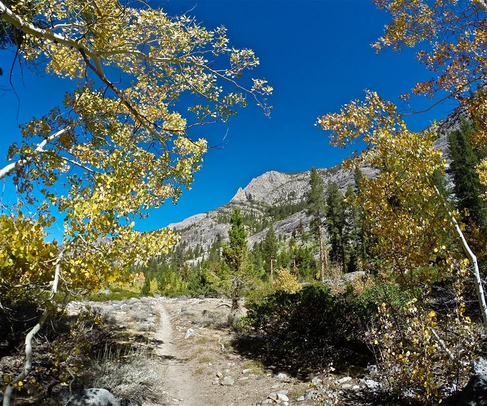
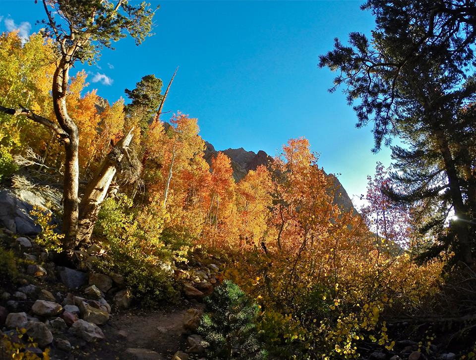 Fall colors on the trail
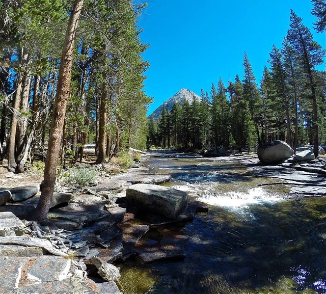
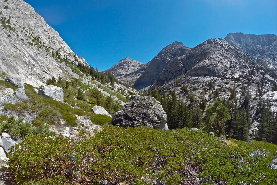
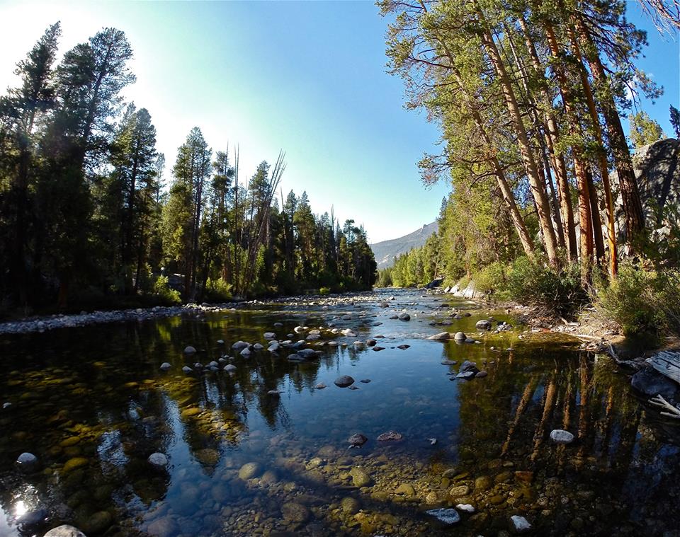
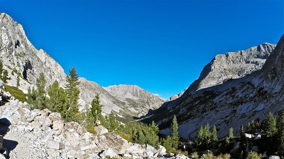
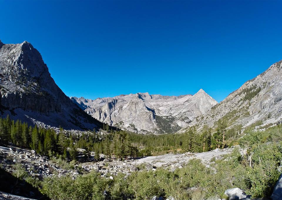
 The north fork of Bishop creek
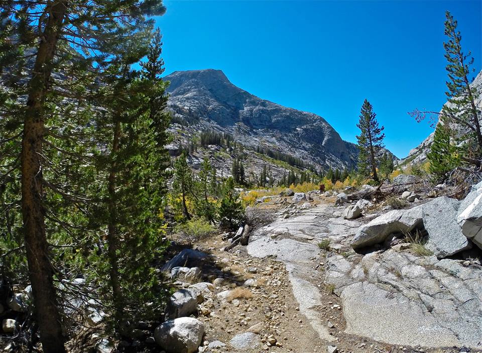
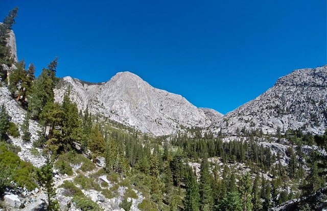
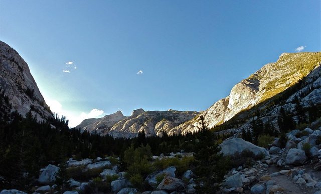
 Hiking passed Piute lake
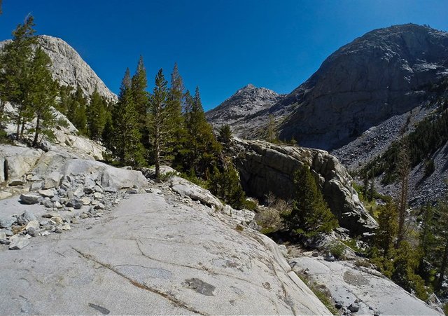
 Views east from Piute pass
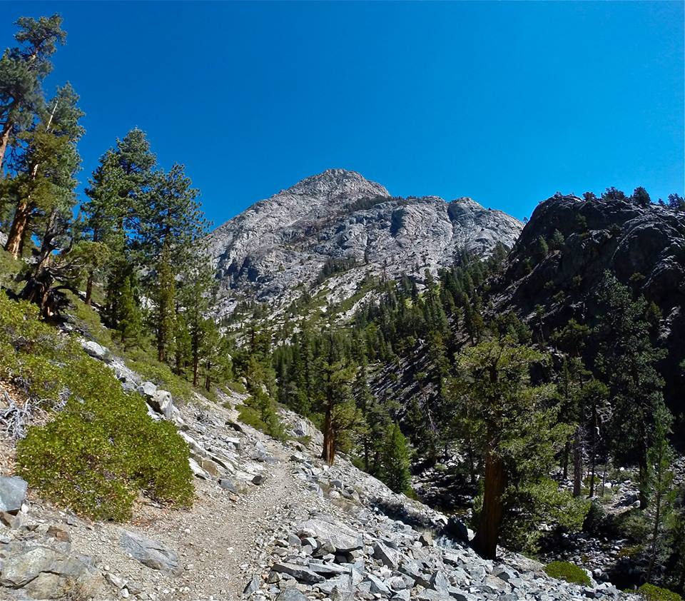
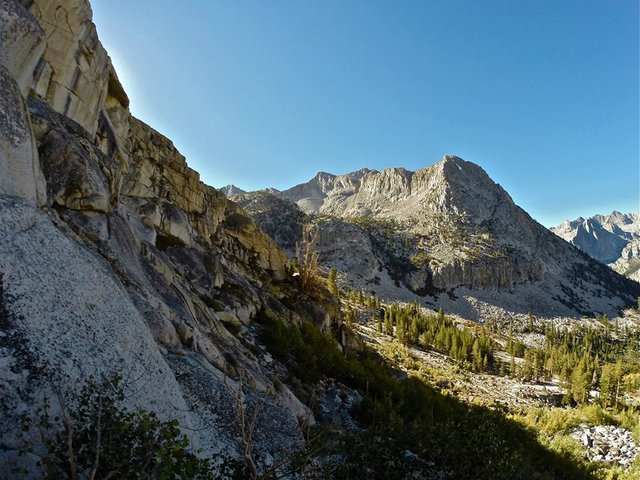
 Approaching Mt. Emerson
 Climbing Mt. Emerson
 Traversing the west ridge of Mt. Emerson
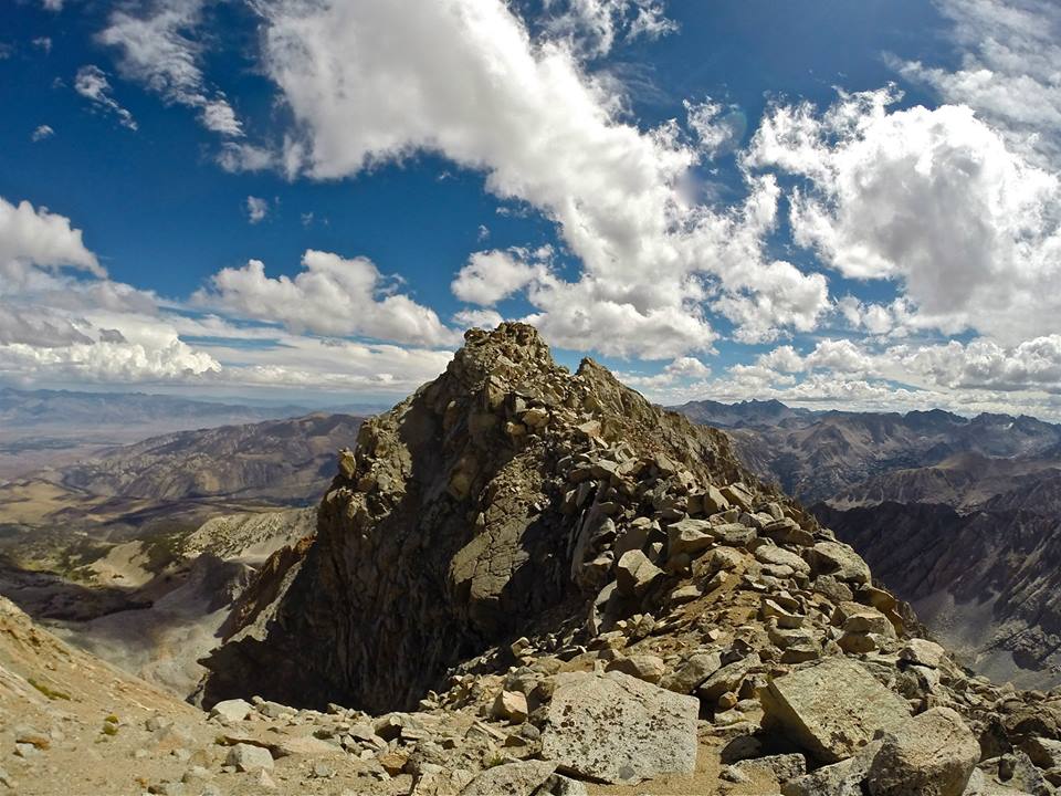
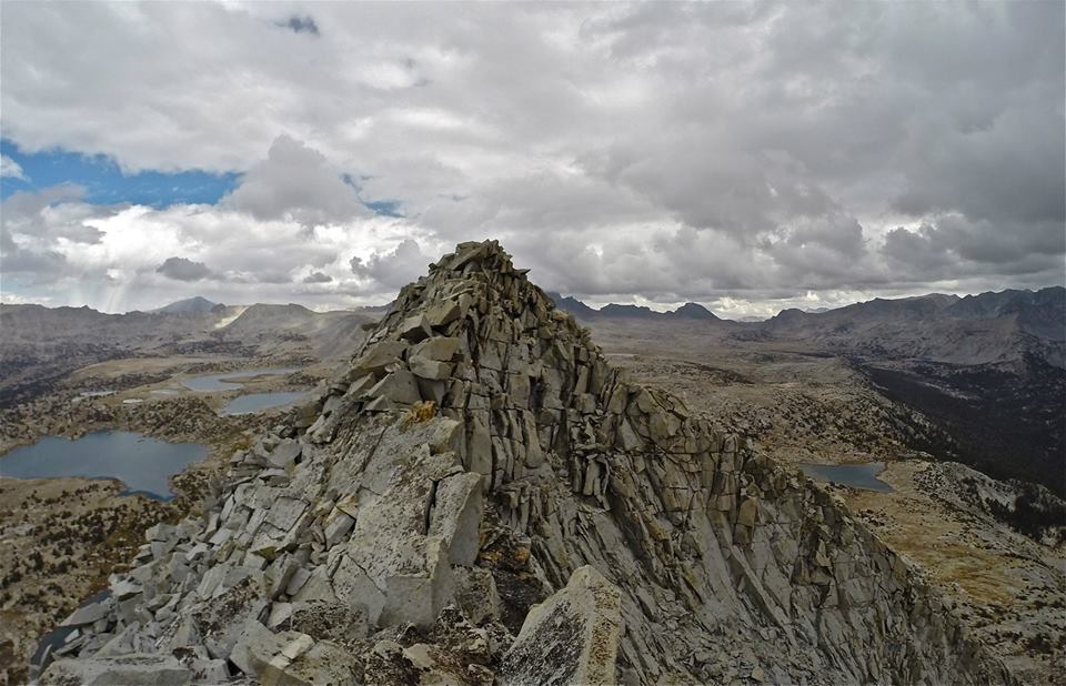
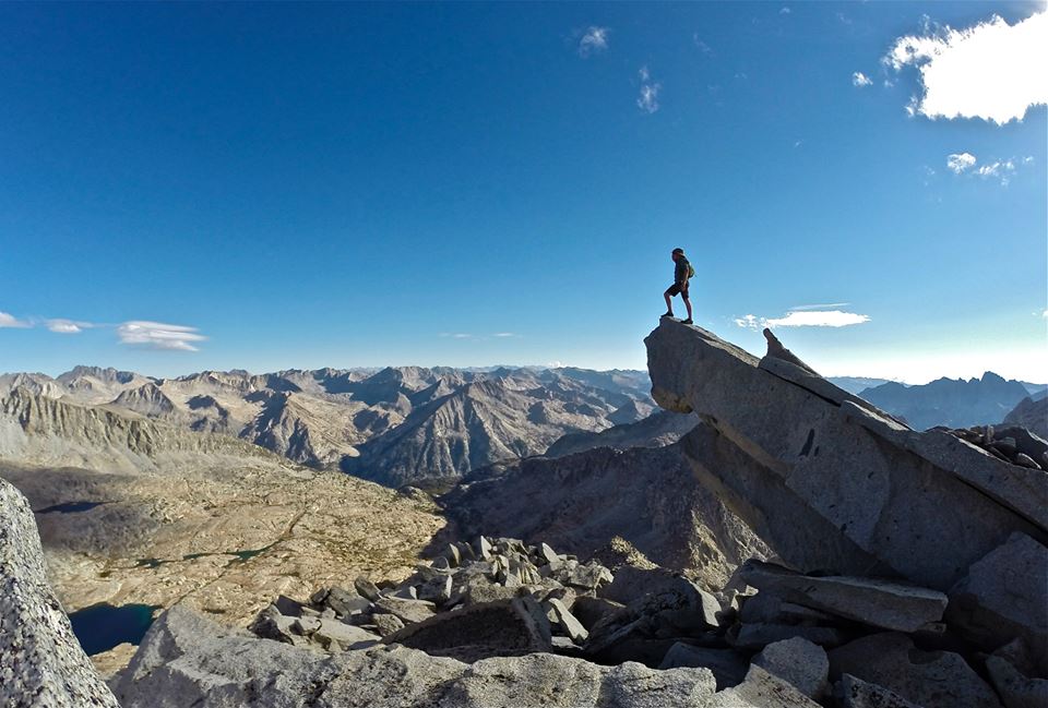
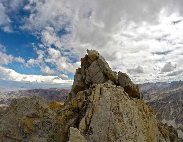 The summit blocks
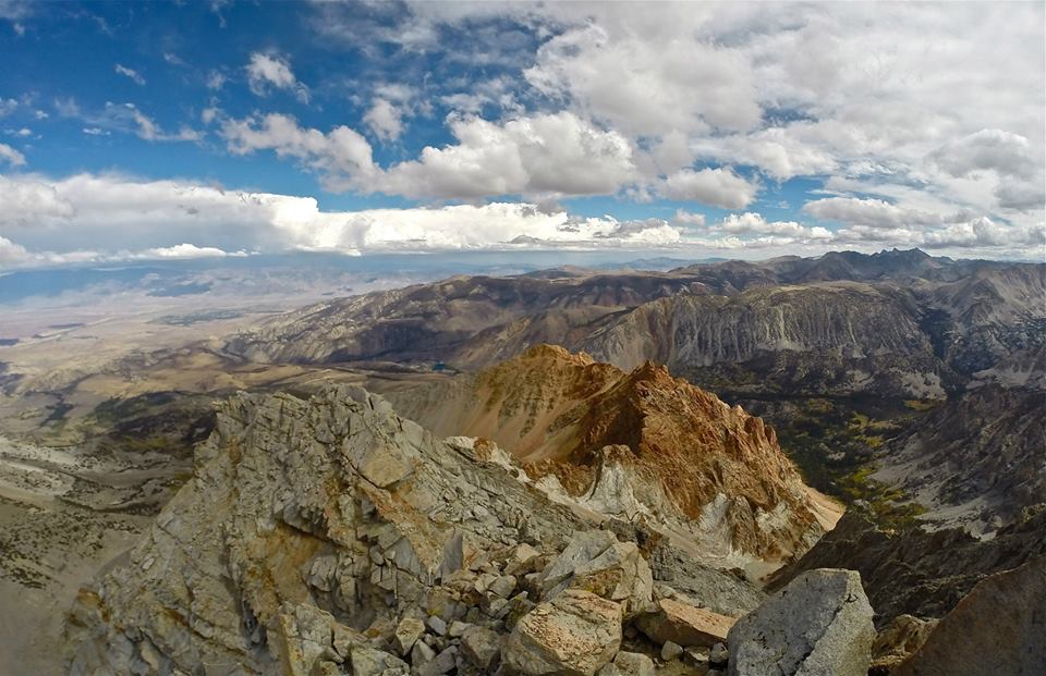 Looking east from the summit
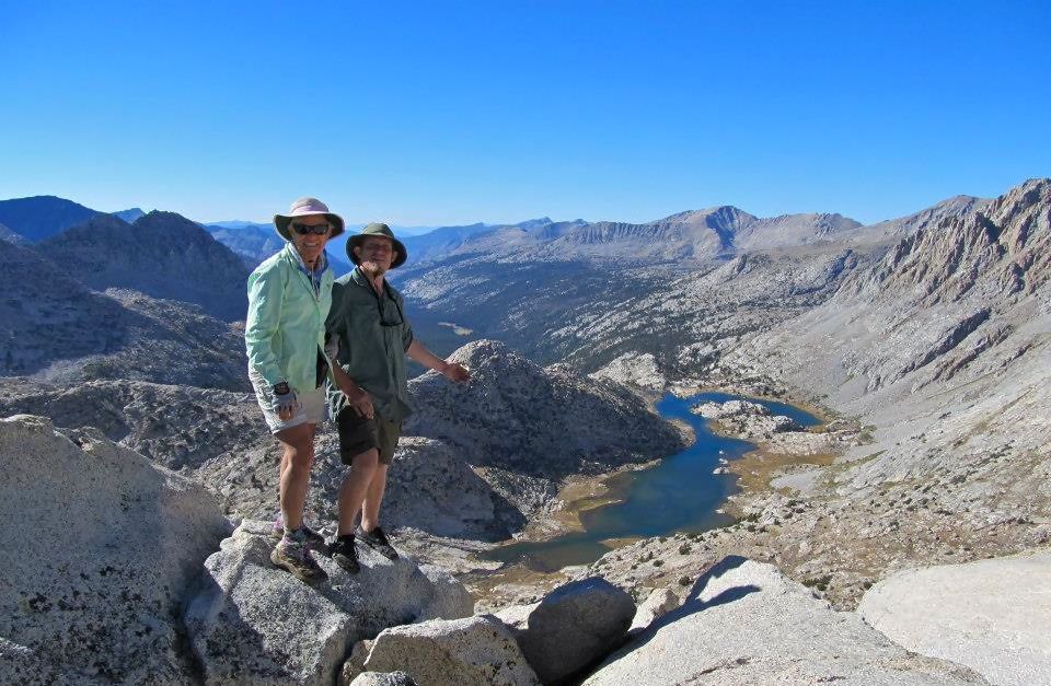
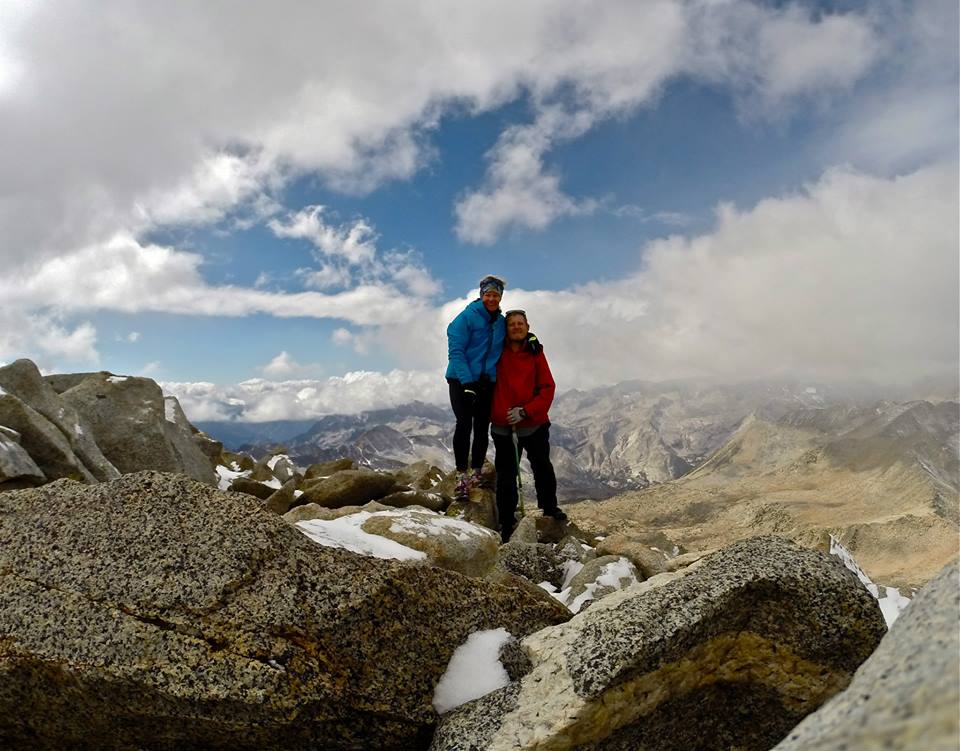
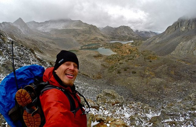
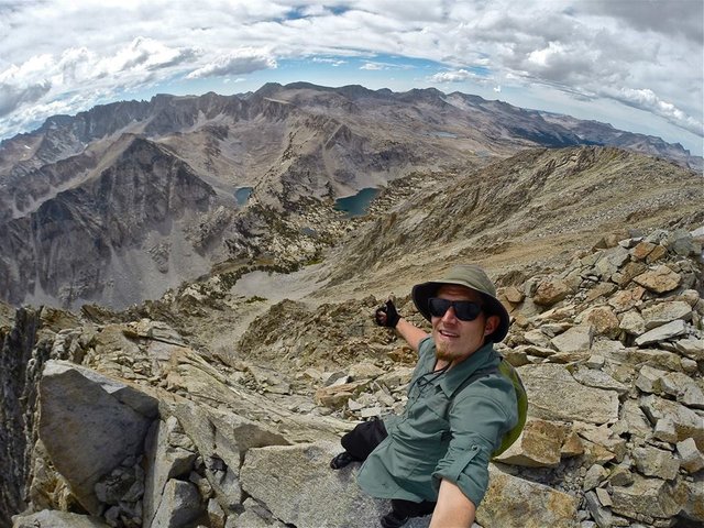 Selfie on the summit
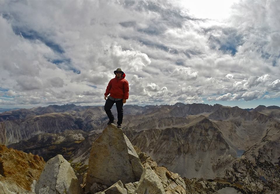 Standing on the summit
 Looking north from Mt. Emerson
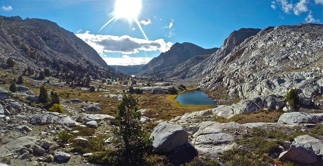
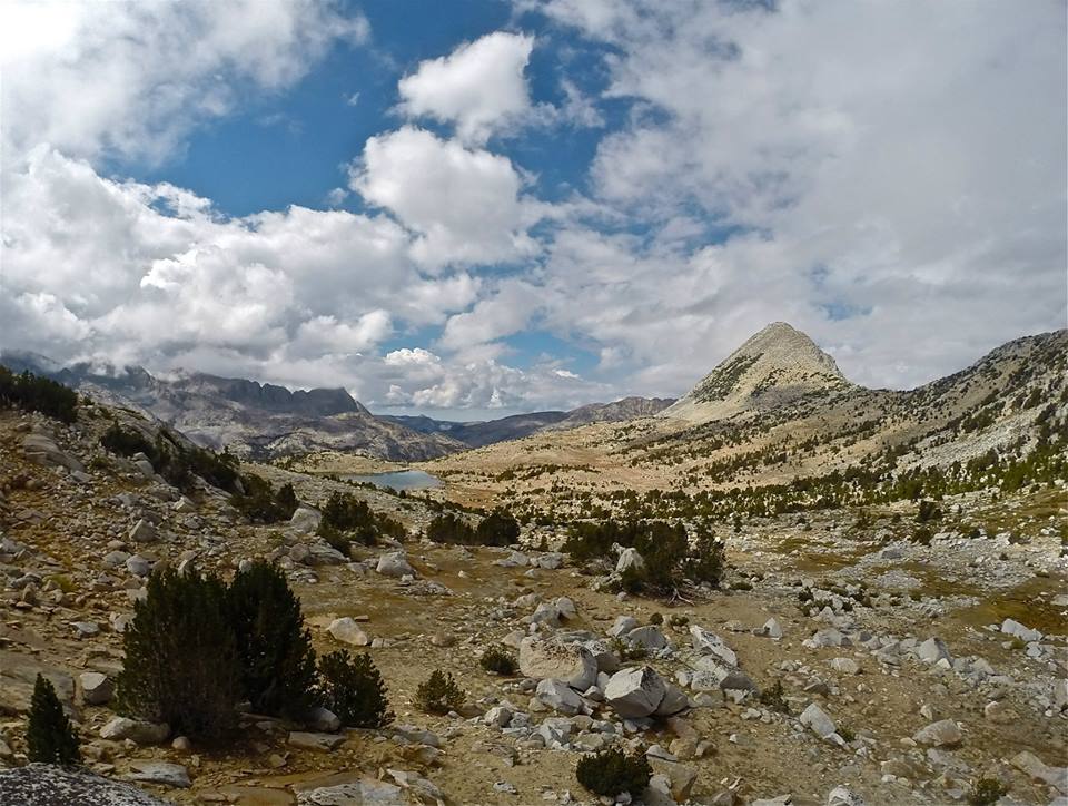
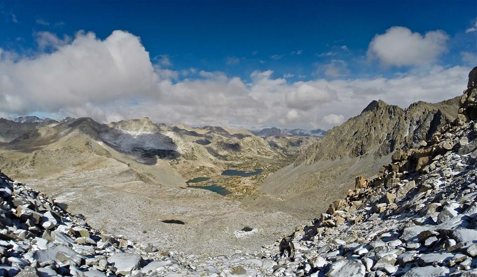
 Crossing Humphreys basin
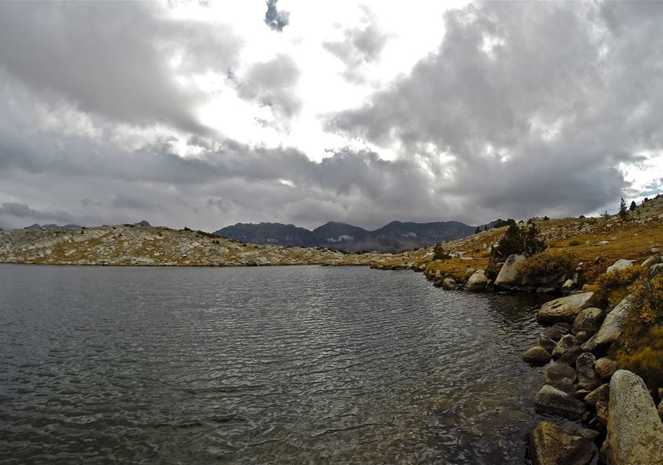
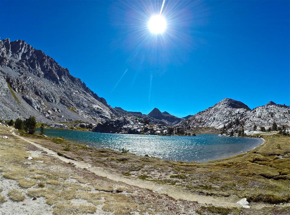
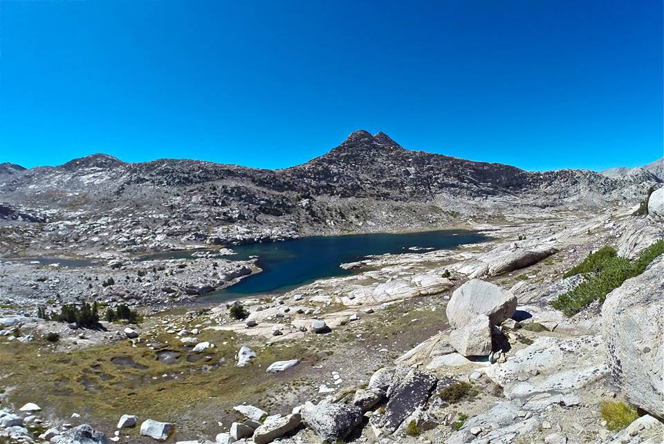
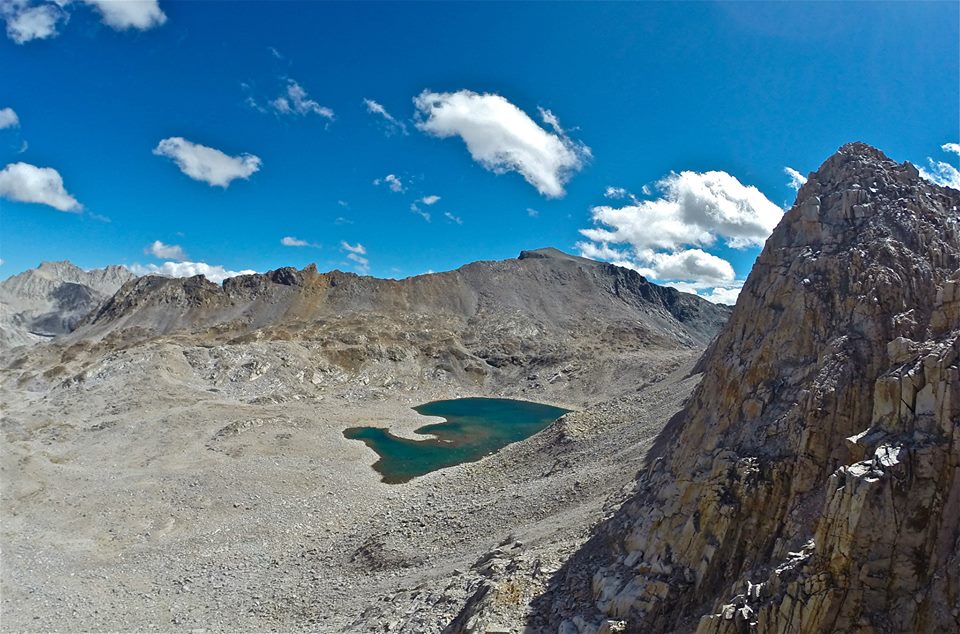
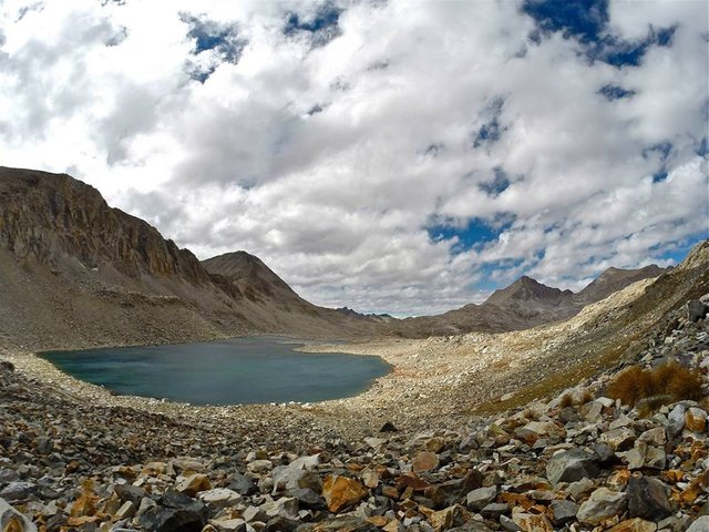
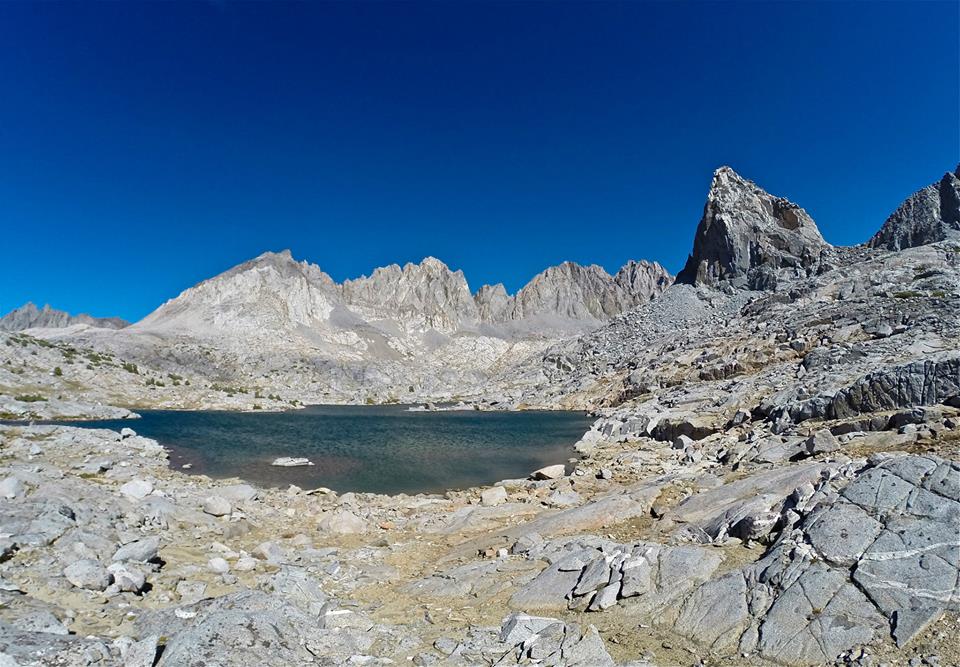
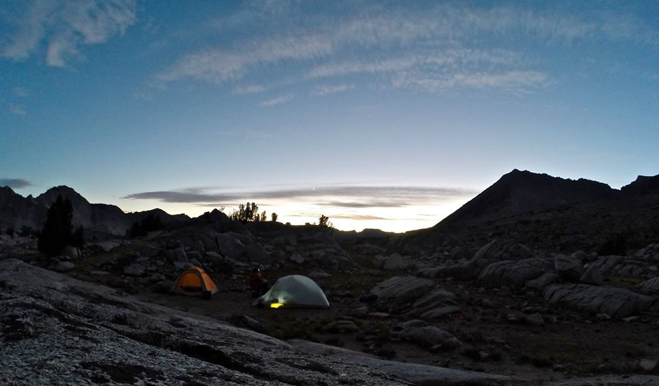
 Arriving at Muriel lake
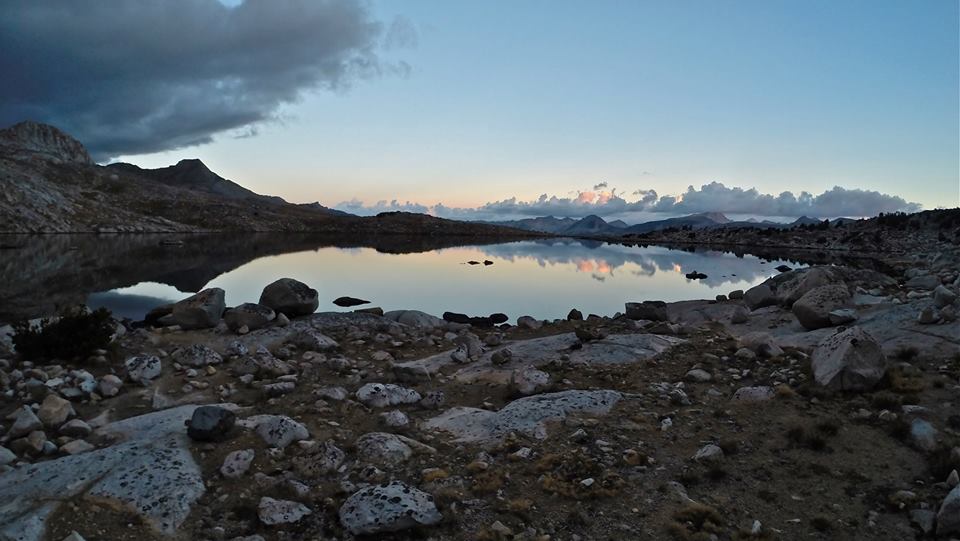 Evening at Muriel lake
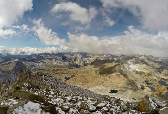
The next morning we packed up our camp at Muriel lake and headed northwest across Humphreys basin. We enjoyed a light snowfall in the morning which mostly cleared before arriving at Tomahawk lake where we setup our second camp. The view of Mt. Humphreys was really amazing from there. It just dominates the scene. Then just after we got our tents setup a light rainstorm moved in. We wanted to go climb Pilot Knob(12,245') and the rain and fog was making us question our attempt, but we headed out anyways. As we approached Pilot Knob the rain and fog got less and less and started to clear as we got closer. The weather cleared out perfectly just in time for us to summit and get some awesome views! It's like it was meant to be. Later on, on our way back to our camp at Tomahawk lake it became cloudy again and started sprinkling lightly. But not enough to stop me from trying some trout fishing in the lake before heading to the tents for the night.
 Crossing Humphreys basin
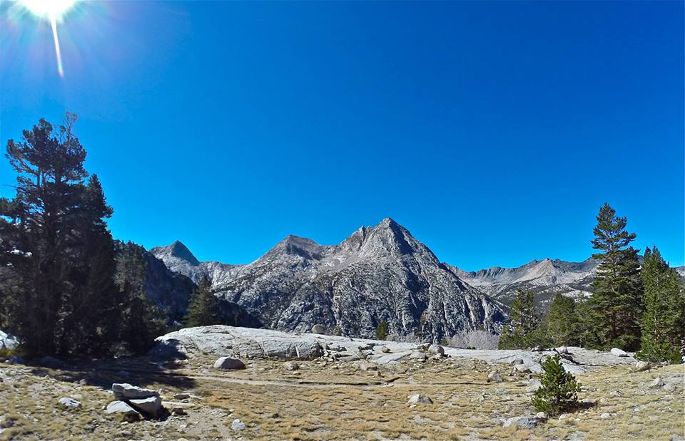
 The Glacier Divide
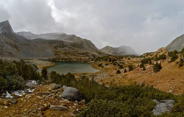
 Arriving at Tomahawk lake Mt. Humphreys towering in the background
 Approaching Pilot Knob
 Views climbing Pilot Knob
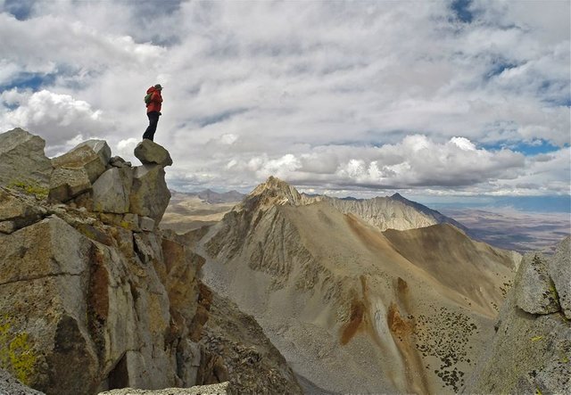
 On the summit of Pilot Knob
 On the summit of Pilot Knob
 The summit of Pilot Knob
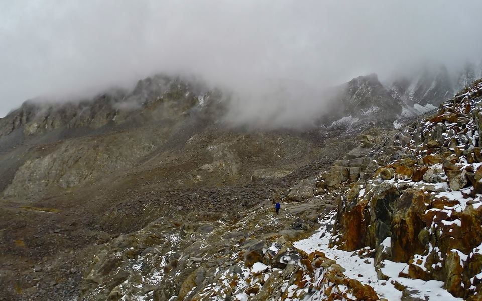
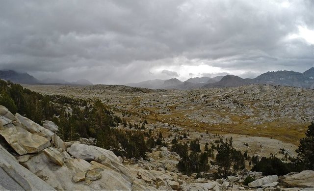 The clouds moving into Humphreys basin
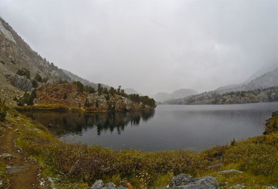
 Back at Tomahawk lake
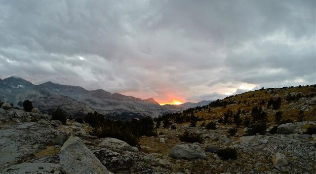 Sunset from Tomahawk lake
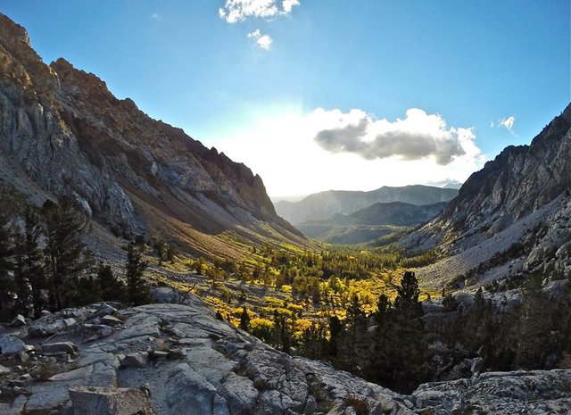
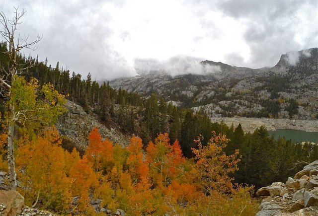
After a good night at Tomahawk lake, we packed up camp and headed down through the very impressive Piute canyon. Huge granite peaks, cliffs, and domes just tower over the canyon on all sides. Then we met with the the JMT(John Muir Trail) and followed it down the south fork of the San Joaquin river towards Muir Trail Ranch. We made our third camp by the banks of the river and spent the evening trout fishing in the river and soaking at Blayney hot springs which was in the beautiful meadow just across the river from our camp. The weather was perfect all day, it was a great day to be in the Sierras.
 Morning views of Mt. Humphreys from Tomahawk lake
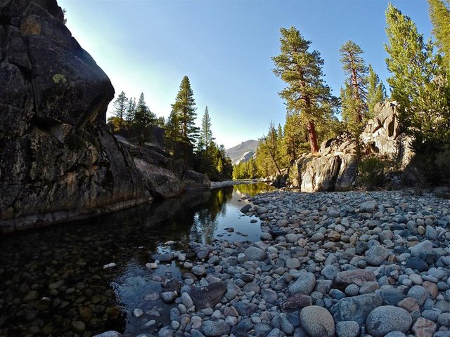
 Looking back up at Pilot Knob from Piute creek
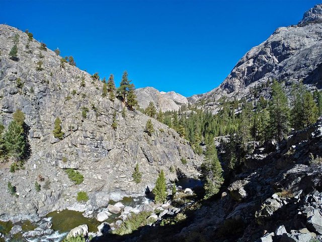
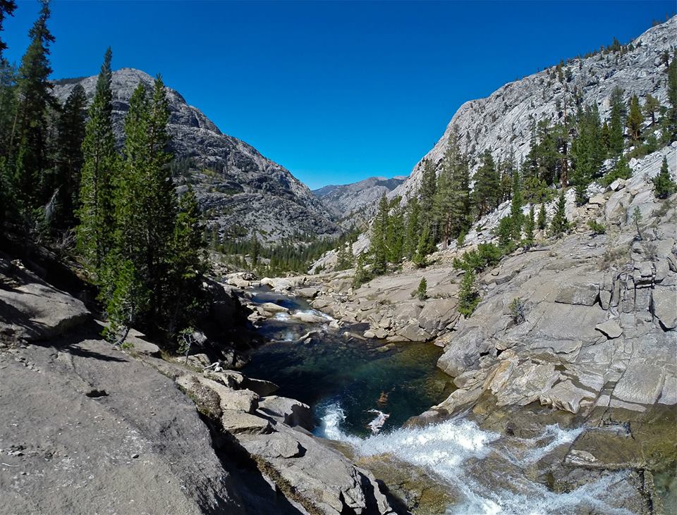
 Piute canyon
 Piute canyon
 Piute canyon
 Piute canyon
 Pavillion Dome from Piute creek
 Trail junction to Muir Trail Ranch
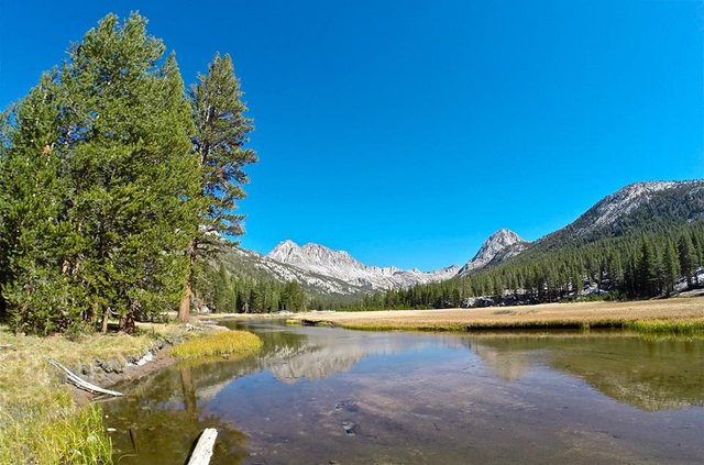
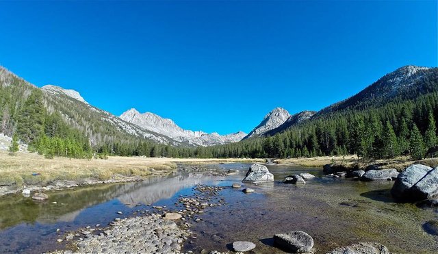
 South fork of the San Joaquin river
 South fork of the San Joaquin river
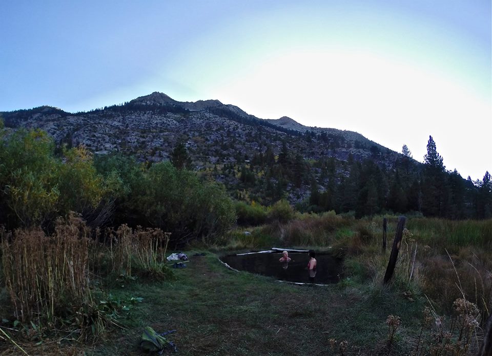 Soaking at Blayney Hot Springs
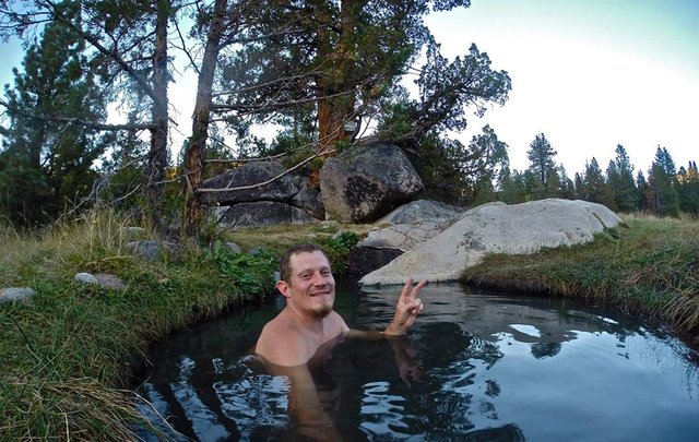 Selfie in the hot springs
 Blayney hot springs
 Sunset glow from the meadow
Feeling nice and refreshed from our evening at Blayney hot springs, we headed back up the South fork San Joaquin river following the JMT, entering Kings Canyon national park at the Piute creek bridge. Then we began our climb up into Evolution valley. We climbed up the trail and enjoyed the many cascading waterfalls of Evolution creek. Taking a nice break for some fishing, swimming, and lunch at some of the waterfalls. Once we reached the valley we hiked through Evolution meadow and made our way to McClure meadow where we setup our fourth camp. The views from McClure meadow are absolutely stunning. Once camp was all setup I went out exploring along Evolution creek having lots of fun trout fishing. The fish were all very small, but there were tons of them and they are still a lot of fun to catch! I also collected some wild onions and blueberries and then headed back to camp. It was my cousins birthday so we had our own little party for her. We even had a small piece of cake and a candle for her! Then we had a some drinks and talked into the night!
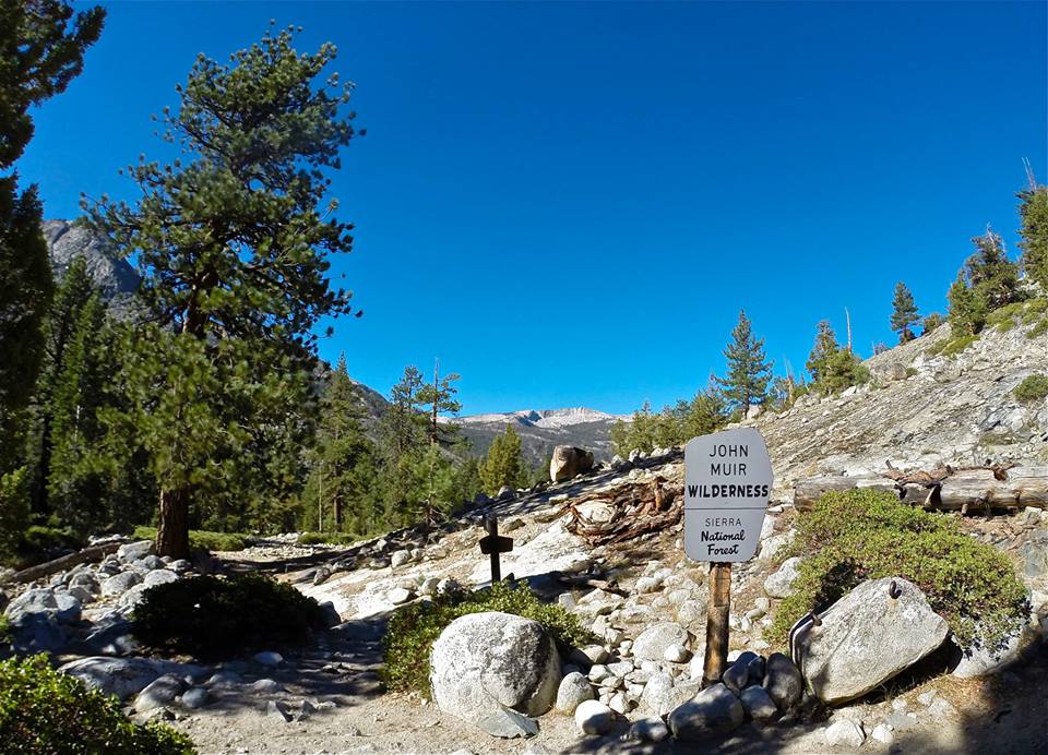 John Muir Wilderness/Kings Canyon national park boundary
 Hiking up the south fork of the San Joaquin river
 Pavillion Dome from Aspen meadow
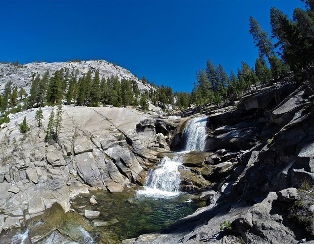 Evolution creek waterfalls
 Evolution creek waterfalls
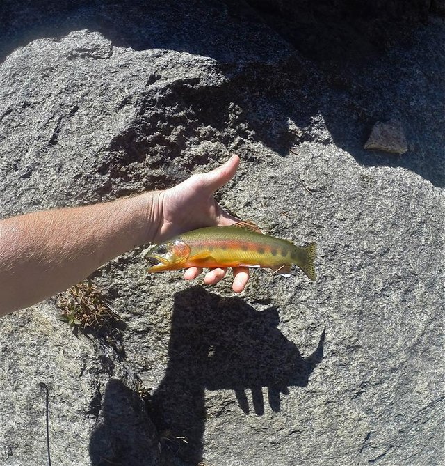 Golden Trout
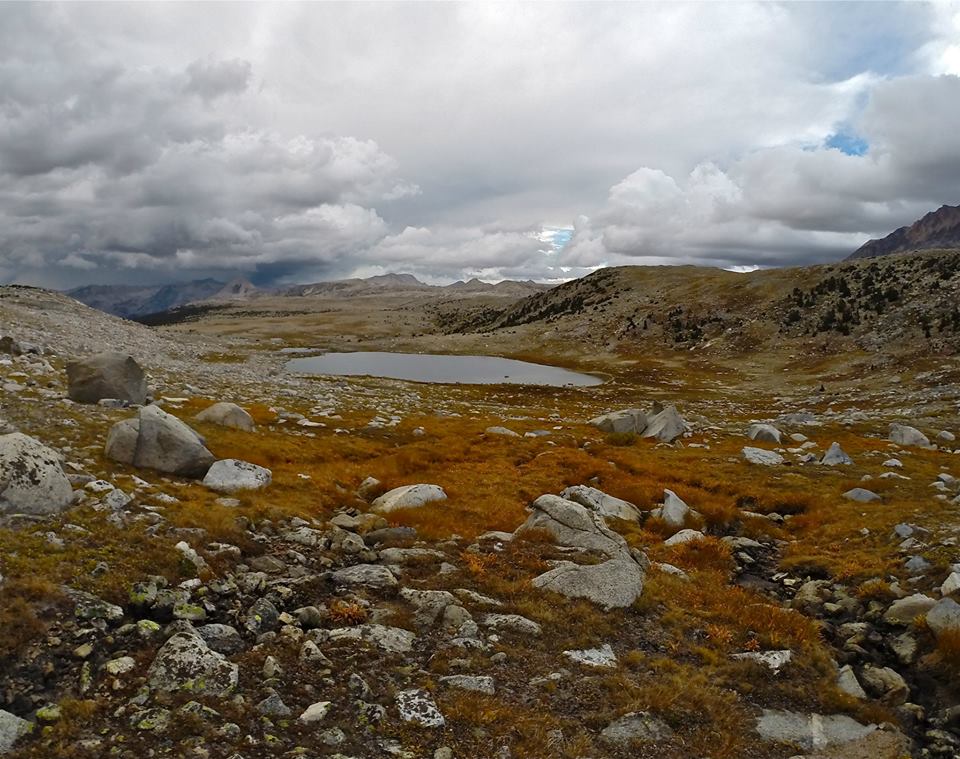
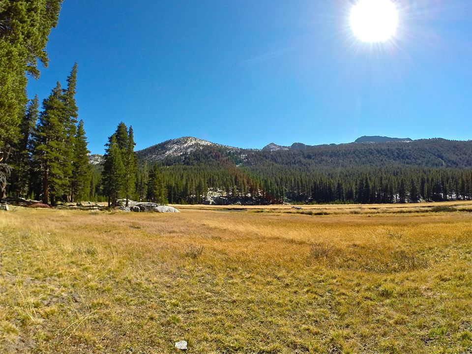
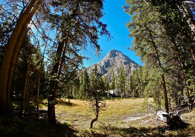
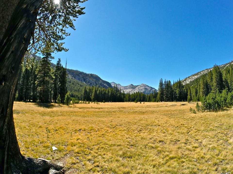 Evolution meadow
 McClure meadow
 McClure meadow
 McClure meadow
 Standing in the meadow during sunset
After a fun but cold night at McClure meadow we packed up our camp and continued up the JMT into Evolution basin. My cousin had a few to many drinks the night before and she was a bit hungover and moving pretty slowly, but we didn't have a lot of miles to cover and It was a perfect clear sunny day. For me the climb up into the basin seemed like almost nothing. And the views just got better and better. The Hermit was just towering over the far side of Evolution valley. We hiked around Evolution lake which is a quite unique and truly beautiful lake. And then we arrived at Sapphire lake, still pretty early in the day. We got our camp set up on the far side of Sapphire lake and then my mom and I (my cousin decided she needed to rest) began our climb to the summit of Mt. Spencer(12,431'). The climb up was a fairly easy class 2 climb and the views from the summit were incredible!! Mt. Spencer sits right in the center of Evolution basin giving it the ultimate view over all the lakes in the basin as well as huge views out over Evolution valley. We signed the summit register and spent plenty of time enjoying the views and then headed back down to our camp at Sapphire lake. I did some trout fishing in the lake and then made some dinner before heading into the tent for the night.
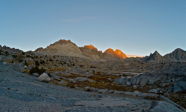
 The Hermit from Colby meadow
 Great views of The Hermit from the JMT
 Getting into Evolution Basin
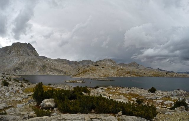
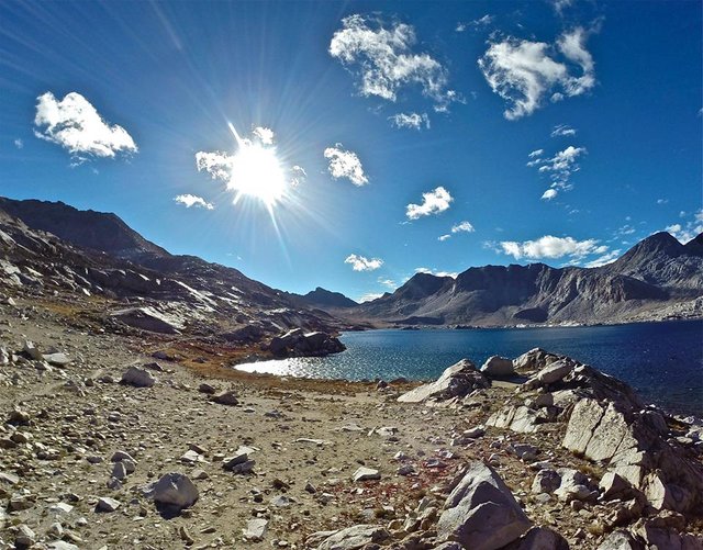
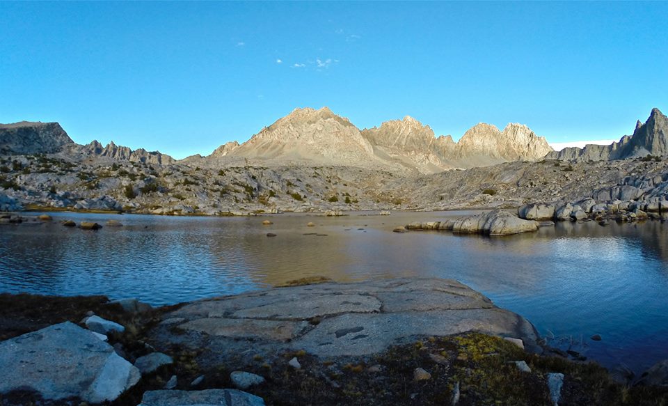
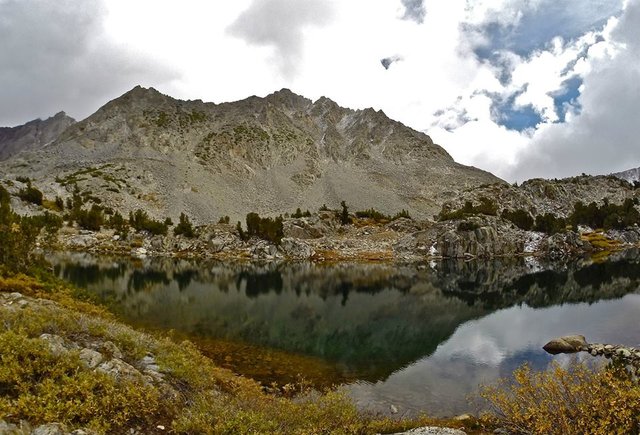
 Evolution Lake
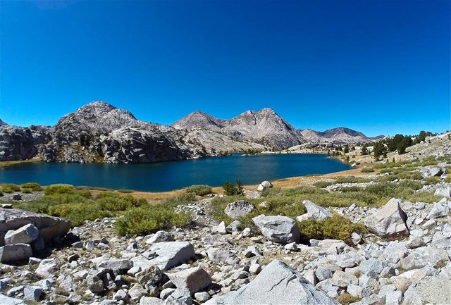 Evolution Lake
 Evolution Lake
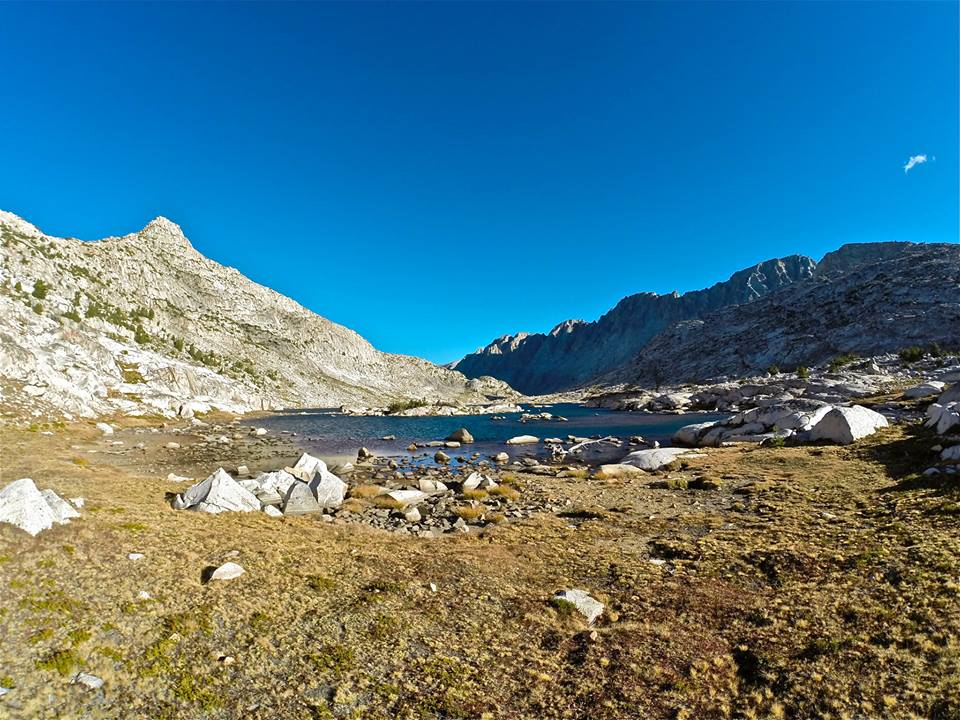
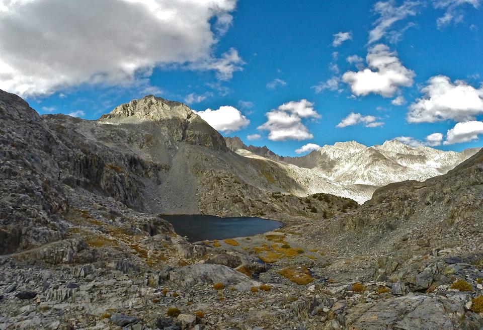
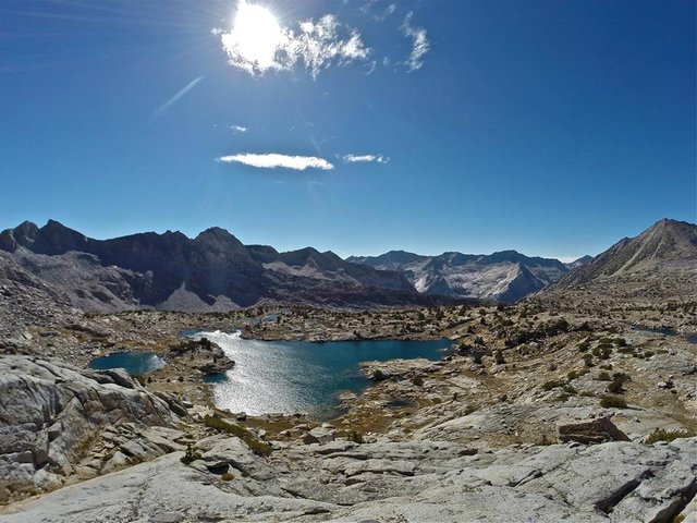
 Arriving at Sapphire Lake
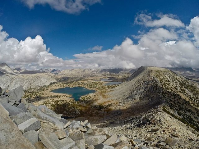
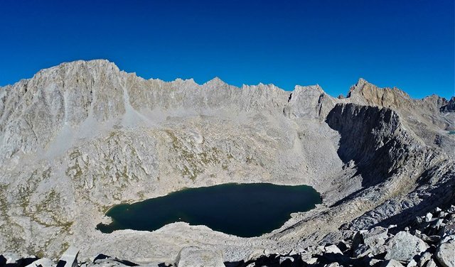
 Overlooking Sapphire lake from the SW slopes of Mt. Spencer
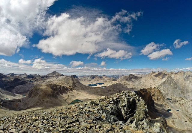
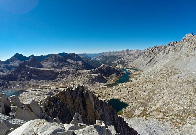 Views SW overlooking Evolution lake and Evolution valley from the summit of Mt. Spencer
 Views S from Mt. Spencer looking way down at our camp at Sapphire lake (on the right)
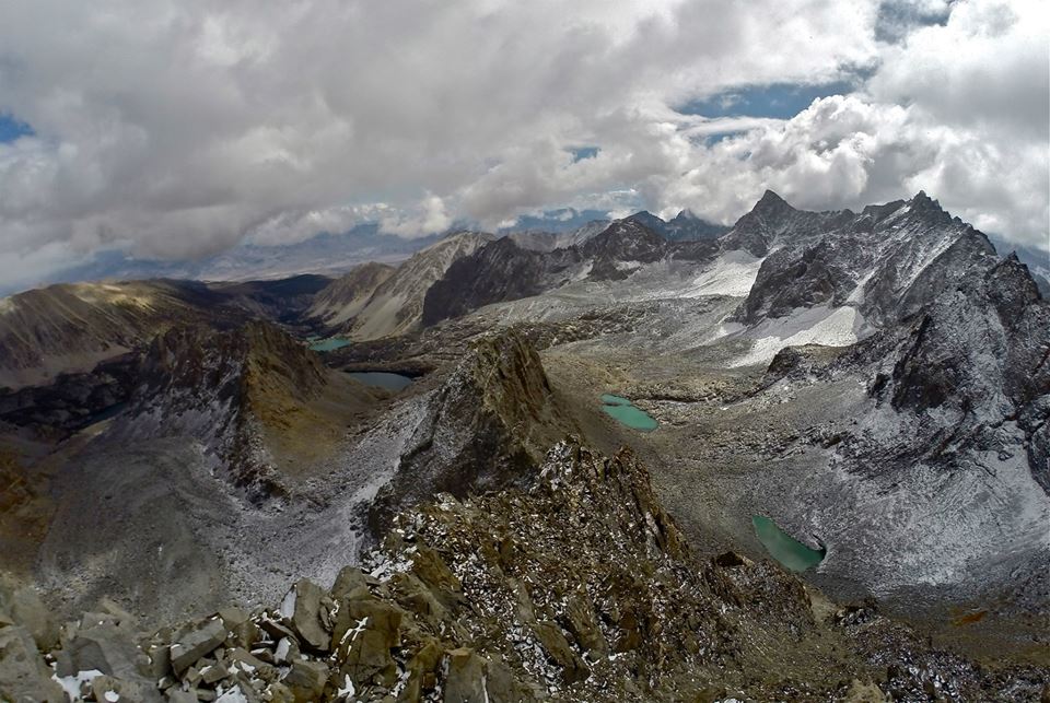
 Views NE from Mt. Spencer with Mt. Darwin towering over Lake 11,594'
 Mom and I standing on the summit of Mt. Spencer
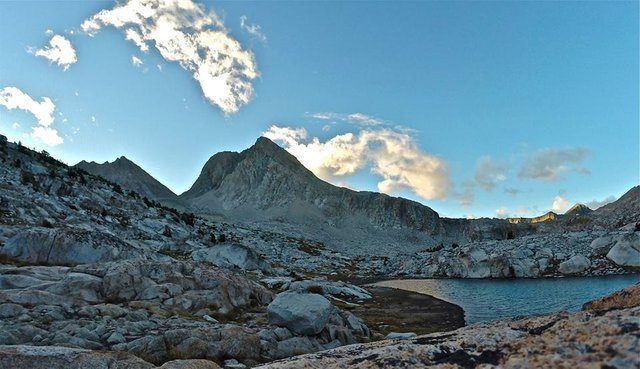 Evening at Sapphire lake
So on day 6 we packed up and left Sapphire lake and headed through Evolution basin by Wanda lake and Lake McDermand up to Muir pass. After a break in the Muir hut, my cousin decided she wanted to finish a day early so she went ahead of us and then finished her hike solo. I on the other hand decided it was a great day for some peak bagging and decided to climb Mt. Solomons(13,034') AND Black Giant(13,330)! Both climbs were steep but relatively easy class 2. The views were amazing of course!! Especially the huge views over LeConte canyon from Black Giant. After my epic peak bagging adventure mom and I dropped down into LeConte canyon and made our camp at beautiful Little Pete meadow. Sitting in the bottom of such a huge canyon, surrounded by massive granite peaks, Little Pete meadow is a little serene paradise. It ended up being a pretty long day, but it was truly amazing. The kind of day that I live for.
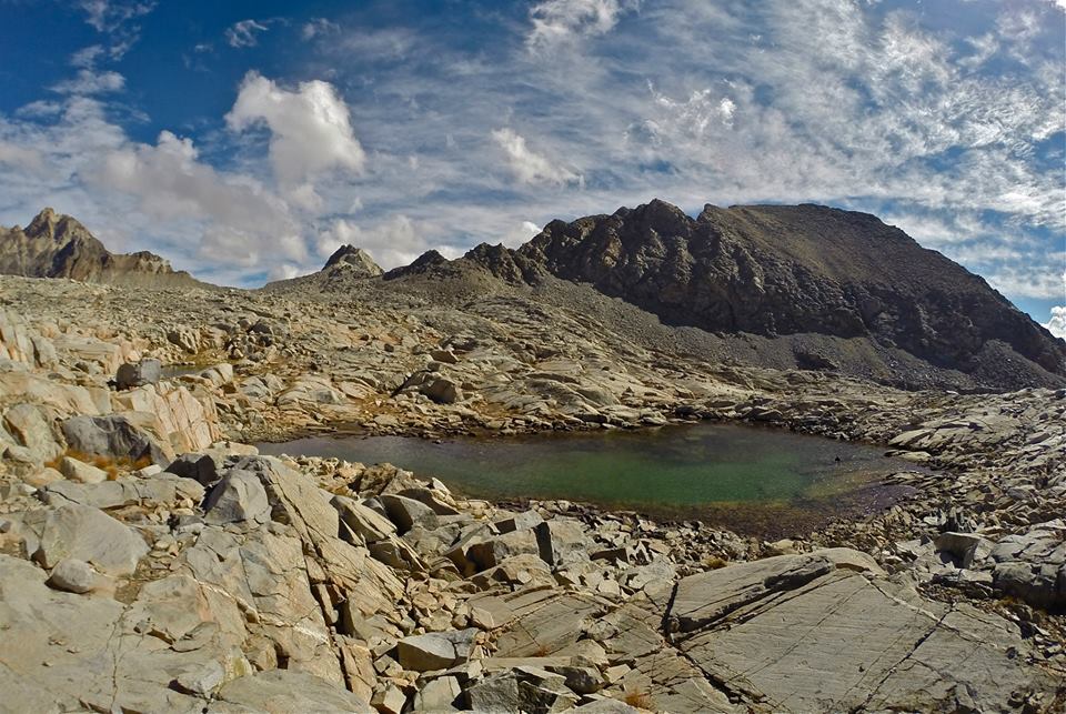
 Evolution Basin
 Wanda Lake
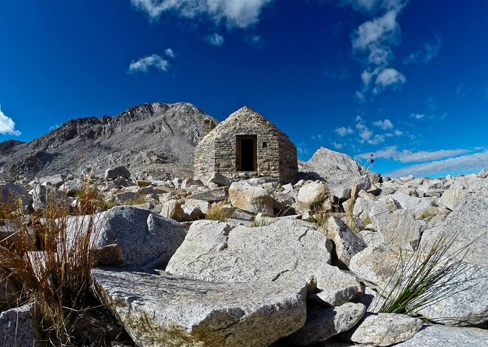 The Muir Hut at Muir Pass
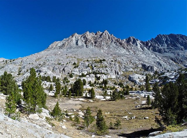
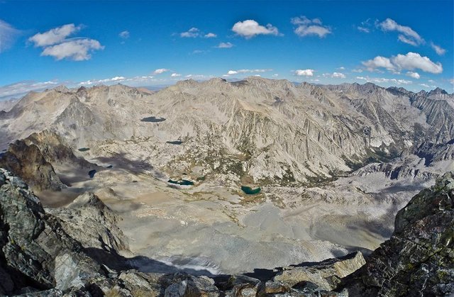
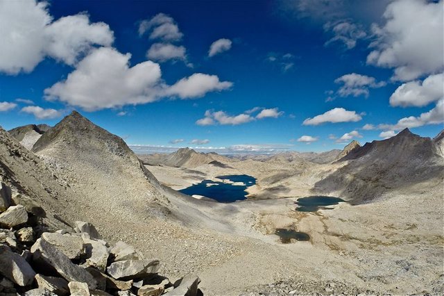 Overlooking upper Evolution basin from the N slope of Mt. Solomons
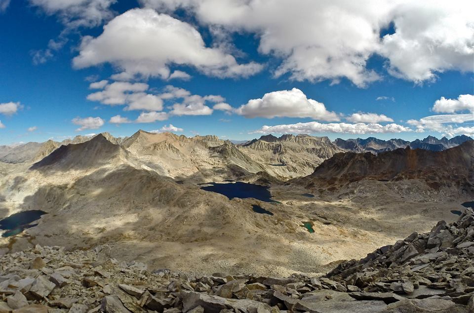 Views NE overlooking the Muir pass area from the top of Mt. Solomons
 Views S overlooking Ionian Basin from Mt. Solomons
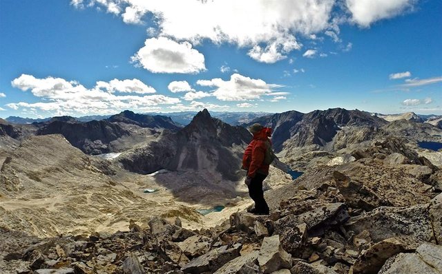
 Traversing from Mt. Solomons to Black Giant
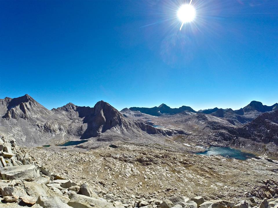
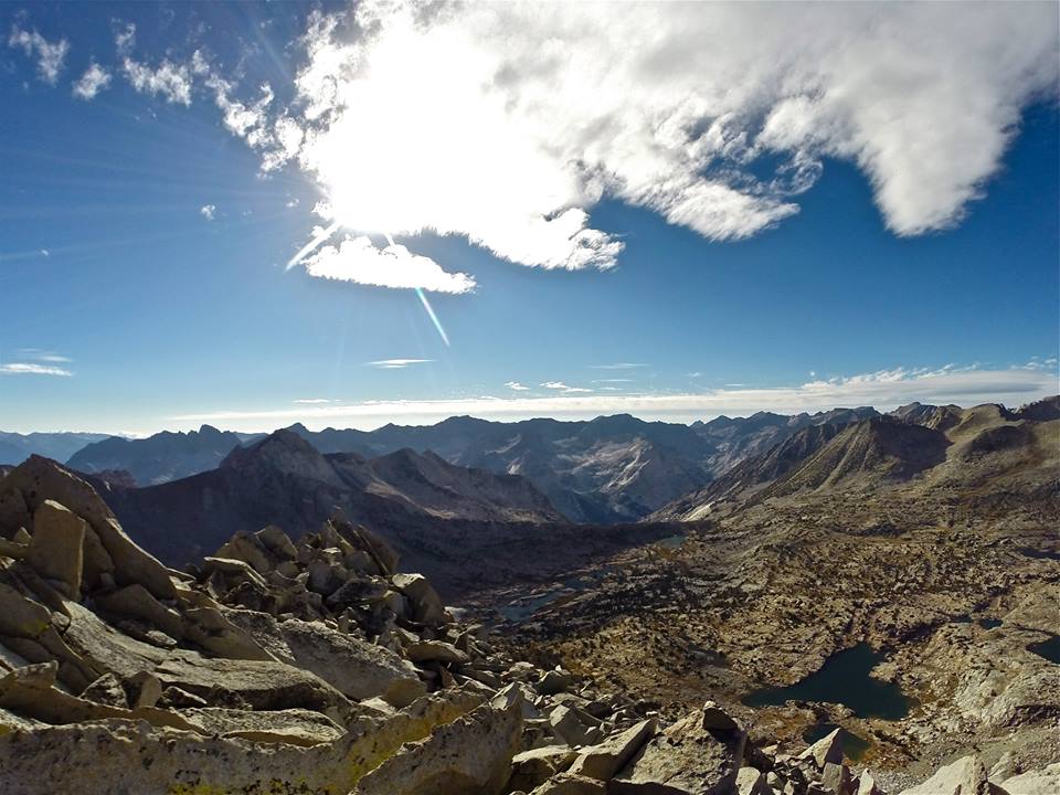
 Views NW from the summit of Black Giant
 Views SE from the summit of Black Giant
 Views NE overlooking LeConte canyon with Little Pete meadow over 4,000 feet below
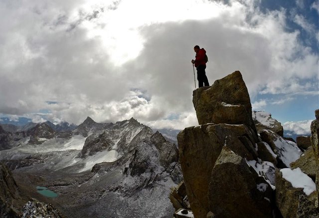
 Shot of me on the summit of Black Giant
 Black Giant pass
 Dropping down into LeConte canyon
 Dropping down into LeConte canyon
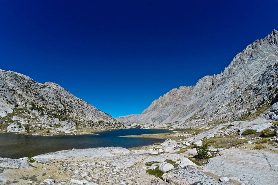
 LeConte canyon
 LeConte canyon
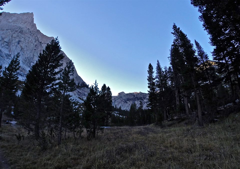 Little Pete Meadow
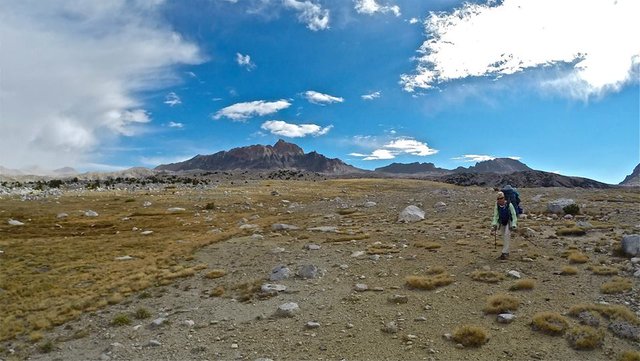
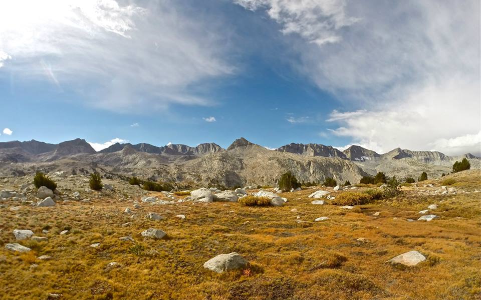
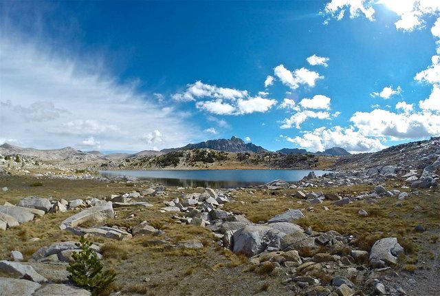
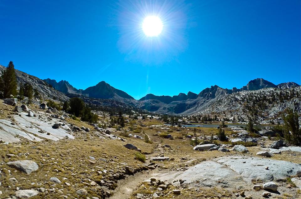
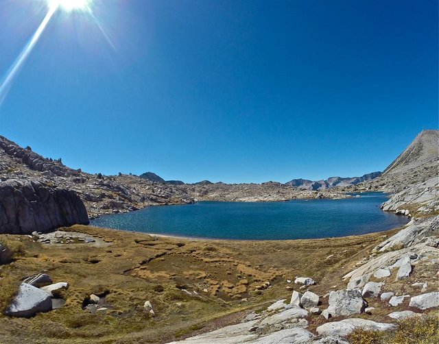
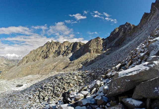
So day 7 we packed up our stuff and headed down the canyon to the junction with the Bishop pass trail. We left the JMT and began our climb up the Bishop pass trail out of LeConte canyon and up into Dusy basin. We made our camp early at one of the beautiful lakes in the upper part of the basin. From there I decided to make the climb up to Columbine peak(12,662') for some awesome views over the area. The climb up and down was a little more technical than I had expected with a bit of class 3 climbing and some huge talus, but it was nothing that I couldn't easily handle. And the summit rock was a really cool 'diving board' kind of rock which made for some great pictures! Then I headed back down to camp and we enjoyed a really nice sunset on the Palisades for our final evening of the trip!
 Climbing out of LeConte canyon
 Climbing out of LeConte canyon
 Climbing into Dusy Basin
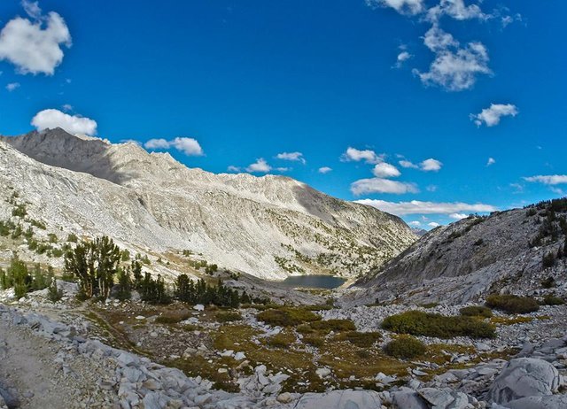
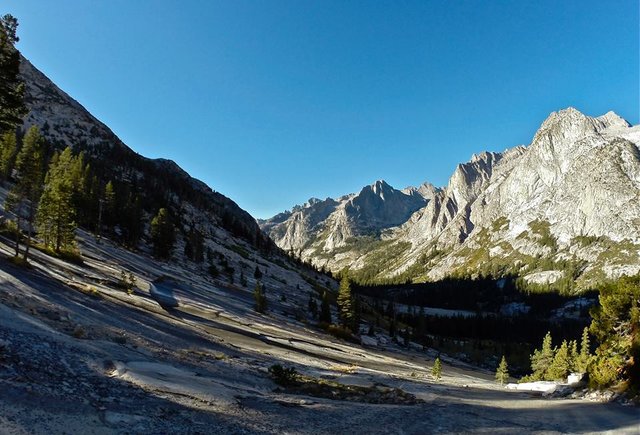
 Lower Dusy Basin
 Dusy Basin
 Dusy Basin
 Dusy Basin
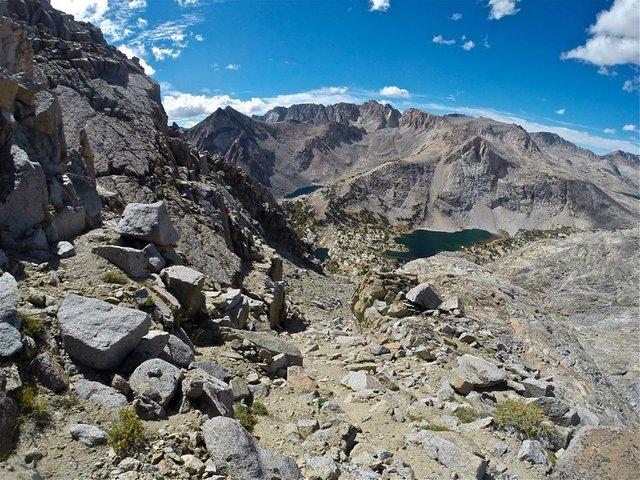
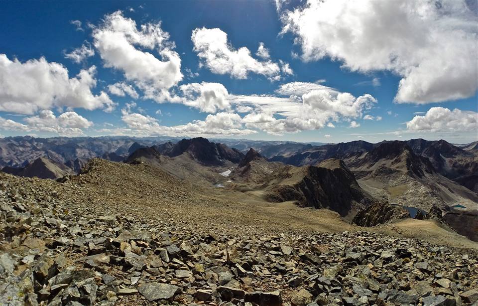
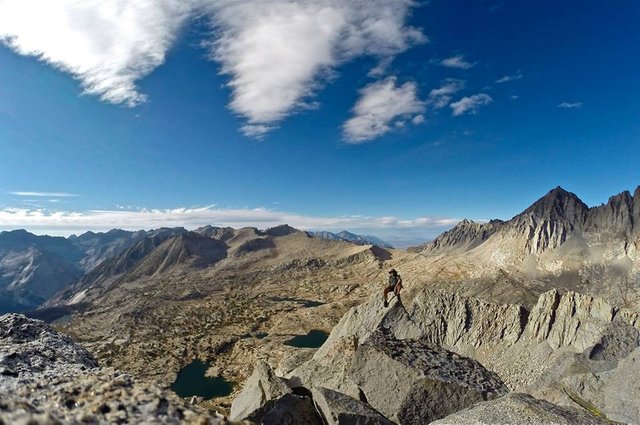
 Views W overlooking Dusy Basin from Columbine peak
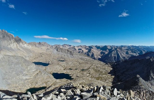 Views SE overlooking Barrett lakes from Columbine peak
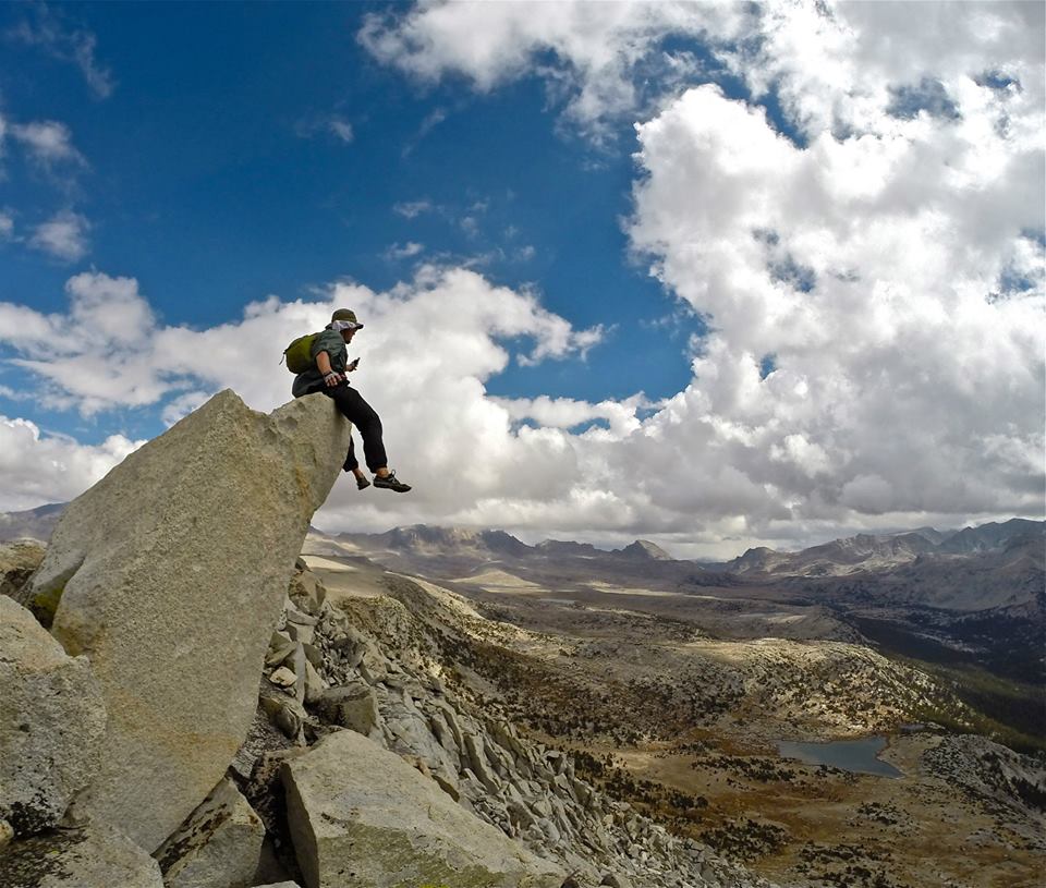
 The 'diving board' summit rock
 Hanging out on the summit of Columbine peak
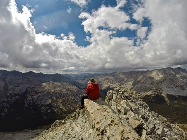
 The Palisades from Dusy Basin
 Sunset glow on the Palisades
 Camping in Dusy basin
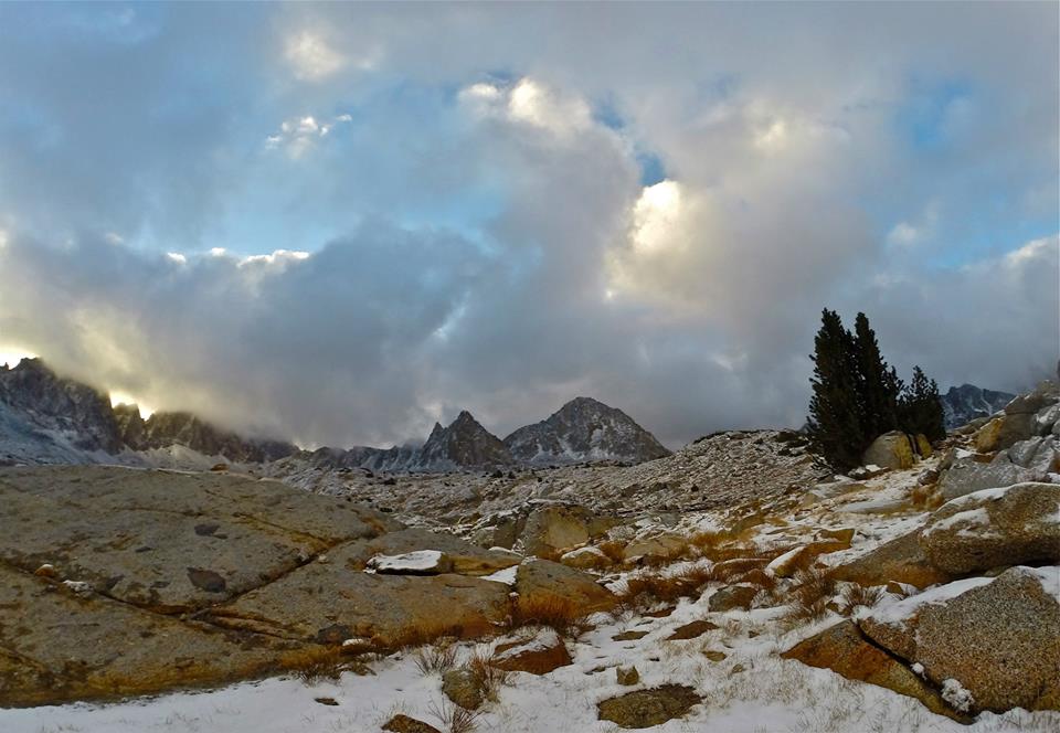
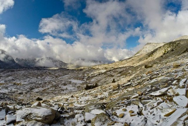
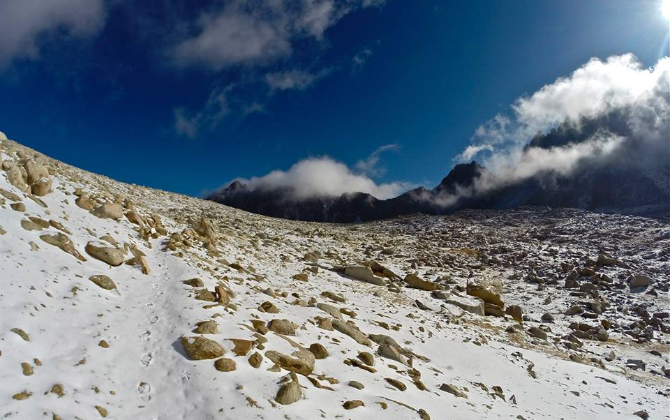
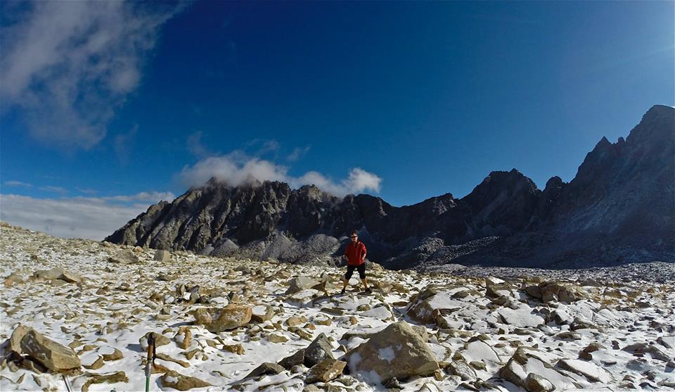
On our final night a storm rolled in and dropped a couple inches of snow on us in Dusy basin. When we woke up the whole basin was coated in white and everything looked super awesome! We packed up our camp and headed for Bishop pass. We arrived at the pass and the clouds had cleared significantly, so we decided to make the climb up to Mt.Agassiz(13,893'), the tallest and the final peak of the trip! We summited with just enough time to enjoy the incredible views before the clouds moved back in and began snowing on us again. The snow and fog made the climb down quite adventurous and it continued to snow on us the rest of the way out on the Bishop pass trail. We hiked through the weather and got down to the trailhead at South lake, our final destination on this awesome trip!! It was really a perfect ending to this incredible adventure.
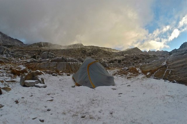 Fresh snow in Dusy basin
 Fresh snow in Dusy basin
 Climbing out of Dusy basin
 Approaching Bishop pass
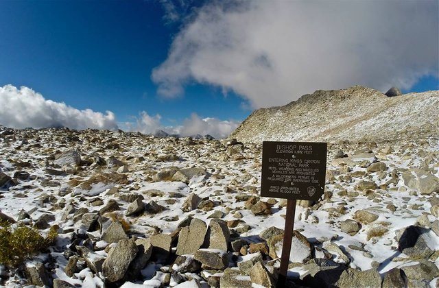 Bishop pass
 Me on Bishop pass
 Climbing Mt. Agassiz
 Climbing Mt. Agassiz
 Views W from the summit of Mt. Agassiz
 Views E from the summit of Mt. Agassiz
 Standing on the summit of Mt. Agassiz
 Mom and I on Mt. Agassiz
 Descending from Bishop pass
 Descending from Bishop pass
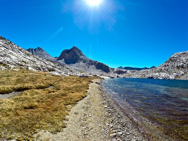
 Bishop lake
 Looking back to Mt. Agassiz (now in the clouds)
 Saddlerock lake
 Long lake
 Fall colors above South lake
Thanks for reading! 

Youtube video -
Thanks for watching!! 
Map -
!steemitworldmap 37.229573 lat -118.618582 long 'North Lake' D3SCR
https://www.facebook.com/CAmountainadventures
https://discord.gg/g22zkFD
Omg! I don't have the time to read it now, but be sure I will!
Upvoted and resteemed by the @Climbing-Trail!
The @Climbing-Trail is an account dedicated to give climbing, alpinism and hiking a plattform here on Steemit. It is curated by @HaTo.
Thanks again @climing-trail! I appreciate the support. Let me know what you think once you get to read through it!
First of all, I'm impressed that you are able to recall all those names! I would be completely lost! ;-)
But what an adventure! I have so many questions:
I'm not an inexperienced hiker myself, but this is at a whole other level. Great post indeed! Thank you so much for sharing!
Wow, thanks for all the great questions! For the most part I don't really have a great memory, but somehow I'm great with place names in the mountains. Probably because I'm always studying the maps... I'm kinda a mapaholic. lol. The tough part is when they start using the same name for multiple places. I couldn't tell you how many "Fish creeks" I've been to. I've stood on Mt. Morgan and had great great views of the other Mt. Morgan. Why they would name 2 mountains so close to each other the same name I've got no idea. But it happens all the time. You could hike from Rancheria creek to the other Rancheria creek or hike the opposite direction to the other Rancheria creek. It can get a bit ridiculous honestly, but somehow I am still pretty good at keeping it all straight.
As for preparation for a long backpacking trip it's not much different than a short trip, but just more food. I count out how many days I'm hiking for and setup that many meals and day snacks. Then I double check all my gear for any problems before throwing it in the backpack and I'm off. Specific preparations are more specific to the places you are going than to the length of the trip. What type of terrain you are traversing, what type of weather might be encountered, what types of wild animals might be encountered, any government rules and regulations for the area, etc. For really long trips you can have food resupplies along your trip so you aren't carrying all the food at once, but that has to play in with the logistics of the itinerary.
As far as what types of food I like to bring, my dinners are all dehydrated. I have my own dehydrator so I can have all kinds of great ingredients for my meals. I'll buy some Knorr rice or pasta sides, some dehydrated refried beans, some idahoan powder potatoes, some ramen soups, some couscous, and other stuff like that and then add all my dehydrated veggies to them. And a lot of those veggies actually come from my own garden too so thats really cool. For breakfast I usually do oatmeal with dehydrated fruit and some seeds and nuts. For daytime snacks I go with more dehydrated fruit, trail mix, some crackers, and some energy bars that I put in my hip pocket for easy access while hiking.
As for the weight of my pack it can really vary just depending on how many luxury items I bring. Things like a block of cheese and a little bottle of booze are my weakness when It comes to going lightweight. lol. For this trip my bag was around 35-40lbs.
As for bad weather, rain gear, pants and jacket come on every backpacking trip. If you are out in the time of year where you could have a big snowstorm things like crampons, snow gaiters, and ice axe should all be packed. Other than that you are just out there exposed living in whatever mother nature has to throw at you. Bad weather is really just all part of the experience, and personally I often really enjoy it.
About how far do I get from 'civilization'... as far as possible! lol. But ya, especially in the High Sierra there are lots of times where I'm well over 20 miles from any trailheads.
As for how long I've been backpacking. Over 27 years. My parents took me on my first backpacking trip when I was only 5. By 7 I had already climbed a few peaks including the highest peak in SoCal. Through my teenage years my parents had problems and we didn't go out a lot, but my mom always made sure we'd get a trip or 2 in every year. Then once I was on my own in my early 20's one of the trips my mom planned was to Mt. Whitney the highest peak in the lower 48. It was actually my 2nd trip to Mt. Whitney, but this time it really captured me. I was in awe of the grandeur of the High Sierra. And Mt. Whitney is at the end of the famous John Muir Trail so I started looking into this JMT thing. That winter I was up in Mammoth on a snowboarding trip with my mom and we planned it all out. And the next summer we hiked the entire John Muir trail from Yosemite valley to Mt. Whitney. Around 300 miles in 32 days! (I'll probably write up a Steemit post about that one someday) After that I was completely hooked and have been backpacking all over California ever since! My mom lives in Arizona and she has a big hiking club out there that she hikes with, but we still always try to get together for a trip or 2 every year! She likes to get me out there for trips in the Grand Canyon and I like to get her out here for trips in the High Sierra.
Well, I hope I answered all your questions. Thanks again for asking, and f you have any more questions feel free to ask!
Wow! Thank you for your detailed answer!!! That is a post in itself! Maybe you should write a post about how to prepare for a long backpacking trip. Something like the dos and don'ts in backpacking!
Getting out there, experiencing unspoiled nature and getting through the rougher bits is just so rewarding! It's great that you and other people love it as much as I do!
Finally I have one last question: how often do you get out every year?
Ps: I would love to hear your story about hiking John Muir Trail!!!
Ya, with all those questions I knew my reply was gonna be a long one. Thanks for the post idea! I'll think about doing a post like that. Looking back at this year I think I've got at least 80 days out hiking/backpacking so far. That does include the single day trips. I think last year was a lot more. I probably got over 120 days last year! And according to my Peakery page I've only climbed 9 peaks this year so far as compared to 28 last year. https://peakery.com/members/DerekJayRichardson/summits/#year=®ion=&order=successes&page=1 I'll just have to make up for it next year! I bet I could get 40+ peaks next year if I try. I have a friend who actually climbed 100 peaks in a year as a self challenge kinda thing a few years back. So I think 40 should be doable for me.
Jesus Christ what a adventure.. 8 days of hiking.. I wouldn't be able to carry enough weed... those are phenomenal pictures you took and it looks like you had a blast.. how many miles in all did you hike?
It was a great adventure. 8 days is long, but I've done even longer trips. And luckily for me weed is pretty lightweight! lol. This hike was approx 80 miles total.
Damn.. 80 miles.. that hurts my feet just thinking about it
My longest hike was an almost 300 mile hike. My mom did approximately 500 miles when she hiked the entire Colorado trail last year.
Damn y'all are hard core.
Wow, 300 and 500 miles!! That's amazing :O You should both be really proud! And thanks for the great post, now I have more places for my "places to visit in California" list :)
I wish I could upvote this multiple times. That's an impressive hike and you got some balls taking pictures standing on those rocks at the peaks with the huge drop in front of you! I tip my hat to you, sir.
Thanks @geoffd84! It was a really impressive hike, the whole area is really incredible. And then getting to overlook it all from those peaks... it was incredible. And the vertical exposure doesn't bother me, I actually enjoy it! Its a big part of the fun when I'm climbing. I'm a little bit crazy. lol.
Haha I'm a bit wild myself but I'm pretty sure that's the number one way people die on hikes... I'm not totally sure about that but I know for sure it's the number one way people die at the Grand Canyon.
Living vicariously through you right now. My hike today got cancelled due to work. Hope all is well!
Yup, falling is the #1. Drowning is #2. I love hiking in the Grand Canyon, me and a friend of mine are trying to plan a trip out there possibly early December. Hopefully we can figure it out and make it happen. Bummer that you didn't get to do your hike. Fuckin' work, always fucking up hiking plans. lol.
Haha yup it always does. I really need the money though after rolling the dice to move out here from New Orleans and losing almost everything. Hope your trip works out. I'll be looking out for the post.
I've been on brief trips to Sequoia and Yosemite, but wow, I had no idea the entire mountain range was so expansive and beautiful. Congrats on your journey.
Your adventures have completely inspired me to get out and further explore the Sierras. Thanks for putting the time into creating this quality post.
Yup, the Sierra Nevada mountain range is gigantic. And it's all beautiful! I could spend the rest of my life exploring the Sierras. I'm honored to be an inspiration. Get out there and explore the backcountry and you will not be disappointed! If you have any questions about planning a trip in the Sierras feel free to ask me anything.
Good Lord!! That was the most epic walkwithme post I've ever seen. And your Mom is mind blowingly awesome!! Some of the places you guys were taking photos from, holy crap I'm scared just looking at it!
Those lakes were incredible! I bet the water is pretty cold though, I didn't see any selfies of you in the lake hahaa.
This one is one of my favourites, it's so inviting...
Heck ya! The 'most epic walkwithme post' award goes to this guy! Thanks @lyndsaybowes!! I think it's a really fun tag, I highly enjoy seeing what other people see on their walks. Each post is like getting a little intimate glimpse of some other part of the world.
Plus, dude, your family rocks!!
Thanks! They are all pretty legit. lol. Especially my mom though, she is a real inspiration to me.
This is an amazing travel blog@derekrichardson! What an epic adventure and your photos are incredible.
Thank you @choogirl! It was an epic adventure indeed.
Heya, just swinging by to let you know you're being featured in our Daily Travel Digest!
Thank you!!

Found you on travel digest, now following. Wow! Used to do some backpacking years ago but I'm height-adverse so wouldn't do what you do - thank you for taking me there with these wonderful shots and story!
It's my pleasure @brightongreg. I highly enjoy getting to share my adventures with others. Thank you for following! I also love reading about other people's adventures so I really am enjoying the steemitworldmap project and the travel digest. Not only does it help me share my posts with others, it provides great posts for me to read, and in the long run it is a data base of info that could be used in planning of future trips! It's just all around great, and I'm happy you found me there!

I've been a great fan of the map and now the digest for some time. Luckily the creator saw I was posting a series moving around Australia a lot and asked if I'd help beta test the app, so I got to see it when there were about 10 pins on it! it's a great tool, and now the first thing I do every day if I'm not posting is check the digest.
Safe travels!
WOW! What an EPIC travel/photography post. The photos are incredible- nice job on that.
-- I found your post in the Steemit Worldmap Digest :-)
Thank you! I'm happy that you enjoyed my photos! I'm loving the Steemit Worldmap, I think it is such a great project. And being featured in the travel digest is just a bonus. And I'm really glad that you were able to find my post there!
great post! thanks for sharing with us! enjoyed it!
Thanks @philippbuxbaum! I'm really glad you enjoyed it.
