I took my kid, my wife and my dog into the wilderness. Part 2
Into the wilderness with my child, my wife and my dog. Part 2
Link to part 1
https://steemit.com/travel/@waggy6/i-took-my-kid-my-wife-and-my-dog-backpacking-into-the-wilderness-part-1
So I left off the last blog post teasing our trip and how we were simultaneously prepared yet unprepared for our hike through Red River Gorge. I'd like to describe that first day out on the trail and how tiringly wonderful it was.
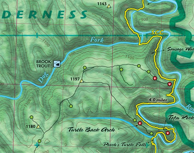
I wanted to take a picture of the maps that I used for our Red River Gorge hike. I was spoiled by them. I have not found maps of this quality for anywhere else we've gone. I would highly recommend them for anyone hiking in Red River Gorge. These maps were well Illustrated topographical maps highlighting all of the official trails and unofficial trails in The Gorge, as well as any campsites that fall within the rules of where you're allowed to camp.
Here's a sample image of the map. Courtesy of outragegis.com
To order maps go to:
https://www.outragegis.com/gorge/
Since I can't find my copy of the maps right now we'll just use this one.
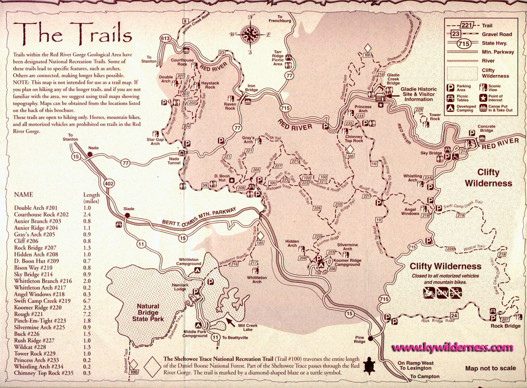
Map courtesy the Purdue Hiking Club
It's not against the rules to hike off trail in Red River Gorge, but with the terrain it's probably not a good idea, it would be very easy to get lost. Also there are specific rules for where you make camp. You must camp more than 300 feet from any official trail. It's also a good idea to try and camp where other people have already camped so as to disturb the environment as little as possible. You also may not camp near a cliff or in one of the many rock shelters.
I really appreciate the rules for camping. I find that the 300-foot rule means that people are camping beyond view of the trail, so even if there are other people there you're less likely to see them. The other rules obviously are for safety, such as not camping near a cliff. The rule about camping in or under the rock shelters is due to the archaeological nature of them. Native Americans used them for shelter and they are considered important archaeological areas. There is also a species of plants unique to the area that lives only is these area.
We started our hiking trip after staying at the Koomer Ridge Campground overnight. The plan was to leave the car parked at Koomer Ridge and have someone drive us to the trailhead at Rock Bridge. If you look at the map that I have included Rock Bridge Trail is in the lower right hand side.
We decided to hike the slightly longer route and hike the Rock Bridge Loop before continuing all the way up Swift Camp Creek Trail, Rough Trail and then koomer Ridge Trail back to the campground. We figured this would take at least 3 days and we had provisions for 5.
We were picked up at about 3 in the afternoon by Ken who owns Red River Adventure, a canoe depot and campground next to the Red River. He drove us and our gear to the start of the trailhead. So we began our hike at about 4 in the afternoon.
http://www.redriveradventure.net
Once again if you look at the map you'll see that Swift Camp Creek Trail is all of about 7 miles and The Rock bridge loop ads maybe a mile to that.
I'm really glad we hiked Rock Bridge loop, some of the pictures I included in the last blog post we came across within the first 20 minutes of our hike. I'm going to show them again here so you get an idea of what we saw the moment we were hiking through the woods.
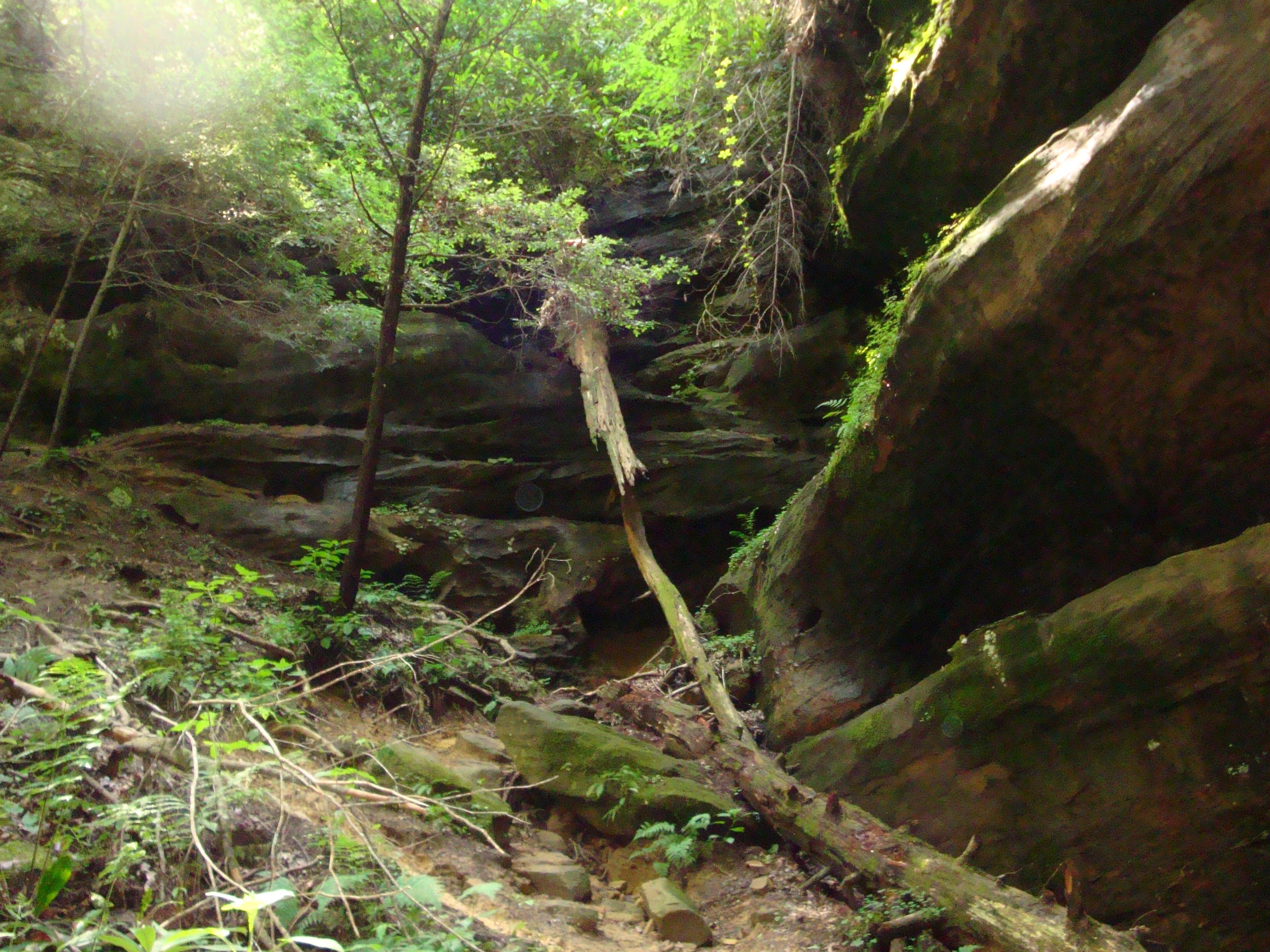
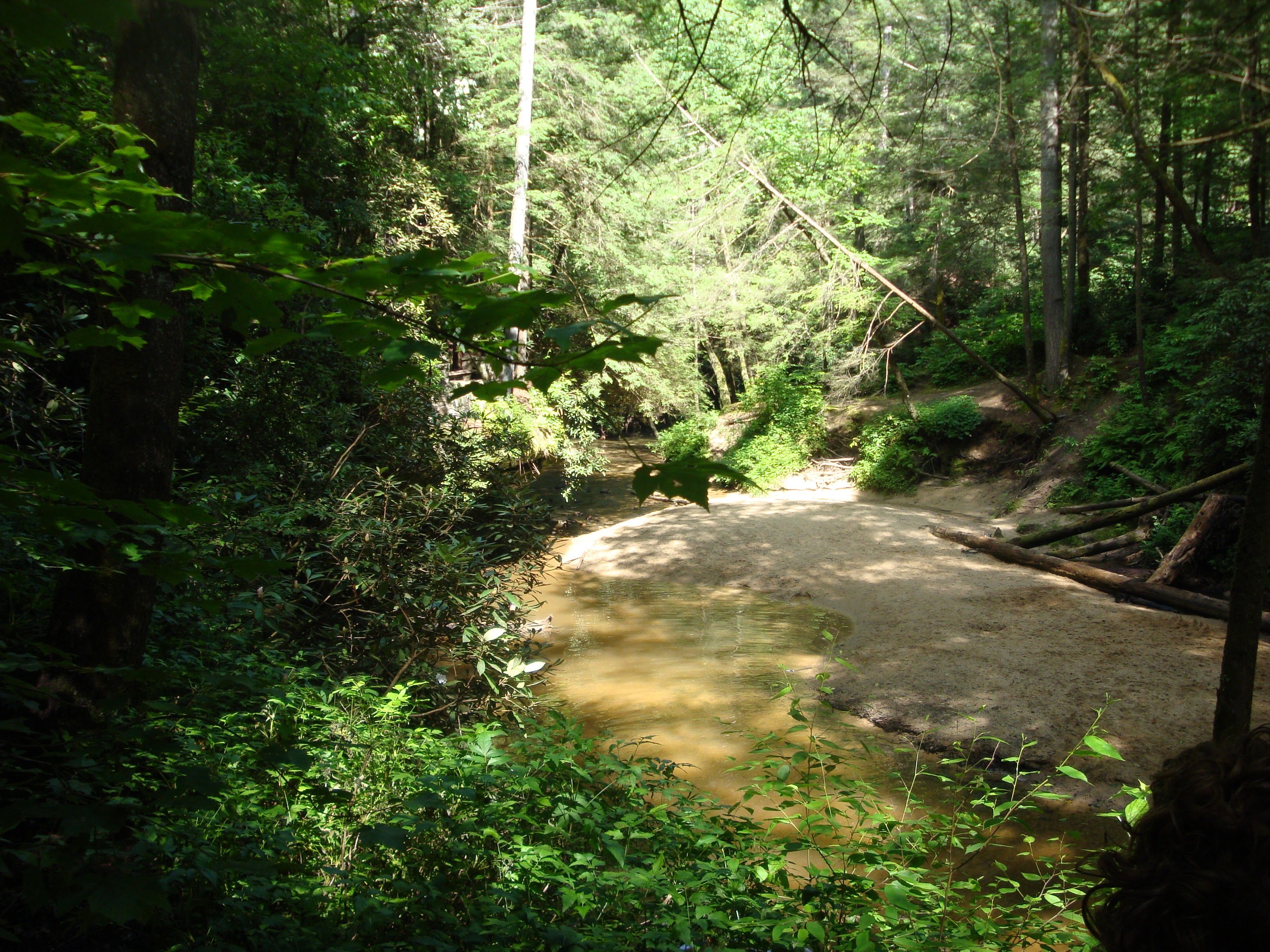
The Rock Bridge Loop trail passes by some great features like Creation Falls.
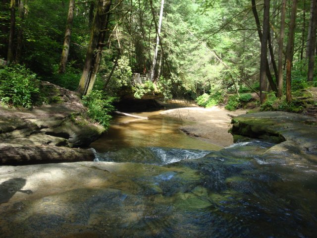
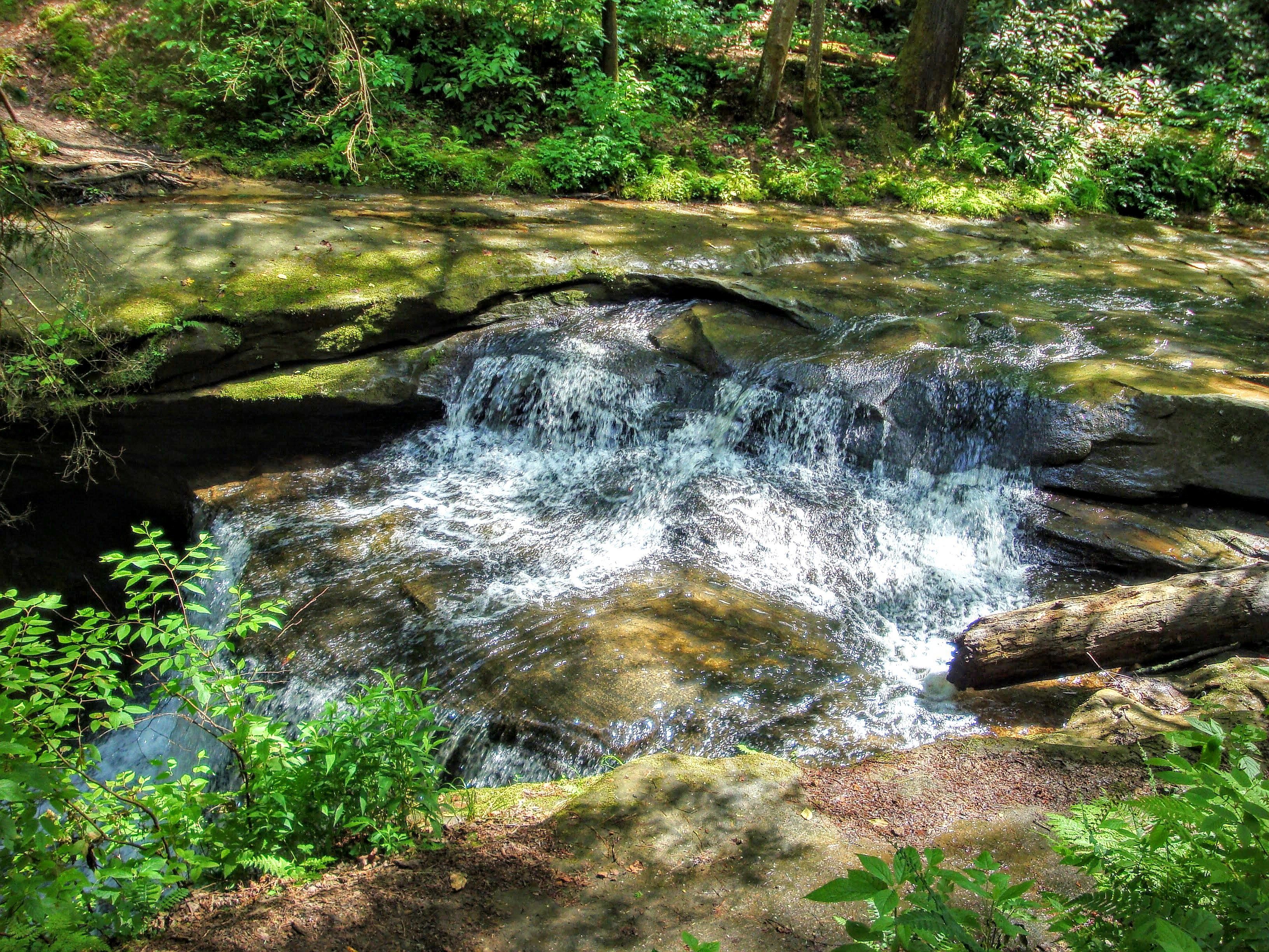
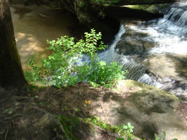
Creation Falls is where we took our first break to cool off and splash around. The waterfalls here are not large but they are still very nice and on a 95 degree day it's a great place to be.
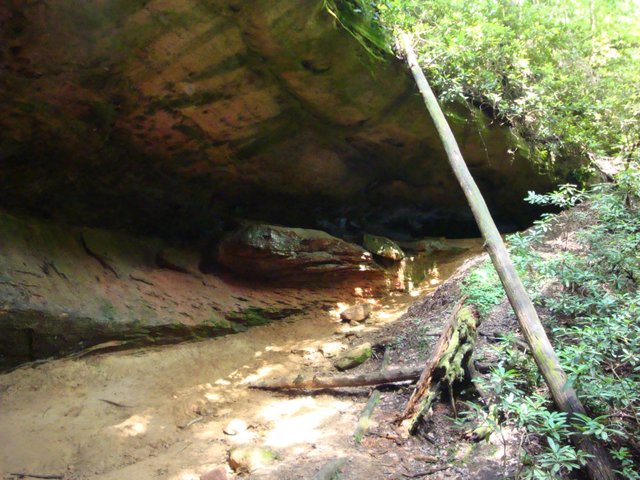
The next thing you hike past on the trail is Rock Bridge. Excuse the blurry photos but they're the best I've got.
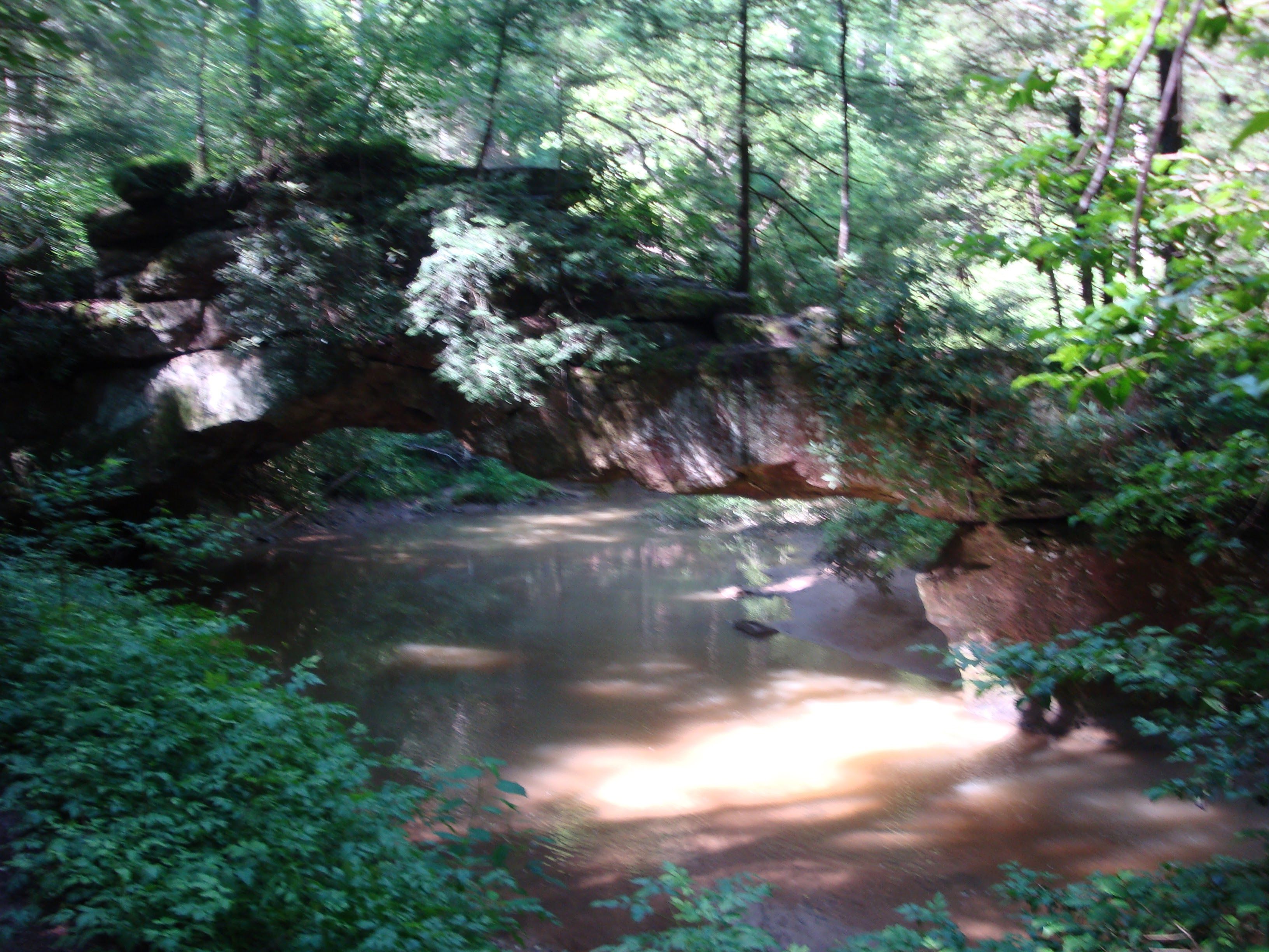
There are a lot of natural arches in Red River Gorge however this is the only known one that has water actively passing under it.
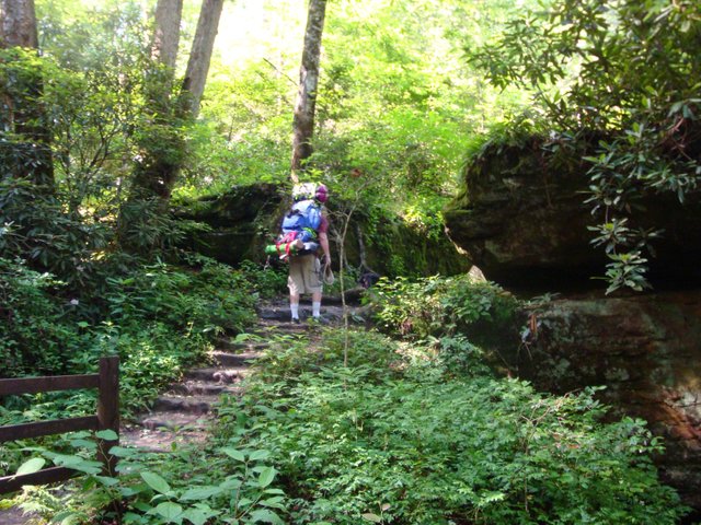
This is where my wife also took the photo of me hiking up some steps near Rock Bridge.
You can see how much gear I have on my pack in that photo. I over-packed. As the trip continued.. no, actually I already was regretting how much weight I had chosen to carry and we were only a mile in. It didn't seem like much in the parking lot but after already having hike to mile at what's a lot of weight.
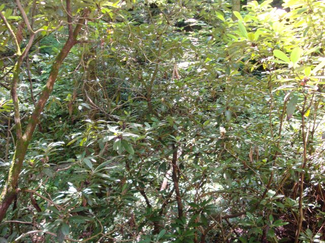
At this point we are only a mile into our trip but we were already appreciating the beauty of this place, picture don't do it justice because there is an experience that is hard to describe. The small waterfalls cascading over the edges of cliffs and caves that you often hear before you see, the cool breeze as you approach the caves and waterfalls, the beautiful ferns, tall trees, rhododendrons in bloom, and streams winding through the landscape. We were already in love with the place before the end of the first mile.
Continuing down Swift Camp Creek Trail from the split with Rock bridge Trail we started to see less and less people. The trail became more rough and narrow. It is a steep climb on one side of the trail and a sharp drop on the other. As we continued to hike, the trail winds around huge house size boulders and traverses across small streams.
Having started our hike at 4 in the afternoon finding a campsite was quickly becoming a priority. It was hot out , we were tired and we didn't want to end up making camp in the dark, or worse, caught on the trail too late.
This is where those great maps came in helpful. Swift Camp Creek is a very steep ravine, without the maps it would be very hard to find a level campsite. With the maps we had clearly marked campsites and we could be confident that if we chose to turn down one site for the next we knew exactly how far we had to go.
We stopped at one possible campsite where we met a young couple who had started an unknown large animal further up the trail. They had decided to turn back. We didn't really like hearing this but we checked that our bear spray was easily accessible and we continued on the the next campsite on the map.
Finally, as the light just barely started to fade. That point where you know the sun will be setting soon we arrived at a point on the map marked Turtle Falls. The trail actually passes over the top of the waterfall and although you can hear it you can't see it. ( For reference, it's about 1/3rd the way from the starting point to Wildcat Trail.)
Our priority now was getting camp set up. It was going to get dark soon, we were exhausted and sweaty, my legs hurt and we had only gone about 2 miles in total all day. We needed to find a safe and level site for our tent, we needed to find a tree to hang our food in, and we needed to make dinner.
When it comes to food while we are hiking we don't mess around. A lot of our food comes from Mountain House.
Basically all you do is add some boiling water into a pack of dehydrated food and there you have it, a pretty decent meal. As darkness set in and with the sound of the waterfall in the background we prepared for our first night on the trail.
Stay tuned for part 3
Forest service site for The Gorge
https://www.fs.usda.gov/detail/dbnf/specialplaces/?cid=stelprdb5277259
So I'm pretty new at this. I could use any feedback you might have. Also I'm wondering if anyone has any questions or requests if what I should talk about next time. Comment below.
You just planted 0.25 tree(s)!
Thanks to @waggy6
We have planted already 3817.33 trees
out of 1,000,000
Let's save and restore Abongphen Highland Forest
in Cameroonian village Kedjom-Keku!
Plant trees with @treeplanter and get paid for it!
My Steem Power = 18667.39
Thanks a lot!
@martin.mikes coordinator of @kedjom-keku
Resteemed by @resteembot! Good Luck!
Curious? Read @resteembot's introduction post
Check out the great posts I already resteemed.
ResteemBot's Maker is Looking for Work
Congratulations! This post has been upvoted from the communal account, @minnowsupport, by Waggy from the Minnow Support Project. It's a witness project run by aggroed, ausbitbank, teamsteem, theprophet0, someguy123, neoxian, followbtcnews, and netuoso. The goal is to help Steemit grow by supporting Minnows. Please find us at the Peace, Abundance, and Liberty Network (PALnet) Discord Channel. It's a completely public and open space to all members of the Steemit community who voluntarily choose to be there.
If you would like to delegate to the Minnow Support Project you can do so by clicking on the following links: 50SP, 100SP, 250SP, 500SP, 1000SP, 5000SP.
Be sure to leave at least 50SP undelegated on your account.
Nice post, really love it
Thank you. I hope you read the next installment.
Congratulations @waggy6! You have completed some achievement on Steemit and have been rewarded with new badge(s) :
Click on any badge to view your own Board of Honor on SteemitBoard.
For more information about SteemitBoard, click here
If you no longer want to receive notifications, reply to this comment with the word
STOPHurray.
@originalworks
Apologize for the delay, been managing and speaking about Steem at the Steem Creators Conference in Las Vegas, NV all weekend. Expect to be within the the 24-48 hour upvote window in the next 48 hours.
As a friendly reminder, the upvote fee is $0.08 SBD ($0.081 for incognito). Current 300%+ upvote is now $0.24+ SBD.
That being said…
Investors who delegate SP to @thundercurator are entitled to 75% of @thundercurator income after curation. Get on-board early and grow with us!