Take a Virtural Hike around Volcano near Seattle - Mt Rainier - Washington, USA - So Cool!
I was absolutely blown away when I got home and saw how well this picture I took while hiking at Mt Rainier Paradise Park turned out.
This is the best picture I've ever taken. It seems everything was perfect. Mt Rainier is stunning.
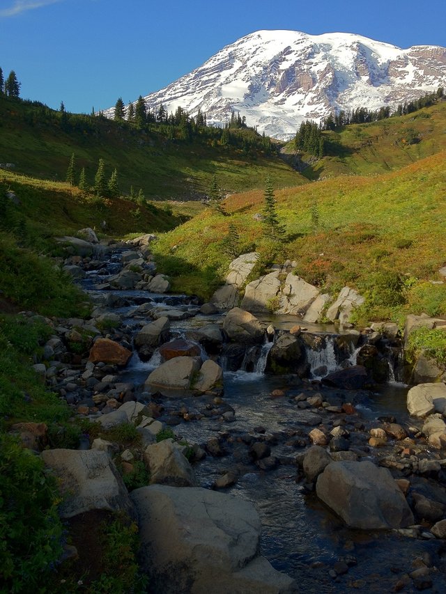
(This was taken by me with an iPhone 4S. I was amazed!)
I actually found the exact spot I took the picture on Google 3D camera. Click that link. It is so cool that google now has off road cameras and you can even hike around Mt Rainier. You can click in a direction and move just like the road maps.
Then click here to see a 360 from the top.
Here are some FAQ's about Mount Rainier:
- Located in Washington State, USA
- The official height is 14,410 ft above sea level.
- In 2015 - 10,025 people tried to climb Mount Rainier - 4,888 reached the summit.
- Mount Rainier is considered an 'episodically active' volcano, which means it will erupt again some time.
- Mount Rainier last erupted about 1,000 years ago.
Taken from a distance showing the mountain
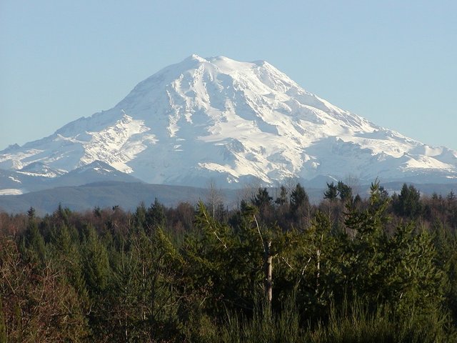
(This was taken awhile ago and I'm only including it here to show the view of the entire mountain)
(These pictures were taken by me)
I'm self promoting this post since it is well received, so there is no need for you to Promote it. You can support me with your upvotes and comments. Thanks Steemit community.
Be sure to check out some of my other posts:
- My introduction - Long time Atari game designer saying hi! Going down memory lane
- SteemWho.com - Help People Find You - Get Listed!
- Moving to paradise - From creating QuickPay for Quicken to living on a sailboat in the Caribbean - Part 1
- Moving to paradise - Part 2 - Sint Maarten to Virgin Gorda and almost crashing on the rocks
- At 42 I thought my life was over - My amazing transformation - It is never too late
- How to draw a Stick Figure - Complete full body tutorial - lol - just having fun :)
- Tropical Paradise - Boracay Philippines - If you need to get away this is it!
- Promoting Steemit while onboard a cruise. Be sure to watch me dock
- Our Aqua Safari at Bora Bora - What a wonderful time

Before you click any links please upvote this post first. Thank you. I would love to make steemit my home.
I live in the Pacific North West and have the great privilege to look up in the blue sky to see this majestic mountain called "Rainer". It never fails to enrich my senses when I see it, especially when I get closer views at it, such as the ones that you've provided in these photos, here.
The beauty of Mount Rainier is a treasure to behold.
This is really amazing for an iPhone....great angle and I love the sunshine.
What camera + lens combo did you use out of curiosity?
Ummm, it was a iPhone 4S :) I was amazed in that fact alone. Do you think I should include that?
Maybe if you want a sponsorship from Apple ;)
Cool job! I love the first photo!
Thanks. Yes that was the one I wanted to showcase. The second one just showed the full mountain.
I would love to go backpacking out there some day. It's so beautiful. Congrats on the awesome photography.
Well now you can virtually ;) I know not the same. But someday it will be just like that Schwarzenegger movie Total Recall. Just put on your VR headset and you're there ;)
Really impressive and expressive pictures. Good job! Thank you for sharing. Mount Rainer - nice to meet you))
Thanks I'm happy that I was able to capture a glimpse of our States beauty.
Lovely
Just Love Pictures And Stories from
this area of the country.
Very Beautiful!
Yes, be sure you take a tour on the virtual hike.
Beautiful photos! Looks like an amazing place.
Oh it is awesome here. The Pacific Northwest is known for its outdoor adventures.
Amazing nature and shot, urban pressure retreated under it. thank you
You are most welcome. I'm glad it turned out.
That's certainly a gorgeous shot:)
Thanks. I was amazed. I was equally shocked to find the exact location where I took the picture from google 3d camera.
I need to get out into the wilderness. To hear nothing of man, only the sounds of nature.
Yes you should :)