Climbing the highest mountain of Lam Dong Province - Lang Biang, Da Lat, Vietnam [Day 7]
Today I'm going hiking with a friend. The place we're going to is the highest point of the Lam Dong province (Da Lat). The starting point is only a 20 minute drive by motorbike from the hostel. The climb starts at 1490 m (4888.5 feet) and the peak is 2167 m (7109.5 feet). So the total climb is 677 m (2221 feet). I'm not trained for any of this, I know it's going to be a challenge. We took a total of 6 hours on this hike. This is a lot of time. But we chilled at the top for over 1 hour. I think I would be able to do it in 4 - 4.5 hours round trip if I didn't chill out at the top.
The address for the starting point is 305 Lang Biang, Thị trấn Lạc Dương, Lạc Dương, Lâm Đồng 672700, Vietnam.
Where to go?
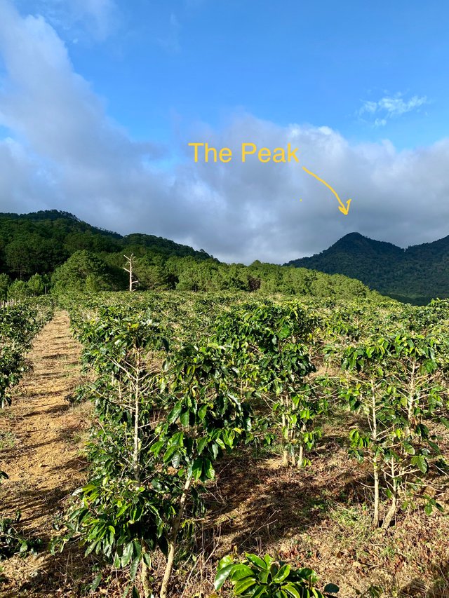
The Lang Biang has 2 peaks. There's a lower peak at 1900+ m and then the highest peak at 2167 m (7109.5 feet). We are interested in the highest peak. There are also 2 ways to get to this peak. There's the park which is paid. You can hike through the park or take the jeep which will take up to the lowest peak or the starting point to get to the highest peak.
The second way to get there is by hiking the trail. The trail is to the right of the entrance. I totally recommend taking this route. It's free and a lot more beautiful. The park really is crap. We tried to take the hiking trail. We drove the motorbike on the dirt path next to the entrance and we wanted to leave it where the hike starts and continue hiking. But we couldn't find the start of the hike and we drove too far. A local guy told us we are too far and we need to head back. So eventually we paid the entrance fee and went through the park.
The park is not worth it. There's an asphalt road with jeeps taking tourists up. There's supposed to be a hiking trail next to the road, but there are barely any signs, there's barely any trail. We're just guessing on where to go from here while walking through the forest uphill. After guessing wrong a few times, we just gave up and hiked our way up along the asphalt road.
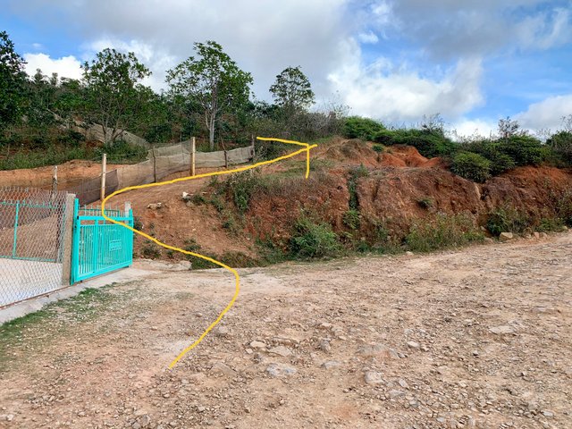
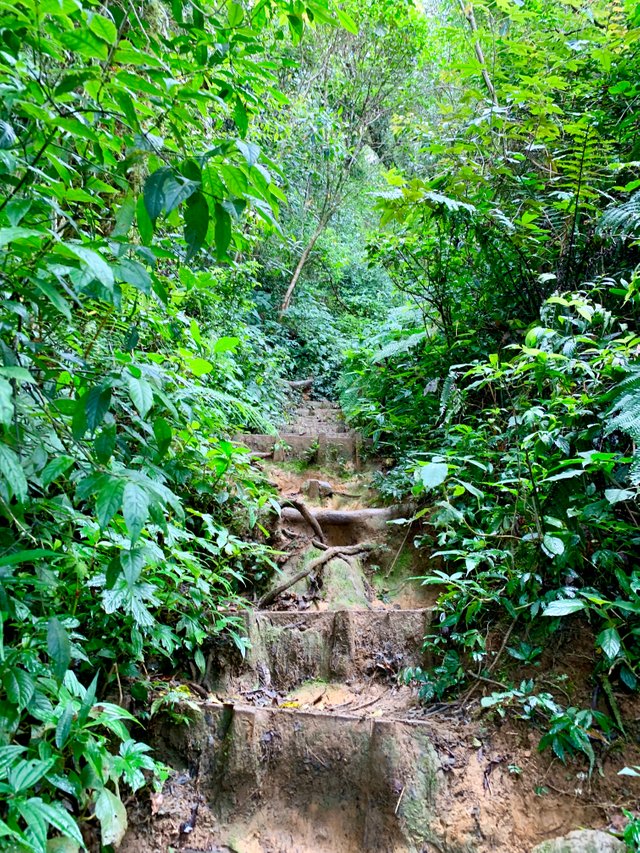
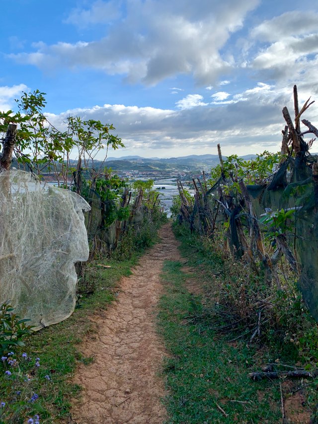
In the distance we can see the real hiking trail to the right of us. It looks so much better than the paid park. It's the real trail and it's straight too. The paid trail is a lot longer than the free one. Take my advice and take the free trail. When you are in front of the big entrance gate, take the dirt path on the right. You need to follow this road until there's a turn to the right where it gets more steep and there a lot of rocks on the road. To the left of you you will see a house with a green/blue fence. This is where the hiking trail starts. You have to go up there. This trail is 100 times better than the park.
The hike
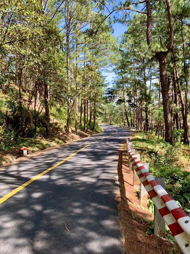
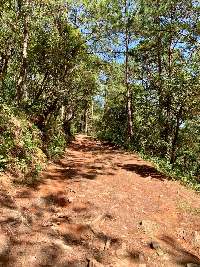
The hike itself is tough. Even from the start through the park. There are so many steep parts. Going up by the asphalt road looks like this.
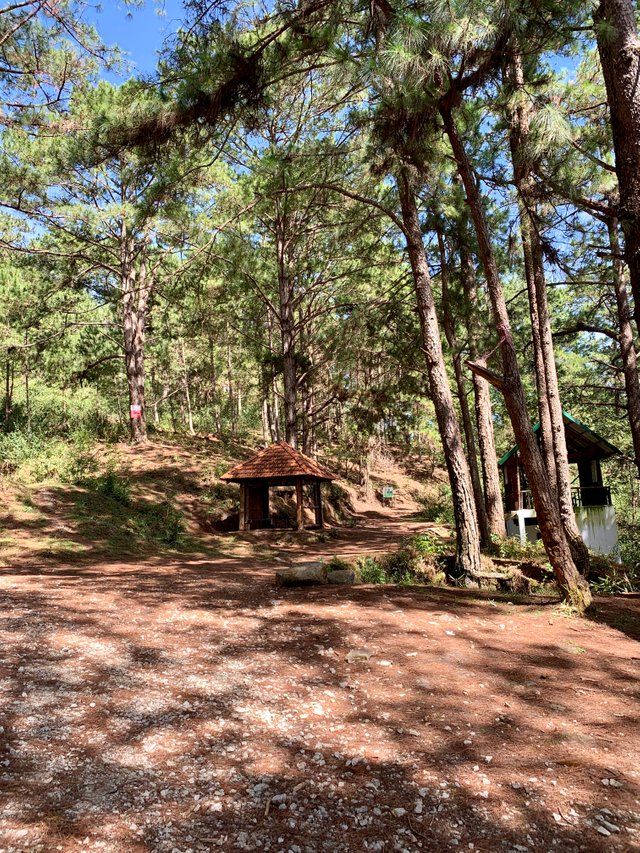
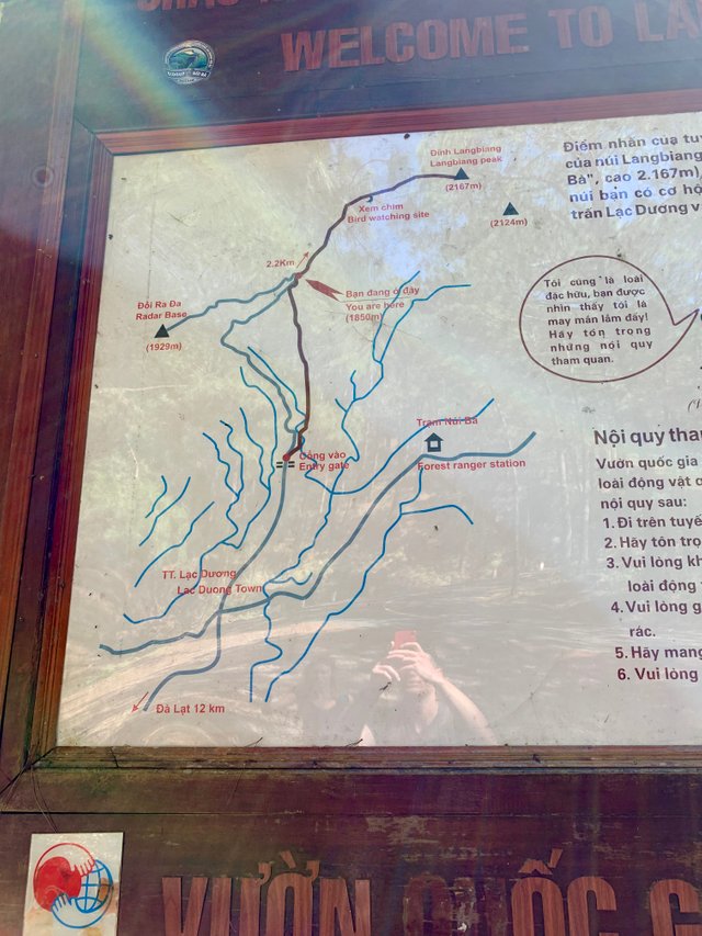
After hiking up you will get to starting point of the hike to the peak. This is the point where all the options of getting up there meet. It doesn't matter if you took the free hiking trail, hiked through the park or got the jeep. You will all come to this point.
There's a map here. This is what the map looks like.
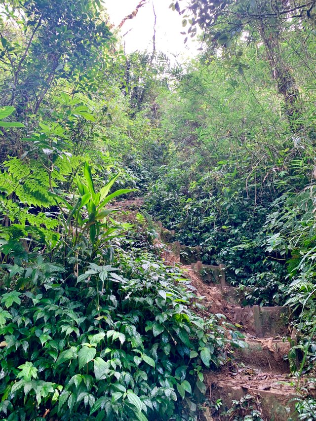
Now the hike really starts. The part before was just a warm up. The worst part still has to come. The trail is still gentle with you at the start.
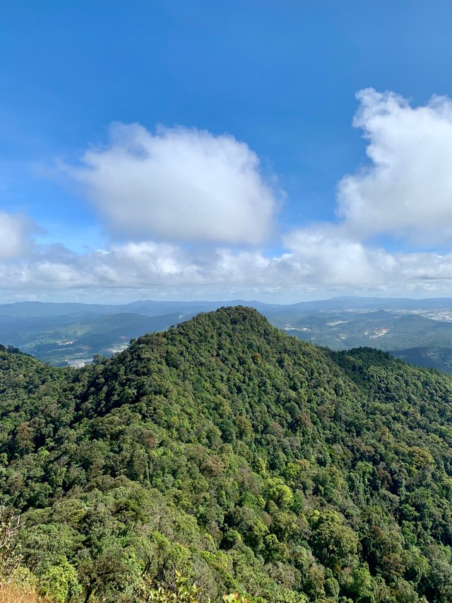
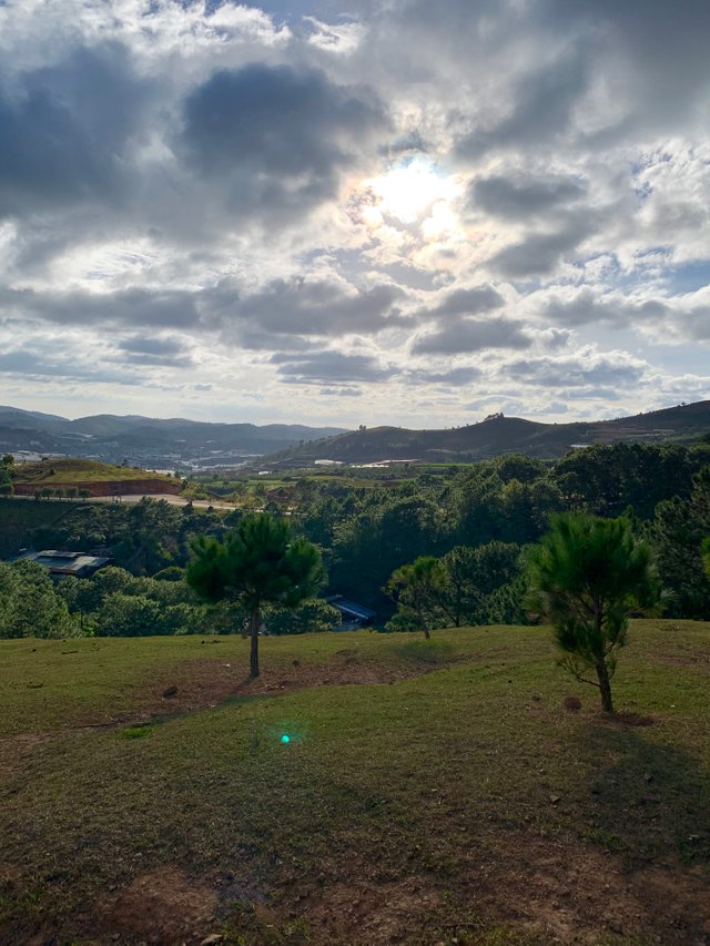
You will pass a viewpoint where it's a bit flat and it goes downhill a bit. This part is very nice and relaxing.
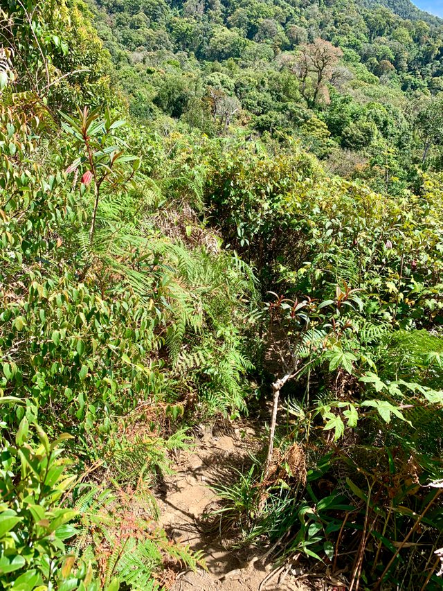
Now after this part is where it's about to go down. This is no joke. The peak is very high up and it is very steep! But by this time you will be too far up to give up.
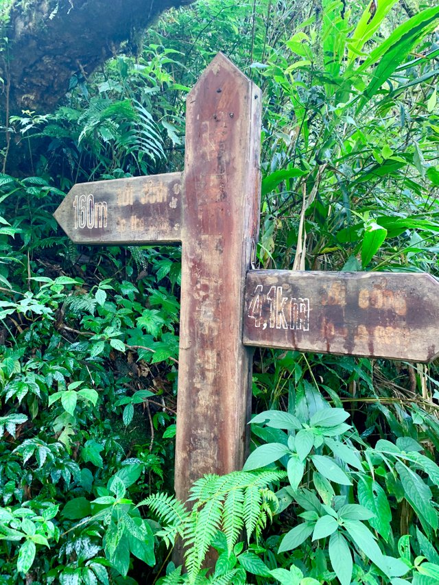
You'll pass by signs saying how many more meters it is to the peak (360m, 260m, 160m, 60m). You will swear at every sign "How can this be only 100 meters!!".
It doesn't look so daunting from these pictures. But it was really tough. If you are following me on Instagram. I made some Instagram stories videos of me climbing up having to use my legs and hands to get up there and being really out of breath.
https://instagram.com/kevinoutdoors
The Peak
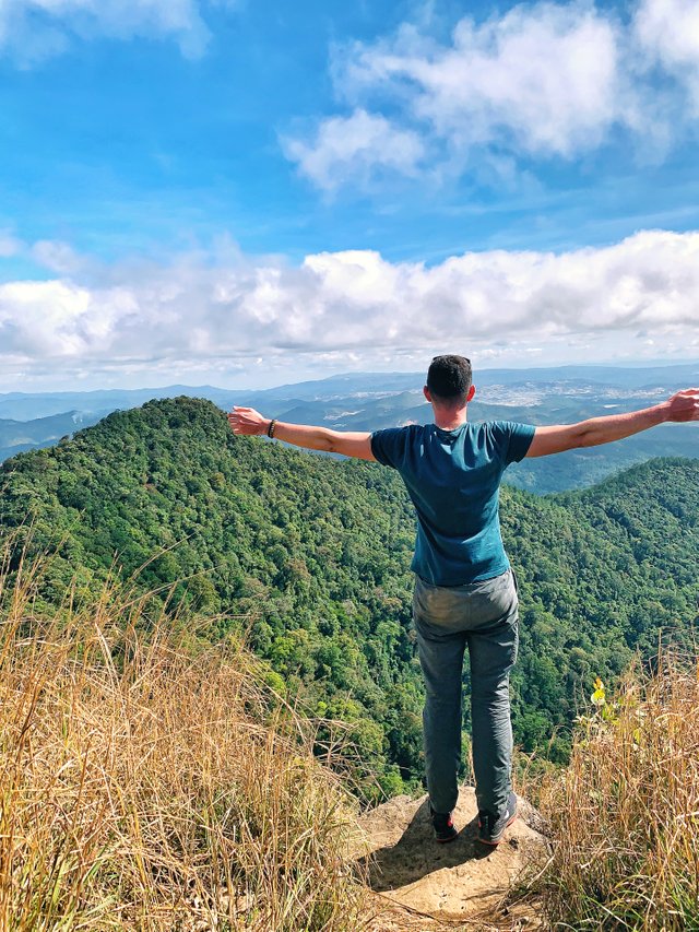
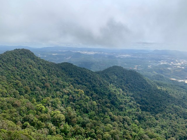
And eventually I make my way to the peak! Wow! The feeling is just amazing! It's so hard to describe. The accomplishment you feel. There are people chilling here who made it to the top. It's very cozy. I just take my backpack off and lay down having to take a rest.
After this I go and celebrate with my friend. Again making Instagram stories with my excitement. Absolutely amazing! We eat some snacks here, take pictures and chill with the fellow hikers.
After chilling for a while a guy from our hostel makes it to the top too. I had no idea he was going to this hike today. It was a pleasant surprise and super fun to hang out there.
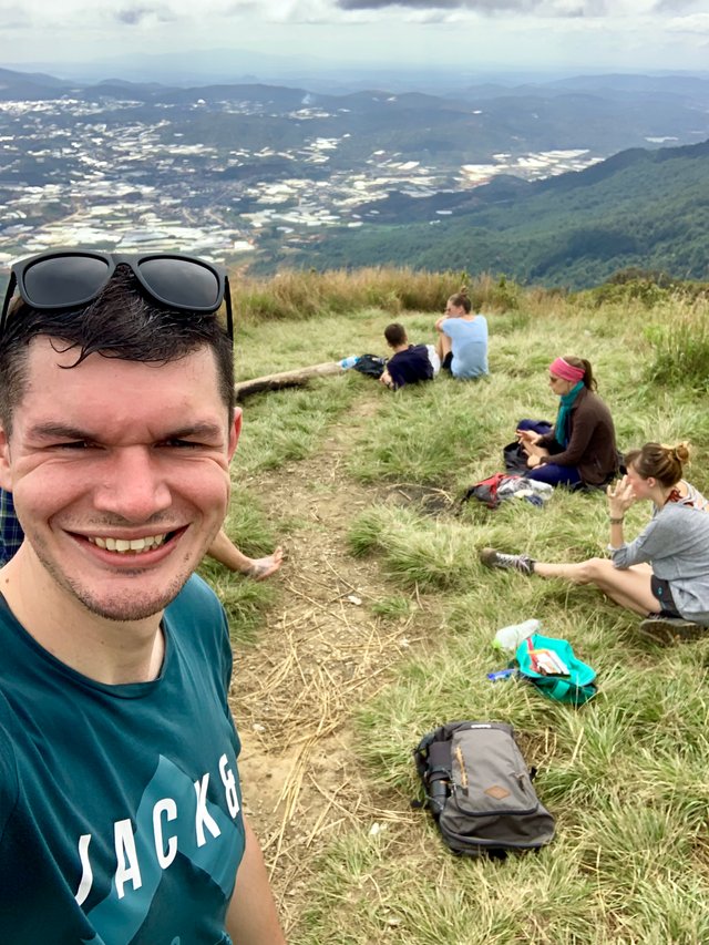
We chill on the top for more than 1 hour. I tried to make some drone videos here. But it was too windy. There was no wind at all sitting at the top, but as soon as the drone got up a few meters it started to get wobbly. There was just too much wind.
The descent
After a while it is time to go back down. We regained energy and we didn't want to stay for long. Sunset is a bit after 5 pm and we didn't want to hike down in the dark.
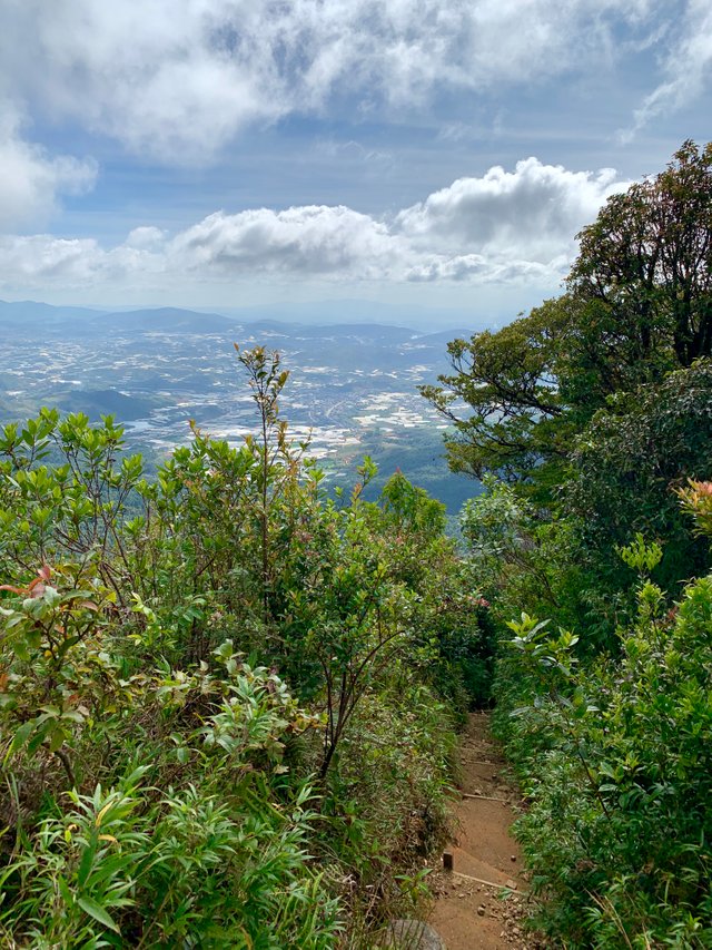
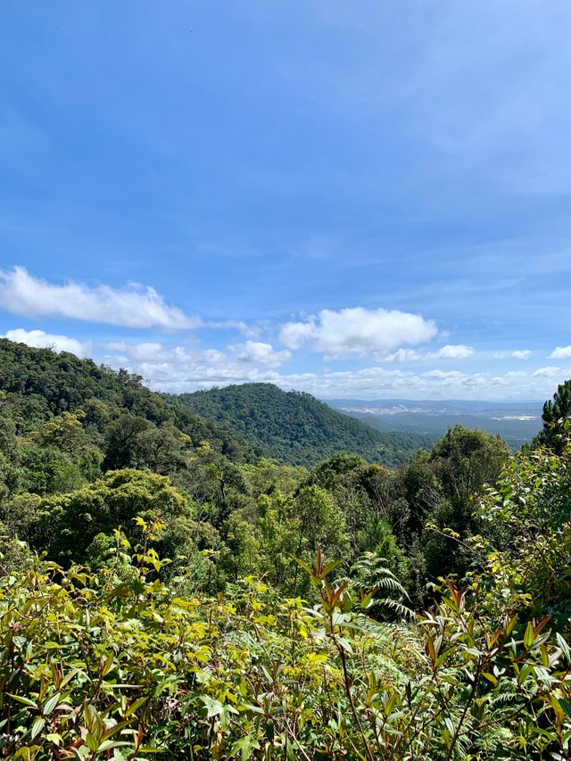
The way down is really tough too. There's a lot more pressure on your knees. But it is better for the cardio tho. You don't really get tired by going down. On the way down we take the free trail down. This road is just so much more worth it. The scenery is absolutely stunning.
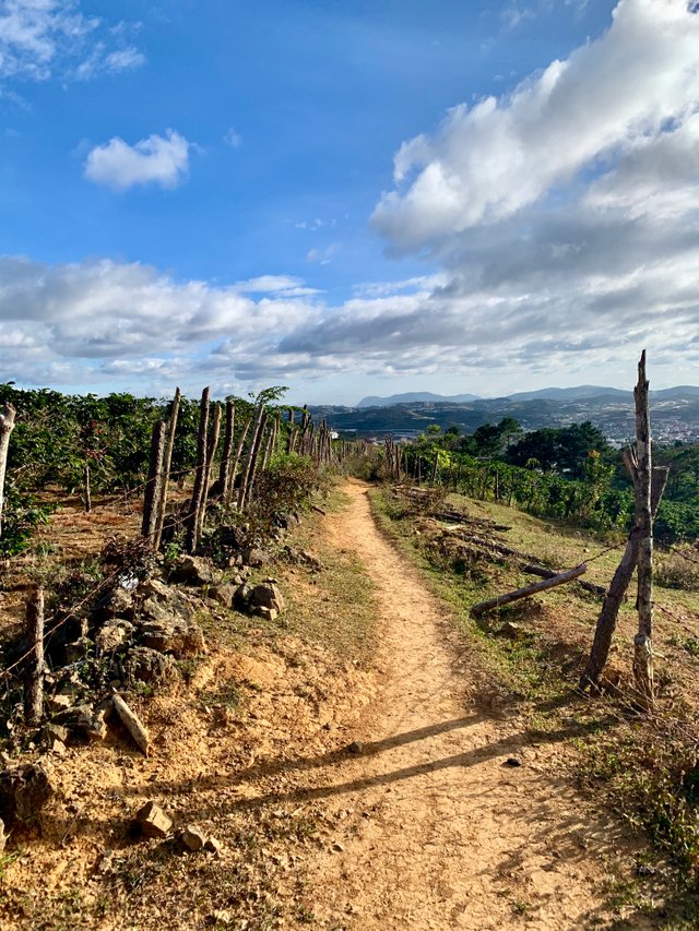
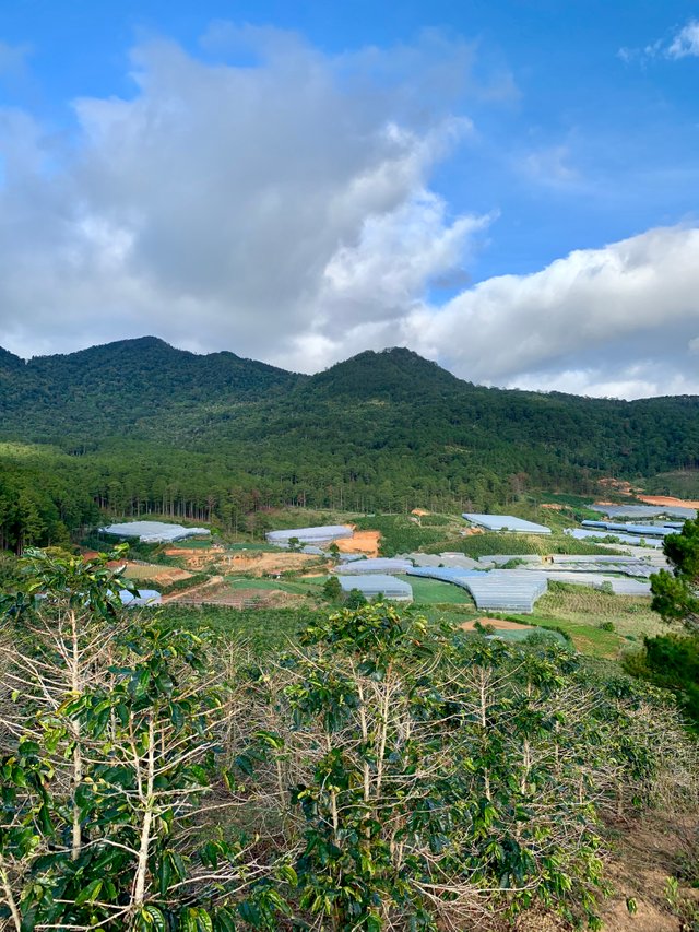
We pass by coffee farms and we get greeted by so many amazing views. I cannot believe we had to pay for such a bad hike while the free one is so amazing. Really, take the free hike both ways.
I am so happy that I succeeded doing this hike. It was very tough, specially for someone with such little experience like me. It was a challenge and I am so happy I succeeded. I just couldn't give up until I reached the top. I knew it was going to be worth it!
Get Email notifications

Subscribe
Stay up to date with my life. Follow me on Instagram!
Continue reading
The secret garden - Da Lat, Vietnam [Day 5-6]
https://steemit.com/travel/@beforeyoupack/the-secret-garden-da-lat-vietnam-day-5-6
The Vietnamese food! - Vietnam [Day 1-4]
https://steemit.com/travel/@beforeyoupack/the-vietnamese-food--vietnam-day-14-y8kksfwr
Before You Pack # Hong Kong - 5 things you should do while visiting Hong Kong
https://steemit.com/travel/@beforeyoupack/before-you-pack--hong-kong--5-things-you-should-do-while-visiting-hong-kong-xcjltnm8
Hong Kong Island Culture Trip and Rooftop Sunset- Hong Kong [Day 7]
https://steemit.com/travel/@beforeyoupack/hong-kong-island-culture-trip-and-rooftop-sunset-hong-kong-day-7
Hidden karaoke bar - Hong Kong [Day 6]
https://steemit.com/travel/@beforeyoupack/hidden-karaoke-bar-hong-kong-day-6
A day in Macau - Hong Kong [Day 5]
https://steemit.com/travel/@beforeyoupack/a-day-in-macau-hong-kong-day-5
Exploring Kowloon and Drone Shots! - Hong Kong [Day 4]
https://steemit.com/travel/@beforeyoupack/exploring-kowloon-and-drone-shots-hong-kong-day-4
Congratulations! Your high-quality travel content was selected by @travelfeed curator @for91days and earned you a partial upvote. We love your hard work and hope to encourage you to continue to publish strong travel-related content.
Thank you for being part of the TravelFeed community!
Learn more about our travel project on Steemit by clicking on the banner above and join our community on Discord.