Ulog 15: A wet day in the Arrochar Alps
Not every mountain I climb has to be a bagging conquest! I've been on a Munro-bagging spree recently, trying to make Ben Nevis my 100th Munro. So far I'm at number 86. But sometimes I climb Munros that I've already climbed before – for the exercise, to see views that I didn't see the first time around, or just because I enjoy climbing them!
Sometimes I organise hillwalks to help others bag mountains I've already done before. I did that last Sunday, on a trip to Beinn Narnain and Beinn Ime, mountains I've climbed several times before.
I run my own Meetup group, and the main reason I got into bagging in the first place was because when I became a hillwalk organiser I felt the need to climb as many hills as possible. It made me feel more confident leading a group walk, if it was one I'd done before.
I've climbed Beinn Narnain and Beinn Ime several times now. They are a couple of much loved Munros near the village of Arrochar in Scotland, part of a group of mountains known as the "Arrochar Alps".
Last Sunday was the fifth time I'd climbed Beinn Ime, which is the highest mountain in the Arrochar Alps, and my third climb up Beinn Narnain. They are usually climbed together.
A "learning experience"
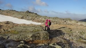
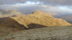
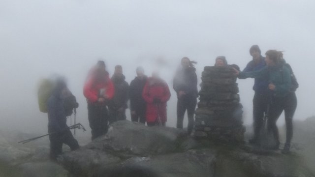
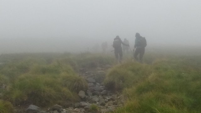
This picture, taken from the summit of Beinn Narnain, gives little impression of how strong the wind was that day.
I really love these mountains. Though I wasn't too impressed with them the first time I attempted them, with two friends, on New Year's Day 2017. There were very high winds, and we took a wrong turning which resulted in us having to scramble up a steep grassy bank, extending the time it took to get to the summit of Beinn Narnain. When we reached the summit, the wind was so strong we could barely hear each other's voices.
I was using a paper map and compass, but it was too windy to take the map out, as it would have blown away. I started to get very cold with the wind chill, so I started to head down the mountain, shouting to the others that I needed to get out of the wind.
The only problem was, I was heading down the wrong way.
Beinn Ime looked lovely that day, but high winds and navigation errors meant there wasn't enough daylight left to reach her.
The others followed me, and we had lunch in a sheltered spot. I started to warm up. But then we realised that we'd gone down the wrong way, so we had to climb back up again.
In early January in Scotland, the sun sets around 4pm, and by the time we got back to the summit, it was already 1.30pm, so we had to forget about climbing Beinn Ime as well, and head back to the car park.
Notoriously unpredictable weather
People often get into difficulty in the Arrochar Alps, and I think one reason is their relative proximity to the Atlantic Ocean. When weather fronts drift in from the Atlantic, they seem to stick to these mountains. The summit of Beinn Ime is often in cloud, and a sunny day can rapidly turn into a white-out in this area.
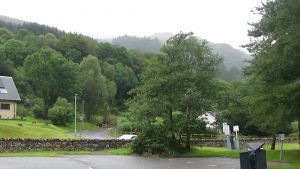
The car park which will soon charge hillwalkers £9 a day (about $11.50). Beinn Narnain can just be seen through the mist.
Since that challenging New Year trip, I've organised a couple of much more successful group walks to these mountains. And when I heard that the charges for Arrochar's car parks are to increase from £1 to £9 a day, I decided to organise another group walk to Beinn Narnain and Beinn Ime – before the charges go up. I've climbed all of the "Arrochar Alps", but but for people who don't have a lot of hillwalking experience, the main Arrochar car parks offer the access to the most straightforward route up these hills.
I chose the day after my walk up Sgor na h-Ulaidh, as the weather forecast for both weekend days was looking good, and hoped I wouldn't be too tired.
But weather forecasts in the west of Scotland are liable to change at the last minute.
When we started the hillwalk, the clouds were low and there was intermittent light rain. I was optimistically hoping that the clouds would lift as the day went on.
They didn't lift. Instead, they got worse, enveloping us in a thick fog as we squelched our way through the bog. I was wearing my light hillwalking boots, and they were soon waterlogged. I'd forgotten to bring my gaiters because until about a month ago, we'd had so many weeks of unusually dry weather that they'd started to seem irrelevant.
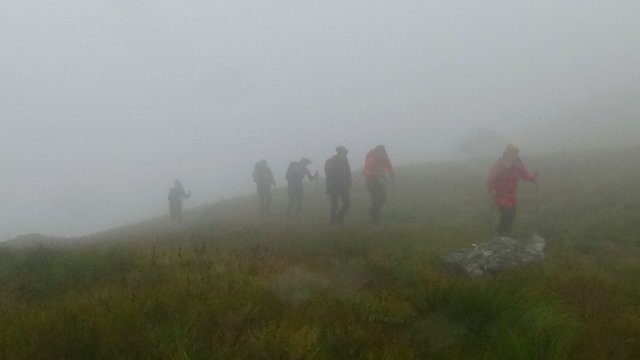
Beinn Narnain is a very steep and rocky mountain, the type I particularly love to climb. However some people were finding it tough going. We took a few breaks so they could catch up and catch their breath, but some of the faster walkers were getting chilly!
It was one of those days. But we all made it to the summit. Sadly there were no summit views.
Lunch on the rocks
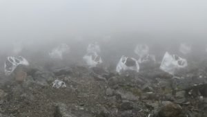
Helicopter bags full of rocks.
We headed down from the summit to a sheltered spot for lunch. There were lots of big sacks of rocks, the type of bags used for helicopter drops. We speculated as to whether the helicopters had brought the big rocks or if they would be taking them away. We decided it must be the latter, as those big bouldery rocks are not great for walking over.
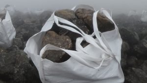
One of the helicopter bags, full of big rocks.
Is this the reason behind the 800% car park charge hike? If so, it raises more questions. Where are the rocks going to be dumped? How much should we be altering the environment of these hills anyway? People visit them because they are wild and natural. It's great to see the path improvements, and I would be happy to pay extra for this, but I consider £9 a day way too steep, and a dangerous precedent.
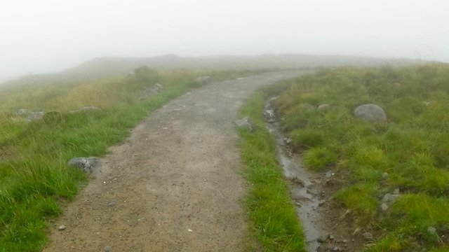
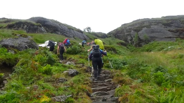
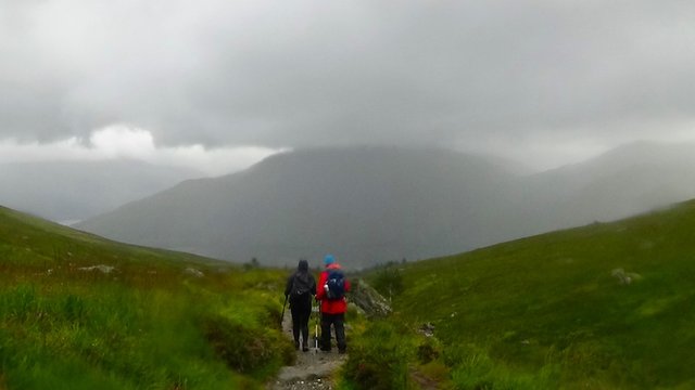
A recently improved path. It only goes as far as the bealach between Beinn Narnain and Beinn Ime. After that it's just a boggy mess.
Feeling refreshed, we set off for Beinn Ime. The path from Beinn Narnain to Beinn Ime has become very eroded and marshy, and we were soon squelching our way through the mud and splashing through streams, as the light rain turned into a heavy downpour.
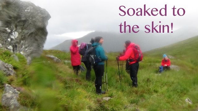
Before long, we were all equally soaked to the skin, whether we were wearing expensive gore-tex waterproofs or bargain bucket gear.
I spent a lot of time on the path up waiting for the slower walkers and checking that everyone was OK, as despite it being "summertime", there was a danger of people becoming too cold and suffering exposure symptoms in those conditions. Luckily everyone seemed fine, and I was surprised at the good humour among the group. When I commented to one walker that the weather was atrocious, he looked genuinely surprised, and said, "Do you not like the rain?"
The wind also began to pick up, and by the time we reached the summit of Beinn Ime, it was difficult to stay upright. There were no group summit photos this time!
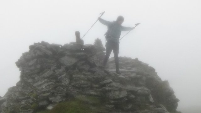
A walker at the summit cairn, battling against the strong wind.
All 13 of us made it to both summits in those challenging conditions. That was an achievement in itself!
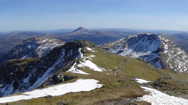
The clouds lifted and the weather cleared up a little on the way back down. It wasn't clear enough to see the fantastic views you normally get of the Cobbler, the most famous mountain in the Arrochar Alps. But everyone seemed happy and we enjoyed our refreshment in the pub afterwards. "Salted Caramel Rocky Road" with two scoops of ice cream seemed only fair after a day immersed in those elements!
Posted from my blog with SteemPress : http://ramblingandscrambling.
.gif)
Congratulations! This post has been chosen as one of the daily Whistle Stops for The STEEM Engine!
You can see your post's place along the track here: The Daily Whistle Stops, Issue 235 (8/23/18)
The STEEM Engine is an initiative dedicated to promoting meaningful engagement across Steemit. Find out more about us and join us today.
That looked miserable to me wind and rain I can do without when I am trying to enjoy something.
It will be interesting to hear if the bags of rocks were coming or going from the hill.
The parking hike is a real shafting, I would think that when it takes affect people's rear ends will be too sore to climb those hills.
Yes, Scotland has more than its share of wind and rain, and it often arrives without warning. And yes, shafting is the right word. If they get away with it, Scotland will soon be too expensive to visit :(
These look amazing, @insideoutlet and I love getting out into nature and I wish we had more mountains in fact your city has none the closest we get is little ant hills
Thanks @shai-hulud! You're right, even in the rain these mountains are amazing, and if you don't have them nearby, a good excuse to travel :)
we are big fans of travel generally to Thailand or Malaysia but its not on the cards for a bit as we just adopted.
so im just going to have to live vicariously through posts like this for a bit
Of course! That's so wonderful. You'll be having a lot of excitement and precious moments for quite some time, and later on you'll be able to share your travel adventures with the wee one :)
You sure make some wonderful hikes and climbs love the view early on
I see in the comments you now use a GPS app, in wet weather its so much easier than using maps, mind you back when I did hiking we didnt have gps devices available, nor apps on Cell phones, heck when we started hiking we didnt even have cell phones
Thanks @tattoodjay! You're right - just 20 years ago there were no such thing as smart phones. They come in for a lot of criticism, but I think they must have saved many lives out in those remote areas.
Ohh yes I have seen so many changes in technology
Mobile phones make life easier for people and have proved to be life savers at times
Is there any reason why you use a map and compass? when I go hiking, I do keep a map with me, but I tend to rely on GPS most of the time.
I'd never used a GPS of my own until that particular day - it was a wake-up call! Now I always use a GPS app and a GPS route on my phone. But I always carry a map and compass too, because I generally find them more useful. I use the GPS app as back-up or to check altitude.
GPS can sometimes be slow or even fail - this can happen in cloudy weather. I've also been on hillwalks where someone has been following their GPS route, and it's not exact, so we were taken all over the place - up hills, down hills, in one direction and then back in the other direction... eventually I took a quick bearing on my GPS, and I could see from it that we needed to be heading direct north. The person who was actually following their GPS was taking us west, because it was cloudy and the arrow was pointing that way for a bit, and then another way... I spoke up and said that actually we needed to be going directly north, in the direction my compass was pointing. We went that way and within minutes we could see the path we'd been trying to find.
Also, GPS batteries can fail. I'm not against them - I use mine periodically, to check that we're on the right track. I think you're unlikely to go wrong with a map, compass and GPS.