Serious Bagging: Magical day on Ben Nevis. 100 in the bag!
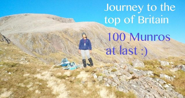
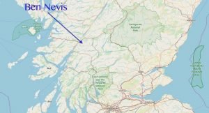
The weather angel smiled on me last weekend. I wanted Ben Nevis, the UK's highest mountain, to be my hundredth Munro (a Scottish mountain over 3000 feet) – and to celebrate, I wanted to climb it via a special route, not via the crowded "mountain path". But I didn't want to do a potentially hazardous off-path or seriously scrambly route in icy winter conditions, so I was racing to complete 99 Munros by the end of summer.
Setbacks
There was a big setback when I fell and sprained my ankle at the end of August. That happened because I was rushing too much – I'd got up very early after a very busy week, and had headed out to Glencoe, hoping to climb three big Munros that day. But I was over-tired and should really have stayed in bed! The result was a month of rest while my ankle healed.
Once my ankle had recovered, I managed to climb some more mountains, and I finally reached 99 Munros. But snow arrived in October, and it looked as if I might just run out of time to climb Ben Nevis in summer conditions.
Then about 10 days ago, I was looking at the weather forecast, and noticed that it was looking unusually mild for the time of year. The snow had started to melt, and the forecast for the weekend was looking fantastic! The weather in Scotland can be very unpredictable, but I knew this was my last chance. While out on a group walk, I announced, "I'm going to do Ben Nevis next weekend!"
My good friend Karen, who has climbed Nevis before, immediately said: "I'll do it with you!"
I told her I was planning to do it via quite an unusual and steep route, but she was undeterred.
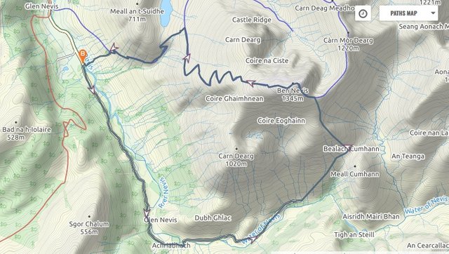
We decided to book beds in the Glen Nevis hostel the night before, so we could get an early start – essential with only eight hours of daylight at this time of year. If the weather forecast deteriorated we would just take the safer mountain path to the top.
Luckily the forecast remained positive, so we decided to stick to my planned steep route heading up Ben Nevis's south face.
I initially wanted to include the CMD Arête walk, a narrow ridge walk that takes in another Munro, Carn Mor Dearg, but Karen talked me out of it. I'm glad she did, as winds were stronger than initially forecast and I would not have wanted to do a narrow ridge walk on that day.
Early start
We left the Glen Nevis hostel at 6.30am to walk the 5.5km (3.5 miles) along Glen Nevis to the start of the hillwalk. Sunrise wasn't until 8am, but the moon was so bright we didn't need to use head torches – Karen's bright hand torch was sufficient.
Our hillwalk started from the car park at the far end of Glen Nevis. We could have parked the car there, but we would then have had a long walk at the end of the day, as the plan was to return via the Mountain Path, which leads straight down to the Glen Nevis Youth Hostel. The early morning walk got us warmed up and allowed us to make the most of the limited daylight for hill time.
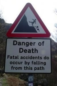
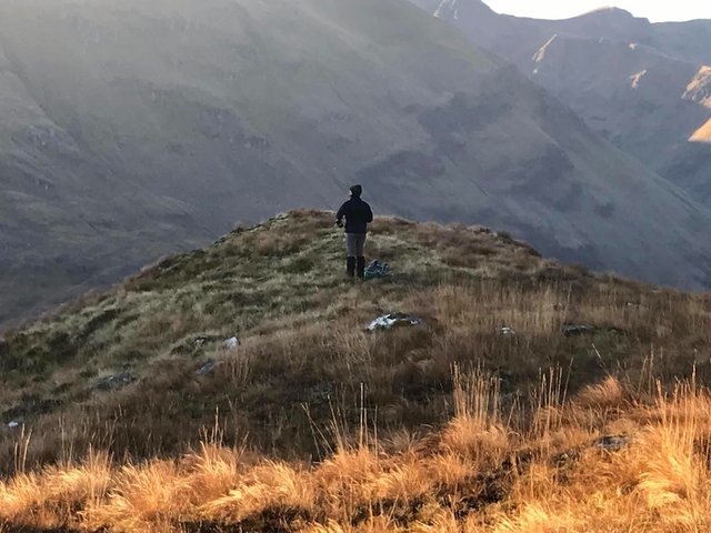
We headed up the grassy, pathless hillside right after a notorious "Danger of Death" sign at the edge of the car park. What a comforting send-off!
The point where we started heading up the hillside.
I had been very nervous about doing this route. I'd planned it out meticulously, and I'd read three online walk reports by people who had done various versions of this route, but none of them had started out this particular way. The map made it look do-able, but until we actually did it we wouldn't be able to tell if the ground was going to be unbearably rough or with unexpected obstacles in the way.
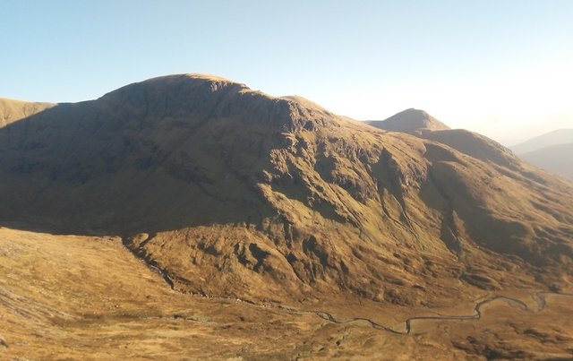
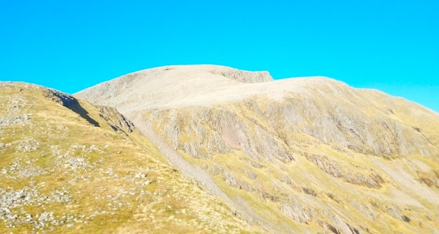
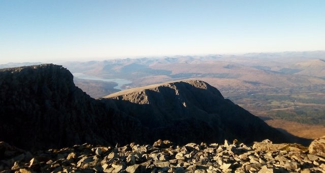
Ben Nevis, as seen from the summit of Meall Cumhann.
The inspiration for this route had come from the hill day we did on my Mountain Leader course a couple of weeks before, when we'd climbed Meall Cumhann, a relatively small mountain, just under 700m, but with striking views of Ben Nevis, the Mamore and the Aonach mountains.
This photo (right), taken from the summit of Meall Cumhann, made me realise that its giant neighbour, Ben Nevis, almost twice its height, at 1344m, was accessible from here. But the route looked quite scary in the mist!

The fantastic photo on the left of the south face of Nevis was taken from this blog. It clearly showed the route I wanted to attempt, and made it look much more accessible. It looks like you could almost skip your way up there! However that photo was taken in June, on a lovely dry and sunny day. And the lower section of it looked quite rocky. I like rocky routes, but wasn't sure how steep those rocks would be close-up.
The upper section looked smooth, almost naked. Would it be big tricky boulders, or slippy, gravelly scree?
Photo, left, by "Mountain Coward" of the blog The Adventures of a Mountain Coward, shows Ben Nevis from Meall Cumhann.
Steep
Happily the first section up to Bealach Cumhann was steep but fairly easy-going, with excellent views of the Mamores and Steall Falls in the early morning sunshine.
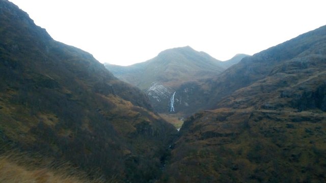
An Gearanach and Steall Falls.
It wasn't long before Bealach Cumhann came into view, at 550m altitude.
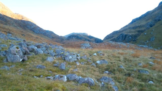
Approaching Bealach Cumhann.
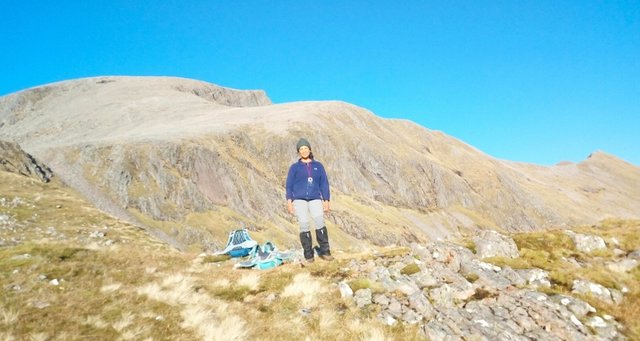
The ground levelled out here. We stopped for refreshment and took in the glorious views.
Karen took this photo of me admiring the views.
Aonach Beag and the Allt Coire Giubhsachan river. I think it looks a bit like a resting lion!
Something weird happened to this photo, showing the sunlit lower slopes of Ben Nevis that we were about to climb. I somehow managed to do a semi-panoramic shot which didn't quite work!
As we climbed higher, Meall Cumhann looked serene, happy to be surrounded by some of Scotland's highest mountains.
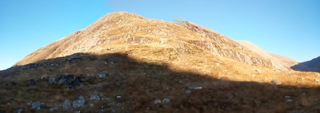
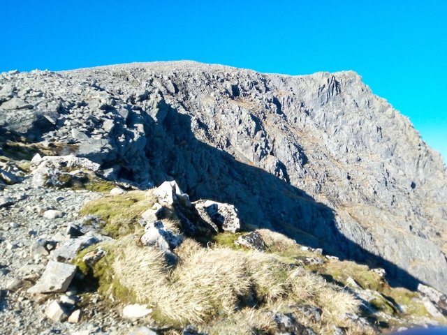
The next section of the route was the one I was most nervous about, as it looked steep and rocky. How rocky, I wondered. Some rocks are easier to climb than others.
These turned out to be not so much rocks as sheer slabs with few holds for hands and feet. Some of them were near-vertical, and to make things more difficult, they had some sections of slippy moss. We probably would have been able to run up some of them, running the risk of breaking an ankle if we fell. That would have meant a very unpleasant end to the day, so we carefully picked our way round them instead.
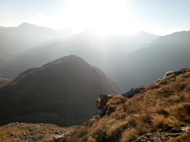
This was one of the steepest sections, but when I reached the top of it, I gasped in delight at this view of the top of Ben Nevis.
Not many people have seen Britain's highest mountain from this angle, and certainly not with this clarity! There are said to be less than 20 days a year on average when the summit of Ben Nevis is clear.
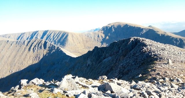
The famous CMD Arête route was also clearly visible.
Me grinning with glee, with the CMD Arête route behind. It's a ridge walk that runs from the small peak at the right (Carn Mor Dearg) to the big peak at the left (Ben Nevis).
As we climbed higher, the Mamores looked glorious, basking in the autumn sunshine.
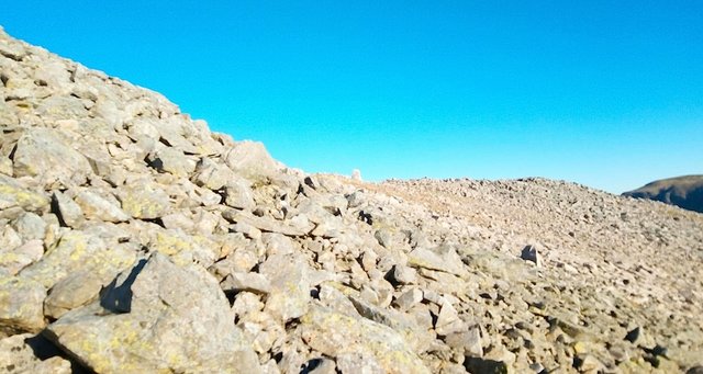
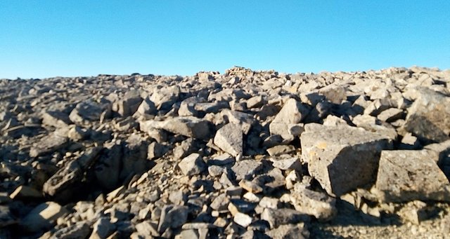
By the time we reached 1000m altitude, the rest of our route was an enormous boulder field. This would be easier to cross in deep snow, bearing in mind that winter brings the risk of cornices and avalanches.
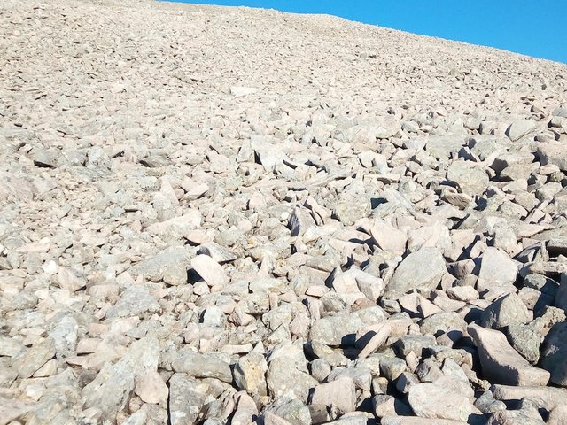
At least it wasn't the dreaded scree. We had to walk over it with care in order to avoid stumbles and broken bones. It was quite an effort, but every time we stopped for a breather, we were rewarded with the most gorgeous views.
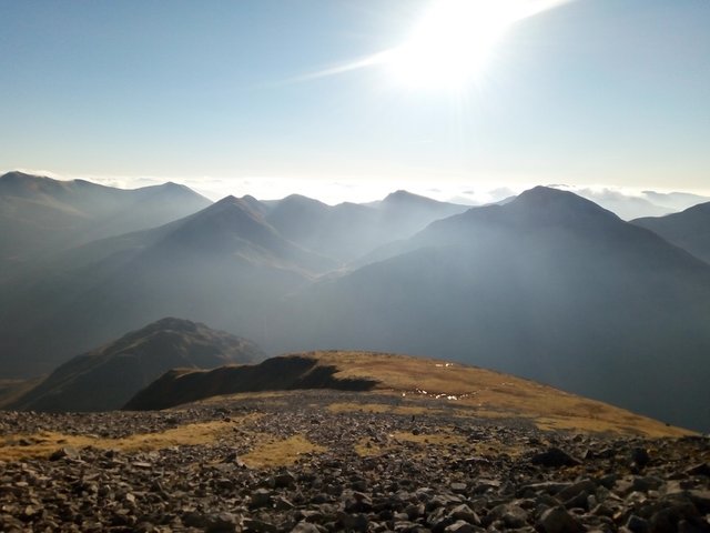
Looking back at the way we'd just come up, with Meall Cumhann below and the "Ring of Steall" mountains beyond.
At last I spotted a small cairn showing that we'd reached the ridge.
As we reached the ridge, the wind strengthened considerably. At times we had trouble staying on our feet! At the point we reached the ridge, it was wide enough to allow us to stay well away from the edge.
The CMD Arête with Aonach Mor behind.
This was the spot where we saw the first walker we'd seen all day. Few people have climbed to this height on Ben Nevis on a beautiful clear day without seeing another person!
It was a man doing the CMD Arête in reverse, and at quite a fast pace. Rather him than me, in that wind!
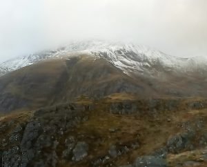
Ben Nevis looked foreboding from this viewpoint.
View up to the summit of Nevis from the CMD Arête.
I didn't take any photos from this point on, because it was a steep hands-on scramble, being battered by the wind, and a tough job to stay upright! I decided to take a rest and check my altitude at the next horizon point.
When I reached it, I whooped for joy, because I could see the summit observatory tower in the distance!
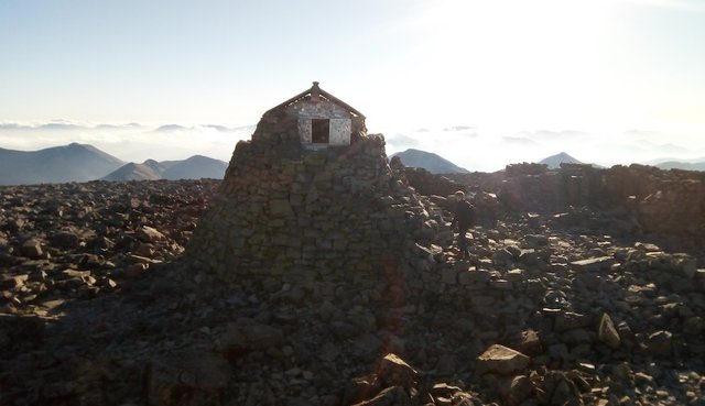
The emergency shelter perched on top of the old observatory tower at the summit of Ben Nevis.
It was 12.45pm, four hours and 45 minutes after we'd started the climb. I was lucky enough to get the summit cairn all to myself for a few minutes – a rare treat on Ben Nevis!
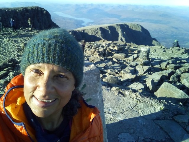
Summit of Ben Nevis: my 100th Munro!
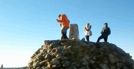
My friend Karen arrived a wee bit later, worn out from walking over all those boulders. I was just high on adrenaline! I opened my champagne chocolates and ran back up to the summit to do a little dance.
A couple of students passed by and offered us a swig of whisky. I was driving later, so I just took a tiny taste. It was very nice.
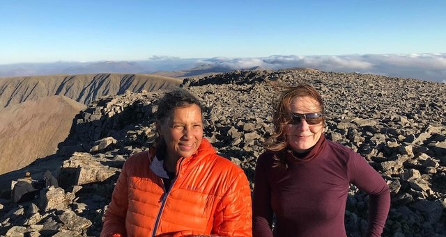
Me and Karen at the summit.
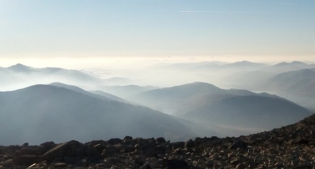
There was a happy atmosphere at the top, with lots of people arriving, making the most of the weekend's unusually fine November weather. It's unusual to get clear views from the summit of Ben Nevis, but I was able to see the Isle of Skye Cuillin mountains in the distance. The photograph I took didn't pick it up too clearly... it's a little grey smudge on the horizon just to the left of the centre of the shot!
Loch Eil and the western hills, with the Isle of Skye Cuillins barely perceptible in the distance.
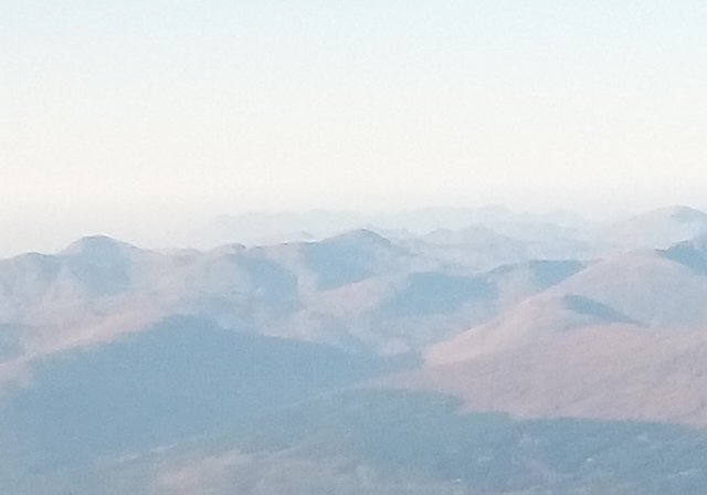
A close-up detail of the photo above, with the Isle of Skye Cuillins right at the back. I'm looking forward to climbing these some day!
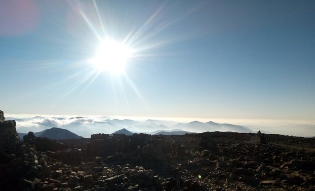
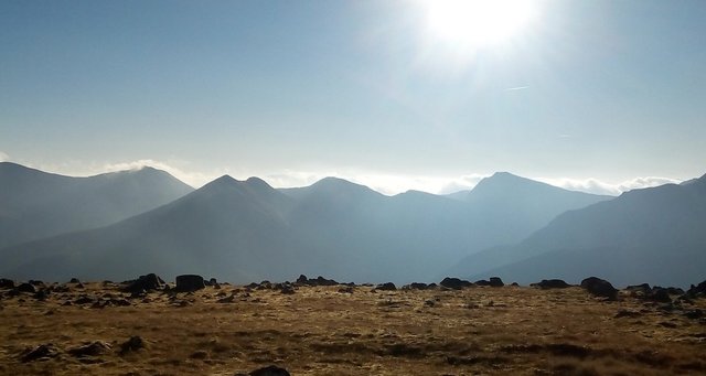
Sunshine over the Mamores and the hills of Glencoe.
As we headed back down the "mountain path" packed with families, people of all ages and dogs, there were more lovely views to enjoy. What a day!
Views out to west to the Isle of Mull.
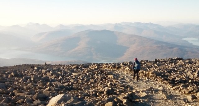
Heading back down via the "mountain path".
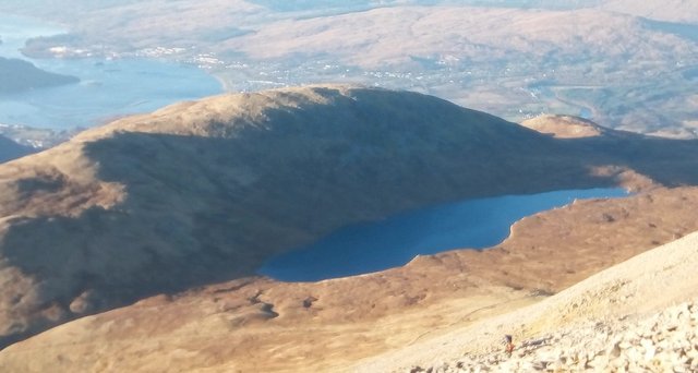
Lochan Meall an t-Suidhe and the town of Fort William below.
We got back down just after sunset at 4.05pm. The two and a half hour drive back to Glasgow was broken with a slap-up meal at the very popular Clachaig Inn in Glencoe.
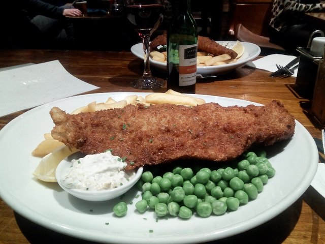
Fish supper at the Clachaig Inn, Glencoe.
A woman sitting near us was eating what appeared to be diet food, and she didn't touch her chips. But we each had 1152 calories to replace, so we tucked in happily!
More bagging adventures...
Will I continue to bag Munros? Of course! There are 282 of them in total, and I can't wait to do them all. But first, I'm going to have a wee rest.
Posted from my blog with SteemPress : http://ramblingandscrambling.co.uk/mountains/serious-bagging-magical-day-on-ben-nevis-100-in-the-bag/

.gif)

Well done, you picked a good day to do it.. no snow on the top. What now, the Himalayas?
Thanks @slobberchops! We were unbelievably lucky with the weather. Funnily enough, on Sunday I went to a presentation by a group of people who had just returned from Annapurna base camp, a trek I would LOVE to do. Those mountains are astonishingly beautiful – but there is NO WAY I will ever climb them! Base camp would be quite far enough :)
WooooooHoooooo. Congratulations on your 100th Munro. The one you wanted most, AND a day in the clear.
I had no idea that Ben Nevis had the mist that it does. The only other peak I know with those sorts of 'clarity' numbers is Denali in the US state of Alaska. I have a friend that worked on the Alaska Railroad for a few years in her youth, she'd make the round trip from Anchorage to Fairbanks twice a week and said she actually saw Denali 3 or 4 times per year...
Congratulations and well done on making your targeted goal.
Thanks @bigtom13! Glad you enjoyed my post. It was such a brilliant adventure.
Scotland is a pretty cloudy country most of the time - clear days are a bonus here. And a mountain as high as Ben Nevis gets even more of that cloud. The clouds just drift in from the Atlantic and cling to the highest summits.
What an amazing achievement ! I'm glad that taking the alternative route paid off. It didn't look like you ran into too much trouble, though those jagged rocks did seem a little bit dangerous.
Thanks @daan.
Congratulations, Your Post Has Been Added To The Steemit Worldmap!
Author link: http://steemitworldmap.com?author=natubat
Post link: http://steemitworldmap.com?post=seriousbaggingmagicaldayonbennevis100inthebag-700edxz8s4
Want to have your post on the map too?
Congratulations! This post has been chosen as one of the daily Whistle Stops for The STEEM Engine!
You can see your post's place along the track here: The Daily Whistle Stops, Issue 318 (11/21/18)
Dear @natubat,
Your story attracted our attention and we would like to introduce our tag #archisteem that could provide you with some extra support. For your information, we are currently running the project – 1001 Places to Remember. Your content is a fit for the project and could be qualified for the 10 Steem reward biweekly contest.
It would be great if we can have this story of yours included in the project. If you agree, please reply to us.
Do drop by and take a look :) Hope to see you around soon.
Stay tuned and Steem on!
@archisteem and team
Thanks @archisteem! I would love to have my post featured in 1001 Places to Remember :)
Awesome, we are totally thrilled to have you with us! Most welcome @natubat :) We look forward to have more of your stories feature in the project. Steem oN!
Hiya, @livinguktaiwan here, just swinging by to congrat you and let you know you're being featured in today's Travel Digest #373.
Please drop by to check out all the rest of today's great posts and consider upvoting the Travel Digest if you like what we're doing.
Congrats!!! You done it at last!! Glad you got a great day otherwise it would have been a long wait over winter!!
Thanks @livinguktaiwan! It would have been a very long wait - I was so thrilled to get there at last :)
Awesome photos. That's so cool. Hubby climbed it twice but before my time. Xx
Posted using Partiko Android
Thanks @riverflows. He climbed it twice! Hopefully not on the same day though :)
Congratulations and good for you for finally reaching your goal! The view looks amazing, I am sure you really enjoyed it while you were up there!
Thanks @zen-art! I felt like I was on top of the world! (Even though I was only on the top of Britain haha)