Augrabies: Warps, twists and valley widening
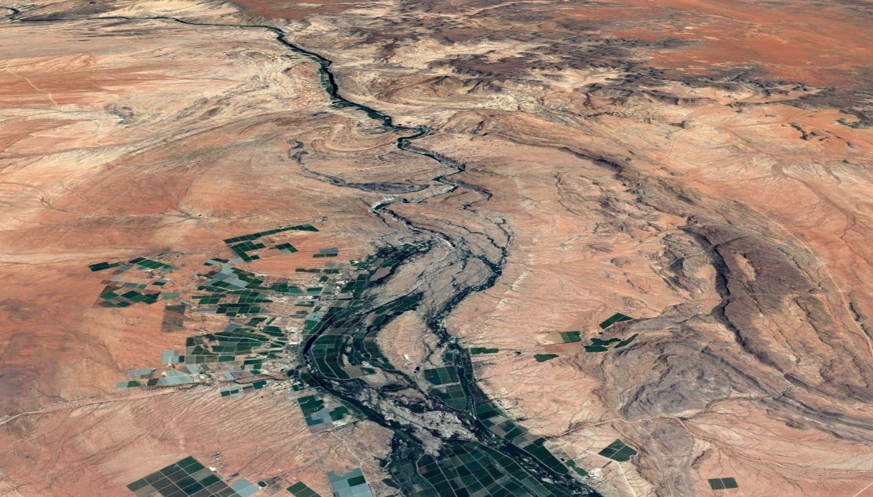
The orange river creates an emerald green carpet in the desert, with table grapes for export being the predominant crop.
In the foreground it can be seen with wide, braided and meandering channels.
The falls only exist because a slab of rocks was warped, twisted and buckled up, blocking the way of the river.
The canyon and advancing falls are the river's response to an obstacle placed in its path.
After the obstacle, the river widens and agriculture continues again off into the distance.
This is a slightly more zoomed view of the area of warping and buckling and the canyon cutting through it courtesy of google earth.
- the falls
- the canyon starts to widen and valley formation processes dominate
- a layer of black rocks buckled up from beneath
Above 3 rock layers can be seen warped in a u-shaped pattern.
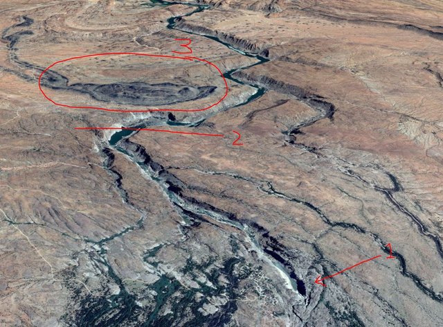
The next sequence of photos are taken on the ground at the points marked by arrows below.
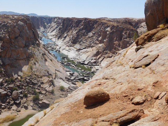
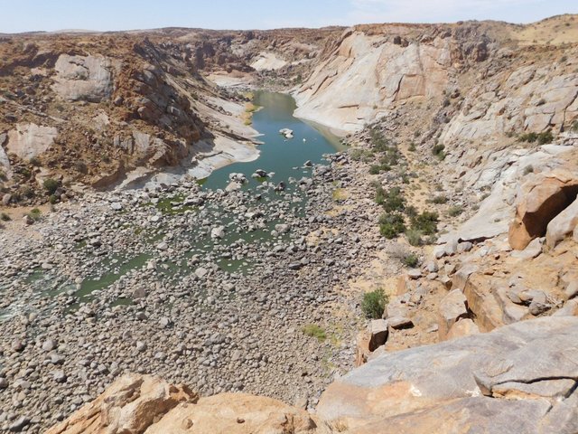
Looking upstream.
The last of the steep sided canyon. One can see the same granite peeling processes from the heat at work here, just like at moon rock.
Looking downstream.
The canyon widens significantly and takes a bend.
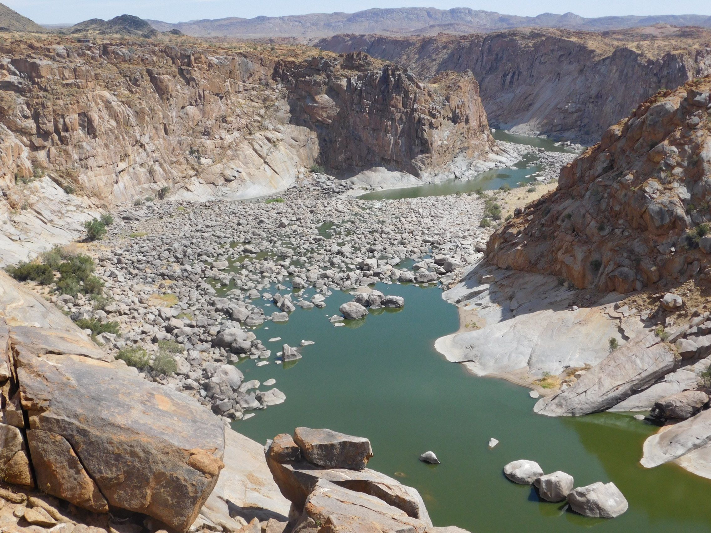
The canyon now has a valley floor, with soil and vegetation beginning to take root around the edges.
As the slope flattens, so does the power of the water and rocks and boulders are dumped in the riverbed, awaiting the next flood and stronger waters to continue their endless journey downstream.
Already they are beginning to take on a rounded appearance.
The water is colored green due to the nutrient pollution from the upstream farmlands.
Due to the prolonged drought, irrigation water seeping back to the river carries with it leached fertilizers, that aid algal growth and tint the water green.

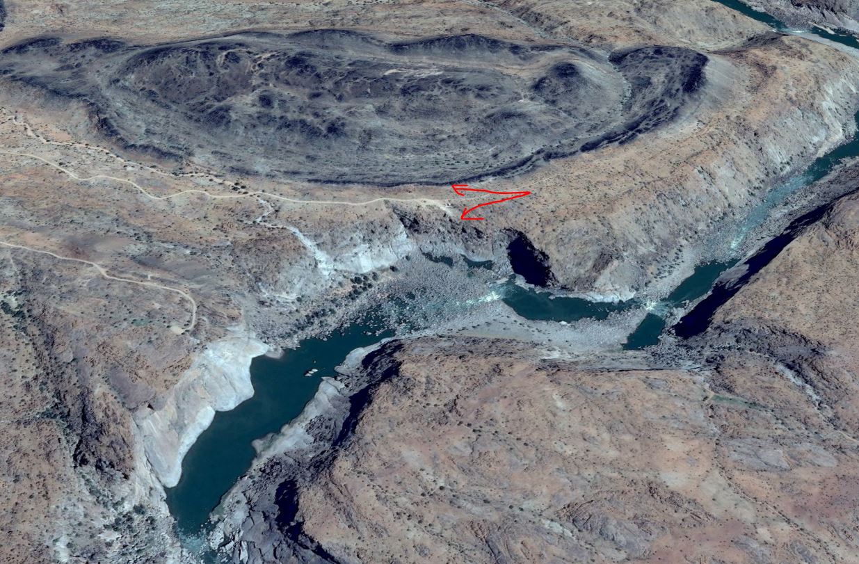
The beginning of the layer of black rocks pointing vertically into the sky due to warping.
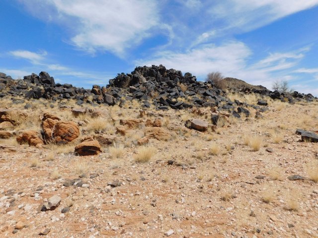
Looking down the length of the black rock layer.

Other posts in this series
Augrabies - The hidden river
Augrabies - The Falls and Floods
Augrabies: a "heart of stone" for valentines day.
Augrabies: Reading the geological history written on the walls
Augrabies: Lizards everywhere
Augrabies: Further examples of weathering and erosion types
Augrabies: Moon rock
Augrabies: how moon rock was formed and is continuing to being shaped
Downvoted in disagreement with rewards generated by concentrated whale voting
G
That's an awesome canyon. It's neat to see those places from the air, or Google Earth, too. The way the shadows accent landscape features is interesting.
I too love aerial/satellite views.
This is very impressive work, @gavvet!
Geo-morphology is one of my passions.
Yes, I can tell. You are very good on this, or is just my newbie impression? :d
@gavvet love the pics of the canyons .. warps eh? hmmm
Really, you know your stuff. I am impressed