Stockholm: Norrström, Söderström and Slussen
The old town of Stockholm is situated on a relatively small island, with a freshwater lake to the west, the salty sea to the east, and (until 1642) strong currents to the north and south. In 1642, locks were built in the south. Today, the whole area around that lock is called "Slussen" - literally, "the lock" - so while there are countless of locks in Sweden, if anyone says "the lock", they would typically refer ... actually, not to the central lock in Stockholm, but to the traffic area surrounding it. The current north of the island is also regulated, to preserve more freshwater; it's being used as a drinking water reservoir. I had roughly an hour available for a walk in Stockholm previous Saturday, so I spent it in this area.
Some notes ...
- All links in the text that aren't marked with destination leads to Swedish Wikipedia, as I believe the Swedish Wikipedia has most information about those places. Most of those articles also exists in other languages.
- You're encouraged to check the map, if you click on the "geohack"-links under the photos, you'll see a map with the position recorded in the photo. The position is not always correct.
- Full resolution photos should be available on the "full quality"-link. The photos are distributed through IPFS, it may be a bit slow, if the photos doesn't load at once, then ... try again.
Norrström and the parliament
The parliament is situated on a small island Helgeandsholmen, situated in Norrström, north of the old town (Gamla Stan) - or, to be more exact, north of Stadsholmen, the island where (most of) the old town is situated. Helgeandsholmen has been expanded slightly over the centuries, originally it was three smaller islets.
Those photos are taken from Riksbron north of the parliament. This pedestrian bridge is connecting Helgeandsholmen with the new city center at Norrmalm. There is a sluice gate under the bridge for regulating the water flow. As we can see on the photos there is very little current, most likely the sluice gate is allowing only small amounts of water to pass. Wikipedia says a lot about the previous iron bridge from 1931, but it doesn't say when the bridge was replaced or why - though it may have been due to many Stockholmers thinking the previous bridge lacked some ... dignity. The previous bridge got the nickname "Råttfällan" (rat trap) due to the look.
The first photo is towards the east and the parallell bridge Norrbro, built 1807. By now we have the freshwater body behind us, and some few hundred metres in front of us there is the salty sea.
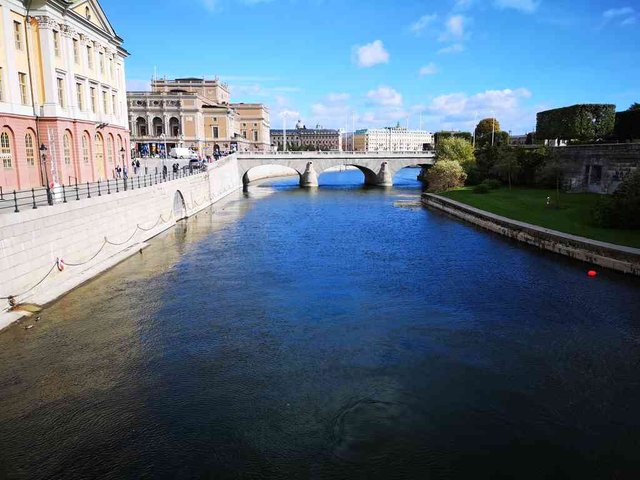
position: geo:59.32843,18.066797 (geohack) - 2018-09-22 12:28:02 localtime - full quality
Turning around, there is Vasabron, it used to be the mainroad between the old town and the northern mainland (Norrmalm). It's a longer bridge, since it doesn't go via Helgeandsholmen. The bridge was opened in 1878. In the middle of the bridge there is some trees and some buildings, this is the island Strömsborg, it's accessible through Strömsborgbron, a small "side bridge" going from the middle of Vasabron and onto this island.
Another thing to note is the markers giving a strong signal to boats that they should not proceed (there were signs as well, but I guess it's easy to ignore signs). I didn't understand it at first, but now that I've read they have sluices under the bridge it's more understandable. Also, today it was relatively quiet - but sometimes this place looks like a waterfall.
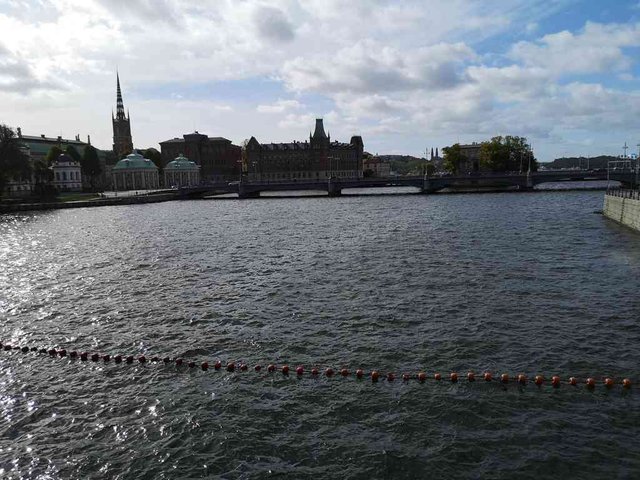
position: geo:59.328281,18.067213 (geohack) - 2018-09-22 12:28:43 localtime - full quality
Now I've crossed Helgeandsholmen, and I'm standing on Stallbron, the current bridge was constructed in 1904, but expanded in the 80s. Reading the Wikipedia article now, I can see that there actually is two levels on this bridge, there is an enclosed walkway under it, Rännarbanan, for usage by the parliament. The view is towards the west and it's still Vasabron behind.
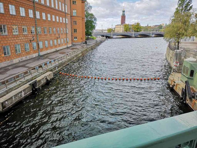
position: geo:59.327526,18.069871 (geohack) - 2018-09-22 12:31:16 localtime - full quality
There are some sluice gates here restricting the water flow - here we can clearly see some of the mechanics. I suppose there is a wall hidden under the water and perhaps 10-20 cm of free water above the wall. However, since there is no visible current I guess the lake level must be pretty low due to the dry summer (perhaps it hasn't been raining as much in Svealand as in Norway) and/or that it was high water while I was going for the walk.
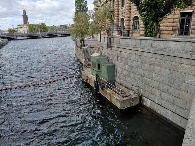
position: geo:59.327526,18.069871 (geohack) - 2018-09-22 12:31:25 localtime - full quality
"Omtänksomhet istället for misstänksomhet", a poster that wasn't removed after the election. The Pirate Party was established in Sweden, later sister parties have popped up pretty much all over the world - they've done it particularly well on Iceland. They got 7k votes in the Swedish election, that's only 0.1% of the votes. Incidentally, this day I was wearing a Norwegian Pirate Party t-shirt with the slogan "digital rights are also human rights". I had a brief look down that hole but didn't get much smart from it. Came to think, I probably should have removed the poster, it looks quite junky by now.
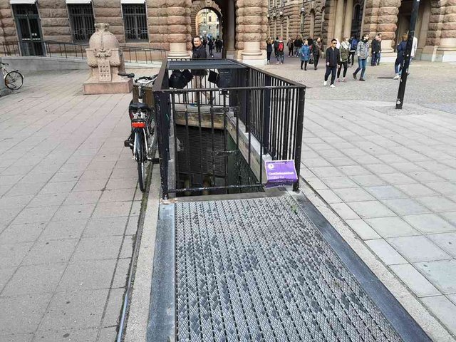
position: geo:59.326938,18.06879 (geohack) - 2018-09-22 12:31:57 localtime - full quality
On my return trip, I went back over Vasabron. Here is a photo of Norstedts (an old publishing house) at Riddarholmen.
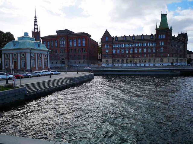
position: geo:59.326843,18.065027 (geohack) - 2018-09-22 13:12:35 localtime - full quality
Centralbron, by today the main road for car traffic passing the central Stockholm. Strömsborg and Strömsborgbron can also be seen on this photo:
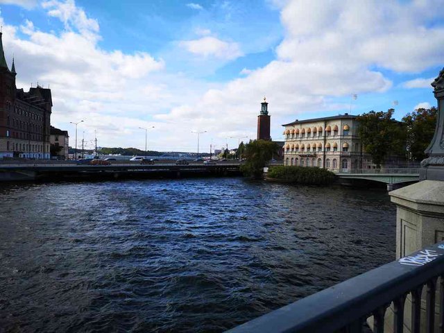
position: geo:59.326843,18.065027 (geohack) - 2018-09-22 13:12:47 localtime - full quality
And finally, a view back to the two bridges I passed in the beginning of this post, Riksbron and Stallbron:
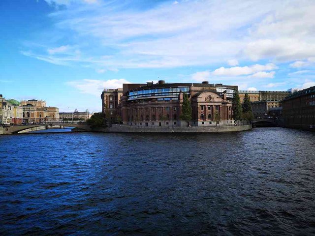
position: geo:59.327301,18.064491 (geohack) - 2018-09-22 13:14:34 localtime - full quality
For those specially interessted, I have two "bonus photos". It seems like with my new phone, photos taken with "digital zoom" does indeed contain more details than photos taken without zoom. On this photo one can clearly see the sluice gate sticking up from the water under Riksbron, some small waves in front of the gate and still water behind. I wish I could read what's written on the sign for boaters; I'd need a binocular or optical zoom to see that. On this photo the Rännarbanan is clearly visible.
Old town
Next, a walk through old town. The old town of Stockholm has quite some charm, it's really worth to take a walk there. I took no photos on my first walk through - I think there were too much tourists this day, and also I wanted to keep this post maritime-themed. I'll leave it to other people to make a post of the old town :-)
On my return trip I decided to take one photo. The portal up there looked much better from the top side of it, but I didn't want to take a photo while walking there due to all the other tourists taking photos and selfies there.
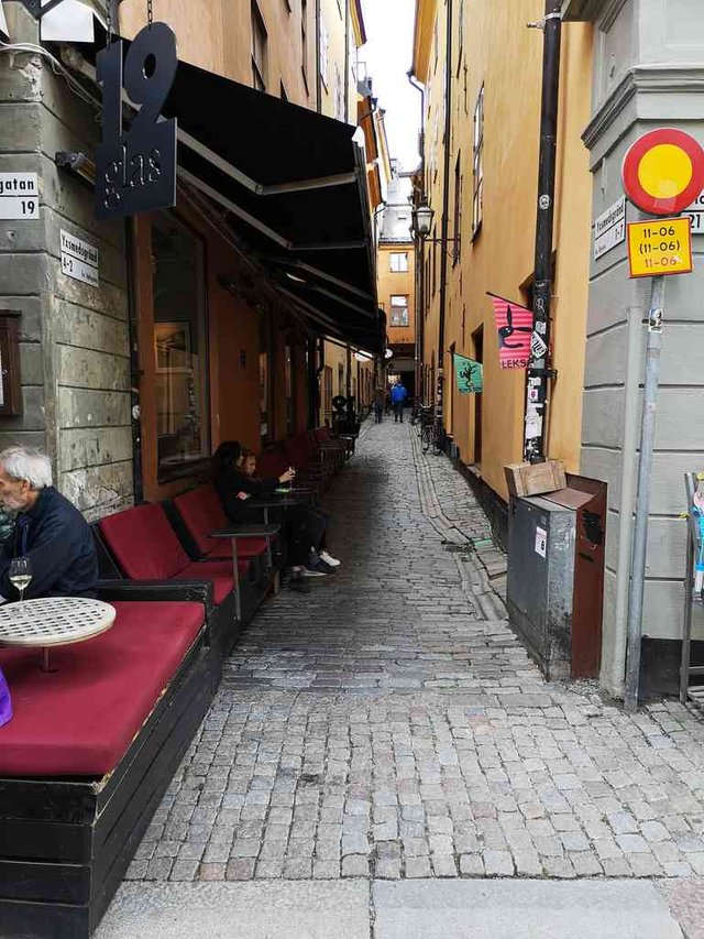
position: geo:59.324542,18.068737 (geohack) - 2018-09-22 13:08:46 localtime - full quality
Slussen
At the south side of the old town we get to Slussen, which is between Stadsholmen and Södermalm. It was not entirely as I had expected it; the whole area was a giant construction site. As I mentioned earlier, they built a lock system here in 1642 - but as traffic and sizes of the ships grew, it was needed to replace the lock - over and over again. Now they are at it again - they are in the process of building the fifth lock. There were big walls on the bridge with some few windows towards the construction site. Those two photos are taken through plastic windows, hence they may not be completely sharp, and you may find some reflections.
Construction work - for the fifth lock
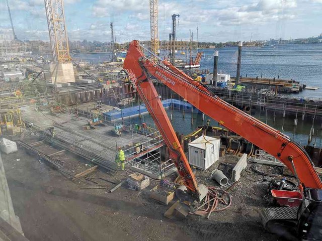
position: geo:59.321269,18.072317 (geohack) - 2018-09-22 12:45:00 localtime - full quality
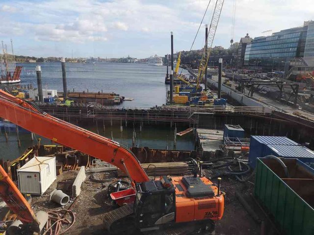
position: geo:59.321269,18.072317 (geohack) - 2018-09-22 12:45:04 localtime - full quality
Walking a bit further, I decided to try to take photos above the wall. It was a bit difficult as I couldn't see the screen - but I managed somehow.
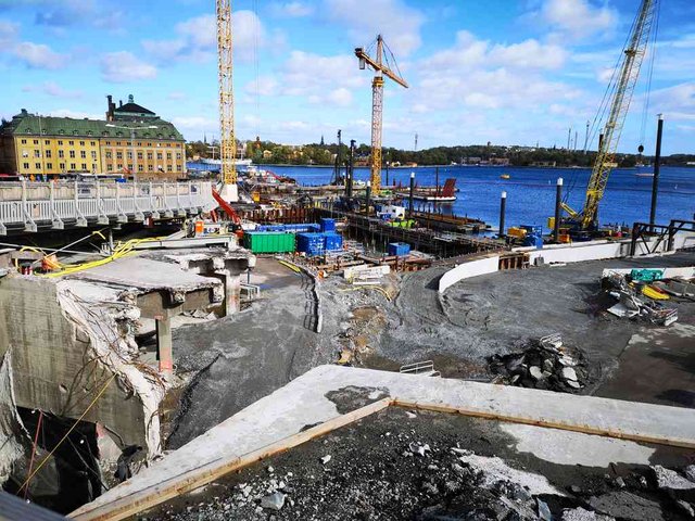
position: geo:59.320541,18.071527 (geohack) - 2018-09-22 12:47:09 localtime - full quality
Slussen, 1930 - 2015
As I wrote in the introduction, "Slussen" refers to the whole area. When the previous lock was built in 1935, the priority was not to serve the boat traffic, but the car traffic. This was a chokepoint in the traffic, the traffic jams would be bad enough even without the bridge opening every now and then. The most significant part of the work was actually to establish an alternative route for the boat traffic, Hammarbyleden south of Södermalm. This southern channel was completed in 1930, it has one lock, the bridges are 26 metres high and can be opened to allow even taller ships to pass. With the southern channel operative, allowing shipping traffic through the central Stockholm got less important, the locks could be closed completely both in the early 1930s as they built the fourth lock, and today while building the fifth lock. It was also no longer needed with an opening bridge, a relatively low fixed bridge would do, redirecting the taller ships to the new channel. A big traffic system was built, mostly on the Södermalm side, it was one of the first cloverleaf interchanges (English wikipedia) in Europe. It seems like we've been lagging a bit behind the Swedes; for me this is more typical architecture of the 50s and 60s. For all the car drivers of Stockholm, "Slussen" is hence not associated with boats at all, but with car roads!
The background for the fifth lock is, unlike previous locks, not to expand the capacity for traffic on the sea nor on land, nor to expand the capacity for bigger boats - the biggest capacity lift will actually be on the amount of drinking water they will be able to extract from the lake! The previous constructions were simply deteoriating - in particular the carrying constructions are sinking deeper into the ground.
Slussen, historical overview
Here is a historical overview of the locks:
- First lock: Drottning Kristinas sluss - 1642-1745. Before they started building the lock, there was a land-based offer to pull ships through the strong current. After 1745, while constructing the Polhems sluss, all cargo had to be unloaded on one side of the lock and loaded onto other ships at the other side of the lock.
- Second lock: Christopher Polhems sluss - 1755-1850?. Parts of this old lock still existed until they started the current construction work.
- Third lock: Nils Ericsons sluss 1850-1931? It was built parallell to the old lock, hence the construction work didn't disrupt the shipping. This lock still exists, it's being used for regulating the water level but not for shipping, and it will be preserved throughout the current construction work.
- Hammarbyslussen (also on kanaler.arnholm.nu) - 1930 - this lock is on Hammarbyleden, an alternative route going outside the central parts of Stockholm. With the completion of this channel, the central lock became less significant for shipping.
- Fourth lock: Karl Johansslussen (also on kanaler.arnholm.nu - 1935-2015
- Fifth lock: Nya Slussen (no proper name yet), expected to open 2022.
Södertälje - the alternative route to Mälaren
There is also another route going to Mälaren lake, through Södertälje kanal, passing through Södartelje. I was doing some meta-research, but still didn't manage to find out if water has always been running this way out of Mälaren or not. The first proper lock was established in 1819, the lock today, Södartälje sluss, is one of the biggest in the Nordic countries. In Södertälje, "Slussen" would typically refer to this lock, not the one in Stockholm.
Södertalje is a short car drive from Stockholm, but the salt-water route from Stockholm to Södertälje is quite long!
Slussen on Wikipedia
Some other Wikipedia articles on Slussen (partly overlapping content, also partly overlapping content with the article on Karl Johansslussen):
Södermalm
Enough on Slussen ... let's continue on the walk! I turned right after arriving at Södermalm. Usage of Studded tires on roads not covered with snow/ice is a big environmental problem and it also puts great wear on the asphalt and cobblestones. In some of the biggest cities in Norway, we're experimenting with extra fees for vehicles driving with studded tires ... but I've never seen a sign like this before:
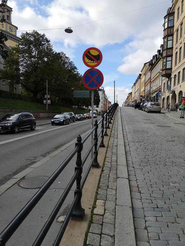
position: geo:59.319713,18.067281 (geohack) - 2018-09-22 12:51:59 localtime - full quality
Those stairs looks nice. I love stairs.
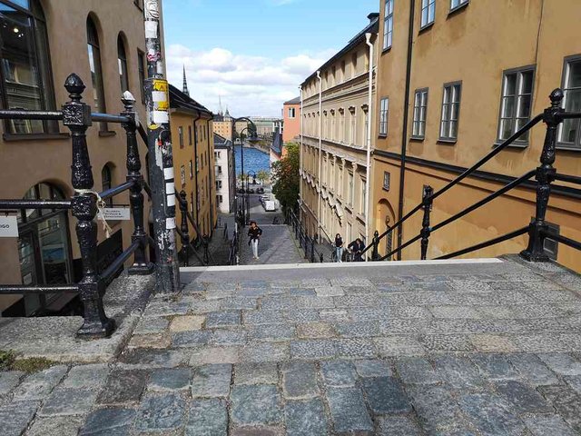
position: geo:59.319576,18.067888 (geohack) - 2018-09-22 12:52:26 localtime - full quality
Though, I decided not to walk down those stairs. I went down here instead:
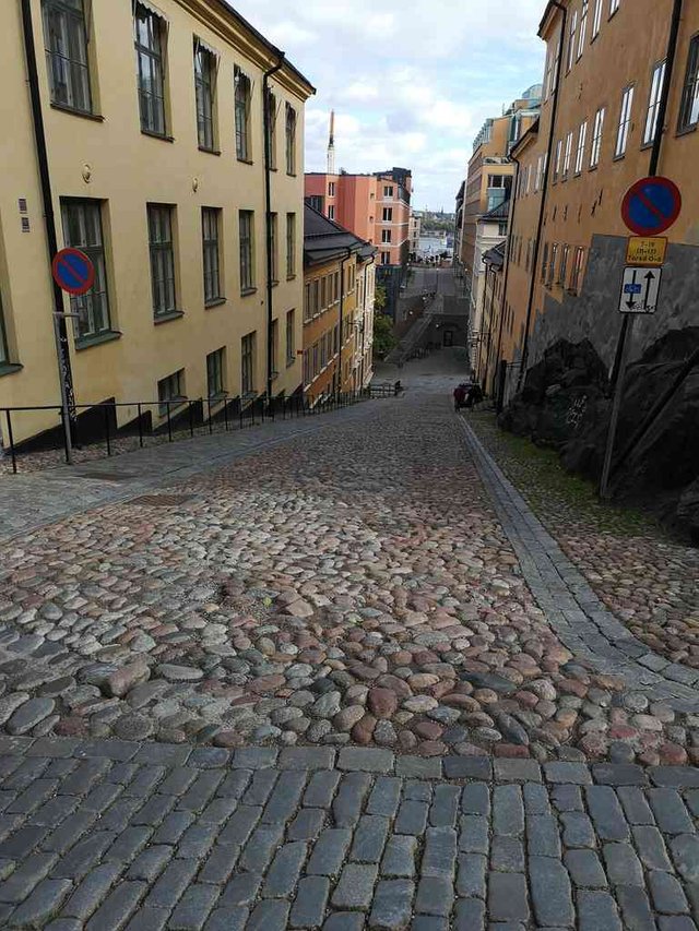
2018-09-22 12:54:09 localtime - full quality
... and I found some other stairs eventually ...
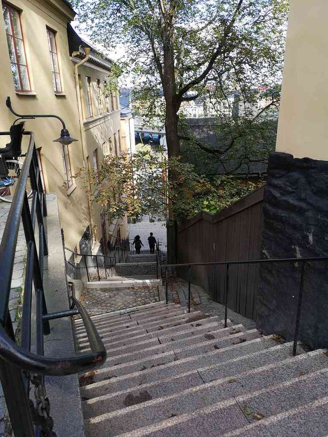
position: geo:59.322818,18.066373 (geohack) - 2018-09-22 12:54:35 localtime - full quality
Here is from the fresh-water side of Stockholm. I believe my new phone is enhancing the blue color slightly.
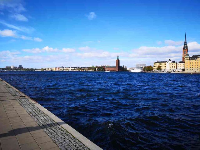
position: geo:59.320995,18.066577 (geohack) - 2018-09-22 12:57:05 localtime - full quality
The Slussen construction work is behind this bridge. There are signs telling that one shouldn't proceed with a boat.
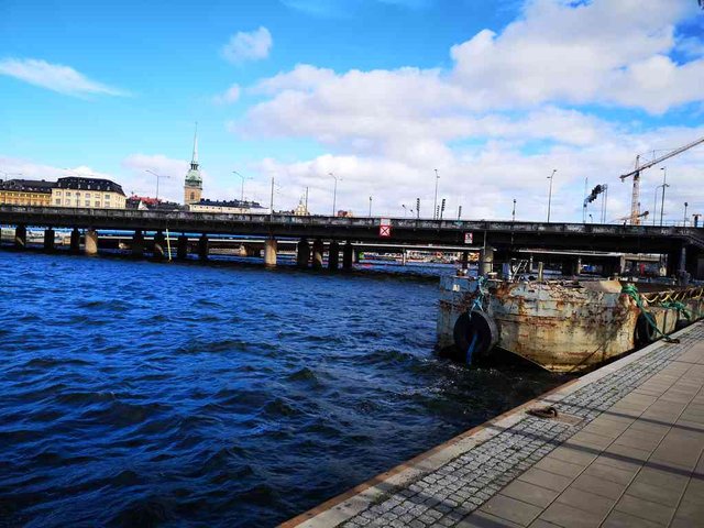
position: geo:59.320945,18.066251 (geohack) - 2018-09-22 12:57:47 localtime - full quality
When I got here, I thought it was about time to get to the train station, so I returned through Stadsholmen to Norrmalm; I've already covered the return trip above.
Selected photos available in original quality on IPFS QmR4Z2bWsa26QTkBaVvWEvGE6MEJc1mQCQEK1XnAqomL5d. All photos taken available in original quality on IPFS Qmd8G5tV2UsGAHP42ABnyKHR1n5VJQrPhbbgoyYDTg3bYf. The CC BY-SA 4.0 license applies on both my photos and the article
Don't be afraid to criticize my posts. I will give a 100% upvote to any (unique) reply pointing out typos, grammar mistakes or mistakes in the facts presented. This applies to any post or comment from me, no matter how old. I also usually give upvotes to opposing points of view, particularly when a good and logically valid argument is given.
What a gift you are to the #walkwithme community.
Thank you for taking into the tour through Stockholm, I remember my husband was there with his parents and his friend, they were all completely fascinated and as a child that is really a dream to be in country of Pipi Longstocking and Astrid Anna Emilia Lindgren.
Thank you for sharing these beautiful photographs, I remember you previous posts while you were traveling to Kiel and Copenhagen with your boat and then it was just the channels but this time I am really pleased to see more pictured from the city itself, those nice cobblestones and narrow alley with little shops or cafe. Wonderful place for tourist to make a break for cup of tea or coffee.
Sweden is a beautiful country. I have never seen much but what I saw I really loved. I visited Goteburg a few year ago and it was such a great experience! You're photos make me feel like I've been to Stockholm too! The buildings look a little bit like Amsterdam or London, I mean from the style perspective. Your photos are very nice. Thank you for sharing!
All I can say is the you are a machine when it comes to post writing and photo snapping. I enjoyed it all. New smartphones take great photos.
Snapping photo is the easy part - but I spend quite much time on selecting what photos to include in the post, even more time on the writing, but on this post I've spent the most time on reading Wikipedia articles.
If I was a machine, this post would have been published hours after my walk, not a week after my walk :-)
Hi tobixen,
Visit curiesteem.com or join the Curie Discord community to learn more.
Hiya, just swinging by to let you know that this post made the Honorable mentions list in today's Travel Digest #332. Please drop by to check out all the rest of today's great posts and consider upvoting the Travel Digest if you like what we're doing.
Wao such a lovely clicks.Really very impressive brige.very beautiful waterfal.Blue water looks so amazing.I really like blue water.Very amazing building in the water.Old town looks so beautiful.Road looks so beautiful.These buildings looks so great.This stones road looks so amazing.I really like it.Tress looks so great.Very neat and clean streets.You cell result is too good.Thanks for sharing.
Hi tobixen,
Visit curiesteem.com or join the Curie Discord community to learn more.
Congratulations! Your post has been selected as a daily Steemit truffle! It is listed on rank 14 of all contributions awarded today. You can find the TOP DAILY TRUFFLE PICKS HERE.
I upvoted your contribution because to my mind your post is at least 6 SBD worth and should receive 150 votes. It's now up to the lovely Steemit community to make this come true.
I am
TrufflePig, an Artificial Intelligence Bot that helps minnows and content curators using Machine Learning. If you are curious how I select content, you can find an explanation here!Have a nice day and sincerely yours,

TrufflePigVery nice thank you for this tour around Stockholm.