Aruba: Self-Guided Tour, Beach Mystery, & Thanks!
//:# (!steemitworldmap 12.613822 lat -70.051354 long California Lighthouse d3scr)
First of all, thank you to all of my new friends who have stopped by to see these posts. It's fun to be part of such a supportive community! The excellent writing and photography are an inspiration. My wife commented that she hasn't seen me with my camera in quite a while. So seriously, thank you!
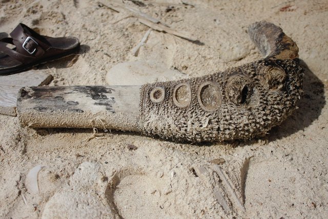
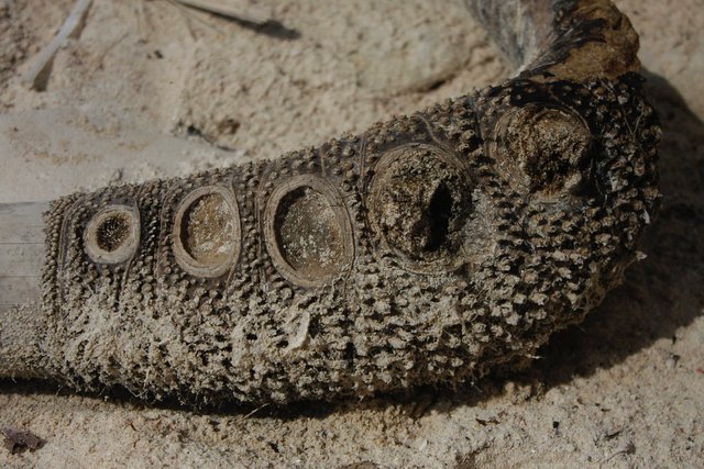
What is this!? I have no idea. It was on one of the beaches we visited today.
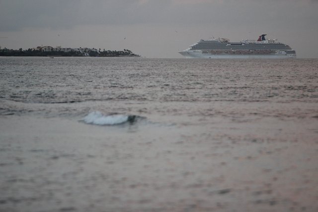
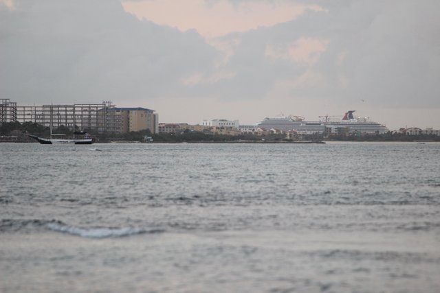
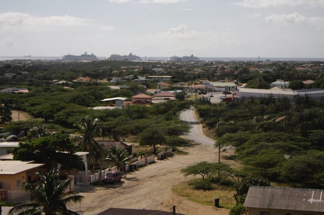
Well, today was one off my "wake up at 4am days." These happen once in a while and there is no going back to sleep. So I got up and swam in our pool, read a book and journaled, and then watched the sunrise. Two massive cruise ships came into harbor just down the coast.
OK, so today we went for a "self-guided" tour of the island that my wife discovered in Fodor's Aruba. We really do love self-guided tours whether walking or driving. I do prefer to walk, it is much more intimate with the local surroundings.
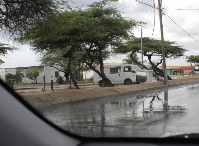
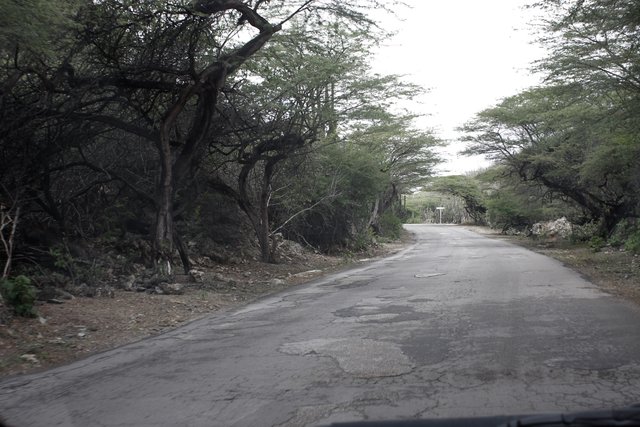
After a delicious breakfast at Diana's pancake house we headed to the south end of the island. It is the Rainy season and it rained! So hard that there was no way I was taking pictures while driving! The roads flooded and I had no idea how good the tires were on my budget rental so I was not going to push it. We tried to find the ruins of a Gold Smelter that was supposed to be near Frenchman's pass but never did see it. Have I mentioned that signage here is sparse, to say the least. Google maps has saved us many times. We did find a lake that had lots of local birds such as herons, cranes, and egrets. Again, I was driving so no pics yet.
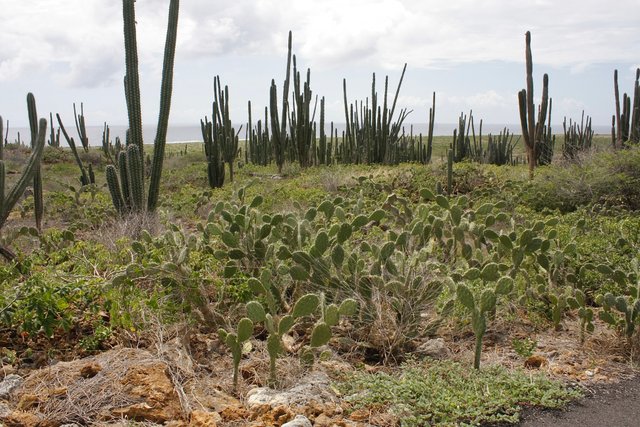
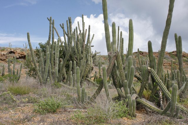
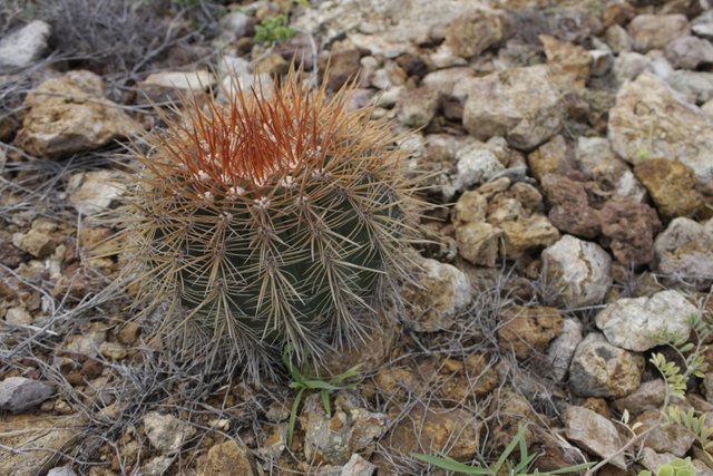
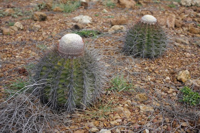
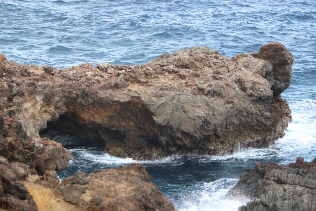
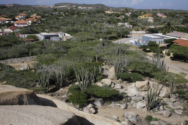
At the south end of the island there is a huge Citgo refinery. On the other side of the refinery are Bachelor's beach, Baby Beach, and a lighthouse. The road to light house goes through a massive cactus growth. It really is amazing.
The lighthouse is much less amazing. This is the "lighthouse" at the south end of the island. It is much more like a "lightpole" than a lighthouse.
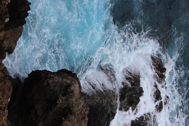
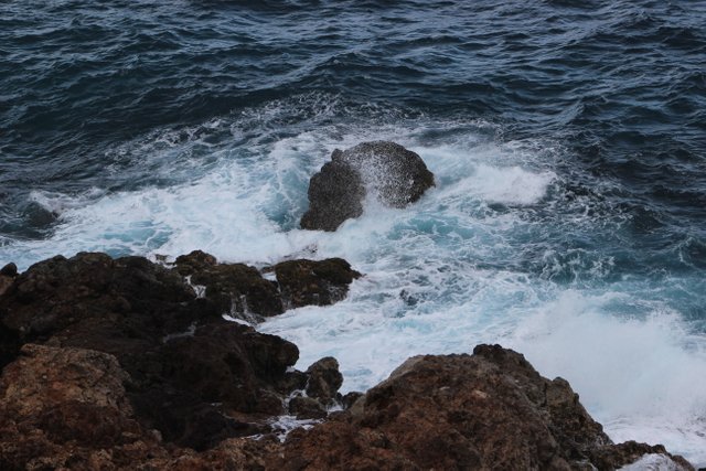
When we arrived we actually laughed out loud that it was called a lighthouse. Still, it is worth the trip b because the varieties of cacti as well as the topography are mesmerizing. It is a short walk to the edge of the island where you find yourself standing on a cliff over looking the churning waters below. To the left you see giant wind turbines and to the right you see Baby Beach. The ground around the lighthouse is volcanic rock and scrub growth and cacti.
 !
!
//:# (!steemitworldmap 12.418891 lat -69.868906 long Lighthouse and mystery structures d3scr)
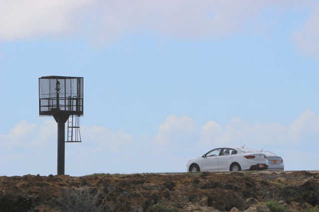
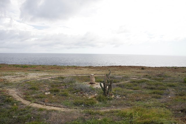
There are three of these old structures. I have no idea what they are. At first we thought it was a foundation for the original lighthouse. Then I found three of them and that theory seemed less plausible. they remind me of ancient canon stations I have seen in Singapore and at other old forts. but there was no mention of that so I don't suppose that was right either.
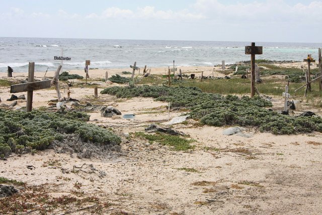
As we drove off down from the lighthouse we passed through the cacti and turned left at the bottom of the hill onto a dirt road. It led us by a beautiful beach where only one other car was to be seen. If you are looking for a secluded beach, this is it. Suddenly, we were driving pass scores of crosses stuck ion the sand! We had no idea what this was. An internet search later confirmed that it was a pet cemetery. Interesting.
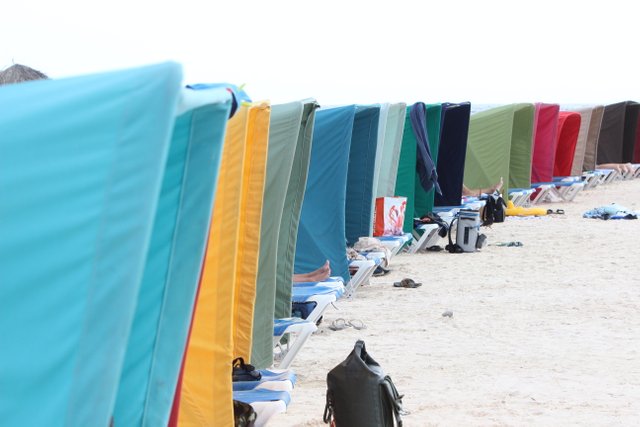
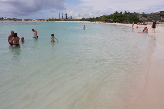
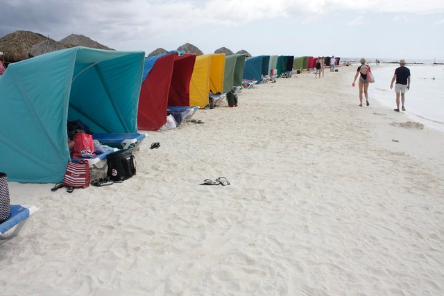
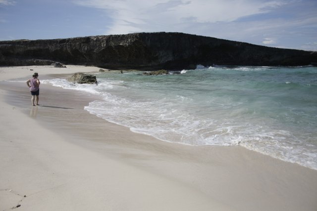
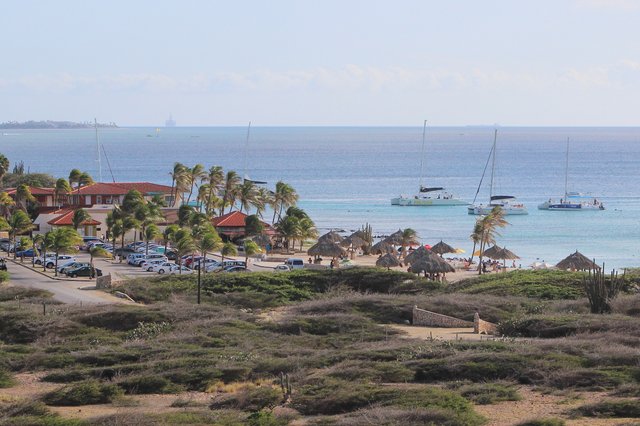
The sand at Baby Beach is incredibly fine and soft, truly remarkable. There were people snorkeling mere meters from shore, a restaurant, bamboo umbrellas, and a row of colorful tent shelters. Is suspect that we had been on the road for about 2 hours past breakfast. That also included a slow bathroom stop at Wendy's restaurant along the way.
Baby beach with the refinery in the background
//:# (!steemitworldmap 12.414072 lat -69.882124 long Baby Beach, Aruba d3scr)
We then turned back north, back through Frenchman's Pass, and to the National Park. The rain was now long gone and the sun was high. At the National Park there is a small snack shop and ranger station with info about the park. The cost to enter is $11 US/person. There is one road that goes in and obviously comes out. So you go in, turn around, and come out. There are multiple off-road routes to take in the park but that requires the rental of a jeep. Rumor has it that will set you back $250 US for the day. $44 to get into the park seemed steep so there was no way we were renting a jeep. Our trusty Hyundai did the job well. While the road is paved, every 100m or so there is a significant drainage culvert across the road. You must go at a snail's pace and think strategically about each one or you may seriously damage your car. There was not much wildlife to see. We saw a herd of wild donkeys and one very colorful bird but that was about it. Again, there are cacti everywhere and small scrub brush. It really did remind me of South Africa.
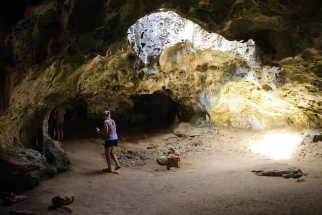
We ventured on to the end of the paved road and even went on the firmly packed dirt to get to a cave. (The first cave we passed was apparently closed.) The last cave, Quadirikiri Cave was open and very cool. Apparently, 4000 bats live in the cave and in the late afternoon and evening they come streaming out of holes in the ceiling of the cave. The holes let light into the cave. This makes exploring the cave very simple. Asluck would have it, there was a tour guide in the cave with another couple. so we tagged along and he was more than happy to answer our questions and tell us about the bats. I realize that many people are not fond of bats. There is nothing to worry about. The cave is clean as the bats live at the back of the cave. They do not congregate near the opening. The part where the bats are is barred off so no one can get in there. The floor of the cave is not littered with bat guano. The bats and their belongings are all deep in the cave. Is this worth $11/person? It is hard to say, but it was pretty cool.
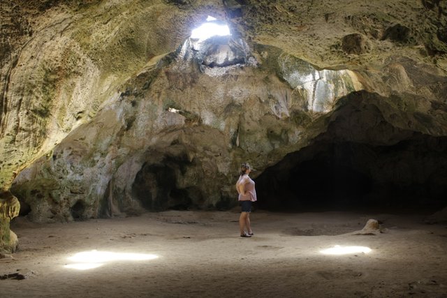
This is the second section of cave with the holes in the roof...
//:# (!steemitworldmap 12.483143 lat -69.899514 long The Bat Cave! d3scr)
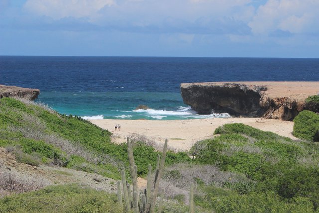
On the way out we stopped at a beach in a small cove. To access the beach you walk down a short flight of stairs. There is no swimming allowed due to a very strong under tow. If you want a beach for sun bathing this could be it. Mind you, there is a fair amount of debris on the beach, man made and natural due to the remote location and funnel created by the cove.
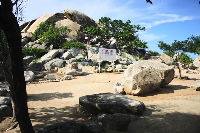
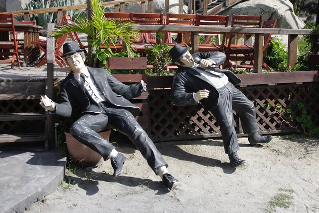
We made our way out of the park and headed to a rock outcrop at Casibari Park. Again, there are some signs but you need to be alert and better still have a good map or Google maps. There is a small bar adjacent to the park, mannequins of the Blues Brothers!?, and a couple old propeller aircraft engines. The rocks are very unique and the view from the top is worth the short climb. This is a place that kids and the young at heart will probably enjoy. It is quirky but not a "must see" IMHO.
In the distance you can see how massive the cruise ships are.
//:# (!steemitworldmap 12.531068 lat -69.996353 long Rocks and Blues Brothers d3scr)
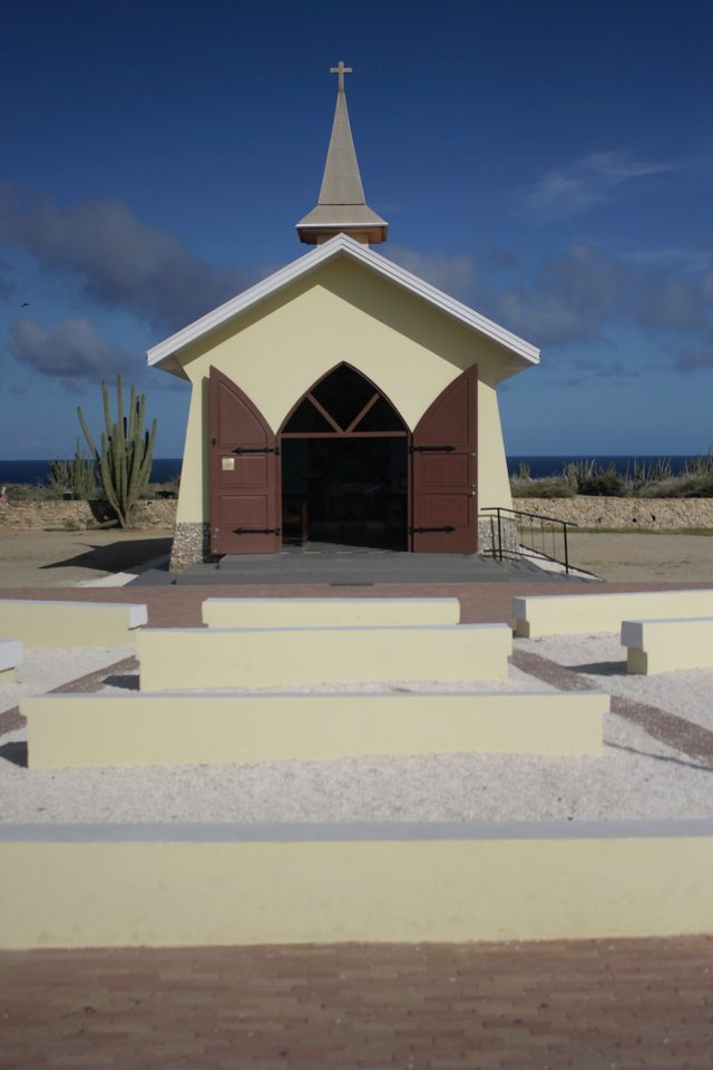
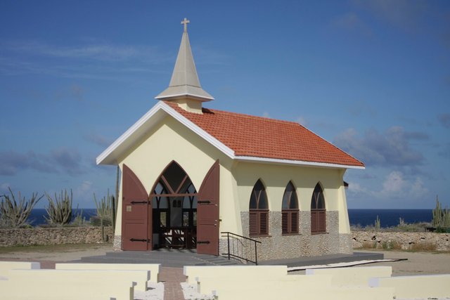
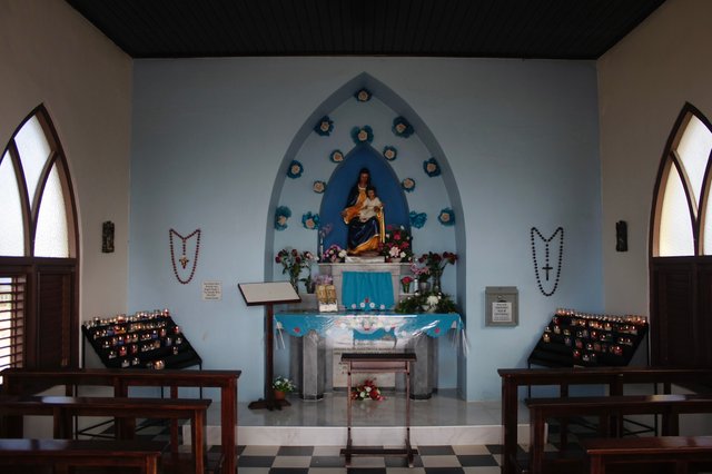
From there we ventured north past the small town of Noord and then east to the Alto Vista Chapel. This Catholic chapel was a quick stop and quite interesting. At least to me. Interestingly, in the parking lot of the church were vendors selling Cuban cigars, various drinks and cocktails, and the requisite souvenirs of Catholicism, and Aruba.
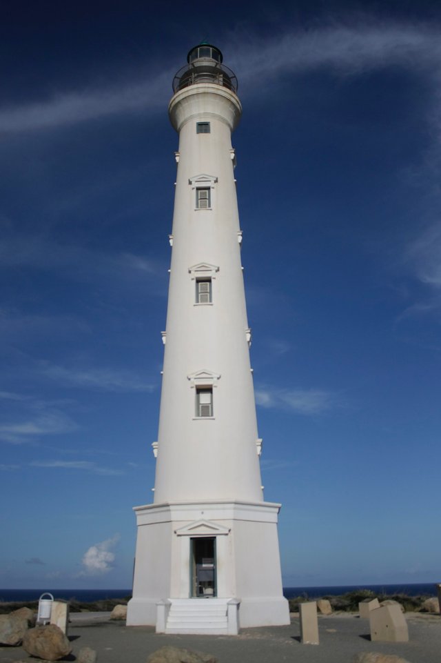
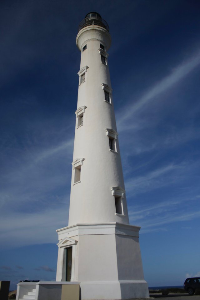
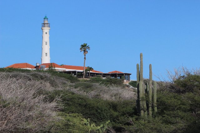
Our next stop was the California Lighthouse. This was indeed a "lighthouse." There are numerous beaches that can be accessed from here. For $5 US visitors can climb the tower of the lighthouse. The former keeper's quarters is now a restaurant. The views overlook a golf course, complete with wild donkeys, and Ashari Beach.
In the distance are the Ritz Carlton (left hand high rise) and Rui (white building with spires) Resorts
Ashari Beach
Our next stop was the supermarket, Super Food. We stocked up on supplies for a cook out and grabbed a cheap bite to eat in the small cafe, Jack's Cafe inside Super Food. Not great food, but you do get some local flavor and it is super convenient.
I did get a 6 pack of the local beer, Balashi. It costs half as much as all the imports and is respectable. It is a Pilsner, so it is a bit lighter than I prefer.
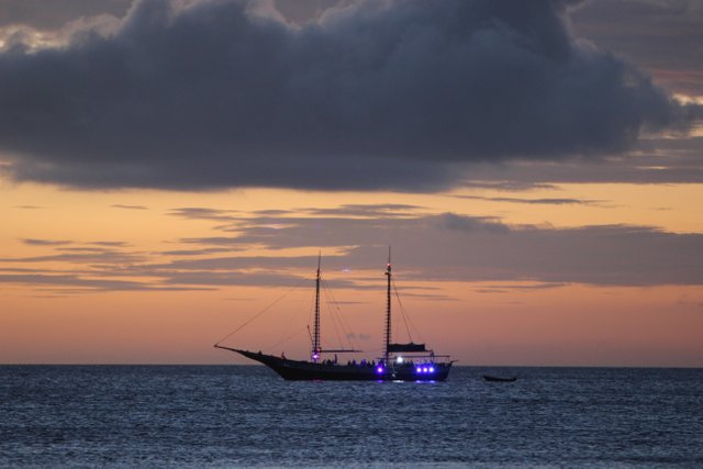
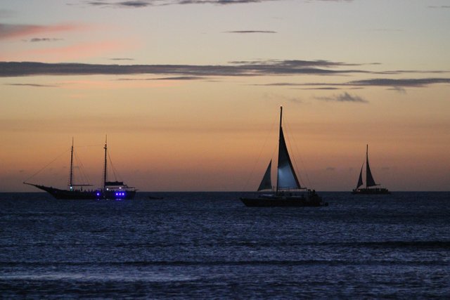
Back at the house we enjoyed the sunset and played games. And I wrote a Steemit post!
That was interesting to tag along with you during your day on this beautiful island.
The @SteemitWorldmap
recently launched a new mobile app called Haveyoubeenhere that allows you to pin multiple locations on the map to make a route for the day . I think that's what you're trying to do in your post here. You can check out the announcementand maybe post from there. It will cross post to Steemit if you select the option.
https://steemit.com/haveyoubeenhere/@steemitworldmap/announcing-haveyoubeenhere-the-social-media-app-for-and-by-travelers
Thanks, yes, I will check that out. I need to hire a Steemit tutor!
Your post was upvoted by the @art-venture account after manual review and included in Art-Venture magazine. The upvote and support of Art-venture magazine would greatly appreciated!

Congratulations, Your Post Has Been Added To The Steemit Worldmap!
Author link: http://steemitworldmap.com?author=kicktheball
Post link: http://steemitworldmap.com?post=aruba-self-guided-tour-beach-mystery-and-thanks
Want to have your post on the map too?
Congratulations @kicktheball! You have completed the following achievement on the Steem blockchain and have been rewarded with new badge(s) :
You can view your badges on your Steem Board and compare to others on the Steem Ranking
If you no longer want to receive notifications, reply to this comment with the word
STOPTo support your work, I also upvoted your post!
Thanks!
This post was shared in the Curation Collective Discord community for curators, and upvoted and resteemed by the @c-squared community account.
If you are a community leader and/or contest organizer, please join the Discord and let us know you if you would like to promote the posting of your community or contest.
@c-squared runs a community witness. Please consider using one of your witness votes on us here
Hiya, @LivingUKTaiwan here, just swinging by to let you know that this post made into our Honorable Mentions in Daily Travel Digest #683.

Your post has been manually curated by the @steemitworldmap team. If you like what we're doing, please drop by to check out all the rest of today's great posts and consider upvoting and supporting us.
Hello @kicktheball, thank you for sharing this creative work! We just stopped by to say that you've been upvoted by the @creativecrypto magazine. The Creative Crypto is all about art on the blockchain and learning from creatives like you. Looking forward to crossing paths again soon. Steem on!