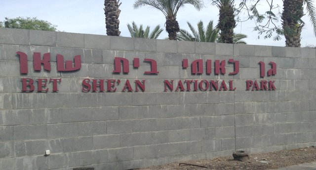
Bet She'an National Park - Israel
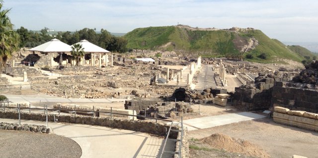
Beit She'an National Park is a relatively recent discovery. The ancient city dates back millennia, but was destroyed by an earthquake around the 8th Century AD. While there were some excavations conducted in the early 20th Century, the majority of the reconstruction at this location only began in 1983. The existing city dates to the roman era and is a modified design. The main road, the Cardo, has been restored. It leads to a large tell, which was left in place, disrupting the normal layout of a Roman city. The tell was left in place in order to erect a temple to Zeus on top. This tell has been dated to the fifth/sixth millennia BC. There are eighteen consecutive civilizations that have been identified at this site.
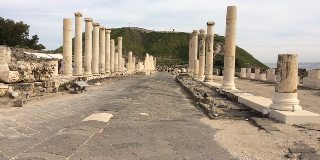
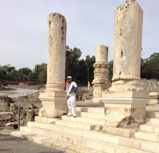
Shown above is the main road through the center of Bet She'an. The Romans refer to this as the Cardo Maximus. The north-south streets were referred to as cardo, while the primary east-west streets were called the Decumanus Maximus. The Cardo Maximus would have been lined with shops and vendors as well as temples and other major civic gathering places. The temples along the cardo are easy to distinguish as they are generally solid white, while the other stone is generally basalt or some other darker stone.
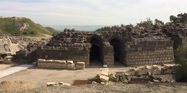
Like most Roman cities, Bet She'an had an amphitheater. Above are the archways that led into the theater. As you can see, the structure is in an amazing state given the earthquake and the amount of time that has passed since they were constructed. There are no black lines, indicating that this entire structure is in situ. (found as is or not reconstructed). Areas of this ancient city that have been reconstructed are defined by a thick black line, which you may see in some photographs of the city. To the left of the photo, you can see that the cardo is at a lower elevation in the distance.
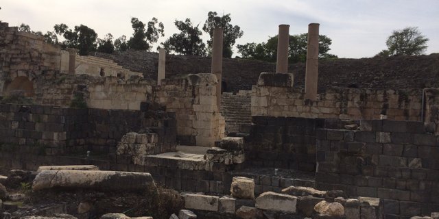
This photo offers another perspective of Beit She'an National Park. The amphitheater to the right, the tell straight ahead and the cardo in between. Looking at the cardo, you will see major pillars that line the road. To either side of the pillars would have been sidewalk like areas lined with shops.
Sitting at the entrance to the cardo is a large white structure. This structure served as a temple, as indicated by the white stone. Looking at this photo gives some perspective on the clear difference in construction that indicates this was once a temple area and not a shop.
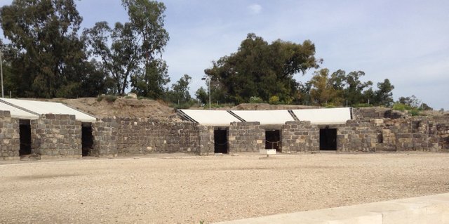
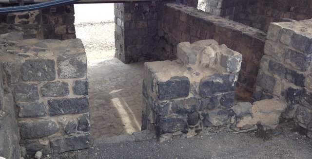
Near the center of the cardo is a ring of structures. Among other things, this would have included the red light district which may be identified by the mosaics on the floor, which are still intact. Below are some additional photos inside these buildings.
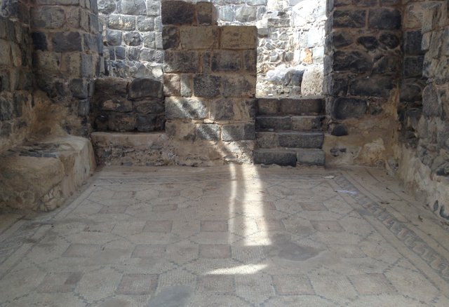
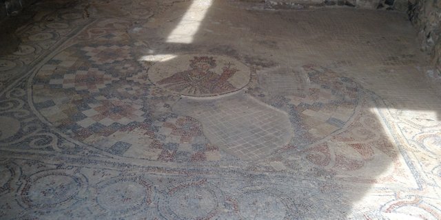
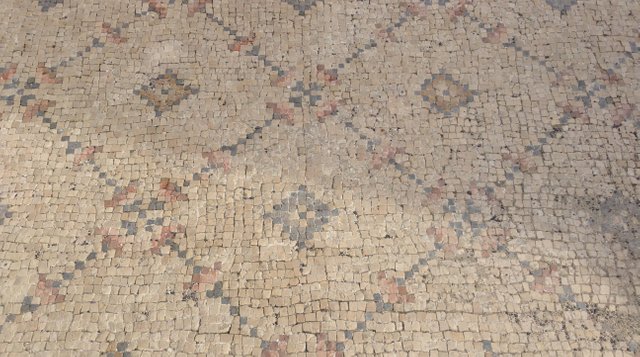
As you can see from the close up photograph of the floors, the mosaic tile is amazingly well preserved. It amazed me that we were able to just walk inside on these ancient floors.
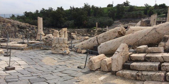
Down the cardo, just before you reach the tell, is a crossroads. The affects of the earthquake are preserved at this spot. Here, you can see where the pillars fell and the capstones landed. The construction of the pillars is visible as the pieces lay deconstructed in basically the same manner that they would have been placed when they were erected. These pillars surrounded the nympheon, which was a roman fountain. This angle is does not capture the fountain area, but there is a semi-circle cutout on the other side of the debris which was once the focal point of this fountain.
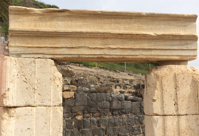
I took a picture of this archway, because it is evidence that Christians inhabited this area at some point in time, probably closer to the earthquake, as the cross was not a symbol of Christianity during the early centuries. If you look below the two rows of lettering, you will see that the stone appears to be peppered. This archway likely had something written on it that early believers did not agree with. It appears that the lettering was erased with a chisel.
This final photograph is an image of another temple. I included this photograph because it displays the sharp contrast in the stone used in construction. Many of the stones at this location are also well preserved. The outer walls appear to have been build well as they appear to remain intact and mostly undisturbed.
A quick biblical primer on this location. It is mentioned several times in the bible, which makes it intriguing to Christian visitors beyond just the archaeological significance. The archaeology alone was enough to hold my interest.
In Joshua 17:11-12, Bethshean is mentioned as a place where the inhabitants were not driven out when the Israelites arrived.
In Judges 1:27-28, the story is reiterated along with information that the Canaanites here were put to tribute rather than driven out.
1 Samuel 31:6-13, the story of Saul's defeat by the Philistines. The full scripture reads:
"So Saul died, and his three sons, and his armourbearer, and all his men, that same day together. And when the men of Israel that were on the other side of the valley, and they that were on the other side Jordan, saw that the men of Israel fled, and that Saul and his sons were dead, they forsook the cities, and fled; and the Philistines came and dwelt in them.
And it came to pass on the morrow, when the Philistines came to strip the slain, that they found Saul and his three sons fallen in mount Gilboa. And they cut off his head, and stripped off his armor, and sent into the land of the Philistines round about, to publish it in the house of their idols, and among the people. And they put his armor in the house of Ashtaroth: and they fastened his body to the wall of Bethshan. And when the inhabitants of Jabeshgilead heard of that which the Philistines had done to Saul; All the valiant men arose, and went all night, and took the body of Saul and the bodies of his sons from the wall of Bethshan, and came to Jabesh, and burnt them there. And they took their bones, and buried them under a tree at Jabesh, and fasted seven days".
Portions of that very wall have been excavated on the tell.
It only takes two or three hours to visit. Shorter, depending on whether you want to hike to the top of the tell or not.
Last entry to the park is one hour before closing time
Summer:
Sunday - Thursday and Saturday – 8 am – 5 pm
Fridays and the eve of holidays – 8 am – 4 pm
Winter:
Sunday - Thursday and Saturday – 8 am – 4 pm
Fridays and the eve of holidays – 8 am – 3 pm
On the eve of New Year, the Day of Atonement, and Passover: 8 am – 1 pm
Admission
Adult – NIS 28 (approximately 8 dollars)
Child – NIS 14 (approximately 4 dollars)
Group (over 30): Adult – NIS 23, child – NIS 13
A Christian Guide to Israel
Hotels
Cinema Hotel Tel Aviv, Israel
Ron Beach Hotel, Tiberias, Israel
Prima Park Hotel, Jerusalem, Israel
Attractions
Caesarea National Park Caesarea, Israel
Mount Precipice Mount Kedimum, Israel
Sea of Galilee Boat Ride Tiberias, Israel
Yigal Alon Museum (Jesus Boat) Ginosar, Israel
Capernaum, Israel
St. Peter’s Restaurant Kinneret, Israel
Caesarea Phillipi Banias, Israel
Gadot Lookout and Memorial Golan Heights, Israel
Jordan River Baptismal Site, Yardenit, Israel
Beit She’an National Park, Beit She’an, Israel
Mount of Olives, Jerusalem, Israel
Garden Tomb, Jerusalem, Israel
Western Wall, Jerusalem, Israel
Western Wall Tunnels, Jerusalem, Israel
Via Dolorosa, Jerusalem, Israel
Bethlehem New Store Gift Shop
Pool of Bethesda, Jerusalem, Israel
Israel Museum, Jerusalem, Israel
Yad Vashem, Jerusalem, Israel
House of Caiaphas the High Priest, Jerusalem, Israel
The Upper Room, Jerusalem, Israel
Tomb of King David, Jerusalem, Israel
Masada National Park, Masada, Israel
The Dead Sea, Masada, Israel
Churches
Discalced Carmelite Monastery Muhraqa, Israel
Basilica of the Annunciation Nazareth, Israel
St. Peter’s Church Capernaum, Israel
Church of the Multiplication Tabgha, Israel
Church of the Beatitudes Tabgha, Israel
Church of All Nations, Jerusalem, Israel
Church of Saint Anne, Jerusalem, Israel
Church of the Holy Sepulcher, Jerusalem, Israel
Church of the Nativity, Bethlehem, West Bank
These photos are my own. They may be used with permission
Never heard before about this ancient city , Thanks for sharing
Great history but not read it before. It really interesting @coldsteem
You have received an upvote from STAX. Thanks for being a member of the #steemsilvergold community and opting in (if you wish to be removed please follow the link). Please continue to support each other in this great community. To learn more about the #steemsilvergold community and STAX, check this out.
Congratulations, Your Post Has Been Added To The Steemit Worldmap!
Author link: http://steemitworldmap.com?author=coldsteem
Post link: http://steemitworldmap.com?post=bet-she-an-national-park-israel
Want to have your post on the map too?
Add the following inside your post:
!steemitworldmap xxx lat yyy long description d3scr
(replace xxx and yyy with latitude and longitude)