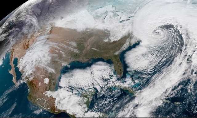
Geocolor Image From NOAA's GOES-16 Satellite of Powerful East Coast Storm

This Geocolor image from NOAA's GOES-16 satellite captures the deepening storm off the East coast of the United States on Jan. 4, 2018, at 16:22 UTC. The powerful nor'easter is battering coastal areas with heavy snow and strong winds, from Florida to Maine.
This post was resteemed by @steemvote and received a 39.61% Upvote
0.13% @pushup from @steemvote
good @gruffalo
Resteemed by @resteembot! Good Luck!
Curious?
The @resteembot's introduction post
Get more from @resteembot with the #resteembotsentme initiative
Check out the great posts I already resteemed.
This post has received a 3.01 % upvote from @drotto thanks to: @gruffalo.
Just another space cartoon. I prefer photographs over photoshopped spliced images, since photographs show you the true shape and nature of Earth. I don't see why people still enjoy cartoons from an organization that is known for faking images, silly kids.
This post has received a 0.87 % upvote from @booster thanks to: @gruffalo.
This post has received a 2.63 % upvote from @steemthat thanks to: @gruffalo. Thank you for your support. Stay Updated And Use Cool Tools At SteemThat.com Want Some Steemish Built On Ethereum? Get You Some!
This post has received a 0.20 % upvote from @buildawhale thanks to: @gruffalo. Send at least 1 SBD to @buildawhale with a post link in the memo field for a portion of the next vote.
To support our daily curation initiative, please vote on my owner, @themarkymark, as a Steem Witness