Some more photos from the Gothenburg channels
I haven't explored all the waterways in Gothenburg yet, but the most important ones beside Göta Elv are Stora Hamnkanalen and Vallgraven (the harbour channel and the moat). The channels and the river carve out an island, which I believe historically was the most central part of Gothenburg. According to wikipedia those channels were made around 1620, there were plans to create a dutch-inspired channel network. The purposes of the channels were to drain the land, provide a harbour, make it easier to defend the city, as well as providing a transportation network. Dutch experts were hired to supervise the work.
Those two channels totally cover some 3 km of distance and creating an island 590000 square metres big - that's not much compared to Copenhagen or any Dutch city, but if I understand the history correct there were more channels that have later been filled up and made into streets with car traffic. Like, "Lilla Bommen" ("small gate") is the guest harbour - it was made in 1640 and was connected to the other channels. It got the name because there was a gate there, boats passing had to pay dues prior to entering the channels. There was a channel "Østra hamnkanalen" (eastern harbour channel) connecting Lilla Bommen with the harbour channel - today there is a street "Østra hamngatan" (eastern harbour street).
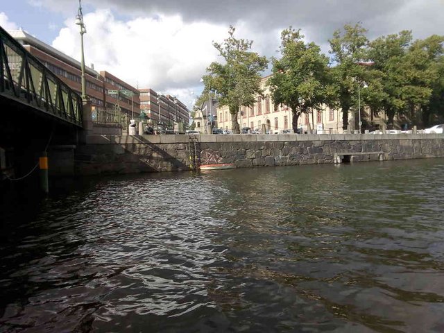
Right after the harbour channel meets the moat channel, there is a lock. The channel continues at a higher elevation for some few hundred metres before meeting the river Mölndalsån. I haven't investigated if the lock works or not. Historically Mölndalsån was quite much used for transportation purposes, today not at all.
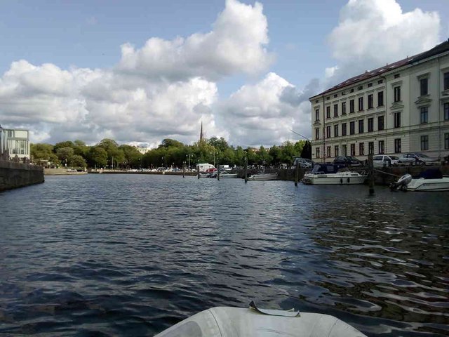
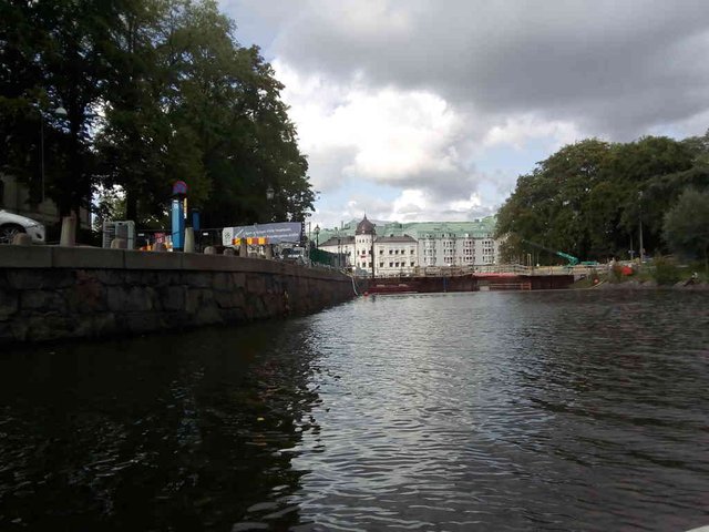
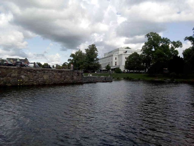
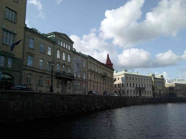
I already posted some photos from the harbour channel earlier in another post - I wasn't aware that it was the harbour channel, but I did comment that there were very few boats in the channel. Here are some photos from the moat channel.
Unfortunately I forgot to photograph the entrance to the moat channel - it was a quite low bridge. The water level was quite high this day, so my masthead navigation lamp was actually ~1 cm too high. I have had the lantern fixed by some ropes so I could easily slide it from vertical to horizontal position. I lended out the boat for two weeks, now I was suddenly surprised to find the light attached by screws. Anyway, after some cursing I managed to pass the bridge. So, there are no boats at all moored up in the harbour channel, but surprise, surprise, in the moat channel there is actually a small boat harbour!
position: geo:57.702556,11.947871 (geohack) - 2018-08-26 16:18:46 localtime - full quality
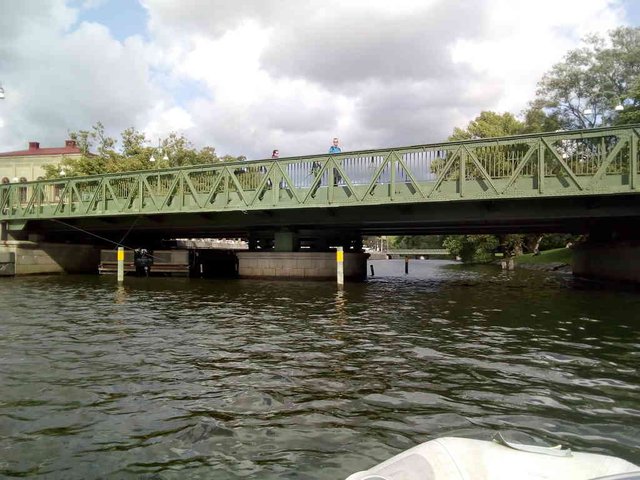
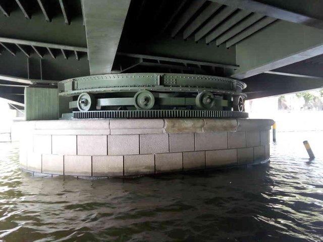
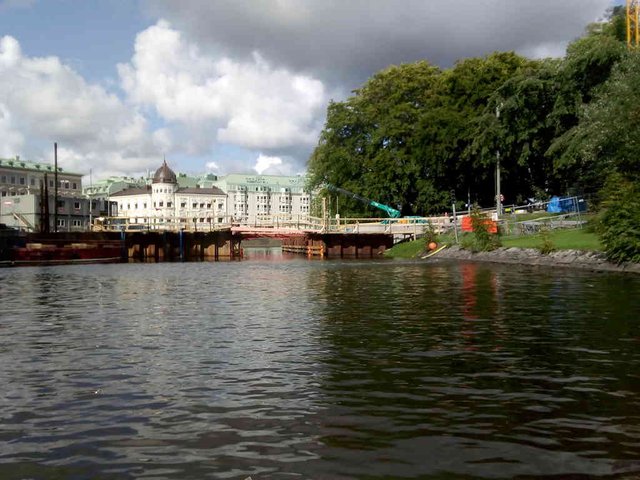
While the harbour channel apparently has several fixed bridges, apparently all the bridges on the moat channel are made - or were originally made - to be opened. I'm not sure if the mechanisms still work today.
position: geo:57.700626,11.959371 (geohack) - 2018-08-26 16:21:46 localtime - full quality
position: geo:57.702789,11.952993 (geohack) - 2018-08-26 16:22:07 localtime - full quality
position: geo:57.699863,11.961072 (geohack) - 2018-08-26 16:22:28 localtime - full quality
position: geo:57.702598,11.966606 (geohack) - 2018-08-26 16:26:11 localtime - full quality
Bridge construction work. If you look at the river bank at the starboard side there is a traffic light there. It was not working this Sunday, but when I came back one week later (and going the other way) I got a red light. I had to press a push-button - of the same kind that is used on pedestrian crossings - to get a green light. My son was steering, while I was to press the button, it was surprisingly difficult to push that button, but we had great fun while doing it. Too bad I was out of battery on my phone and unable to take photos.
position: geo:57.701313,11.96547 (geohack) - 2018-08-26 16:26:49 localtime - full quality
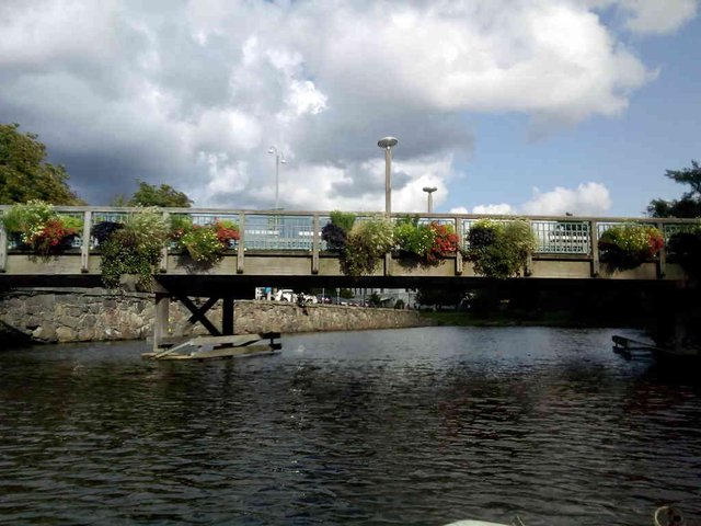
Hm ... did I say all bridges seemed to be possible to open? This one looks a bit fixed ...
position: geo:57.702365,11.967207 (geohack) - 2018-08-26 16:29:48 localtime - full quality
position: geo:57.702423,11.967298 (geohack) - 2018-08-26 16:29:53 localtime - full quality
position: geo:57.702724,11.968503 (geohack) - 2018-08-26 16:30:52 localtime - full quality
position: geo:57.702095,11.965561 (geohack) - 2018-08-26 16:30:55 localtime - full quality
position: geo:57.702415,11.969343 (geohack) - 2018-08-26 16:31:46 localtime - full quality
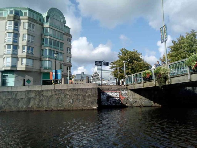
The bridge ahead looks very fixed. But that big resturant barge certainly needs bridges to open to be able to get in or out. Well, maybe it will never need to get out and maybe it got in before the bridge behind was built.
position: geo:57.702415,11.969343 (geohack) - 2018-08-26 16:31:52 localtime - full quality
position: geo:57.704429,11.972891 (geohack) - 2018-08-26 16:35:16 localtime - full quality
position: geo:57.704502,11.972878 (geohack) - 2018-08-26 16:35:18 localtime - full quality
position: geo:57.704582,11.972863 (geohack) - 2018-08-26 16:35:23 localtime - full quality
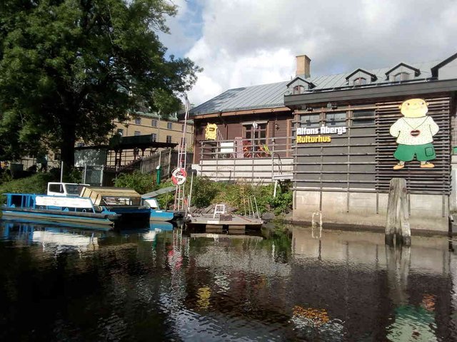
The Alfons Åbergs Kulturhus is on the very end of the moat channel; I've been here in my previous post.
position: geo:57.704643,11.972803 (geohack) - 2018-08-26 16:38:27 localtime - full quality
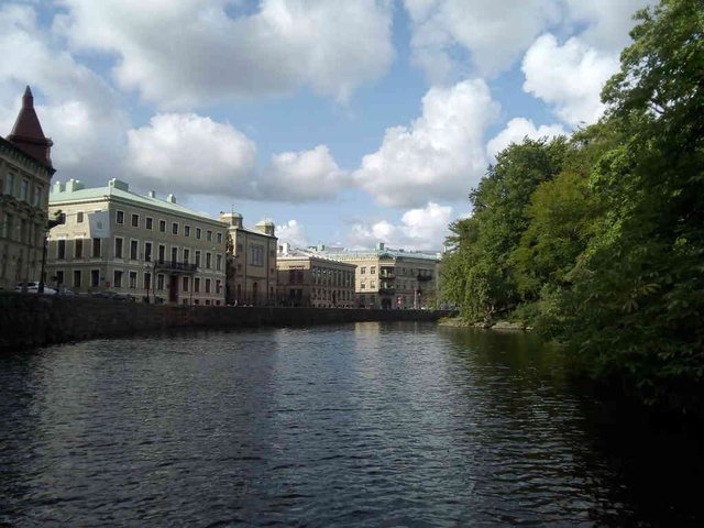
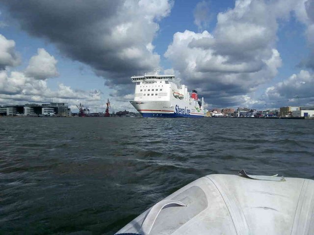
This photo is from the river itself
position: geo:57.701213,11.933191 (geohack) - 2018-08-26 16:08:32 localtime - full quality
Selected photos available in original quality on IPFS QmT5K7rw3LLbQfrFNFyqHL8uDY1xwow2J8RZY1GwNw6FSd. All photos taken available in original quality on IPFS QmepiFGhGfr3MVxerRiM6zNbGdfEHJKVk9yGjDRfuQP9yx. The CC BY-SA 4.0 license applies on both my photos and the article
Congratulations, Your Post Has Been Added To The Steemit Worldmap!
Author link: http://steemitworldmap.com?author=tobixen
Post link: http://steemitworldmap.com?post=some-more-photos-from-the-gothenburg-channel
Want to have your post on the map too?
Although I read the article from my phone I can say that those photos really changed my perception about Goteborg. It looks like you showed us one of the great areas of the city.
Is your boat still there or you sailed it already to Oslo?
I'm in Moss now, Oslo tomorrow
Wao such a interesting and fabulous photography,Entrance of the moat channel is so wonderful,bright looks so beautiful.water is so impressive.level of water looks so high,Sky and clouds looks so great.Natural beauty attracts the peoples,very beautiful buildings,tress looks so fabulous,river looks so neat and cleans,Many chips in the water,peoples are also enjoying.I really like your photography,thanks for sharing.
Tobixen you are opening a whole new world to me with the travels in your sail boat. Gothenburg is very interesting to see from the water perspective end not just from the land. I am amazed how you manage to get your boat under such low bridges.
looking so beautiful. It is able to make the mind fresh. Such kind of beauty has really a power to be wondered.
Hi @tobixen!
Your post was upvoted by @steem-ua, new Steem dApp, using UserAuthority for algorithmic post curation! Your UA account score is currently 3.819 which ranks you at #4303 across all Steem accounts.
Your rank has dropped 18 places in the last three days.
In our last Algorithmic Curation Round, consisting of 206 contributions, your post is ranked at #120.
Evaluation of your UA score:
Feel free to join our @steem-ua Discord server
That is amazing the photo-gallery it was like being on board, I can imagine that in the past the water channels were there so connect the certain areas faster and probably you can transport with boats more. I am originally from Münster we also have a channel it is called Dortmund-Ems canal, Ems is the river.
Reading through your post I noticed you and your son are on that boat. I am just curious is it a freighter you are steering, or is it just your own boat and you have a nice holiday throughout water channels. I also noticed your photos from being in Kiel.
I remember when my son was little he liked to be at the channels shore and wave to the captain and was so excited when he had a wave back. Do you see many people waving you when passing by.
Also another thing I noticed, Stena line we travel often from Harwich to Hook of Holland, but now because of being up in Scotland we take DSDF Seaways may be you also met on your way.
Cheers, @Stef1
Thank you for the interesting and fascinating descriptions
of the places you saw on this wonderful journey, @tobixen
I would not be able to navigate this channel so accurately and smoothly.
If I saw one huge ship, I'd be scared. ))
Photos of the city from the canal look impressive.
And under the bridge - all the great!
All the smallest details of the structures are visible!
Great shot. Thanks for the new knowledge!
Hiya, just swinging by to let you know that this post made the Honorable mentions list in today's Travel Digest #315. Please drop by to check out all the rest of today's great posts and consider upvoting the Travel Digest if you like what we're doing.