Where Eagles Fly - Part 3 - Appalachian Mountains by Zedekiah Morse
I'm a bush-pilot, aerial photographer, and explorer.
Our world is truly beautiful from up here!!
This is my third post from the series I'm writing for Steemit about my ongoing nature/adventure production: Where Eagles Fly - The American Wilderness Expedition.
Appalachian Mountains ~ Oldest Mountains on Earth
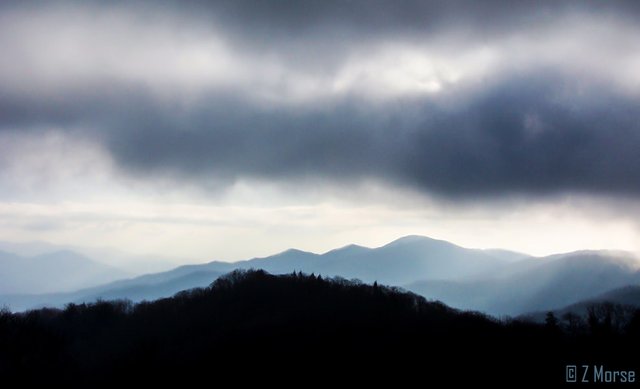
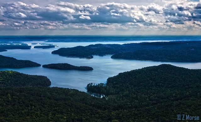
The Smoky Mountains of North Carolina
The Appalachian Mountains are the oldest known mountains on Earth. Formed roughly 480 million years ago in the middle of the original super-continent, Pangaea, they originally reached as high as the Alps or Rocky Mountains but over millions of years, the processes of weather eroded them to their current size and shapes.
Along the western side of these mountains, a prominent set of strange geological features extends down from the Pennsylvania Salient 700 miles southwest to the Sequatchie Valley in Alabama. These are the heavily forested "Ridge-and-Valley Appalachians", an archaic and very odd geological formation characterized by long, tree capped ridges with lengthy, continuous valleys in between.
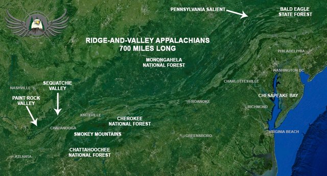
Flying along the deep valleys just west of the Appalachian Mountains we follow these undulating forested ridges from the Bald Eagle State Forest in Pennsylvania south through the George Washington and Thomas Jefferson National Forests in Virginia down to the Chattahoochee National Forest.
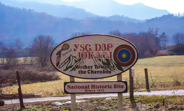
These mystical mountains are the historic homelands and hunting grounds for many ancient First Nations Native American cultures; The Iroquois, Shawnee, Cherokee, Chickasaw, Creek and Choctaw.
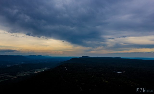
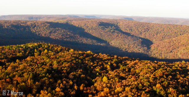
Lookout Mountain Tennessee
The Tennessee River ~ Ancient Superhighway
In older times when animal power dominated transportation there was no safe or secure way to cross from the east over this long mountain range full of endless ridges and valleys. Early colonial settlers considered these mountainous ridges the far Wild West and rarely ventured beyond them.
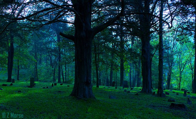
Pioneer Cemetery in Latham Hollow in the Paint Rock Valley, Alabama
Waterways such as the long and winding Tennessee River were the super highways of the day, taking tribesmen and traders down from the Smokey Mountains to the lower deltas. Eventually American pioneers such as Daniel Boone and Davy Crockett ventured through the mountainous passes, settling on the Cumberland Plateau near where Tennessee, Alabama and Georgia meet along the Tennessee River, west of Nickajack Lake.
Honeycomb Cove Wilderness Area on Guntersville Lake, Alabama
These lands are full of limestone caves and caverns, historical Native American sites and old pioneer homesteads and cabins. On the border of Tennessee and Alabama in the Cumberland Plateau lies the Paint Rock Valley, flanked by steep mountains and threaded by a meandering river this place is so remote the residents of some of the outlying communities lived in a state of isolation that is hard to envision, electricity did not reach the valley until 1949.
Lookout Mountain Ridge Above the Tennessee River
Paint Rock Valley, Alabama
Down in the valley along a tributary of the Paint Rock River, the waters of Larkin Fork run a peculiar shade of blue-green, a color caused by water percolating through the limestone underground. The primary source of all the valley’s rivers, creeks and streams are underground springs emerging from limestone caves at the base of the Cumberland Plateau.
These feed into the Paint Rock River which supports a hundred different species of fish and 45 mussel species, two of which are found nowhere else in the world, the pale Lilliput and the Alabama lamp mussel.
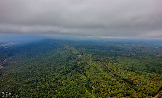
Deep Furrowed Hollows of the Cumberland Plateau, Tennessee
The Paint Rock Valley watershed harbors a unique massive rock formation known as the “Walls of Jericho”. The underlying limestone of the watershed is riddled with caves, springs and sinkholes and is a well-known destination for cavers and spelunkers. 700 caves have been documented in the area and literally hundreds of caves are discovered every year.
One previously unknown side entrance to Guess Cave, located in a side cove of Paint Rock Valley, led to five miles of passages with spectacular formations, and an underground stream with a twenty-five foot waterfall. Over the years many of these caves have been used for moonshine stills, blacksmith forges and homes by Native tribes and pioneer settlers.
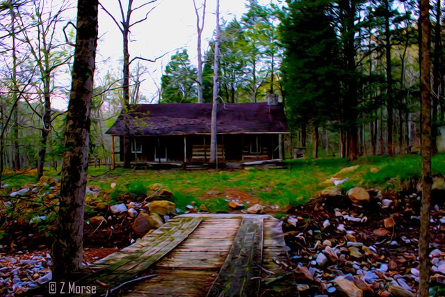
Old Pioneer Cabin in Cherokee Hollow, Paint Rock Valley, Alabama
The Paint Rock Valley is easily accessed via the Paint Rock River which is a free flowing tributary of the Tennessee River. This area has a long human history stretching back thousands of years to the unknown Native Tribes which eventually became the Cherokee Nations.
These tribes initially traded with the early colonial settlers during the Colonial days up until the period preceding the American Revolutionary War, when they sided with the British forces against the colonies.

Storm Above Cherokee Reservation, North Carolina
First Nations Cherokee Homeland
During this time the Cherokees waged a continuous battle against the pioneer settlers all up and down the Tennessee River, led by the famous Cherokee War Chief “Dragging Canoe” and his 3 brothers “Little Owl”, “Badger” and “Turtle-at-Home”.
From their village at Running Water Town, on the banks of the Tennessee River, Dragging Canoe led attacks on white settlements all over the American Southeast, especially against the colonists on the Holston, Watauga, and Nolichucky rivers in eastern Tennessee. After 1780, he also attacked settlements in the Cumberland River area, Middle Tennessee and into Kentucky and Virginia as well.
According to Cherokee legend, his name "Dragging Canoe" is derived from an incident in his early childhood. When he asked to join a war party attacking a neighboring Shawnee village, his father told him he could join the war party as long as he could carry his canoe, but he could only manage to drag it.
Dragging Canoe died February 29, 1792 at Running Water Town on the Tennessee River from exhaustion after dancing all night celebrating a recent victory against the Cumberland pioneer settlements.

My campsite on Turtle Time Farms atop Lookout Mountain near Cloudland, Georgia
During the American Civil War there were 4 minor battles fought in the Paint Rock Valley. There was a small foundry making cannon balls and it was the home of the “Paint Rock Rifles” an Alabama Infantry Regiment which fought at the Battle of Shiloh in 1862. There are numerous caves where salt peter was mined for gunpowder going back into the early 1800’s.
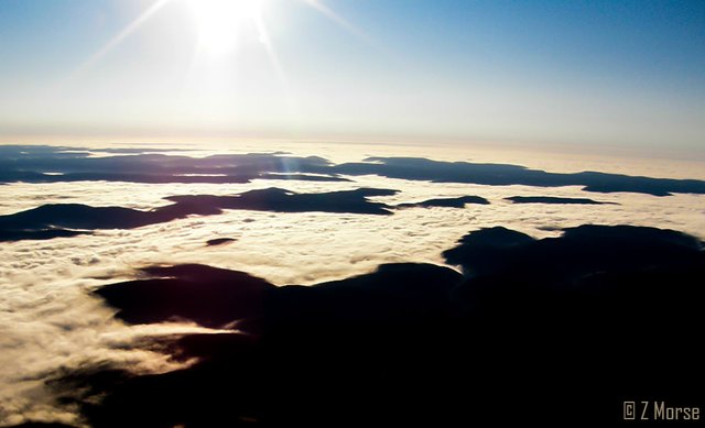
Valleys Of the Cumberland Plateau Filled With Rivers of Fog
Claude “Curly” Putnam, Jr., who was born in the Valley, introduced “The Green, Green Grass of Home”, first sung by Porter Wagoner in 1964. The song recorded by just about every famous country music artist since, expressed his sentiments about Paint Rock Valley and the sentiments of just about all the folks who ever lived there.
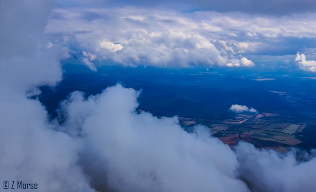
Clouds Above Cumberland Plateau, Tennessee
Ok, that's a Wrap for this installment!
Thanks for taking time to read this article, if you like it please vote and I would love to hear from you as well, so if you can, take time to leave a comment or ask a question. My ongoing goal here on Steemit is to utilize this platform to build community awareness to my project Where Eagles Fly, stay tuned as I'll have more information on the project in my next post.
To review my introductory first steemit post on this project please go here.
And for the second post about the Zapata Ranch go here.
Also for those folks on Facebook, please come say hello. I am simply Zedekiah Morse.
To view images from the project Where Eagles Fly - The American Wilderness Expedition please view my other posts. I am on a mission to raise awareness of our Iconic Natural Heritage Treasures of North America.
And if you would like, press the button to automatically follow my stories! Love to have you on board.

So cool. Thank you for sharing this to us. Your so adventurous person and love to travel anywhere else. Thanks nice. Your such a good photographer. Keep it up. Upvoted <3
Thank you zionuziriel ... I'm glad you enjoy it. I appreciate it!!
Really amazing photos! Looking forward for future stories.
Pablo! thanks so much... I am glad to keep posting!
Take me flying lol
Into the sky we go!!!
serisously thought i always dream one day to do some flying courses. Any advice?
Absolutely! it is not that difficult at all to get your license. And depending on what you intend on doing with it the cost will vary from Private Pilot to Commercial Pilot to Airline Transport Pilot. You can study online for your initial ground school and test and finding a local instructor or school is also not difficult. If you want to meet over on steemit chat I can give you more advice pertaining to your local area and your intent.
Incredible photos skypilot, love the one with your plane!
Thanks daveks... Turtle Time Farms is a cool place to go.
Beautiful! These pictures makes me want to visit the mountains
lisadang, that is exactly the underlying purpose of my efforts... to inspire people to want to visit these places!! Thank you so much for that!
This post has been linked to from another place on Steem.
Learn more about linkback bot v0.4. Upvote if you want the bot to continue posting linkbacks for your posts. Flag if otherwise.
Built by @ontofractal
Amazing photos and a great commentary! Love all the history, nature and culture of this part of US!