Precursor to the Mỹ Lai Massacre: 1968 Phong Nhị, Phong Nhất_#9
Chapter 9 : The Banyan Tree witnessed it all
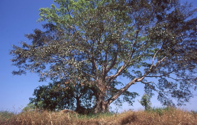
The banyan tree at the entrance of Phong Nhị. May, 2000. Photograph taken by humank.
The banyan tree (cây da dù) stood there as always. A gentle breeze caused its leaves to tremble ever so slightly. The branches of such a deeply rooted tree would not so much budge, however. People believed this tree to be a deity. It stood in the entranceway of the village. The wind from the Indochina East Sea coyly embraced the tree before running through Phong Nhị, making its way to Phong Nhất. It was a zephyr announcing an impending storm, on the morning of February 12, 1968. And the banyan tree stood there as always.
Phong Nhị and Phong Nhất were neighboring villages that faced the wind together. The Chinese character for “Phong” (風), literally means, “wind.” With “Nhất” meaning first, and “Nhị” meaning second, Phong Nhất means the first wind, Phong Nhị, the second wind. There were many legends pertaining to these two villages, particularly one that told of a god of wind that settled eons ago in central Vietnam. He had five sons in total, to each of whom he gave a piece of land: Phong Nhị, Phong Nhất, Phong Tam, Phong Tứ, and Phong Ngũ. Phong Nhị and Phong Nhất weathered through the years and designated the banyan tree as their guardian deity. The banyan tree was a type of fig tree. It was a very symbolic tree, like the Dangsan tree in Korea.
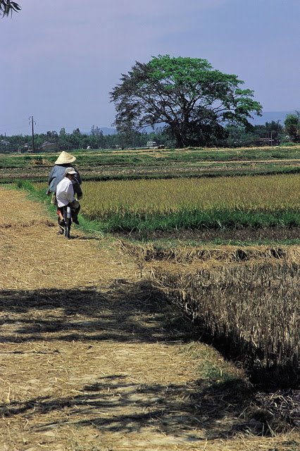
Phong Nhất faced westward, while Phong Nhị faced eastward. To the west of Phong Nhất were vast jungles. The Trường Sơn mountain range, the backbone of Vietnam, extended from the northern part to the southern part of the country. It served as a base for the Viet Cong. The Ho Chi Minh Route, which served as a transport route for troops and supplies coming down from Hanoi to Saigon, passed through this area as well. Farther west was the Laos border. On the opposite side of the mountain range was prairie. This area was mostly dominated by U.S., ROK, and South Vietnamese troops. Farther east was the sea. The west wind from Trường Sơn and the east wind from the sea crossed paths at Phong Nhị and Phong Nhất. The winds roamed about freely over the vast fields.
The banyan tree at the entrance of Phong Nhị. May, 2000. Photograph taken by humank.
The banyan tree had stood guarding over Phong Nhị and Phong Nhất since 1960. That very year, the country was divided into North and South Vietnam. According to the Geneva Convention held on July 20, 1954, north of the 17th parallel became the Democratic Republic of Vietnam (North Vietnam), while south of the same border, the Republic of Vietnam (South Vietnam). The nations that signed at the convention, North/South Vietnam, the U.S., England, the Soviet Union, and China, agreed to organize a unified government through a general election two years later, but due to opposition from the U.S., the general election could not be carried out. It was because Ho Chi Minh of North Vietnam was receiving overwhelming support from the people of Vietnam.
Phong Nhị and Phong Nhất, which were located right below the 16th parallel, was part of South Vietnam. In North Vietnam, Ho Chi Minh’s Labor Party (Communist Party from 1976), which defeated the French in 1954, exerted absolute political domination, and with the support of China and the Soviet Union, was pushing forward with agricultural socialism and the development of the manufacturing industry. Ngô Ðình Diệm, who came to power with the help of the U.S., became president of South Vietnam on October 26, 1955. The 13th and last emperor, Bảo Đại, of the Nguyen Dynasty, who had become the head of South Vietnam since the end of World War II, sought political asylum in Paris, France. Phong Nhị and Phong Nhất fell under the jurisdiction of Ngo Dinh Diem, who was so Catholic that he received criticism for oppressing Buddhists. He also had nearly 50.000 communists arrested, being very thoroughgoing in his anti-communist activities. He gradually lost the support of farmers because of his nepotism and land reform favoring the wealthy. Even the center-right nationalists turned against him and began sympathizing with the communist forces.
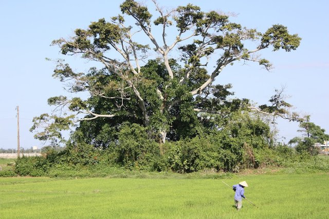
The banyan tree at the entrance of Phong Nhị. February, 2013. Photograph taken by humank.
In 1960, there were two decisive events in South Vietnam. First, the November coup d'etat of Colonel Nguyễn Chánh Thi and his airborne troops failed, even after they successfully took over the presidential palace because high-level generals did not cooperate. It was the prelude to many consecutive coup d'etats that would follow the internal rift within the right wing. Second, in December, South Vietnam’s National Liberation Front (NLF) was formed. The Ngô Ðình Diệm administration’s indiscriminate arrest of members of the opposing parties, coupled with the farmers’ rising discontent, had sparked a systematic way of resistance. The NLF was comprised not only of communists, but also of farmers, laborers, intellectuals, minorities, and Buddhists who were opposed to the Diệm administration. The term “Viet Cong,” which referred to Vietnamese communists, was also coined during this time. The North Vietnamese government assumed the rear-base and promised support to the NLF. They began attacking the South Vietnamese administration and public buildings.
The number of tree rings of the banyan tree increased yearly. Five years later on March 8, 1965, 3,500 U.S. Marines entered Da Nang, a city located 25 km north of Phong Nhị and Phong Nhất. In April, two more battalions of the U.S. Marines were dispatched, as the Air Forces prepared its airaid of North Vietnam and more ground forces were to be dispatched. On August 7, 1964, U.S. Congress gave over absolute authority to President Johnson to take any action with respect to the Vietnam War. It was only five days since the press announced the North Vietnamese attack on USS Maddox in what came to be known as the ‘Gulf of Tonkin Incident.’
Not too long after the first Indochina War (1946~1954, France-Vietnam) ended, the second Indochina War (U.S.-Vietnam) began. The 2nd brigade of ROK Marines who arrived in Cam Ranh on October 9, 1965, headed up to Hoi An on January, 1968. Hoi An was an old city of international commerce, located 35 km south of Phong Nhị and Phong Nhất. There was a shift in power in South Vietnam; Young generals, Nguyễn Văn Thiệu and Nguyễn Cao Kỳ, took the place of Diệm, who was assassinated in November of 1963 in a coup d'etat. In September of 1967, they became president and vice president, respectively.
Breathtaking tension and a relative calm alternated in Phong Nhị and Phong Nhất. In the daytime, South Vietnam exercised control, but at night, the Viet Cong took over. The Viet Cong visited each home, soliciting supplies and carrying out their political maneuvering. Village leaders and other government officials fled for Da Nang at nightfall. In some cases, families, either partially or entirely, moved to Da Nang or Hoi An. In order to do away with reactionaries, the Viet Cong set boobytraps or made assassination plans. Phong Nhất was especially more susceptible to Viet Cong rule, though it wasn’t completely dominated by the Viet Cong. There were a considerable number of South Vietnamese militia near the Kiểm Lu guardpost, which was located near the number one national highway. They received directions from the U.S. military. Some of their relatives lived in Phong Nhị and Phong Nhất. They had exchanges with the U.S. troops stationed in Kiểm Lu. The villages were in a way, a ‘safety zone.’ It was designated as a ‘Control Fire Zone’ by the U.S. and South Vietnamese armies. It wasn’t a ‘Free Fire Zone,’ wherein one was allowed to shoot anything that moved. The Korean troops therefore were not supposed to freely pulled their triggers near the banyan tree, which stood at the entrance of Phong Nhị.
Phong Nhị and Phong Nhất, for the district’s administrative purposes, were villages, Within Phong Nhi and Phong Nhất were many smaller villages, inhabited by less than 200 families. Twelve villages, including Phong Nhi and Phong Nhấ, belonged to Thanh Phong Xã (later Dien Anh). Tan Phong belonged to the Dien Ban District, along with 20 other Xã such as Điện Dương. Eighteen such districts like Dien Ban came together to form Quang Nam (changed to Quang Nam Da Nang in 1975 and then back to Quang Nam in 1997). The city of Tam Kỳ, which housed the royal palace, took pride in being located in the very center of Vietnam, 860km to the north of Hanoi, and 860km to the south of Saigon. Phong Nhi and Phong Nhất of Tan Phong Xã, Dien Ban District, Quang Nam Province were essentially located in the center of Vietnam, the long stretch of land that ran north to south.
Quang Nam was not originally Vietnamese land. It was the Champa Kingdom for over a thousand years from the second century, 192 A.D., to the formation of the Champa state in the 15th century, during which time many Indo and Hindu civilizations bloomed.
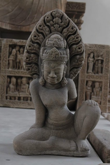
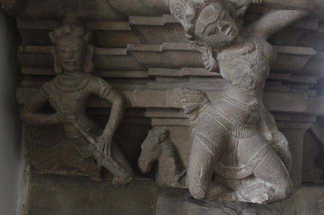
The Champa kingdom existed in Quang nam Province, to which Phong Nhị and Phong Nhất belonged. Various forms of civilization took root from the period that spans over 1000 years between the formation of Línyì in the 2nd century, 192 A.D., to the formation of the Champa state in the 15th century. Champa relics displayed at the Da Nang Champa Museum. Photograph taken by humank.
During the 9th century, Quang Nam, which went by the name, ‘Indrapura,’ was the capital of Champa. Vietnam's first dynasty, Nước Đại Việt, which became independent from China in the 10th century, ruled the present-day northern Vietnam. Champa also had command over Quảng Bình, which is located on the 18th parallel, Quang Nam, which is beneath it, and Phan Rang, which was located in the south. Nước Đại Việt tried to expand southward while the Champa kingdom tried to expand northward. In the 14th century, Nước Đại Việt came all the way down to Hue, and the two countries fought back and forth between the Hai Van pass, đèo Hải Vân, which connected Hue and Da Nang. Eventually, in March 1471, Lê Thánh Tông of Nhà Hậu Lê of Nước Đại Việt caused the present-day Da Nang and Quang Nam, which lay beyond the Haiban Pass, to surrender and even obtained the area of
Vijaya, which used to be the capital of Champa and is now present-day Qui Nhơn.
60,000 Champa troops were killed and 30,000 captured. The king of Champa, Ban La Tra Toan, was also killed. It marked the beginning of the destruction of Champa. Lê Thánh Tông of Nước Đại named the area "Quang Nam," to mean “vast southland.” In the 17th century, when Nước Đại was divided into Nhà Trịnh in the north and Nhà Nguyễn in the south as a result of a battle over the throne, the Nguyen regime, which espoused the capital. was also called the “Quang Nam State.”
In 1190, when the kingdom of Champa was in full swing, it was invaded by the troops of its rival kingdom, Angkor Dynasty of Cambodia, which resulted in a 32-year war and much bloodshed. In 1177 the Champa kingdom had invaded the Angkor Dynasty first, and Angkor was retaliating. In 1283, it experienced the Mongol invasion. In the 15th century, after the war with Nước Đại Việt whereupon it came under the possession of the Vietnamese dynasty, Da Nang was invaded by the French army.
In 1787, Nguyễn Phước Ánh of the Gia Định regime based in southern Saigon brought along 1,650 troops. Finally, with the help of France, he overturned the Tây Sơn regime which conquered the Nguyễn and Chánh Thi regimes in the north and south, and established the Nguyen dynasty (1802-1945), the last united kingdom of Vietnam. In 1804, the Qing Dynasty awarded the country name of "Vietnam" to Nguyễn Phước Ánh. The Champa dynasty, which shrank into a small southern region called Phan Rang and was barely staying afloat, was absorbed by Vietnam in 1832 when Minh Mang was emperor, and thereafter completely vanished. It was like South Vietnam, which disappeared from the world map in 1975.
Less than 4 km from the banyan tree remained a vestige from the days of Champa. It was Bằng An, which hosted a lonely 21.5-meter-high red pagoda. Mỹ Sơn, which is located deep in the jungles near the Bồn River basin, 30 km South in Quang Nam Province, is rich in architecture and sculptures that display the splendor of the Champa civilization. The historical site of Mỹ Sơn site was designated as a UNESCO World Heritage Site after the war. Historical sites of the Champa, which used to be more than 200 throughout all of Vietnam, was reduced to about 30 locations due to the Vietnam War and natural destruction.
On February 12, 1968, the 1st Squadron, 1st Battalion, 2nd brigade of the Korean Marines passed by the banyan tree. The surrounding area weathered many rounds of bloodshed, starting with the Chinese troops, the Nước Đại Việt, Angkor, and Mongolian troops when it used to be the Champa kingdom, the French and U.S. troops, and even the Japanese troops before their surrender at the end of World War II. And now Korean troops entered this very land. That morning, the soft breeze that passed through the leaves of the banyan tree quickly turned into a bloody whirlwind.
The banyan tree witnessed it all. The soldiers who intruded the civilian villages of Phong Nhị and Phong Nhất, the elderly, women, and children who were shot, the little girls who ran out crying from their thatched-roofed houses that were on fire, the U.S. helicopters that hurriedly carried away the wounded. It thus became customary for the villagers of Phong Nhị and Phong Nhất to refer to that day’s bloodbath as the ‘banyan tree Massacre.’
- Written by humank (Journalist; Seoul, Korea)
- Translated and revised as necessary by April Kim (Tokyo, Japan)
The numbers in parentheses indicate the respective ages of the people at the time in 1968. This series will be uploaded on Steemit biweekly on Monday.