Geological Survey: Accretion in the Marin Headlands of the San Francisco Bay Area
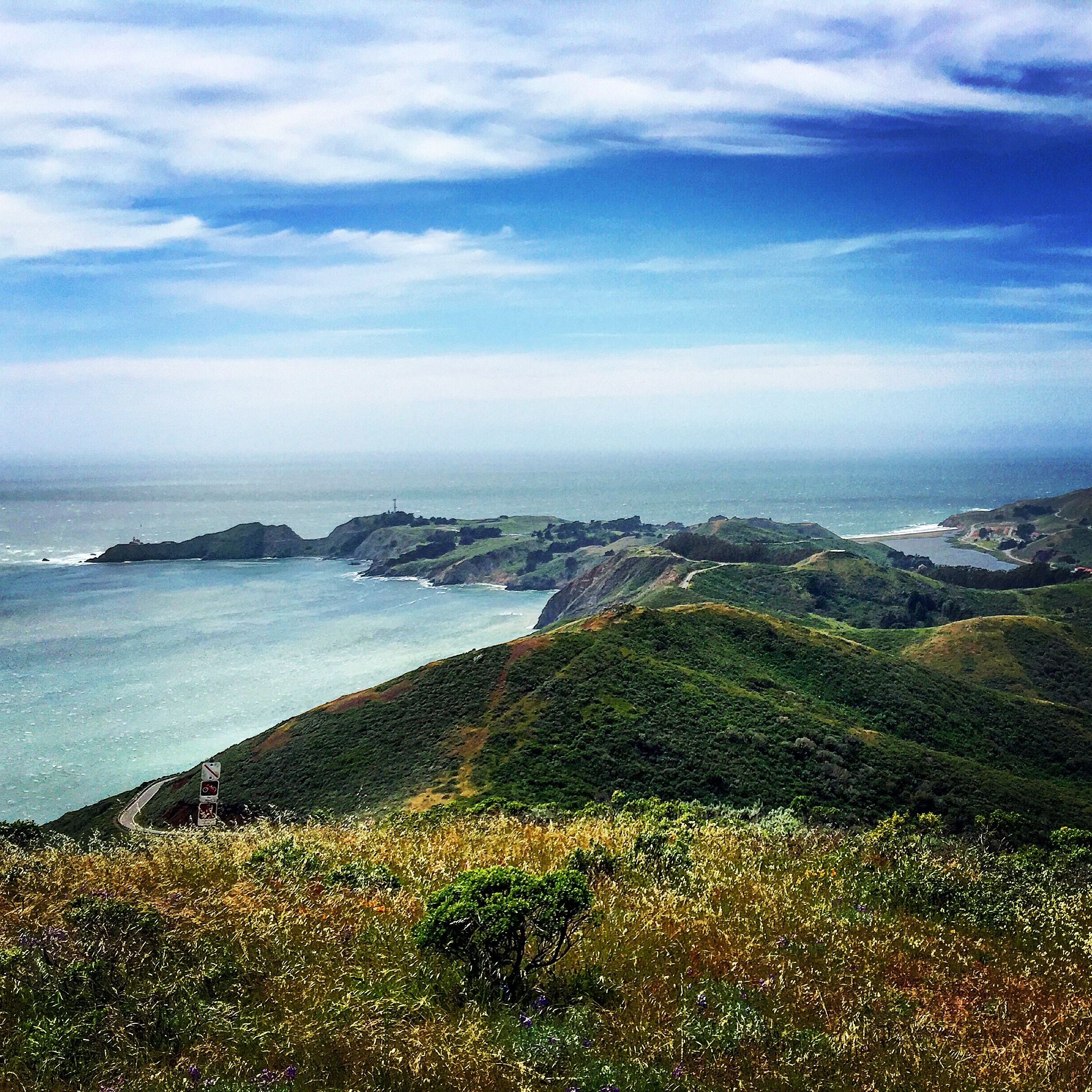
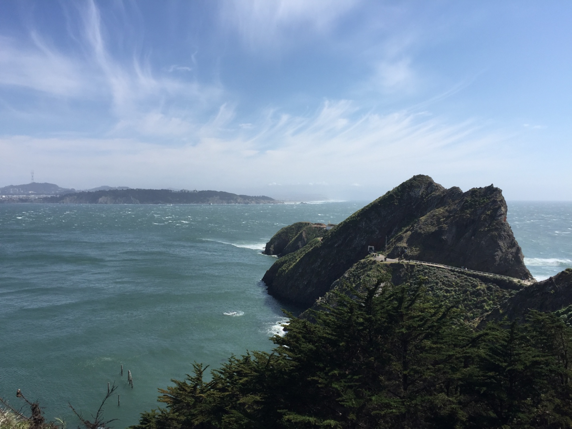
From this view you can see all three locations I'll be visiting on this trip. Take notice of the lagoon on the right side of the picure.
On April 25th, 2017 (12:30 pm) I conducted a geological survey of three locations within the Marin Headlands (top of Conzelman Road, Point Bonita Lighthouse, Rodeo (Cronkhite) Beach). The purpose of this trip was to develop a better understanding of the origin of certain rock formations—chert, pillow basalt, shale, sandstone— and the effects that plate tectonics had on them over the course of millions of years.
Location 1: Top of Conzelman Road
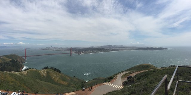 Panorama of the San Francisco Bay Area atop Conzelman Road.
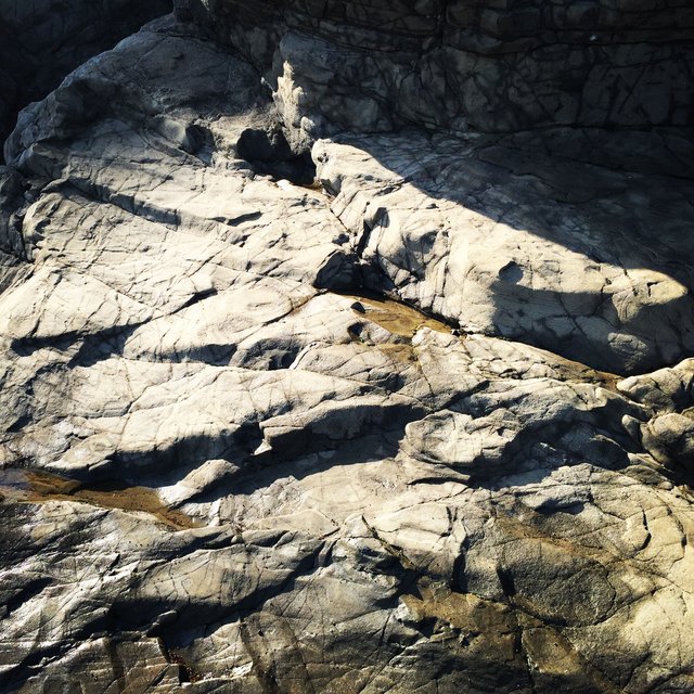
The first stop of this field trip was at the top of Conzelman Road, where I viewed strata of chert and shale that had been exposed due to roads being built. Below in Fig. 1, is a great example of stratified layers of chert and shale. In this particular picture, the layers of shale measure between an inch to a few mm. As for the layer of chert directly above the orange pen (7 inch), it measures almost a foot which was fairly thicker than in other areas in the region. For instance, in Fig. 2 below, you’ll see a great example of folded radiolarian ribbon chert and most of these layers have an average thickness of 1-2 inches. Another observation was that most of the hill tops in this region have exposed chert. This is due to chert being highly resistant to weathering because it is a microcrystalline variety of quartz.
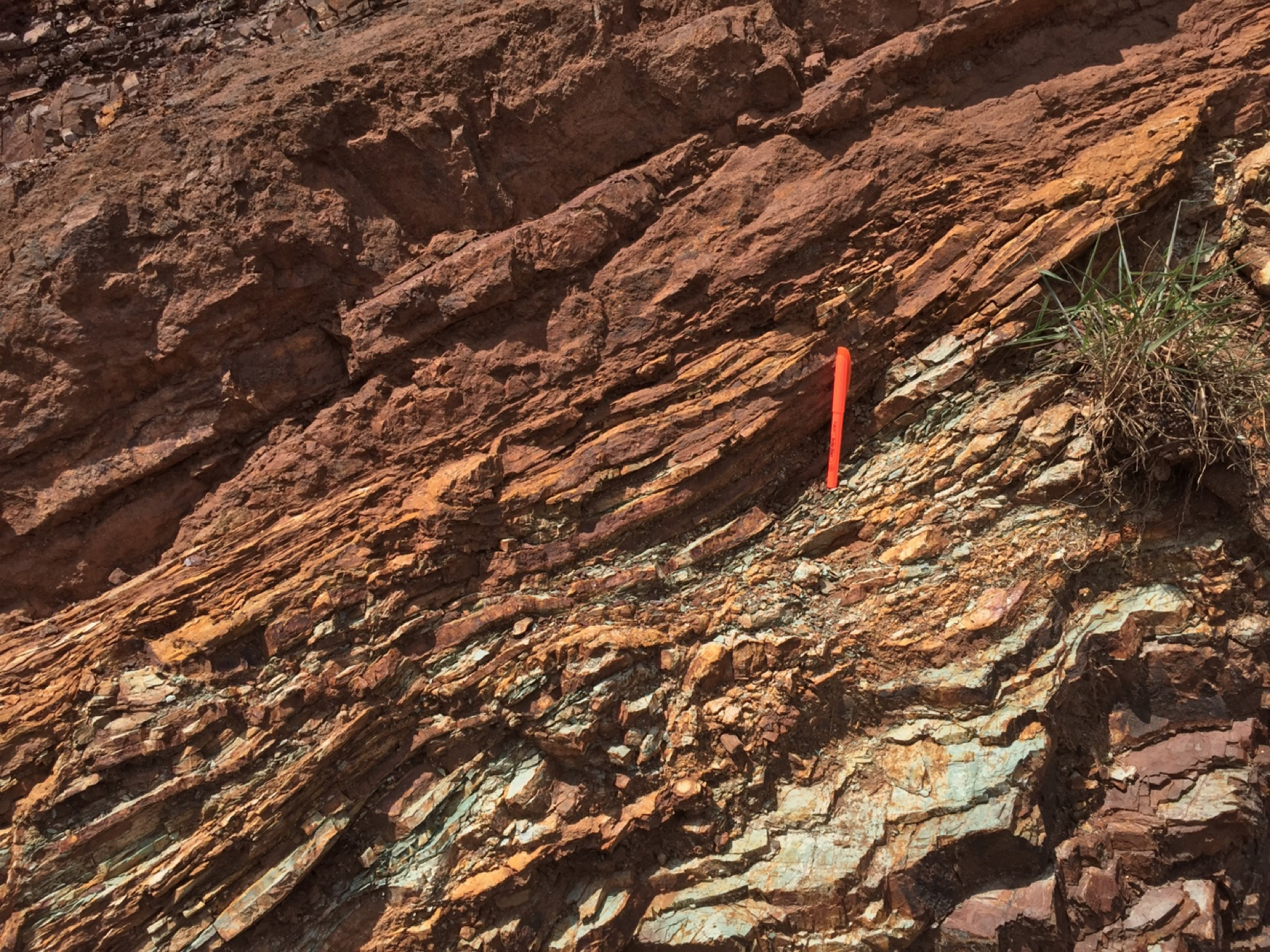
Figure 1. Layers of chert and shale.
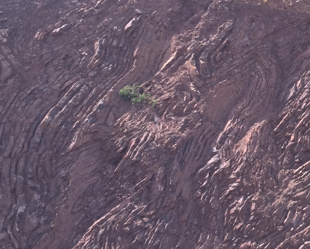 Figure 2. Highly distorted radiolarian chert caused by plate tectonics.
The type of chert you are viewing formed very far out at sea hundreds of millions of years ago. One major piece of evidence that leads to this theory is the high amount of radiolarian skeletons within the chert. The dip direction of these layers appear to point in a southwesterly direction. These layers of chert and shale ended up here due to accretion from the subduction of the Farallon plate (Farallon Islands SW of area) under the North American Plate millions of year ago. It should be noted that San Andreas fault lies about 3 miles (4.8 km) west of this area and it is possible the right lateral strike-slip movement of the San Andreas caused the dip of this strata to change over the years.
Update- Upon further research I discovered this USGS bulletin giving a detailed explanation as to why the dip direction of the chert and shale in Figs. 1 & 2 had a southwest dip direction:
“After this oceanic fragment became attached to the North American margin, rather than being subducted under it, right lateral faulting produced by northeasterly-directed subduction, transported it northward along the western edge of the continent. Finally, San Andreas-related transform faulting moved it further up the coast to the Bay Area and rotated the Marin Headlands block into the position the it is found in today.” (Wahrhaftig 1984a; Curry et al., 1984; Wakabayashi, 1999).
Location 2: Point Bonita Lighthouse
Point Bonita Lighthouse Trail
The second stop on this trip was at the Point Bonita lighthouse. On the hiking trail towards the lighthouse, the first outcrop seen on my right side of greywacke sandstone. A little bit further down the trail just below the radio tower, you’ll see a prominent fault and sheared zone that is separating the greywacke from another formation of altered greenstone (diabase). Also you’ll be able to see weathered/oxidized iron rich shale close by as well. Below in figure 3, you’ll be able to see great examples of pillow basalt that have been exposed from wave erosion.
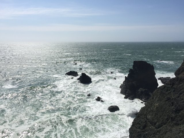
Figure 3. Pillow basalt that has been exposed due to weathering from the ocean.
How did these rocks end up here? The pillow basalts are a product of the East Pacific Rise when magma flowed out from the divergent plate boundary. As the Farallon Plate moved eastward and came closer the the continent, the erosion from continental rocks created sediments which rested on top of the pillow basalt, which then lithified to become sandstone and shale. Then over the course of millions of years, the accretion of these rocks built up on the coast from the subduction of the Farallon plate, attaching itself to the North American plate by means of accretion.
Location 3: Rodeo Beach
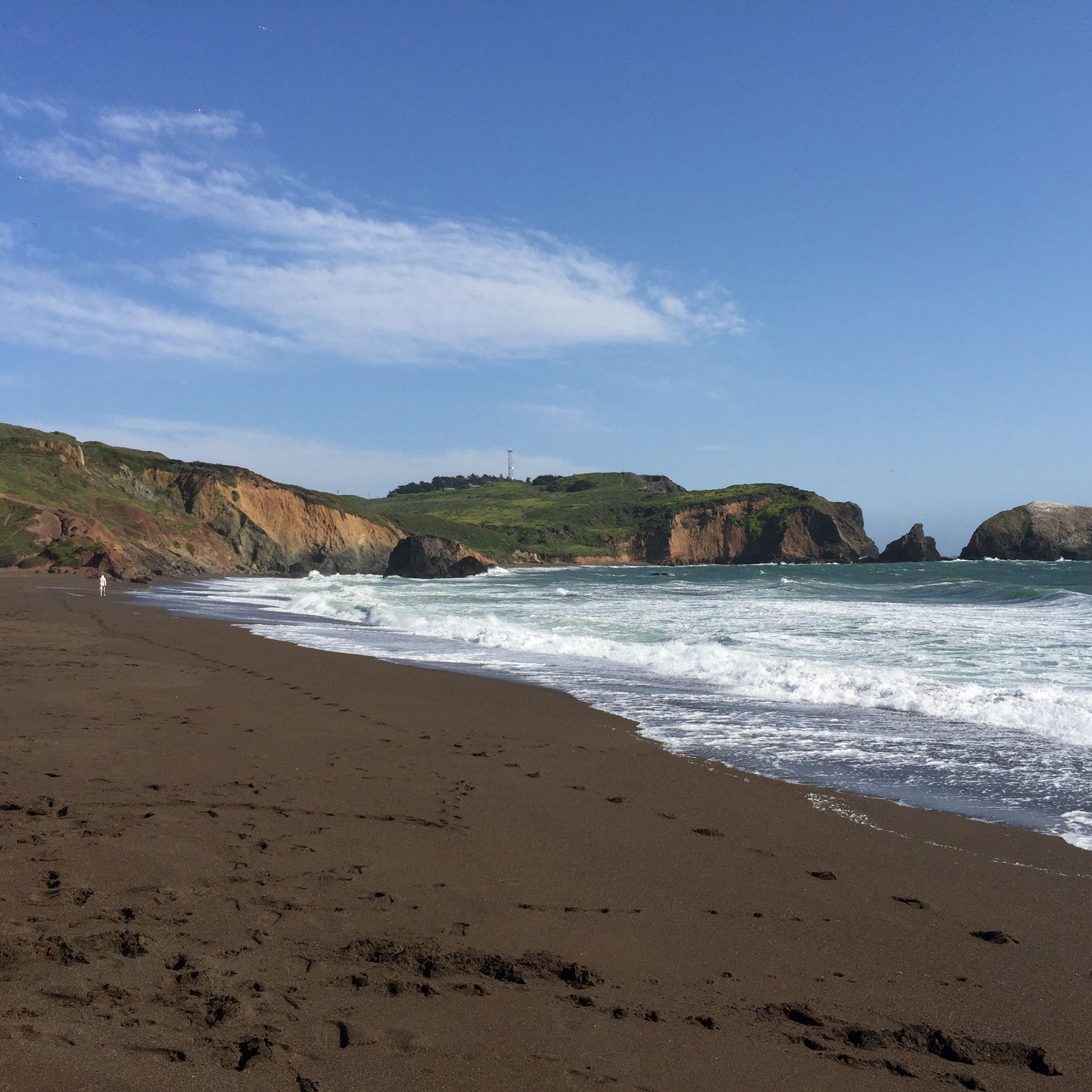
The third stop of this trip was at Rodeo Beach, just north of Point Bonita lighthouse. Here I studied the different grain sizes found on the beach and the composition of it as well. The grain sizes varied between sand (1/16th to 2mm) and gravel (over 2mm). There was generally more sand than anything, but it was found only near the wash line of the beach (Figure 5 below). Closer inland near the lagoon and the crest of the beach, rounded gravel size rocks were found (Figure 4 below), but they were the same composition of the sand on the wash line. The composition of the rocks in the sand/gravel were the following: chert, greenstone, pillow basalt, sandstone, sea shells, serpentine and very little quartz.

Figure 4. Gravel sized rock at beach crest at Rodeo Beach.
The variety of rocks found on this beach derive from local bedrock of the Franciscan Complex, which can be seen from the cropped out bluffs on either side of the beach. The lagoon behind the beach is called Rodeo Lagoon. Unlike other beaches, the sand and gravel on Rodeo Beach does not originate from the stream which flows into the lagoon. However, it should be noted that the lagoon only flows into the sea during the winter and spring times when it overflows due to seasonal rains. Within the lagoon itself, you can find layers of silt and clay, along with the same rocks found on the beach. As for the beach itself, it is technically considered a sand bar, which is a deposited sediment that crosses the mouth of a river or stream. Judging from an aerial view of the beach, it is fairly obvious waves and ocean currents have carved out and deposited sediments on this beach for quite some time.
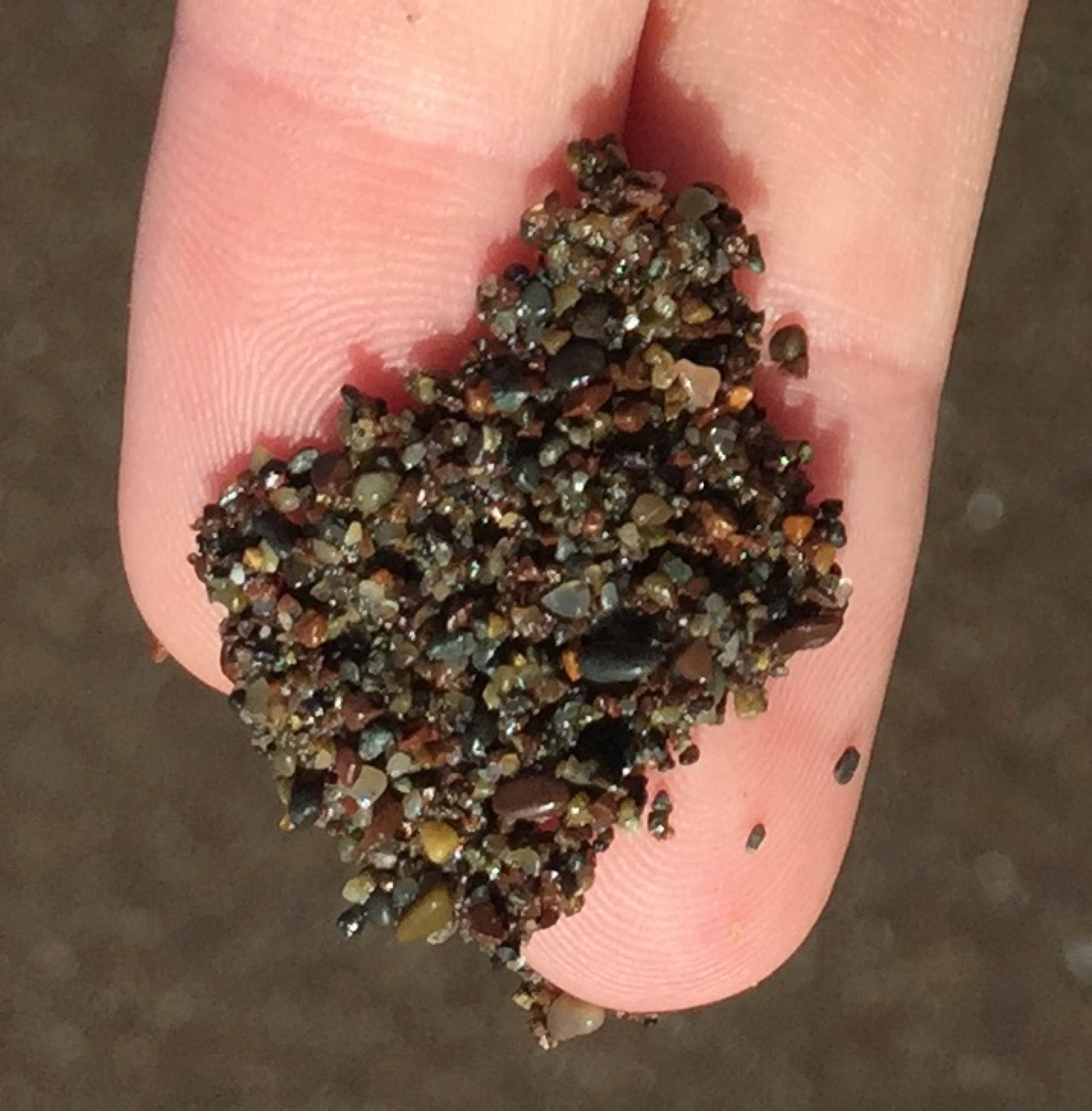
Figure 5. Beach sand grains on wash line at Rodeo Beach.
What it all means:
The Marine Headlands are the product of accretion due to plate tectonics; more specifically, accretion from the subduction of the Farallon plate millions of years ago. As mentioned earlier in the report, when the Farallon plate was moving eastward towards the North American plate, it carried pillow basalt along with it. Over the course of millions of years, formations of chert began to form on top of the basalt. This was when the formations were still very far out at sea. Then as the plate and formations moved closer to the continental crust, sediments from the continent began to fall on top of these formations, which then became lithified to create layers of shale and eventually sandstone.
 Abstract photo of the greywacke sandstone that is visible while hiking the Marin Headlands.
When subduction occurs at a plate boundary, the denser ocean floor sinks while the less dense strata builds up on the continent and accretion occurs. Imagine taking a block of cheese and cutting it with a cheese knife horizontally. As you push the block of cheese towards the knife, some of the cheese is scraped upward, slowing collecting above the knife, while the block continues to move the same direction. This same principle applies to accretion and plate tectonics. Once again, it should be noted that throughout my research of this region, I read that the motion of the San Andreas fault had a significant impact on the orientation of certain strata in the Marin Headlands as well.
Special note:
All pictures in this survey are produced and owned by Magmatini a.k.a. me. I'm also the author of this geological survey.
Bibliography:
https://pubs.usgs.gov/bul/b2188/b2188ch3.pdf
https://en.wikipedia.org/wiki/Accretion
https://www.google.com/maps
Marshak, Stephen Essentials of Geology 4th Ed. W.W. Norton & Company, 2012

We have the same silt - different clay, here on the Oregon Coast. Great article! You really know your geology and writing - I'm following and upvoting and resteeming.
Thank you! I'm trying to head up to the Oregon coast sometime soon. I'm hoping I can get enough money through Steemit to buy a car, lol.
Heck yeah accretionary terranes! Got a lot of similar stuff up here in Oregon, albeit from the Juan de Fuca plate, not the Farallon.
I stayed up in Oregon around Mt. Hood a couple summers back, but I unfortunately never made it to the coastline. When I move back out west, I plan on driving the 1 all the way up. By the way, is it normal to be upvoted so high in the early stages of Steemit? Since those first big pops, I can't seem to gain traction. Like Steemstem hasn't upvoted my past three posts. Not sure if it's a quality issue or not.
They might just be behind on upvotes, I dunno- I'm not privy to their inner workings. Just keep at it! (I didn't run into steemstem until a few months into using steemit- it definitely helps a lot.)
@originalworks
The @OriginalWorks bot has determined this post by @keephy to be original material and upvoted it!
To call @OriginalWorks, simply reply to any post with @originalworks or !originalworks in your message!
This post has received a 0.02 % upvote from @drotto thanks to: @steemstem-bot.
Well done! This post has received a 5.00 % upvote from @litasio thanks to: @steemstem-bot. Whoop!
If you would like to delegate to the @LitasIO you can do so by clicking on the following link: 10SP
Very explanatory, I have a lot to learn on San Francisco as a geographer. With you I have no worries
What an amazingly written article. Just by reading it you can see how much effort you put into writing it. And, I can see you get a well-deserved award for it. From what I am seeing right now 100$ and 98 votes. That is amazing. Congratulations.
I wish more people would take this as an example and put more effort into writing their posts. Sooner or later your quality content will get noticed. Just like yours.
Keep writing amazing posts, and have an amazing day. :)
Congratulations! This post has been chosen as one of the daily Whistle Stops for The STEEM Engine!
You can see your post's place along the track here: The Daily Whistle Stops, Issue #11 (1/8/18)
The STEEM Engine is an initiative dedicated to promoting meaningful engagement across Steemit. Find out more about us and join us today!