Developing the ingenuity of children | America (Part 2)
Hello, dear family Steemit! Welcome to our virtual classroom, sometimes we are not aware of how education influences our lives. In the first part, of our class on the American continent, we had the opportunity to know the North American subcontinent, its countries, geography, relief, rivers, lakes, traditions, languages, currencies, among other things. This day I invite you to know about Central America, a very important content for the development of any child. So I invite you to enjoy this class where we can clarify questions and doubts in children about America! A new world, as the Europeans called the American continent, because of its discovery.
AMERICA
A new world
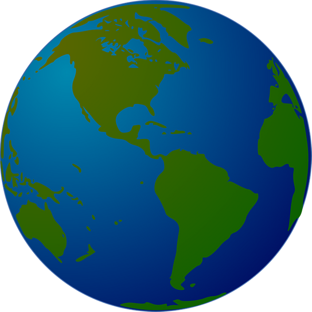
The continent is conformed by 35 sovereign nations, in which they are: Antigua and Barbuda, Argentina, Bahamas, Barbados, Belize, Bolivia, Brazil. Canada, Chile, Colombia, Costa Rica, Cuba, Dominica, Ecuador, El Salvador, United States, Grenada, Guyana, Haiti, Guatemala, Honduras, Jamaica, Mexico, Nicaragua, Panama, Paraguay, Peru, Dominican Republic, Saint Kitts and Nevis , San Vicente, Santa Lucia, Suriname, Trinidad and Tobago, Uruguay and Venezuela. It is also accompanied by a Commonwealth and 24 independent territories.
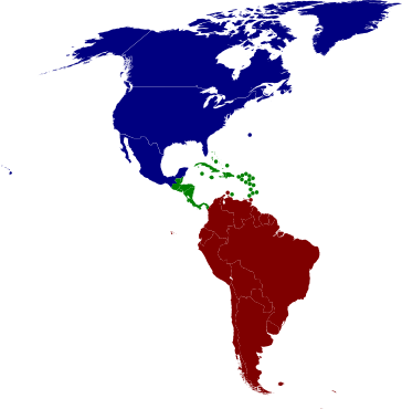
From the territorial and physical point of view, it is possible to differentiate "three Americas":
From the territorial and physical point of view, it is possible to differentiate "three Americas":
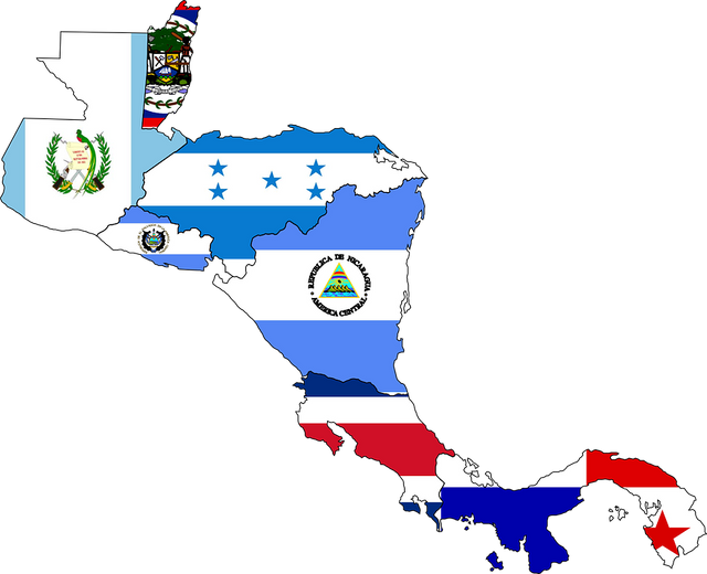
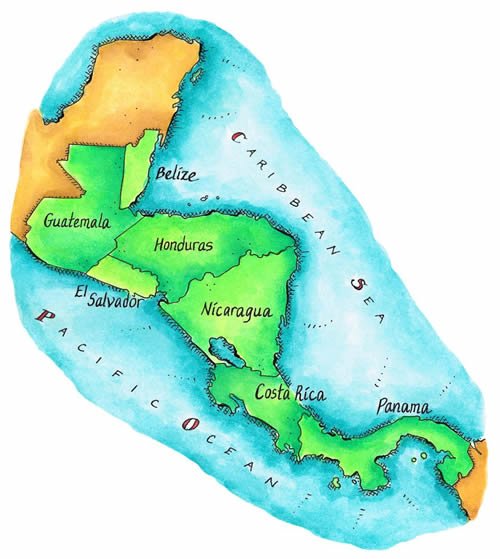
CENTRAL AMERICA.
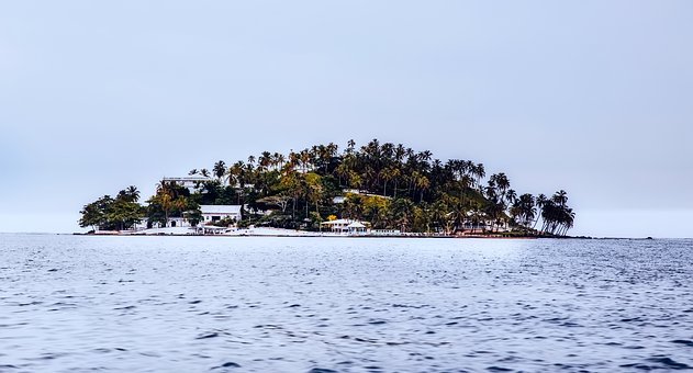
It is comprised of the countries (Guatemala, Belize, Honduras, El Salvador, Nicaragua, Costa Rica and Panama). Inhabited by descendants of Spaniards, indigenous or mestizos. In the Caribbean Sea are the islands that make up the archipelagos of the Antilles, whose inhabitants descend mostly from the black slaves brought from Africa.
What are the languages of this continent?
In Central America, Spanish is the official language in 6 out of 7 countries, with the exception of Belize, whose official language is English, although the majority of the population of this country also speaks Spanish.
Where are you?
This subcontinent is located between two isthmus: Tehuantepec and Panama. In the Caribbean Sea, the archipelagos of the Antilles are grouped, which are divided into the Greater Antilles and the small Antilles. Both areas are very hot, with tropical vegetation and very striking animals.
Guatemala
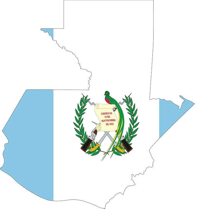
Official name of the country: Republic of Guatemala.
Area: 108,889 km2.
Capital: Guatemala City (founded in 1776 as Nueva Guatemala de la Asunción).
Other important cities: Escuintla, Totonicapan, Retalhuleu.
Official language: Spanish.
Currency: Quetzal.
Antigua Guatemala was the most splendid city in Central America. It had the first printing in 1660, the first newspaper in 1729 and the first university in 1676. It was capital until 1773 when it was destroyed by an earthquake. Currently, many of its monuments have been restored.
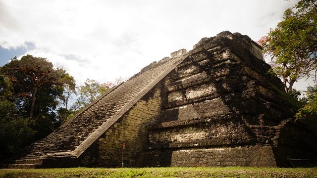
Did you know…?
In Guatemala, there are numerous volcanoes and the mountains predominate, except in the north, where there is a lower and jungle area. In the east are the depressions of the Polochic River, the Isabul Lake, the Dulce River, and the coastal plain, rich in alluvial and volcanic materials.
Belize
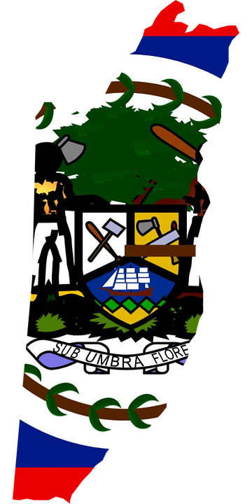
Official name of the country: Belize (Belize).
Area: 22,800 km2.
Capital: Belmopan (founded in 1970).
Other important cities: Belize, Orange, San Ignacio, Santa Elena, Carozal, Walk.
Official language: English.
Currency: Belize Dollar.
The state of Belize is located on the Caribbean coast, south of Mexico and east of Guatemala, on a coastal strip of the Yucatan peninsula and also includes islands, such as those of Turneffe.
Its relief, in general, is flat, with dense rainforests. It has some elevations to the south (the maximum height is Victoria peak, 1,222 meters high). The flat and swampy coast is flanked by a row of cays and barrier reefs.
Did you know…?
The coral reef located off the coast of Belize, in the Caribbean Sea, is the second in the world for its length, over 280 km (only surpassed by the Great Australian Reef Bream).
Honduras.
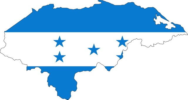
Official name of the country: Republic of Honduras.
Area: 112 492 km2.
Capital: Tegucigalpa (founded in 1762 by Alonso Fernández de Heredia).
Other important cities: San Pedro Sula, Danli, La Ceiba, Choluteca, Tela, El Progreso, Puerto Cortes, Comayagua, Olanchito.
Official language: Spanish.
Currency: Lempira.
Honduras is made up of 18 departments, and these in 298 municipalities. Tegucigalpa is the capital of the republic, next to the city of Comayagüela, they form the Central District.
The Honduran territory is dominated by mountains from north to south, the Central American Cordillera (which divides it into two regions, the eastern and western), and between its cordons are fertile valleys and savannahs, where a large part of the population lives.
Did you know…?
The Savior.
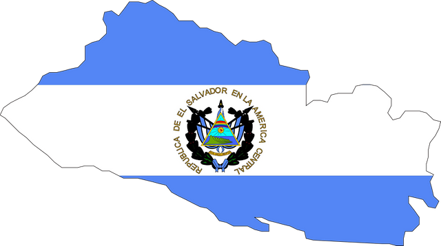
Surface: 21 041 km2.
Capital: San Salvador (founded in 1525 by Diego de Alvarado).
Other important cities: Santa Ana, San Miguel, Mejicanos, Delgados, among others.
Official language: Spanish.
Currency: US dollar.
El Salvador is made up of 14 departments, 39 districts, and 262 municipalities. The city of San Salvador is the capital of the country, its metropolitan area includes 14 nearby municipalities, and concentrates the political and economic activity of the republic. The cities of Santa Ana and San Miguel are other important centers of the country.
The jewel of Cerin is one of the most recent archaeological discoveries in El Salvador. It is a pre-Hispanic village whose remains (buried by the ashes of the Laguna Caldera volcano) while vestiges of the daily life of the Central American peasants fourteen centuries ago.
The Salvadoran territory has five areas:
-Mountain chain of the North (where El Pital is, 2,730 meters, the maximum height of the country).
-Pacific coastal line (largely marshy, rocky and flat).
-The central high plateau (with heights of 427 and 853 meters).
-The valleys (between the Lempa and Grande de San Miguel rivers).
-Southern mountain range, dominated by volcanoes, many of them active.
Nicaragua
Official name of the country: Republic of Nicaragua.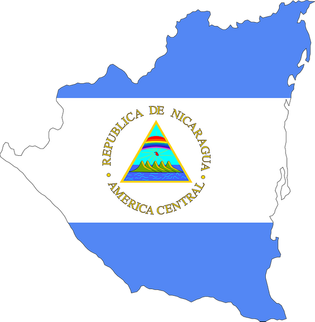
Surface: 129 494 km.
Capital: Managua.
Other important cities: León, Chinandega, Masaya, Matagalpa, Granada, Estelí, Jinotega, Juigalpa, Bluefields, Jinotepe.
Official language: Spanish.
Currency: Nicaraguan Cordoba.
Nicaragua is made up of 15 departments and 2 autonomous regions. Due to its extension, it is the largest of the Central American countries. The territory harbors numerous volcanoes, many still active. The central area is crossed by mountains. The low and humid eastern coastline is known as the Mosquito Coast.
The western coast is dominated by a narrow plain, where is the most important industrial and agricultural area of the country, which extends into an interior depression in which the Managua lakes are located (on whose banks is the capital of the country). Nicaragua is one of the largest freshwater reservoirs in the world, with nearly 500 islands and diverse marine species, including sharks.
Costa rica
Official name of the country: Republic of Costa Rica.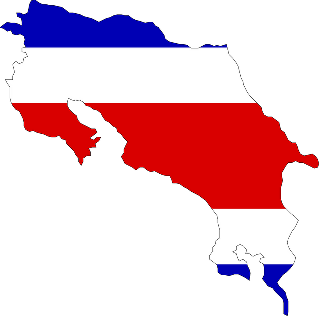
Area: 51 100 km
Capital: San Jose.
Other important cities: Alajuela, Cartago, Puntarenas, Limón, Heredia, Liberia.
Official language: Spanish.
Currency: Costa Rican Colon.
Costa Rica is divided into seven provinces: San José, the capital; Alajuela, Cartago, Heredia, Guanacaste, Puntarenas, and Limón. To the North, it borders Nicaragua, to the South with Panama, to the East, and to the West with the Atlantic and Pacific oceans, respectively.
The Costa Rican relief is marked by the mountain ranges that cross the country from northeast to the southeast (in which volcanic cones abound) and form a central plateau (of about 9,000km2), where the majority of the population sits towards the coasts there are forests tropical
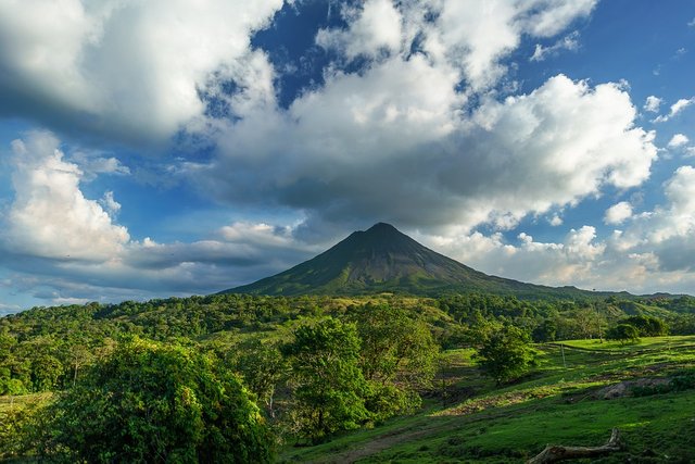
La Amistad National Park is declared a world heritage site by UNESCO. And it is a shared territory With Panama.
Did you know…?
Panama.
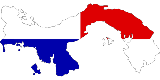
Area: 78,200 km2.
Capital: Panama City (founded in 1519 by Pedro Arias Dávila).
Other important cities: San Miguelito, Colon, David, Penonomé.
Official language: Spanish.
Currency: Panamanian Balboa and US dollar.
The Republic of Pana is located at the center of the Western Hemisphere and to the North it borders the Caribbean Sea, to the East with the Republic of Colombia, to the South with the Pacific Ocean and to the West with the Republic of Costa Rica. It is divided by 10 provinces and 5 counties. Its official language is Spanish, however, many Panamanians speak English.
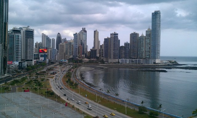
Nicaragua is the largest country in Central America. To the southwest is the great Lake of Nicaragua, where many aquatic species live, including sharks. The quetzal is a bird of green and red plumage, and its long tail can reach 90cm. This bird is the symbol of Guatemala. Belize's coral reefs are considered one of the seven underwater wonders of the world. They are the second largest barrier reef in the world, and their 289 kilometers in length traverse a submarine border between Belize and the depths of the sea. The passage that connects the Atlantic Ocean and the Pacific is called the Panama Canal. It measures 84 km, passing around 12,000 boats per year! As the terrain has different heights, there are gates to allow ships to move. Panama is the country of Central America where women have a higher percentage of participation in the labor force. In the next few years, it is planned to build an interoceanic highway between the ports of Balboa and Cristóbal. A waterfall is a large waterfall caused by a sudden drop in the ground. A glacier is a large mass of ice that slowly slides down the mountains. Honduras is one of the largest banana producers in the world. The name of this country is due to the fact that the waters that bathe its coasts are the deepest of the Caribbean Sea.
Did you know…?
CONCLUSION
- The American continent presents a very broad climate variety, which corresponds to the extension of its territory. This influences the distribution of its flora and faunam that offer an amazing biodiversity.
- America ranks second in the world in its size, after Asia, before Africa and three times that of Europe.
Thank you all for joining me in this fantastic and perfect exercise for the development of children, With this fun series of questions and answers, you can have a good time with the little ones in the house, help you in your physical and mental development, allowing you to expand his technique of concentration and observation to help them understand their environment. In addition, they provide us with the necessary knowledge and skills that allow us to protect ourselves against all adversities.

REFERENCES
- America.
- America Spanish!
- Central America
- Geography of central america.
- The Savior.
- Belize.
- Panama.
- Costa Rica.
- Guatemala.
- Nicaragua.
- Honduras.

@steemiteducation "If we are alone in the Universe, it would surely be a terrible loss of space" - Carl Sagan

@saracampero
(promoting education)
I invite you to meet the family @ecotrain, where you will find wonderful people, talented and with an incredible human quality! Check out the #ecotrain hashtag to see more high quality items.........................................................

Supporting People Who Help
Make The World A Better Place
........................................................

........................................................

........................................................
- The Savior.
Great information of central america
Thanks friend, Regards and blessing
This comment has received a 25.00 % upvote from @steemdiffuser thanks to: @steemcaptcha.
Bids above 0.1 SBD may get additional upvotes from our trail members.
Get Upvotes, Join Our Trail, or Delegate Some SP
You got a 2.25% upvote from @oceanwhale With 35+ Bonus Upvotes courtesy of @steemcaptcha! Delegate us Steem Power & get 100%daily rewards Payout! 20 SP, 50, 75, 100, 150, 200, 300, 500,1000 or Fill in any amount of SP Earn 1.25 SBD Per 1000 SP | Discord server
You got a 33.43% upvote from @luckyvotes courtesy of @steemcaptcha!
You got a 33.33% upvote from @sleeplesswhale courtesy of @steemcaptcha!
You got a 2.69% upvote from @emperorofnaps courtesy of @steemcaptcha!
Want to promote your posts too? Send 0.05+ SBD or STEEM to @emperorofnaps to receive a share of a full upvote every 2.4 hours...Then go relax and take a nap!
Great articulo @saracampero! congratulations!
thanks for your visit honey!
I love Panama, i like this information!
thanks for your support girl!
simply beautiful!
thanks for your support @jbautista
Congratulations! this post got an upvote by @steemrepo and was manually picked by the curator @horpey to be added on STEEM REPOSITORY, simply comment "YES" and we upload it on STEEM REPO Website.
Want to know more about the Steem Repo project? Contact us on Discord
YES
If you would like to support the educational community by delegating to @steemiteducation, please click on any of the following links. This will ensure that more teachers are supported on a daily basis.
100SP 200SP 300SP 400SP 500SP 750SP 1000SP 2000SP 3000SP 4000SP 5000SP 10,000SP 25,000SP
Congratulations!,@saracampero Your post has been upvoted by @reach.curation
Our goal is to support Minnows on Steemit.
Join our discord group https://discord.gg/NWAkKfn
@saracampero you were flagged by a worthless gang of trolls, so, I gave you an upvote to counteract it! Enjoy!!
Congratulations @saracampero! You have completed the following achievement on Steemit and have been rewarded with new badge(s) :
Click on the badge to view your Board of Honor.
If you no longer want to receive notifications, reply to this comment with the word
STOP