Biking to work - the biggest detour
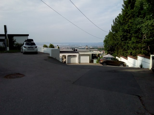
Another post in my "biking to work"-series - yesterday I took a quite big detour to get to work - the whole route was like 16 km while the distance by straight line to the office is a mere 6.5 km, so roughly 2.5x the air distance. I spent a bit less than an hour on this trip, with the electric bike. There is quite some up and down, I start at 150 metres above sea level, when I get out of the forest and onto paved car roads I'm at 305 metres above the sea level, and when I end the trip I'm down to 112 metres above the sea level. The trip is beautiful, fresh air, lovely lakes and the downhills in the end is crazy. I have a speedometer on my bike, it stops working at 47 km/h - I've probably been rolling around 60 km/h in the "worst" downhills. Due to all the uphills in the beginning of the journey it takes quite much longer time with a regular bike.
Here the forest starts. This is an artificial lake, "Badedammen", or "the bathing pond". It was made after the popular bathing lake above it was made into a drinking water reservoir. Behind the dam in the end of the picture it's a parking lot.
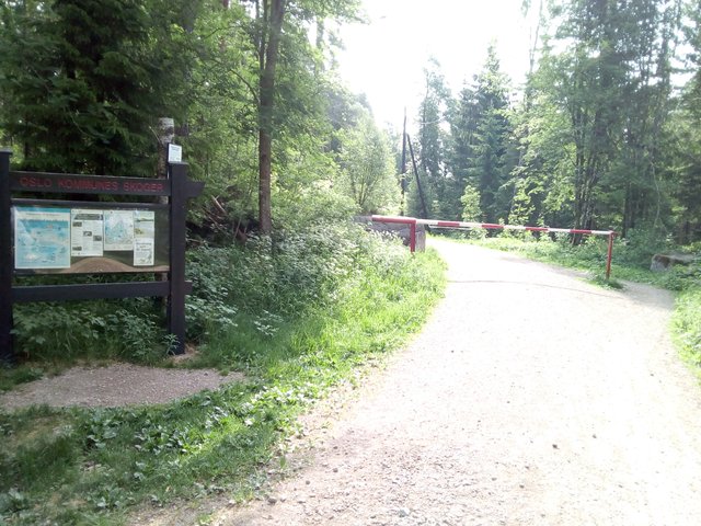
Here is a bit of the road as well - this is the standard for the forest roads in the area. The general public is not allowed to drive cars or motorbikes here, but there are some exceptions, like for people working or living in the forest.

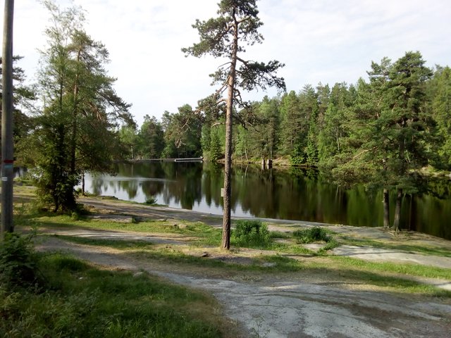
Here is the lake above - "Steinbruvann", aka "Stemmern". It's not used for drinking water anymore, so now it's back to being a bathing lake - and it's great for that purpose. It's more than a kilometre long. The lake was divided in two by a stone causeway (hence the name ... stone bridge water), but this one is now some few metres under the water due to the dam that was built when the lake was made into a drinking water reservoir.
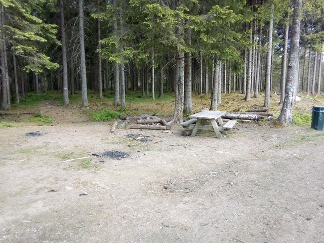
A random pique-nique bench on the way. I'd rather take my lunch at a place with a view to a lake than here, but that's my personal preference. The black spots are from people making fires in the winter time. Currently the risk of a forest fire is "extreme" according to Norwegian standards, there is even a temporary ban on grilling.
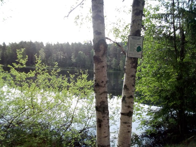
I passed quite some lakes on the trip, but didn't get time to photograph them all. By this lake there is a sign that the lake is used for drinking water, hence activities like camping near to the lake is prohibited. Around some of the lakes there are also fences, and along the fences there are typically some gates that are opened up in the winter time to allow the skiers to take shortcuts over the lakes.
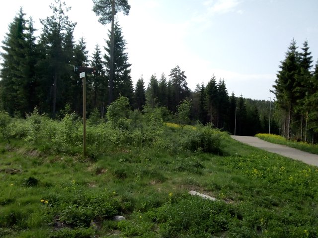
A clearing and a signpost. There are signposts everywhere along the roads and significant paths.
Here I've just left the forest road, at Solemskogen. There is still some few km of downhills left through the forest, but on asphalted road where the public is permitted to drive cars. I failed to take photographs in Solemskogen - it's a settlement in the forest zone ("bydel marka" - or "the forest city district"). There are strict regulations for constructions etc outside the "forest border", though people are allowed to maintain and renew what they already have.
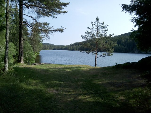
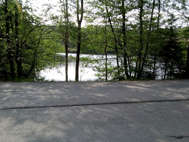
Here is the next lake, along the paved road.
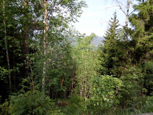
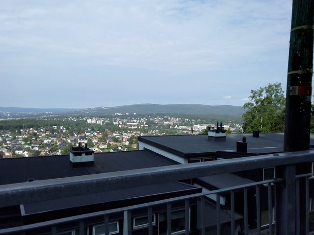
There are some really nice views along the route, but really difficult to photograph. When biking, the trees are like a blur and one can see the view behind. When one is trying to stop and take a photograh, one cannot see the view except for the trees (and even when seeing the view, it's rarely as magnificent on a photograph as in reality). If you can manage to see something blue on the photo below, it's part of Maridalsvannet, one of the biggest lakes in Oslo and also the most important drinking water source for Oslo.
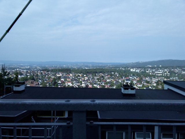
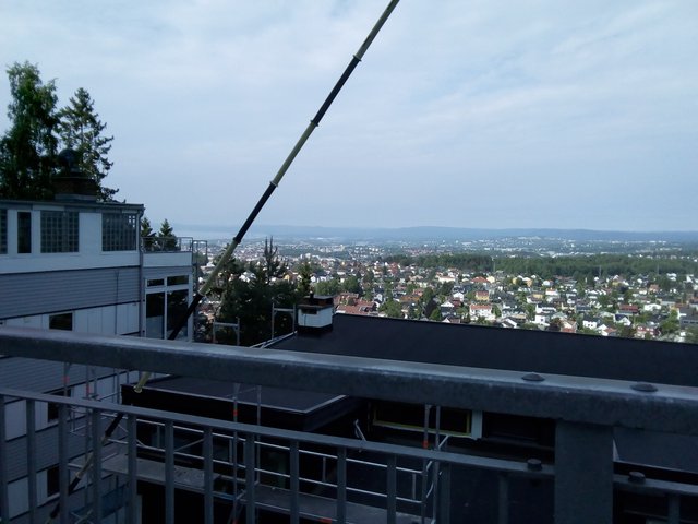
The forest border was crisp and clear ... and now I've left the forest, but there is still quite some view. It's a bit easier to take photos between the buildings than between trees, but still one gets a better impression of the view while biking than while trying to take photographs.
All photos available in better resolution on IPFS QmNoJLtd1JPv38eZ7DJDk3fsoG1AAnYTERFeEQc3DKGHEj. License: CC BY-SA 4.0
Ah lets see, what will it be today; the scenic route or the drudgery route? Good thing it's an electric bike or you would need to go to the showers after such a workout.
So I wonder, do you carry an altimeter or are the elevation levels posted along the way?
We do have a shower at work for such purposes (bikers), and I was using it some times previous time I was biking. The worst is actually not the good-weather days, because one is lightly dressed and get some wind in the face all the time. It's worse on days with rain when one is efficiently trapping all the sweat under rain clothes. It's even worse in the winter time, with all the salt on the road as well as studded tires it gets really very dirty out there in the car roads.
I have eventually given up on biking and has bought a one-year pass for the public transport. But on days like this I let sunken costs be sunken costs and enjoy biking!
Me too, I've pretty much given up on biking anywhere within the city limit even though we have some bike trails and big parks. It's mainly because of the automobile exhaust, it just doesn't feel healthy which was the original intent.
Even way out in the country and in the National Parks (only 45 minutes by car) you find yourself either still on a (less traveled) road or on a trail that is more risky. You had better pay attention on the trails and not "space out" in any way. A fall becomes a bad accident as we get older.
A friend of ours uses a three wheel, recumbent bike which is great; it can be an active workout or a very laid-back experience (Stop, Look and Listen) but you always want nice, paved pathways whenever you can get them.
I checked the map when I came home. Very manually. I should probably install some app that can generate a GPS track for me.
These pics are absolutely marvelous
And share your bike pics also
Dude 16 kms on a bike is huge I think. For me at least it's huge. But on the brighter side you managed to capture some lovely photographs on the way. So it was worth it.
Beautiful view ................
Rode a bike after several years, this Monday. The trip was only about 4km and thankfully I didn't get any cramps the next day. Although my trip was at night so my view was a bit different ............... but still nice :D
Flott der. Har bodd en del o samme imprde på voksenlia å sykkla mye downhill i marka der så dette var kjent.
Hva slags elsykkel har du? Ok tempo. Pleier å ligge på det smame i skogsløyper med vanlog sykkel. Hard Rocx rock machine.. fin sykkel.
Lott vratter der du snakker om da. Men sikkert digg med batteri.
Ha en fin dag
Det er en sammenleggbar sykkel som fruen fikk anbefalt, og kjøpte. Fungerer relativt greit, bortsett fra at noe går i stykker omtrent hver eneste gang jeg prøver å brette den sammen, noe som skjer relativt ofte for å slippe å betale for sykkelen på toget, samt for å få plass til den inne i båten.
Elmotoren gjør at jeg ikke er redd for oppoverbakker - men det er kjedelig å sykle bortover på elsykkelen, ettersom motoren ihht reguleringer stopper å gi kraft etter 25 km/h. Tråkke rundt uten å gi noe kraft på pedalene, og det går i 25 km/h. Tråkke rundt og gi relativt mye kraft på pedalene, og det går i 26 km/h. Så kan man selvfølgelig presse skikkelig på å få 30 km/h, men da uten hjelp fra elmotoren ... men å holde mer enn 25 km/h uten elmotor greier jeg ikke i lengden da må man enten være godt trent, ha godt med medvind eller ha en sykkel som er særlig designet for høy fart.
Ja min klarer jeg dwt. Men er en offraod som er lett med låsbar demper.
Men sykler ikke for farten. God og morsomm trening i skogen. Har du bilde av sykkelen? Hva koster den?
Veldig lyst på elsykkel. Bor i en liten bygd nå så hadde vært deilig på morningen.
Hva går i stykker da? Fester og låser og sånt?
Mange som bruker #bikewithme? Kanskje legge ut litt der selv. Mye hoggorm der jeg sykler. Skal ta bilde viss keg sykler over en en dag. Prøver å unngå det, men kommer til å skje snart nå som det er så varmt.
Er vel ikke ulovlig om det er en ulykke? De er jo fredet.
Jeg tar bilder og beskriver den i en egen post etterhvert. Fruen kjøpte den, aner ikke pris. Den er sammenleggbar, for ditt bruk er det sikkert fordelaktig med en sykkel som er mer robust.
Jo men bare sånn cruiser til bygda er det jo genialt. Ikke på tur. Trenger ikke batteri til det sånn som jeg liker å sykle nå. Men 16kmh på sammenleggbar sykkel er jo sprekt da. Hehe.
Mye trafikk på #bikewithme ?
Awsome travel. I really love pond. We have also some pond in our village and when we visit to village we must visit the pond.
Biking is really enjoying for every moment but warning by medium running & best of luck ;
Soak up that sun!!
Wow, what a beautiful place it is, Oslo should be named as house of beautiful lakes.
And your explanation about each and everything drags me there to feel like I'm really there enjoying all these, such a great writing power you got and photography skills.
It's not only the lakes, it's the sea also. Oslo is quite unique as it has quite much nature quite close to the city area, and that this nature is protected by strong regulations.
Nature protection is the main thing which any country must keep as first priority and Oslo government is doing great which is really appreciated.
aha...I miss "flat forests" mabye a bit strange to say when u ar there but here in Canada or here in Vancouver its just so hilly we relay dont have "flat" forest like back home or u Ned to go super fare in to the mountains
to get find it. a I think I appreciate the nordmarka more and more with all the small roads. a have been on all the blue trail in lilomarka is underestimated a think u can go to sinober form liloseter now. or a now the planing to make a gravel road there. a few years back. it super nice in the summer time. its nice to have u take photos of my home. just give me
some nostalgi keep them coming :)
That's trails, no biking roads. Probably you could get there with the fat tires though.
o yes am a all mountain biker this path is one of the best one i Oslo starting at årvold and ending up at Sinober then to maridalen. and yes not a "gravel rode" atm. its technical trail. or it us to be. haven't been there in years. lilomarka is mabye to bomby on "gravel biking" if u have some time the gravel rode over to tømte is super nice. better then kikut in my mind. 50km ish.
Well, Marka can be really bumpy here in Oslo, not to forget all the cliffs - I thought it was much flatter before I moved down here. Part of the reason why the detour was so big is that the forest road actually is relatively flat, staying at around 300 metres above the sea level most of the way, and to do so it has to curl around the hills and lakes.
Came to think, except for skiing I haven't been there for a while, and I heard someone else saying the same - that they are planning a road between Sinober and Liloseter. For me that would be pretty awesome, I'd like to bike to Kikut.
ye it most be 5 years or more sins since I have heard it. stuff like this take a lot of the to figure out.

true on the bumpy nes but over here its like form 0 meters above sea level to 500 ad then "flat ish" so from the city u ned a car or crasy good shape to do anything. biking is very different here. most of Canada Mountain
feel a bit like vestlandet. it not like jotunhement att all or not where a have been
its suprisng me a bit People here do not go any special on top trips not like we do back home
where its all of us "most" are collecting 2000m tops in jotunhemen.
like here flat or state up. this is 20min from my flat
or this one from
its like this all over the place or here in Bc its like this.