Mt. Talinis: Cuernos de Negros, the Sentinels Watching Over Oriental - Life in the Tropics 06
In this story, I recount the few times I have visited the majestic mountain range of Mt. Talinis in Negros Oriental. Read on to get the feel of hiking and to learn a thing or two about this richly diverse rainforest.
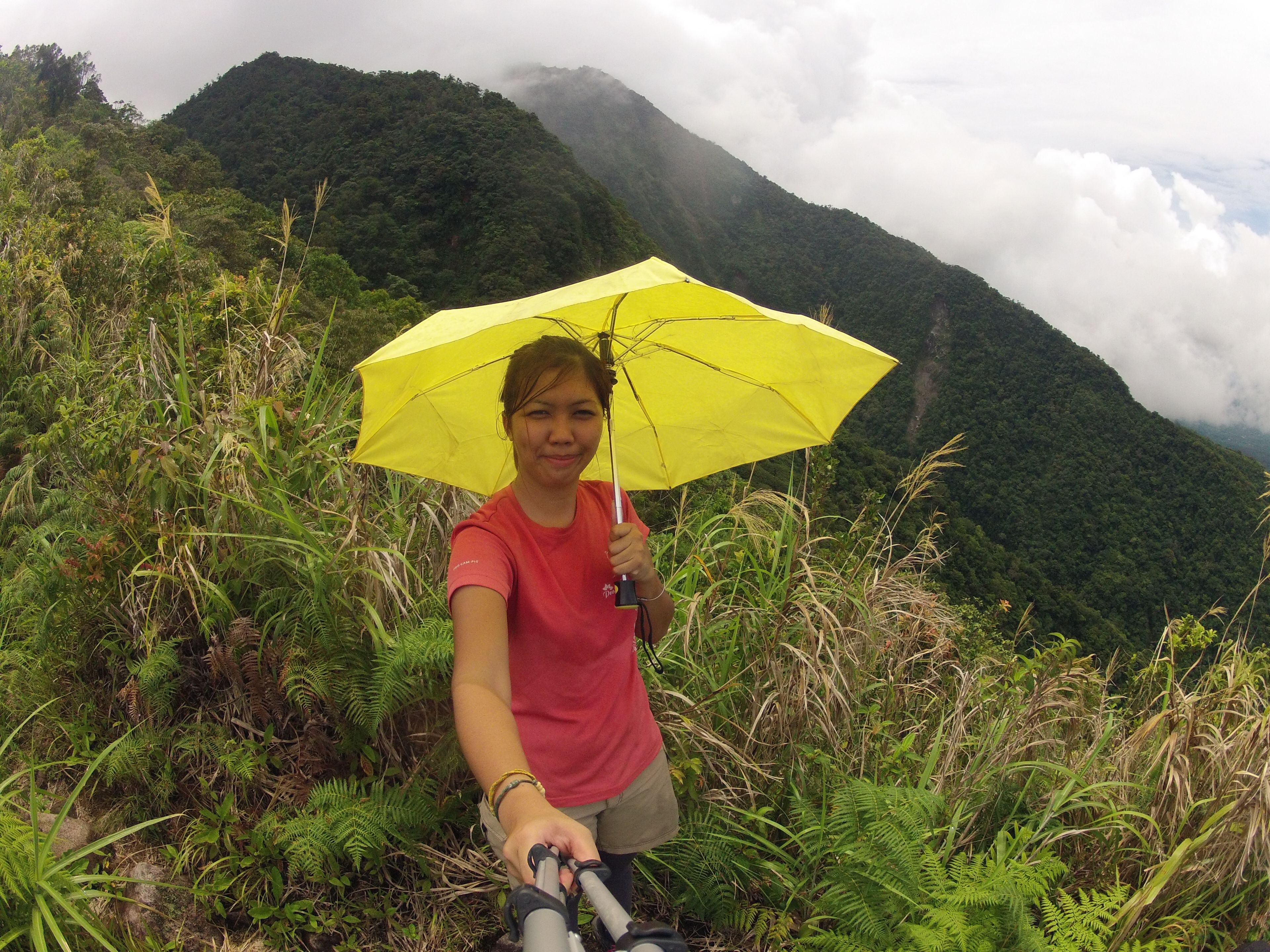
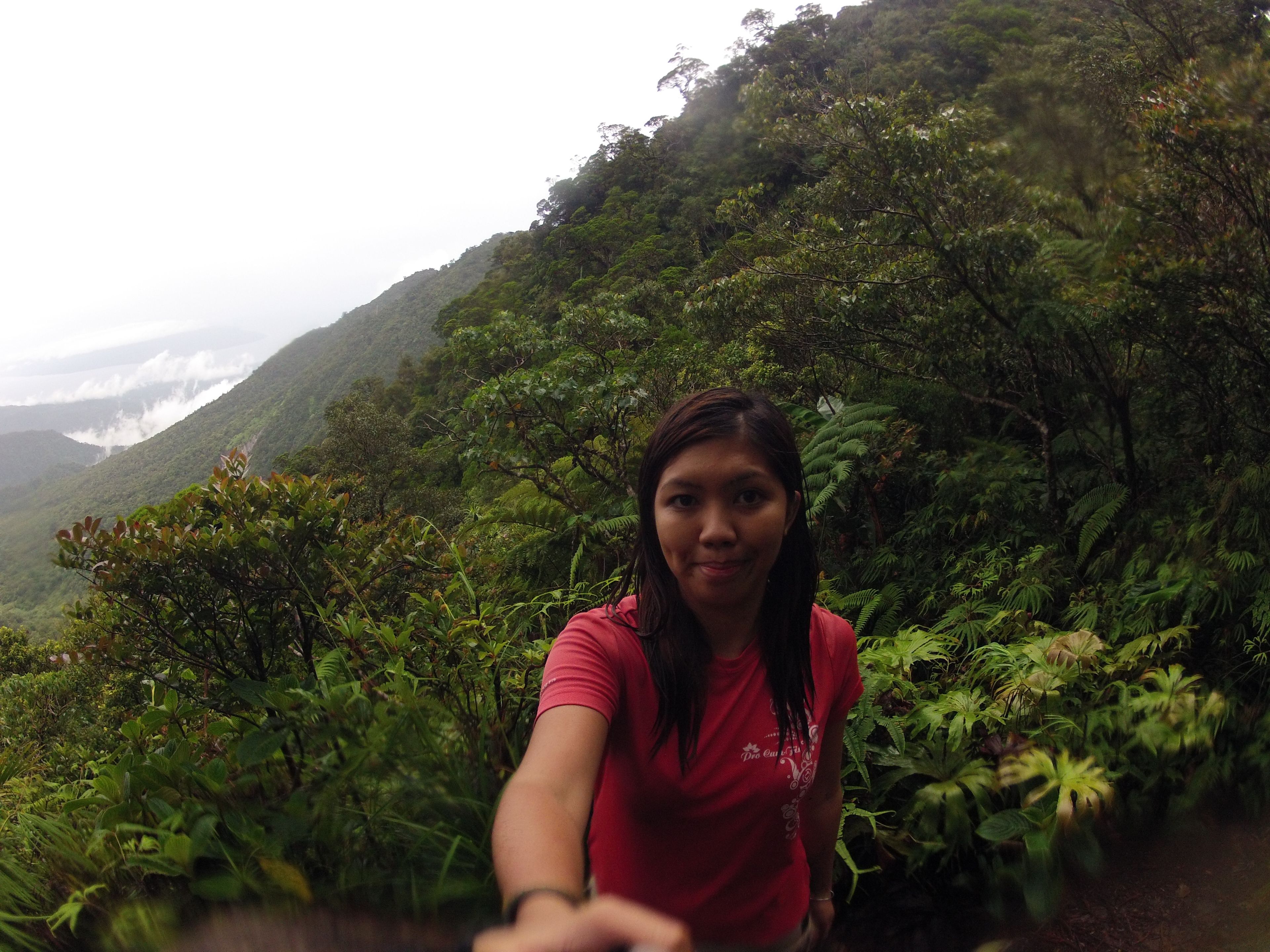
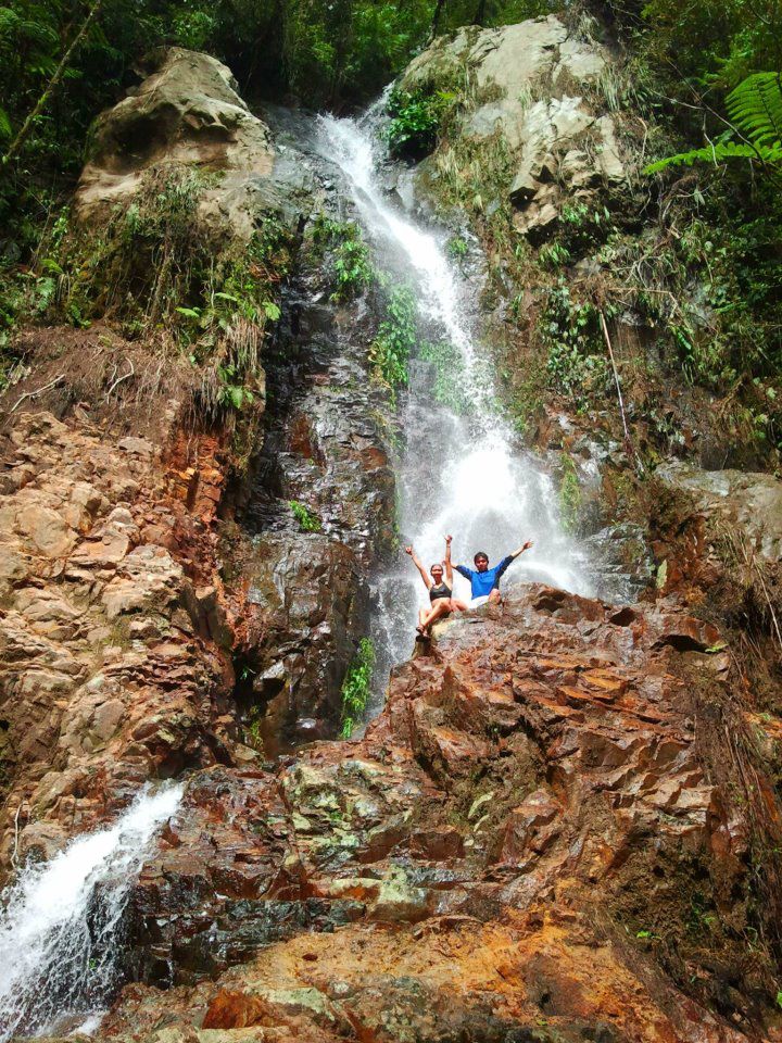
A sunny day at one of Talinis' ridges.
If relationships were a metaphor to mountains, Mt. Talinis would be the mistress to my first love Mt. Mandalagan. But that doesn’t the slightest bit describe the fulfillment you get from climbing them. I have scaled Mt. Talinis for four times in my life, three of them when I used to be fit and can run trails. I say, it definitely is not your typical mountain, so as most climbing spots in Negros Island. It’s not a mountain you climb to reach the summit, record the altitude and coordinates of the peak and caption your Facebook photo with. Talinis is a vast range of peaks that sentinels the gentle cities of Negros Oriental. These peaks stand as horn-like structure thus the name “Talinis” meaning pointed in the Cebuano vernacular, or “Cuernos de Negros” Spanish for horns of Negros. And like I said, it’s not your typical summit mountain. Talinis is more frequented not for its peak, but for it’s numerous hidden lakes and waterfalls, and a large stream of water flowing off a sulfur vent, a complete package that is home to richly diverse flora and fauna.
Mt. Talinis can be approached with these two most common options: via Apulong, Valencia, which is quite an easy ride since the way is mostly concrete up to Casaroro Falls, the jump off site, or via Bediao in Dauin which is quite a bumpy ascending ride to the jump off. The catch though is that Apulong trail is packed with elevation gain when you start walking up the slippery trails. Bediao is a little friendlier in terms of elevation gain but it’ll still greet you with a cardio-pumping assault anyway.
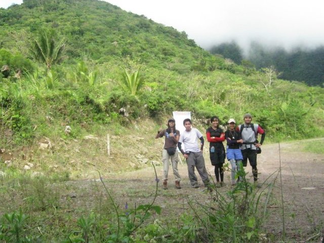
Bediao jump-off point – October 2010 (Me, Bryan, Maroelle, Kai and Rebreb)
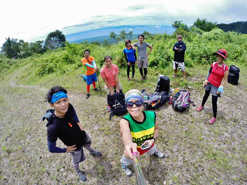
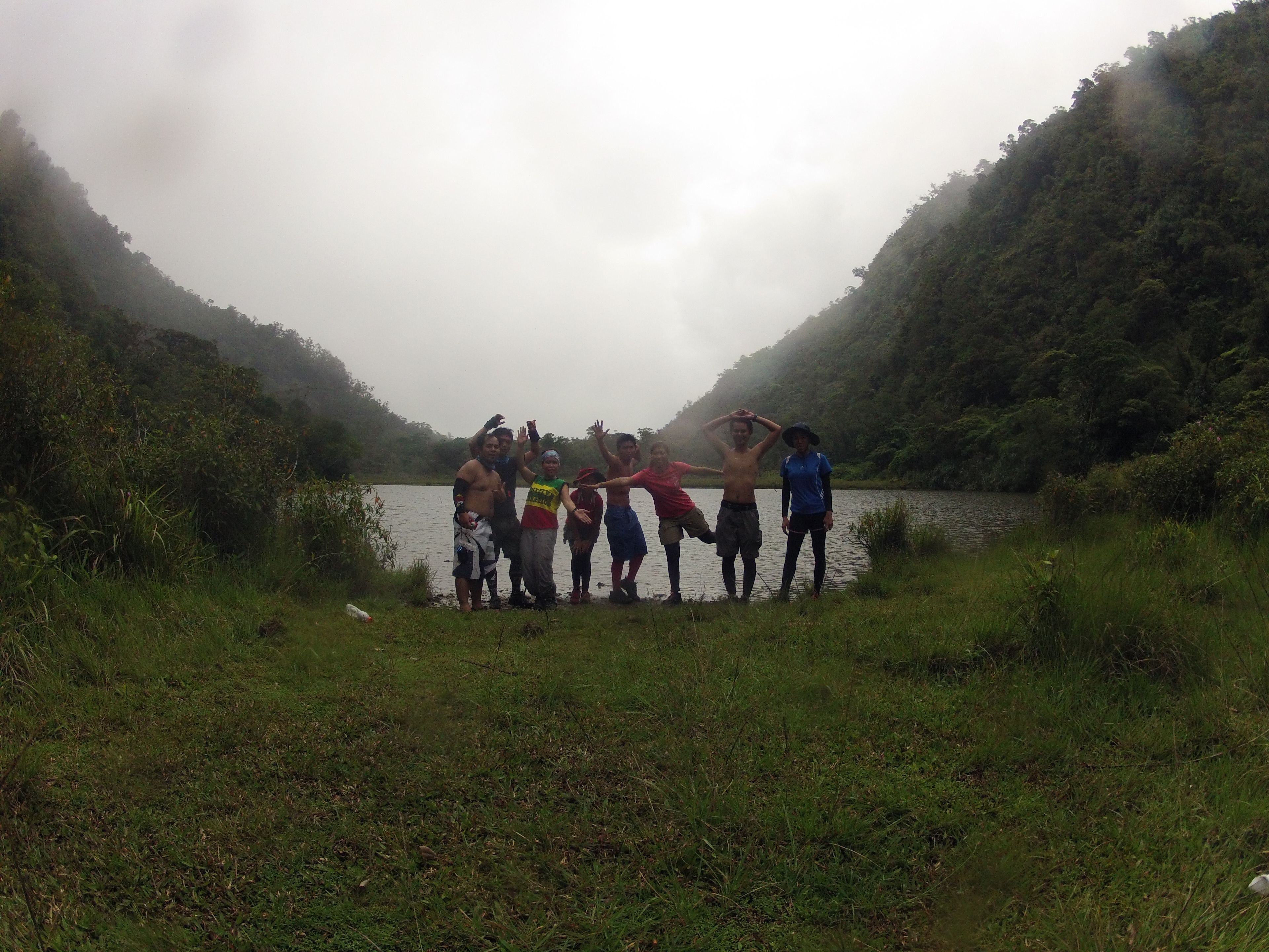
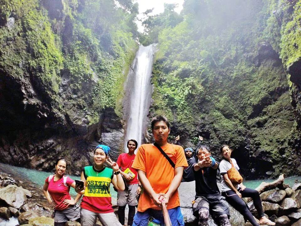
Bediao August 2014 – Neo, Jason, Me, Denisse, James, Tope, Joyce and Arlyn
I’ve ascended both trails and I can say they’re just as painful except that Apulong is very muddy with all the water pipes supplying the nearby towns traversing through the trail. These PVC pipes may have tiny leaks that keep the land moistened all of the time, thus the muddy, slippery trail.
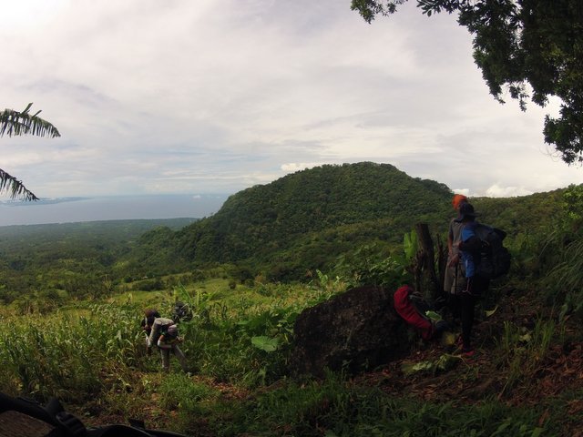
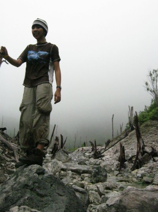
Entry assault overlooking Tanon Strait
I would take Bediao as entry point for majority of my climbs to mother Talinis, so this is where my story will be starting at. From Dumaguete City, take a bus bound to Dauin and tell the driver to drop you off at Lipayo Market where you will have a greater chance at a habal-habal (or you can say Bediao junction, as some habal-habals could be available there too). The habal-habal used to cost us 100pesos from Lipayo Market, but just recently, we had to pay 150pesos from the Bediao junction. It’s about half an hour roller coaster ride up the rough road to Bediao. You’ll have to pass by a registration point, which the habal-habal driver will direct to you. A few more minutes of habal-habal ride from the registration point will get you to the entrance jump off.
The jump off point is a wide rocky path very open to the sun (if you climb a non-rainy day) which is why you need to somehow climb fast to avoid draining yourself in the heat. The trail starts from bush-high vegetation ascending for a few meters, before finally entering the nearby tree-line. The tree-lined trail is a lot cooler and shadier, which at least makes up for the all-ascending path. The trail twists and turns up for about an hour, before finally reaching the open viewing deck. Atop that, you can see the town of Dauin, the Tanon Strait, and at far back the island of Siquijor. It’s rather sunny here too, and will take a couple of minutes before you enter the tree-line again. At this point, the trail becomes rolling up and down which describes being in the midst of the horns.
For another hour, with a normal pace, you will reach the vast plateau that formed Yagumyum Lake. Yagumyum is a large swampland, the catch basin of rain pouring from the 1700+ peak to the right and the ridge trail to the left. The view almost resembles the east view of Mt. Mandalagan’s Danao, only that water here almost never dries up. Here climbers on multi-day climbs take their first day’s lunch, or those on day hike from Bediao make their turn around.
Yagumyum Lake
Lunch by the lake, a photo from eight years ago!
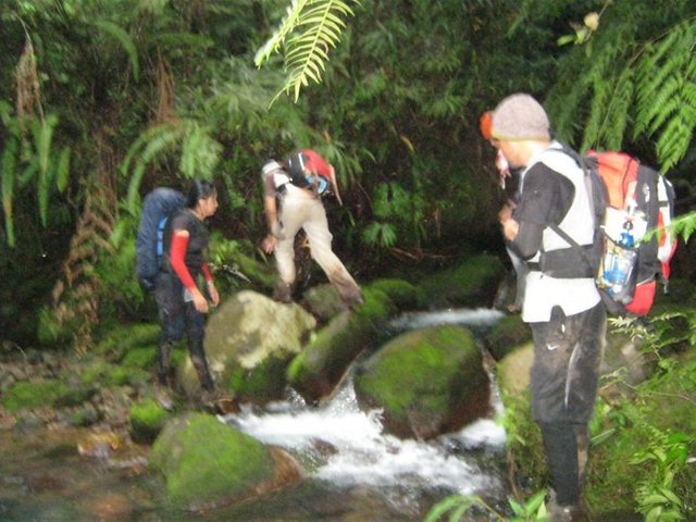
The after-lunch trail begins to the left of Yagumyum Lake. It’s an assault of a long ridge that forms one of the horns. This ridge will last for about an hour or two of assault, lined with stunning vegetation and trees, probably secondary or tertiary in nature. If you’re observant throughout the length of the ridge, there are beautiful views all around. To the right, you will be overlooking Yagumyum and 1700+ peak, and to the left is the Halawig Lake at the bottom, usually not a visible body of water as the vegetation could be taller that the water level especially in summer, bounded by another ridge that stretches a few horns away from the summit. The final part of this current ridge is an obvious patch of land, framed in tree roots, layered by decomposed leaves, and hollow at the bottom. The trampoline as how it’s commonly called, is a soft layer of land that bounces when weight pushes it down. For so many years, the trampoline never eroded, showing just how sturdy it is. From that point, the trail descends a slippery mix of loam and lime, down to the marshland of Halawig. If it recently rained, water could still be streaming down from the opposite ridge, draining it’s water to Halawig Lake. Follow the tiny upstream for about half an hour, and you’ll finally find yourself to the Nailig-Kaipuhan junction. The fork to the left leads to Nailig Lake, and the fork to the right leads to Kaipuhan sulfur vent.
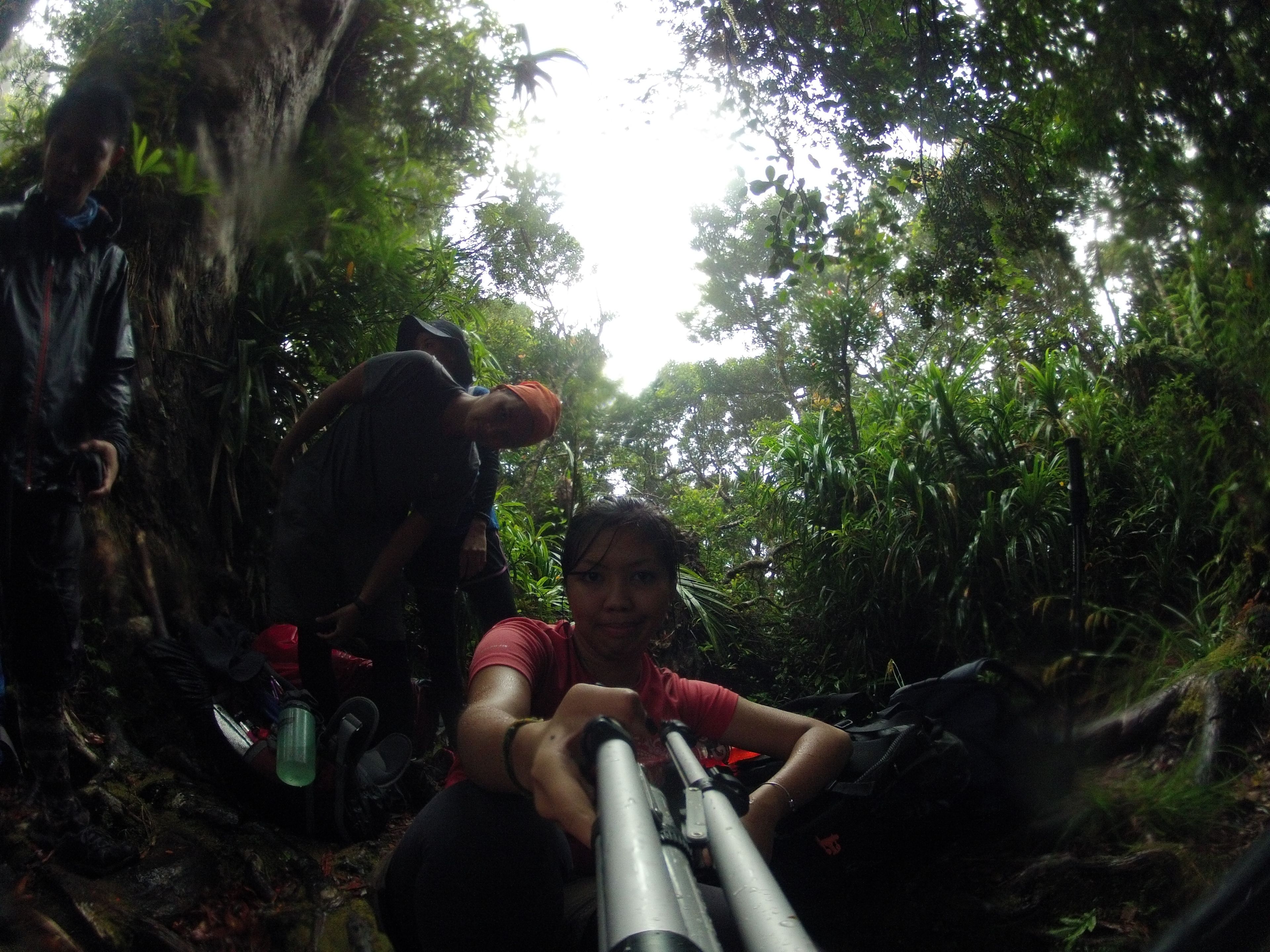
Through the ridge and the fog
Preferring the trail to the left, you’ll be tracing the trail that borders another less frequented lake, the Nabilog. I have never gone close to this lake but they say it’s a bit visible to your right when trailing to Nailig, which is positioned left. The point where the trail descends marks your encounter to the beautiful Nailig Lake. Nailig never dries up and in fact even fills up with water up to the treeline. When camping in summer, there’d be a few meter’s stretch of damp bank to camp on, but on rainy season, you’ll have to pitch tents inside the treeline – which apparently has been obviously cleared out by frequenting campers.
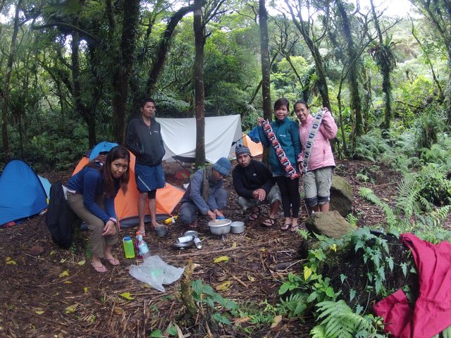
Nailig camp site – 2014
It is discouraged to drink water directly from the lake, especially without prior boiling or emulsifying with purifying tablets. A small stream of water near the treeline camp may be a better source but it usually dries up in summer. It is disallowed to wash or bathe with soap or shampoo at the lake. Visitors should also maintain a good amount of clearance from the lakeshore and water lines when trying to dispose of human wastes.
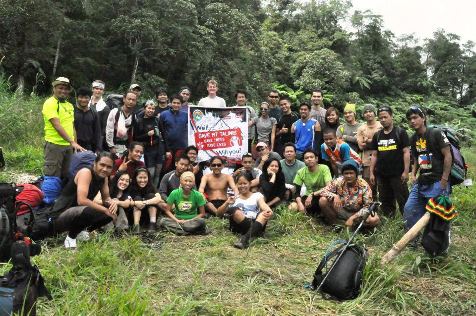
Lake Nailig – Save Mt. Talinis: Katkat Pahinungod 2012
Jason at the summit overlooking Nailig
When facing Nailig Lake, you’ll find the trail to 1900+ summit to your left. I have never assaulted this summit and I keep to myself to never climb it when visiting Talinis except when I’m 40 and still maybe strong enough to climb. I find that there is always way more than a mountain than summitting its highest point, and with it, Talinis is too beautiful, I won’t need to reach the peak to be amazed by its glamour.
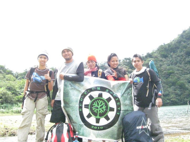
Ecotech Society 2010
The weather wasn’t very permitting when I first visited Nailig. The wind was so strong, the fog too thick, and our souls too brave that we camped out by the bank. By midnight I couldn’t sleep with our tent fly seeming to dance around with the wind. It was my second major climb, November of 2010, and I never thought I could make it until morning with the temperature that cold. But I did live through the night and the next day the sun shone brightly like there was no proof of the dancing tent fly and the deadly cold (well at least it was deadly for a noob like me).
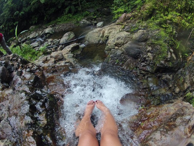
I like swimming in Nailig. It refreshes me from the long hike or cools me even more, not that I’m not already cooled by the breeze alone. It’s like subjecting yourself to unknown abundance of water, which looks like where a leviathan could thrive. Lakes are probably the most mysterious bodies of water. They don’t seem to move a lot, and the water could maybe just settle there for the longest time, depending on the grade of soil underneath. Usually the lake bed is extremely soft, just a little milder than quicksand, making wading quite a task.
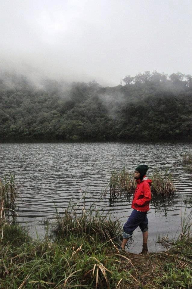
Early morning at Nailig Lake in 2012
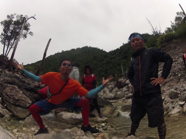
On the trail to Kaipuhan Sulfur Vent
Second day’s hike could be Nailig to Rancho/Twin Falls, or Nailig to Apulong for overnighters. Nailig to Rancho or Twin Falls is a pretty short hike, around 3 hours on average pace which gives you ample time on your second day to swim at Nailig or assault the peak. To get to your second day’s destination, back track the trail up to Nailig-Kaipuhan junction. Upon reaching the junction, this time take the trail to your left (or the only trail you’ve never been through so far). This is a majority descending trail where pace is expected to speed up a bit. After an hour, you’ll be passing by a stream of water through big boulders which actually used to be a waterfall. During Sendong typhoon late in 2011, these big boulders rolled down from the side of the mountain eroding the water fall. When I reached this spot last February 2012, I was surprised at how lifeless it looked. After visiting last August 2014, the water found its way back, slowly reclaiming the stream it used to be.
At Kaipuhan in 2010
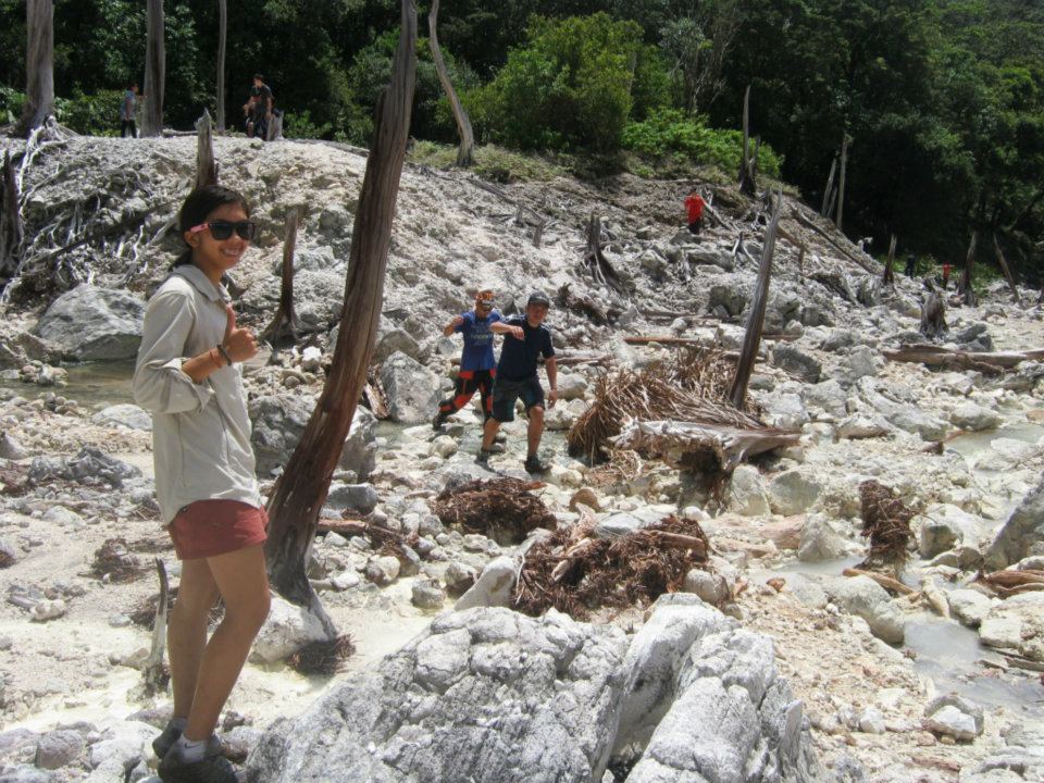
At Kaipuhan in 2012
At Kaipuhan in 2014
After less than an hour, you’ll finally reach Kaipuhan, a river coming from a sulfur vent. I can’t exactly describe the sulfur content of this water but it seems cool and fresh already. The sulfur vent must’ve been consumed a long time ago, and what remains are white powdery rocks, and fantastical looking tree trunks within some meters from the river bank. From Kaipuhan, Rancho is just minutes away. You’ll first pass by a small patch of farm and a farm house where you can actually camp. Adjacent to this small farm is the Rancho, which used to be a vast grassland still good for camping, but recently I just found it hard to pitch a tent with the thick vegetation. Between the small farm and Rancho is a stream of water where you can source drinking water, and which you can follow down to lead you to Banika River and Apulong trail – the best choice when opting for an overnight hike only and aiming for the shortest way. However, you can still hike onwards to Twin Falls for a side trip or even camp near the watershed facility. To get there, follow the trail at Rancho and after a short assault take the right junction which descends straight to the river coming from the Twin Falls. If you go straight down, you can cross the river and find the watershed facility. If you go down to the right, you’ll find the Twin Falls.
Twin Falls – Katkat Pahunungod 2012
I have only visited the Twin Falls after typhoon Sendong so I can’t imagine how it originally looked like. All I found were two really tall falls, the bigger one falling from a mossy cliff and forming a large deep pool at the bottom, and the less stronger but wider one was falling from an odd formation of red rocks where the water streams thinly down to a small pool. The one with the red rocks is supposed to be the actual Twin Falls. They say it used to be two identical falls before one got eroded by Sendong. I’m not exactly sure how the other large falls is called, and after a few visits, I opt to leave it a mystery.
On top of Twin Falls
I have once camped at the watershed, where instead of pitching my tent, I found a net hammock near the shed’s cooking area and camped the night there. If lucky, you’d find fireflies blinking their way through tree branches looking for love. If someone’s manning the shed, they’d be requesting you to log your names on a record book just to keep track, but no fees are collected for this.
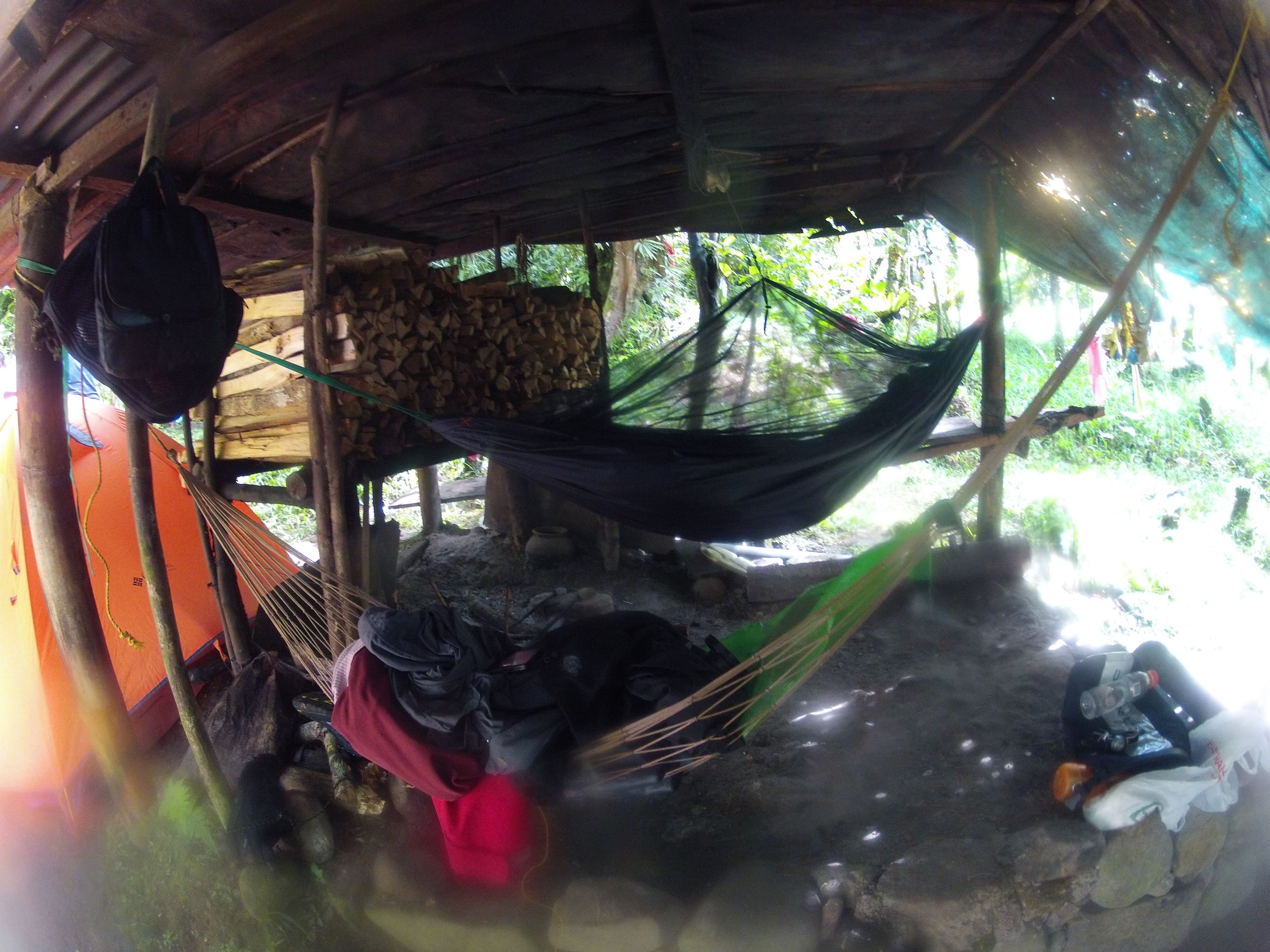
Hammock camp at Watershed station
There’s a visible trail from the watershed that will lead you to your exit for the third day. This trail is rather swampy though as compared to the one at Rancho. Both trails will still lead to Banika river where they unite to form a single trail out to Apulong. Banika river used to be a narrower mossy water line before Sendong. Now, you’ll find it wider and deeper and less lined with rocks than before. Banika is the source of water for the adjacent towns.
Banika River 2010
From Banika river, you’ll be climbing up another mountain, this time where the bordering communities of the horns are more visible. Along the ridge is where we tried to reforest Talinis after the damage of Sendong two years ago. Last time I visited, some of the seedlings managed to grow a few feet in that wild environment. It’s takes about two hours to finish off the ascending trail, and finally be descending all the way down to Apulong. At this final approach, you’ll be hiking alongside PVC pipes. At one spot, you may even slide down on them. This final stretch would last about an hour before finally reaching the community, marked by the receiving area for Casaroro Falls. You may opt to descend Casaroro, with the way already paved with iron steps leading all the way down. I’ve never been to Casaroro too. I choose to be the one who gets left behind to watch the backpacks while everyone goes. Yes, I’ll probably visit it when I’m forty.
Casaroro Falls
At the community, you’ll have to ask around for available motorcycles that can take you to town in Valencia or straight to Dumaguete City. Prices here always vary, but the last time I took the habal-habal to Dumaguete it was around 270 per ride, for two people. When in Dumaguete, don’t rush to get home soon. Instead, take a walk at the boulevard or visit the known restaurants or hangout places. Some restaurants are even meant to have the outdoorsy mood. Try Sans Rival, El Amigo, Hayahay, etc.
Recently, an exploration of a geothermal power plant is going on within the boundaries of Mt. Talinis. This lead to a deforestion of a massive number of trees tantamount to the threatening of the habitat of endemic species. This never ending need for power and the ignorance to switch to clean renewable sources will lead to an even catastrophic degradation of our forest, that is if it’s not yet damaged enough. The 2011 typhoon that destroyed significant parts of Mt. Talinis has been indirectly brought about by human-agitated climate change. But this deforestation directly done by man is unforgivable. It is at a sad note that I close this story, but I do hope that before it’s too late, this exploration activity could still be slowed down if not completely stopped.
!steemitworldmap 9.246030 lat 123.172307 long Mt. Talinis - Cuernos de Negros d3scr
All photos are owned by the author.
Follow me on the "Life in the Tropics" series for more outdoor adventures. Thanks for your time!
Cheers,
@xaydtrips
Heya, just swinging by to let you know you're being featured in our Daily Travel Digest!
I am also part of the curation guild @ocd, and would love to nominate you there! Let me know if you accept here!
Thank you @steemitworldmap! Happy to be able to share these great hiking spots in my country. And yes, I accept the nomination. It would be an honor 😊
Hi @xaydtrips! I enjoyed reading this article so much that I want to try mountain climbing so badly. haha. I haven't tried (didn't attempt) because I think I'm not capable of getting to the top. For a beginner like me do you have any suggestion, which mountain to climb? (Preferably here in Cebu). Good job! I look forward to your future adventures! Thanks!
Thank you @reewritesthings! I know I write very lengthy posts but I really appreciate people who get to the end of my story. And yes, you can try Sirao and the other hills in Brgy. Babag area. We can even organize a Cebu Steemit hiking activity one of these days 😊
Great idea! Better get my body working arun physically fit mag climb hehe. @xaydtrips
Such a great read @xaydtrips. Reading this brings back the memories. I have been to Talinis once when I joined the Trek to Talinis last 2015. It was raining all day from the moment we started the trek. The rain helped a bit though by keeping us cool during the trek but the nights are just unbearable. It was super cold in Nailig. I have not gone up to the summit though. The group went to the summit the morning of the second day while it was still raining but I have other plans (sleep! hehe).
Rainforests really are tricky but the long hike and harsh conditions sure makes up for the wonderful views and memorable experience. I wouldn't fret about not going to the summit myself, because Talinis is more known for its other features anyway. Following you here on steemit based on your profile because I love hikes and bikes too (sadly, I have zero photography skills) :D
Yes, totally right. It's really not the summits that draws me to hike mountains. As they say, it's the journey that counts but the summit is also a great plus side to the adventure. I would definitely be back to Talinis. And if weather is good, maybe a summit for me :)
Congratulations, Your Post Has Been Added To The Steemit Worldmap!
Author link: http://steemitworldmap.com?author=xaydtrips
Post link: http://steemitworldmap.com?post=mt-talinis-cuernos-de-negros-the-sentinels-watching-over-oriental-life-in-the-tropics-06
Want to have your post on the map too?
Idol ni nakong bukida.. Makamingaw ang pics nimo!
Lagi, nostalgic kaayu mga pics from eight years ago :D