Steemit Maps and Directions
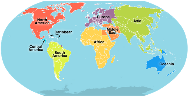
To show the surface of the earth we draw maps, A map shows the shape of the land or sea. By studying a map we can locate the continents, seas, countries, sea parts, rivers mountains and lakes etc. Maps cannot usually shows the tree or actual size of a place or a thing therefore maps draw according to the scale. A map reader can work out distance between two places easily.
On a map every feature cannot be shown as it is, so symbols are used to show them. For example: A river shown as a wavy blue line, for a forest we show green tree. These symbols or signs are explained in the key. Every map have a key. It is important to show direction on a map in order to locate a place.
Directions:
A compass helps people to find out which direction they are going. Compass have two needles. They are colored which is called a pointer.
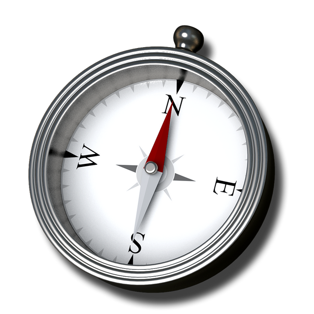
Needles keep moving as we change direction. The direction are also drawn on maps. We can see four main points on it, They tell as about the north, the south the east and the west.
If we stand up facing the rising sun early in the morning , the south is on our right, the north on our left, the west on the front and the East at our back :)
I upvote U
Dear User known as @creativework
Steemit has a BOT problem! Your Vote Counts... Maybe
https://steemit.com/steemit/@weenis/bots-steemit-s-first-community-based-decision-on-bots-your-vote-counts-to-be-or-not-to-be-details-inside