Walkwithme: Skien - from Bryggevannet to the train station
I had an hour in the town of Skien some days ago, I'm not much familiar with that place, I didn't know much about it except that it's pronounced somehow like "Sche'en", that it's very close (and connected with a river) with the neighbour town Porsgrunn (a place I visited briefly in the early summer), that it's the end-stop on the train line "Vestfoldbanen", and that it's a completely different place than Ski. I was surprised that the train station was a kilometer outside the center of the town - particularly considering that this is indeed the end-stop. I first walked downtown without taking any photographs, then back to the train station.
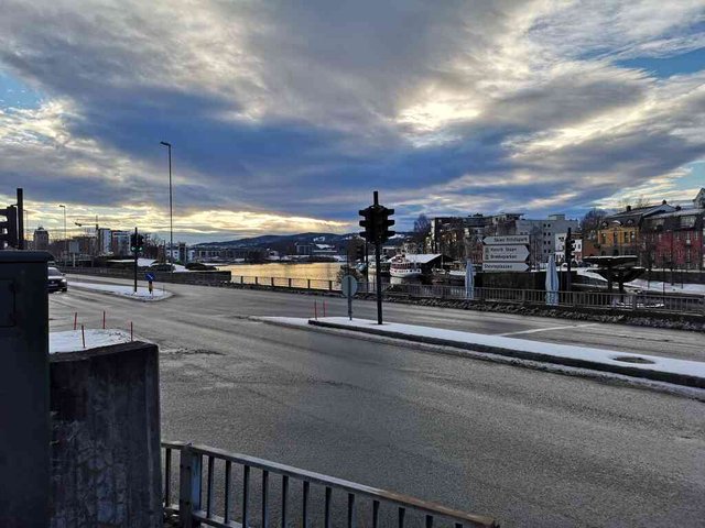
Here is Bryggevannet ...
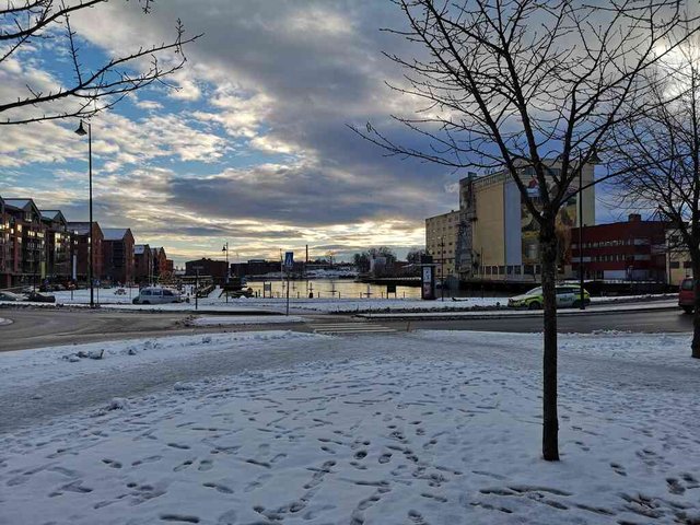
position: geo:59.207096,9.610535 (geohack) - 2018-12-10 13:12:38 localtime - full quality
What is it actually? According to the name it's a lake, it looks more like a bay, but there is a lot of movement in the water, very unlike a bay or a lake ...
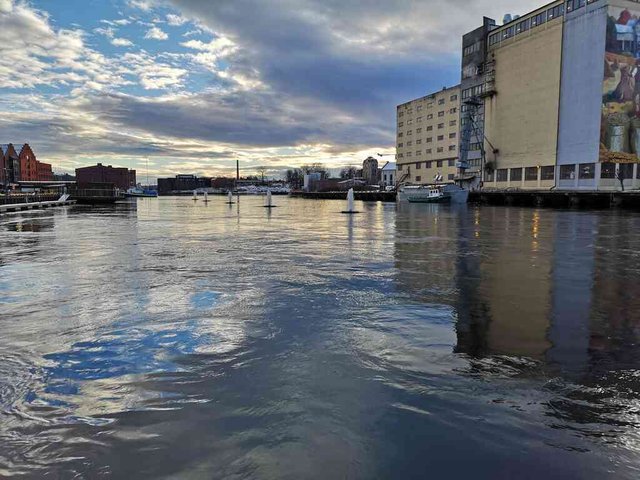
position: geo:59.206123,9.610778 (geohack) - 2018-12-10 13:14:10 localtime - full quality
The water seems to be coming from under that building. A former (or current?) power station? I couldn't find anything through a very quick internet search, but I suppose it was for a mill producing flour from wheat.
position: geo:59.206123,9.610778 (geohack) - 2018-12-10 13:14:14 localtime - full quality
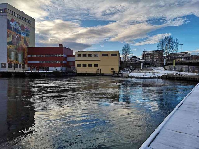
I took some 5-6 shots here, planning to make an animation. Note to self: remember to keep the camera/phone completely still when making an animation of water in movement ... duh.
position: geo:59.206161,9.609845 (geohack) - 2018-12-10 13:15:10 localtime - full quality
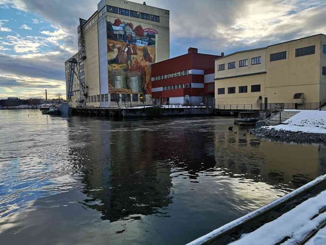
At the upper side it's Hjellen/Hjellevannet, a dammed lake. Looking at the boats there, probably it's possible to get up there through some locks (checking Wikipedia ... yes, this is the starting point of Telemarkskanalen, the biggest out of two Norwegian inland waterways with locks connected to the sea. I should have known)
position: geo:59.20623,9.608201 (geohack) - 2018-12-10 13:16:51 localtime - full quality
To get up to the train station one should pretty much follow a valley. I went down following the east side of the valley, up again on the west side. Valleys typically feature a river or a stream; this one has none, but a bit of googling, and I found that there has been a small stream there - lortebekk (aka Kverndalsbekken). Today it's been dug down. Perhaps it's contributing to the visible water flow in Bryggevannet. The name "lortebekk" comes from the fact that a lot of waste and sewage found its way into the stream, so it was dirty, polluted and stinking (source). Allegedly, some people in the neighbour town Porsgrunn still use the derogative word "Lortebekk" for Skien.
position: geo:59.20829,9.606918 (geohack) - 2018-12-10 13:19:19 localtime - full quality
I do like the decoration at the wall. Nice church, too.
position: geo:59.208713,9.6076 (geohack) - 2018-12-10 13:20:26 localtime - full quality
The church is quite big indeed ... and it has a wikipedia entry as well.
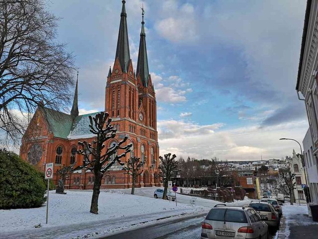
position: geo:59.209651,9.605576 (geohack) - 2018-12-10 13:22:28 localtime - full quality
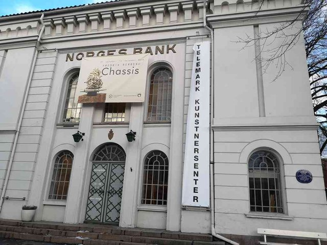
Norges Bank is the national bank of Norway. According to the right-hand blue sign it was build in 1846-1849, and was serving the national bank until 1986. By now it's apparently an art museum.
position: geo:59.209968,9.605366 (geohack) - 2018-12-10 13:22:48 localtime - full quality
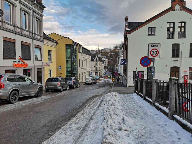
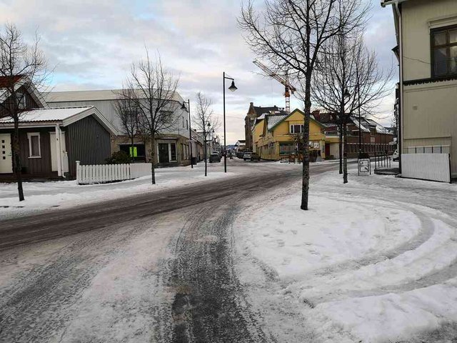
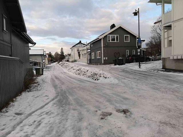
Just a random street photo.
position: geo:59.213378,9.6029 (geohack) - 2018-12-10 13:37:42 localtime - full quality
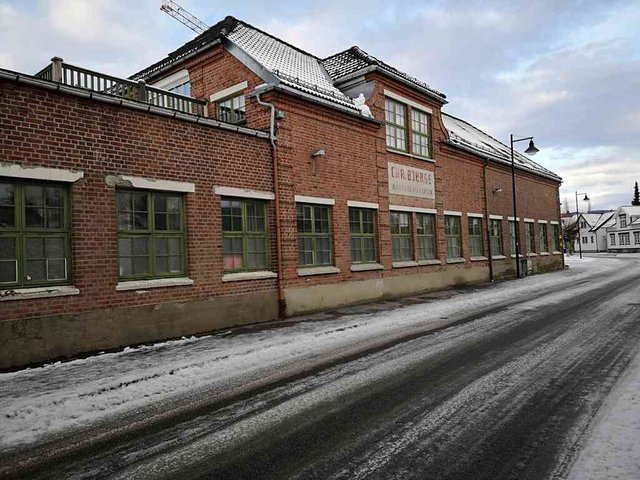
Chr. Bjørgs Karosserifabrikk - so they produced coachworks for buses.
position: geo:59.214031,9.603159 (geohack) - 2018-12-10 13:38:52 localtime - full quality
According to a quick web search, the company still exists, they are doing service on damaged buses and lorries, metal repairworks and varnishing. More on lokalhistoriewiki and digitalt museum. Apparently the building has been expanded, here is an older photo (from digitalt museum):
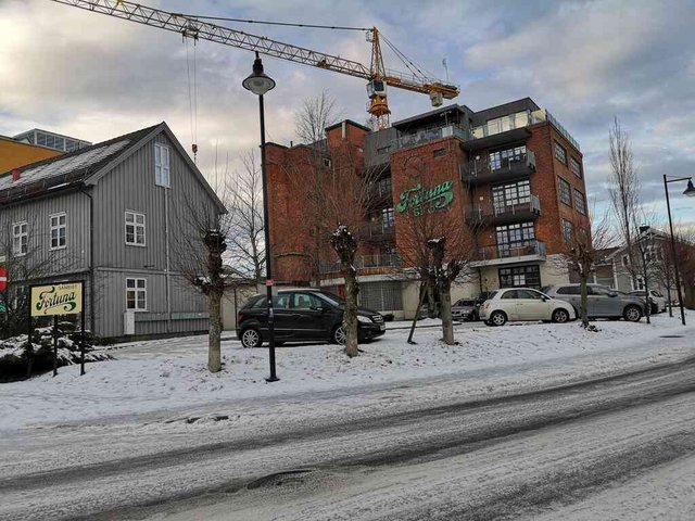
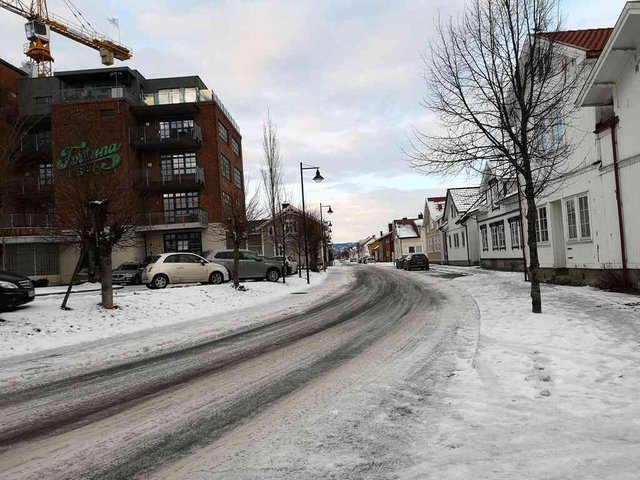
"Sameiet Fortuna" ... meaning that the apartment building is collectively owned by the apartment owners. On the building it says "Fortuna sko". It's pretty obvious that this was a former shoe factory, now turned into an apartment building. There is more information at Lokalhistoriewiki, so apparently "Fortuna sko" was not the name of the factory itself, but one out of several trademarks produced there. There still seems to be shoes produced with the brand name "Fortuna", but probably with no relationship to the ones that were produced in Skien.
position: geo:59.214466,9.603418 (geohack) - 2018-12-10 13:39:55 localtime - full quality
Another random street shot ... same place, a bit different angle.
position: geo:59.214466,9.603418 (geohack) - 2018-12-10 13:39:59 localtime - full quality
position: geo:59.215442,9.604238 (geohack) - 2018-12-10 13:42:05 localtime - full quality
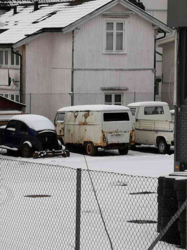
Some other car repair shop ...
position: geo:59.216194,9.602998 (geohack) - 2018-12-10 13:43:36 localtime - full quality
... seems like they are collecting old Volkswagens
position: geo:59.216232,9.603852 (geohack) - 2018-12-10 13:43:48 localtime - full quality
Quite amazing that the grass is still green here by this gate, "protected" by the dense trees.
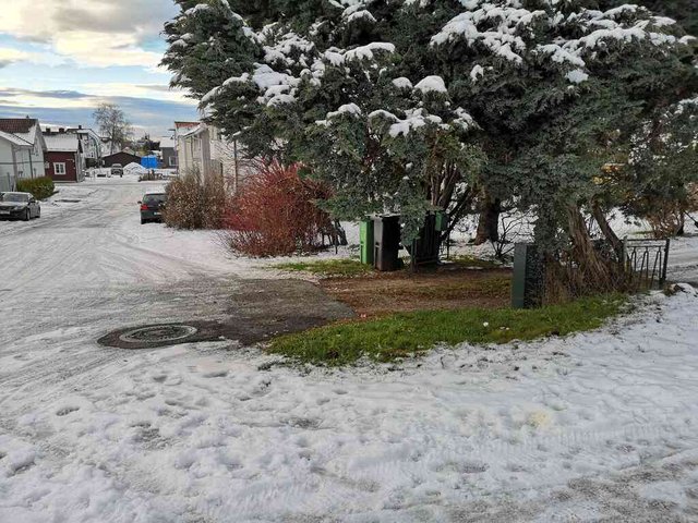
position: geo:59.216876,9.603272 (geohack) - 2018-12-10 13:44:59 localtime - full quality
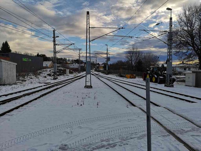
Train station.
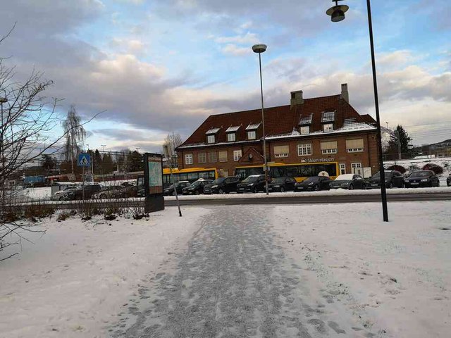
position: geo:59.218357,9.602289 (geohack) - 2018-12-10 13:47:41 localtime - full quality
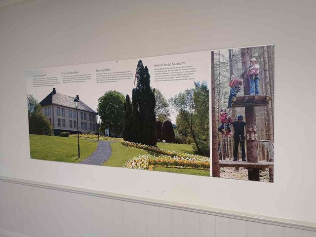
Oh. Inside the train station there is a poster with some suggestions on what to do and what to see in Skien. Too bad I'm seeing it when leaving the town. Well, I'll be back sooner or later, probably in June.
position: geo:59.21891,9.603255 (geohack) - 2018-12-10 13:50:01 localtime - full quality
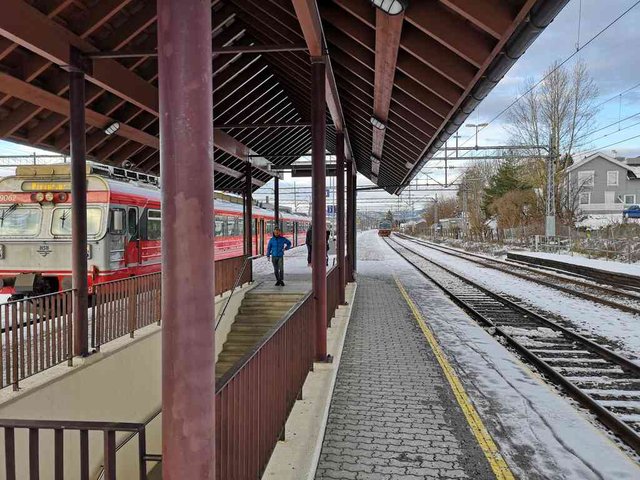
Of course, I had to google a bit on the train stations as well. So, Vestfoldbanen was established in 1881/1882 (as Grevskapsbanen or Jarlsbergbanen), it was originally narrow-gauge (converted to standard gauge in 1949 and electrified in 1957). Originally the tracks ended at a station very centrally located right by Bryggevannet. Then another line was built, Bratsbergbanen in 1916. One of the main purposes of this line was to connect factories of Norsk Hydro at Rjukan with the harbour at Menstad/Borgestad (between Skien and Porsgrunn). This was a standard-gauge line, and they established a new railroad station Skien N (N for new) at the current location. Between Skien N and Menstad the track consisted of three rails, so both narrow-gauge and standard-gauge trains could use the rails. Skien N was used as the end-line of Vestfoldbanen between 1917 and 1927 - due to public pressure, the old station was again reopened and used for passenger traffic until it was permanently shut down in 1963 (I haven't been able to find out why).
While Skien is the end-stop of Vestfoldbanen (going from Oslo ... or, today it's R11 going through Oslo), there is also another more local line here, going between Porsgrunn and Notodden. The trains were meeting here as I came to the station, the T69 to the left has stopped at the station and should continue to Porsgrunn, the T70 to the right has just left the station and is heading for Notodden.
position: geo:59.219512,9.603617 (geohack) - 2018-12-10 13:51:28 localtime - full quality
View towards Porsgrunn
position: geo:59.218921,9.604007 (geohack) - 2018-12-10 13:52:07 localtime - full quality
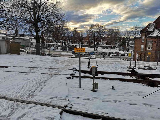
Illegal to cross the tracks ... but definitively quite easy and faster than going through the station. It's quite strict in Norway, and most places there would be quite much more fences stopping people from just crossing the tracks.
position: geo:59.218837,9.604021 (geohack) - 2018-12-10 13:52:17 localtime - full quality
Selected photos available in original quality on IPFS QmcfE9mbGEqrnZnXpFnK5zo4m5FPpkSSW2LWooLo1nriGK. All photos taken available in original quality on IPFS QmaHNDwPDVn7SUFRDw27xvjFZdkCZwgRv21QT71AcVALtb. The CC BY-SA 4.0 license applies on both my photos and the article
Don't be afraid to criticize my posts. I will give a 100% upvote to any (unique) reply pointing out typos, grammar mistakes or mistakes in the facts presented. This applies to any post or comment from me, no matter how old. I also usually give upvotes to opposing points of view, particularly when a good and logically valid argument is given.
It's nice to see my childhood city make its debut on the Steem blockchain! I don't think anyone has blogged about Skien before. As for the power station; you are correct. The yellow building on your third photo from the top is Eider kraftverk. There also another power station a few hundred meters away, called Kosterfoss kraftverk.
Anyway, it was nice to be able to see your thoughts on first time in Skien :) Let me know if you need any "inside knowledge" about the city. I'm not an expert in local history, but I lived there for the first twenty years of my live, so I know my way around a lot of it anyway.
Best regards from @valth
I was incorrect, as it (as I read that wikipedia article) has always been an electric power station and never a grain mill.
The huge building right next to it is the grain mill. It is called Skiens Aktiemølle, but I don't think it is operational anymore.
So the mill was driven directly by the hydro power earlier, then they electrified it.
http://www.skiensaktiemolle.no/wp-content/uploads/mollehistorikk-05.04.2018.pdf
I'm not sure I understood the end. Does it mean the old shareholder company is disbanded, but the mill is still operating under another owner? Or is there another mill in Skien that is still operating?
Congratulations, Your Post Has Been Added To The Steemit Worldmap!
Author link: http://steemitworldmap.com?author=tobixen
Post link: http://steemitworldmap.com?post=walkwithme-skien-from-bryggevannet-to-the-train-station
Want to have your post on the map too?
Dear @tobixen,
Thank you for the submission for our project – 1001 Places to Remember. Hooray, your story is now listed in our project publication, you can check through our progressive report either from our @fundition project page or @archisteem account. We will be sorting out the seasonal shortlist authors and make an announcement soon for the seasonal reward.
Stay tuned and Steem on!
@archisteem and team
Thanks for taking us on a tour there :)
Posted using Partiko Android
Hi @tobixen!
Your post was upvoted by @steem-ua, new Steem dApp, using UserAuthority for algorithmic post curation!
Your UA account score is currently 3.915 which ranks you at #4024 across all Steem accounts.
Your rank has dropped 6 places in the last three days (old rank 4018).
In our last Algorithmic Curation Round, consisting of 253 contributions, your post is ranked at #110.
Evaluation of your UA score:
Feel free to join our @steem-ua Discord server