Walk with me. A circular walk around Noss Mayo, South West England.
I think I might have blogged about Noss Mayo before but if I did it was a while ago and I definitely didn't use the #walkwithme tag or a route map, so here goes.
I was sitting at my desk last Thursday staring out at a clear blue sky (well as blue as they get now on our geoengineered planet) and decided I would take an impromptu half day off work so I could walk around Noss Mayo with my girlfriend. We haven't been for a decent walk for at least a month, so what better way to get back into our walking routine and rid ourselves of the winter blues than with a nice coastal walk.
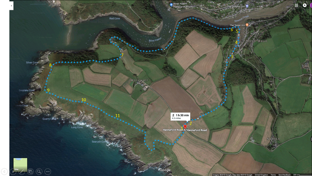
This Noss Mayo circular walk is 4.3 miles long and starts off at Warren Car park where you can either walk in a clockwise direction which means starting off walking along the coastal path before heading down into Noss Mayo, or you can walk anti-clockwise which takes you down a steep hill into Noss Mayo before coming back up to the coastal path and back to the carpark. From personal experience, I would recommend the anti-clockwise route because the hill back up to the car park at the end of the clockwise route is an absolute killer and it's so much easier heading down at the start of the walk rather than up at the end.
Here's a photo of the entrance to Warren car park. (Marked number 1 on the route map). It's a small car park but it's free!

Head to the entrance to the car park and turn left then take the next right down Hanniford Road. Here's a photo looking down Hannaford Road towards Noss Mayo. (2 on the map). It's more of a path than a road to be honest.

When you get to the bottom of Hanniford Road you come to the tennis courts (marked 3 on the map)

It's a short walk from the tennis courts before you enter Noss Mayo itself. For some reason, I didn't take a picture of the quaint little church but did take a few pics looking over the harbour between points 4 and 5 on the map.


As you head out of Noss Mayo the path goes left and you enter 'Passage Wood' (6 on the map) for the slight uphill walk to the headlands. Here's a pic of the Passage Wood info signs for people who might be interested.

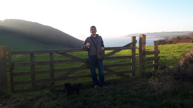
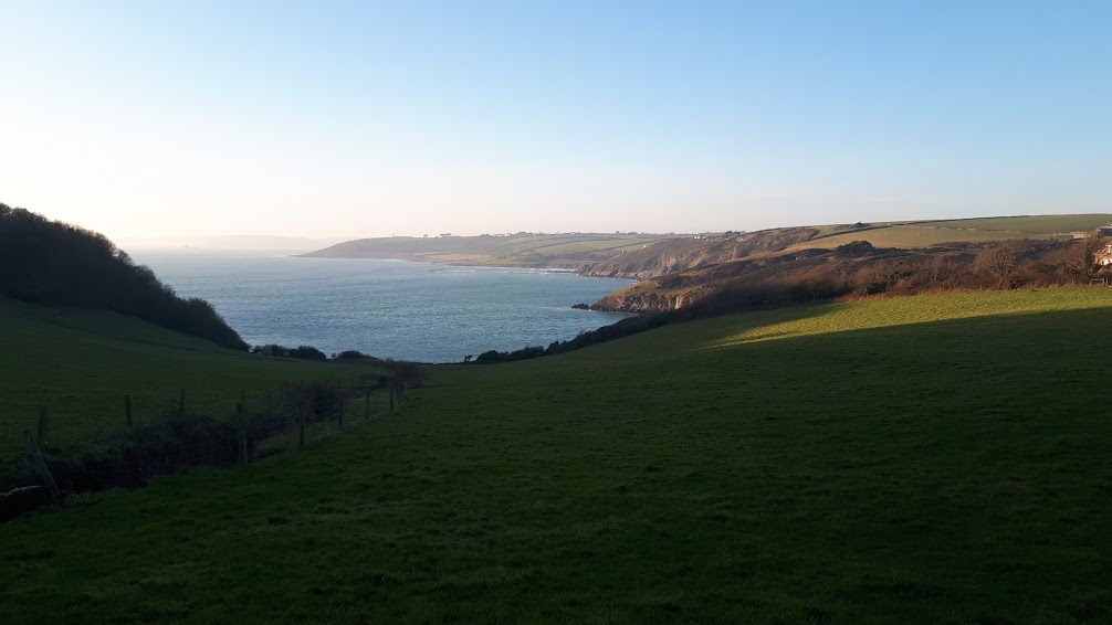
It's a lovely walk through the woods overlooking the River Yealm and as you near the top you pass some holiday cottages with great views. Here's a photo of me and Ted at a place (7 on map) we sometimes stop for a picnic when we have the kids with us (we climb the gate into the field).
And another with a better view.
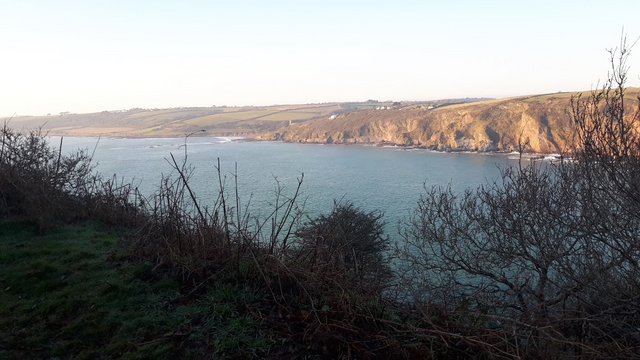
As you reach the end of the Passage Wood you reach the clifftops. The picture below was taken at point 8 on the map
As you round the corner to Quarry Cove things start to look a bit more rugged.

Point 9
There are gorse bushes everywhere and at certain times of the year, they burn them (deliberately). It's quite a cool thing to see, especially as it gets dark.
Here's a view looking down at the see with the gorse bushes in the foreground.

Point 10
My phone is particularly bad at taking photos of the sky and sun but this one turned out ok I thought.

Point 11.
It's a relatively short walk from point 11 before you are back at Warren Car Park where you started.
That's it.
Happy Walking !!!!
That was sooooooooo beautiful Jim!!! xoxoxooxxo Excellent captures on your phone! My personal favourite...
Thanks Lynds. I was hoping you'd read it since it was you who made me aware of the #walkwithme tag. Glad you enjoyed it. I plan on doing more as the days get longer & the weather better. Bring on the spring/summer!!!
If Monet had had a camera ....These are beautiful!
Thanks.
You have received an upvote from STAX. Thanks for being a member of the #steemsilvergold community and opting in (if you wish to be removed please follow the link). Please continue to support each other in this great community. To learn more about the #steemsilvergold community and STAX, check this out.