Big Sur: National Forest Administration Site and Brazil Ranch
Background
It seems my obsession with that National Forest land near Bixby Bridge in Big Sur is not yet over. According to my previous conversation with the Monterey Ranger District Office, there are no officially sanctioned dispersed camping opportunities in northern Big Sur, including that area. Although not ideal, maybe there are some "unofficial" opportunities there, or areas where you could stealth camp and not get caught. I plan on taking a drive down Coast Rd from Bixby Bridge to check it out sometime, but today I had some different goals.
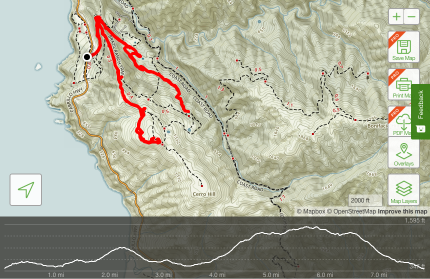
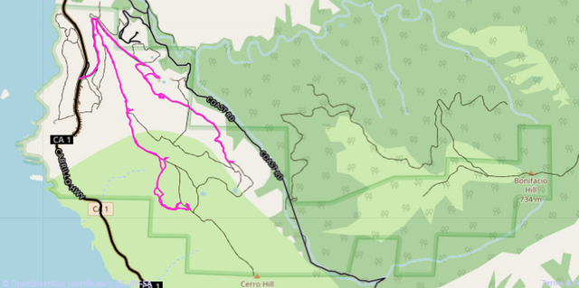
I was told the area of National Forest I was looking at was administrative, but I came across some more complete information. While part of it is an administrative site, another part is open for hiking. According to The Treadmill, that area was actually being considered for development and the community fought back. The land was purchased in 2002 by the Trust of Public Land and others. The US Forest service was then given responsibility of managing the land for public use. Much of the area contained in that section of land is known as Brazil Ranch. There are hiking trails and the US Forest Service provides guided hikes on Saturdays, although anyone can hike at any time. According to the literature, there is a barn and guest house that are shown as part of the hikes. I wanted to see if I could find those and if I could make it down to Coast Rd by hiking through the administrative site. After that, I planned to hike up through Brazil Ranch. Here are some maps showing where I ended up exploring. The first map shows my GPS data in AllTrails. The second map shows my GPS data in OpenStreetMap with a darker green blocky border showing the National Forest land boundary. The GPS path closer to Coast Rd goes through the administrative site and the other path goes up into Brazil Ranch.
Trailhead
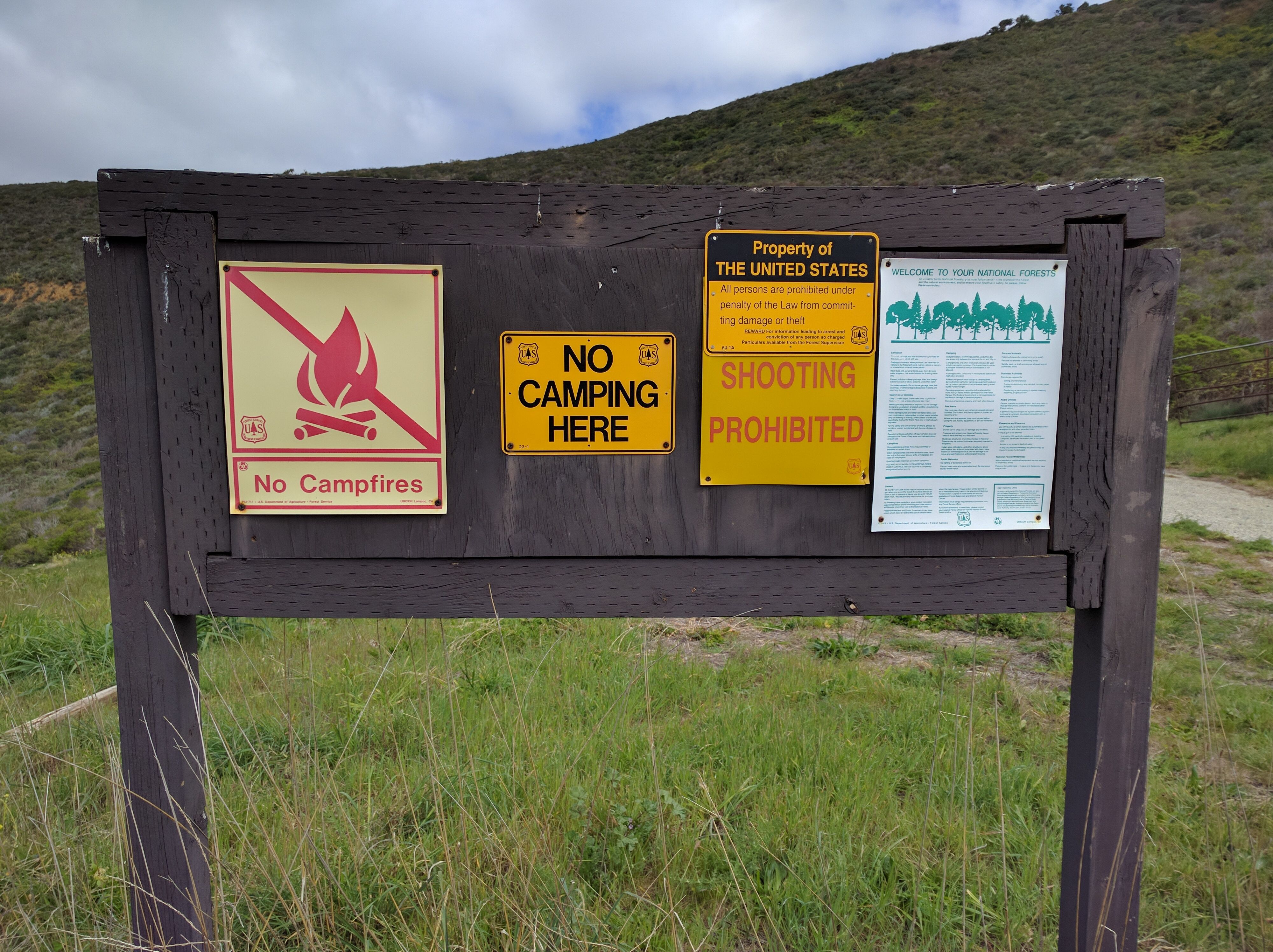
When I arrived at the trailhead off of Hwy 1, I found a sign that said no camping, I guess I shouldn't be surprised at this point.
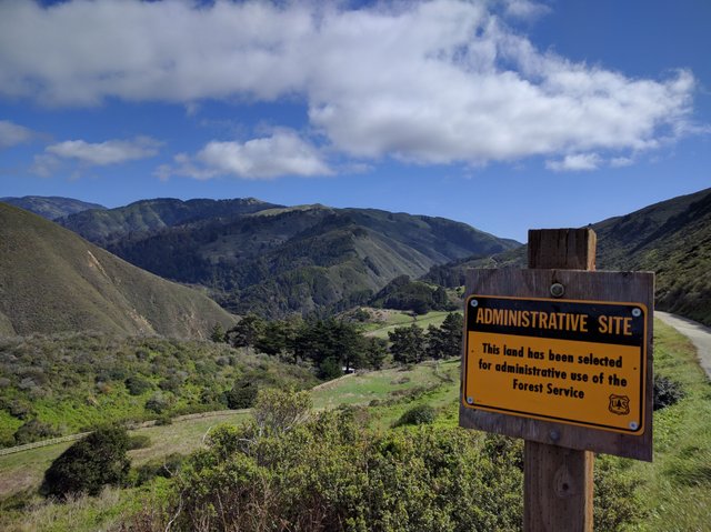
Everything from this point on is walking, as the road is gated off. I walked up the road and entered the National Forest Administrative Site.
Administrative Site
As I continued into the administrative site, I came across a section of road that had collapsed.
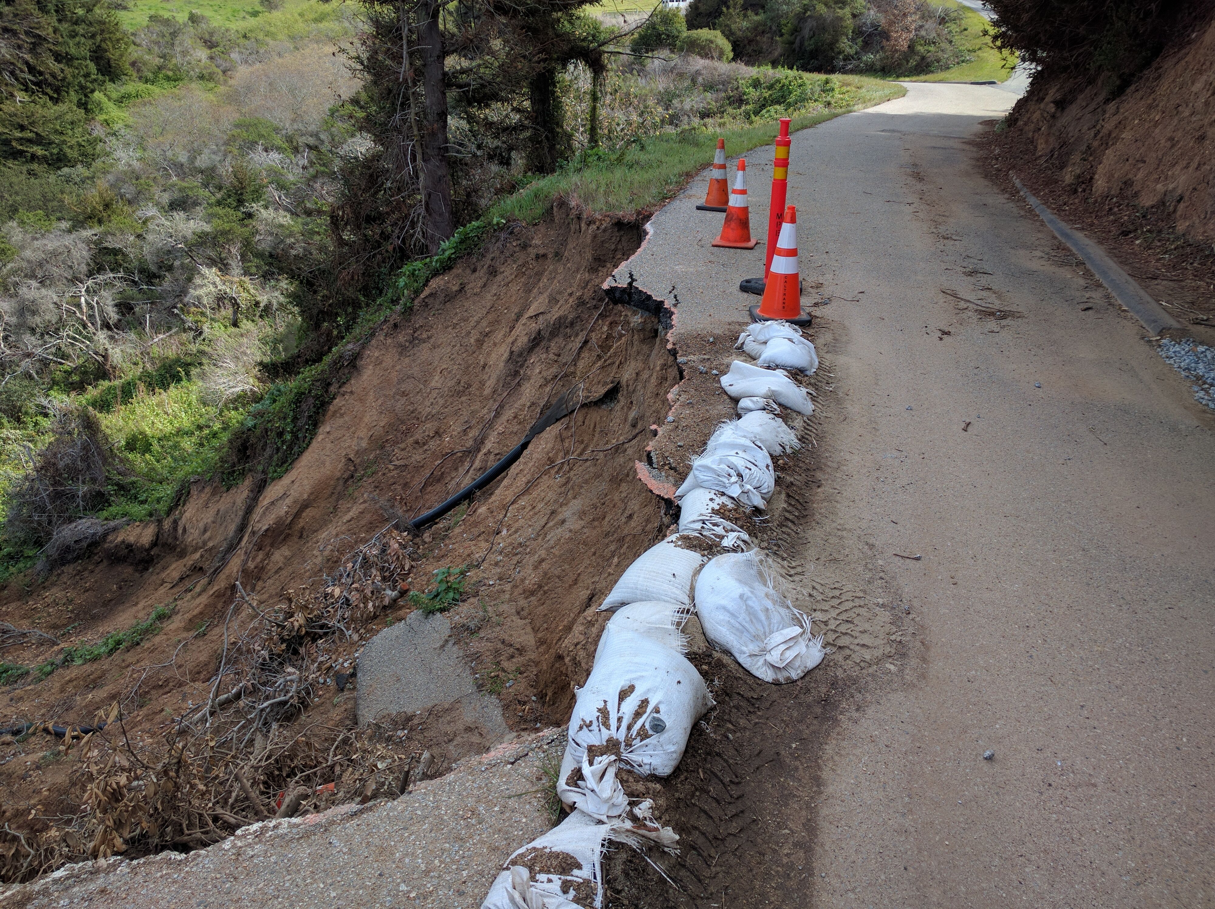
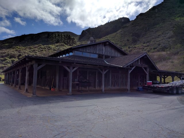
The general public can't drive in here anyway without the National Forest service opening the gate, but that section of road would make it a bit precarious. I eventually found the barn I was looking for. Looks like it might be in active use, but I didn't see anyone directly around it.
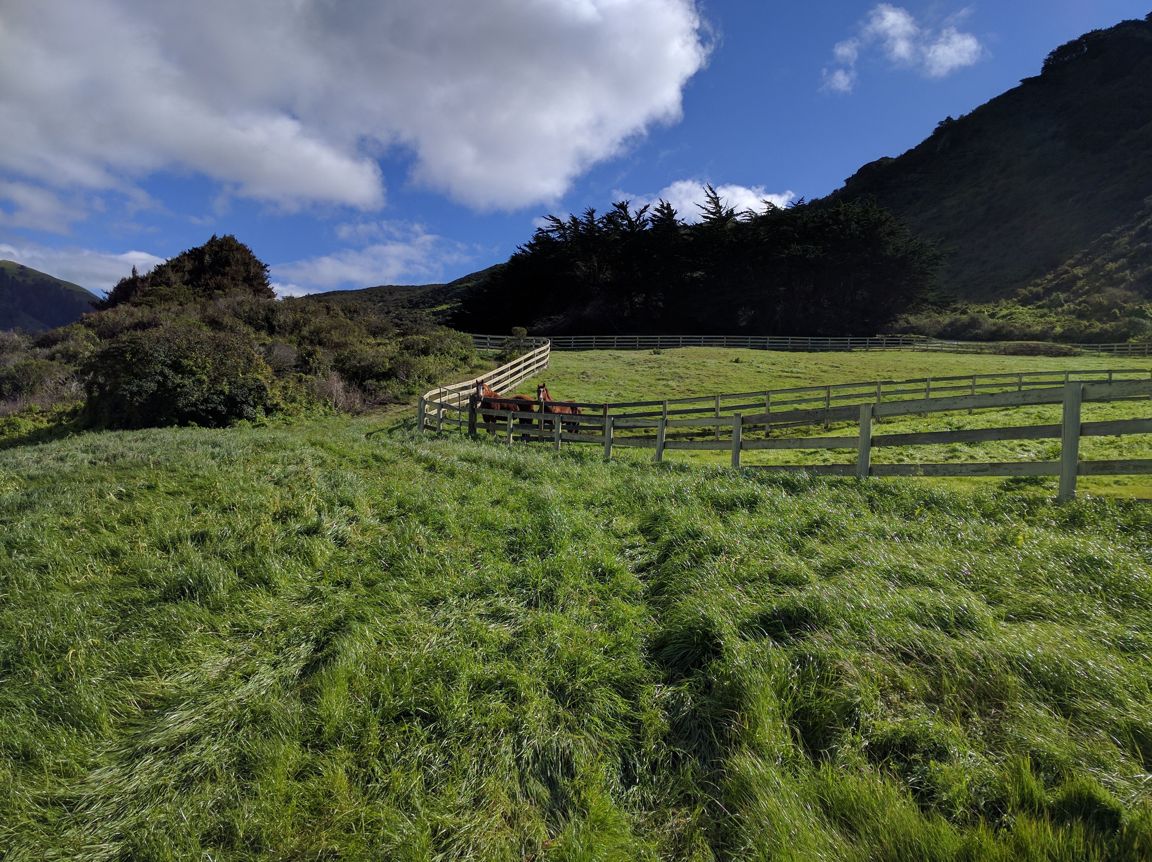
As I continued on, I came across some horses. They seemed interested in my presence.
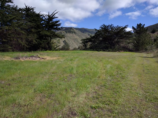
After passing the horses, there was an open meadow with a fire pit and wood that would make an excellent spot to camp. Unfortunately, getting a vehicle up here is not possible due to the gates blocking the road at Hwy 1. Also, someone would probably notice you as they probably use it.
Shortly after the meadow, I reached the guest house. No one was around the area and the guest house was not open. I could see two made up beds through the windows. I'm not sure how often it is used and for what? In any case, it would be a really nice spot to stay.
I wanted to hike down near Coast Rd from here to see if I could find any pull offs from the road that could be used for stealth camping. However, to get down there I would have had to go by a building with vehicles present and activity as shown below.
Since I don't really think I was supposed to be wondering around in the area, I decided not to do that. I continued along the road for a bit but I was coming across increasing amounts of scat and some fresh paw prints. I'm not sure if they were mountain lion or something else, but it was some kind of wild animal as there was a lot of hair in the scat. I didn't have anything for self defense and was feeling a bit uneasy so I turned around to head back to the main trail entrance to Brazil Ranch.
Brazil Ranch
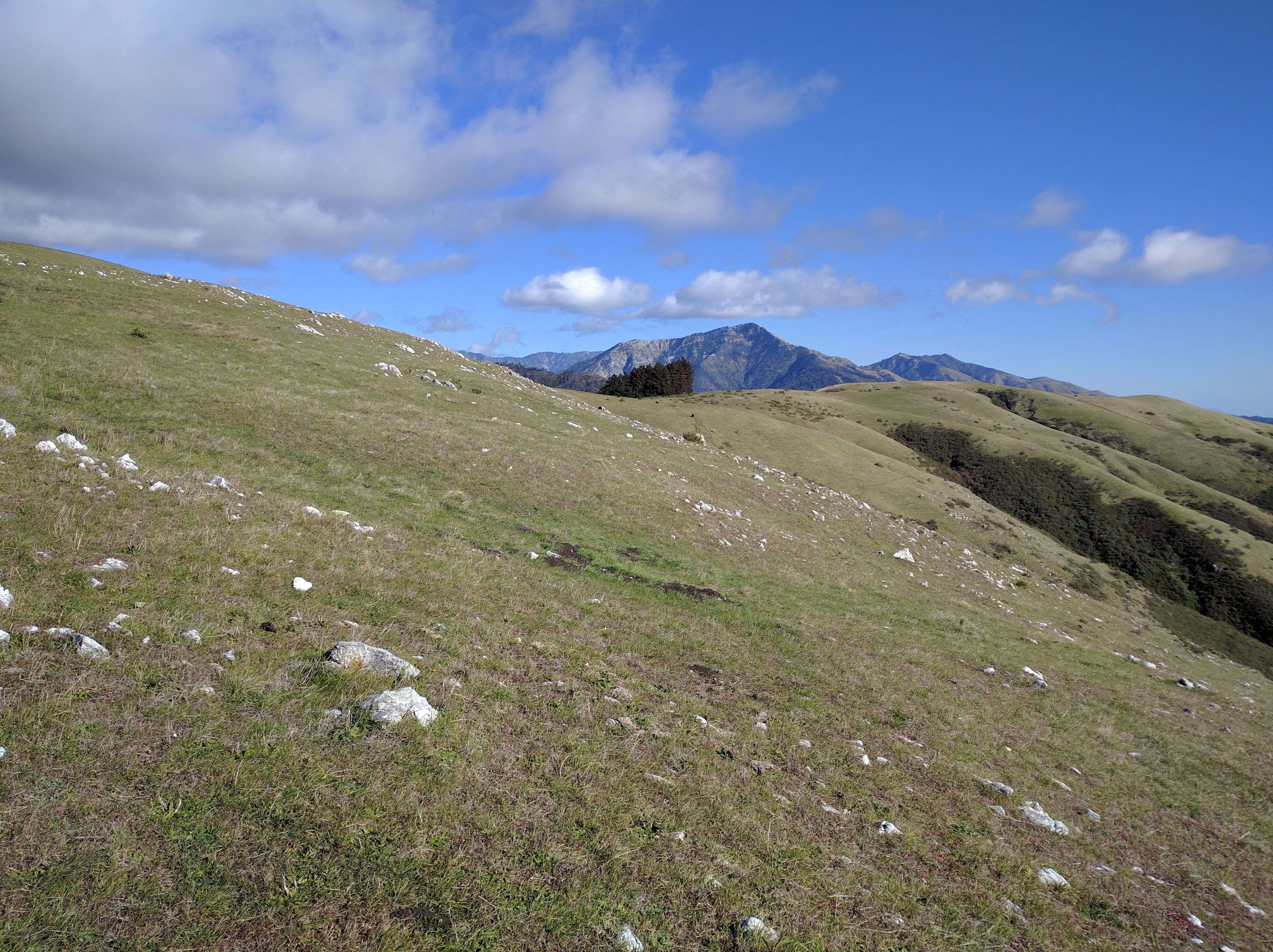
The Brazil Ranch trail got straight to the point. It was a constant uphill grind with no relief until near the top. I sweat my ass off getting up it. Near the top of the first part, I came across a chained up gate which I thought was odd. It wasn't locked so I unchained it, went through, and re-chained it. Finally, the trailed flattened out temporarily in a meadow. Below is my attempt at a panoramic shot from the meadow.
I continued on from the meadow and it was about this time that I just couldn't stop saying wow every couple seconds. It was just so beautiful. I was now in a gigantic cow pasture and it was all wide open, no trail you had to stay on.
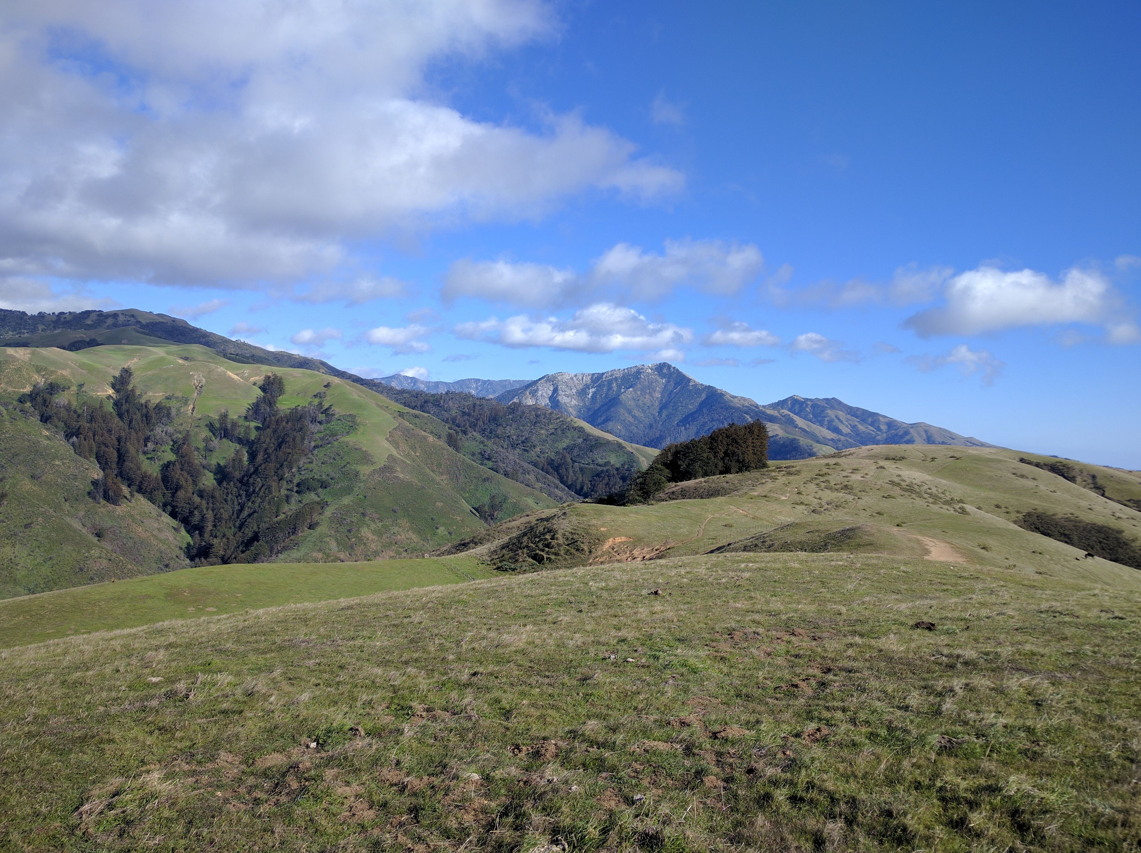
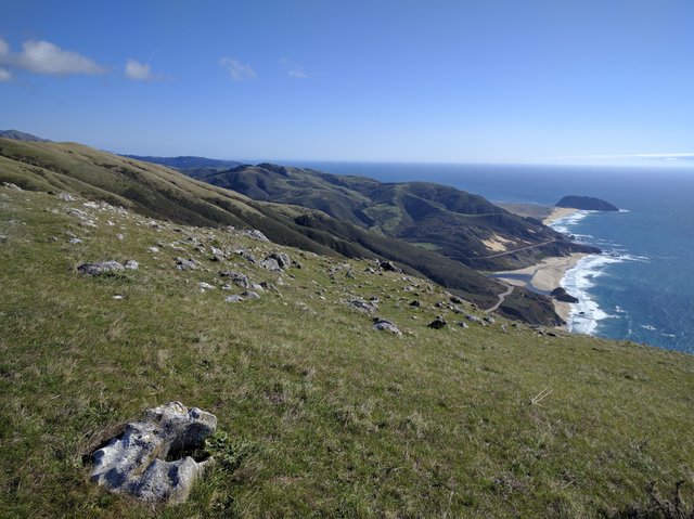
Everywhere you looked was beautiful. The mountain in the distance. The small scattered boulders. The ocean. The cows. Everything.
I loved hanging out with the cows. I gave them space as I didn't want to bother them. They would notice me and watch me. One was a little skittish and took off. But mostly, they were unfazed.
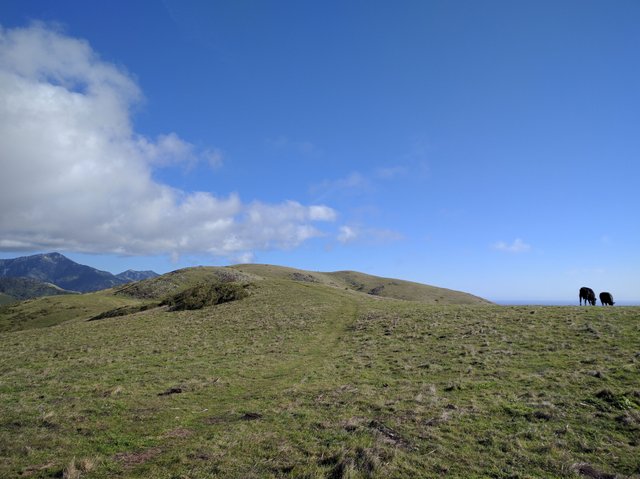
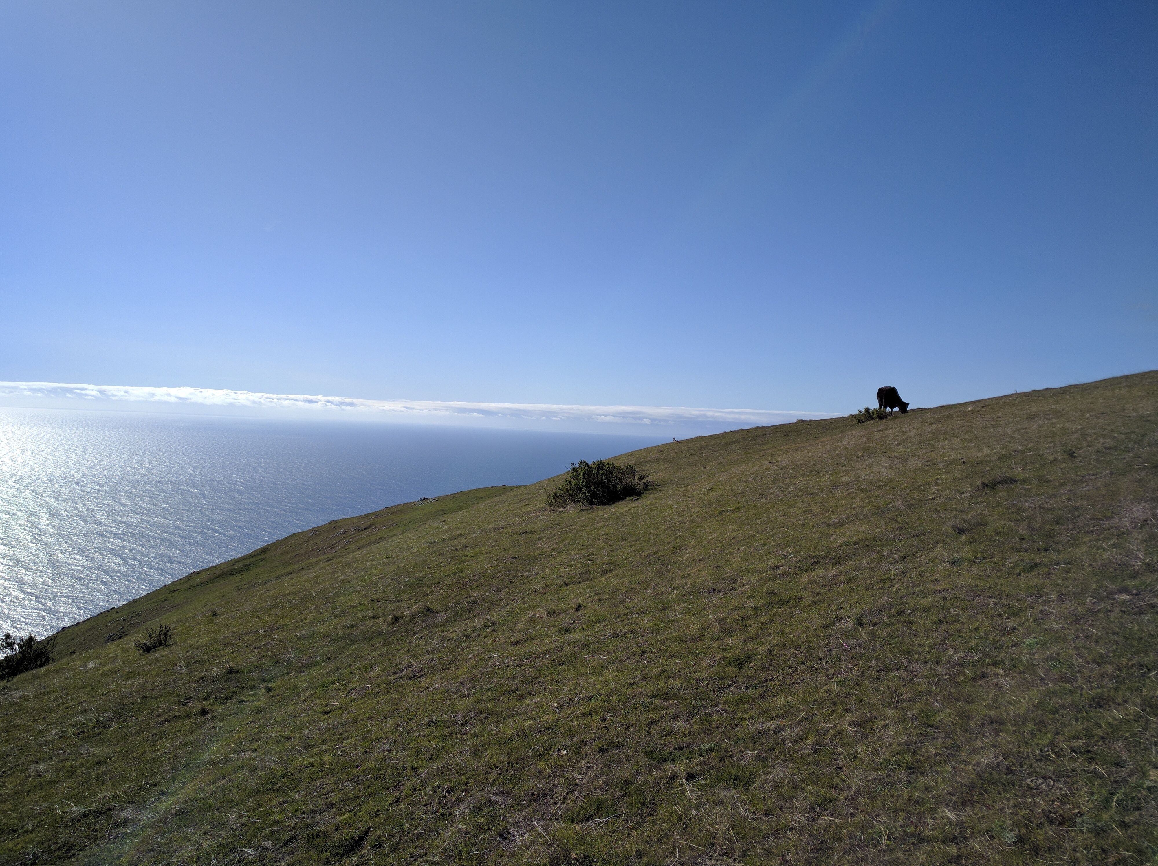
This cow was on top of the world, as was I.
Conclusion
Brazil Ranch is now on the top of my list for Big Sur spots I've been to. I wasn't able to make it all the way to Cerro Hill as the sun was going down and I had to get out before dark. I definitely want to go back and make it to Cerro Hill as well as explore the area further. I didn't see a single person while I was hiking up there, just a lot of cows. Now that's my kind of hike!
Congratulations! Your high quality travel content caught our attention and earned you a reward, in form of an upvote and resteem. Your work really stands out. Your article now has a chance to get curated and featured under the appropriate daily topic of our Travelfeed blog. Thank you for using #travelfeed
Too bad I left Cali. Big Sur is one of my playgrounds. I didn't get to explore it much before moving to the Pacific Northwest due to the massive landslide on the Pacific Coast Highway.
Ya, I'll be leaving soon so I'm trying to get in as much as I can before that. Where did you move to? I'm planning to head up through Oregon and Washington this summer.
Congratulations, you were selected for a random upvote! Follow @resteemy and upvote this post to increase your chance of being upvoted again!
Read more about @resteemy here.
California! You're gonna have ta develop your sneakiness. More important, you'll have to overcome that little boy inside sayin, "Oooooh! You're gonna get in trouble!"
Dude, check out this contest. Might get ya some extra scratch.
Haha, ya. I already do that everyday since I'm not supposed to be in any of the places I overnight. I will have to go through it again for new places though. I saw you write about that somewhere, usually taking a day or two to get comfortable with a spot.