Toter Berg ("dead mountain") - a mountain that's actually not dead!
"Toter Berg" can be translated as "dead mountain". It is a mountain 454 meters above sea level near Rossatzbach in Wachau Valley in Lower Austria.
Rossatzbach is a little bit more than 200 meters above sea level so you have to cover a height difference of almost 250 meters!
This mountain is rather unknown and many people do not know it. When I walked up this mountain I didn't see any signpost naming this mountain. Still, it is not very hard to find the way up. I recommend using a Smartphone app like Bergfex as help or buy a hiking map of Wachau Valley. On my weblog schmatz.cc you can find a detailled map as well. Google Maps, which is great when you plan your car trips, but it is currently (November 2019) definitely not the best option concerning hiking paths!
When you come from Mautern, your starting point will be on the left side of the street, about 100 meters before the beginning of the village "Rossatzbach".
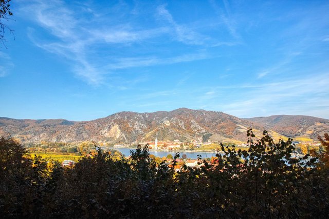
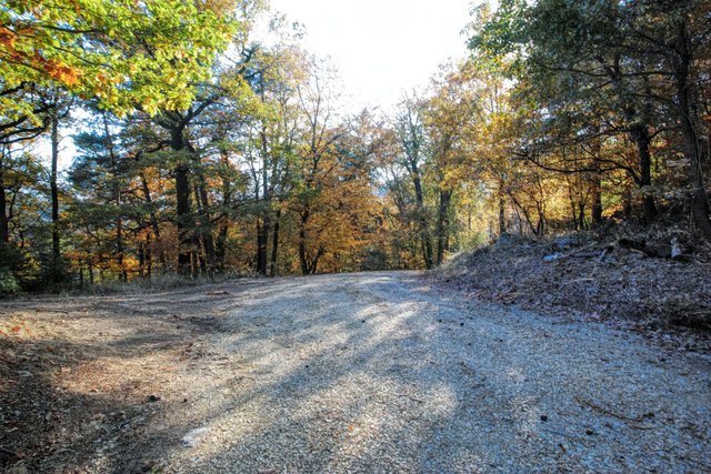
You have to walk up a steep "Holzweg" (broad enough for tractors or trucks transporting wood) in south-western direction. After about hundred meters you can already enjoy a beautiful view on the small town of Dürnstein, probably the best known but also most crowded tourist spot in Wachau Valley.
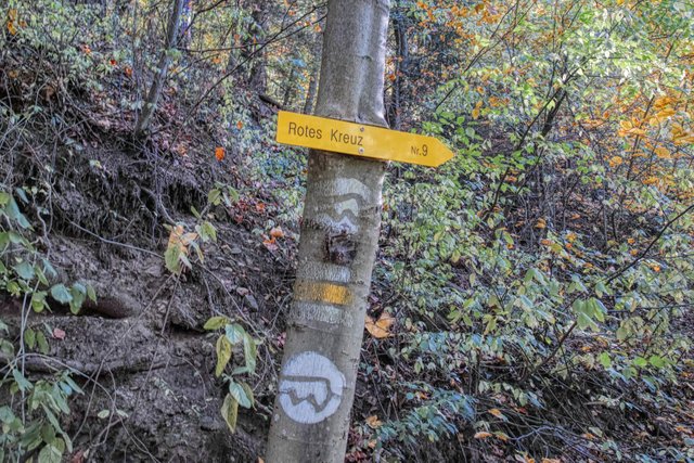
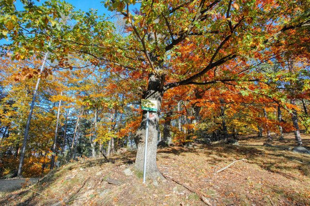
After approximately 15 minutes of walking your way crosses a way called "Rossatzer Panoramaweg". You can still follow your way or turn left and take a steep and narrow abbrevation that is marked with the "Welterbesteig"-Logo - a white circle with a symbolic wave above the letter "W".
Ten minutes later you'll be back on the broader "Holzweg" and follow this way in the left (Eastern) direction.
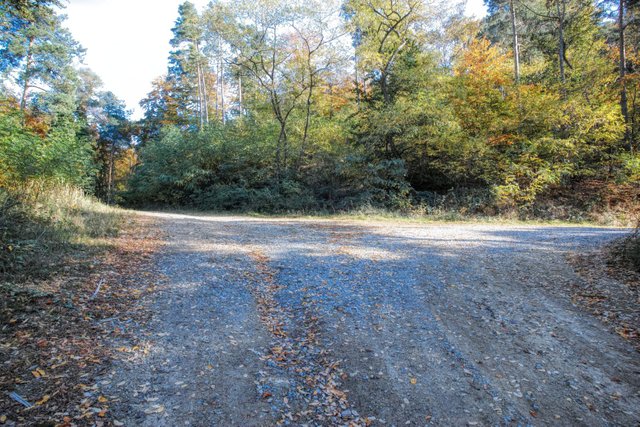
Again ten minutes later the way will split. The way on the right direction would lead to a mountain called "Pemexel". For this mountain, you also find a signpost. But now you'll walk straight ahead on a way that is a little bit narrower and not graveled. The way is now more or less flat!
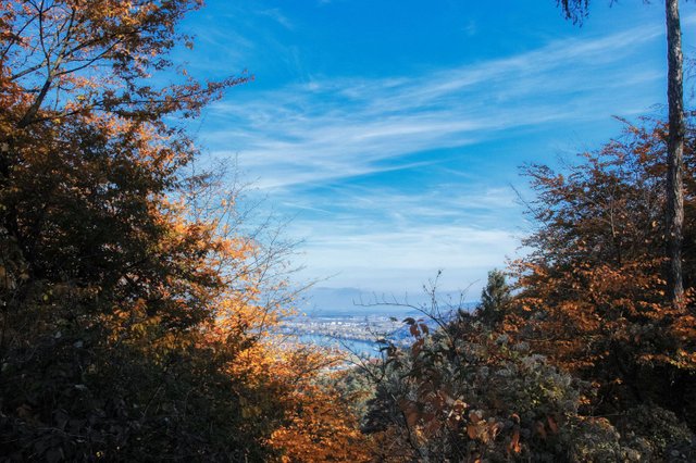
Sometimes you can see the Danube between the trees. The way will now become steeper and windy.
Take care when you reach the highest elevation of the way! Do not walk downwards! You now have to turn sharp left!
A sign tells you that this is a nature protection area. Do not worry! This does not mean that it is forbidden to walk in this area! Unfortunately the rules only exist in German. In short: Be quiet, do not light a fire, do not pick plants or cut trees, do not touch animals or eggs! Or even shorter: Leave this place the way you found it!
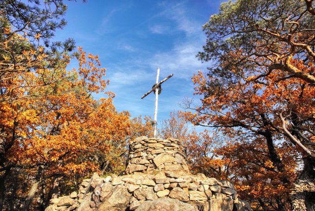
After five minutes you will reach the summit. It is marked with a cross made of birch branches.
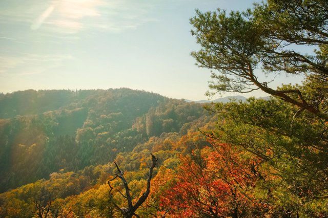
As the summit is in the middle of a protected forest you won't see much more than trees when you look down.
Maybe that's the reason why this mountain is not that well-known and not that popular. Still, it is a very nice hike, especially in autumn when the leaves are red and yellow.
For the way up you'll need approximately 1 hour in total.
A detailled German description including a map can be found on my weblog schmatz.blog!
View this post on TravelFeed for the best experience.
Congratulations, Your Post Has Been Added To The Steemit Worldmap!
Author link: http://steemitworldmap.com?author=schmatz
Post link: http://steemitworldmap.com?post=toter-berg-dead-mountain-a-mountain-that-s-actually-not-dead
Want to have your post on the map too?
Hiya, @LivingUKTaiwan here, just swinging by to let you know that this post made into our Top 3 in Daily Travel Digest #680.

Your post has been manually curated by the @steemitworldmap team. If you like what we're doing, please drop by to check out all the rest of today's great posts and consider upvoting and supporting us.