Journey to the Aral Sea. Part 3. Ustyurt plateau.
Hello, this is the third part of my story about the journey to the Aral Sea, which I made in September 2018. The first part was devoted to Sudoch'e Lake, the second part directly to our stay on the Aral Sea coast, and in the third part I will tell you about the Ustyurt Plateau.
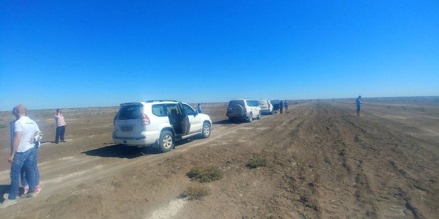
After admiring the sea, we loaded into our SUV and went on a many hours journey on the Ustyurt plateau.
The plateau occupies an area of more than 200 thousand square kilometers and is located on the territory of three countries - Kazakhstan, Uzbekistan and Turkmenistan. On satellite photos, this is a huge desert that lies between the Aral Sea and the Amu-Darya River.
Previously, on the territory of the plateau were carried out the tests of both chemical and nuclear weapons. Underground nuclear explosions were carried out in the territory belonging to Kazakhstan.
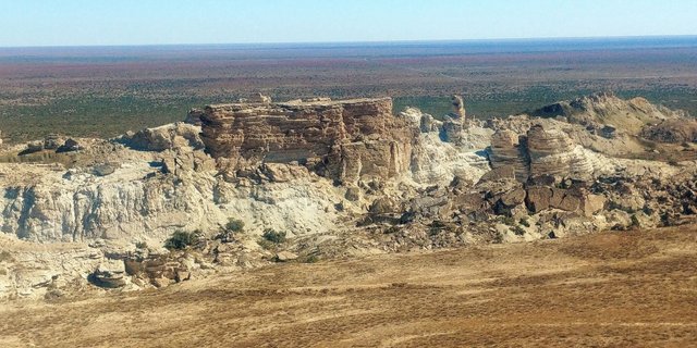
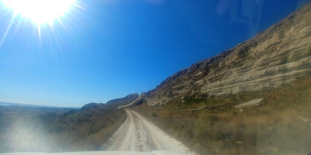
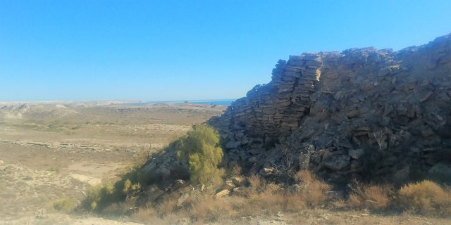
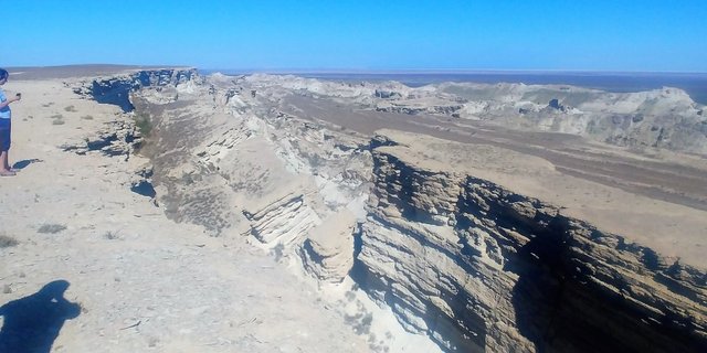
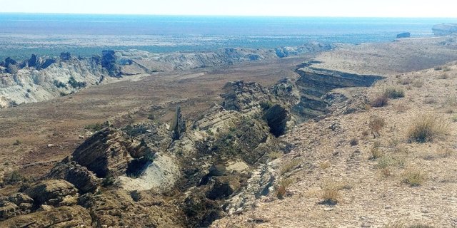
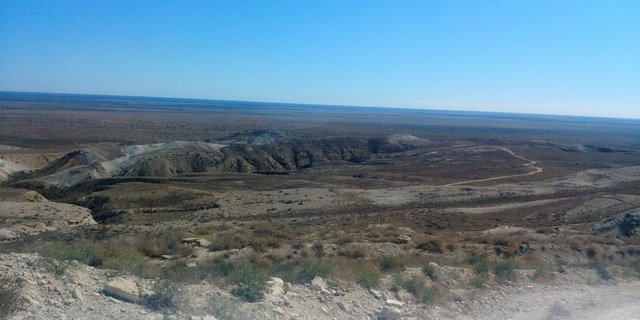
Once the coast of the plateau washed the ancient sea. In the photo below you can see that the road goes along the natural wall. In fact, we drove along the bottom of the dried sea and the wall on the right is the former seashore. This wall is called the "chink" - the steep edge of the plateau, when it was the seashore. It consists of many layers consisting of limestone and chalk. Among them are fossilized remains of marine sediments. Below there are photos where there are multicolored pillars of chink.
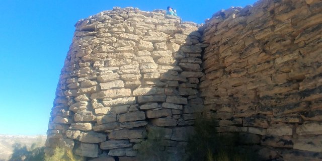
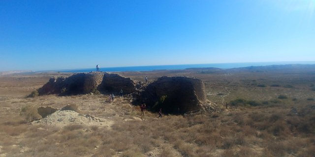
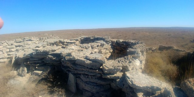
But we will get to them. In the meantime, we went to see the ruins of an ancient caravanserai built in the XI-XIII centuries. Trade routes of the Great Silk Road passed here beforea and there were ancient settlements but the Amu Darya changed its course and people left these places. In general, this part is little studied by archaeologists. We can say that they have just begun to explore these places.
According to our drivers, we were brought to the ruins of an old caravanserai, but it is quite possible that it was a fortress or the house of some wealthy merchant who preferred to live on “first line by the sea”. As seen in the photographs, the walls of the building are very thick, made of flat stones.
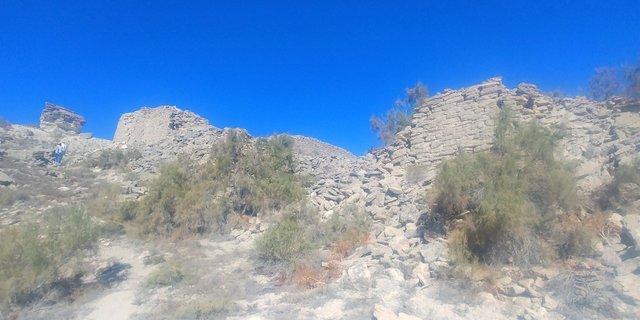
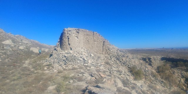
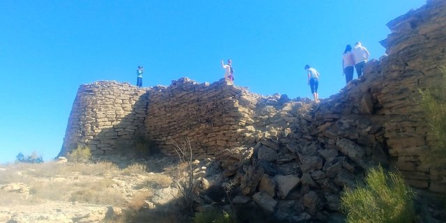
On the sides are pretty powerful towers.
Unfortunately, I don’t always remember what the guides say as I often find myself fascinated by photographing the sights and often miss their words. In the case of famous historical sites like Samarkand or Bukhara this is not a problem. In those cases I can google the information. But here there was a difficulty - there is very little information on the sights of the Aral Sea and the one that is not very informative. We have to strain our memory and remember what the drivers told us. But nothing, little by little, our historians and archaeologists will get to these places.
After the caravanserai we drove to the canyon, visiting the old cemetery on the way.
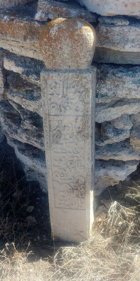
This is an old and abandoned cemetery of the XIV-XV centuries, and if I am not mistaken it is Kazakh cemetery.
After that we went to the side of the canyon. The terrain was flat as a table and the drivers managed to accelerate to 100 km / h. So, we quickly reached the canyon. Got out and were stunned ....
The harsh and majestic beauty of this place is difficult to describe in words. And the possibilities of my camera also can not reflect it fully. Here you have to go live, stand on the edge of the plateau, breathe the air and feel the aura of this place.
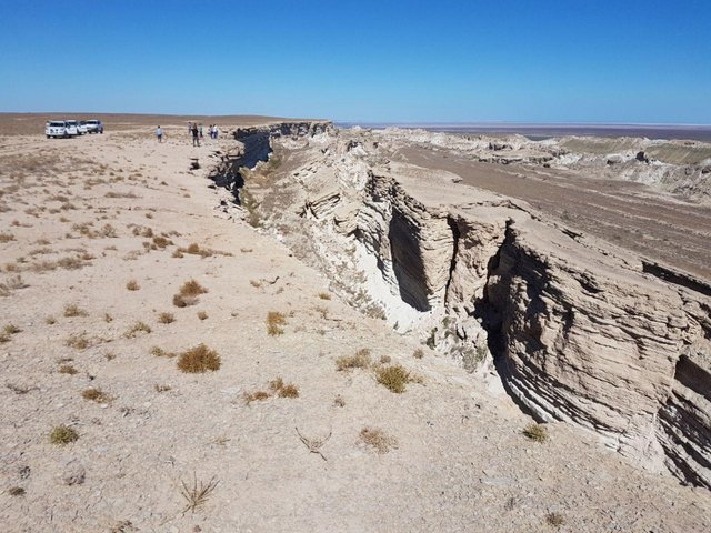
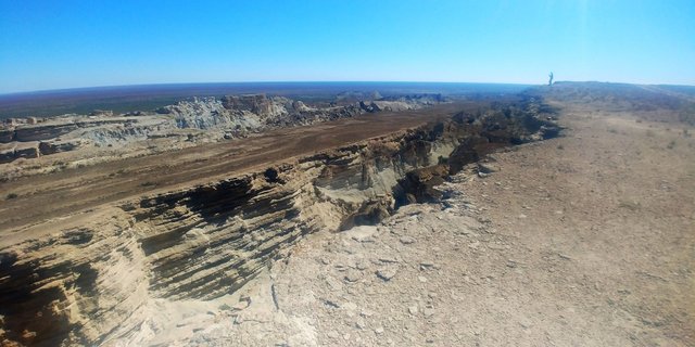
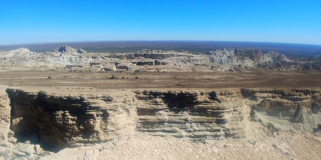
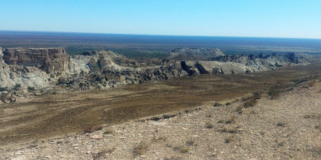
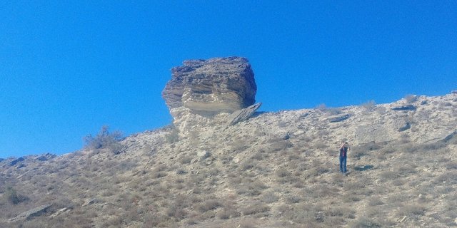
Here, strong winds constantly blow, cutting out amazing pillars and towers from a chink.
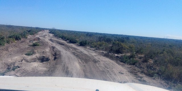
I do not know how many time we spent here, but iwe were forced to move on. We again descended from the plateau to the bottom of the former sea and went to the city of Muynak in order to see the ship graveyard.
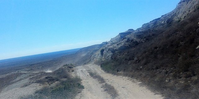
On the way, we stopped a couple of times to take photos.
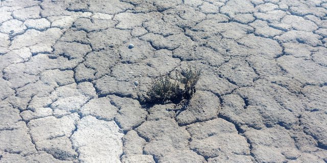
The vegetation here is not the most diverse, but tenacious. It breaks through the dried and salty soil.
Soon the smooth road was replaced by such bumps, and we significantly slowed down our speed.
Closer to dinner, we got to Muynak. After a delicious lunch in a private house, we went to the ship graveyard, which is located on the outskirts of the city. My next photo report will be about this place.

!steemitworldmap 44.163935 lat 58.797822 long Journey to the Aral Sea. Part 3. Ustyurt plateau. d3scr
Such a great trip it was and i could see you did quite a lot to even get to this third phase. Awesome scenes wealth to watch all day.
Thank you! I'm preparing the forth part of my photo-report about ship graveyard in the desert. Hope it will be interesting for you!
Congratulations, Your Post Has Been Added To The Steemit Worldmap!
Author link: http://steemitworldmap.com?author=damm-steemit
Post link: http://steemitworldmap.com?post=journey-to-the-aral-sea-part-3-ustyurt-plateau
Want to have your post on the map too?
Hi damm-steemit,
Visit curiesteem.com or join the Curie Discord community to learn more.
Out of many travel stories came across in steemt, I think these (Kazakhstan, Uzbekistan and Turkmenistan) in your blog were missing and happy to see a travelogue on it. 200 thousand square kilometers , and the area is using for nuclear tests is really makes an interesting read though.
Vegetation was also there? Photographs looks great. Na overall I enjoyed your journey through this place
Thank you very much! Yes, there is vegetation there but there is very little of it. Just a few types. Mostly saxaul grows there
Congratulations @damm-steemit! You have completed the following achievement on the Steem blockchain and have been rewarded with new badge(s) :
You can view your badges on your Steem Board and compare to others on the Steem Ranking
If you no longer want to receive notifications, reply to this comment with the word
STOPVote for @Steemitboard as a witness to get one more award and increased upvotes!
Hiya, @choogirl here, just swinging by to let you know that this post made into our Top 3 in Daily Travel Digest #3559.

Your post has been manually curated by the @steemitworldmap team. If you like what we're doing, please drop by to check out all the rest of today's great posts and consider upvoting and supporting us.
100 Snax tokens will be in your wallet by next Monday courtesy of @crowdmind. Learn More
it's really amazing how much beauty there can be even in the desert! you made an original journey to places where very few tourists put their eyes. Beautiful pictures!! congratulation for your curie rating :-))
Thank you very much!
What was the temperature over there? It looks HOT! :)
200 thousand square meters.. I can't even imagine how large it is :) It is all dessert or the landscape change a bit?
Those walls are very strong of they still stand there in such harsh conditions. I also find myself missing what the guide says as I'm too captured in observing the place instead of listening and then I miss the information :) I think it's normal though..
Thank you for sharing and have a good day!
Thank you! In the summer it reaches +43 - +45 degrees Celsius. In the winter -25 -30 degrees Celsius. Also there is very windy. Most part of Ustyurt plateus is a steppe.