Adventure. Solo trekking to Khao Chang Puak. The Albino Elephant Mountain. Thailand (+Drone video)
Hidden away along the Thai Burmese border lies an old mining village called Pilok. Originally built about 40 years ago its sole purpose was to accommodate miners and store mining equipment. Old dormitary style cabins can still be found along with rusty machines. The area has become a popular tourist attraction for those who dare venture the never ending single lane mountain road!
However, there is also another reason why people come to visit Pilok- Khao Chang Puak, which translates to 'The Albino Elephant Mountain'. Apparently the steep mountain cliffs and rocky ridge resemble an albino elephant! A short drone clip I filmed half way up the main ridge and peak can be watched below.
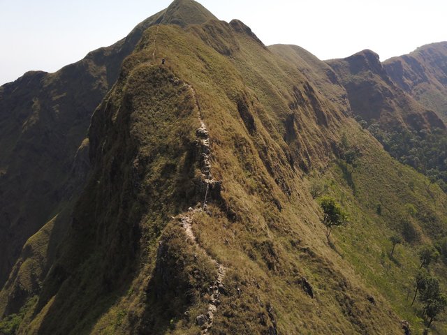
Image: DJI Mavic Pro
I understood the rules of the mountain to be only 'guidelines' and to be taken as a suggestion, albeit a strong suggestion and had heard several stories of people solo trekking during the 'closed' months.
Setting out with a pre-made Google map image-stitch labelled with rough waypoints I set off from Pilok at 6am (photos were added later after the trip).
.png)
To avoid the ranger station and official entrance that may have turned me away, I headed to the edge of town and followed a path out the back to the village trash site. A stinking stench was prominent and barking stray dogs living there made my presence known- luckily no one was about and I found the forest path behind the dump.
It was this path that bypassed the ranger station and looped round following the border until it met the main path a few hills on.
.jpg)
Confirming I was on the correct path and not wandering off into Burma, I met the expected ranger hut (used in the open season), national park sign and first view of Khao Chang Puak. I have to admit, as I approach at 6:30 I did tip toe, stepping around the crunchy leaves and fallen branches just in case there was a ranger in the hut- there wasn't and I continued.
.jpg)
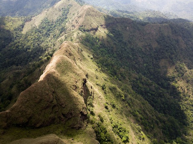
The path continued for 6.5km. It continually climbed up and over every hill before dropping down to the valley floor once again. A path that followed flat contour lines would have been much easier and by looking back over the terrain from each peak, this would have been very possible for the early stages of the trek!
.jpg)
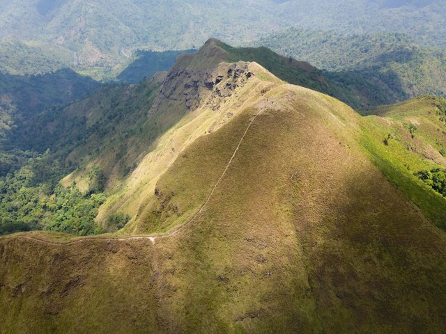
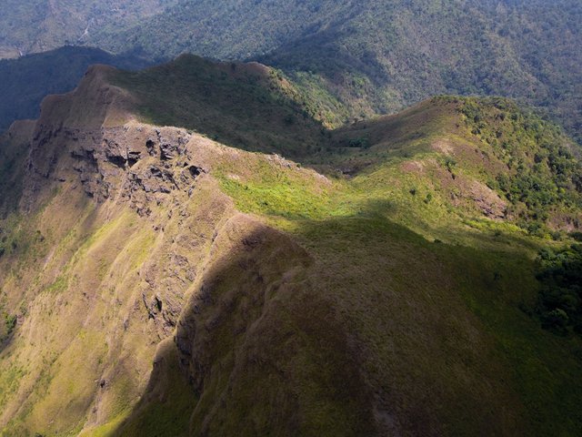
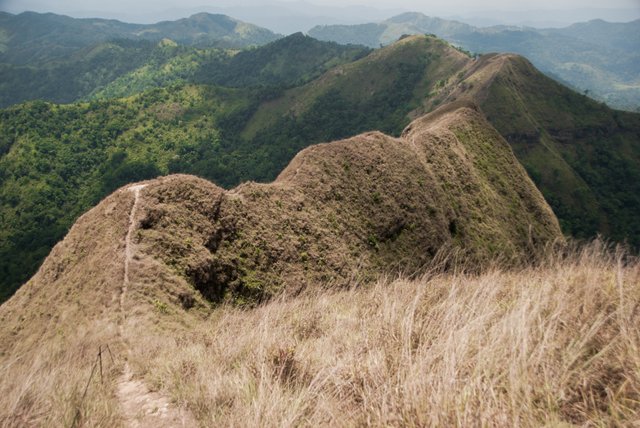
As the trail gained height and became more rocky, tree cover was swapped for grassy hillsides and fantastic views.
.jpg)
.jpg)
Looking back over the mountains I had just covered I could see Pilok in the distance. The village appears as a faint white line in the distance.
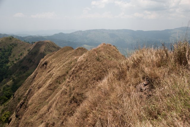
It was from here that every corner and climb gave amazing views back over Thailand (right hand side) and out towards Burma (left hand side).
%20(1).jpg)
.jpg)
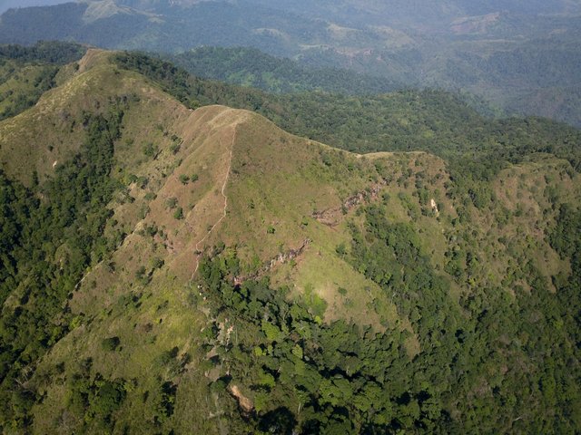
Walking through the national park, the mountains and hills were alive. Sounds in every direction could be heard, I just had no idea what was making the sounds. Bushes often rustled from larger sized animals and fresh animal poop of various species turned the path into a mine field!
.jpg)
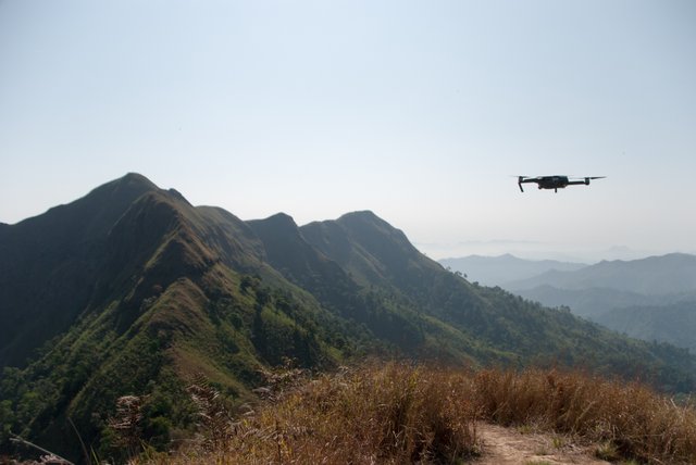
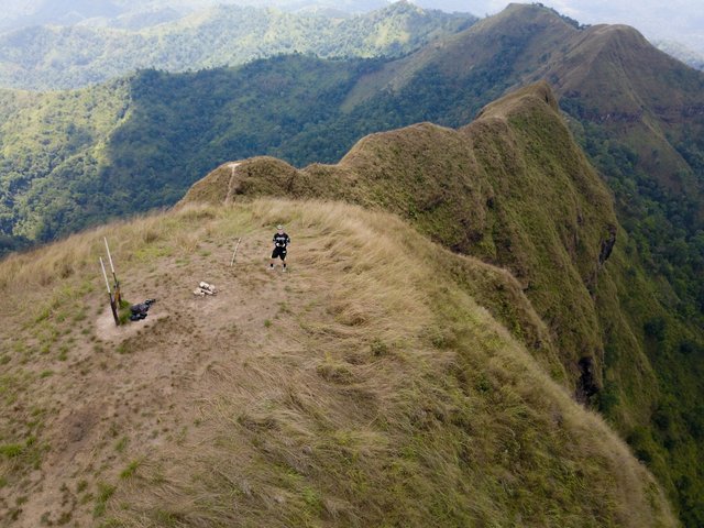
With only one more hill to climb before reaching the 'tour group camp site' at the foot of Khao Chang Puak, the trips first drone flight was a must.
Perfect flying conditions made things even better but timing each flight around passing clouds became an issue later in the day with dark shadows cast over the peak and main ridge.
A peregrine falcon that I spotted in a tree earlier seemed to be following me along the ridge. It took a disliking to my drone and started squawking and dive bombing. At first I was completely unaware of being stalked and only realised when the forward facing sensors started beeping while the drone was 2km out and '90' meters up- a near miss from the peregrine must have set them off!
I brought it back as quickly as I could watching the falcon follow. It made aggressive attacks but kept just enough distance. Flying manually allowed me to 'counter' move in the opposite direction and by changing altitude quickly probably confused the bird more.
.jpg)
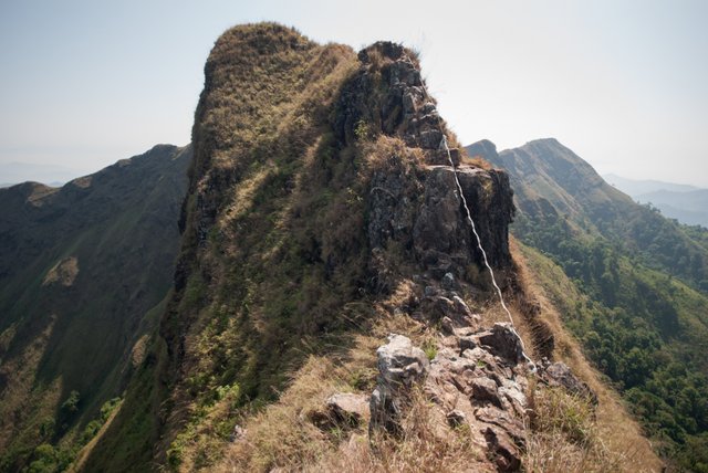
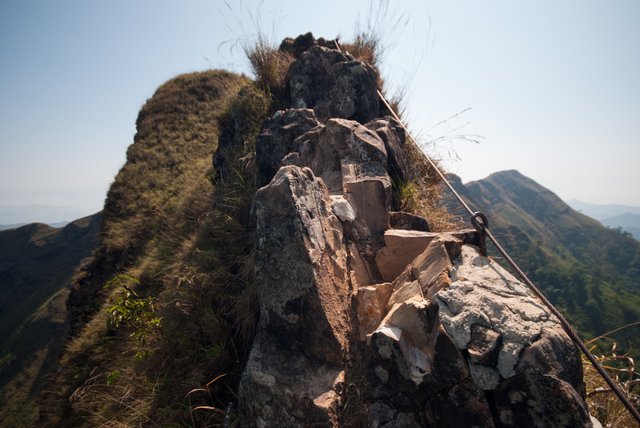
Steel rope had been secured to some of the steeper rock climbs and metal stakes gave extra support.
It was about 2 years ago that this very ridge made headlines when one trekker, part of a group lost their footing and fell.
.png)
Image source: Thai news article, https://www.thairath.co.th/content/848758
As I got higher I could see how an accident could occur. Edges with overhangs were hidden by long grass and loose rocks meant each step had to be planned.
.jpg)
Even though the ridge was relatively short in distance, I must have spent a solid hour walking along the top taking photos, flying the drone and enjoying the views.
Sheers drops of each side made my stomach drop as I neared the edge to get that special 'mum' shot!
.jpg)
Nearing the peak, I was excited to see 360 degree views and listen to the noisy jungle sounds below. The scenery really was breathtaking. The 2 hour stop I took at the top really wasn't long enough.
During the entire trek, I had not seen or met another person. I was half expecting this but for a long weekend, I thought there might have been someone.
The map work and pre-planning paid off and each turn was the right turn. To be fair it would have been kind of difficult to get lost as the path was well defined!
The climb down was harder than coming up, mostly because you are looking down on the backdrop a few hundred meters lower making you realise what might happen if you fell!
Reaching the grassy hills leading back into the forest, my feet were starting to get sore- new shoes on a first trek are never a good idea.
A few hours of slower walking I made it back to he village but not before making a short detour following the sound of water I had previously ignored earlier that morning. A quick dip and cool off from the days sun and sweat was a great way to end the trip before heading back into the village.
.jpg)
If you liked my post, please don't forget to follow and upvote for more :)
great shots! and not much of a border along those mountains.
Upvoted (by @rycharde), resteemed (by @accelerator) and has been added to the latest MAP Upvotes post.
= Quality Content Creators can request to join MAP = see the Benefits = Free Membership =
Doesn't look like an albino to me! Did they name it during snow season? :D (I know there's no snow season .. probably)
Never thought or heard of falcons chasing drones!
Great and thorough post; and effortful, in a good sense.
Go here https://steemit.com/@a-a-a to get your post resteemed to over 72,000 followers.
this trip was fabulous. take a beautiful nature😍
Thank you. Glad u liked it.
Thank you
Interestingly. You are well done. I respect people who do not sit still.
Great post of what sounds like an awesome journey. Love the photos.
This is really beautiful and wonderful.
Glad you are back
Am sure you back with great travel post like this
This is brilliant
Don't ever leaves us again. Keep posting and commenting.
And a final advice: don't ever stop producing wonderful travel posts like this.
Keep steeming
@tormiwah
I know it took a lot of work to get this post out originally but please don't repost or there's a chance it'll get flagged as spam.