El Hatillo: the hidden geographical treasure on the map of Venezuela
In the Northeast region of my country there is a town that doesn't stand out on the map, it isn't even mentioned in the road advertisements of one of its busiest roads even when it is parallel to it, and it's very curious because this place is so particular, is a land of natural riches.
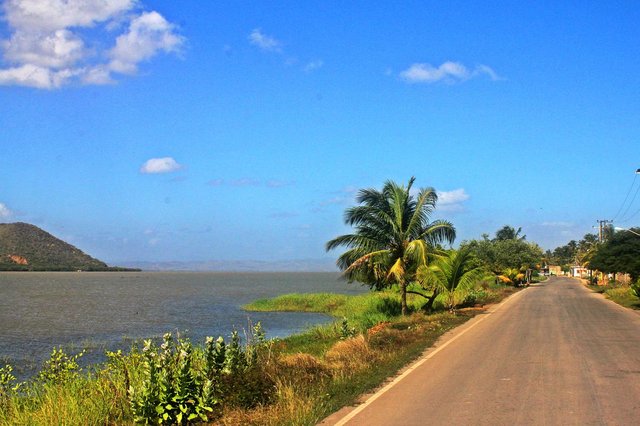
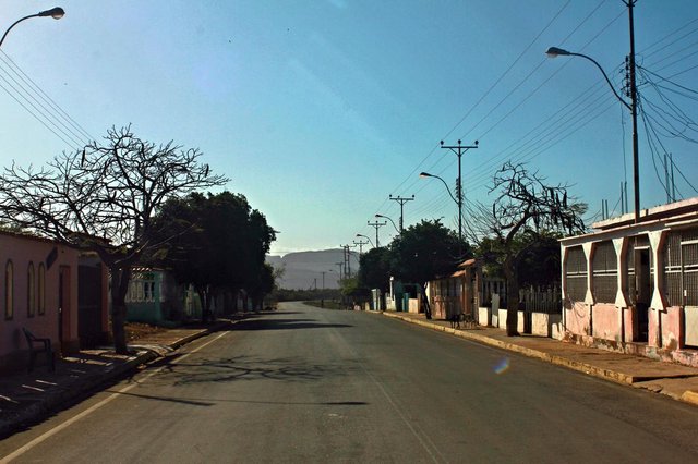
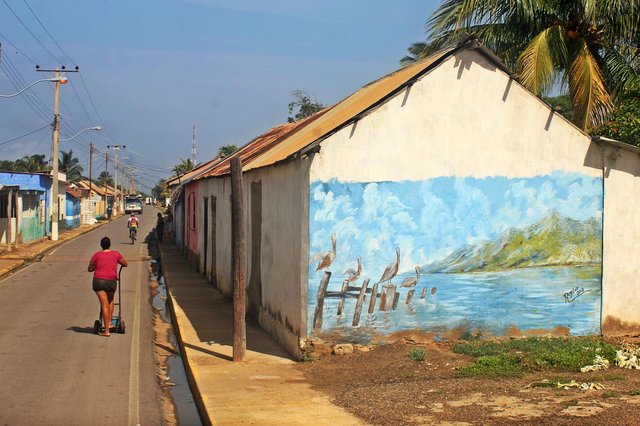
📷 View of the Laguna de Unare from the main street of El Hatillo.
I want the world to know about its existence! But I warn you: I only recommend this town to people who know how to appreciate nature, and who usually perceive the good side of life. I clarify it because El Hatillo is a paradise that perhaps isn't within the standards of a traditional tourist place.
It's a place without luxuries, of limited public services, but with one of the greatest geographical and ecological fortunes of Venezuela: it is formed by an isthmus, an estuary, a lagoon, a bird observatory and a prosperous ecosystem for fishing.
If you are willing to enjoy contact with nature in the most humble way, this post is for you; otherwise, keep reading because you may find in the following paragraphs and photos some reasons to practice a different tourism.
🗺️ The route
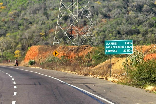
El Hatillo is a place in the state Anzoategui, located between the towns of Clarines and Boca de Uchire, in the famous Troncal 9, better known as "Highway to the East", which connects this region with the center of the country.
📌 El Hatillo is the general name given to the region, but it is divided into three sectors: one with the same name, Nuevo Unare and La Cerca.
However, there is no sign on the road that mentions it, there is hardly a worn, almost illegible little warning that signals a detour to the "Laguna de Unare and Boca de Uchire".
I was 10 years old the first time I visited this wonderful place, it was thanks to my dad; he loves fishing and since I can remember that has been his favorite place to launch the hook.
It's been 15 years since that and whenever I return I have the same impression: ** I find it incredible that there can be a place with such biodiversity, less than two hours from my house, parallel to such a busy highway, and that still not be recognized as the tourist potential that is **.
The first impact you receive when you take the detour, you enter a place very different from the one you left a few meters behind.
📌 Public transport with route to El Hatillo travel every day from Barcelona, Puerto Piritu and Clarines, but the service is available only at certain times.
The Troncal 9 is a road axis with many curves, and is surrounded by abundant vegetation and some farms or restaurants, while on the route to El Hatillo you find a road that seems infinitely straight and on each side a plain appears cleared.
The type of soil makes this part of the road interesting, because it is mostly a sandy terrain, with a striking terracotta color, which lacks vegetation.
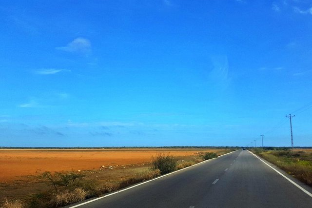
📷 The absence of vegetation allows to see the bottom of each side of the plain, highlighting green mountains on the left, and stretches of the river on the right.
This landscape lasts about 10 minutes, until you see the first houses of Nuevo Unare, a sector of the town with very few inhabitants. It is a town that barely has a main street and a parallel street.
5 minutes from Nuevo Unare is La Cerca, I would say where the true natural spectacle of the region begins to be revealed. So when you get there, be very attentive.
You will know you are in La Cerca when you cross the only bridge in the whole route, and then something amazing will happen: the Caribbean Sea will appear before you, and when you turn to any side you will also find an affluent of the Unare River.
You will be surprised to be in the middle of two bodies of water so different but so close at the same time. That experience becomes inexplicable because it is not common to see a beach and a river separated by just 300 meters wide in a strip that suddenly transforms from sand to land.
📷 Here begins the Caribbean Isthmus.
The more you enter the town, the more treasures you discover. Sightseeing here is a privilege, in one place you have at your disposal an important diversity of ecosystems, so you can afford to choose which attraction to enjoy.
La Cerca begins when crossing the bridge and extends three kilometers to limit with El Hatillo, while this territory covers two more kilometers, and from there the same road that connects Nuevo Unare and these two sectors continue for 20 more kilometers up to Boca de Uchire.
🏘️ The town
A "herd" is a space destined to the raising of cattle, reason why it is believed that the name of El Hatillo comes from there. It is probable that before becoming a population it was a land dedicated to this activity. Anzoategui has the distinction of having two ecoregions: the plains and the coast; and in the plains is where the herds are usually found.
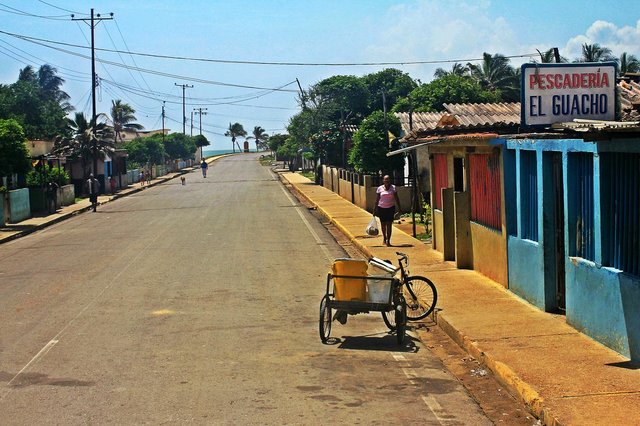
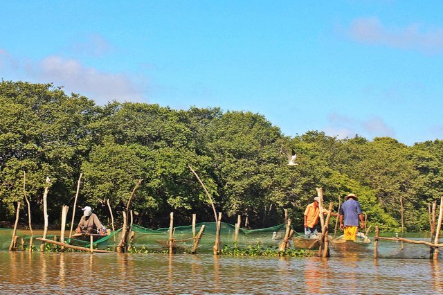
But the main economic activity to which the region is dedicated is fishing; likewise, the aspect of the town is totally of the coast, the sectors are ornamented by coconut trees, the sand abounds in the streets and stretches of saline soil that stand out for their brittle and whitish appearance, until the waves are heard from certain places; besides, it seems that the sun never shines there, temperatures are always high.
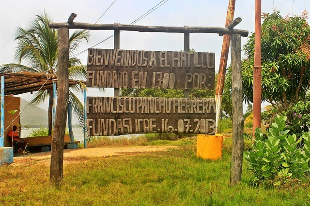
📌 A sign carved in wood on the shores of Laguna de Unare states that El Hatillo is 318 years old, having been founded, exactly in the year 1700.
His lifestyle is based on simplicity; It is normal to see the inhabitants walking in the streets barefoot and in comfortable clothes, the women taking care of their children, the children playing on the sidewalks or on the beach, the elderly resting in chairs or hammocks under some shade, and the men loading their nets to fish over the shoulder.
We always slow down to enjoy the "welcome" that in some way the inhabitants of El Hatillo give to tourists, because as they pass they greet you and smile as if they knew you; and that sometimes surprises me, I think they are more polite and friendly than many people I've met in the city; Above all, you can be sure that what little they have will always be shared with you.
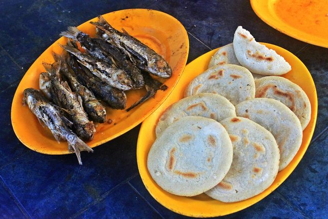
And as simple and humble as they are its architecture, built in mostly colorful houses, with facades that show clay ornaments or snails, and notices that advertise the sale of fish and shrimp (foods on which their typical cuisine is based). What most strikes me is that most live with the doors open, although in some cases they were replaced with curtains.
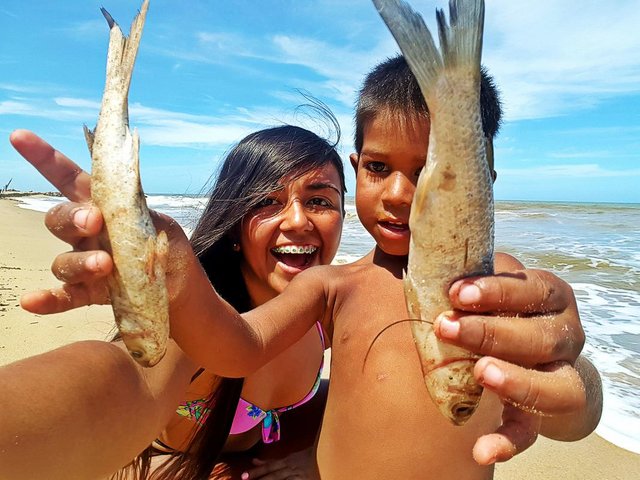
📷 I made a friend in El Hatillo who introduced me to his two "shoemaker fish".
In my opinion the Haltillanos learned to live happily despite their shortcomings; even if they don't have water service and they have to wait for a truck that provides them with the liquid weekly, although they must go to other cities in search of food, even if the telephone signal is poor, even if they have only one bakery and a few mini-markets, although receive as many tourists as before to be able to diversify their commercial activities, and even if they seem to have been forgotten.
💎 The treasure
The true value of El Hatillo lies in its biodiversity. Thanks to its natural attributes it is ideal for the practice of Rural Tourism, especially in the modalities of Ecotourism, cultural tourism, sports tourism and adventure tourism.
Currently there is no type of tourist service available in the area, but you can practice the modality you want on your own by asking one of the inhabitants to guide you and provide you with the tools or means of transport depending on the modality you want to enjoy.
The geographical treasure of this town offers countless ways to connect with nature at its best, some more extreme than others but all equally magical.
🏝️ The isthmus
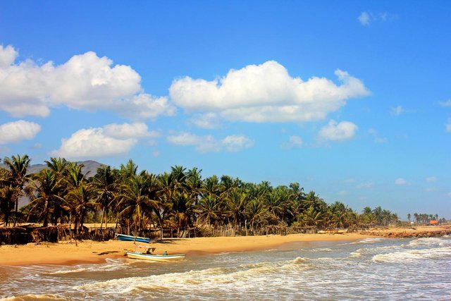
📷 Beach of the Caribbean Isthmus.
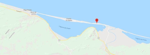
If you look at the cartographic reference of Google Maps you will notice that the area where it is located El Hatillo is just a thin strip of land that separates the Caribbean Sea and the Laguna de Unare, thus joining two territories of the Anzoategui state. This incredible geological formation that connects two areas across the sea is called isthmus and is one of the little-known natural features that makes this town special.
In my country only three isthmus stand out: the "Isthmus of Los Medanos" that connects the Peninsula of Paraguana with the rest of Venezuela, that of Isla de Margarita that separates the Caribbean Sea from the Lago de La Restinga, and that of El Hatillo, called "Caribbean isthmus".
📌 This sand cord is more than 20 kilometers long, starts at La Cerca and ends at Boca de Uchire.
Its beaches have very particular characteristics. The depth varies, especially near the waves break, where the right side is usually deeper and with stronger waves, while on the left side you can go up to 50 meters and the water will continue at your waist with a softer swell .
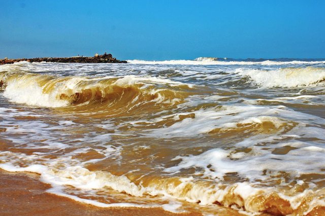
The color of the sea also causes me curiosity, because on the banks it is brown due to the current that keeps the sand upset, and because the Rio Unare flows into it; but from a certain limit you can notice how the water turns turquoise in all the extension.
These beaches are ideal for resting because they are usually alone, they also serve for fishing from a jetty, for surfing on its waves, or for Skimboarding on its shores (although you must find a stretch where there are no snails or stones).
💧 The lagoon
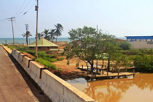
📷 Entrance to the Laguna de Unare from one of the main canals of the Unare River.
In geomorphological terms the Laguna de Unare is a lagoon, a slightly salty body of water that is separated from the sea by a strip of sand, but with which it remains in communication.
The surprising thing about this formation is the adaptation of the ecosystems that make it up, the freshwater and the saltwater ones, managing to develop organisms from different origins interacting in the same place, which makes this lagoon a very important area. biological wealth.
It is one of the largest lagoons in the state, the surface is developed along the Caribbean Isthmus, and despite being so extensive its depth barely reaches five feet in general, but the brown color of its waters, which prevents visibility , makes you believe that it could be deeper.
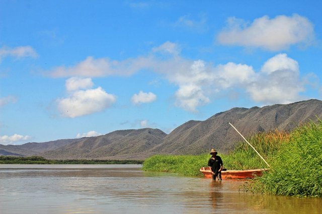
The Laguna de Unare is the main field of work of the fishermen thanks to the fact that shrimp farming is prosperous there.
The "La Cerca" sector gets its name from there, since an end-to-end fence was built between the river and the lagoon to prevent the shrimp from leaving the lagoon's limits.
From the tourist point of view, this wetland is perfect for expeditions in kayak or paddleboard, or simply for boat rides.
🌊 The estuary
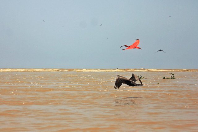
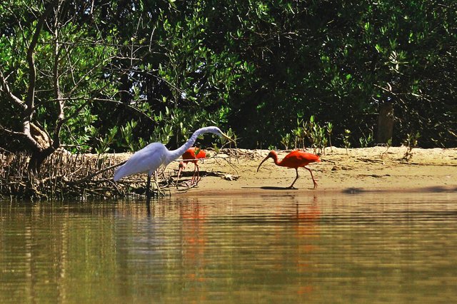
📷 In the photo you can see how the waves rise over the calm water of the river, right there where they join. By the way, this is one of the favorite places for birds to meet.
Of all the components of the geographical treasure that is El Hatillo, your estuary is my favorite. It is the mouth of a river in the Sea, in this case it is the Unare River that pours its waters into the Caribbean Sea.
If it is surprising to see that a strip of sand divides these two bodies of water, even more is to see how they mix, and the emotion triples when you are standing in the middle of both and you feel how the current takes you. At that point the depth is minimal, hardly reaches half a meter. The landscape becomes even more incredible when you look up and watch hundreds of birds flutter all over the place.
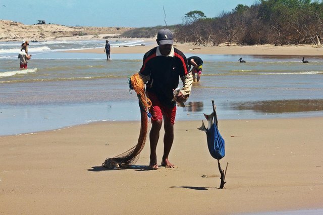
📌 It is another of the places where, depending on the season, fishermen mostly concentrate on catching "lebranches" and "lisas".
To get there you have two roads. You can navigate for 30 to 40 minutes on the river (time is determined by the current and breeze).
You can also go along the shore of the beach, which in some sections is reached considerably by water, which forces you to take shortcuts between the mangroves.
The Unare River is a tributary that runs more or less 200 kilometers between the states of Guarico and Anzoategui, and visit El Hatillo gives us the opportunity to travel its last kilometers of calm waters, with a depth close to 3 meters.
Both the river and the beach are surrounded by trees with a unique ability to tolerate salts; These are called Mangroves and are another of the exceptional ecosystems developed in the area.
The adrenaline will consume you the first time you go no matter which road you take, it is a journey of constant uncertainty that can easily become one of the best adventures of your life.
🦅 Bird observatory
📷 The Gray Heron is one of the species with greater reproduction in the area.
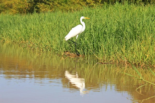
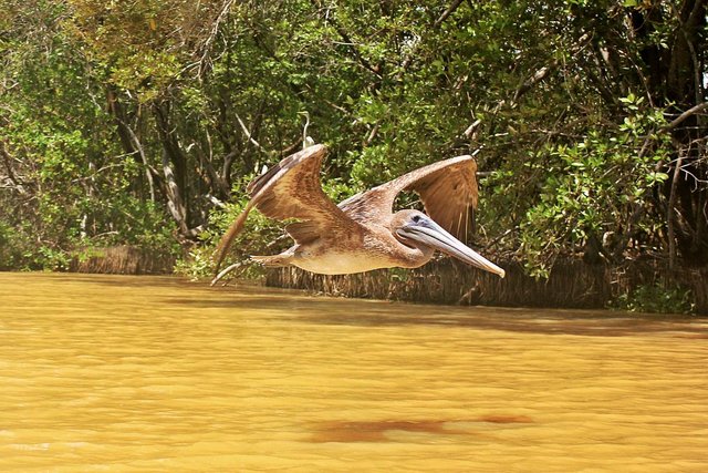
The richness of this region reiterates its great value with the presence of the approximately 180 species of birds that live there and that live between the Laguna de Unare and the Unare river, which makes this territory one of the main Anzoategui bird observatories.
It seems that they got used to the presence of humans, because they stand next to the fishermen without any fear. Even, in my travels I have found birds that are calm, like posing, waiting to be photographed.
They are always between the tops of the trees, the banks of the river or in the water (depending on the species) pending of possible prey to feed themselves; almost all that I have seen use the same technique: they observe, they glide, they approach quickly and they catch the fish with their beaks or legs.
The greatest concentration of birds I have seen in the estuary, there many species meet, and it is an experience that will mark your life, because although they are of different types they live mixed, what the human should leave an important message.
💙 Become a millionaire!
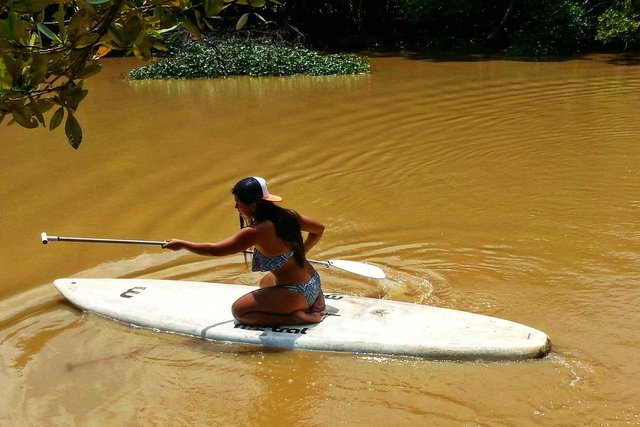
📷 In my Paddleboard I have sailed from the Albufera to the Estuary.
I have taken several friends to meet this amazing place, and have fun but then have not wanted to return because "it is sunny", because "can't enjoy the beach by the surf," because "there are no supermarkets," and so on.
In the end they always ask me why, despite those reasons, I like this place so much. Before I couldn't explain the exact reason, I only knew that my heart was shaking every time I visited it, but writing this work I understood why.
In El Hatillo I found something that in the city there is no longer: the feeling of security, peace and full freedom when exploring its extensions, which makes this land very valuable. And if you also want to enrich your soul, do not think about it! Go!
📷 All the photographs used are my own and were taken with my Canon EOS Rebel T2i.
📣 My native language is Spanish, sorry if I use any expression you don't understand, I try to translate the text as best as possible, but if you have any questions you can ask me.

Congratulations! Your high quality travel content caught our attention and earned you a reward, in form of an upvote and resteem. Your work really stands out. Your article now has a chance to get curated and featured under the appropriate daily topic of our Travelfeed blog. Thank you for using #travelfeed
Learn more about our travel project on Steemit by clicking on the banner above and join our community on Discord
PS: Did you know that you can support TravelFeed by claiming your free Byteball Bytes?
Hi milkabustamante,
Visit curiesteem.com or join the Curie Discord community to learn more.
Congratulations @milkabustamante! You have completed the following achievement on Steemit and have been rewarded with new badge(s) :
Click on the badge to view your Board of Honor.
If you no longer want to receive notifications, reply to this comment with the word
STOPTo support your work, I also upvoted your post!
Do not miss the last post from @steemitboard:
SteemitBoard World Cup Contest - The results, the winners and the prizes
Que experiencia tan increíble, Venezuela merece ser recorrida. Gracias por compartir, El Hatillo esta en mis lugares por visitar :)
¡Totalmente! Venezuela es un paraíso, pero debemos aprender a verlo como tal.
Deseo que puedas ir a El Hatillo, de pana lo vas a disfrutar.
Tengo solo días en esta red social, la verdad es el primer articulo informativo que se merece uno y mil votos mas. He podido apreciar que escriben cosas sin sentido, pero tu contenido es de calidad y merecido todo lo ganado. Saludos.
¡Muchísimas gracias @leiffer! 💙 ya descubriste cuál es la clave del éxito en Steemit entonces: posts creativos, con una correcta redacción, con una estructura dinámica, y sobre todo originales, que estén impregnados de tu esencia en cada palabra.
Los nuevos usuarios creen erróneamente que pueden hacerse ricos sólo publicando cualquier cosa, pero lo cierto es que esta plataforma es como la vida misma: sólo el esfuerzo te genera grandes resultados.
¡Feliz día!
Muchisimas gracias por tus consejos amiga. Los voy a seguir al pie de la letra para ver los resultados.. Una pregunta, tengo sitios web, hay problemas si los llevo a ingles y los posteo aqui ??? Disculpa la molestia... Gracias
Thanks
Con mucho gusto, @leiffer 😉
Y no, no hay problema siempre y cuando menciones que el post es una traducción de un artículo propio que publicaste en otro blog, y coloques el link de origen. Es importante porque en Steemit existen los "limpiadores de contenido" (por llamarlos de alguna manera), que se encargan de detectar y "limpiar" la red de plagios y spam principalmente; y si no mencionas el origen del trabajo puede tomarse como plagio.
Pero sinceramente te aconsejo que produzcas contenido nuevo, o que al trabajo que ya realizaste le anexes nuevas ideas o "le des la vuelta"; muchos proyectos de curación toman en cuenta el hecho de que el usuario haga contenido exclusivo, eso tiene más valor que un "refrito" 😉
Espero haberte ayudado.