A particle physicist around the world - the Korean DMZ
As an academics, I have the chance to travel a lot around the world. While many of my collaborators are in Europe, many of them are also living in the US or in Asia. As a result, it is not unlikely that my carbon footprint is not exemplary...
Using mostly the train when commuting from one European country to another, I am regularly flying to the US or Asia. This however also gives me the opportunity to visit many countries. Once in a while, I will hence deviate from my usual physics posts to share a few images.
Today, I decided to visit the Korean DMZ, one of the few demilitarized zones in the world. Although called demilitarized, the first thing you notice when trying to walk around is that you cannot walk around. All the moves are heavily controlled and although the zone is called demilitarized, it is not free of soldiers. The solider density is actually larger than anywhere else I had the chance to go.
Having a look to the situation between North and South Korea, this is of course understandable.
HISTORY OF THE DMZ IN A NUTSHELL
I hope the following paragraphs are accurate enough. In any case, please do not hesitate to comment and I will edit the post. I do not want to write down a lesson of history but just give snippets of the information I gathered.
The DMZ is the demilitarized zone that was created at the end of the Korean war, in 1953. It is a band of land that extends over 2km from each side of the demarcation line, over about 250 km.
All of this probably starts in 1945 at the end of World-War-II when Japan capitulates. Korea is then split into two at the height of the 38th parallel, the North being under Soviet influence and the South under American influence. Three years later, the 38th parallel becomes the official border between the newly created Korean states.
In 1950, North Korea invades South Korea and takes control over most of the country in 15 days. The United Nations (lead by the US) reacted and after three years of war and more than 200.000 deaths, an armistice agreement is signed in 1953. A demarcation line is settled and a demilitarized zone is created all along the border of the two countries. This agreement is still valid today.
The DMZ is heavily guarded on both sides, and the absence of human presence in this zone has made it an incredible wildlife reserve with several thousands of rare plant and animal species.
Over the last 15 years, the reunification had become one of the main project of South Korea. One can notice several successes, like a train line connecting Seoul to Pyongyang being used again, sport teams of both nations marching together and the Kaesong industrial park being a joint economical project of both Koreas.
But after the increasing tensions of the last few years, unification seems now far from manageable… The Kaesong center is closed, the border is closed and no trains can go through...
PICTURES
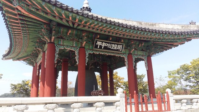
The peace bell, to welcome the 21st century as a time of reunification and peace (for all mankind).
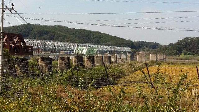
The Freedom bridge, through which more than 12.000 prisoners have been exchanged after the war. We can notice the pillars of previous railroad bridges lying next to it. North Korea lies on the top of the picture and South Korea at the bottom.
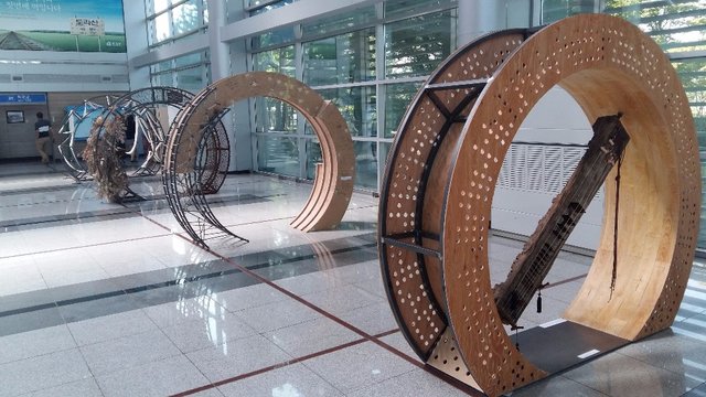
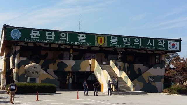
Exhibition in the Dorasan station in honor of the possible future unification. The Dorasan station is the last South Korean station on the train line connecting Seoul to Pyongyang. This line is today mainly used by tourists and is cut at the border.
Dreaming about unification
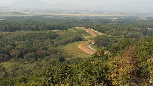
In the DMZ, nature dominates. The zone is indeed very green. We can notice the double (electrified) fence. The areas on the rear side of the picture belongs to North Korea.
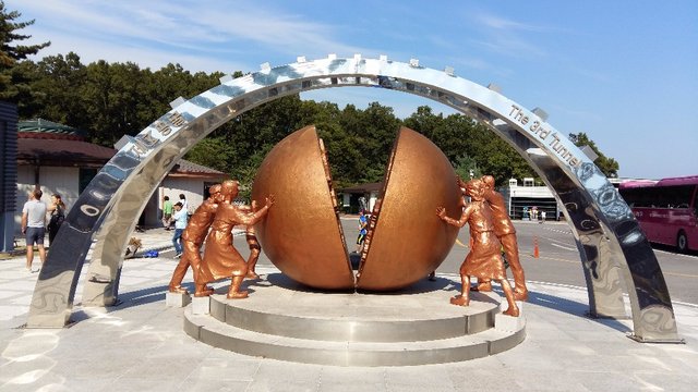
Still a memorial where unification is hoped to. At this place, it was possible to visit one of the four tunnels dug by North Koreans from 1970 to 1990 that have been found by South Korea (which means there might be more, but unfound). The aim of these tunnels was of course to allow for a new invasion. I have been inside one of these, but photos were not allowed…
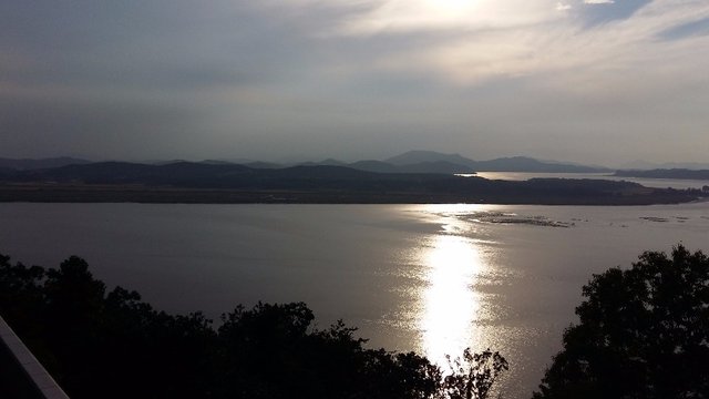
And the sunset for the end, with North Korea on the top side of the picture and South Korea on the bottom. At this point, the Han river and the Imjin rivers join. I would have like to go hiking there... But of course no way ;)
Credits: all images are mine (and taken with a mobile phone; sorry for the quality)!
Post included in: Steemprentice Spotlight for September 26th
Thanks a lot!
You're welcome!
Ok, science is alson travel. Why not!
Thanks for the travel photos! Hope that i can one day go there myself. Very nice view
I am sure it will be an adventurous "hike" ;-)
It depends how you feel comfortable with mines ;)