New Zealand #6 - Along the West Coast to Fox Glacier - South Island
In my previous post we drove through Haast Valley alongside the Haast River to Haast. On arriving however we discovered our caravan park was really in Haast Junction, so this morning as we leave we take a slight detour to drive through Haast Township and then Haast Beach, so we can say we've seen all the 'Haasts' in this very remote part of New Zealand. Actually there's not much to see, in Haast Beach for example there's just a petrol station, in the township a couple of motels and restaurants. It's raining heavily and there's also not much motivation to walk out on to the beach or to take any photos - so there are none to show!

Warning sign at the start of the walk in to Fox Glacier. The park guide was not very talkative.
You may remember when we picked up our rental at Queenstown airport I had the mandatory 'never driven in New Zealand' briefing, which seemed to focus far too much on one-lane bridges. Well we've encountered a few so far, short spans, most of them with no oncoming traffic so simple to figure out who has right-of-way and to cross. But our drive today starts by crossing the longest one-lane bridge we’ve encountered, a span of about 500 meters, with 2 passing bays on the bridge to facilitate encountering opposing traffic, which is wise because in the rain we can't see the far end of the bridge! What we can see initially is an oncoming bicyclist, and we have to wait a few minutes for him to cross because he has priority, and part way across we have to pull over again into one of the bays to let oncoming traffic through. Unfortunately we are so fascinated by the bridge and the protocol for crossing that we forget to take any photos!
In heavy rain trying, unsuccessfully, to take a photo of Lord of the Rings trees.
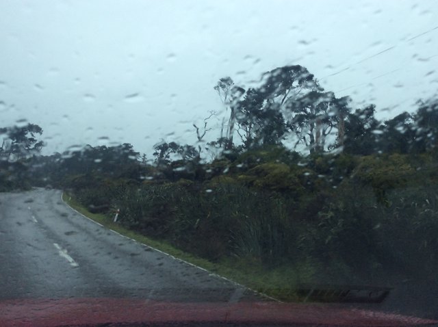
We then encounter rain forest, and in the first stretch some amazing trees that remind us of the walking trees in Lord of the Rings. Unfortunately we can’t get a photo because it's raining too hard and there is no place to stop. Highway 6 passes along the coast a bit, and loops inland as well, past a couple of small lakes, but there is virtually no habitation along the entire route. Bruce Bay has perhaps one building, but a nice stretch of beach with, in New Zealand English, roughish surf from across the ditch.
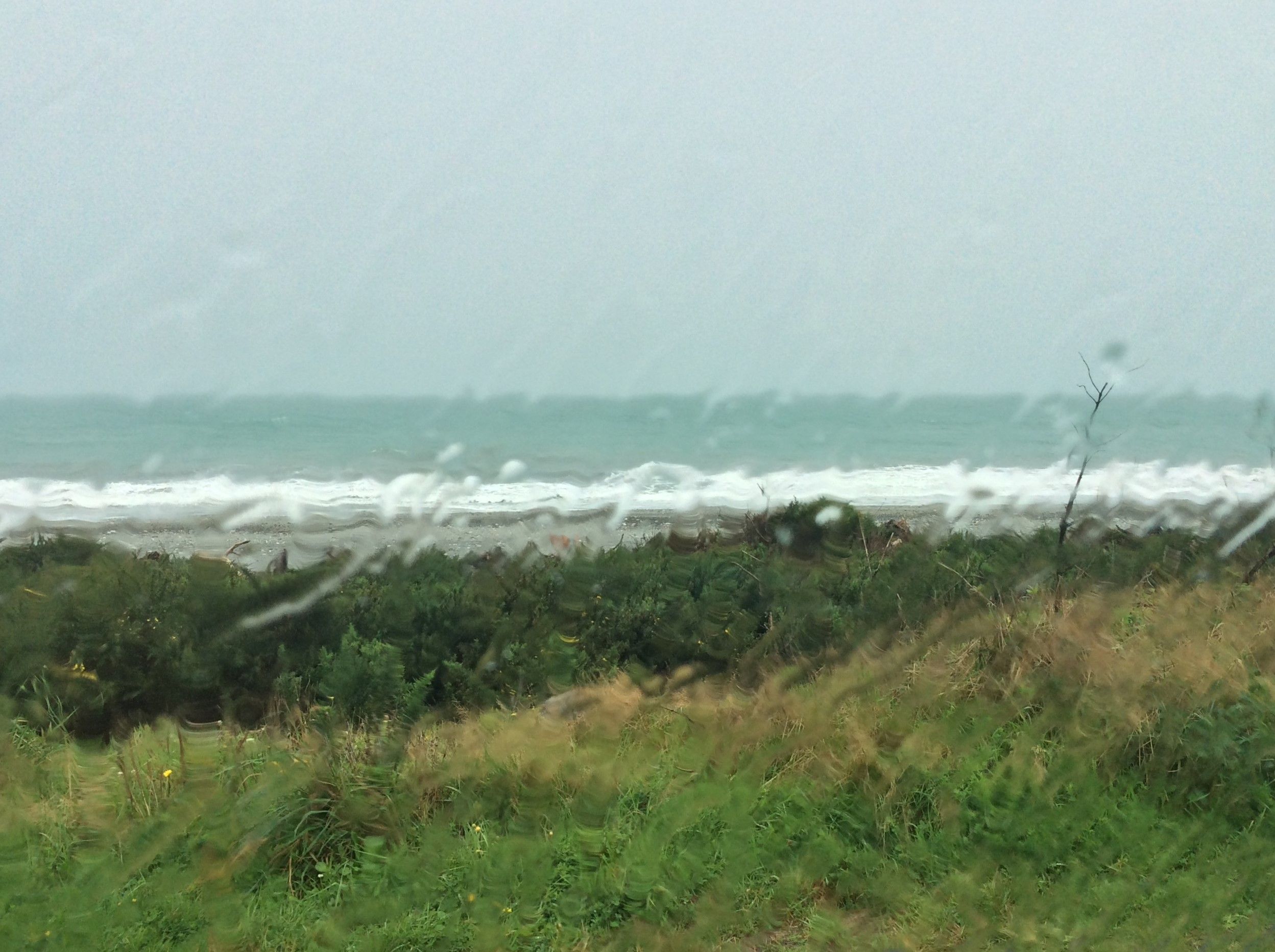
Tasman Sea - the ditch - in roughish weather.
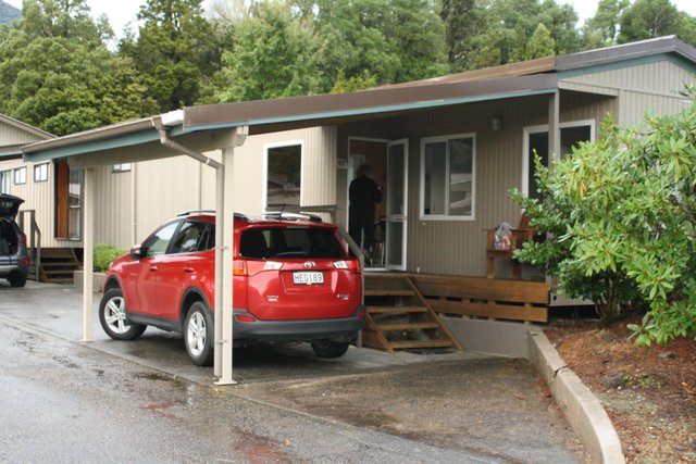
After less than 2 hours we arrive at Fox Glacier caravan park and get an early check-in. The park is very well laid out and maintained, e.g. reception has a low fieldstone wall around its base so it blends into the mountain setting, and our ‘motel’ (New Zealand English for cabin) has a carport so we can unload out of the rain. The unit is very nice inside except there's no electrical outlet in the bathroom, so brightonbonnie does her hair using her small magnetic mirror attached to the fridge!
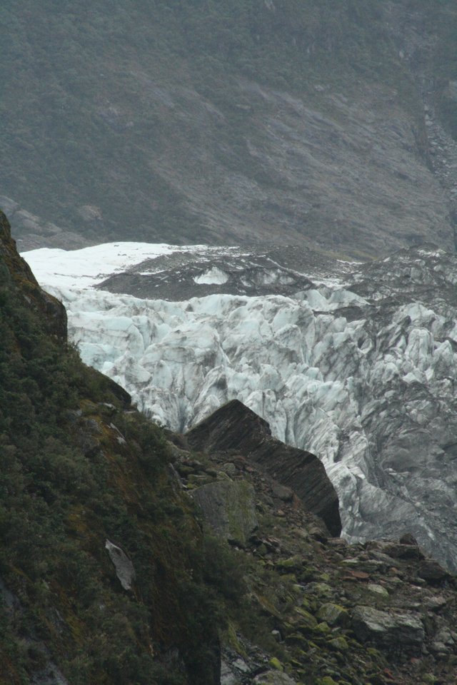
The rain lets up a bit so after a quick lunch we drive back a few kilometers to Fox Glacier, very well organized with signage leading you into a parking area about 4 kilometers off the main highway. From there the walk along a gravel path to the glacier is reasonably good.
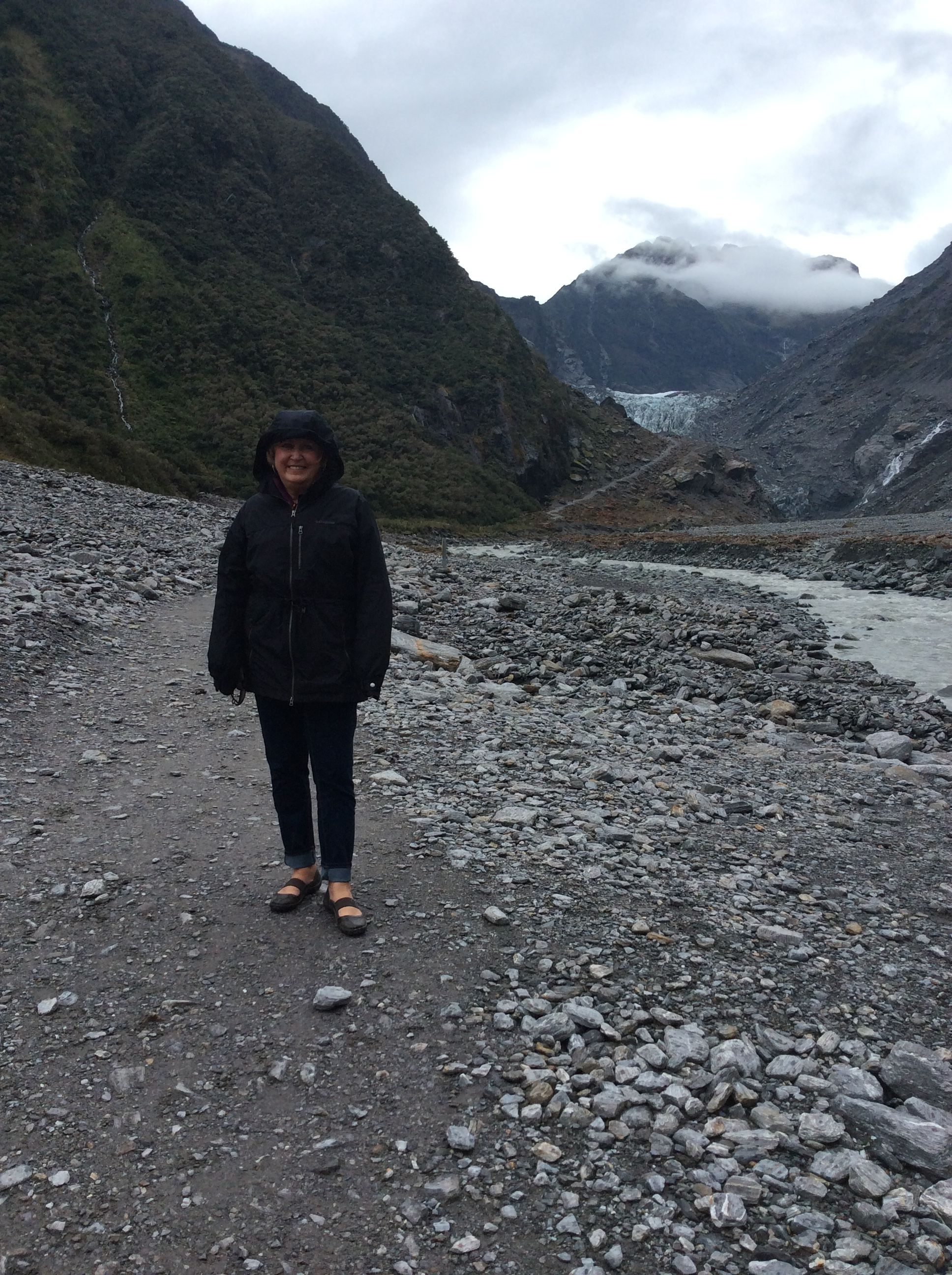
brightonbonnie dressed for the weather.
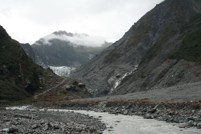
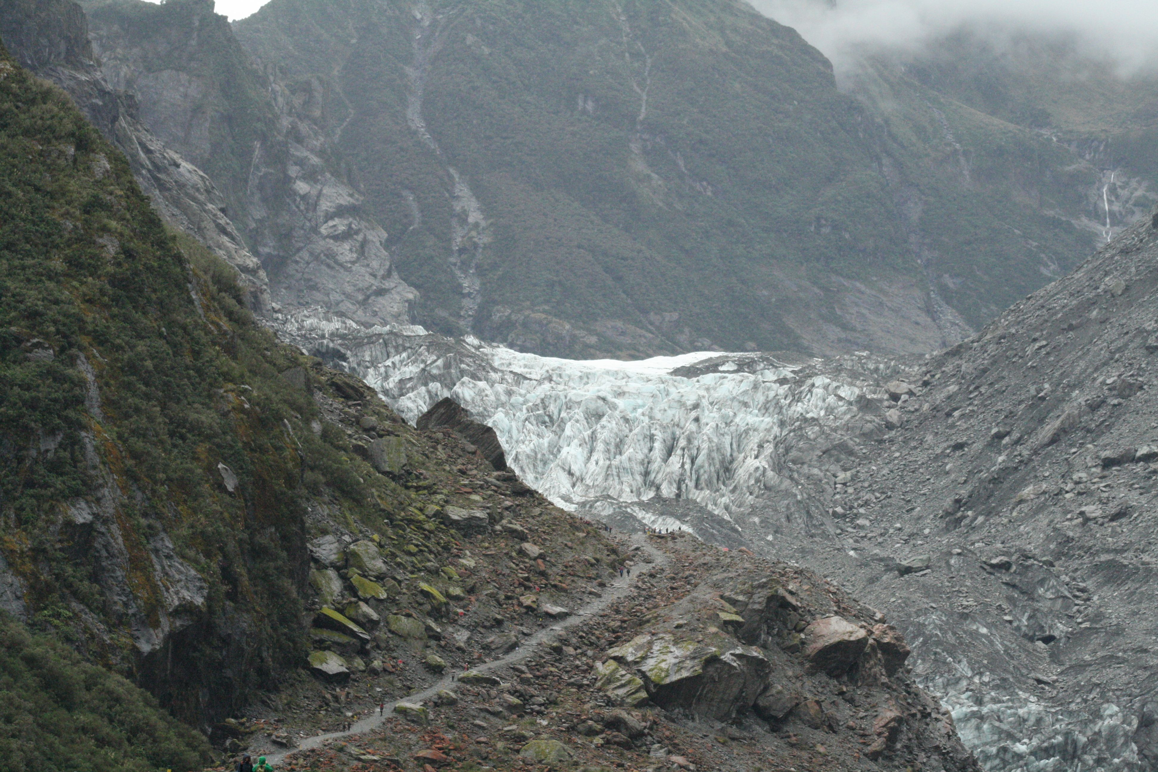
Not too many years ago the glacier extended into this valley.
The path is well-marked, and relatively flat until the last ascent which you can see in the foreground.
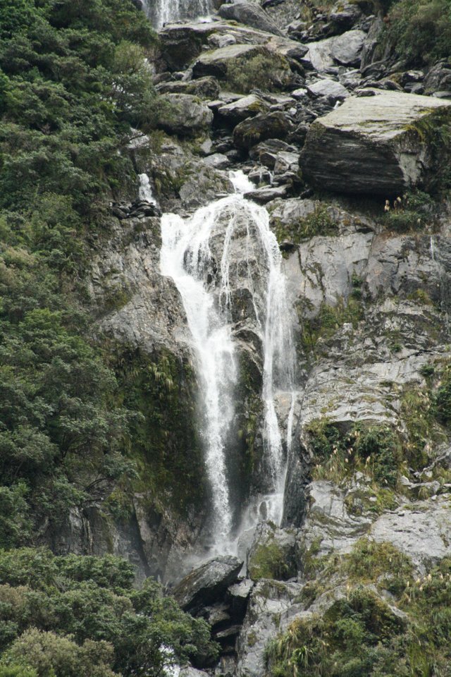
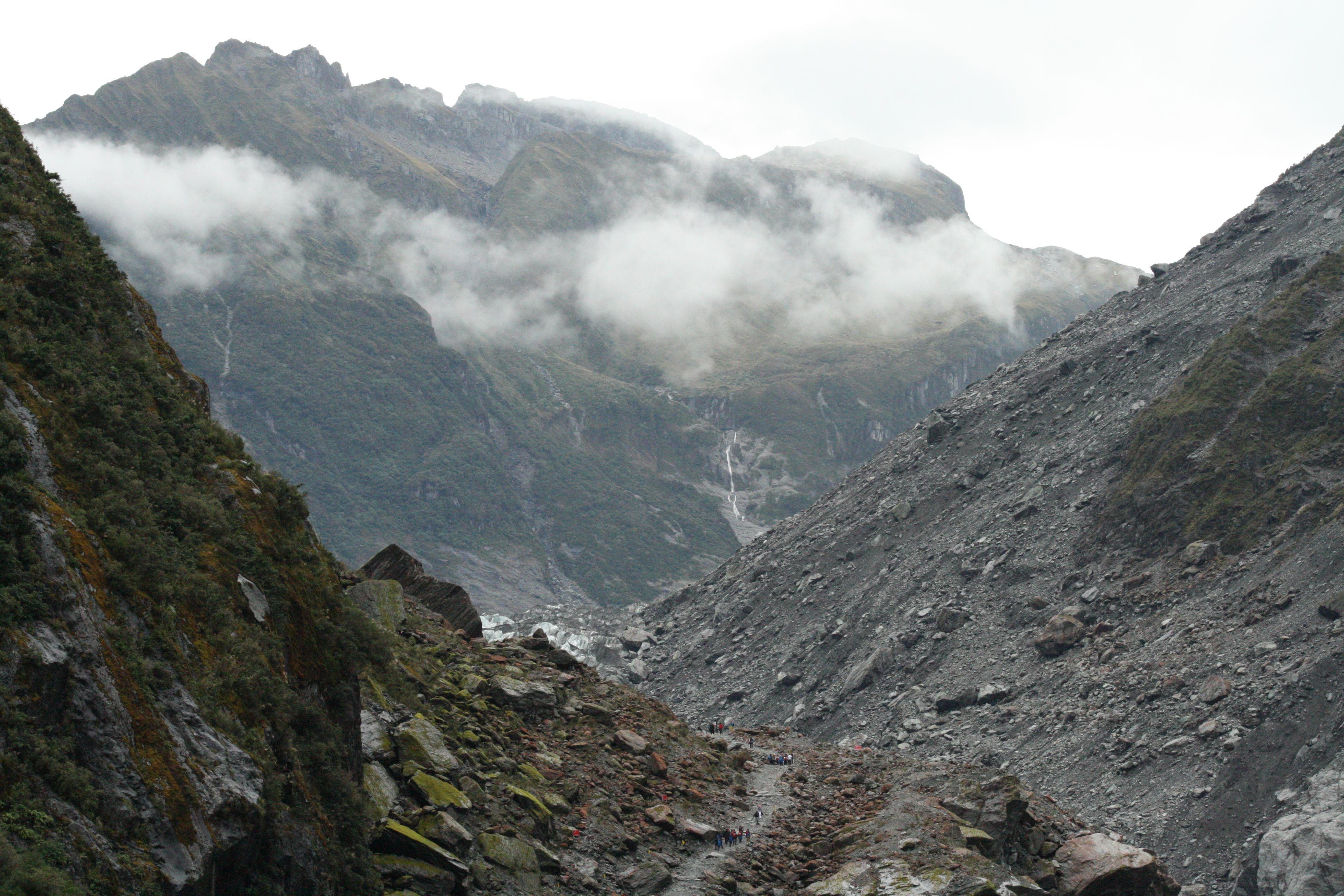
There are many small waterfalls coming off the surrounding mountains...
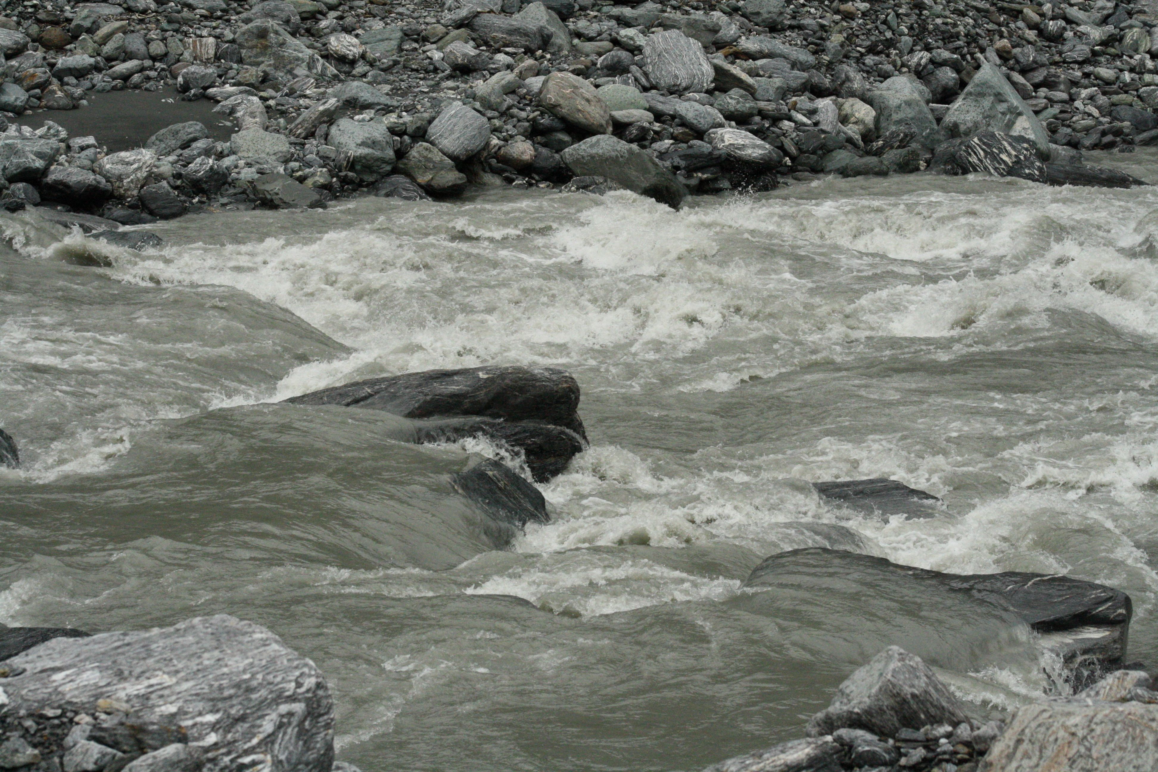
... feeding the main stream which flows very quickly through the valley.
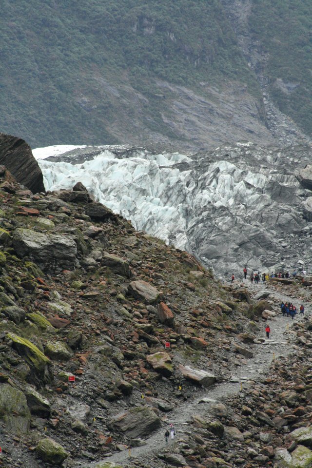
Very tiny people in the far distance, shot with my telephoto zoom.
Closer...
... and closer still.
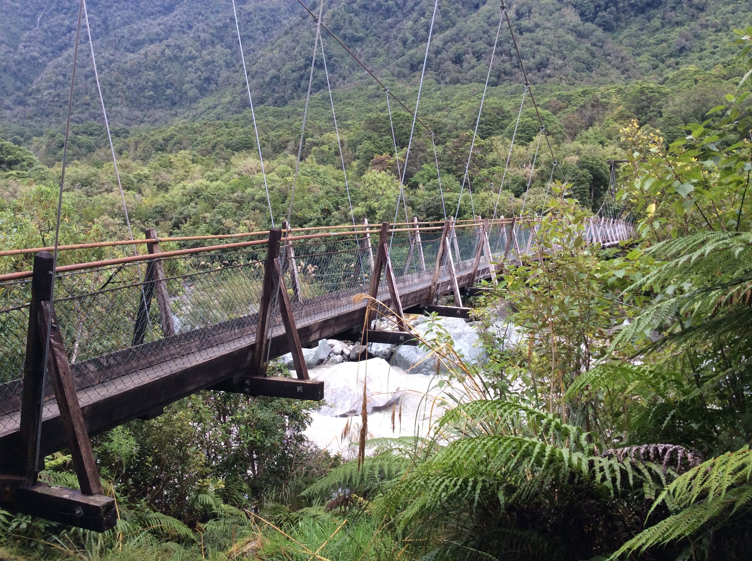
Leaving the car park we are the only visitors who notice a sign marking the suspension bridge built to improve access in 1929, when the glacier first became a destination for travelers, and extended much further down the valley.
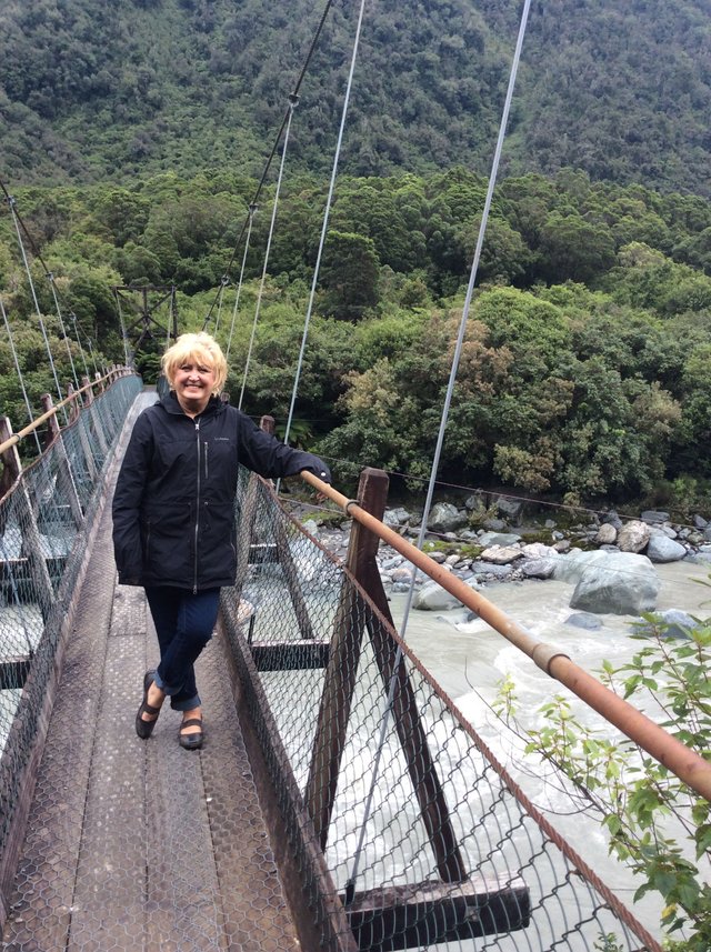
There are nice views over the river strewn with large boulders – but we don’t venture too far out on the single file bridge because it sways a bit and there is a sign limiting it to 5 people at a time!
We end a very interesting day back at the park, but our plan to walk 1 kilometer into town is derailed by - guess? - heavy rain, so since we did not have lunch on the road we drive to the highly recommended The Last Kitchen for dinner. Venison with noodles and Asian-spiced vegetables for me, for brightonbonnie a rib-eye with fries, both excellent.
PS - if you've enjoyed this post please check out my first 5 New Zealand posts, the previous 19 posts in my Australia series, and the 3 before that as we started our 90 day roadtrip in Tahiti!
And please join us in my next post as we continue north-east along the west coast to Punakaika and the Pancake Rocks!
read me!
!steemitworldmap -43.544402 lat 169.946141 long Fox Glacier South Island New Zealand d3scr
Congratulations, Your Post Has Been Added To The Steemit Worldmap!
Author link: http://steemitworldmap.com?author=brightongreg
Post link: http://steemitworldmap.com?post=new-zealand-6-along-the-west-coast-to-fox-glacier
All OK!
Finally, I completed this...! :) I don't know if you have this 'bad' habit of mine - I leave interesting posts on in tabs, for later when I can read and fully enjoy at leisure, and refuse to read them for the sake of completing them! Lol - yours fell into this category!!
Love the surreal scenery! That terrain is like inviting an ankle sprain and I'm highly susceptible to those - ugh! Would love to have gone on that bridge though... Ok, on to the next adventure.... :)
Glad you are caught up - Not! Just posted #9 lol! And pix hasn't announced you as a winner, so I think you are right about not being right!
Have a great weekend - I'm just starting mine!
Those single lane bridges are quite common when driving about the South Island aren't they? I liked how well marked they were with the signs showing who had priority by using strong and weak arrows of different colors. It saved a lot of confusion and attempts to communicate with flashing headlights etc.
Image credit
I'm looking forward to seeing your Pancake Rocks post (I visited there twice). Have you been to Cape Foulwind? There's a great walk along the cliffs there. At least it's great when the weather is pleasant.
Thanks for feedback and for posting a shot I couldn't get in the rain! Not that this is the Haast River bridge of course, far too short. But will anyone notice the railway track that you also have to figure out? I decided early on the very large trains have priority no matter what direction they are going!
Trying to do Pancake post tomorrow, then Westport and if I can fit in the seal colony at Cape Foulwind, though this may require a separate post!
Yes, those rail tracks are an oddity.