Spatial Science

Source: [nilaimas.com.my]
Spatial Science is the study of spatial information describing the Earth, its physical features and the built environment. It influences everything we all do every day. It incorporates fields such as geographic information systems (GIS), remote sensing, surveying, and cartography.
Spatial Technology
Source: [archive2.cra.org]
Spatial science is the power of linking information from one place to another all over the world and being able to share that information with people from everywhere. Some examples of spatial technologies are given below.
- Geographic information systems (GIS):
By using GIS one can get any information that is linked to the earth in a mapping application. Users can place multiple layers of data together in GIS for analysis. - Global Navigation Satellite System (GNSS):
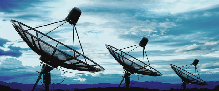
GNSS sometimes referred to as Global Positioning System (GPS). GPS is a satellite based radionavigation system which is owned by the United States government and operated by the United States Air Force. GPS satellite navigation systems used in cars and mobile phones. - Remote Sensing(RS):
Remote sensing, which refers to the scanning of the earth by satellite or high-flying aircraft in order to obtain information about it. Remotely sensed data about a place can provide information including weather and oceanographic information, land use, vegetation types, fuel level and moisture loads of a location. - Google Earth:
Google earth is also a good example of spatial technology. It uses satellite imagery and gives users access to the virtual world.
Geography as A Spatial Science
Geography is described as a spatial science because geography answers where things occur and why they occur there and also relates to location, place, spatial pattern and spatial interaction.
- Location:
In Geography location is a point or an area on the Earth's surface or elsewhere. Latitude and longitude is a convenient way to find something's location. - Place:
Place refers to both the human and physical characteristics of a location. - Spatial Patters:
A spatial pattern is a perceptual structure, placement or arrangement of objects on Earth. - Spatial Interaction:
Spatial interaction is the flow of products, people, services, or information among places, in response to localized supply and demand.
Spatial science is an approach to Human Geography which was formulated in the 1950s-1970s. Surveyors, mapping specialists, land developers, paleontologists and other professionals use spatial information. It helps them to get the right information to make important decisions and these decisions have an impact on natural and build environments around the world.
Congratulations! This post has been upvoted by @bdcommunity, requested by @reazuliqbal. It is a curation and support project for Bangladeshi content creators. You can support us by following our curation trail.
Please join us at the STEEM.com.bd Discord Channel.
Please dont use copyright protected image.. And add a valid reference under ur image... If u need guideline about image usage, take a look at this article.