Mountain biking Los Gatos California, BTC calm before the storm?
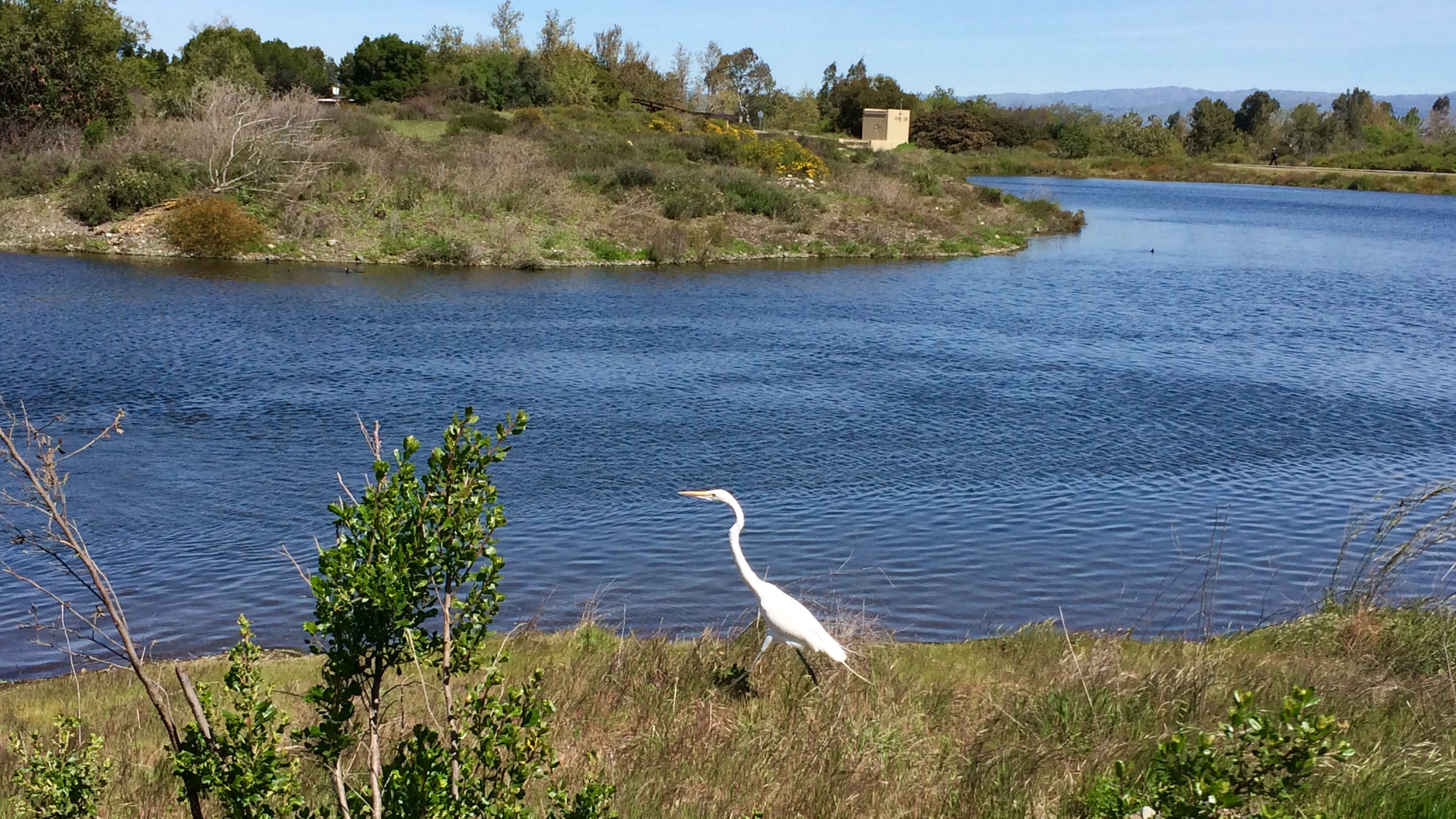
Hello all, this is my mtb ride from this afternoon in Los Gatos CA. It was a nice 65* F day and sunny! The shot below is from the Campbell percolation ponds of a adult egret. I'm surprised that I was able to get this close as they usually fly away fairly quickly when anything but another bird is close.
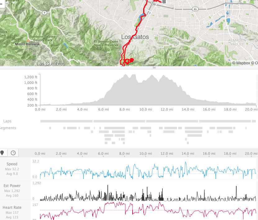
The ride was 20 miles and 1900 ft of climbing! (Sweating was on the menu)
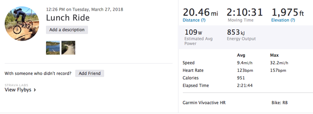
GPS data is from a Garmin Vivoactive HR uploaded to Strava.
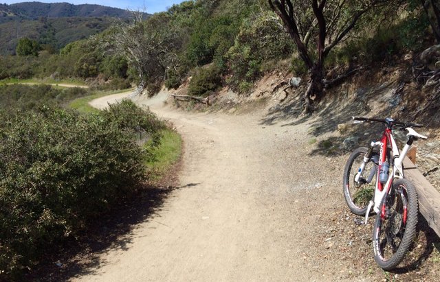
Here is a look down a part of the trail, it is pretty much a fire road and a lot of mtb'ers use this hill as a midweek workout.
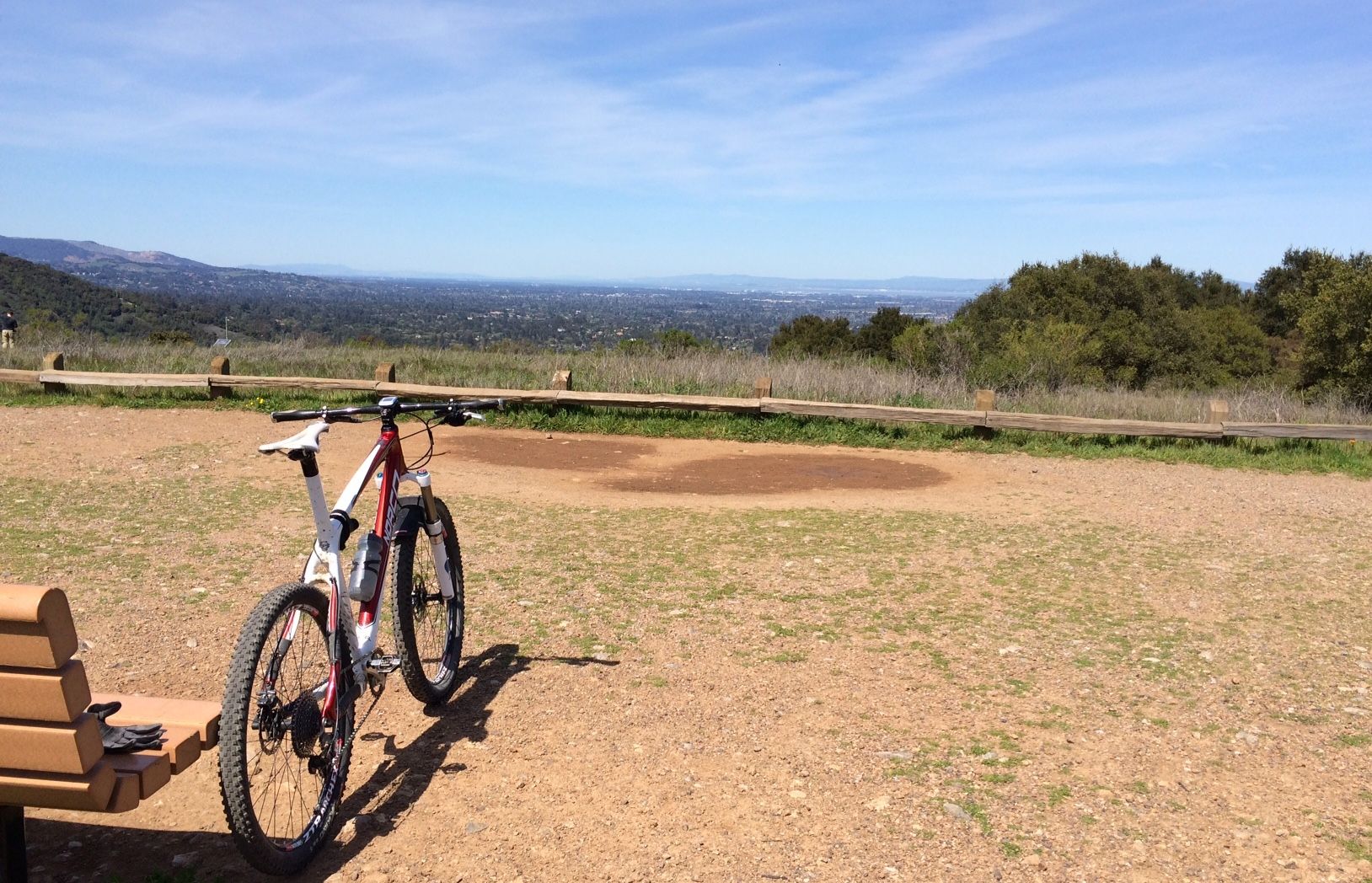
A shot of the top of St Joseph's hill. This is overlooking the south bay area
Back to the percolation ponds, there are quite a bit of wild flowers blooming. There was a mound of small yellow flowers that looked like a colored carpet. (And some light pink ones in the background)

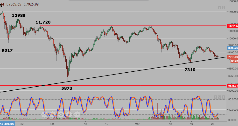
And of course, when I got back (after getting some Panda Express), I looked at the BTC chart. This is a 4hr log scale chart from the GDAX exchange.
The lower ascending trend line has provided support, will it hold?
If the trend line holds, BTC will be getting 'squeezed' by the lower trend line and the 11.7k resistance level.
It may be ready for a cycle trend up as stochastics have an upwards bias. Even if it does, it may not sustain a long term uptrend due to the 11.7k resistance level.
Good work and its a healthy activity. Keep it up.
You got a 15.27% upvote from @thebot courtesy of @thedawn!
Please delegate us Steem Power & get 97% daily rewards share!
20 SP, 50, 75, 100, 150, 200, 300, 500, 1000 or Fill in any amount of SP.
Click For details | Discord server
wow, nice pretty adult Egret....looks like sand hill cranes I used to see in the sand hills of NE when lived on a farm.
BTC went up a bit since 24 hrs ago then came down 4% already...who know what it will do but looks Bearish to me short term...other pro traders are leaning Bearish too.
I think egrets are part of the crane family, I always stop to check them out as they are unique compared to ducks and seagulls.
You need a lot of nerve to trade BTC unless it's in a major bull market. Lots of stress...
Some forex brokers and Crypto brokers allow traders to trade BTC and one can "Short" and buy back later as price goes down. That way you have 2 options instead on waiting for Bull market to trade only.
I like the way you analysis charts also great and important that you get away from the chart from time to time as well.
To answer your questions, I think we test the low on 3/18 at $7200.
It may come close to a retest, it's like a guessing game...
wow...so nice places dear and so good post thanks for sharing
If i am not mistaken, the Garmin Vivoactive does not have a barometer. So the elevation gain would be way off target. It would be reading almost double of the actual climbing
The Garmin Vivoactive has GPS which typically has 3 satellites tracking the device. The elevation gain is fairly accurate, it is off by a few feet when two people ride the exact same ride and compare elevation gains.
Ah, yes. But elevation gain calculated from a GPS is not very accurate.
You can compare your data with someone using a Garmin Edge 510 or above. The watches do not have a barometer afaik.
From https://support.strava.com/hc/en-us/articles/216919447-Elevation-for-Your-Activity
Also, you can go through many similar threads on the Garmin forums:
https://forums.garmin.com/forum/on-the-trail/wrist-worn/fenix-3/102206-true-elevation
This is from Garmin regarding GPS and elevation gain:
GPS heights are based on an ellipsoid (a mathematical representation of the earth's shape), while USGS map elevations are based on a vertical datum tied to the geoid (or what is commonly called mean sea level). Basically, these are two different systems, although they have a relationship that has been modeled.
The main source of error has to do with the arrangement of the satellite configurations during fix determinations. The earth blocks out satellites needed to get a good quality vertical measurement. Once the vertical datum is taken into account, the accuracy permitted by geometry considerations remains less than that of horizontal positions. It is not uncommon for satellite heights to be off from map elevations by +/- 400 ft. Use these values with caution when navigating.
It is much harder and time consuming for someone to calculate based on a topographical map, which is why most people use GPS these days.
On another note, double the elevation? If you followed me up this route, you would know that it was not 1000 feet of climbing.
Thanks. That was informative :)
Haha. I wouldn't mind following you up that route. It looks like a real nice place to ride a bike.
Double the elevation comment was made with regard to my personal experience. Where our comps would show 1400-1500 metres. The watches and smartphones would be showing anywhere between 2600-3000 metres of elevation gain. Which as you would agree is considerably off!
You got a 4.32% upvote from @postpromoter courtesy of @glennolua!
Want to promote your posts too? Check out the Steem Bot Tracker website for more info. If you would like to support the development of @postpromoter and the bot tracker please vote for @yabapmatt for witness!
trail and bike looks amazing , if you can write a content related to mtb bike it will be good , great post