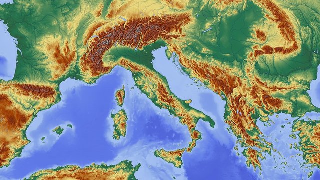
Part #14 [geology]Maps, Geological Equipment and Geological Mapping ..... ???

DID YOU KNOW ABOUT MAP, GEOLOGY EQUIPMENT AND GEOLOGY MAPPING......... ?
TOPOGRAPHIC MAPS
Peta topografi adalah peta yang menggambarkan bentuk/roman muka bumi, yang meliputi perbedaan tinggi/relief, sungai, danau, vegetasi, dan hasil kebudayaan manusia. Peta topografi yang biasa digunakan adalah dengan skala 1:50.000; 1:25.000; 1:12.500; dan 1:5.000 (biasanya peta topografi wilayah kota)...

Use of topographic maps
1.To know the condition of the terrain / area we will visit, knowing the location of the village, highway, river, low area, perititan area, steep slopes, and ramps.
To know and determine our position (field orientation) in the area we visit so as to avoid the danger of getting lost.
In the military field it is used for military strategy, such as the election of a strategic position for defense, assault, logistic place, etc.
4.As a base map (basemap) for the creation of special maps, eg geological maps, land use maps, etc..
Topographic map type
Topographic maps are divided into 2 types (with point reference point 0 mdpl / above sea level), namely:
Surface map (map map), is a map that describes the face of the earth above sea level (positive value).
The subsurface map is a map depicting the surface of the earth beneath the surface of the sea or below the earth's surface (negative value)
Part of topographic map
- Map title and map sheet number (map registration). The title of the map, for example: Sukabumi sheet, Singaparna, etc.
- Legends, symbols or images of terrain that represent a shape or place in an area.
3.Coverage diagram, That is a diagram showing the origin of map data obtained - The administrative index, namely the division of areas by area of administration
- Index of adjoining sheets, ie instructions for knowing the existence of a map with other adjacent maps.
- Map Edition (year of map creation) and name / institution of map maker
- Map orientation
- Grid and Graticula
- Contour lines, Contour lines are imaginary lines connecting points in a map with the same height (calculated from sea level).
Topographic map serves to estimate and interpret various geological conditions that occur in a region, such as aspects of the spread of lithology, geomorphology, stratigraphy, or geological structure.
All these aspects can be studied by taking into account topographical elements, such as contour line patterns, flow patterns, contour density, hill forms, ridge straightness, valley form.
The following will explain one of the key elements in the topographic map that play a major role in determining the particular type of lithology and the developing structure, namely: the basic drainage pattern.
Types of river flow patterns
Dendritic, common forms such as leaves, develop in rocks with relatively similar hardness, relatively flat sedimentary rock layers, and resistant to weathering, slope of the ramps, less influenced by geological structures.
Rectangular,broodstocks with creeks show curved arches, structural controllers or faults that have slope angles, do not have a refractive layer of rocks and often exhibit an intermittent drainage pattern.
Parallel,the general shape tends to be parallel, moderately steep, moderately steep slopes, influenced by geologic structures, found in elongated hills influenced by folding, is a transition from dendritic and trelisian patterns.
Trellis, the shape extends along the direction of sedimentary rock layers, the tributaries often form an axial curve cutting the length of the path of the ridge. Usually controlled by fold structures. Sedimentary rocks with sloped or folded, volcanic rocks and metasedimen rocks are low level with clear weathering differences.
Radial, the shape diffuses from one center, usually occurring in an intrusion dome, a volcanic cone, and a conical hill and the remnants of erosion.
Annular, shaped like a ring arranged by the tributaries, while the brook holding the creek is almost perpendicular. Characterize a clipped or eroded adult dome which is composed of hard and soft rocky surfaces. Also a concave and possibly stocks.
Multi-basinal, surface sediments in the form of gravel of landslide results with the difference of grinding or rocking of the bedrock, is a region of ground motion, volcanism, limestone dissolution and melting snow or permafrost.
Contorted, formed on metamorphic rocks with intrusion dike, vein that shows the relatively hard areas of rock. Longer tributaries to subsequent curves generally show the slope of the metamorphic rock layers and are the distinction between anticline and syncline immunization.
The geological map is a form of geological information that specifically presents the dissemination of rock (lithology or stratigraphic unit unit, whether it is igneous rock, sedimentary rock, or metamorphic rock and also stratigraphic hubu (contact between rocks and geological structure of a region, represented by certain geologic colors and symbols.
Geological maps can provide information on:
- Type of rock and stratigraphic arrangement
- The thickness of sedimentary rocks
- Geological history
- Geological structure
- The shape of the landscape and the process of its formation
- Economical minerals and minerals
Geological map making is done directly, ie by doing mapping and research in field, or made indirectly that is by analysis and interpretation of data from topography map and remote sensing by using aerial photographs and Landsat image (Landsat image).
Supporting literature / Reference
- Responsi, geology dasar, 2010, Departement pendidikan KM HMG “ARC-SINKLIN”
- https://pixabay.com/
- https://id.scribd.com/doc/307379189/Mineral-pdf
All about my article part1, part2, part3, part4,part5, part6, part7, part8, part9, part10, part11, part12, part13.

This post has received a 0.53 % upvote from @booster thanks to: @rabo.