Das Tal von Mała Łąka-The valley of Mała Łąka-Dolina Małej Łąki
[DE]
Das Tal von Mała Łąka
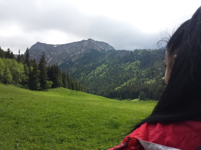
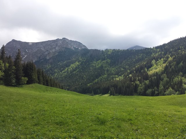
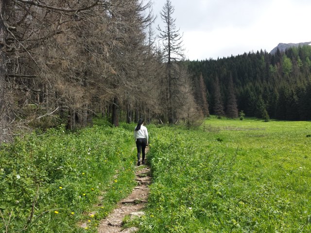
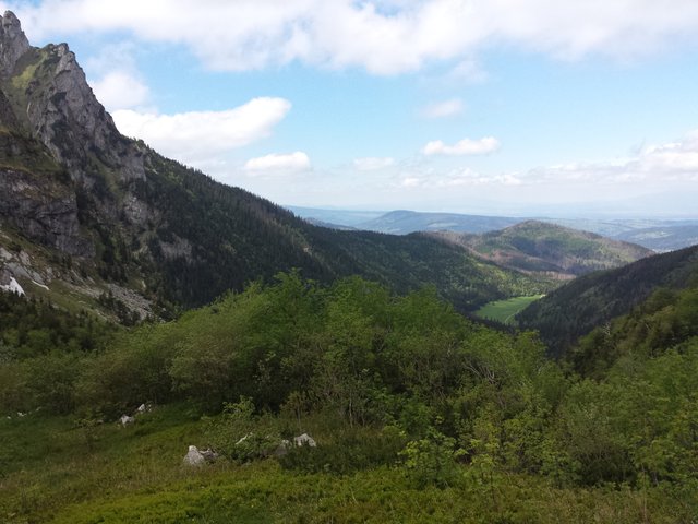
Das Tal von Mała Łąka - die Täler in der polnischen Westtatra, zwischen dem Bystratal und dem Kościeliska-Tal.
Es hat eine Länge von 5,4 km und eine Fläche von etwa 5,7 km². Es ist das kleinste der Tatra-Täler [2]. Der Auslauf befindet sich auf einer Höhe von ca. 930 m auf der Ostseite von Gronik. Das Tal nähert sich dem Hauptkamm von Czerwone Wierchów auf dem Abschnitt von Kopy Kondracka nach Małołączniak. Orographisch wird die rechte Grenze des Tals durch den Nordrücken des Kopy Kondracka nach Giewont, weiter nach Mały Giewont, Grzybowiec und dem nordwestlichen Grat von Lysanek gebildet. Die linken Hänge des Tales bilden der Rote Kamm von Małołączniak, Wielka Turnia, Skoruśniak und Hruby Regiel.
[EN]
The valley of Mała Łąka
The valley of Mała Łąka - the valleys in the Polish West Tatras, situated between the Bystra Valley and the Kościeliska Valley.
It has a length of 5.4 km and an area of about 5.7 km². It is the smallest of the Tatra valleys [2]. The outlet is located at an altitude of about 930 m on the eastern side of Gronik. The valley approaches the main ridge of Czerwone Wierchów on the section from Kopy Kondracka to Małołączniak. Orographically, the right limit of the valley is formed by the northern ridge of the Kopy Kondracka to Giewont, further to Mały Giewont, Grzybowiec and the north-west ridge of Łysanek. The left slopes of the valley are formed by the Red Ridge of Małołączniak, Wielka Turnia, Skoruśniak and Hruby Regiel.
[PL]
Dolina Małej Łąki
Dolina Małej Łąki – dolina walna w polskich Tatrach Zachodnich, położona pomiędzy Doliną Bystrej i Doliną Kościeliską.
Ma długość 5,4 km i powierzchnię ok. 5,7 km². Jest najmniejszą z walnych dolin tatrzańskich[2]. Wylot znajduje się na wysokości około 930 m po wschodniej stronie Gronika. Górą dolina podchodzi pod główną grań Czerwonych Wierchów na odcinku od Kopy Kondrackiej po Małołączniaka. Orograficznie prawe ograniczenie doliny tworzy północna grań Kopy Kondrackiej po Giewont, dalej Mały Giewont, Grzybowiec i północno-zachodni grzbiet Łysanek. Lewe zbocza doliny tworzy Czerwony Grzbiet Małołączniaka, Wielka Turnia, Skoruśniak i Hruby Regiel.
good luck!!!
have a great day!!!
thanks
Congratulations @cabontomasz! You have completed some achievement on Steemit and have been rewarded with new badge(s) :
Click on the badge to view your Board of Honor.
If you no longer want to receive notifications, reply to this comment with the word
STOPTo support your work, I also upvoted your post!
Do not miss the last post from @steemitboard!
Participate in the SteemitBoard World Cup Contest!
Collect World Cup badges and win free SBD
Support the Gold Sponsors of the contest: @good-karma and @lukestokes