Where Eagles Fly : Taos to Winslow ~ Part 5 ~ Across the Otherworldly Hopi Buttes Volcanic Field
This is the last of my 5 post series based on an aerial exploration from Taos, New Mexico, across the desert to Winslow, Arizona over some very interesting and unusual wilderness.
Continued from Part 4...
After circling around those interesting ruins I took note of the time I'd been in the air and my GPS told me I was 150 miles (241 k) away from Winslow. Looking at my current fuel status I calculated I was safely within my established flight parameters and even though there was a 10 knot right quartering headwind, I still had enough fuel to fly some exploration.
Instant Aerial Roller Coaster
I had spent a little over 2 hours in the air and covered a number of interesting locations so far. Suddenly winds across the desert picked up, as they usually do when dawn becomes day. It wasn't unexpected but the immediate fury of the wind was intense. The beating I was taking made me reconsider my route. I did some quick calculating and determined that these rapidly changing variable headwind speeds would decrease my speed while increasing my fuel burn.
Flying west bound I could see in the distance the distinctive shapes of the Hopi Buttes Volcanic Field across the and it was getting very violently bumpy. I was getting pretty harshly slammed. The upside of wind is it clears the air, providing a beautiful field of depth for miles. The downside is it makes photography focusing rather difficult.
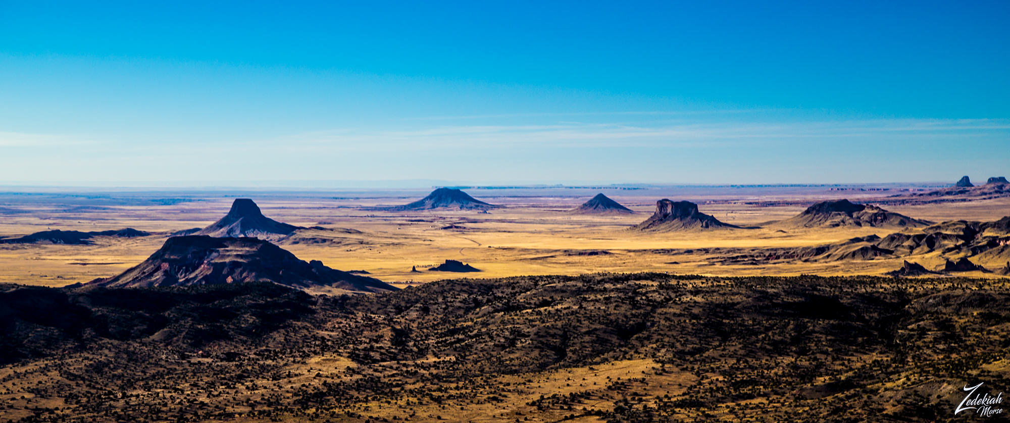
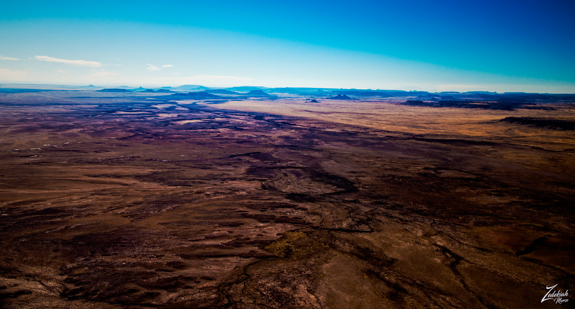 Hopi Buttes Across the Valley ~ Click to Enlarge
Looking toward Yellow Creek Valley across the Chuska Mountains and onto Defiance Plateau, I thought about the strong winds. This updraft buffeting was happening because the rising warm air, heated up by the ground in the morning sun, mixed with the general coriolis-effect and produced intense winds.
Then those fast winds coming across the deserts would sink into those cooler canyons and become amplified by the Venturi effect in those deep canyons. This would then whip up out of the canyons for thousands of feet on the leeward side, which was the direction I was approaching from. Crossing that rough terrain in windy conditions was not a good idea.
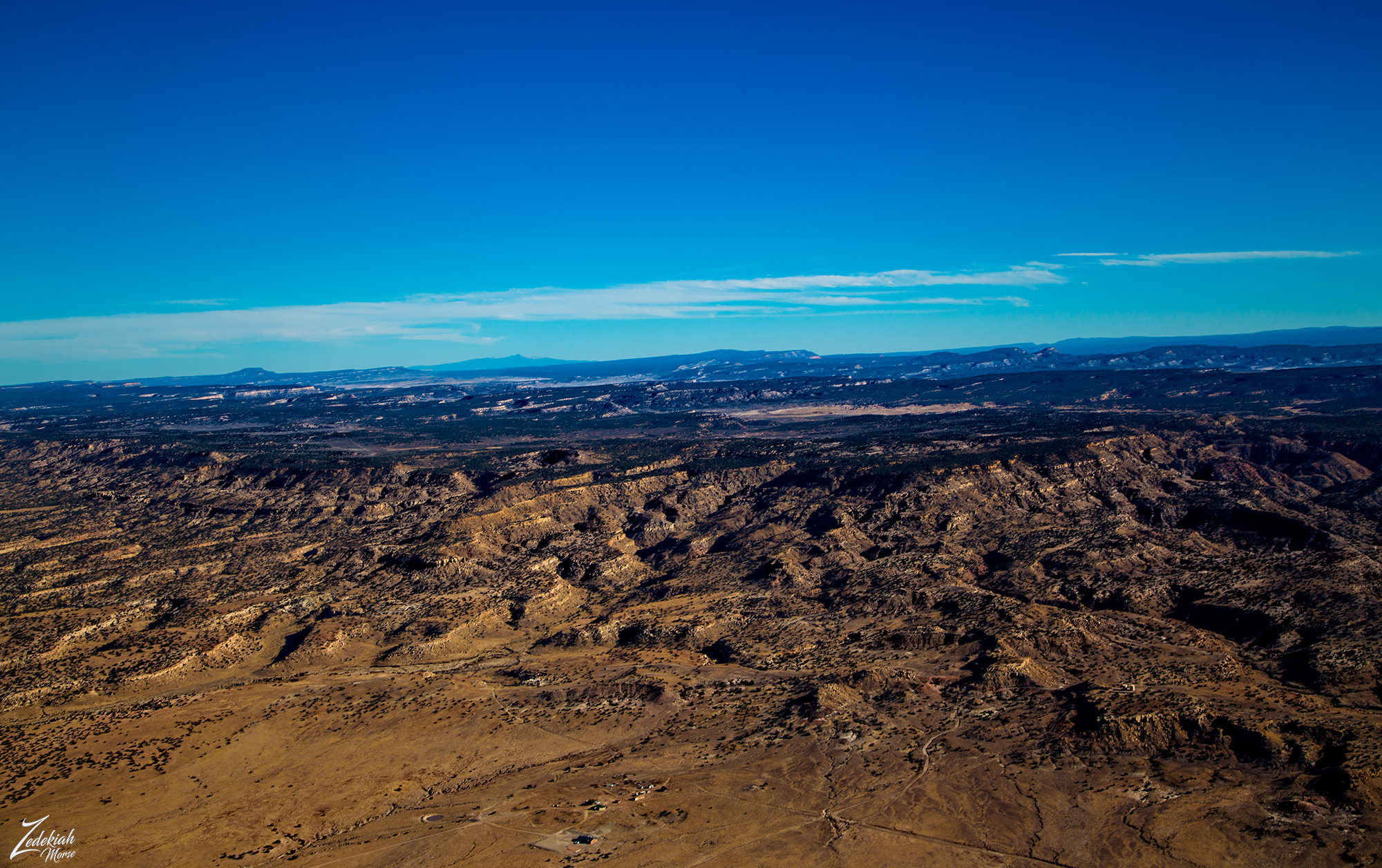 Chuska Mountains & Yellow Creek Valley ~ Click to Enlarge
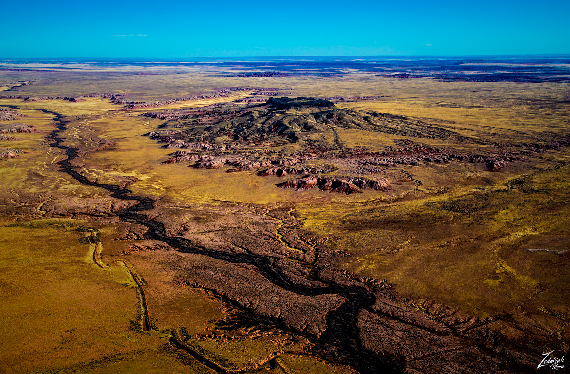
I decided to forgo visiting the Chuska Mountains and continued on for another 40 miles until I came out of the windy conditions on the southwestern side of the Red Hills in the First Nations Diné (Navajo) Reservation. As I turned towards the large shapes of the Hopi Buttes Volcanic Field on the horizon, I came upon this strangely colored scar across the ground.
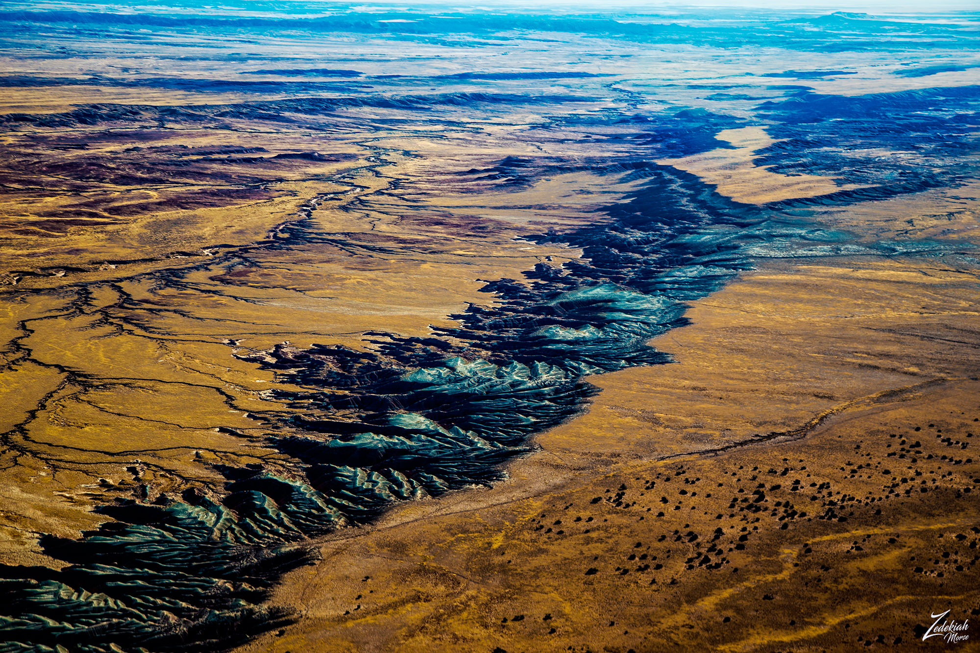 The Colors of Sabito Wash ~ Click to Enlarge
Resembling an abstract painting, this surreal landscape is caused by the mesa on the right side being slowly eroded at such a shallow angle that it exposes a large layer of gray material in bands caused by the thousands of small rivulets created by the rain and winds. All those many rivulets lead dow to bigger and larger streams which all flow into Sabito Wash and on into the amazing Petrified Forest National Park on the left side of this image.
Hopi Buttes Volcanic Field
Hopi Buttes volcanic field is a 965 square miles (2,500 km2) monogenetic volcanic field located on the First Nations Diné (Navajo) Reservation. The image above is of a feeder diatreme made of monchiquite. In this large volcanic field most of the volcanic activity occurred between 8.5 and 6 million years ago, with the most recent at 4.2 million years ago.
(Research Source)
 Hopi Volcanic Dinosaur Spine ~ Click to Enlarge
As I entered the Hopi Buttes Volcanic Field the very first thing that caught my eye was this small series of volcanic remnants sticking up out of the desert floor. I named this formation "Hopi Dinosaur Spine" as it is literally a ridge line of small volcanic cores, now exposed.
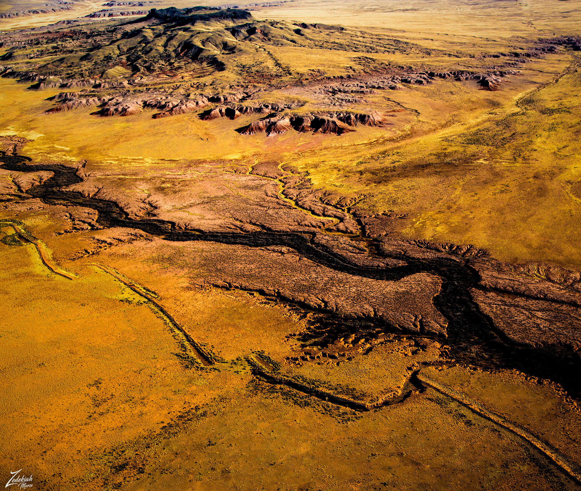
As I flew into the volcanic field I was surrounded by an array of large multi-hued buttes of various sizes and shapes.Go here to view a satellite image and map of the location.
To my left was a river cutting through the desert next to a statuesque volcanic capped butte. This was the Pueblo Colorado Wash, an alluvial aquifer, and an important water source for the First Nations Diné (Navajo) Reservation. The name “alluvial” refers to the loose, un-layered nature of the material – often silt, clay, sand, and gravel which are deposited by running water in and around rivers.
The colors of the river as it cuts across the desert are juxtaposed against the vibrant hues of the different rock layers that make up the base of this magnificent butte.
 Pueblo Colorado Wash & Volcanic Caprock Butte ~ Click to Enlarge
Buttes such as this are tall, flat-topped, steep-sided towers of rock created through the powerful process of erosion. Millions of years ago the buttes seen in these images were all part of a vast flat elevated area that was either a mesa or plateau. Over time, the overwhelming natural forces of water, wind, and ice slowly cut through the ground and created streams, creeks rivers and lakes.
This continuous, timeless process slowly eroded away the softer soil while leaving the hard top layer, called a caprock, which resists weathering and erosion. As a result, this formation is about the same height as the original plateau or mesa that surrounded it. Because caprock protects the more vulnerable rock beneath it, buttes are constantly evolving.
(Research Source)
 Erosion Process Over Millions of Years ~ Click to Enlarge
Evidence of this continual process is everywhere in these images. The colorful base of the butte with its many eroded hills of purple and magenta; the many streams and rivulets draining down into the main river and finally the cracked earth fault line on the left side of the image; All of these are a testament to the transformative power of nature.
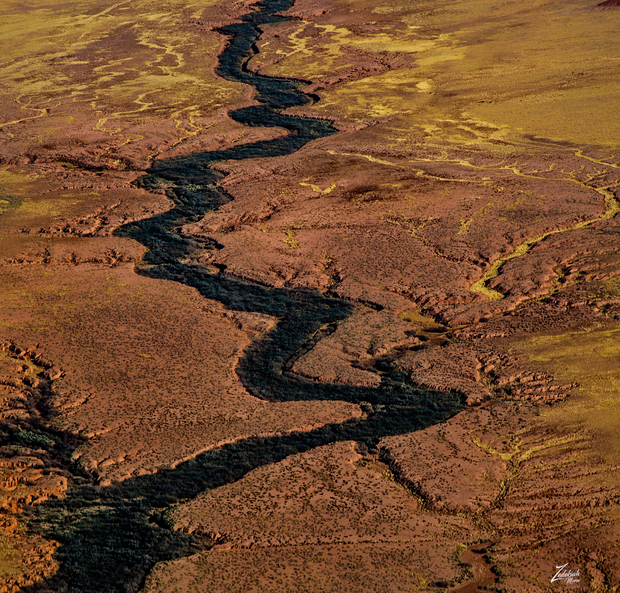 The Lush Trees of the Pueblo Colorado Wash ~ Click to Enlarge
An interesting thing about this image above. Looking closely at the river, note that there is a carpet of trees and brush that occupy the entire river bottom. Notice the depth of the main river which is running on the right side of the river channel. Many rivulets drain into the main wash, collecting as much water runoff as possible.
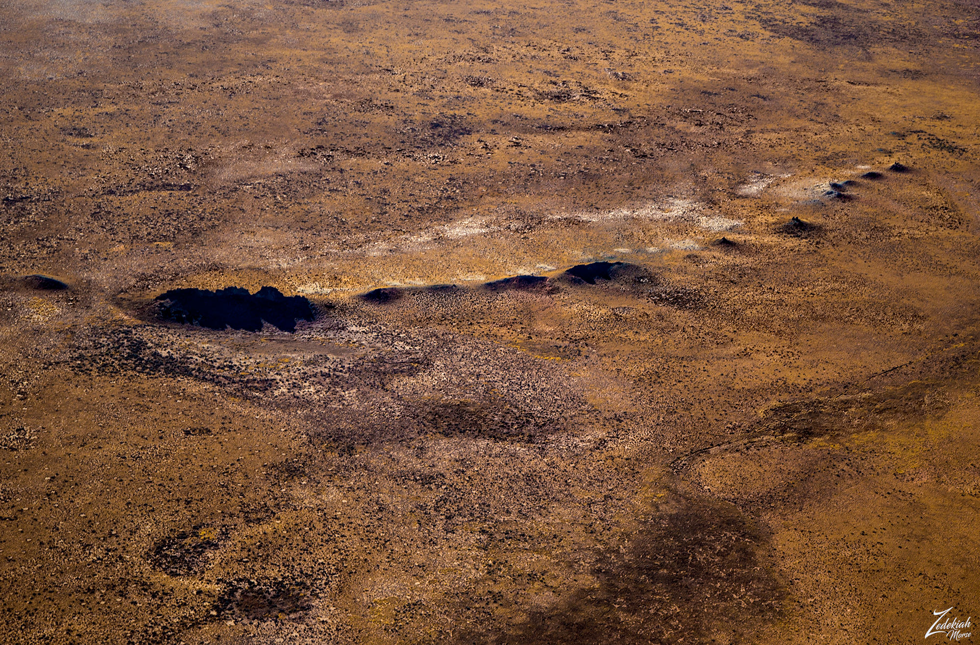
In the image below at the western base of the formation known as Five Buttes I found this solitary towering monadnock this impressive formation is an exposed ancient volcanic throat or core. Multiple volcanic maars and diatremes range across the field in the distance.
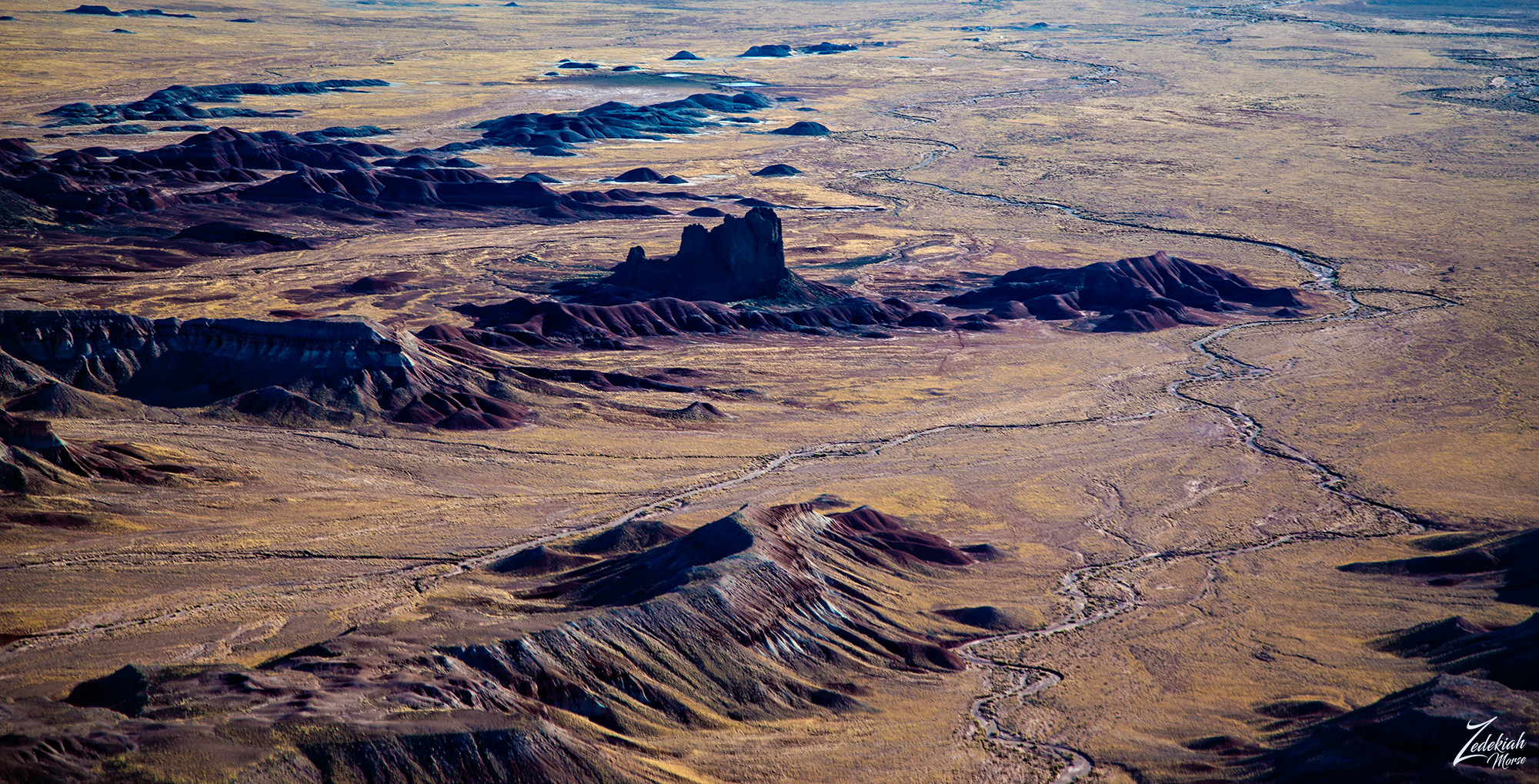 Flying Butte ~ Volcanic Throat Core ~ Click to Enlarge
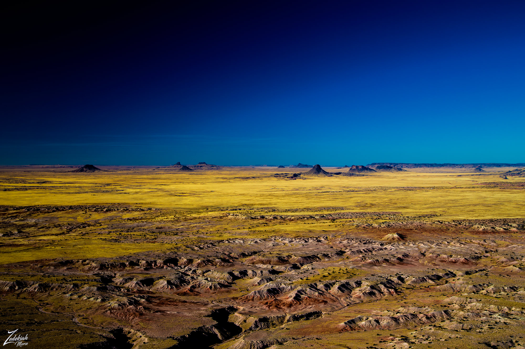
As I crossed through the eastern side of the Hopi Buttes Volcanic Field, I was surrounded by numerous volcanic buttes. This volcanic field covers an area of approximately 965 square miles (2,500 km) and contains about 300 such volcanic formations. It is interesting to look at these images and realize all of these towers, cones and spires used to be underground. And then to realize this process is still happening. What will it look like in a few million years?
 Tode Haho Tsiquini & Chezin Chotah Buttes ~ Click to Enlarge
My GPS showed I was only 20 miles from Winslow, but before I began my landing checklist I took one more picture of this otherworldly landscape, stunning in its primordial starkness. This was the land of dinosaurs, where the human concept of time has little bearing. This place will always be here, slowly transforming. Imagine the night sky here!
 Hoppi Butte Volcanic Buttes ~ Click to Enlarge
Trip Summary
After flying from Taos, New Mexico in a fairly straight line across the desert I safely landed at Winslow after being in the air for 3 hours and 12 minutes. This map shows my path and denotes the different places I photographed along the way.
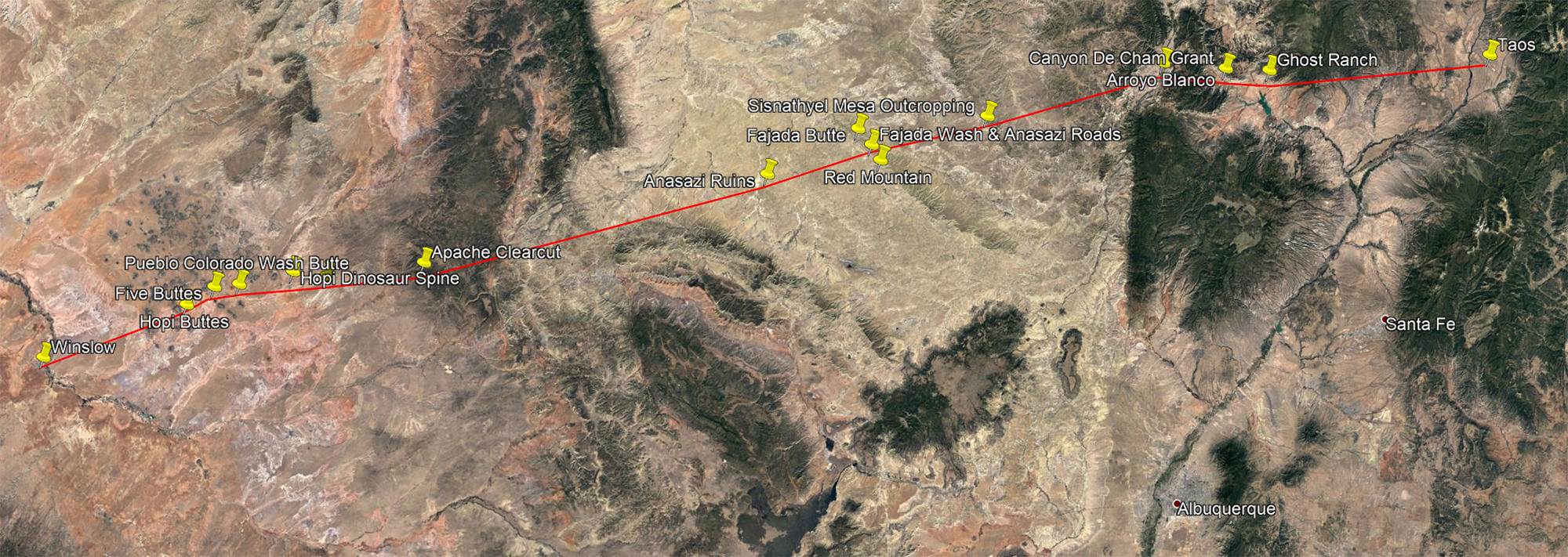 Flight Map with Photo Locations ~ Click to Enlarge
In a trip lasting a little over 3 hours I was able to visit some absolutely remarkable places. That is exactly what my project is all about, taking cross country trips to reveal a unique view of the world rarely seen. There is so much of the world to explore in this manner.
We are utterly surrounded by wild spaces, awe-inspiring places with forgotten history and I am going to explore as many as I possibly can!
About The Project
Where Eagles Fly - The American Wilderness Expedition is my personal mission to introduce people to these amazing locations that surround us. I am piloting a bush plane while exploring and filming throughout the remote back-country areas of North America to raise awareness of the 47% of the USA and 90% of Canada that are unpopulated wilderness.

About The Author
My name is Zedekiah Morse and I'm a Bush Pilot, Photographer, Explorer and Filmmaker. I live in the Rocky Mountains and devote my time and resources to exploring as much of the world as I can by air. If you wish to watch a short film detailing how I do my work and this project, go here.
If you like what you see here upvote and resteemit so that others may experience these wondrous places.
And if you'd like these images to be part of your feed, follow me.
Thanks for your support and Yehaw!!
Great Post & Images!
Congratulations.
Thanks for sharing and steem on :)
yeehaw
ME gustan mucho tus publicaciones, mu buenas imágenes amigo :D
Gracias por su apoyo, mi amigo. ¡Espero que continúes leyendo mis publicaciones! ¡Tengo mucho más en el futuro!
Así sera mi hermano, lo haré:)
The "Painted Desert" is amazing terrain. I do miss the scenes in Arizona! Of course I never ever saw them from so high up with all of the inner contours in view as your excellent photography clearly shows.
Yes it is one of the most amazing places both on the ground and from the air... even from space it looks awesome!
I grew up in Winslow! Some beautiful landscapes, but it's kind of a shit hole. Nice shots though!
LOL I don't know about that... the people at the airport and hotel were pretty nice... Of course I visited the corner :)
Wow, 'The Colors of Sabito Wash' looks absolutely stunning! I've loved keeping up with this series and am sad to see the end of it! I hope there's still plenty more like it on the way!
And there is I promise!! Yes Sabit Wash is a really odd place... it is only colored like that because of the shallow angle of the erosion off of that mesa top on the right side of the image.
Whew! It is phenomenal to see, it makes me want to buy another drone! I'll never have the head for heights to be able to even think about something like learning to fly, but hey, I can get a little closer to the clouds!
Amazing stuff as always!
yehaw!!!