Sardis Lake and the Little Tallahatchie River
The colors in nature are stunning. I find beautiful places that can only be seen from up above the ground. Sardis Lake is such a place. Once morning as I was flying westbound at a couple thousand feet above ground, just after sunrise on a clear winter morning I came upon this view. The colors were stunning.
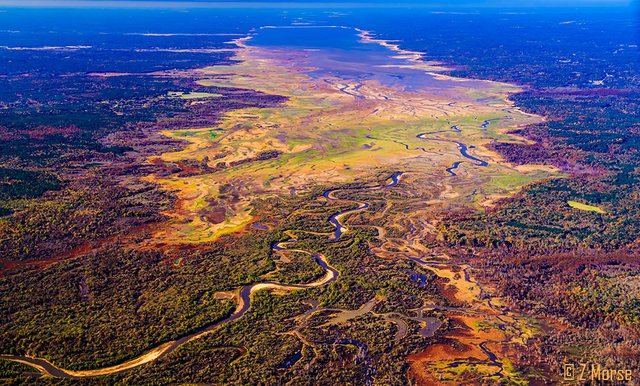
Sardis Lake with the Little Tallahatchie River flowing from it through the marshes
Sardis Lake is a 98,520-acre (398.7 km2) reservoir on the Little Tallahatchie River in Lafayette, Panola, and Marshall counties, Mississippi. I took these images flying a couple thousand feet about the lake early in the morning when the sun was at an angle that brightly, intensely lit up the amazing earth colors.
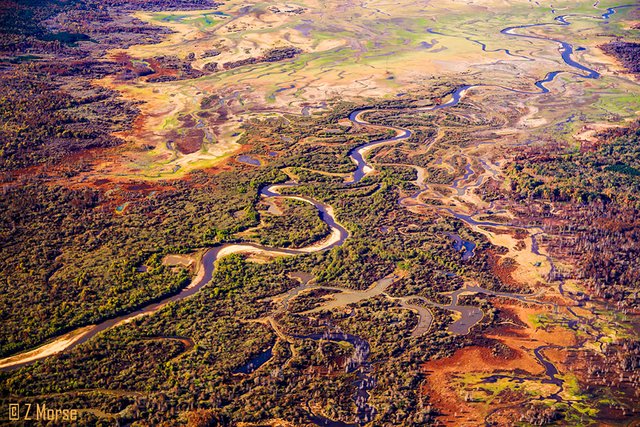
Little Tallahatchie River flowing through colorful ambrosial marshes
The Tallahatchie River runs 230 miles (370 km) from Tippah County, down through Tallahatchie County, and on to Leflore County, where it flows into the Yalobusha River to form the Yazoo River. The river is only navigable for 100 miles (160km).
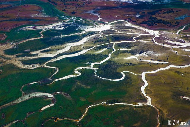
Multiple rivulets and catch ponds flowing from the Little Tallahatchie River
Tallahatchie is a First Nations Choctaw name meaning "Rock of Waters." This name derives from the source of the Tallahatchie River which has outcrops of iron sandstone.
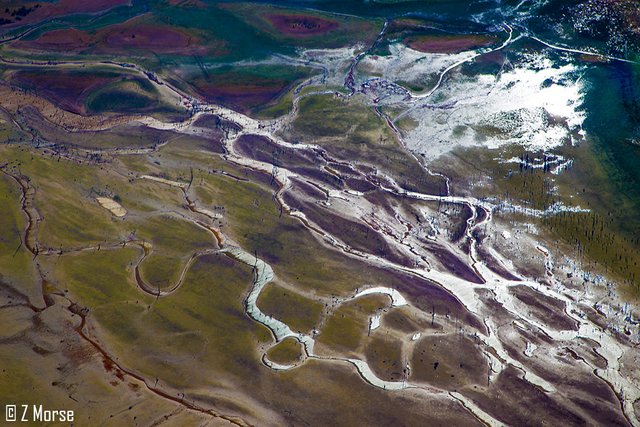
Multiple rivulets and catch ponds flowing from the Little Tallahatchie River
As part of the Flood Control Act of 1936, the federal government constructed an earth-filled flood control dam on the Tallahatchie near the town of Sardis, Mississippi. This created Sardis Lake to protect the town and surrounding area from flooding.
These photos are from my project: Where Eagles Fly - The American Wilderness Expedition
If you would like to learn more about the project please visit my introductory-post and second post on the Zapata Ranch. Also drop by my Facebook profile Zedekiah Morse
To view images from the project Where Eagles Fly - The American Wilderness Expedition please view my other posts. I am on a mission to raise awareness of our Iconic Natural Heritage Treasures of North America.
And if you would like, press the button to automatically follow my stories! Love to have you on board.

What colors! Unbelieveable.
I agree.... the photos only capture part of the experience... seeing it all around you from the air was intense! I am glad you like it....
Yes, you are right, I can only try to imagine. Thanks for sharing ;-)
Beatiful photos
Thank you! I am glad you like them!!
I envy the birds' who have this view every day ))
As do I.... I feel we take for granted how the creatures of the earth experience it. Also most birds are tetrachromatic, possessing four types of cone cells. So their perception of color is pretty awesome!
Great views!
My fav is the second photo, has a romantic side to it
Thanks! I like that one as well! I like the way it shows the horizon for perspective. Although I have now flipped it and made it the first picture...
I am familiar with this area as years ago I had friends that were from there. Beautiful pictures and colors.
Thank you, I'm glad you like them. I have friends that fly out of Tupelo, but I was just passing over on my way from Tennessee to Montana to film in the Glacier National Park when I flew over this. I was really impressed by the vibrant colors!
Whoa, these are amazing!
The color palette is exceptional. The abstract nature of the rivers/undulating lines is a strong compositional element.