On the volcano up and down
This happened during our expedition to the Kunashir island(the southernmost of the Kurile Islands).
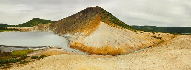
It so happened that we waited almost a week for permission from the border guards to go to sea. And since our goal was seal rookeries, where you can only go by boat, you had to sit on the shore. Thanks to the reserve, he organized a program for us on the island for this time. And one of the most interesting items in it was the journey to the volcano Golovnina.

Of course, we could not ignore the two lakes that are inside this crater named Goriachee(Hot) and Kipaschee(Boiling). For this reason we took with us an underwater box with a camera and various Go-pro. I must say at once that the trip was for the most part on foot, since from the place where the car can drive up to the crater of kilometers 8-10. A small path, which all the time winds and leads something then up, then down. With our equipment can not be said that there was an easy walk.
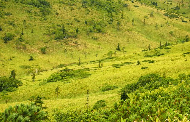
So the picturesque-green look the slopes of the hills on the way to the crater. It seems that all these are solid meadows, with bright green grass. But no, it's all a bamboo maker (not to be confused with bamboo). When you look at it from above, it sometimes starts to seem like it's such a grass, as golf courses. But this is a mistake caused by its phenomenal density.
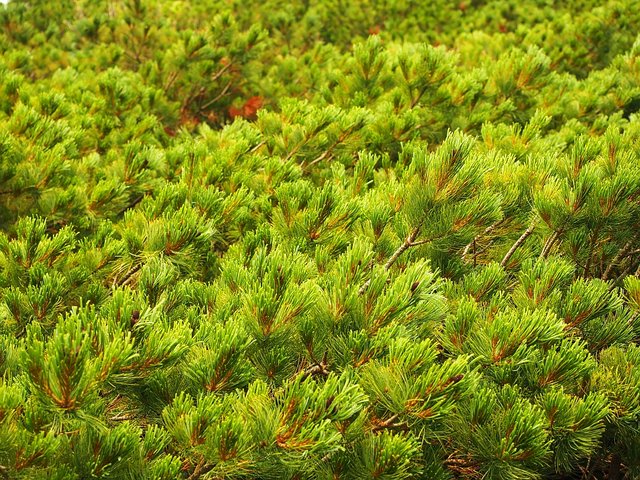
In fact, the height of the bamboo is comparable to the height of a man. Go to these hills you will not help even the machete, on so many dense thickets of this plant. He also hides the lower meter and a half of all the trees in this photo. Well, bushes and not large conifers look like dark green heels on the general background. Also I must say very dense.
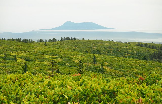
When the first ascent to the top is over, you can see the volcano Tyatya towering in the distance. Of course, if the weather does not disappoint. We ourselves did not get to the queen, just like several other groups. Rains and fog are the usual weather on Kunashir, and most of the Kuril Islands. Clear days here are much rarer.
When the first ascension is overcome, a view of the entire caldera opens. Two lakes in a frame of bright greenery. And immediately it becomes clear that these lakes are not simple. Are more suitable for a fairy tale about a humpbacked horse's skull, where it was necessary to jump into one vat, then another ... We could not deny ourselves and swam in both lakes. In the hot water is quite a decent, almost like in the pool - transparent and a temperature of 25 degrees.
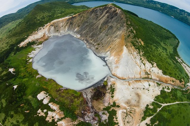
But in the Boiling Lake there you can adjust the degree of "cooking", then swim, then away from the sources. And those divorces that are visible in the photo from the air, it's just the results of our swim. The composition of the water can be judged from several facts: for example, after a small swim, a silver cross was decently so oxidized, becoming purple. A nearby twin-bearing volcano bears the name of Mendeleyev, and not because of the fact that the famous scientist has been here ...
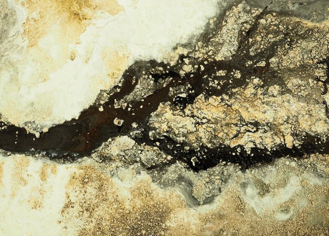
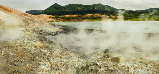
Going down, and passing through the river that liaison two lakes, you can be accessed to the active zone of the volcano. There is no vegetation anymore, and everything is more like landscapes from other planets. Geysers, fumaroles, stains of strange flowers on the soil. And all this in constant smoke.
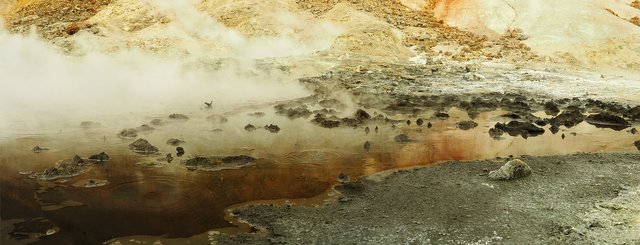
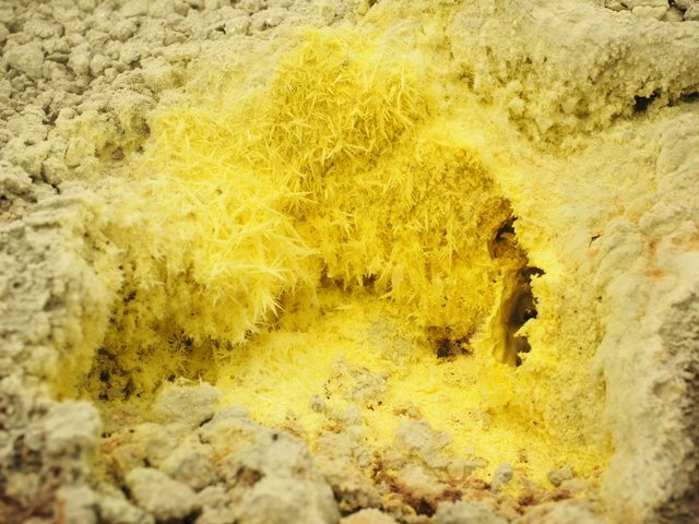
That's how the sulfur crystallizes on the surface. Well, the smell there is appropriate. It is already dangerous to approach very closely to such places. The soil under the feet can contain large voids filled with steam and boiling liquid of complex chemical composition. According to our guide, the cases when people fell down, happened more than once.
It would be nice to meet the sunset here, but spending the night here is not the most successful idea. It's one thing to stay some hour or two apart, it's quite another to breathe these evaporation for more than a day. So we have only one option - to move back. And this means again climbing into the hill and descending from the other side.
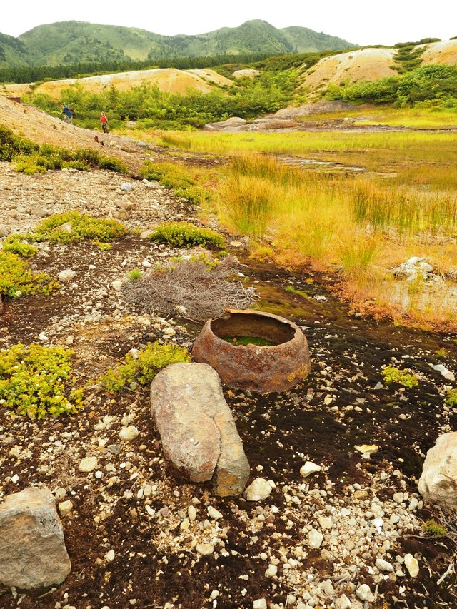
Again the same 8-10 kilometers along the slopes of the volcano. Past the barely noticeable remnants of the Japanese gray-mining factory. Past a small strange looking swamp, on which I was surprised to find sundew. Past the green bamboo wall ...
So, when we got to the road in the evening, 3-4 hours later than expected, everything was happy. We, and the driver waiting for us, whose working day has long since ended. But the legs quickly moved away, the burnt skin in a couple of days went off, and the impressions and photos remained)
My photos and materials from the Underwater World of the Far East project.
[//]:# (!steemitworldmap 43.864181 lat 145.503311 long Volcano up and down d3scr)
I would not want to become part of the sulfuric acid soup if I fell down there wonder if that is a quick or slow corrosive acid great photography and interesting destination.
Amazing shots, great work
World of Photography Beta V1.0
>Learn more here<
You have earned 5.85 XP for sharing your photo!
Daily photos: 1/2
Daily comments: 0/5
Multiplier: 1.17
Server time: 11:09:07
Total XP: 1036.39/1600.00
Total Photos: 39
Total comments: 12
Total contest wins: 19
Follow: @photocontests
Join the Discord channel: click!
Play and win SBD: @fairlotto
Daily Steem Statistics: @dailysteemreport
Learn how to program Steem-Python applications: @steempytutorials
Developed and sponsored by: @juliank
Congratulations, Your Post Has Been Added To The Steemit Worldmap!
Author link: http://steemitworldmap.com?author=narchuk
Post link: http://steemitworldmap.com?post=on-the-volcano-up-and-down
Want to have your post on the map too?
What an incredible experience! I certainly thought that "picturesque grass" photo looked like it came out of a child's book or some fairy tale, but how crazy that it's actually such dense thickets! Still beautiful, and certainly otherworldly as you described in your descent. Thanks for sharing these parts of the world we may not have otherwise seen! :)
Thanks!
The islands in the Far East are fraught with a lot of amazing things.
But it is really difficult to get there((
Certainly looks like it's worth the trek! :)
Hiya, just swinging by to let you know that this post made the Honorable mentions list in today's Travel Digest!
Congratulations! This post has been upvoted from the communal account, @minnowsupport, by narchuk from the Minnow Support Project. It's a witness project run by aggroed, ausbitbank, teamsteem, theprophet0, someguy123, neoxian, followbtcnews, and netuoso. The goal is to help Steemit grow by supporting Minnows. Please find us at the Peace, Abundance, and Liberty Network (PALnet) Discord Channel. It's a completely public and open space to all members of the Steemit community who voluntarily choose to be there.
If you would like to delegate to the Minnow Support Project you can do so by clicking on the following links: 50SP, 100SP, 250SP, 500SP, 1000SP, 5000SP.
Be sure to leave at least 50SP undelegated on your account.
Saw this featured on @jrvacation (๑•‿•๑). I've never seen photos from this area, so this is pretty cool (๑✧‿✧๑). I didn't even know there was a settlement here till I Googled it. Seems like you've had quite a journey to get there and back!