High Sierra Trips - The High Sierra Trail Part 1
This post has now been combined with "part 2" to make it complete. You can find the full story here - https://steemit.com/photography/@derekrichardson/high-sierra-trips-the-high-sierra-trail-part-2
We headed up to the Giant Forest to backpack across Sequoia National Park from west to east via the High Sierra Trail. This was a 10 day trip so I've decided to split this post into 2 posts. So watch out for part 2!! The High Sierra Trail leads from Crescent Meadow in the Giant forest up the canyon of the Middle Fork of the Kaweah River, crossing the Great Western Divide over the 10,700' Kaweah Gap. It then descends into Big Arroyo canyon and climbs up to the Chagoopa Plateau. Then it drops down again into the Kern River Canyon. It heads north up the bottom of the Kern Canyon, then turns east, climbing parallel to Wallace Creek up to the junction where it joins the John Muir Trail to the summit of Mount Whitney(14,505') the highest summit in the Sierra Nevada. Then it descends the mountain via the Mt. Whiney trail to the end at the Whitney portal.
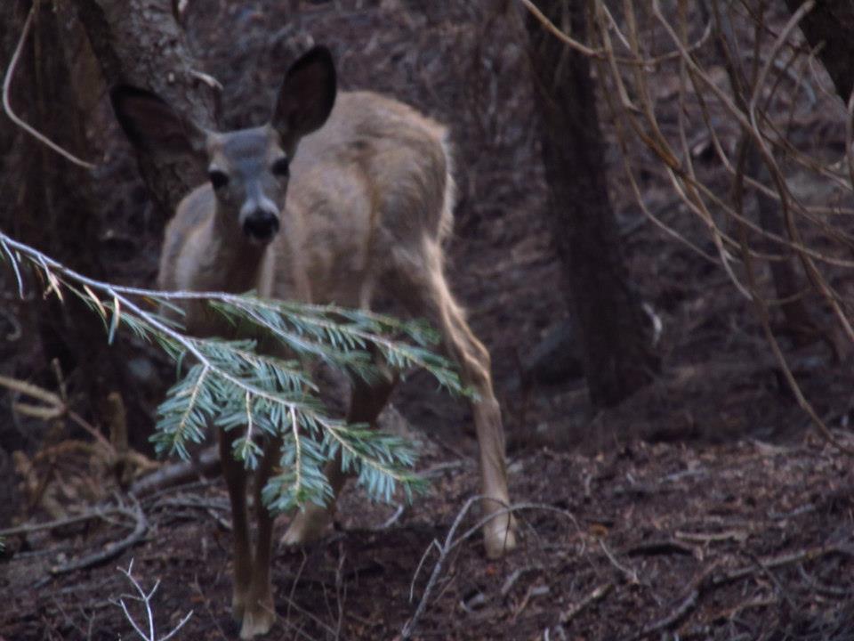
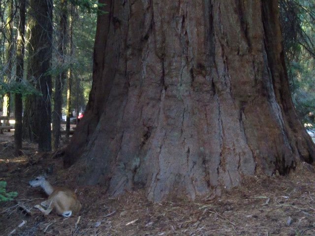 A doe resting in the Giant Forest
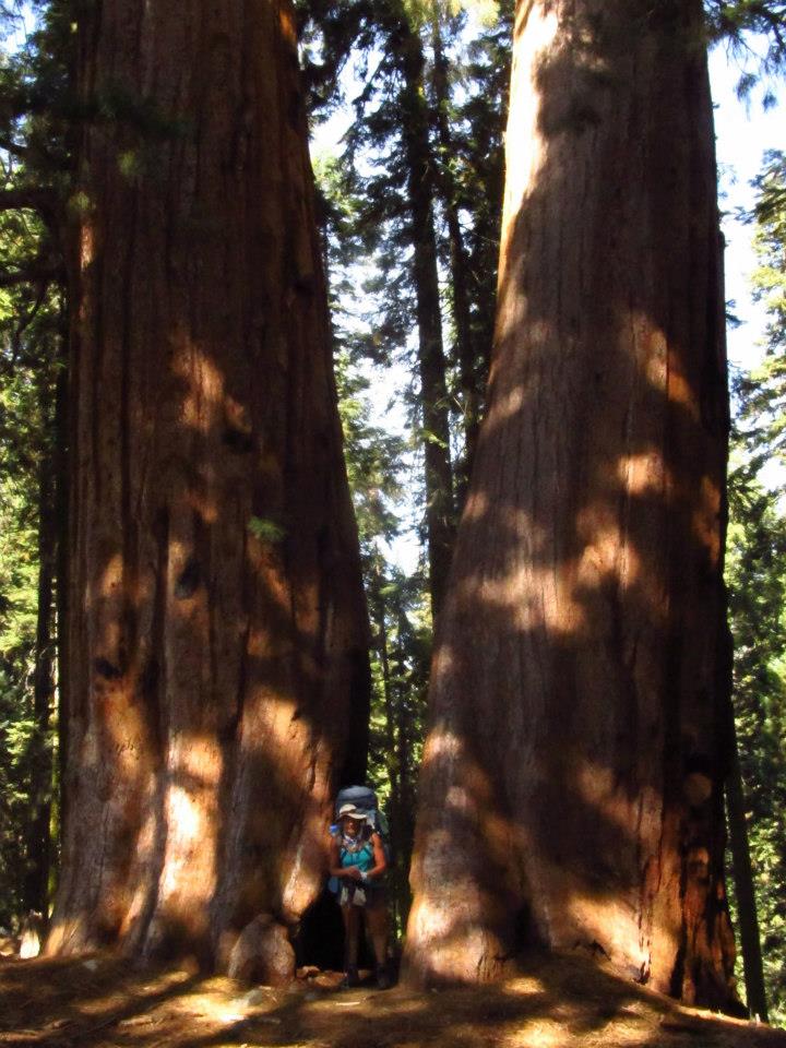
We drove up to Sequoia the day before we planned on starting our trip so we could be sure to get our permit. We got up there pretty early and got a campsite at the Potwisha camp. Then we headed up to Lodgepole and got our permit at the ranger station. We still had lots of time so we checked out some stuff in the Giant forest including the General Sherman tree(the largest Sequoia tree), and we climbed up the huge granite dome called Moro rock. It's the touristy stuff, but it was fun to do before our big journey.
Staring out from the Giant forest
Day 1 -
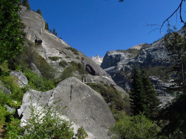
The next morning we started out from the trailhead at Crescent meadow. There were lots of deer wondering around the Giant Forest and the huge Sequoias were incredible. We got out of the forest and followed along the trail high on the side of the mountain with the Kaweah river thousands of feet below. The huge views of Castle rocks, Moro Rock, Blue dome Sugarbowl dome and the Great Western divide were awesome. We crossed Panther creek and Mehrten creek and eventually got to 9 mile creek where we decided to make camp. There was a great campsite and the creek was flowing good. After making camp I explored upstream a bit and there were some nice pools to get in and cool off after hiking all day. Then I got up to a big smooth granite wall where the water was pouring over and at the bottom there was a dead, and half rotted coyote carcass. I'm guessing he tried to cross above the falls and it didn't work out so well. Needless to say we were concerned about the water quality after that, but nobody ended up with any ill effects that I know of. We made our dinners and as light faded we had more deer encounters. Those things are just to cute.
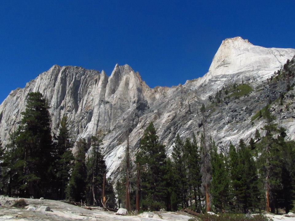
 The High Sierra Trail with Castle rocks in the background
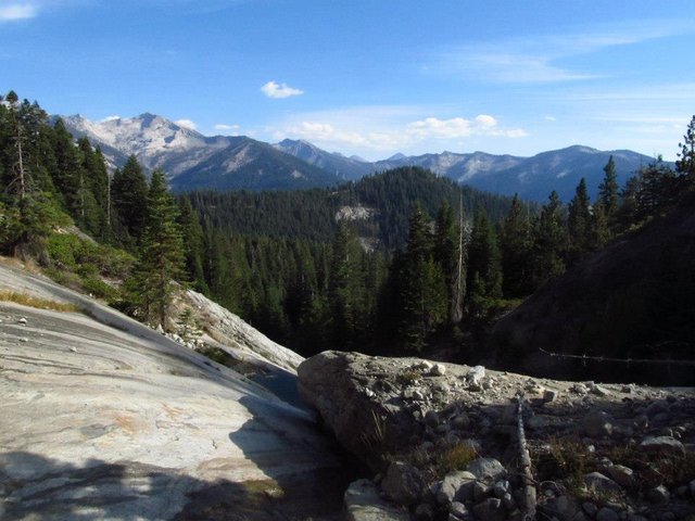
 Blue dome, Sugarbowl dome, and the Great Western Divide
 Top of the falls at 9 mile aka Dead Coyote creek
 Mule deer near our camp
Day 2 -
The next day we hiked down to Buck creek and then up over Bearpaw meadows then back down to Lone Pine creek and then up again to Hamilton lake. Lots of ups and downs, but the trail is very well maintained and the milage for the day was low. Our only major issue was a hornet's nest along the trail that required a quick yet cautious passing. Luckily no one got stung. The views over River valley, up at the Hamilton towers, the Valhalla, and ultimately at Hamilton lake where we made camp, where breathtaking! It is possibly the most impressive area in the High Sierra that I have ever seen in all my travels up there. We got to Hamilton lake and setup our camp with plenty of light to spare so I jumped in the lake to cool off then headed out around the lake to have a little fun trout fishing. I did catch a few small rainbow trout(catch and release), but nothing super exciting. Then we had our dinner and headed off to the tents for the second night on the trail.
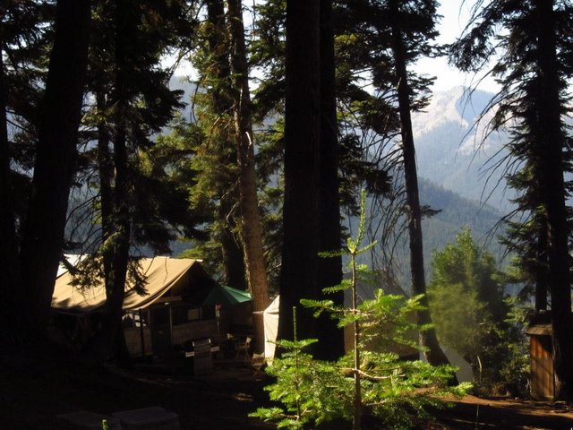 Bearpaw meadow camp
 Castle Rocks from Bearpaw meadow
 High Sierra Trail
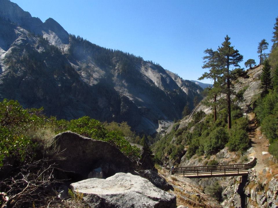 Crossing the bridge at Lone Pine creek
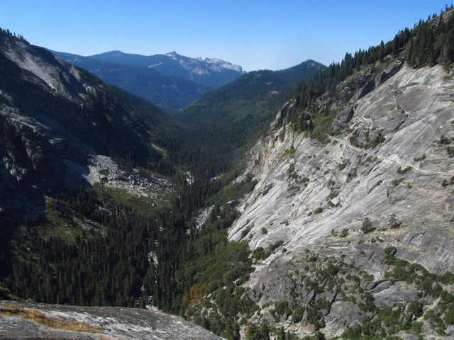 Overlooking River Valley
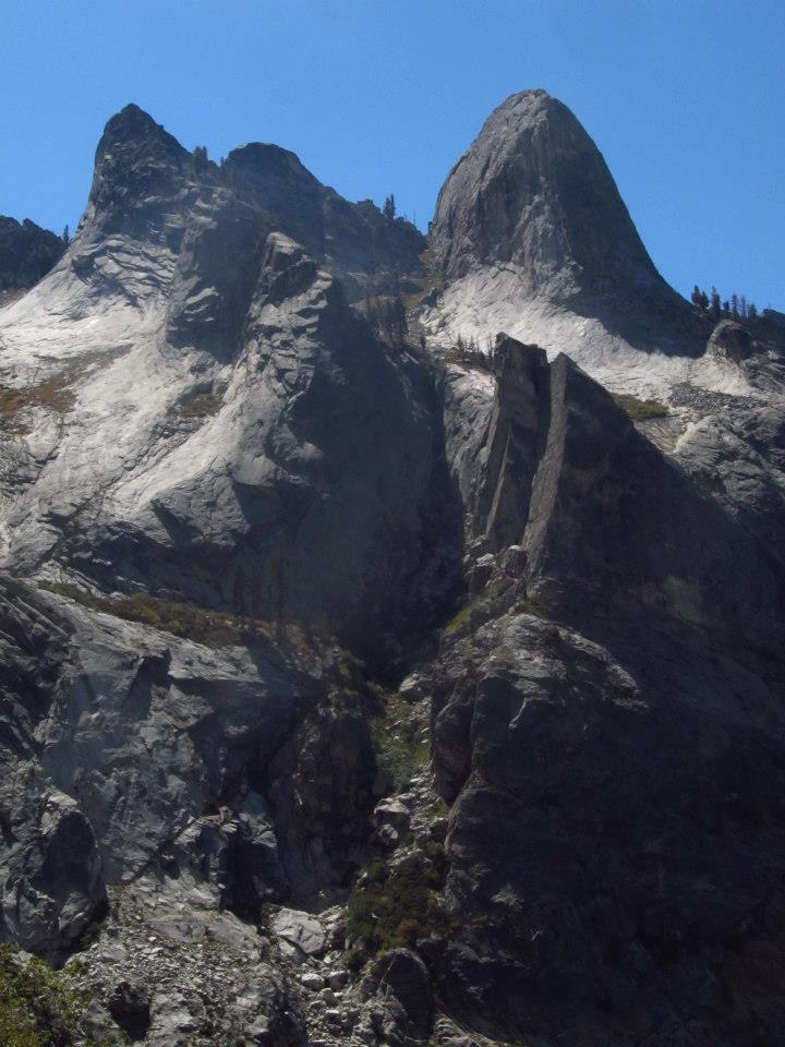
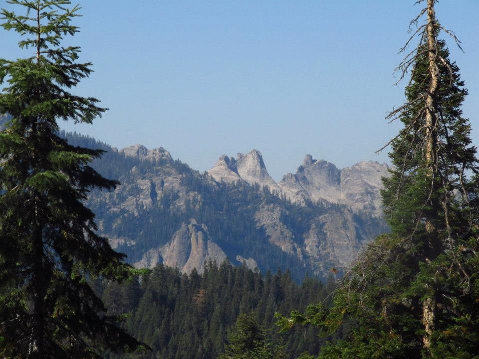
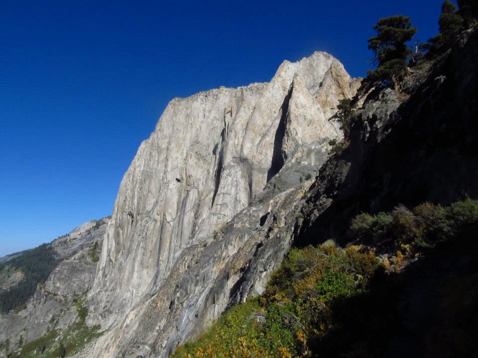
The Hamilton Towers
Hamilton lake
 Cheribum Dome from Hamilton lake
 Cotton candy clouds and the silhouette of Valhalla
Day 3 -
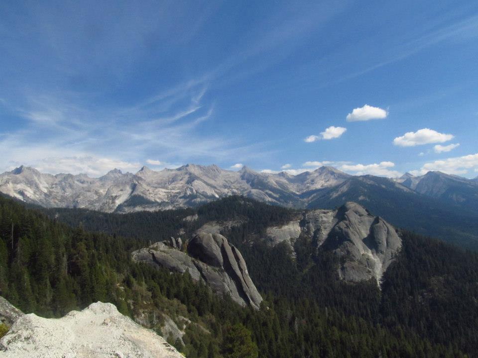
The next morning we packed up camp and headed up the switchbacks, climbing up and traversing high above Hamilton lake. The views overlooking the lake, and Valhalla, River valley. and even all the way back out to Moro rock and castle rocks were awesome! Then we got up to Precipice lake. The most beautiful blue lake with the sheer jagged cliffs of Eagle Scout peak rising vertically behind it make it quite spectacular. I had to jump in to those blue waters no matter how cold it was. (It was cold!) Not far beyond that we got to the top of our climb at the Kaweah Gap(10,700'). From the gap we got killer views of Nine lakes basin, Black Kaweah, and the Big Arroyo of which we were about to descend into. After a break at the gap we dropped into the Big arroyo, a huge wide canyon with the Kaweahs rising up to the east and the Great Western divide to the west. We headed down to the junction with the Little 5 Lakes trail where there are some old cabins and some nice camp spots by the creek. We had met another group of hikers up on the Kaweah gap that were also hiking the HST and they ended up camping near us that night. We hung out and told stories and even played some frisbee with a "light up" frisbee. We all had dinner together and enjoyed each others company.
 Valhalla from the switchbacks
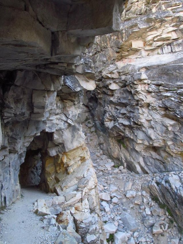
A cave on the trail
 Overlooking Hamilton lake
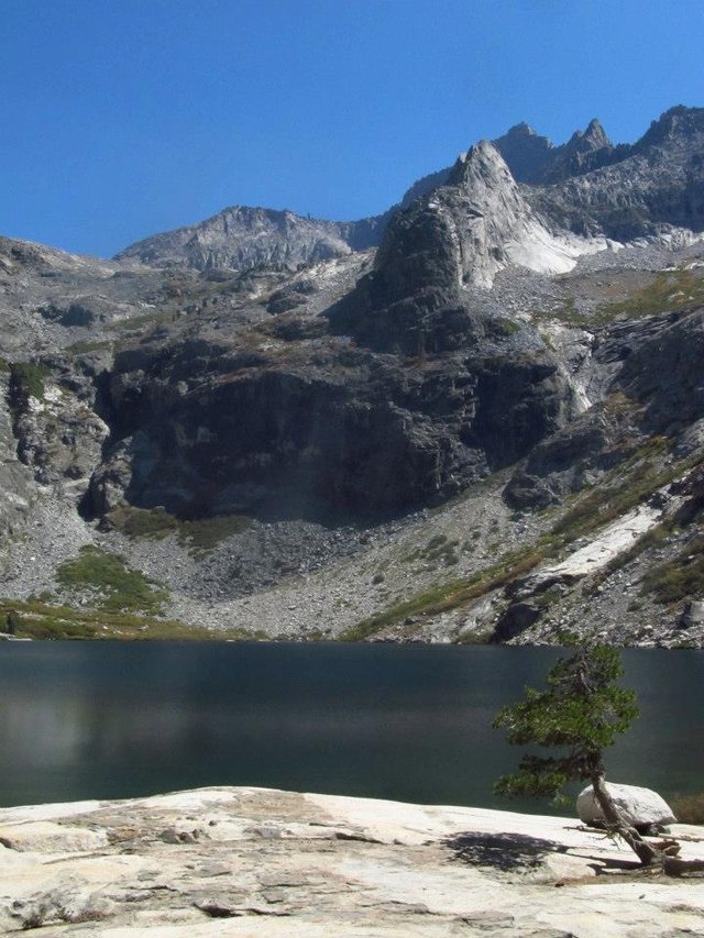
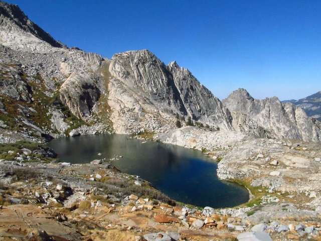 Lower Precipice lake
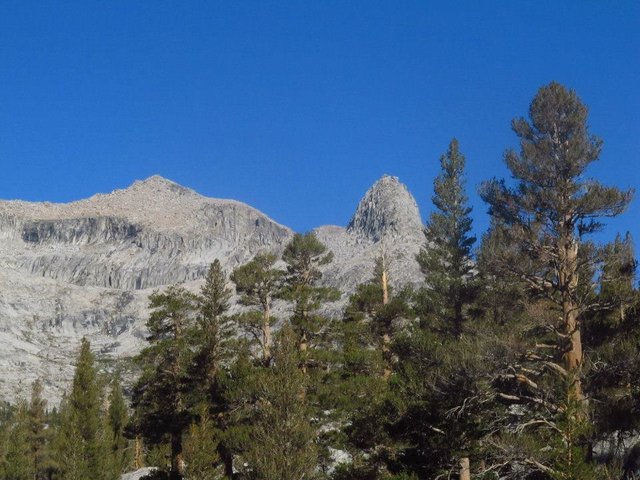
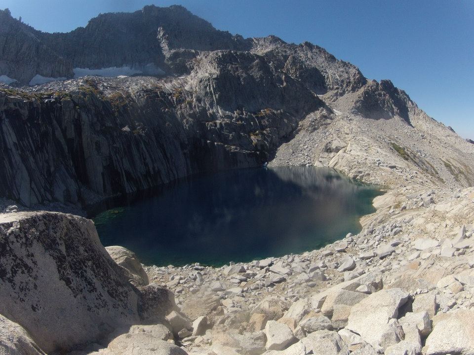 Precipice lake
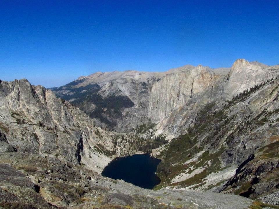
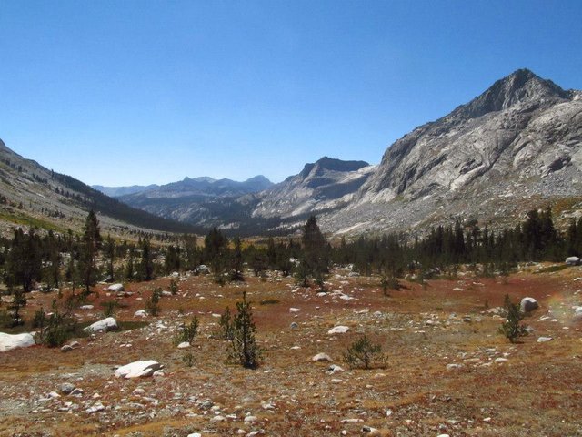 Big Arroyo
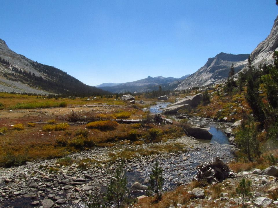 Big Arroyo
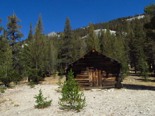 Old cabins
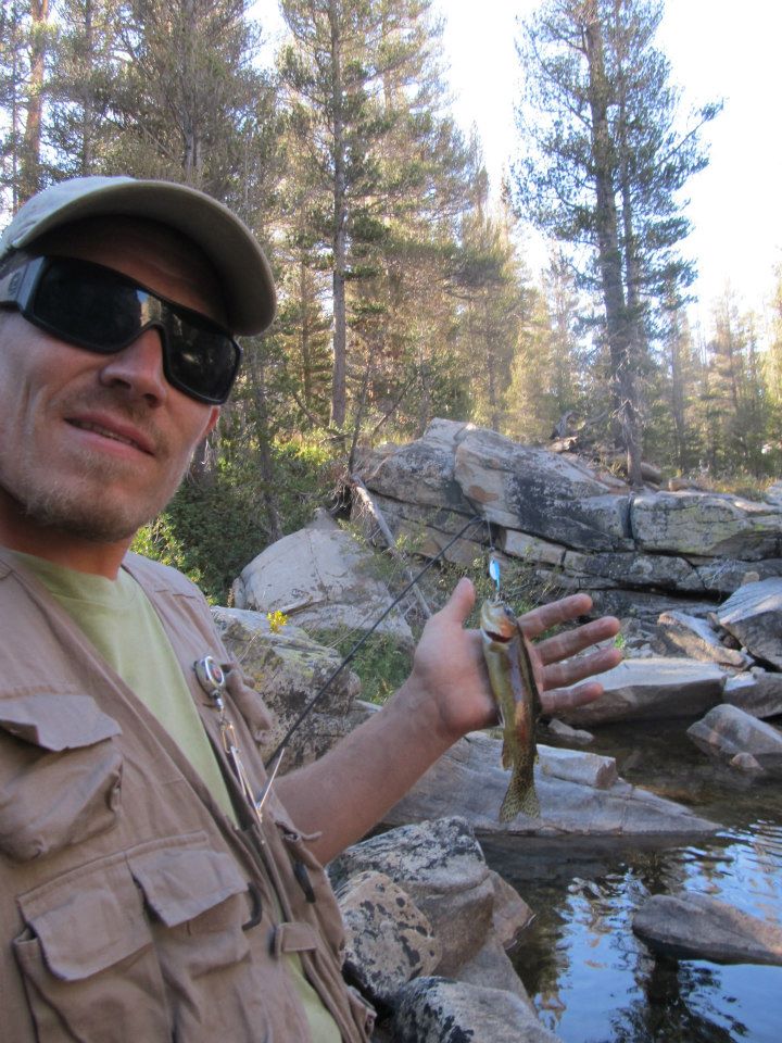 Trout fishing in Big Arroyo
Day - 4
From our camp by Big Aroyyo we climbed up pretty gradually onto the Chagoopa Plateau. We had incredible views over the Big Arroyo and out at the Great Western divide. We hiked across the plateau through some beautiful meadows where there were really great views up towards Mt. Kaweah. From there the HST actually splits into 2 different routes. We decided to take the longer route which visited Moraine Lake. We found a great spot to camp by the lake and we still had plenty of time to relax and swim and really enjoy the lake. I tried a little fishing, but no success.
 Views from Big Arroyo
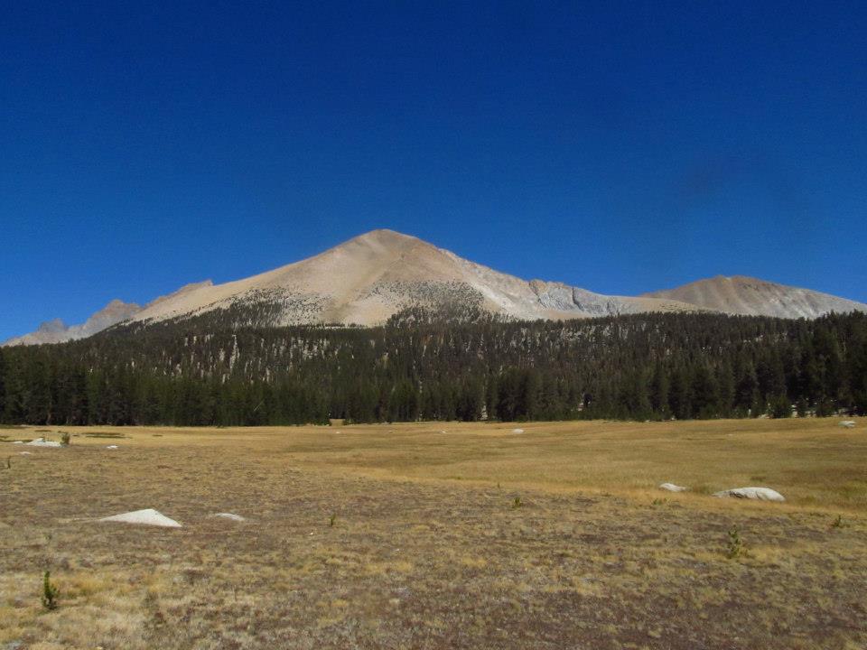 Mt. Kaweah
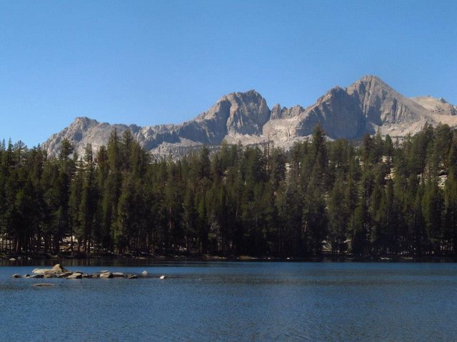 Moraine lake
 Campsite at Moraine lake
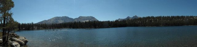 Panorama shot at Moraine Lake
Thanks for reading!
Youtube video will be on the "part 2" post.
Part 2 - https://steemit.com/photography/@derekrichardson/high-sierra-trips-the-high-sierra-trail-part-2
www.californiamountainadventure.com
Congrats @derekrichardson. Your photo made it on the Top Photographs Daily Selection today :). Upvoted and Resteemd!
https://steemit.com/photography/@mycamerashots/best-photos-trail-25th-july-2017-2017725t113545536z
Heck ya. Thats super cool, thank you! Wait until you see the opening shot for the "part 2" of this HST series. It's a really cool early morning reflection shot on Moraine lake. I really like it. That post will be up later today.