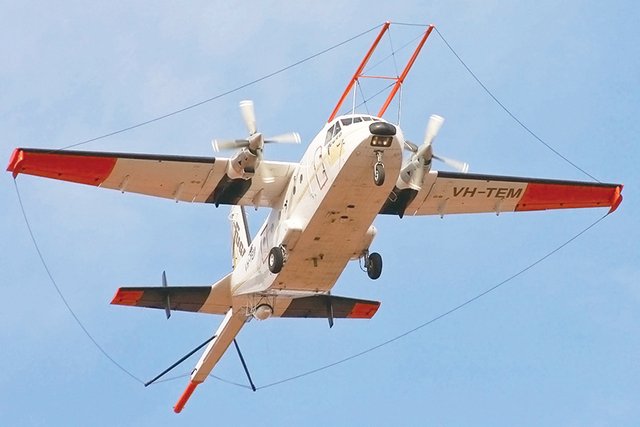
Have you ever seen one of these.
From time to time they fly overhead, have you ever wondered what they are and what they are doing?
If you live in a mineral rich area its more likely to see an airborne geophysics airplane.
or even a helicopter dragging this weird contraption around.
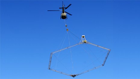
They are filled with very precise instruments and are busy taking detailed measurements in the changes in gravity strength and other metrics below them.
This enables them to produce the following types of maps of the surveyed area.
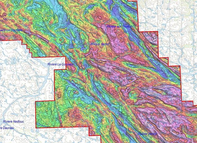
This helps pinpoint minerals and other ore bodies quickly because it highlights the differences in gravity profile and hence densities and probable makeup of rocks.
The great thing about it is it can detect ore bodies and mineralizations even under many feet of soil and vegetation.
Interesting!
Do they have enough resolution and sensitivity to detect archeologically interesting sites as well?
Something like a pyramid perhaps... but there would need to be a significant difference in density of the object and the surrounds... that's where the helicopter type would be more maneuverable and useful... they also do this with drones.
Its very expensive though...
They generally are more likely to use ground penetrating radar on archaeological sites.
Yes, I know, but GPR uses such a short wavelength I'm not sure it would reach far enough down from the air. Would be great, though, pushing the GPR things around can get boring. Maybe from a low-flying drone, but the energy consumption would be a problem. Hm.
I have never seen one of those flying overhead, but I have always wondered how they made those maps. Very interesting!
It is a very ancient 'Mag' survey plane. (Magnetic survey). As you say, they are used to record relative magnetic readings from the earth below. The lower you fly, the more accurate, to a degree. Beware a mag map with lots of contour lines on it! How did they fly that low?
Mag surveys are expensive and generally point geologists in the direction of where to carry out 'exploration'. Geologists use them on the basis that if there is a band of mineral x and then an intrusion of mineral y, given the area and prevailing geological patterns, then point A holds a high probability of containing mineral z.
Nowadays helicopters can carry new smaller equipment.
the contour lines were likely just super-imposed later from other accurate sources.
They used these ancient ones a lot for identifying Kimberlites over vast distances under deep covers of desert sand.
Thank you @gavvet for the update and explanation. I actually wondered, after I had commented rather hastily, whether they were using some sort of long wave technology for some purpose, rather like submarines do.
I am no geologist but I am involved in mining is Sth America.
Thank you again for your high standards! Namaste!
dddd
Hi friend steemit, Follow me and upvote https://steemit.com/@fahmiauliasfr
I would love to know more about the contraption and how it actually works. The mapping looks great. Is it base on electromagnetic resonance measurements? Thanks again for the information and namaste :)