Stunning Snowshoe Tour Above The Clouds - Atemberaubende Schneeschuhtour über den Wolken [EN/DE] - MyPictureDay
Hey Steeminans,
as I promised, today I would like to tell you about my last snowshoe tour in the Allgäu Alps. This time I went from the Hochgrat (1834m) over the Gelchenwanger ridge to the Rindalphorn (1821m) summit. A really fantastic but also very exhausting tour. The sun above the clouds was just wonderful, but it was still very cold (according to weather forecast -22° C) because a very strong wind was blowing. Here I would like to show you some picture and video impressions of this beautiful snowshoe hike and hope you enjoy the report. 🌄 ❄
Hey Steeminans,
wie versprochen möchte ich euch heute von meiner letzten Schneeschuh Tour in den Allgäuer Alpen berichten. Dieses Mal ging es vom Hochgrat (1834m) über den Gelchenwanger Grat zum Rindalphorn (1821m). Eine wirklich traumhafte aber auch sehr anstrengende Tour. Die Sonne oberhalb der Wolken war einfach herrlich, trotzdem war es sehr kalt (laut Wetterapp -22° C) da ein sehr heftiger Wind wehte. Hier möchte ich euch nun ein paar Bild und Video Eindrücke dieser wunderschönen Schneeschuhwanderung zeigen und hoffe das Ihr an dem Bericht Gefallen findet. 🌄 ❄

My little adventure started while driving. My navigation device obviously didn't know the roads of the region and so it sent me first to Austria. I knew that I need to go nearby Steibis and was only wounded why my sat nav sent me to Austria. But I thought, ok, maybe I have to drive around a part of the mountain range to get to the destination, I knew such stories from my road trip through the Alps. The actual goal is 10 kilometers as the crow flies away, but since there were no roads over or through the mountains, I had to take sometimes 3 hours of highway driving to get to the destination. So my navigation system decided to send me on a small road up a mountain, where I then arrived at about 1700m altitude at an abandon mountain hut.
"You have reached your goal!" 📣
Hmmm... wait a minute....
On the map I was about 5 km away from the actual destination and was now somewhere in the mountains at an abandoned mountain hut ... Awesome! 😆
Maybe my GPS had other plans than me.
So I turned off the smart navigation system, drove the same way back again and just oriented myself on the city signs. (Pro Tip ... Hahaha) It was not long then I had achieved my actual goal. The valley station of the Hochgrat Cable Railway near Lanzenbach behind Steibis. YEAY! 😄 🚗 🚩
Mein kleines Abenteuer fing schon bei der Autofahrt an. Mein Navigationsgerät kannte offenbar die Straßen der Region nicht und so hat es mich erstmal nach Österreich geschickt. Ich wusste das ich Richtung Steibis musste und war erst verwundet warum mich mein Navi weiter nach Österreich schickte. Aber ich dachte, ok, vielleicht muss ich einen Teil der Bergkette umfahren um an das Ziel zu kommen, solche Geschichten kannte ich ja von meinem Road-Trip durch die Alpen. Das eigentliche Ziel ist keine 10 Kilometer Luftlinie entfernt, da es aber keine Straßen über oder durch die Berge gab musste ich teilweise 3 Stunden Autobahnfahrt auf mich nehmen um an das Ziel zu kommen. Mein Navi beschloss also mich auf einer kleinen Straße einen Berg hochzuschicken, wo ich dann auf ca. 1700m Höhe an einer Berghütte ankam.
„Sie haben Ihr Ziel erreicht!“ 📣
Hmmm… Moment mal…. Auf der Karte war ich ca. 5 km von dem eigentlichen Ziel entfernt und stand nun irgendwo in den Bergen an einer verlassenen Berghütte… Geil! 😆
Vielleicht hatte mein Navi andere Pläne wie ich.
Also schaltete ich das schlaue Navi aus, fuhr den gleich weg nochmals zurück und orientierte mich einfach selbst an den Ortschildern. (Pro-Tipp… Hahaha) Es ging nicht lang dann hatte ich mein eigentliches Ziel erreicht. Die Talstation der Hochgrat Steilbahn bei Lanzenbach hinter Steibis. YEAY! 😄 🚗 🚩
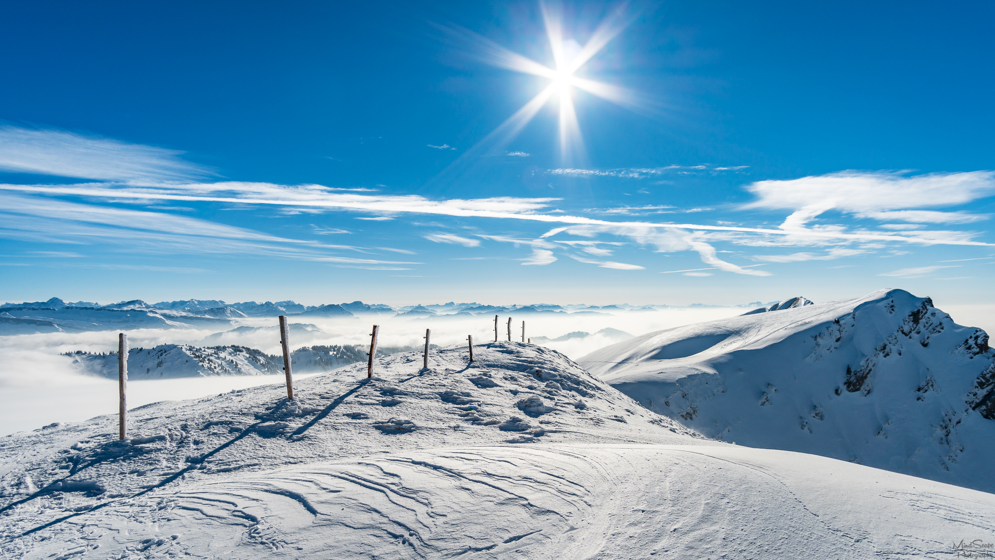
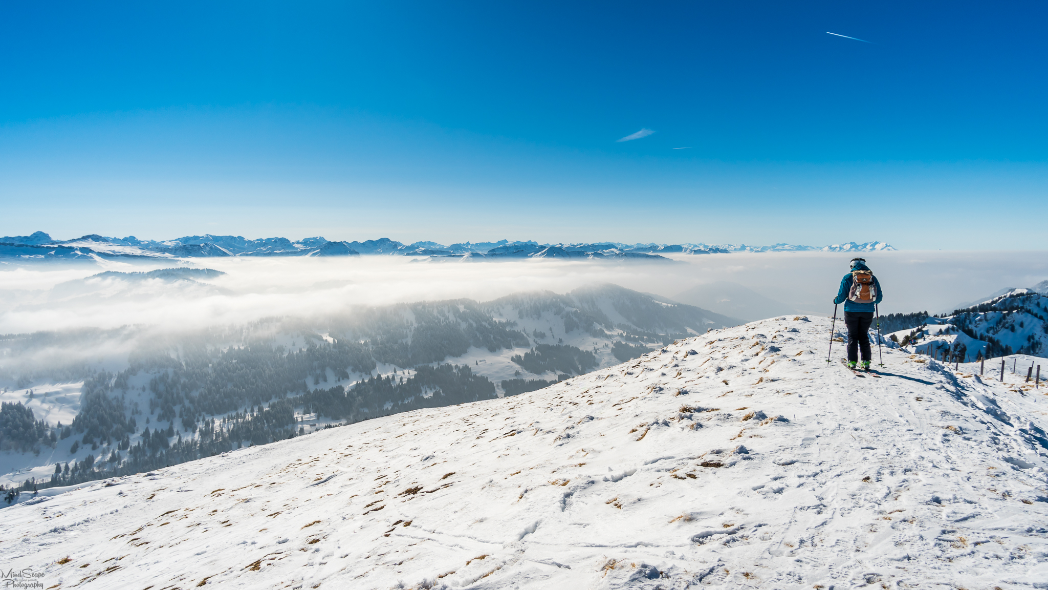
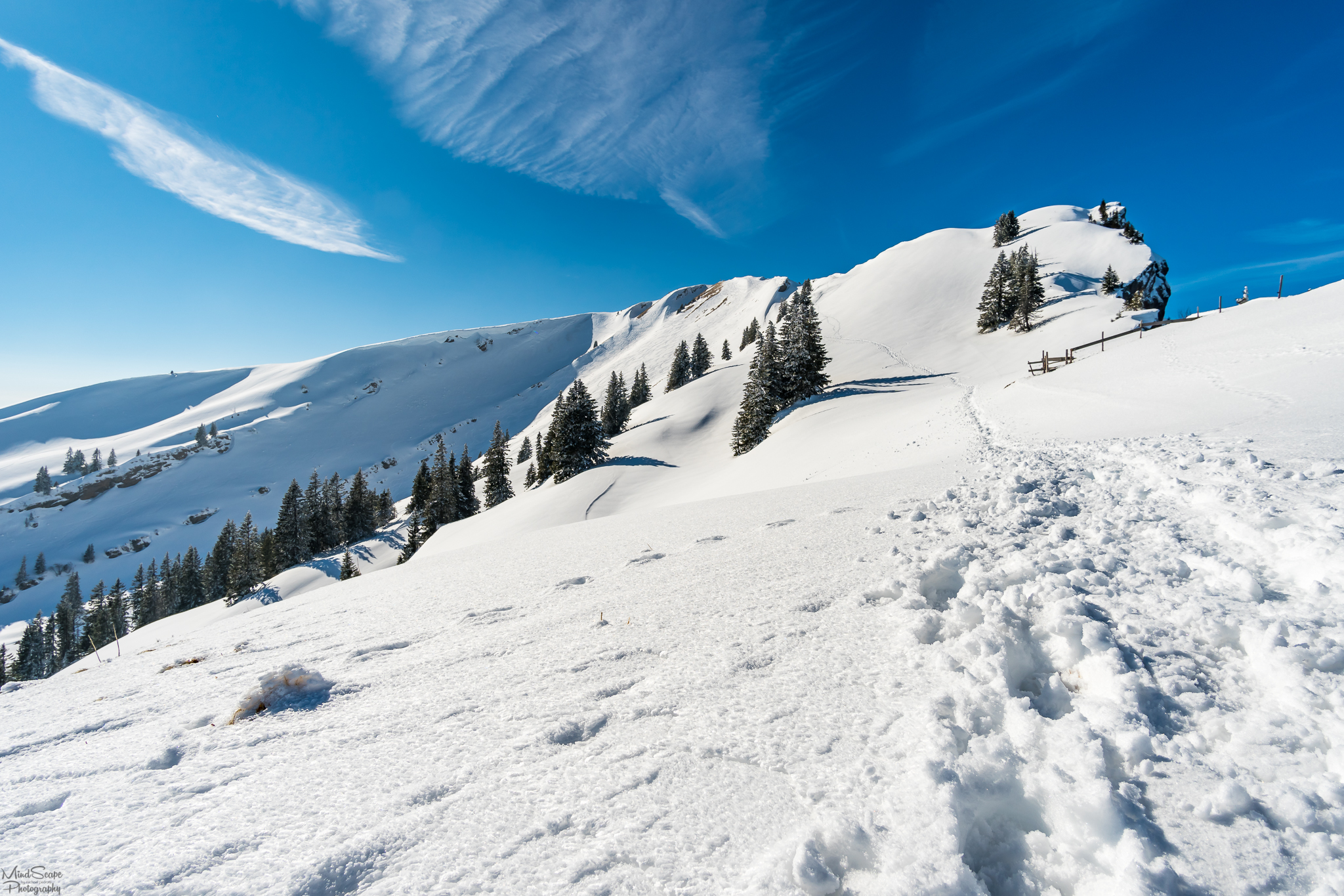
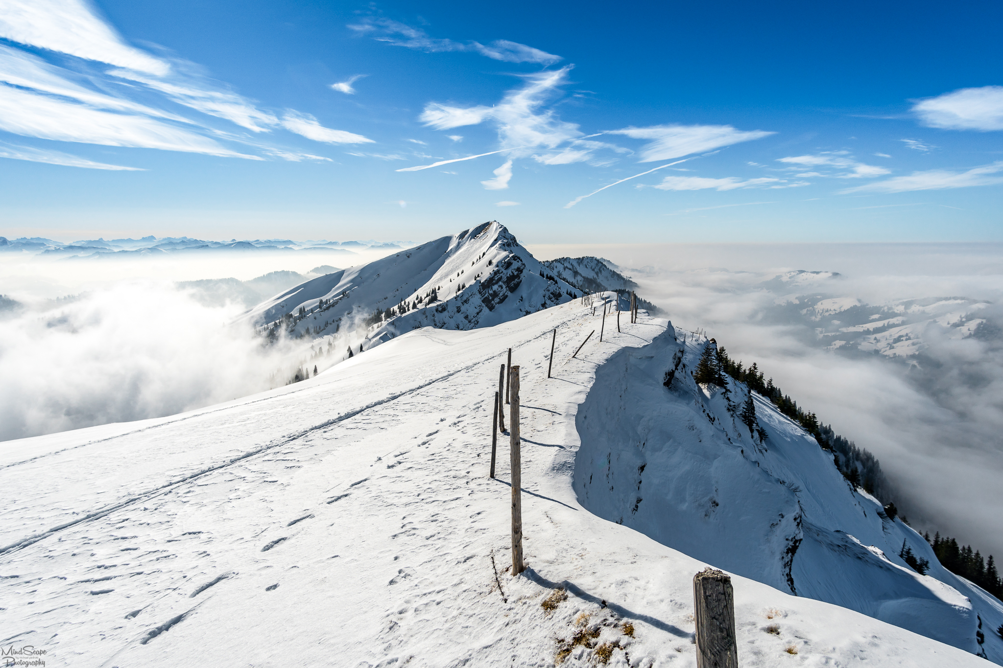
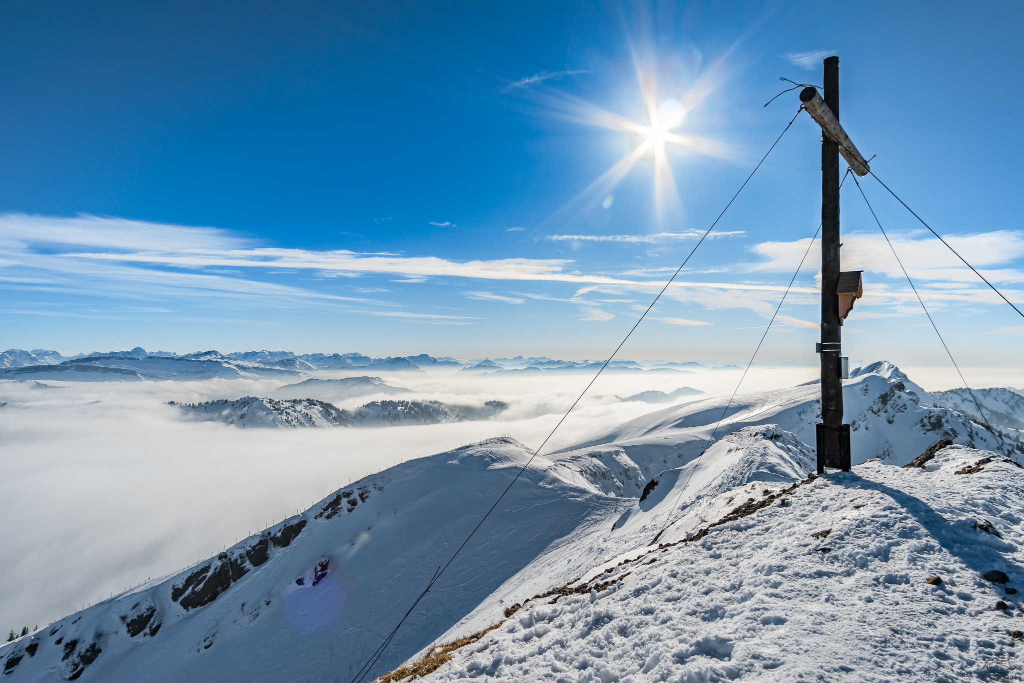
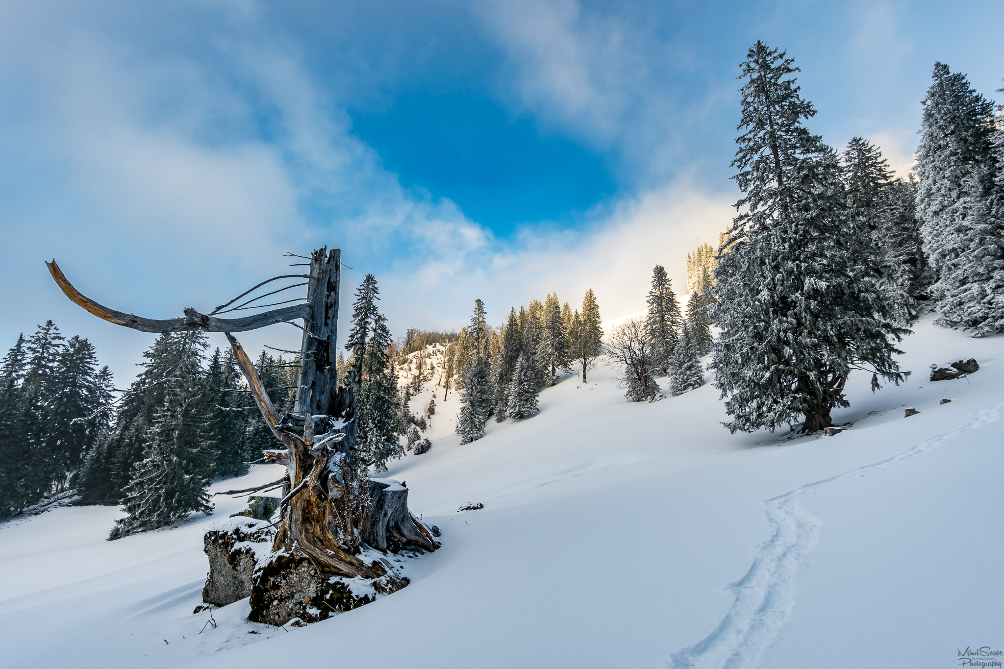
The starting point was the mountain station of the Hochgrat cable railway. Originally, I first wanted to treat myself to a delicious portion of Kaiserschmarren at the Staufner Haus, before the actual snowshoe hike started. However, since I was already over an hour late thanks to my navigation system, I reluctantly decided against it. So I put on my snowshoes and headed for the first summit, the Hochgrat at 1833m. On the summit I was allowed to enjoy a beautiful panoramic view above the clouds on the Swiss, Vorarlberg and Allgäu Alps.
Startpunkt war also die Hochgrat Seilbahn, mit der es erstmal bis zur Bergstation hinauf fuhr. Ursprünglich wollte ich mir zuerst beim Staufner Haus eine leckere Portion Kaiserschmarren gönnen, bevor die eigentliche Schneeschuhwanderung losging. Da ich jedoch dank meines Navis bereits über eine Stunde Verspätung hatte, verzichtete ich schweren Herzens darauf. Ich zog mir also meine Schneeschuhe an und machte mich in Richtung des ersten Gipfels, dem Hochgrat auf 1833m Höhe. Auf dem Gipfel angekommen durfte ich dann einen wunderschönen Panorama Ausblick oberhalb der Wolken auf die Schweizer-, Vorarlberger- und Allgäuer Alpen genießen.
 |  |
|---|
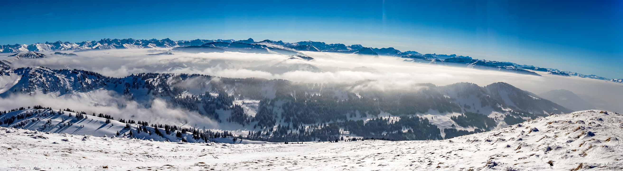

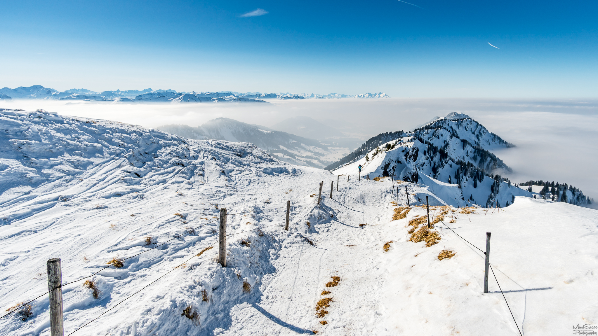
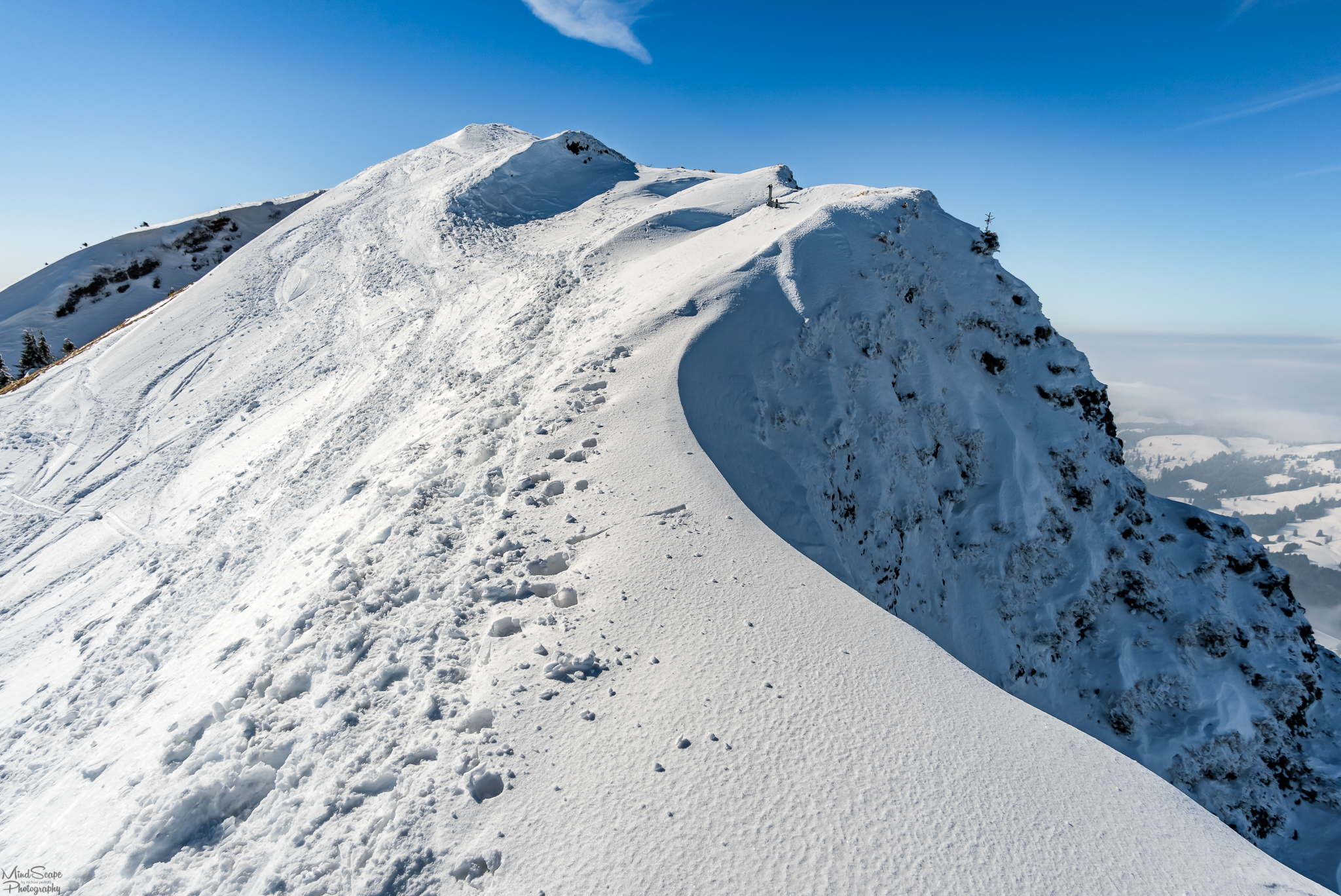
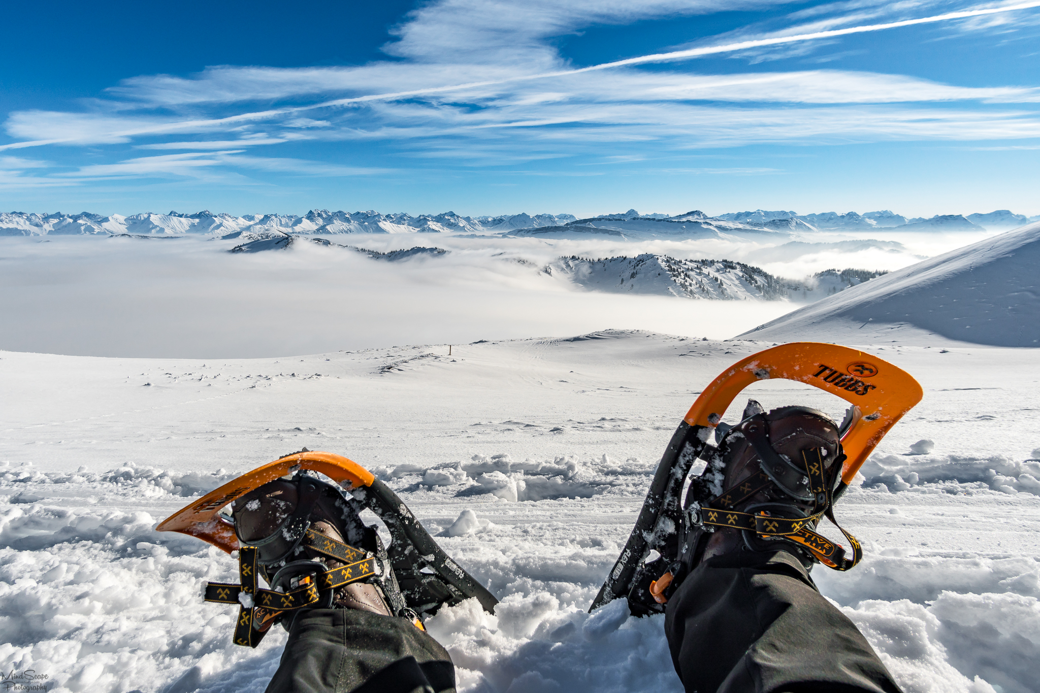
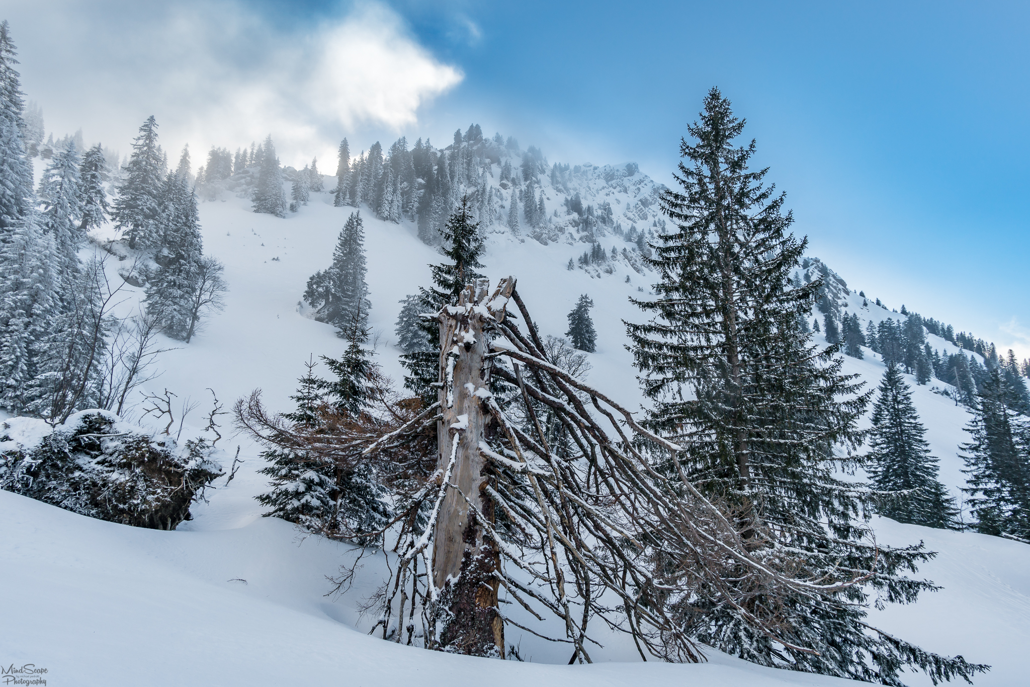
After a short break I went from the Hochgrat downhill to the Brunnenscharte and again uphill to Gelchenwanger ridge. Here, the wind was getting more and more violent, so it was always more strenuous to hike up the mountain with snowshoes. According to weather information, it had felt -22 degrees Celsius due to the strong wind on that day. Happily, I didn't freeze during the whole tour because I was dressed up warm enough and had kept my body warm by the movement.
Nach einer kleinen Pause ging es dann vom Hochgrat bergab zur Brunnenscharte und wieder weiter bergauf zum Gelchenwanger Grat. Hier wurde der Wind langsam immer heftiger, sodass es immer anstrengender wurde den Berg mit den Schneeschuhen hinaufzulaufen. Laut Wetterinformationen hatte es durch den starken Wind an diesem Tag gefühlte -22 Grad Celsius. Gefroren habe ich während der ganzen Tour jedoch nicht, da ich warm genug angezogen war und durch die Bewegung meinen Körper auch gut warm gehalten hatte.
 |  |
|---|
 |  |
|---|
Video impression of the weather and the panoramic view 😉
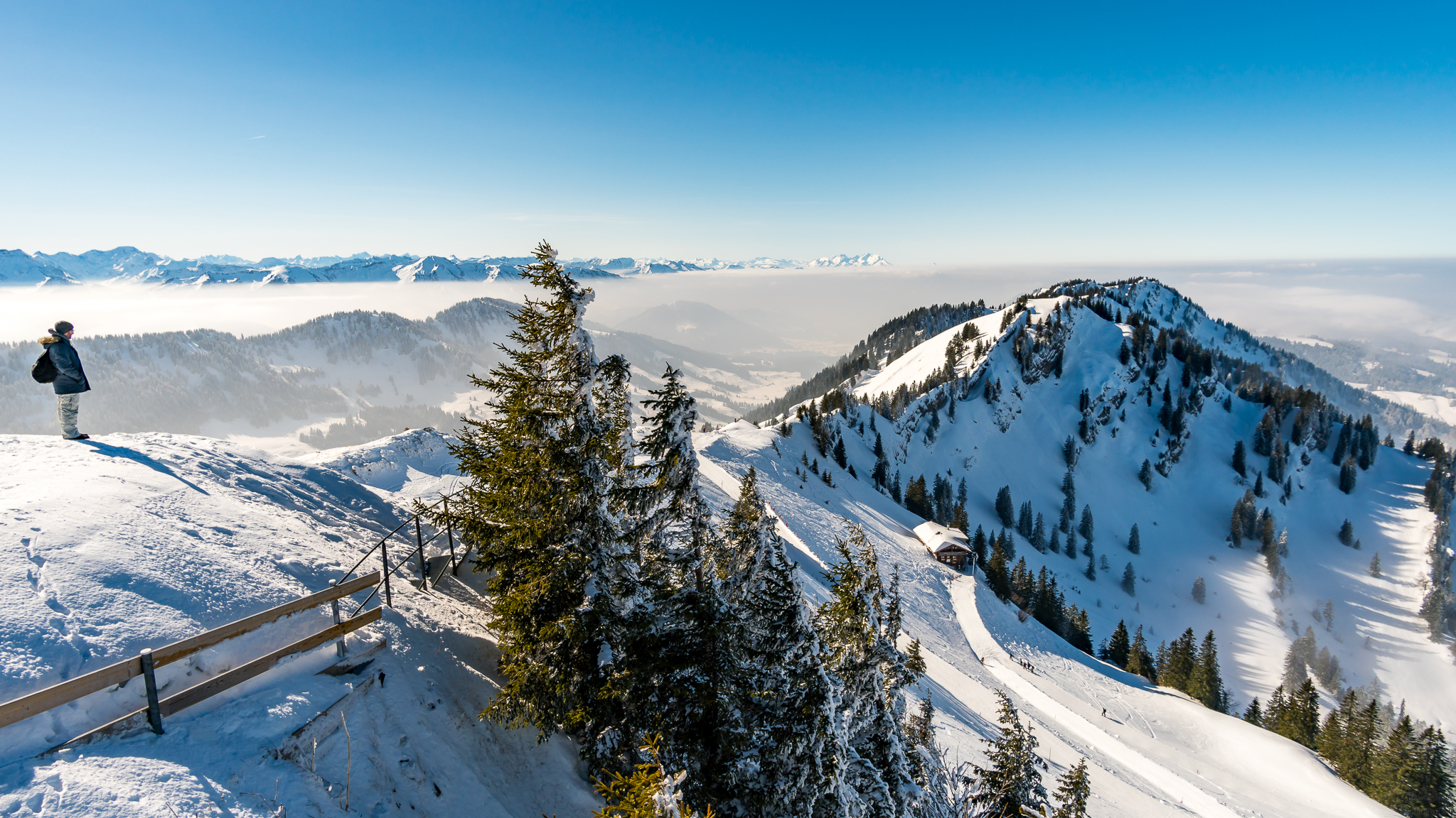
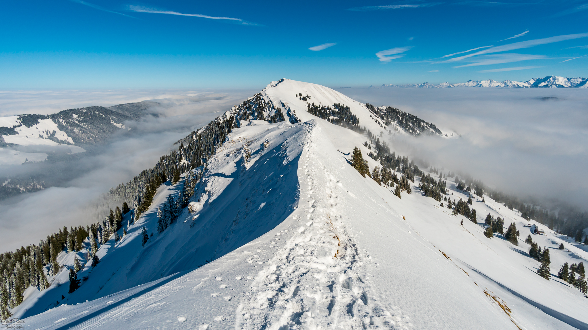
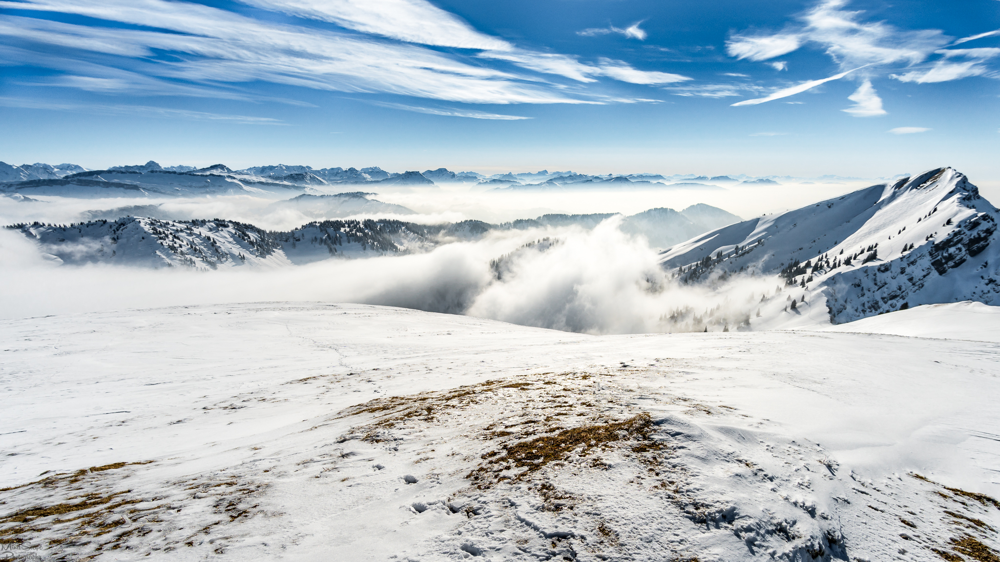
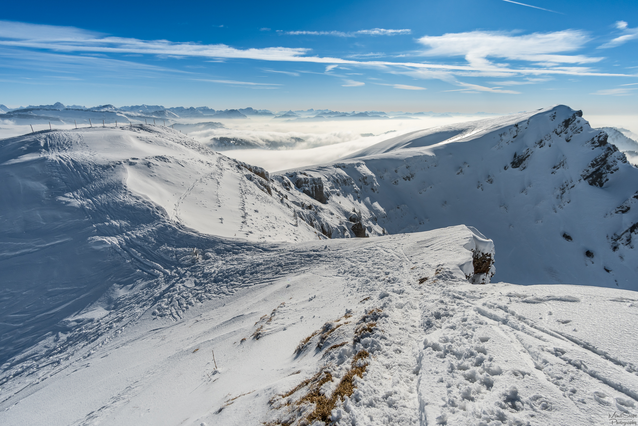
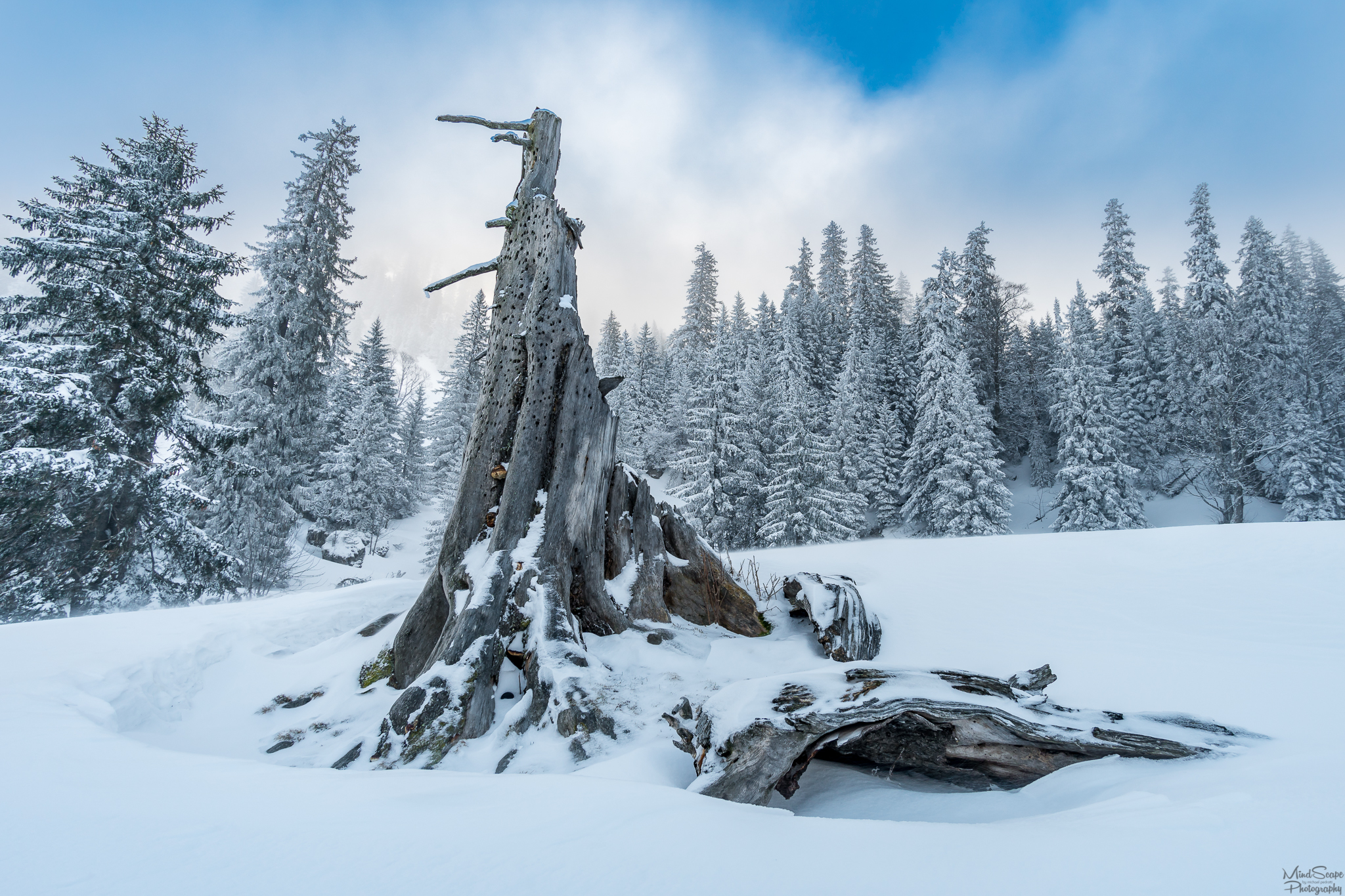
Behind the Gelchenwanger ridge, it was then somewhat windless and I took the opportunity for a little break in the beautiful sun, with panoramic views of the Allgäu Alps, before it went up to the Rindalphorn summit. ☀
Hinter dem Gelchenwanger Grat wurde es dann einigermaßen Windstill und ich nutzte die Gelegenheit für eine kleine Pause in der wunderschönen Sonne, mit Panorama Ausblick auf die Allgäuer Alpen, bevor es weiter zum Rindalphorn ging. ☀
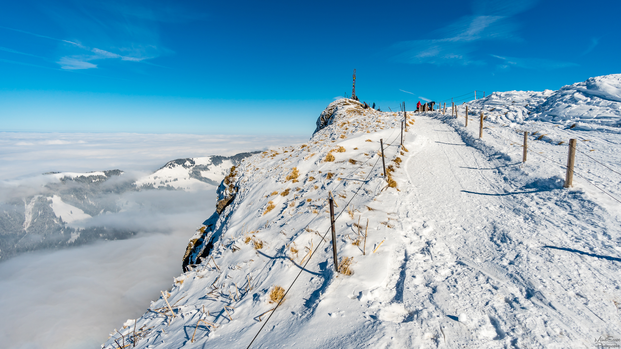
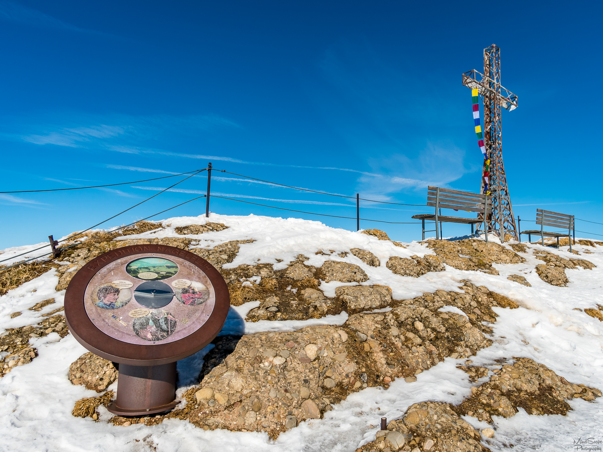
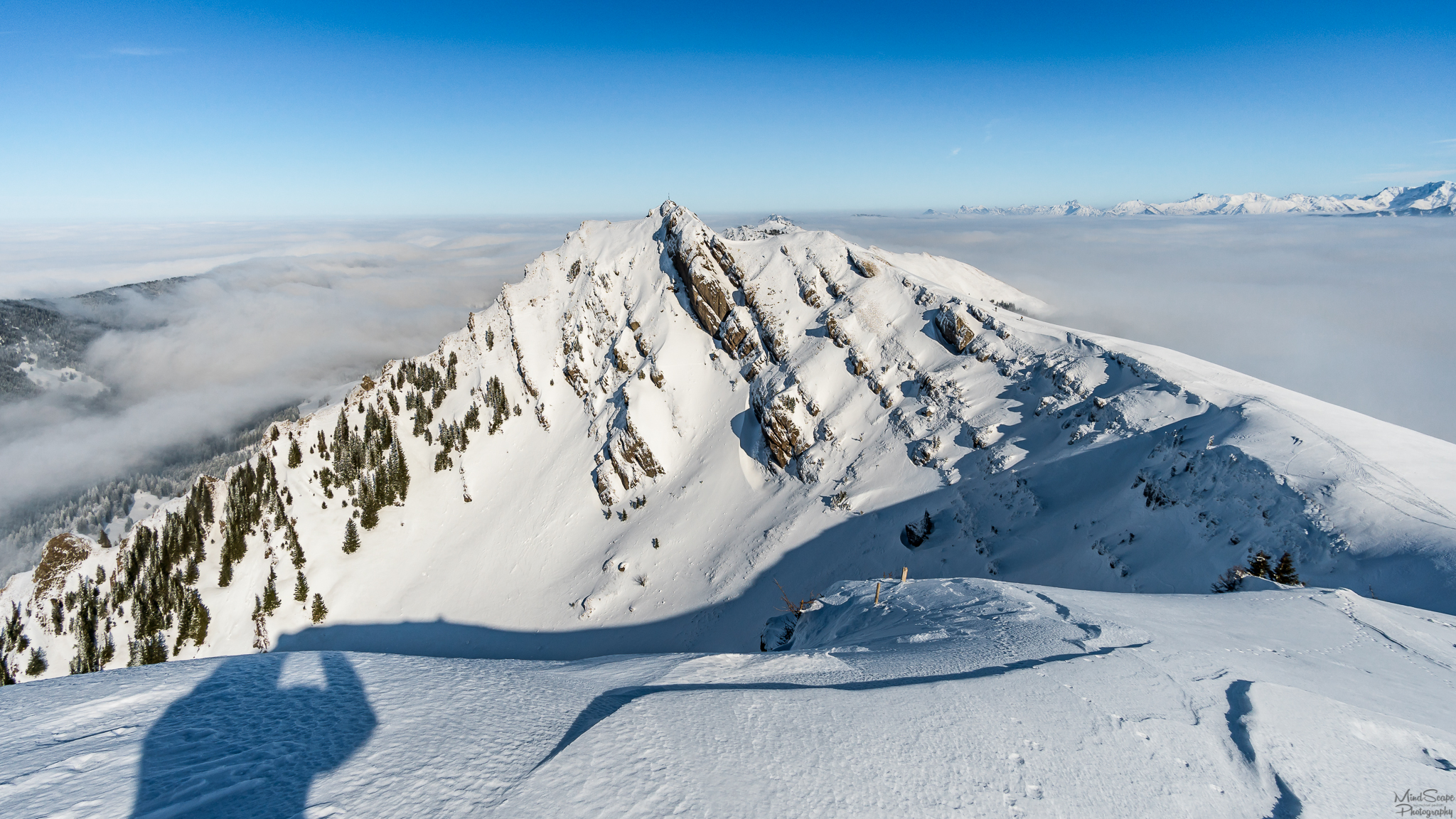
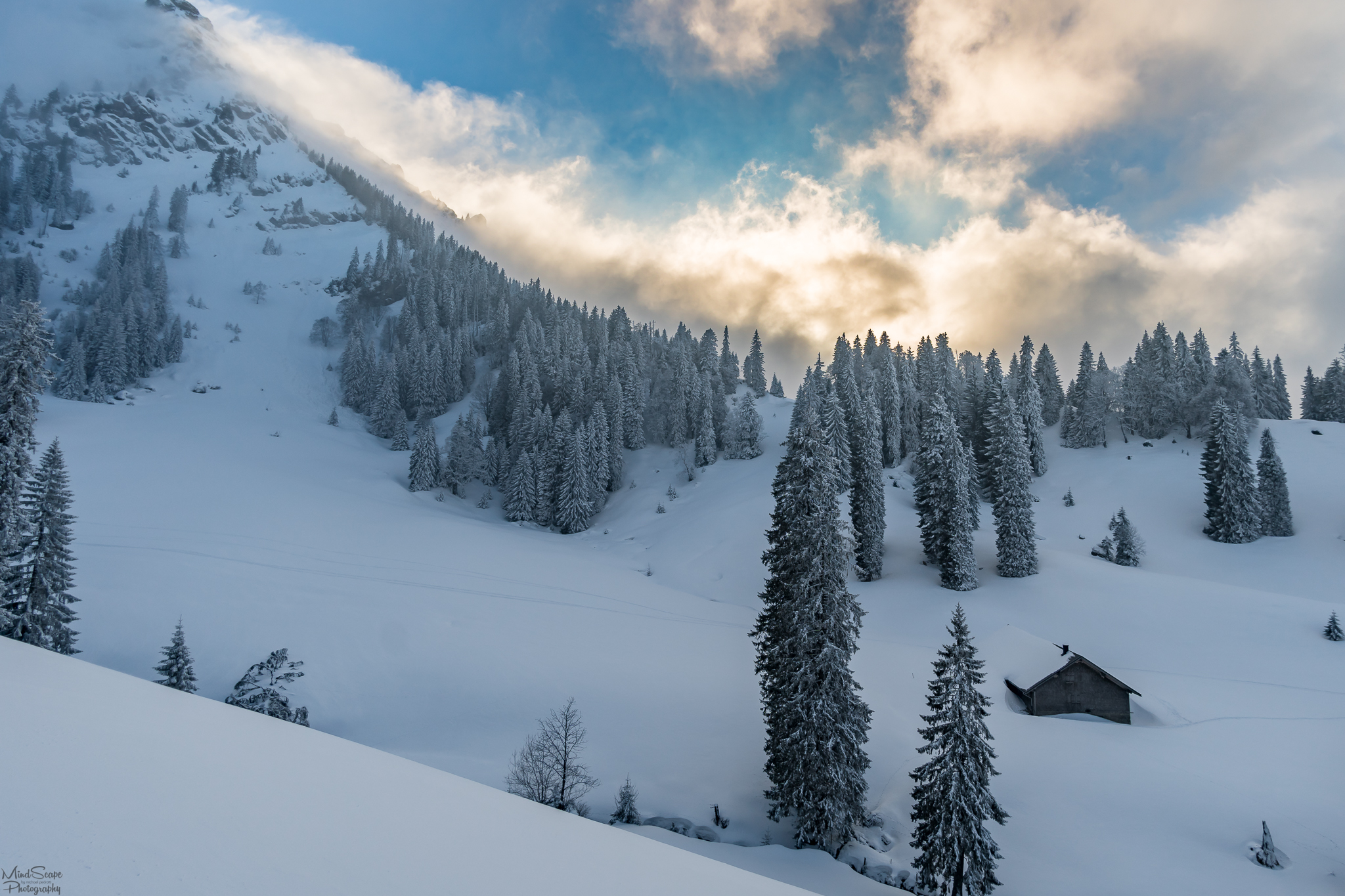
Since I still had a long and exhausting journey ahead of me, I made my way back to the next summit. The beautiful Rindalphorn at 1821m altitude. Also from here, you have an incredible view of the Allgäu Alps. It was just beautiful to see the mountains above the cloud cover. Simply fantastic. 🌄
Da ich aber noch einen langen und anstrengenden Weg vor mir hatte, machte ich mich dann auch wieder weiter zum nächsten Gipfel. Dem wunderschönen Rindalphorn auf 1821m Höhe. Auch von hier hat man einen unglaublichen Ausblick auf die Allgäuer Alpen. Es war einfach wunderschön mit anzusehen, wie die Berge oberhalb der Wolkendecken heraus schauten. Einfach traumhaft. 🌄
 | |
|---|
Another video impression of the Rindalphorn summit 🗻
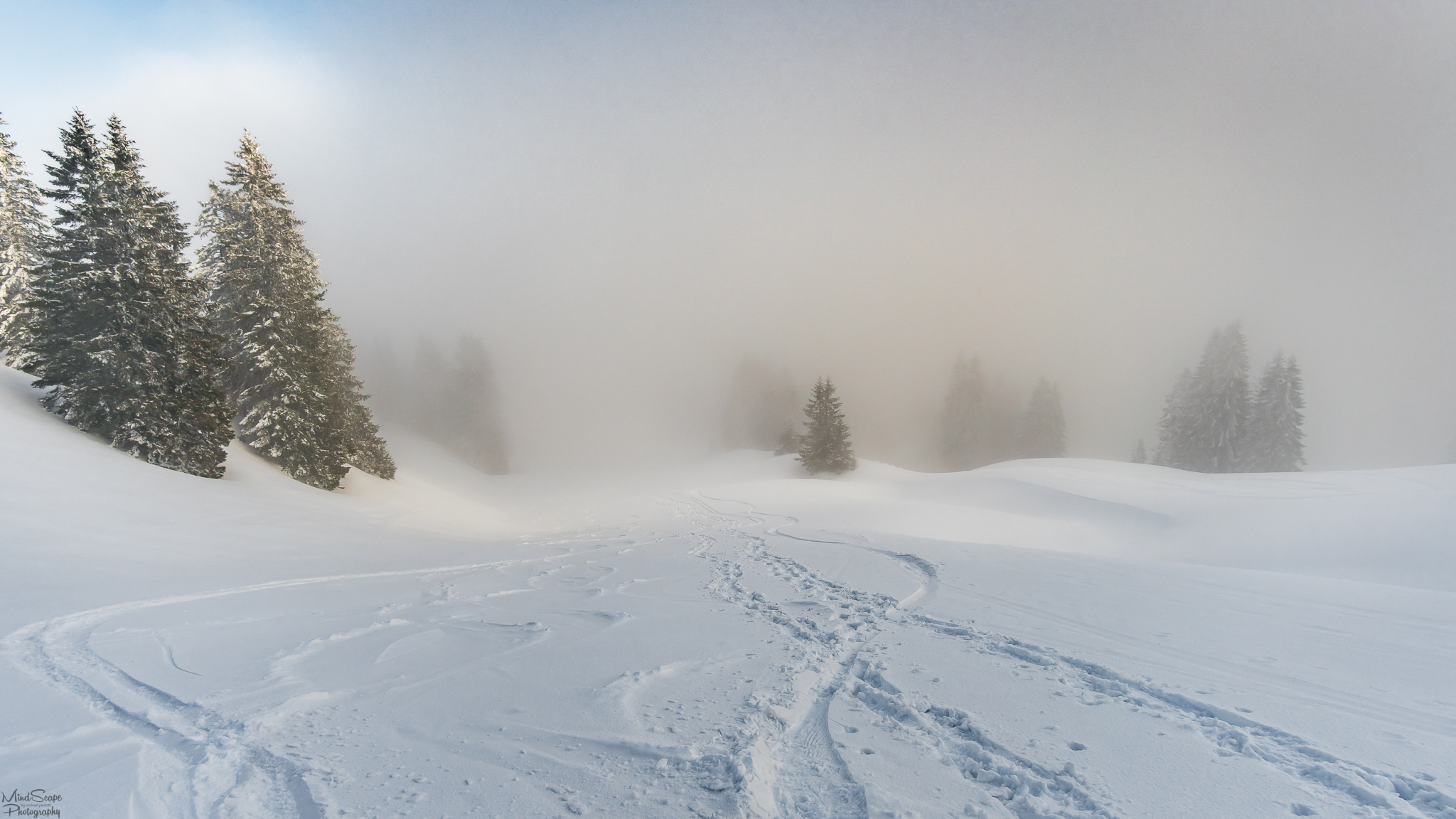
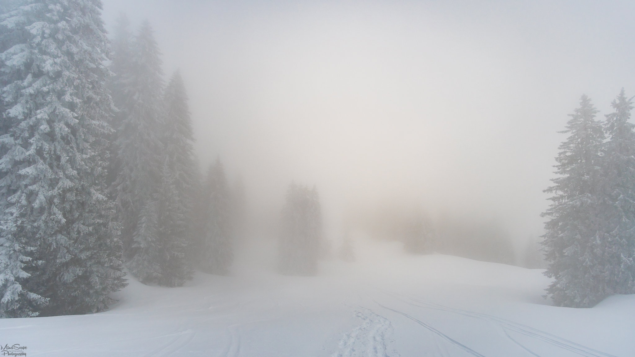
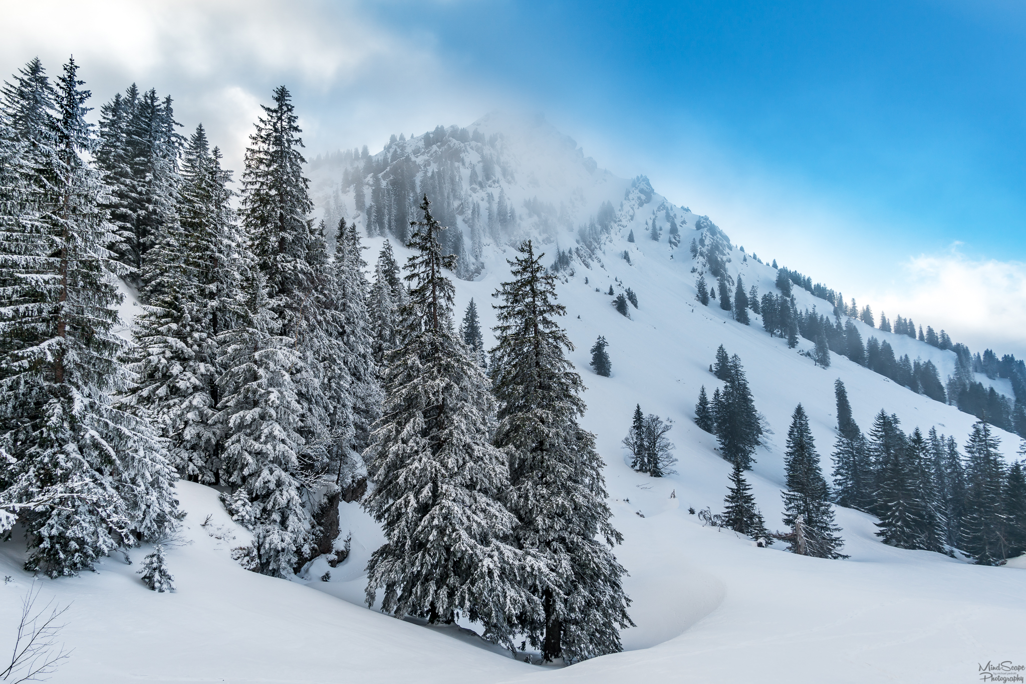
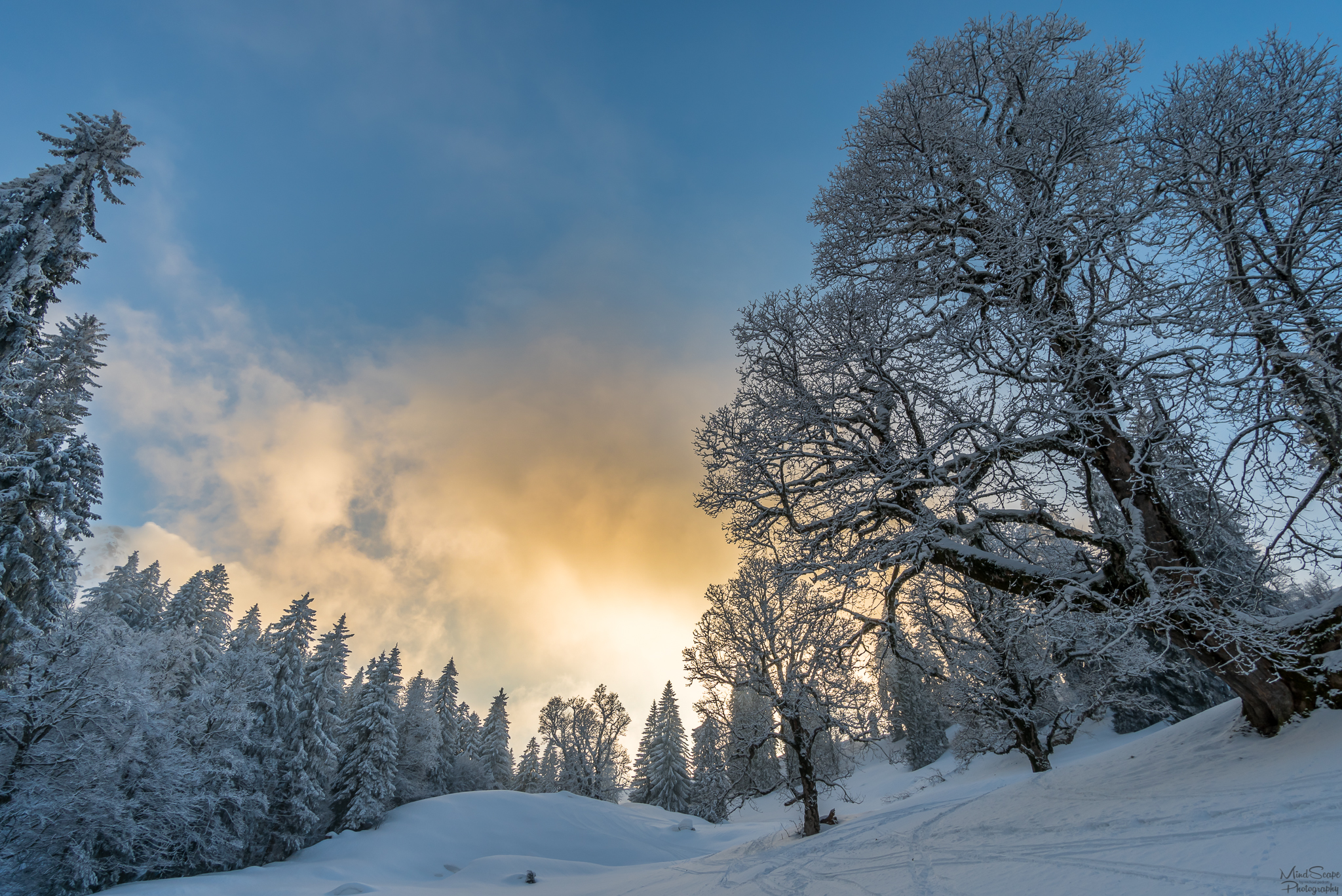
Unfortunately, after having reached my last summit for today, I had to slowly return to the valley. Thus back under the cloud cover. The descent through the clouds was like suddenly entering another world. A few meters further up you were still surrounded by a bright blue sky and you were allowed to enjoy the sun. Now you suddenly stood in the middle of the clouds, everything around you turned white and gray. A really mystical but also nice experience. Nevertheless, I was glad when I came out sometime below the cloud cover and could also see where my way led me. ☁
Nachdem ich nun meinen letzten Gipfel für heute erreicht hatte, musste ich mich leider auch wieder langsam zurück Richtung Tal machen. Und somit auch zurück unter die Wolkendecke. Der Abstieg durch die Wolken war als würde man plötzlich eine andere Welt betreten. Ein paar Meter weiter oben war man noch von strahlend blauem Himmel umgegeben und durfte die Sonne genießen. Nun stand man plötzlich mitten in den Wolken, alles um einen herum wurde weiß und grau. Ein wirklich mystisches aber auch schönes Erlebnis. Trotzdem war ich froh als ich wieder irgendwann unterhalb der Wolkendecke herauskam und auch sehen konnte wohin mich mein Weg führte. ☁
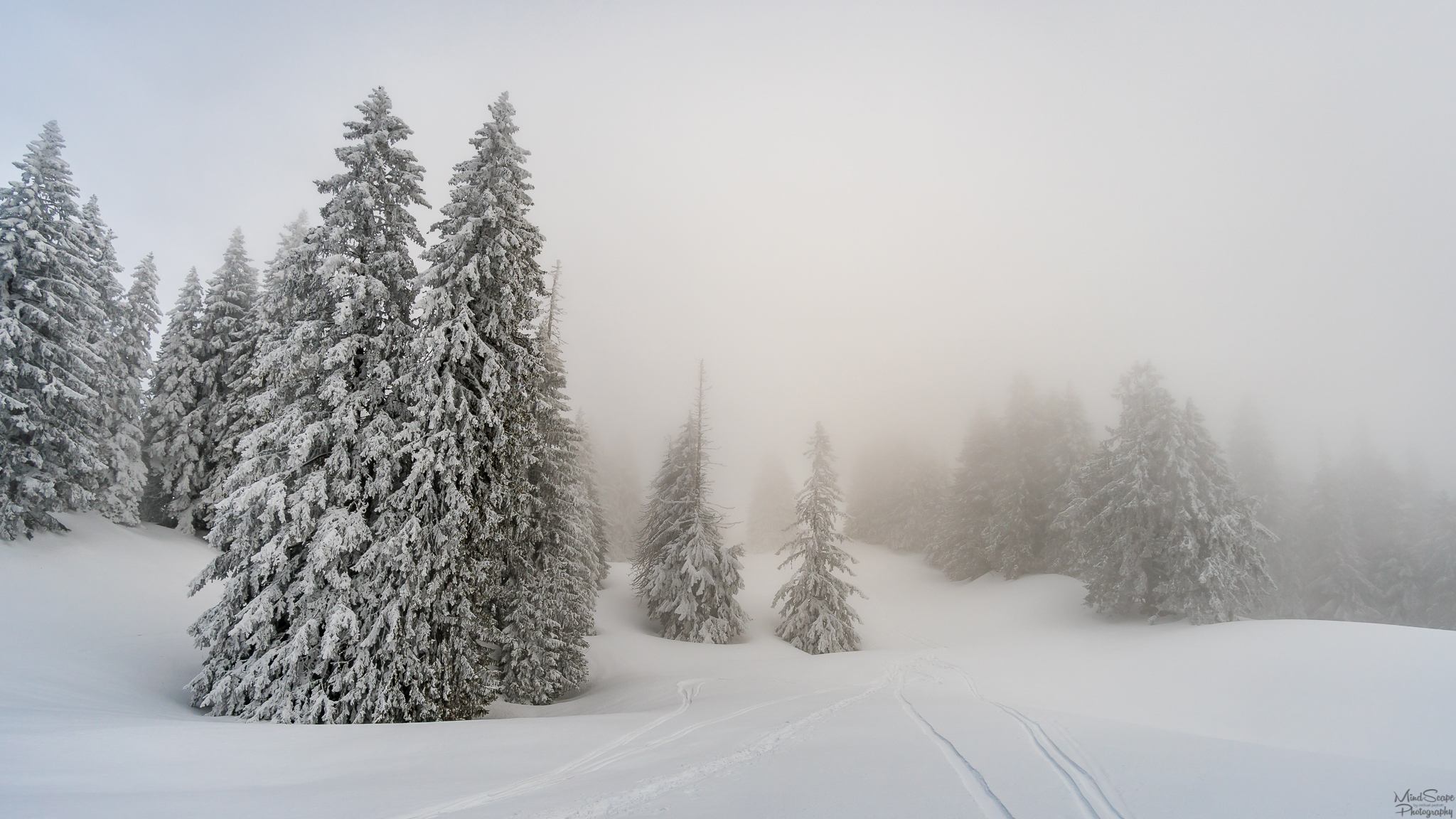
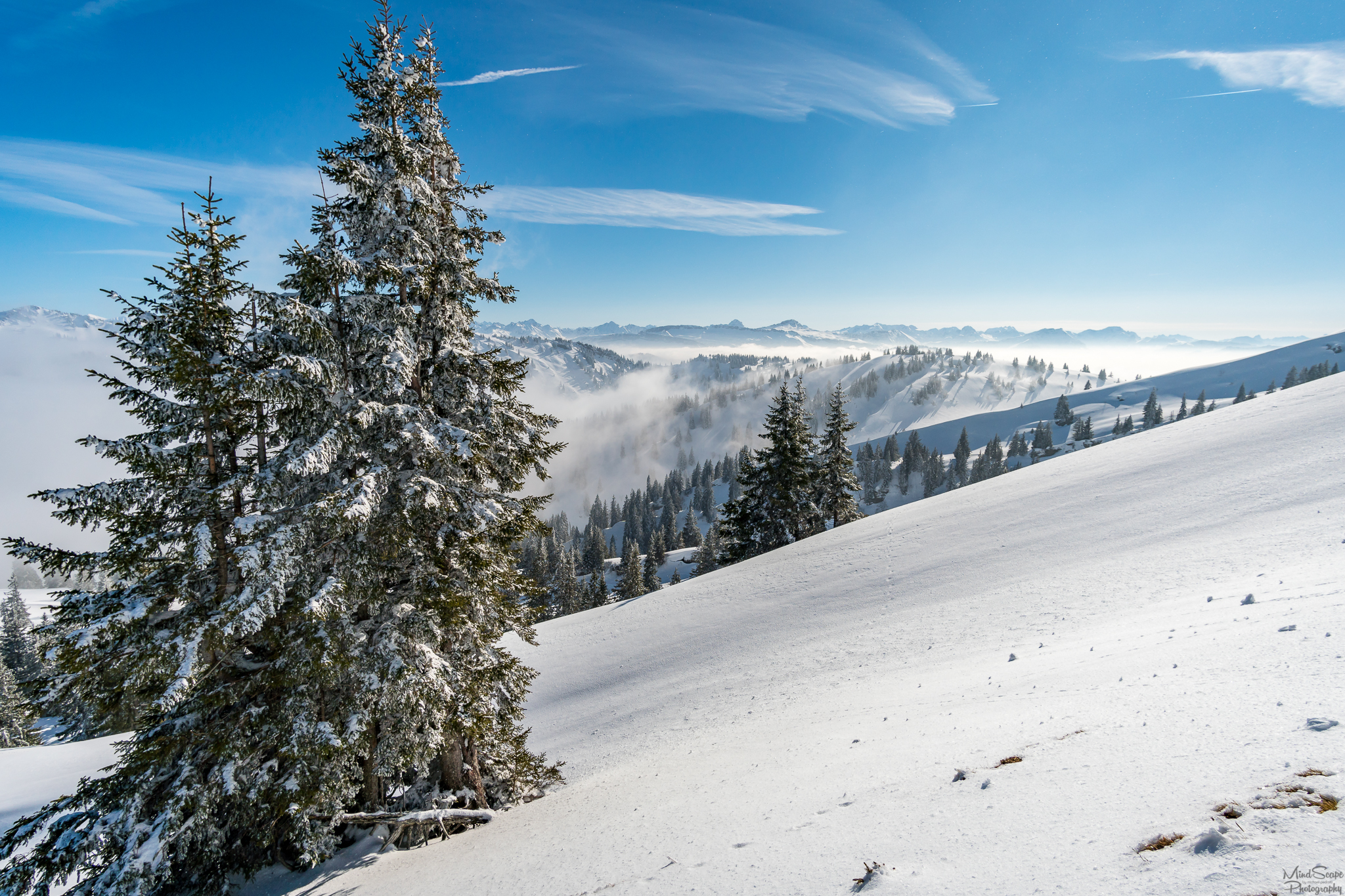
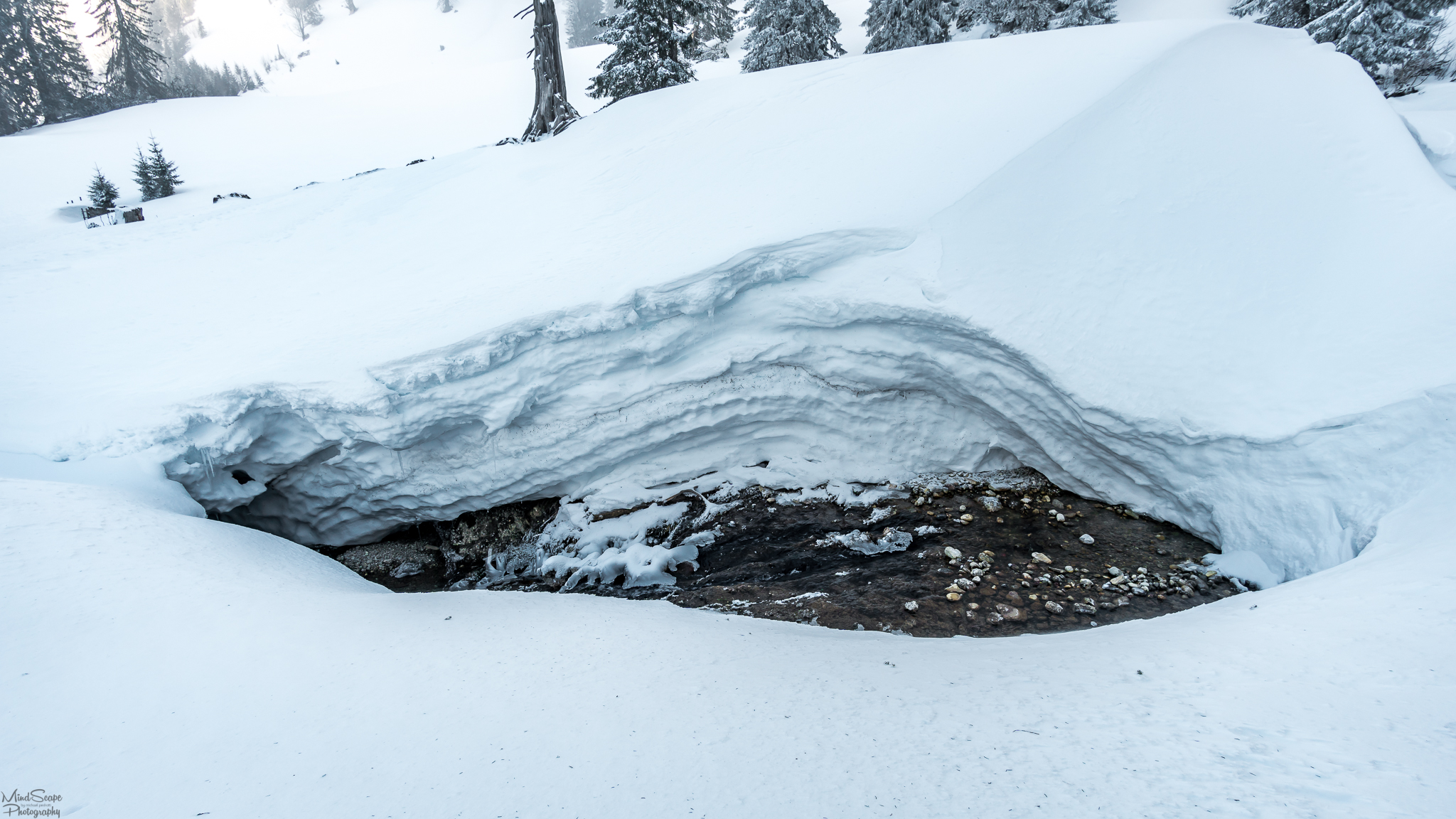
On the descent, I then hiked by the Gündlesscharte past the forest slope on the left. A beautiful snowy winter landscape, which was also a bit dangerous. The descent was directly behind the summit of the Rindalphorns. Due to the wind, larger snowdrift accumulations had formed here. So I had to watch which way I went, that I don't trigger an avalanche. Here I was really happy that I was already out of the cloud cover so I could see the snow deposits and could plan a safe way. 🗻
Beim Abstieg ging ich dann bei der Gündlesscharte vorbei den Waldhang links hinunter. Eine wunderschöne verschneite Winterlandschaft, die aber auch etwas gefährlich war. Der Abstieg befand sich direkt hinter dem Gipfel des Rindalphorns. Durch den Wind hatten sich hier größere Triebschneeansammlungen gebildet. Ich musste also aufpassen welchen Weg ich ging, damit ich keine Lawine auslöste. Hier war ich dann auch wirklich sehr froh, dass ich aus der Wolkendecke heraus war, damit ich die Schneeablagerungen sehen konnte und mir so einen sicheren Weg planen konnte. 🗻
 |  |
|---|
A really breathtaking and exciting tour, which was also very exhausting. I was glad when I arrived the parking lot in the evening at around 8 clock again. I started my journey home without navigation system, because I was very broken and only wanted to go home in my warm bed. Who knows on which adventurous journey this clever thing would have led me again. 😃 🏁
I hope I could give you some nice impressions of this adventurous snowshoe tour in the Allgäu Alps. 🌄 ❄
Eine wirklich atemberaubende und spannende Tour, welche jedoch auch sehr anstrengend war. Ich war froh als ich gegen Abend um ca. 8 Uhr dann auch wieder am Parkplatz ankam. Meine Heimfahrt trat ich ohne Navigationssystem an, da ich sehr kaputt war und nur noch nach Hause in mein warmes Bett wollte. Wer weiß auf welche abenteuerliche Reise mich das schlaue Ding wieder geführt hätte. 😃 🏁
Ich hoffe ich konnte ich euch ein paar schöne Eindrücke dieser abenteuerlichen Schneeschuh Tour in den Allgäuer Alpen wiedergeben. 🌄 ❄
This blog post is also my is my submission into the #MyPictureDay Challenge Round #18 organized by @timsaid.
| Camera | Lens | Location |
|---|---|---|
| Sony A6300 | Samyang 12/2.0 | Hochgrat/Rindalphorn, Allgäuer Alpen |


In love with your pictures!!!
Thanks for sharing !!!!
Thank you!
I'm glad to hear! :)
The real proof that neither sky or clouds are the limit! Adventure and the beauty of the nature is unlimited :)
Hehehe, oh yes, this is so true... :)
Ja aufs Navi kann man sich dann doch nicht immer verlassen...Manche sind dann komplett verloren aber gut das du dann doch noch zum Ziel kamst!
Das sind wirklich atemberaubende Bilder, wow! Das nächste mal nimm mich bitte mit!! :D Richtig schön muss es da oben gewesen sein.
Du hast nicht gefroren? Ich glaube ich wäre keinen Schritt vorwärts gekommen aber meine 30€ Jacke hält eh nicht warm..
Toller Beitrag!
PS: Riiiichtig geile Bilder!
Danke schön, freut mich zu hören das dir der Beitrag gefällt. :-)
Ja, manche Navis haben wirklich einen an der Klatsche... :-D
Wir können ja mal im Sommer eine Steemit DACH Tour in die Berge machen ;-)
Gefrohren hab ich nicht, war gut angezogen. Nur Durst hatte ich irgendwann... Da sich meine zwei Flaschen Wasser im Rucksack in Eis verwandelt hatten... :D
Coole Tour. Ich hab auch Schneeschuhe, aber seit Jahren nicht mehr benutzt. Bei deinen Bildern krieg ich richtig Lust sie mal wieder anzulegen...
Danke :)
Freut mich das dir der Beitrag gefallen hat und das ich dir wieder Lust auf eine Schneeschuhtour gemacht hat... Macht wirklich richtig Laune :-)
Würd mich freuen ein Bericht von dir zu sehen ;-)
Stunning pictures, it surely was one hell of an experience there. I know what cold with wind means, in Estonia right now it is -18C + 17m\s wind = -45C actually felt cold. It is not very enjoyable haha.
Thank you so much, I'm glad to hear :)
Luckily I was warm and windproof dressed up, I was just a little bit thirsty because my water bottles in my backpack were frozen after some time... :-D
OMG, -45 degree seems to be like a cold hell.
This post has received a 1.11 % upvote from @booster thanks to: @mindscapephotos.
Amazing pictures and views! Thank you for sharing them and your story!
Thank you so much!
I'm very happy you like it :)
This post has received a 0.13 % upvote from @drotto thanks to: @banjo.
You got a 1.98% upvote from @buildawhale courtesy of @mindscapephotos!
If you believe this post is spam or abuse, please report it to our Discord #abuse channel.
If you want to support our Curation Digest or our Spam & Abuse prevention efforts, please vote @themarkymark as witness.
Congratulations, Your Post Has Been Added To The Steemit Worldmap!
Author link: http://steemitworldmap.com?author=mindscapephotos
Post link: http://steemitworldmap.com?post=stunning-snowshoe-tour-above-the-clouds-atemberaubende-schneeschuhtour-ueber-den-wolken-en-de-mypictureday
Want to have your post on the map too?