Οὐιδουα
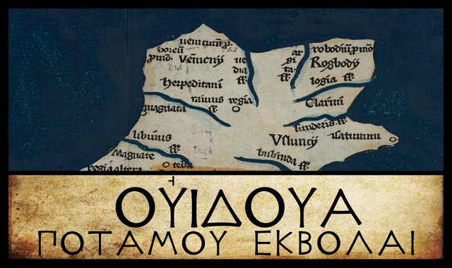
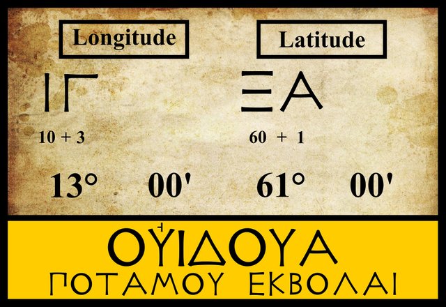
Sailing along the north coast of Claudius Ptolemy’s Ireland from east to west, the next landmark we come to after the Argita is another river mouth: the Vidva. All editions and manuscript sources agree on the latitude and longitude of the mouth of the River Vidva.
| Edition or Source | Longitude | Latitude |
|---|---|---|
| Müller | 13° 00' | 61° 00' |
| Wilberg | 13° 00' | 61° 00' |
| Nobbe | 13° 00' | 61° 00' |
| Vat Gr 191 | 13° 00' | 61° 00' |
There are, however, a number of variant readings of Vidva. Some of these differ only in the accents, which were not yet in use in Ptolemy’s day.
| Source | Greek | Roman |
|---|---|---|
| Müller | Οὐιδούα | Vidva |
| Ο, Δ | Οὐιδοῦα | Vidva |
| Ψ | Οὐδιόα | Oudioa |
| D, M, Σ, Φ | Οὐδίοα | Oudioa |
Ο is Oxoniensis Seldanus 2, 45, one of the Selden Manuscripts in the Bodleian Library at Oxford.
Δ is Florentinus Abbatiae 2380, a codex from the Abbey of St Lawrence in Florence.
Σ, Φ and Ψ are three manuscripts from the Laurentian Library in Florence: Florentinus Laurentianus 28, 9 : Florentinus Laurentianus 28, 38 : Florentinus Laurentianus 28, 42.
D is one of the Codices Parisini Graeci in the Bibliothèque nationale de France in Paris (Grec 1402).
M is the Editio Argentinensis, which we have met before. It was based on Jacopo d’Angelo’s Latin translation of Ptolemy (1406) and the work of Pico della Mirandola. Many other hands worked on it—Martin Waldseemüller, Matthias Ringmann, Jacob Eszler and Georg Übel—before it was finally published by Johann Schott in Straßburg in 1513.
In English, Ptolemy’s Οὐιδουα is variously transcribed: Vidva, Vidua, Widwa, Widua, Widoua. Ου- was Ptolemy usual way of representing v- or w-, sounds for which there was no longer a Greek letter.
The identity of Ptolemy’s River Vidva is still a matter of debate. In the early 17th century, William Camden confidently identified it with an obscure river in County Donegal:
Beyond this [Lough Swilly], to the west, liv’d the Vennicnii; which tract was enjoy’d by Mac-Swiny Fanid, Mac-Swiny Na-doe, and Mac-Swiny Bane ... In these parts, Ptolemy places the river Vidua, now call’d Crodagh; and the Promontory Vennicnium, now Rame’s-head; and Boræum, now S. Helens-Head. (Camden 1411)
Camden’s choice is quite bizarre. His Crodagh is thought to be the Tullaghbegley River, a diminutive stream that flows through Falcarragh into Ballyness Bay in County Donegal. Why Ptolemy should choose to record such an obscure feature—I certainly never heard of it before—while overlooking more notable waterways is never explained.
Forty-seven years later, the Irish antiquarian James Ware identified the Vidua with Lough Swilly, a long fjord in the same county of Donegal. In the following century, Ware’s editor, Walter Harris, added a gloss of his own to Ware’s remarks:
Lough-Swilly, in the same County of Donegall. [As Camden has run into an Error in making the Argita before-mentioned to be Lough-Swilly, so he is under a necessity of looking out for another place to fix the River Vidua, which he makes to be the River Crodagh; perhaps he meant the Clandagh in the Barony of Kilmacrennan in this County. For I must profess my Ignorance of any River under the name of Crodagh. The Welsh Writers draw the Word Vidua from Vi-Dov for Doun, i. e. a deep River.] (Ware & Harris 44)
According to Darcy & Flynn (58, fn 2), the Crodagh is the River Tullaghabegley (or Tullaghbeg River) and appears under the former name on John Speed’s map of 1610. Like Ware, however, I have not been able to find it—on Speed’s map or any other map. Speed’s Glandagh River does appear to be the Tullaghbeg River, which rises in Altan Lough and flows into the sea at Falcarragh. But whatever river Camden was thinking of, it cannot have been very significant, as there are no significant rivers west of Lough Swilly in this part of the country.
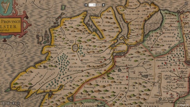
Harris’s Welsh Writers refers to William Baxter’s glossary of British and Irish antiquities of 1733, which give’s Crodach as the name of Camden’s river (Baxter 250).
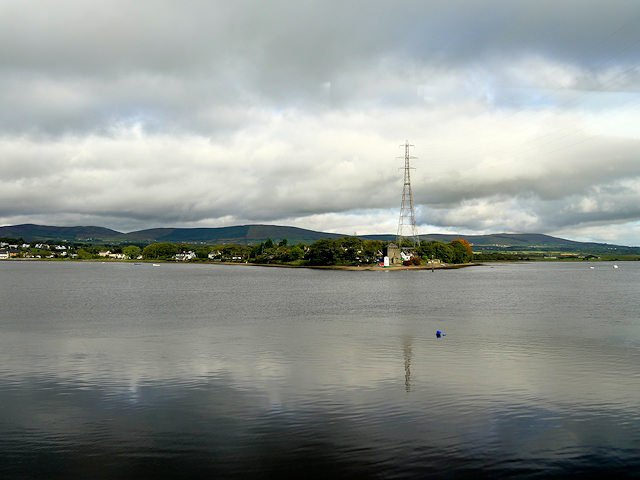
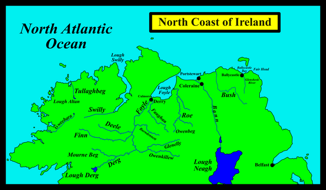
Over the centuries, the most popular choice for Vidva has been the Foyle, whether Lough Foyle or the River Foyle that flows into it. Karl Müller endorsed this identification in his 1883 edition of Ptolemy’s Geography:
Today this river is called the Foyle. I suspect, therefore, that Οὐιδούα [Vidva] is a corruption of Οὐιλούα [Vilva], through the interchange of the letters Δ [d] and Λ [l], as often happens. (Müller 75)
Goddard Orpen, who followed Müller for much of his analysis, was not convinced that any emendation was required. Nor was the Irish Celticist T F O’Rahilly, who regarded the name as one of the few in Ptolemy’s description of Ireland that made perfect sense. Moreover, as he did not identify it with the Foyle, there was never any temptation to try and connect it with the Irish name Feabhail:
Vidva is a good Celtic name, = O. Ir. fedb, ‘widow’, W. gweddw ... it is probable that Vidva is the Bann, which in our native records is called simply Bandae (later Banna), ‘goddess’. (O’Rahilly 6)
The experts at Roman Era Names have an alternative etymology:
Ουιδουα (or Ουδια) river mouth (Widua 2,2,2) was the Foyle, evidently named from PIE *widhu- ‘tree’, whose descendants include OE widu and OI fid. This might refer to the mouth of Lough Foyle out towards the open sea, but more likely to further inland where the later name Derry referred to “extensive woodland that once covered much of the east bank of the River Foyle”. (Roman Era Names
Finally, Louis Francis agrees with James Ware in identifying the Vidva with “the major outlet of Lough Swilly”.
These are the principle identifications of Ptolemy’s Vidva. Over the centuries a few other rivers have been suggested, without, however, attracting much support. Among these may be mentioned the Derg (or Dirgh), a tributary of the Foyle, which rises in Lough Derg. I have also come across a reference to the Culmore, but this seems to be another name for the lower Foyle, Culmore being a townland at the mouth of the Foyle.
In 2000, Patrizia de Bernardo Stempel broke new ground when she identified the Vidva with the River Gweebara. This small river, however, has its mouth on the west coast of Donegal, so it does not fit Ptolemy’s data.
| Tullaghbegley (Crodagh)? | Foyle | Bann | Lough Swilly | Gweebara |
|---|---|---|---|---|
| Camden (1607) | - | - | - | - |
| - | Ware (1654) | - | - | - |
| - | O’Conor (1766) | - | - | - |
| - | Müller (1883) | - | - | - |
| Martin (1892) | - | - | - | - |
| - | Orpen (1894) | - | - | - |
| - | - | O’Rahilly (1946) | - | - |
| - | Mac an Bhaird (1991-93) | - | - | - |
| - | - | - | Francis (1994) | - |
| - | Duffy (2000) | - | - | - |
| - | Toner (2002) | - | - | - |
| - | - | - | - | Stempel (2002) |
| - | Darcy & Flynn (2008) | - | - | - |
Source: Darcy & Flynn 56
If pressed on the matter, I would opt for the River Foyle. Having identified the River Argita with the Bann, the only significant rivers left to choose from are the Foyle and the Swilly, and the Foyle is by far the larger of the two. Of course, if the Argita is the Bush, then the Bann would be the obvious choice, so O’Rahilly’s analysis should not be discarded.
References
- William Baxter, Glossarium Antiquitatum Britannicarum, sive Syllabus Etymologicus Antiquitatum Veteris Britanniae atque Iberniae temporibus Romanorum, Second Edition, London (1733)
- William Camden, Britannia: Or A Chorographical Description of Great Britain and Ireland, Together with the Adjacent Islands, Second Edition, Volume 2, Edmund Gibson, London (1722)
- Robert Darcy & William Flynn, Ptolemy’s Map of Ireland: A Modern Decoding, Irish Geography, Volume 41, Number 1, pp 49-69, Geographical Society of Ireland, Taylor and Francis, Routledge, Abingdon (2008)
- Seán Duffy, Atlas of Irish History, Second Edition, Gill & MacMillan, Dublin (2000)
- Charles Trice Martin, The Record Interpreter: A Collection of Abbreviations, Latin Words and Names Used in English Historical Manuscripts and Records, Reeves and Turner, London (1892)
- Karl Wilhelm Ludwig Müller (editor & translator), Klaudiou Ptolemaiou Geographike Hyphegesis (Claudii Ptolemæi Geographia), Volume 1, Alfredo Firmin Didot, Paris (1883)
- Karl Friedrich August Nobbe, Claudii Ptolemaei Geographia, Volume 2, Karl Tauchnitz, Leipzig (1845)
- Charles O’Conor, Dissertations on the History of Ireland, G Faulkner, Dublin (1766)
- Thomas F O’Rahilly, Early Irish History and Mythology, Dublin Institute for Advanced Studies, Dublin (1946, 1984)
- Goddard H Orpen, Ptolemy’s Map of Ireland, The Journal of the Royal Society of Antiquaries of Ireland, Volume 4 (Fifth Series), Volume 24 (Consecutive Series), pp 115-128, Dublin (1894)
- Claudius Ptolemaeus, Geography, Biblioteca Apostolica Vaticana, Vat Gr 191, fol 127-172 (Ireland: 138v–139r)
- James Ware, Walter Harris (editor), The Whole Works of Sir James Ware, Volume 2, Walter Harris, Dublin (1745)
- Friedrich Wilhelm Wilberg, Claudii Ptolemaei Geographiae, Libri Octo: Graece et Latine ad Codicum Manu Scriptorum Fidem Edidit Frid. Guil. Wilberg, Essendiae Sumptibus et Typis G.D. Baedeker, Essen (1838)
Image Credits
- Ptolemy’s Map of Ireland: Wikimedia Commons, Nicholaus Germanus (cartographer), Public Domain
- Greek Letters: Wikimedia Commons, Future Perfect at Sunrise (artist), Public Domain
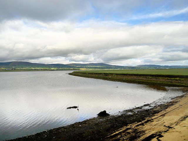
- Culmore Point, at the Mouth of the River Foyle: © David Dixon, Geograph Ireland, Creative Commons License
- Mouth of the River Foyle: © David Dixon, Geograph Ireland, Creative Commons License

Excellent post good article and photography dear @harlotscurse i appreciate your writing
Wow! such a wonderful history D :) friend @harlotscurse .i love your post. Really your photography is awesome. Thanks for share this post.
Good post. Upvote for You
Very good post.
Very good historical post dear buddy. I always respect your writing