Ναγνατα Πολις
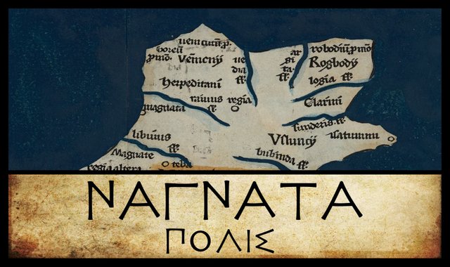
Sailing down the west coast of Ireland, with Claudius Ptolemy’s map as our guide, our next landfall after the River Ravios is the city of Nagnata. In several manuscripts of Ptolemy’s Geography, this settlement is called Ναγνατα πολις ἐπισημος, The Eminent City of Nagnata.
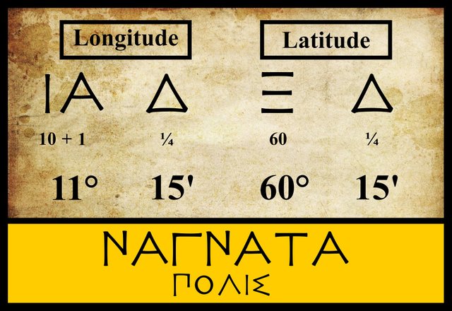
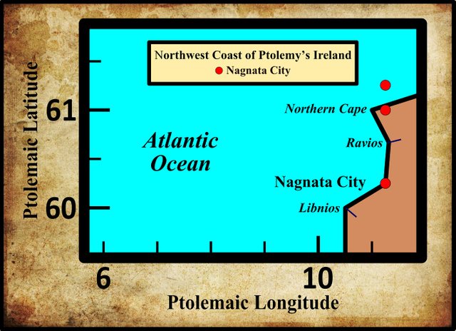
The three modern editors I am following assign the same coordinates to this feature. All the manuscript sources give the same figures for the longitude, but a handful of them give different figures for the latitude:
| Edition or Source | Longitude | Latitude |
|---|---|---|
| Müller | 11° 15' | 60° 15' |
| Wilberg | 11° 15' | 60° 15' |
| Nobbe | 11° 15' | 60° 15' |
| M | 11° 15' | 61° 00' |
| X, Σ, Φ, Ψ | 11° 15' | 61° 15' |
Σ, Φ and Ψ are three manuscripts from the Laurentian Library in Florence: Florentinus Laurentianus 28, 9 : Florentinus Laurentianus 28, 38 : Florentinus Laurentianus 28, 42.
M is the Editio Argentinensis, which we have met several times before. It was based on Jacopo d’Angelo’s Latin translation of Ptolemy (1406) and the work of Pico della Mirandola. Many other hands worked on it—Martin Waldseemüller, Matthias Ringmann, Jacob Eszler and Georg Übel—before it was finally published by Johann Schott in Straßburg in 1513.
X is Vaticanus Graecus 191, one of the earliest surviving sources. The coordinates for Nagnata are difficult to read. The latitude looks to me like 61°, not 61° 15'. The longitude is clearer and Müller’s reading of 11° 15' seems to be correct.
Variant Readings
Most of the manuscript sources record the name of this settlement as Nagnata, after a local tribe called the Nagnatai. Relatively few have the variants Magnata and Magnatai. Curiously, it was Magnata that Karl Müller opted for in his 1883 edition of Ptolemy’s Geography, in opposition to Friedrich Wilberg (1838) and Karl Nobbe (1845), who had chosen the more frequent variant Nagnata. Müller surmised that the name derived from τὰ Μάγνα [ta Magna], a Greek transliteration of the Latin Magna, “The Great [City]”. In support of this conjecture, he referenced two important early sources:
These both refer to a place in Britain as Magnis. A Romano-British town near Kenchester in Herefordshire has been identified as the settlement in question.
The Irish Celticist T F O’Rahilly, however, was having none of this. Referring to the tribal name from which the settlement took its name, he wrote:
The form Μαγναται, adopted by Müller, has very little authority. (O’Rahilly 2)
Of the fifty or so manuscripts of Ptolemy’s Geography, only about eleven have the form Magnata, so O’Rahilly is justified in rejecting it. Goddard Orpen, however, was largely supportive of Müller:
The new editor [ie Müller] prefers the form Μάγνατα to Νάγνατα, which has hitherto usually appeared, and gives good reasons for thinking that the epithet ἐπίσημος [distinguished, remarkable, noteworthy], hitherto appended to the name of the town, has crept in from the margin where it was a sort of gloss on the name, which may have been simply Μάγνα. (Orpen 118)
As Müller suggested, the epithet ἐπίσημος, found in several manuscripts, was probably a gloss introduced by a Greek-speaker, who took the name Μάγνατα to be a Greek transliteration—τὰ Μάγνα—of the Latin Magna. In other words, ἐπίσημος was given as a Greek translation of the Latin name. But it does not follow that Μάγνατα is what Ptolemy originally wrote.
| Edition or Source | Greek | Roman |
|---|---|---|
| Müller | Μάγνατα | Magnata |
| Wilberg | Νάγνατα | Nagnata |
| Nobbe | Νάγνατα | Nagnata |
| M, X, N, V | Μάγνατα | Magnata |
| R | Νάγνατος | Nagnatos |
| B, E | Τάναγρα | Tanagra |
N refers to a pair of Latin manuscripts discovered by the Prussian geographer Konrad Mannert.
V is an edition of Ptolemy’s Geography published in Ulm in 1482 by Lienhart Holle, with the assistance of the cartographer Nicolaus Germanus Donis.
R is a Venetian manuscript identified by Müller as Venetus 516. It is possibly kept in the Biblioteca Nazionale Marciana, though I have not been able to confirm this. It gives Nagnata the masculine form of the name: Nagnatos.
B and E are two of the Codices Parisini Graeci in the Bibliothèque nationale de France in Paris: Grec 1404 and Grec 1403 respectively. These give the variant reading Τάναγρα [Tanagra]. Müller believed that this was another instance of the Greek definite article τὰ [ta = “the”] being added to the Latin Magna. This was later corrupted to Τάναγρα, perhaps under the influence of the Greek city of this name, which Ptolemy records in Book 3, Chapter 14 of the Geography. (Müller 76, 542)
Identity
In an earlier article in this series I pointed out that there were no towns or cities in ancient Ireland. Ptolemy’s πολεις, “cities”, cannot, then, be taken literally. The term probably referred to strongholds or trading emporia (Orpen 126, Darcy & Flynn 61, 64).
In the early 17th century, William Camden tentatively placed Nagnata in County Sligo:
The County of Slego ... is divided from Leitrim and Roscoman by the rugged Curlew-mountains and the river Succus. Hereabouts Ptolemy places the City of Nagnata; but I have not been able to discover it. (Camden 1385)
The River Suck forms part of the western boundary of Roscommon, but it separates it from County Galway, not Sligo. The Irish antiquary James Ware had little to add to Camden’s account:
Nagnata or Magnata: Ptolemey calls this an eminent City, and by the Situation he seems to point out some Place not far from Sligoe: But I cannot discover the least Foot-steps of a City so called in all that Tract of Country; so all-devouring is Time! (Ware & Harris 42)
Ware’s editor Walter Harris added the following comment:
And this Instance is very apposite to that of the Capital City of the Veii, “the Ruins of which are now so far lost, that Geographers are not able to determine the place where it once stood [Joseph Addison, Remarks on Several Parts of Italy] ... There are indeed some Remains of the Place in Magio, now called Mayo (which is mentioned in Bede), a noted Village of the adjoining County southward. But the Distance of its Situation will by no means admit it to be the Magnata of Ptolemey. Yet perhaps it may be imagined by some, that Ptolemey has misplaced this City a little. But I must leave that Matter to the Enquiry of others. (Ware & Harris 42)
The village of Mayo, or Mayo Abbey, as it is also known, lies far inland and was founded in the late 7th century by St Colmán, Bishop of Lindisfarne. It could not possibly be Ptolemy’s Nagnata (or Magnata).
The Welsh Celticist William Baxter believed that the correct spelling was Naguata, and that the place referred to was Galway City, as Ware noted:
Baxter judges this Place to be the modern Galway. and would have it mean Cuan-Na-Guactie, i.e. the Port of the Small Islands, alluding to the three Islands of Arran that make a Bar in the Mouth of the Bay of Galway, and other little Islands lying nearer to the Town; and he derives the Name from Cuan, which signifies a Port, Na, a Prepositive of the Genitive Case, and Vact or Guact, a little Island, i.e. Na-guactie; for Nagnata he will have to be a small Error of Transcribers instead of Naguata. And indeed the Situation of Galway, according to Ptolomey, is pretty near the truth of this Notion. (Ware & Harris 43, Baxter 181-182)
Baxter’s fanciful etymology was later endorsed by the librarian James Hardiman, whose history of the city and county of Galway was first published in 1820. Samuel Lewis also cited Baxter in support of this identification in his Topographical Dictionary of Ireland of 1837.
Goddard Orpen, who, as we have seen above, adopted the reading Magnata, believed that this place had left some traces of its name in County Mayo:
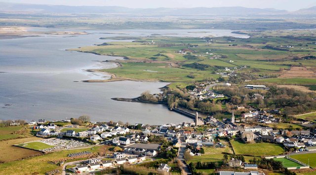
The site of this town should probably be looked for somewhere on Killala Bay, where we find the names Moyne Abbey (Ir. Maighin, representing an older Magen), and Magh-eó (or Mag neó), from which the Co. Mayo derives its name (Joyce, i. 425, 510). (Orpen 118)
Orpen’s somewhere on Killala Bay has been taken to mean Ballina by Darcy & Flynn (p 56). Ballina is the principal town in this part of County Mayo, though it is hardly on Killala Bay. It is really an inland town.
T F O’Rahilly, as we have seen, believed that the form Nagnata was the more authoritative. Speaking of the Nagnatai, the local tribe from whom the settlement took its name, he wrote:
Nagnatae. These were apparently located in North Connacht. Cóiced Connacht as a name for the western province is a late creation, which could not have come into existence until after the Connachta (Goidels from the Midlands) had conquered the province. An earlier name for it was traditionally remembered as Cóiced (n)Ól nÉcmacht (or Nécmacht). We also find fir Ól nÉcmacht (i.e. the men of Connacht) and tuatha Ól nÉcmacht [the kingdoms of Connacht]. None of the attempts that have been made to explain the phrase can be regarded as satisfactory. As to what Ól may mean, I have no suggestion to offer; but it is possible that Nécmacht is related to Ptolemy’s Nagnatae. Unfortunately we have no fixed point to argue from, for it is probable that both Nagnatae and Ól Nécmacht have been corrupted in transmission. (O’Rahilly 11-12)
The etymologists at Roman Era Names identify Ptolemy’s Nagnata as a settlement at Sligo, and they suggest the following origin of the name:
Ναγνατα (or Μαγνατα) πολις (Nagnata 2,2,4) was a settlement at Sligo, of the Ναγνατοι (or Μαγνατοι) people. An element -gnata naturally means either or both of ‘known’ and ‘born, descended from’ (Delamarre, 2003:180-181) in a range of ancient languages, as also discussed here. So, if Na- meant ‘not’, the Ναγνατοι might have been ‘unknown’ or ‘unrelated’ people, implying that that region on the west of Ireland was ethnically or linguistically different from further east. (Roman Era Names
In recent decades, a number of other locations for Nagnata have been proposed, all of them in the west of County Mayo:
- Achill Island
- Erris Peninsula
- Westport
| Sligo | Killala Bay | Westport | Achill Island | Galway | Erris Peninsula |
|---|---|---|---|---|---|
| Camden (1607) | - | - | - | - | - |
| Ware (1654) | - | - | - | - | - |
| - | - | - | - | Baxter (1733) | - |
| - | - | - | - | Hardiman (1820) | - |
| - | - | - | - | Lewis (1837) | - |
| Martin (1892) | - | - | - | - | - |
| - | Orpen (1894) | - | - | - | - |
| - | - | - | - | - | Mac an Bháird (1991-93) |
| - | - | - | Ikins (1996-2005) | - | - |
| - | - | Stempel (2002) | - | - | - |
| Darcy & Flynn (2008) | - | - | - | - | - |
Source: Darcy & Flynn 56
A few other candidates have also been touted over the centuries—Killala in County Mayo, Drumcliff in County Sligo, and even Limerick city—but there is no credible evidence that any of these towns or cities existed in Ptolemy’s day, let alone four or five centuries before his time. The identity of Nagnata must remain a mystery.
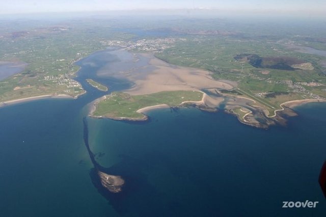
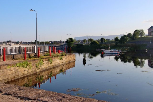
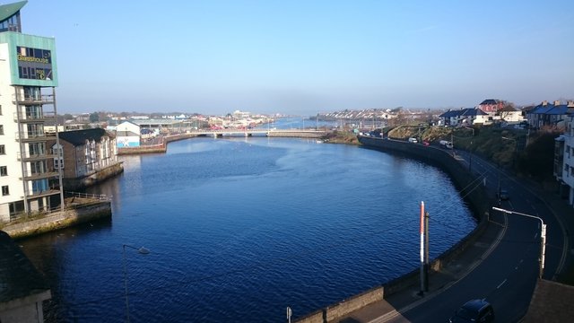
Nevertheless, if I were pressed on the matter, I would opt for the present site of Sligo town. This has the only significant harbour on the stretch of coast between the mouths of the Erne and the Moy, which are in my opinion the best candidates for the two rivers on either side of Ptolemy’s Nagnata. The outer harbour is well protected from the Atlantic by Coney Island, while the mouth of the Garavogue River would have made an ideal location for a trading settlement—not a town or permanent settlement, but a landing place for foreign ships.
References
- William Baxter, Glossarium Antiquitatum Britannicarum, sive Syllabus Etymologicus Antiquitatum Veteris Britanniae atque Iberniae temporibus Romanorum, Second Edition, London (1733)
- William Beauford, Letter from Mr. William Beauford, A.B. to the Rev. George Graydon, LL.B. Secretary to the Committee of Antiquities, Royal Irish Academy, The Transactions of the Royal Irish Academy, Volume 3, pp 51-73, Royal Irish Academy, Dublin (1789)
- William Camden, Britannia: Or A Chorographical Description of Great Britain and Ireland, Together with the Adjacent Islands, Second Edition, Volume 2, Edmund Gibson, London (1722)
- Robert Darcy & William Flynn, Ptolemy’s Map of Ireland: A Modern Decoding, Irish Geography, Volume 41, Number 1, pp 49-69, Geographical Society of Ireland, Taylor and Francis, Routledge, Abingdon (2008)
- Patrick Weston Joyce, The Origin and History of Irish Names of Places, Seventh Edition, Volume 1, M H Gill & Son, Dublin (1901)
- Samuel Lewis, A Topographical Dictionary of Ireland, Second Edition, Volume 1, S Lewis & Co, London (1840)
- Charles Trice Martin, The Record Interpreter: A Collection of Abbreviations, Latin Words and Names Used in English Historical Manuscripts and Records, Reeves and Turner, London (1892)
- Karl Wilhelm Ludwig Müller (editor & translator), Klaudiou Ptolemaiou Geographike Hyphegesis (Claudii Ptolemæi Geographia), Volume 1, Alfredo Firmin Didot, Paris (1883)
- Karl Friedrich August Nobbe, Claudii Ptolemaei Geographia, Volume 2, Karl Tauchnitz, Leipzig (1845)
- Thomas F O’Rahilly, Early Irish History and Mythology, Dublin Institute for Advanced Studies, Dublin (1946, 1984)
- Goddard H Orpen, Ptolemy’s Map of Ireland, The Journal of the Royal Society of Antiquaries of Ireland, Volume 4 (Fifth Series), Volume 24 (Consecutive Series), pp 115-128, Dublin (1894)
- Claudius Ptolemaeus, Geography, Biblioteca Apostolica Vaticana, Vat Gr 191, fol 127-172 (Ireland: 138v–139r)
- Herbert Weir Smyth, A Greek Grammar for Colleges, American Book Company, New York (1920)
- James Ware, Walter Harris (editor), The Whole Works of Sir James Ware, Volume 2, Walter Harris, Dublin (1745)
- Friedrich Wilhelm Wilberg, Claudii Ptolemaei Geographiae, Libri Octo: Graece et Latine ad Codicum Manu Scriptorum Fidem Edidit Frid. Guil. Wilberg, Essendiae Sumptibus et Typis G.D. Baedeker, Essen (1838)
Image Credits
- Ptolemy’s Map of Ireland: Wikimedia Commons, Nicholaus Germanus (cartographer), Public Domain
- Greek Letters: Wikimedia Commons, Future Perfect at Sunrise (artist), Public Domain
- Sligo Harbour: © Zoover, Fair Use
- Killala: © 2018 Staycation Holidays, Fair Use
- The Waterfront, Sligo: © Alan Reid, Creative Commons License
- Sligo Port: © Firefly, Fair Use

What such a wonderful history good article very nice post i like your post thanks for share dear @harlotscurse
Excellent post good article wonderful history i like your post thanks for share dear @harlotscurse