Mt. Washington: Meet the worst weather ever

Read "Mt. Washington: Meet the worst weather ever" on TravelFeed.io for the best experience
If you are looking for the worst weather in the world, you have come here to the right place. Mount Washington in the US state of New Hampshire is only 1917 meters high, but with this modest size it is the highest elevation in the whole northeast of the USA. Its surroundings tower above the bare rock by up to 1.400 meters, a steep needle in the flat landscape of the other mountains of the Presidential Range, where the cold air from the north piles up before meeting warm air from the south and west. The result is a magical mixture that regularly produces the worst, most uncomfortable and ugliest weather imaginable.
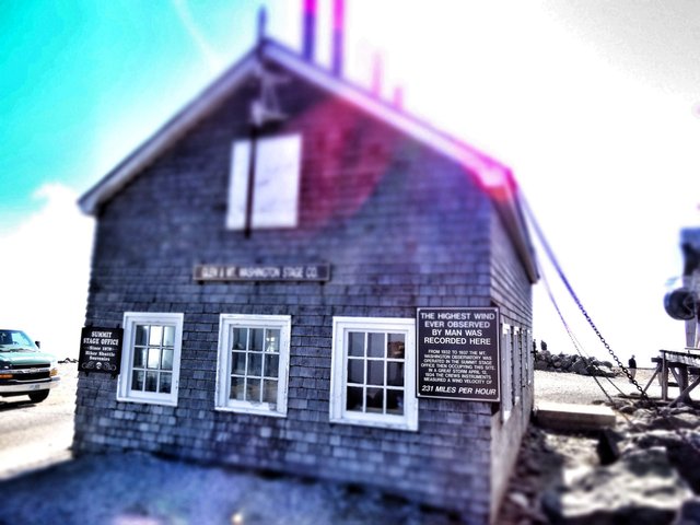
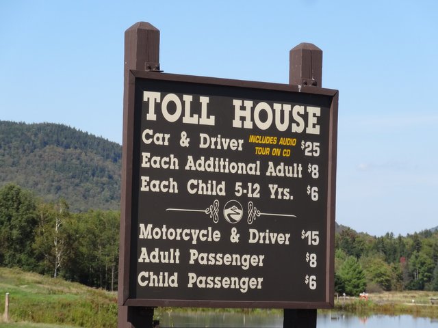
A touristical hotspot indeed! 280.000 people are coming every year to feel the worst weather and windchill as a real pain. On the summit of Mount Washington the highest wind speed ever observed anywhere was measured. On April 12, 1934, meteorologists read 231 miles off their instruments here - that's 370 kilometers per hour, more than three times the hurricane speed. A human being would be blown away in a storm like that.
Fortunately, however, on normal days, Mt. Washington is barren, bare, and a stiff wind always blows over the summit. But if you hold on tightly, you can certainly enjoy a panoramic view. Only in winter or late autumn a visit is not recommended, because then it gets slightly colder than -30 degrees Celsius and then a medium strong wind is enough to cool down completely within minutes.
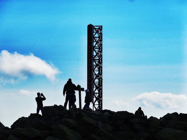
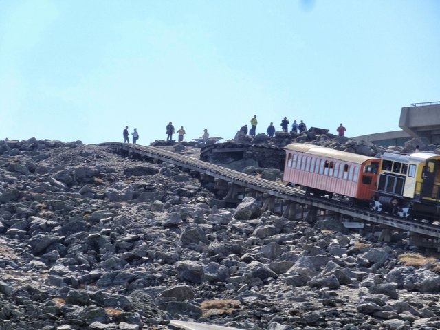
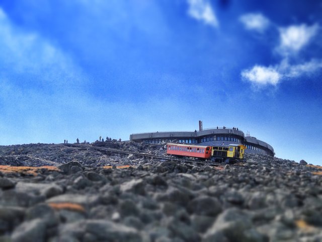
Because there is never a windless up here realizes every one of the hundreds of thousands of visitors of the Mt. Washington State Park after having completed the endlessly ascending road that the stay will be real uncomfortly. On more than 100 days a year, the wind speed at the summit reaches hurricane force with more than 120 km/h. On average, the wind still blows at 56 km/h and the average temperature is -2.7 °C. On the other hand, the trip up to the mountain who the natives called Agiocochook, which means "home of the Great Spirit", is an experience in itself.
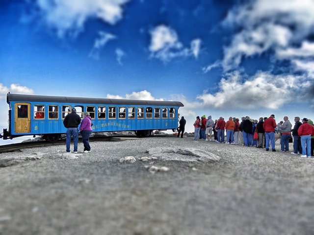
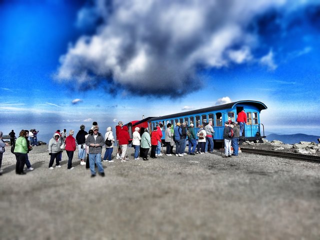
Already at the parking place, signs warn that this is one of the most dangerous weather zones of North America. "The area ahead has the worst weather in America," informs the US Forest Service, "many people have died here from hypothermia, even in summer." As soon as a weather deterioration is indicated, one should turn around and leave the mountain, even if one is only a few hundred meters away from the Sherman Adams Building, which houses a visitor center, a cafeteria, sanitary facilities, the souvenir shop, a weather station and a museum.
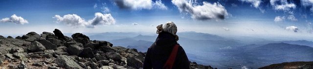
Those who want to hike here will find numerous trails, but must be prepared for fast weather changes. The effort to walk up or down the Crawford Path or the Tuckerman Ravine Trail is rewarded by imposing views of a landscape that may be in bright summer sunshine while you think you are in the deepest winter.
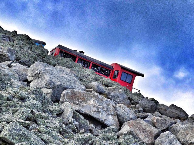
But also for the way back in the car one has to plan some time, as the way down is a challenge. The twelve kilometres are so steep that signs keep warning you to stop to let the brakes cool down. Better to do this, because even this wind here is not able to do it alone.
If you like my work please follow me: https://travelfeed.io/@koenau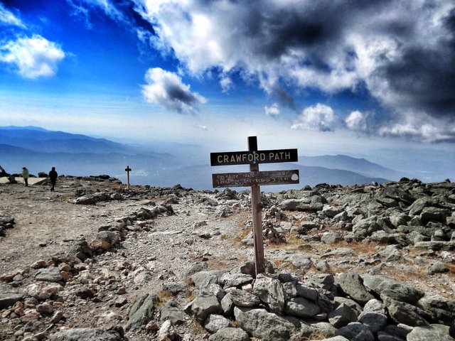
View this post on TravelFeed for the best experience.
Congratulations @koenau! You received the biggest smile and some love from TravelFeed! Keep up the amazing blog. 😍 Your post was also chosen as top pick of the day and is now featured on the TravelFeed.io front page.
Thanks for using TravelFeed!
@for91days (TravelFeed team)
PS: Have you joined our Discord yet? This is where over 1000 members of the TravelFeed come together to chat. Join us!
Congratulations, Your Post Has Been Added To The Steemit Worldmap!
Author link: http://steemitworldmap.com?author=koenau
Post link: http://steemitworldmap.com?post=mt-washington-meet-the-worst-weather-ever
Want to have your post on the map too?
Hiya, @LivingUKTaiwan here, just swinging by to let you know that this post made into our Honorable Mentions in Daily Travel Digest #784.
Your post has been manually curated by the @steemitworldmap team and got an upvote from @blocktrades to support your work. If you like what we're doing, please drop by to check out all the rest of today's great posts and consider supporting us so we can keep the project going!
Become part of the Haveyoubeenhere community:
This post was shared in the Curation Collective Discord community for curators, and upvoted and resteemed by the @c-squared community account.
If you are a community leader and/or contest organizer, please join the Discord and let us know you if you would like to promote the posting of your community or contest.
@c-squared runs a community witness. Please consider using one of your witness votes on us here