An unusual map of Europe in 1570 Abraham Ortelius. A review of surprising moments.
On the Internet I found an old Atlas of the world. It amounted to was a Flemish cartographer Abraham Ortelli ( 1527 — 1598) in 1570.
the
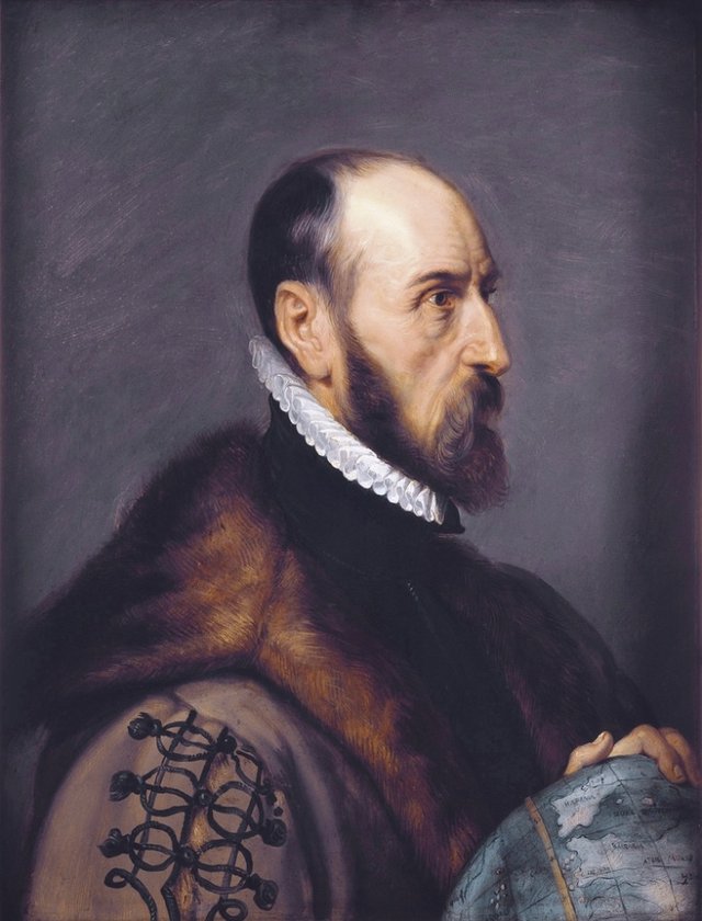
This man is considered to be sufficiently well-deserved cartographer of his time. His map was reprinted after the author's death. Was released pocket world Atlas, which was used by travelers.
I already wrote a post about the Mercator map.
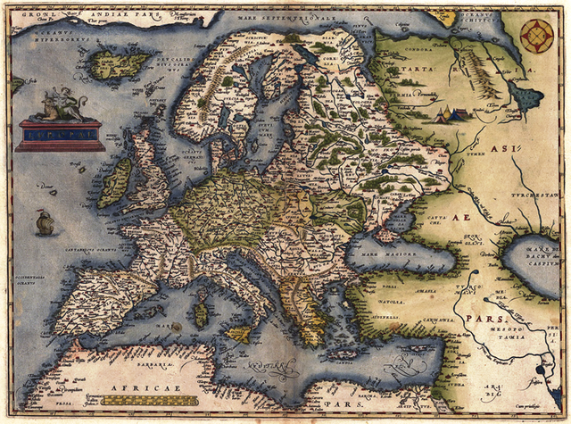
What we see on the world map or the Mercator projection.
Merit in Ortelius cartography is no less important.
Along with Gerardus Mercator, he played a crucial role in the development of cartography. Ortelius also belongs to the first detailed map of the Pacific ocean.
the European view of Europe of the 16th century. And again Tartary.
Primarily I'm interested in the map of the European part of Eurasia.
the
It turned out that the border separating Europe from Asia was held on the Volga and Northern Dvina. And Kazan was already in Asia.
It is not surprising that the map shows Tartary.
It is surprising that the site of the present Western Ukraine is the country Russiya (Russia).
the
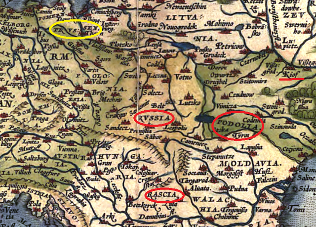
At the bottom, approximately in the South of Hungary is also a country with a similar name Ruscia. Upstairs yellow I circled Prussia (Prussen) in advance responding to the suggestion that under the name of Russia means exactly what it is.
In his post the Ancient ruins of Kiev in the drawings by Abraham van Westerfeld. Why Kiev in the 17th century looked razrushennyi? I quoted the words of Polish diplomat Reinhold Hagenstein (1553 -- 1620)
For several centuries the princes of Kiev were masters of all Russia, as that which is now called Moscow, and that which hitherto called Rus. Ruled by the princes to the Black sea and the Danube. Their capital was Kiev. When it was built, how long there is to be times of Colchis and Aeneas, known to close down the distant past and the indifference of historians...
Maybe he meant these "Rus"?
Kiev has a strange name "Kiof" the territory in which he is called Podillia (Podolia). Where's the Polish which included the territory of the Principality of Kiev in 1569?
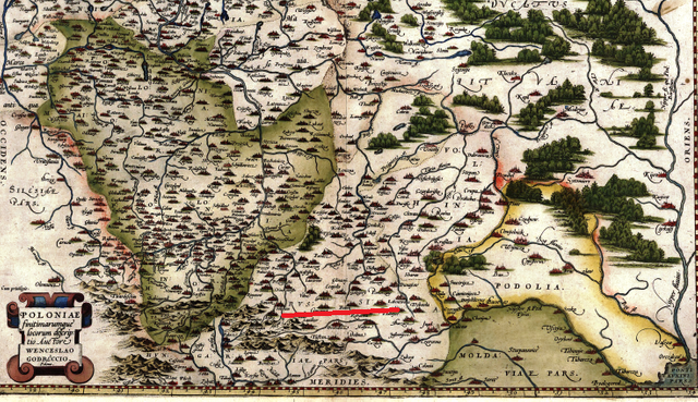
For a more detailed map of that territory, Kyiv is already included in the Grand Duchy of Lithuania, and the territory of Podolia separated.
In red I highlighted the name of Russia. Why is there no mention about this rather large country?
The map is a kind of Polonium are highlighted in green. Perhaps it is Poland. But still, this card does not fit in with the story.
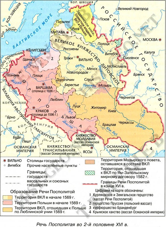
As we were taught in school, map of these territories in 1569 was supposed to look like.
the
Indeed, in our textbooks, any mistakes can not be. So lying Fleming.
That's just the question. Why?
This post has been ranked within the top 50 most undervalued posts in the second half of Apr 16. We estimate that this post is undervalued by $1.25 as compared to a scenario in which every voter had an equal say.
See the full rankings and details in The Daily Tribune: Apr 16 - Part II. You can also read about some of our methodology, data analysis and technical details in our initial post.
If you are the author and would prefer not to receive these comments, simply reply "Stop" to this comment.
nice story... i like written
Very insightful research. If you enjoy antique maps and history, follow me. That is the focus of 90% of my posts.