Geological characteristics of the highest mountain in the world - Mount Everest
Referring to the publications on the science of geology, I want to show in this next publication a topic of great interest for lovers of this science, it is about the highest mountain that exists in the world better known as Mount Everest a formation which is divided into other formations, making this magnificent mountain look like a large geology and, above all, with a lot of geological history. Below I show the geological characteristics of the largest mountain in the world.
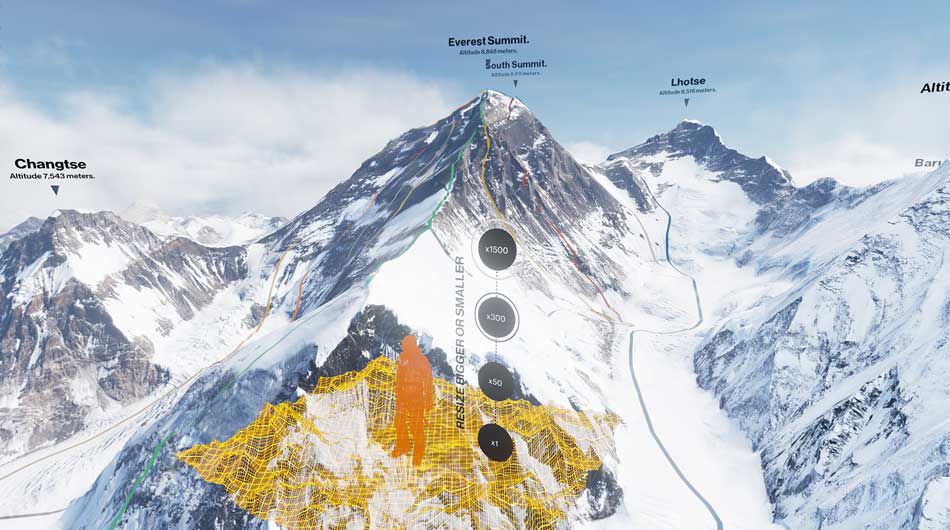
Mount Everst at its maximum expression
Mount Everest is the highest mountain on planet Earth, with a height of 8848 meters (29 029 feet) above sea level.1 It is located on the Asian continent, in the Himalayas, specifically in the sub-range of Mahalangur Himal; marks the border between China and Nepal.
Geologists have subdivided the rocks that comprise Mount Everest into three units called formations.48 49 Each formation is separated from each other by low-angle faults called take-off faults, along which an envelope has been pushed. another to the south. From the top of Mount Everest to its base these rock units are: the Qomolangma formation, the North Collet formation and the Rongbuk formation.
Formation of the Qomolangma
Known as the Jolmo Lungama formation or the Everest formation, it runs from the summit to the upper reaches of the Yellow Band, about 8,600 m (28,200 ft) above sea level. It is composed of parallel gray to dark gray or white, limestone sheets from the Lower Ordovician period interspersed with secondary beds of recrystallized dolomite with sheets of clay and siltstone. Swiss scientist Augusto Gansser documented finding microscopic fragments of crinoids in the limestone. Subsequent petrographic analyzes on samples of limestone collected near the summit, revealed to be composed of compressed carbonate stones and finely fragmented remains of trilobites, crinoids and ostracods, all of them marine organisms. Other samples were so badly cut and recrystallized that their original components could not be determined.
Formation of the North Col
The bulk of Mount Everest, between 7,000 and 8,600 m (23,000 and 28,200 feet), consists of the formation of the North Col, of which the Yellow Band forms the high part between 8200 to 8600 m (26 900 to 28 200 feet) . The Yellow Band is formed by layers interspersed with diopsid-epidote marble from the Middle Cambrian period, which gives it a distinctive yellowish brown color, and Muscovite-biotite phyllite and shale. Petrographic analyzes of marble collected at 8300 m (27,200 feet) found that they consist of 5 percent recrystallized fragments of crinoid ossicles. The last five meters of the Yellow Band that are adjacent to the Qomolangma takeoff fault are highly deformed. A fault gap of 5-40 cm (2-15.7 inches) thick separates it from the overlying Qomolangma formation
Rongbuk training
Below 7,000 m (23,000 ft), the Rongbuk formation lies below the formation of the North Pass and forms the base of Mount Everest. It is formed by shale of sillimanite-orthoclase grade K, and gneiss mixed with sheets and leucogranite dikes with a thickness degree of 1 cm to 1,500 m (0.4 to 4,900 feet) .49 54 These leucogranites are part of a belt of intrusive rocks of the Oligocene-Late Miocene period known as the Upper Leukogranite of the Himalayas. They were formed as a result of the partial fusion of high-grade metasedimentary rocks from the Upper Himalayan Sequence from the Paleo-Proterozoic to the Ordovician period, about 20 to 24 million years ago during the subduction of the Indica plate.
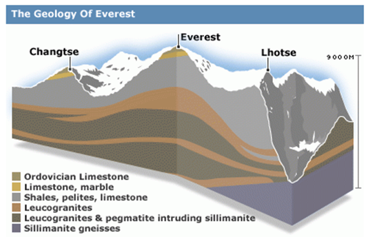
Geology structure of the three formations of Mount Everest
Mount Everest is formed by sedimentary and metamorphic rocks that have been pushed southward over the continental crust, composed of archaeozoic granules of the Indica plate during the collision in the Cenozoic of India with Asia. Current interpretations argue that the Qomolangma and Collado Norte formations are formed by marine sediments that accumulated within the continental shelf to the north, and the Indian continental limit prior to the collision with Asia. The collision in the Cenozoic of India with Asia later deformed and transformed these strata while pushing them southwards and upwards. The Rongbuk formation is formed by a sequence of high grade metamorphic rocks and granitic rocks derived from the alteration of high grade metasedimentary rocks. During the collision of India with Asia, these rocks were pushed down and to the north while they were ridden by other strata; heated, transformed and partially melted at depths of more than 15 to 20 kilometers (9.3 to 12.4 miles) below sea level; and then forced up to the surface pushed south between two major takeoff faults. The Himalayas rise about 5 mm per year.
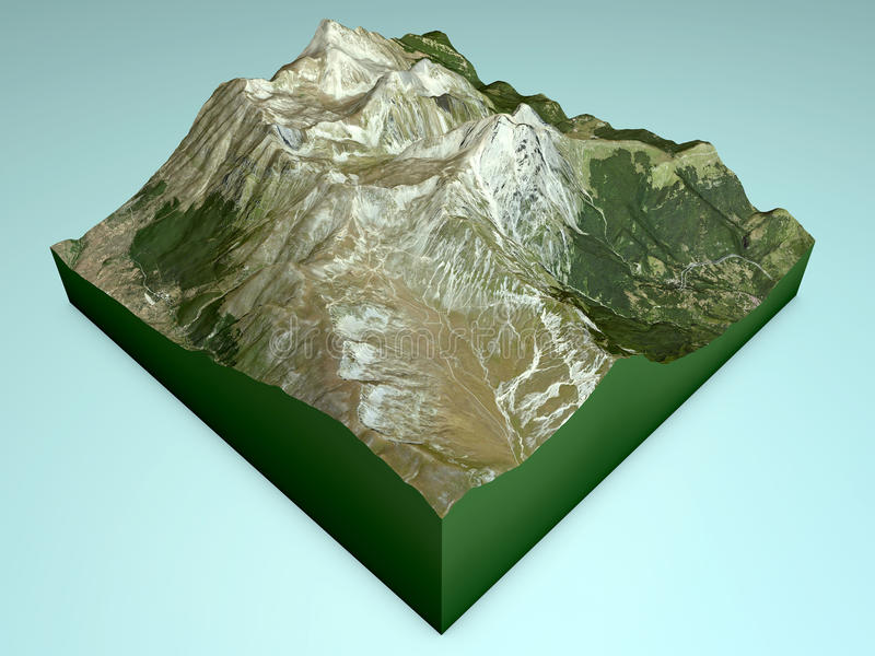
3D modeling of the Himalayas
Tectonic plates in the everest?
Two tectonic plates converge in a fault line in the Himalayan zone. It is the plate of India or Índica Plate, which moves towards the north, and the Eurasian plate. Precisely the clash of these two plates arose in his day the Himalayas.
At present, the Indica plate is moving towards the northeast with a velocity of 5 cm / year, while the Eurasian plate is moving towards the north at only 2 cm / year. This is causing deformation of the Eurasian plate, while the India plate is compressing with a speed of 4 mm / year.
At the site of the earthquake on Saturday, about 80 kilometers northeast of the Nepalese capital of Kathmandu is where the plate of India converges with that of Eurasia, which drives the lifting of the Himalayas, the highest in the planet, which houses Mount Everest (8,848 meters).
The first seismic data obtained from sound waves traveling through the earth after an earthquake indicate that the ground beneath the capital of Kathmandu has shifted three meters south due to the natural event. However, at the moment it is not clear if these changes are large enough to require adjustments to the world's highest precision maps.
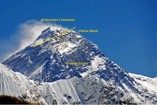
Mount Everest with melted snow, showing in bands the high geological layers. The "Yellow Band" can be seen extending through the mountain.
Measurement of height
The height of 8,848 m (29,029 ft) is officially recognized by Nepal and China, however, Nepal plans a new measurement study.
In 1856, Andrew Waugh announced Everest (then known as Peak XV) as 8,840 m (29,002 ft) in height, after several years of calculations based on observations made by the Great Trigonometric Topography Project.
The altitude of 8,848 meters above sea level was determined in an Indian study conducted in 1955, moving closer to the mountain and also using theodolites. This height was reaffirmed later, in 1975, by a Chinese measurement, in both cases the top of snow and not of rock was measured. In May of 1999, an American expedition led by Bradford Washburn, placed a GPS on the rock at the top. The device obtained a height of 8,850 meters above sea level for the rock and 1 meter for the snow and ice layer, although Nepal has not officially recognized it, 32 this figure is widely cited. In any case, the geoid shape of the Earth raises doubts about the accuracy shown by the 1999 and 2005 measurements, and about the utility of determining height with very high accuracy.
calculated heights on Mount Everest
More recently, new height calculations have been made that result in 8,848 meters (29,029 feet), although there is some variation in the measurements. After Everest, the highest mountain is K2, with 8,611 masl (28,251 ft).
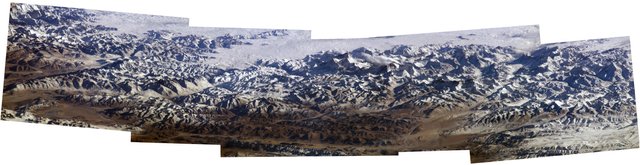
Mosaic of photographs of the Himalayas, 2004; with Makalu and Mount Everest since Expedition 8 of the International Space Station.
Mount Everest is still rising and moving towards the northeast, motivated by the plate tectonics of the South Asian area. Two sources, 36 37 suggest that the movement speed is 4 mm per year in elevation and 3-6 mm to the northeast. Even a decrease in height has been suggested.
The lowest point of the ocean is deeper than the height of Everest: the Challenger Abyss, which is located in the Marianas Trench, is so deep that if Everest were located in its bottom it would be more than 2 km short to reach the surface.
The Mount Everest region and the Himalayas in general are suffering from melting and snow loss, possibly due to global warming
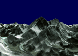
3D sequential design of Mount Everest
Bibliography :
- https://marcoah.com.ve/2014/06/geologia-del-monte-everest/
- https://es.wikipedia.org/wiki/Monte_Everest
- http://www.geoenciclopedia.com/monte-everest/
Your post has been personally reviewed and was considered to be a well written high quality article!
You received a 20% upvote since you are not yet a member of geopolis.
To read more about us and what we do, click here.
https://steemit.com/geopolis/@geopolis/geopolis-the-community-for-global-sciences-update-1
If you do not want us to upvote and comment on your posts concerning earth and earth sciences, please reply stop to this comment and we will no longer bother you with our love ❤️
HAVE you been in any of these palaces?. I love Everest but is too complicated to climb it. A,follow,for you.
well said sir
Hello joseferrer!
Congratulations! This post has been randomly Resteemed! To join the ResteemSupport network and be entered into the lottery please upvote this post and see the following rules.