Fourth of July Trail
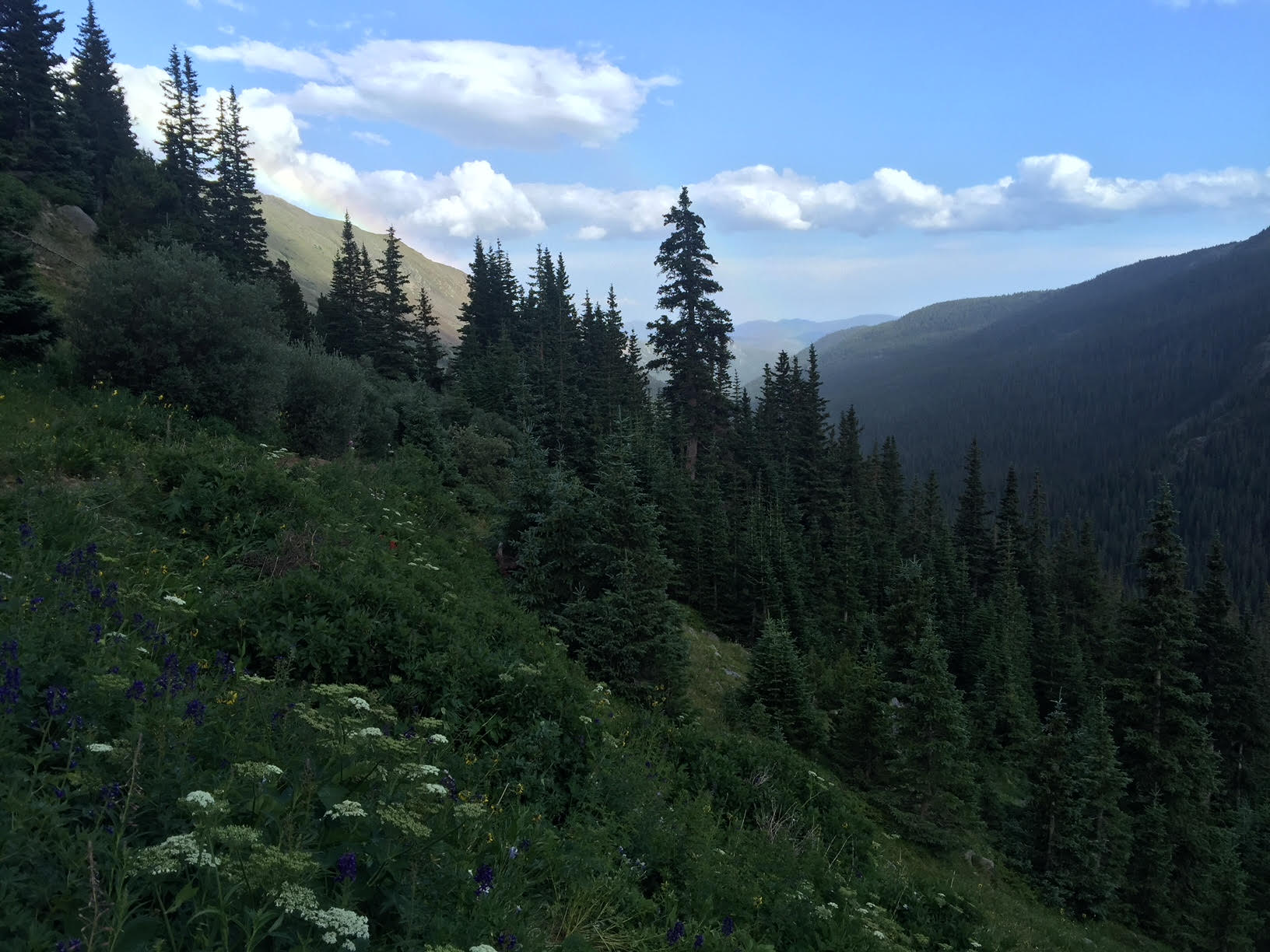
The Fourth of July trail is located near Nederland, Colorado and is the doorway to peaks, lakes, mountains, and a glacier. The trail is named for old mine remnants that can be found along the path. This trail is the entrance to Indian Peaks Wilderness and is considered a moderate climb. There is hiking, camping, mountain climbing, and bird watching. Dogs are allowed on this nature trail.
Historical Facts
The artifacts on the trail lead us to a very interesting history to an old mining project, the mine generated some attention but the mine never produced. The Fourth of July trail is named after the first claim staked on July 4, 1872. The mine produced some gold, silver, copper, lead, zinc, and ore. Mostly a chemical element called tellurium.
There was an attempt to build a wagon road with funding from the federal government in 1906, but the money did not last long and what was left of the road is now the current hiking trail. The mine ran until its abandonment in 1937.
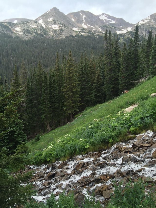
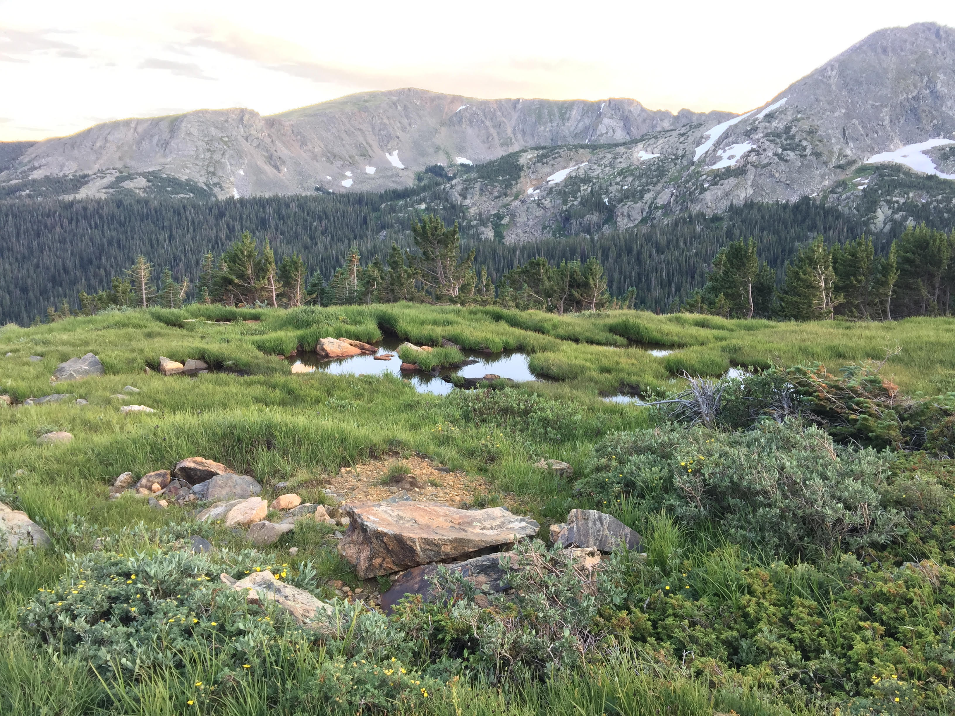
Up above the mine there is a flat area filled with Krummholz, or vegetation that have been stunted and deformed by freezing winds and continual exposure. This area has been home to hunters and explorers for over 9,000 years. There is water, shelter, and is a major crossroad over the Continental Divide.
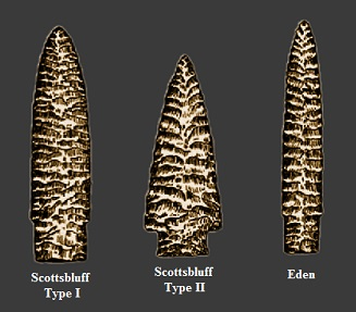
Interestingly, archaeologists have found Eden and Scottsbluff projectile points or arrowheads. The First Nation used both of these points for hunting, and the hunting ground was right up the trail on Arapaho Pass. These points have been dated back 9,000 years and is a confirmation that this area has been home to humans for a long period of time.
Hiking Fourth of July Trail
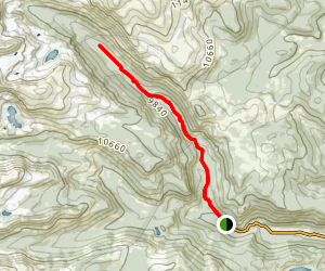
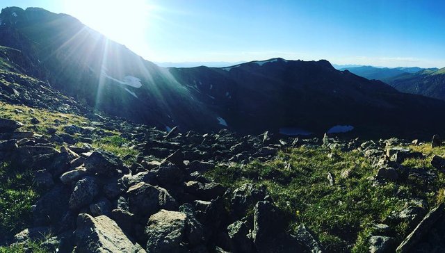
To get to The Fourth of July trail there is a rough five mile, four-wheel drive road. Once you hit the trailhead there is limited parking. There is no winter access. The Fourth of July gives is a trail that leads to Arapaho Pass, Diamond Lake, Arapaho Glacier and is located within Indian Peaks Wilderness.
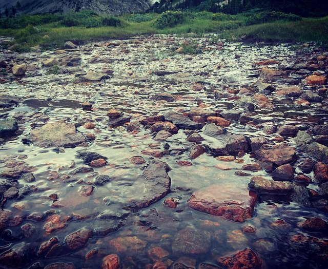
Arapaho Pass Trail is a 1.2 mile hike with an elevation of 11,906 feet. Diamond Lake Trail is a connection from Fourth of July trail and is an elevation of 11,245 feet. There is an additional lake by the name of Lake Dorothy that can be seen if you continue hiking another .25 miles with an increase in elevation to 12,061 feet.
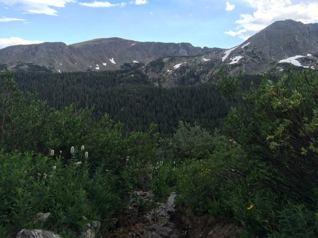
The trail continues as a part of the old road that was created with federal funding. The cliff was blasted to create Caribou Pass. Some of this trail is very rocky and narrow. Bravery is definitely needed through this part of the path. This path continues onward and drops 750 feet for approximately nine more miles to Monarch Lake. A heavily wooded area ends at the Continental Divide Scenic Trail.
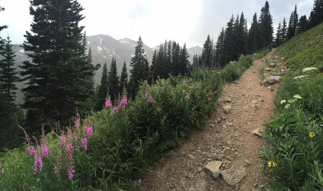
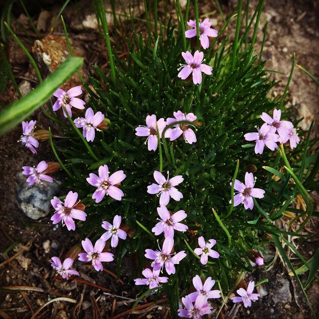
If there was too much snow at that first intersection then continue on the trail named Mt. Neva at 12,814 in elevation. There is a lake and 4 plus terrain with snow climbing. There are plenty of wildflowers as far as the eye can see.
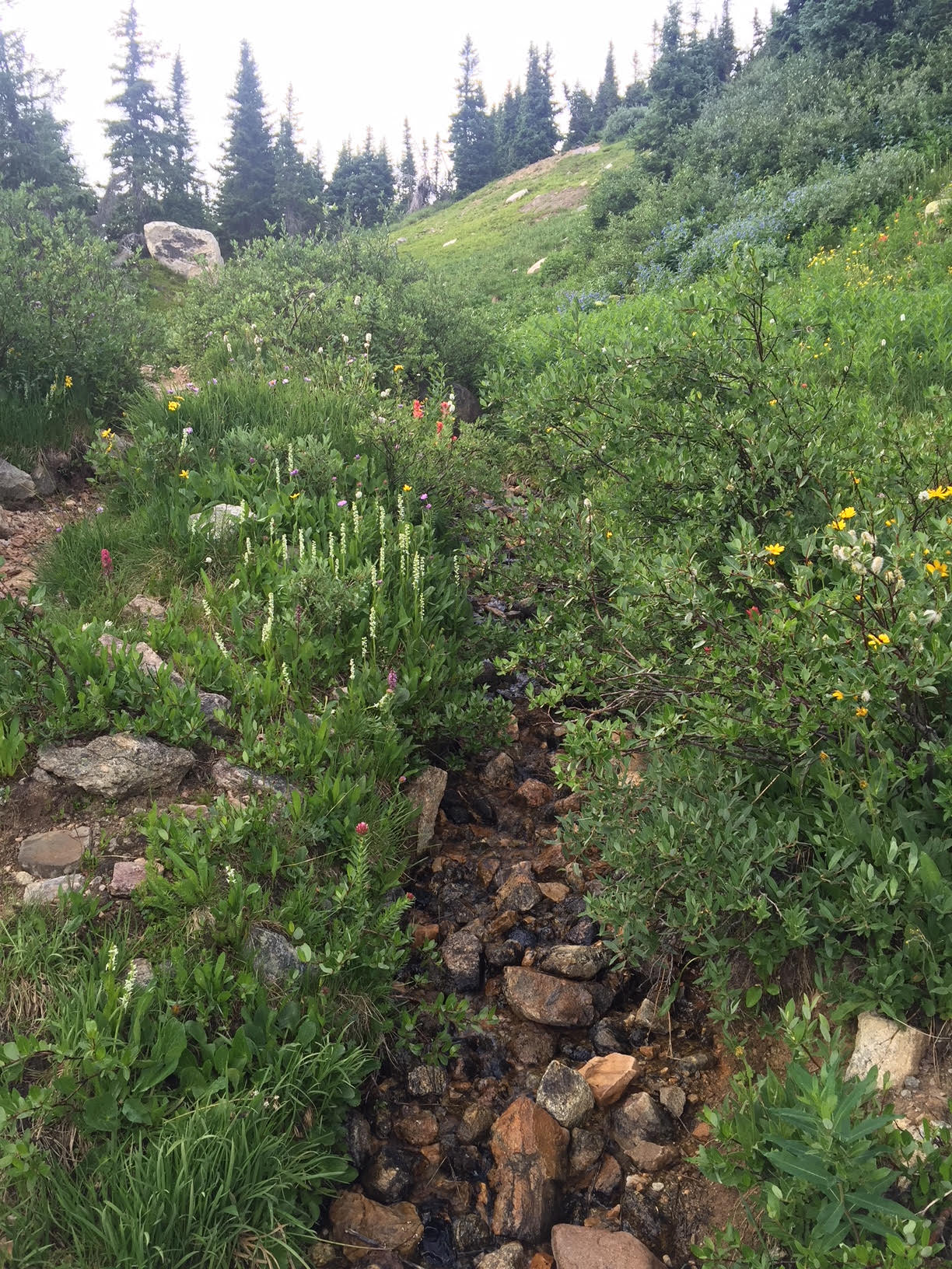
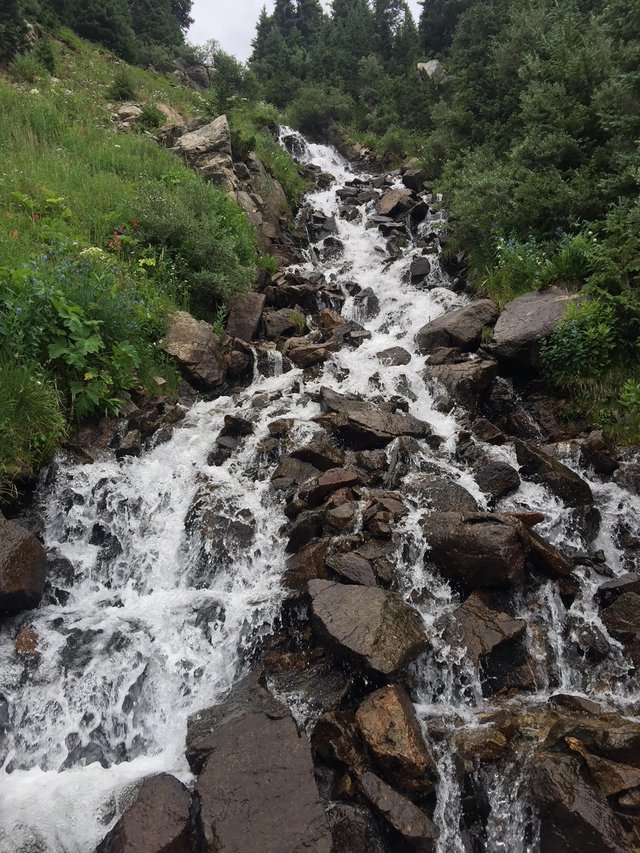
Other option for hiking are to S. Arapahoe Peak at 13,379 feet that has a class 3 climb over to N. Arapahoe Peak at 13,502 feet. There is even a Cessna plane crash wreckage if you are into morbid scenery amidst nature. There are plenty of waterfalls to take a perfect photo too.
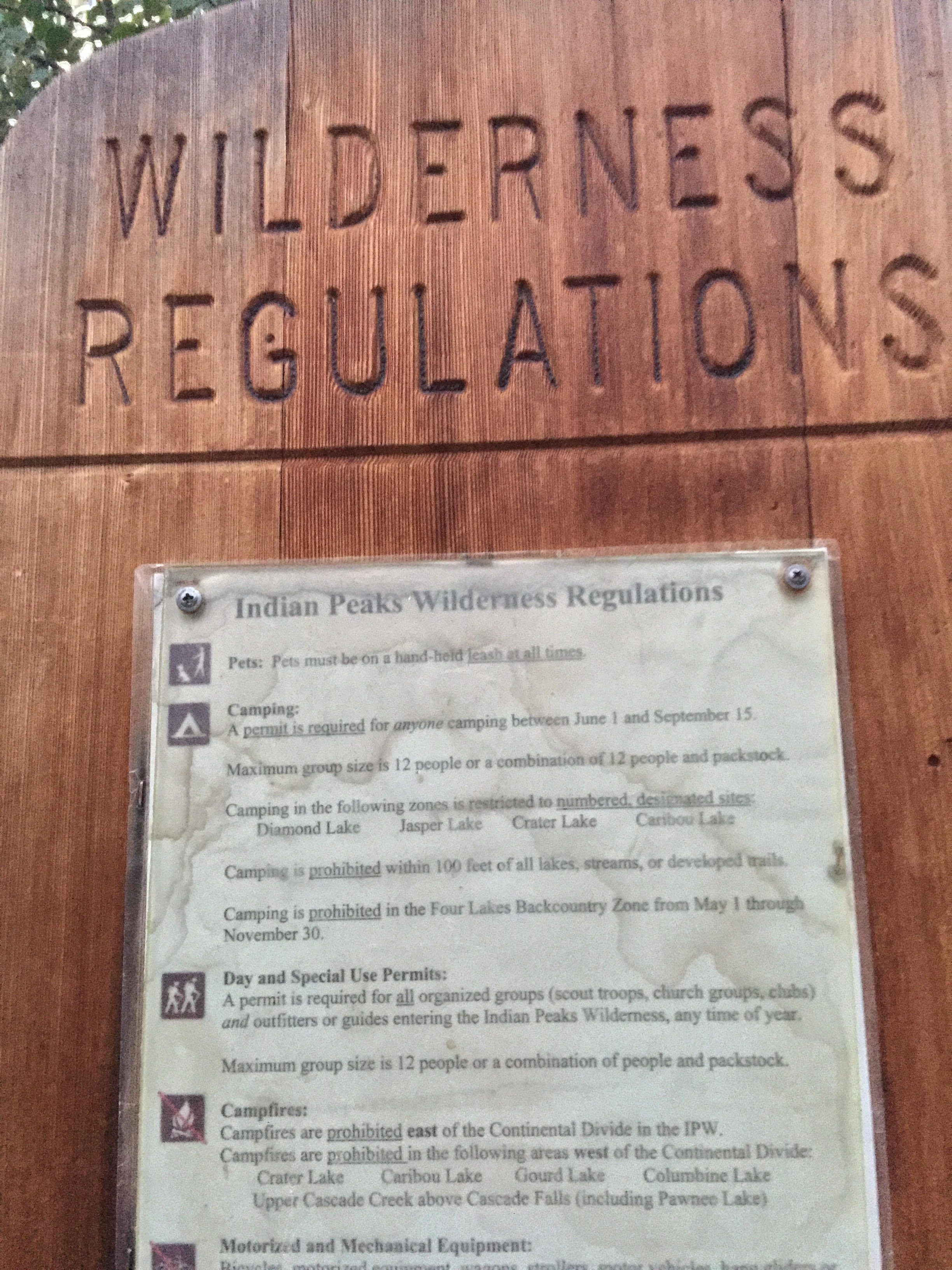
While hiking in any wilderness it is important to remember:
Temperatures can change within a very short time period. Carrying layers is very important that will protect from sun, wind, or rain. There may be snow even in the summer month of July.
The trail can be very busy, especially during the summer so arrive early to secure parking.
Bring a lunch to pack out, and bring plenty of water (water-bladder is recommended) , with hiking or climbing in high altitude staying hydrated is very important.
You may want to bring binoculars since there is an abundance of wildlife. You can find elk, bighorn sheep, and mountain goat.
Arapahoe Glacier
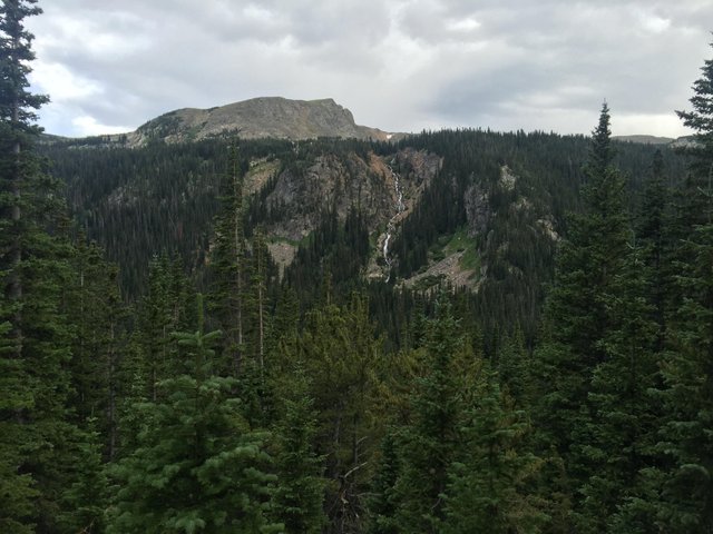
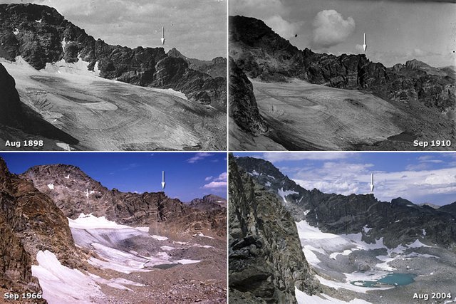
As we have previously discussed, this particular section of the Indian Peaks National Forest has been a hunting ground for Native Americans for centuries. But, it was not until 1920, that tourists started to arrive in cars and horseback to visit this amazing glacier. The glacier itself falls 1,300 feet downward in a series of switchbacks intersecting Arapahoe Pass. During the early period people would slide down the glacier, but today this is not allowed.
Technically, Arapahoe Glacier is now considered a snowfield or a permanent expanse of snow. The elevation of the Arapahoe Glacier is 12,434 feet. This area is considered a mountain glacier since it is surrounded by mountain terrain, and a cirque glacier or bowl shaped. The glacier is the largest in Colorado, but is only one quarter mile long, a half mile wide, and 15 feet thick.
The glacier is a water source for Boulder City and is shrinking yearly. The water source is closely monitored, but it has been determined that it will soon dry up. Some scientists believe the Arapahoe Glacier will disappear within 60 years.
If you are ever on this side of Mother Earth, take a day and make your way up to the glorious Fourth of July Trail. You definitely will not be disappointed. Peace.


You received a 60.0% upvote since you are a member of geopolis.
To read more about us and what we do, click here.
https://steemit.com/geopolis/@geopolis/geopolis-the-community-for-global-sciences-update-3
If you do not want us to upvote and comment on your posts concerning earth and earth sciences, please reply stop to this comment and we will no longer bother you with our love ❤️
Yay! Thank you so much! xx🦅
@eaglespirit,
Nature walks are great for the body, mind and soul.
Beautiful images.
BTW, many years ago, the first time I visited Colorado was for freefall parachuting at the Air Force Academy, Colorado Springs.
I wasn't acclimated to the altitude and got out of breath jogging to my rental car! Lol!
Upvoted and calling on @originalworks and @steem-untalented upvotes for your post. (Please be patient. Sometimes it takes awhile for them to respond.)
May you and yours be well and love life today.
Namaste,
JaiChai
Hi there @jaichai, thank you for visiting my blog and yes hikes are great!
I appreciate your kind words about my photography. Freefall parachuting .. what??? Ah, yes the Academy that must have been interesting.
OMG the altitude is so bad ... I had no idea my body would react as it does .. after 2 years I still get out of breath. It is the worst.
Thank you so much for calling the bots .. they haven't come for me in a long time. Tears.
Much love and blessings to you. xx
These pictures are just too beautiful. That's got to be on my visit list. Sneak Opal in my backpack maybe.
And I'm a fan of rocky streams... Though maybe it's pretty cold there.
Hi @eonwarped! Thank you so much Forbes you’re appreciation. Opal is allowed on the trail. Most trails in Colorado are pretty much puppy friendly. Another reason why I like it here. Just gotta remember to pack out the poo. LOL
You all would love this hike for sure. The streams and waterfalls are all over. I hadn’t some videos but they wouldn’t be upload. Upsetting but I moved on.
It can be cold, yes. This was End of July I took this hike and it had hot, cold, drizzly and as you can see snow all in one day. LOL
xx🦅
Congratulations! This post has been chosen as one of the daily Whistle Stops for The STEEM Engine!
You can see your post's place along the track here: The Daily Whistle Stops, Issue # 34 (2/2/18)
The STEEM Engine is an initiative dedicated to promoting meaningful engagement across Steemit. Find out more about us and join us today!
Yay, thank you so much my friends ... I just love this little choo choo. xx
I haven't checked that trail out but need to. I haven't been up to Ned in awhile. Used to live up there for a short while when I first moved out here.
@intuitivejakob you will definitely enjoy the hike. Maybe that could be one of our Meetups when the weather gets nicer ... a hike for all of us to enjoy together? Ned is great, that must have been interesting. I could not live there, too much snow! LOL
Hugs. xx
I'm all about it, let's do it!
It might be fun! I wonder what the group would think?
Not sure but I know some of us have been discussing outdoor stuff.
Have you met @rebele93 yet? He is planning ahead for a camping trip to go set up his custom telescope for some viewing.
Sounds good and fun! Do you camp? The telescope would be AWESOME! Yay. I hope you are well and feeling better. I hope you had a lovely birthday. xx
Beautiful! Another place in Colorado I need to go and visit! Too many places, too little time. Thanks for sharing another epic location and providing some history on it :)
@falseyedols, glad you have found another place to go visit! Maybe when your baby gets older she will go with her dad and you can have a lovely experience together. :)
Sort of like Dad Day and a time to catch up on chit chat. You are very welcome and I am happy you stopped by to read and comment. I truly appreciate your support. xx
Wonderful place, Eagle. Such stunning photography. Love the place names too like Diamond Lake and Caribou pass. Great write-up. I didn't know you were into hiking.
love
Anj xx
Thank you Anj! Yes I hike quite a bit and have ton quite a few write ups like this one. :)
Love
Eagle xx
I lived in colorado for 10 years and was an advid hiker, I don't know how I never heard of this trail! I guess next time I visit there in the summer I know what trail I'm gonna be hiking! Thanks for this awesome post!
Hey @moderndayhippie, nice to see you again. Yes well as you know there are endless trails here in Colorado and we could probably spend lifetime maybe many lifetimes hiking every trail here. You will enjoy this one I’m sure, especially Ignacio you are fit.
Thanks for stopping by and showing my post some love. xx🦅
Amazing post . So beautiful photos . @eaglespirit
Thank you very much @mrakeshrex! I appreciate you stopping by, taking a peek and commenting. xx
Nice pictures, sad to see the glacier disappearing. Guess they don't have alternative water sources planned yet?
Thank you so much for your appreciation. Yes it’s always sad to see something end. Yes there are alternative sources of water, ther always is especially in a town like Boulder.