Part Two - Hidden treasure in your local parks: Using Avenza maps to GPS your geocaches and the path of your treasure hunt

Link to part one - Using Avenza Maps and QGIS to create custom maps for free treasure hunting
Geocaching is fun way to spend some time in nature, learn about mapping technology, and find some hidden trinkets left behind by previous travellers. It's a free-to-play, completely immersive, total reality game with real prizes!
In part 1, we detailed how you can use the free mapping software QGIS, and the Avenza Maps smartphone app to create your own base map, and use it with your smartphone's GPS.
In Part 2, we'll explain how to use Avenza maps to capture the path we took walking around the Canning River Park, and the coordinates of things we saw on the way. We'll also capture some placemark coordinates for the spots where we hid a few geocaches for future explorers.

Using geocaching.com's smartphone app to find a cache
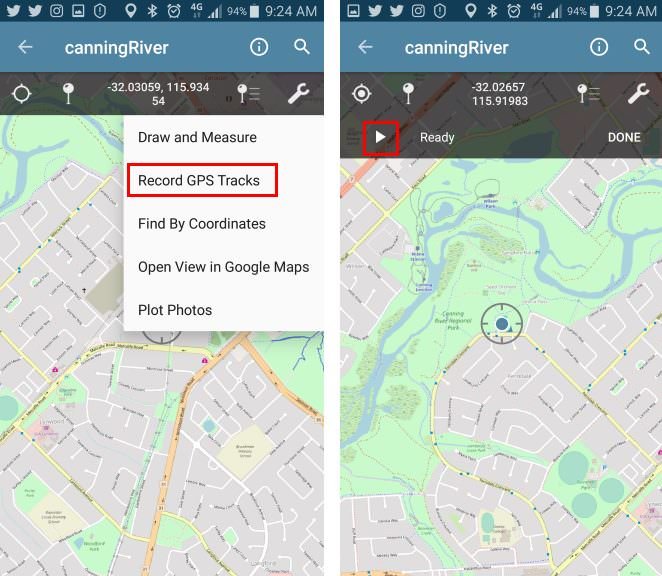
First load the Avenza Maps app (see Part One for install links) on your smartphone. Turn on your phone's GPS, load up the basemap you made in part one, and press the spanner on the top right to access the menu, and select "Record GPS Tracks". When your GPS has a lock on your position, it will say "Ready" next to the "play" triangle, and you can press the triangle to start recording the track, and start walking.
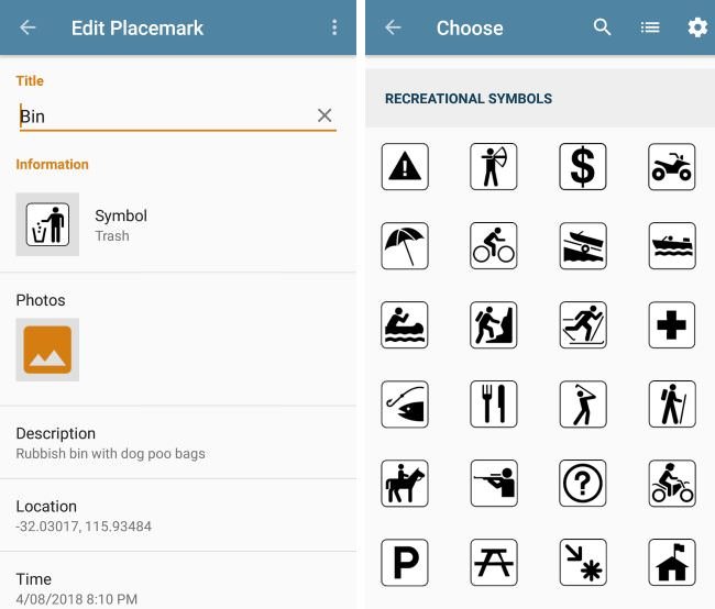
While walking along (and a little way off) the tracks looking for cache spots, we can also capture the location of a few points of interest. Noticing a bit of rubish littering parts of the riverside, and needing somewhere to drop off my dog's smelly droppings, I captured the location of a few rubbish bins by clicking on the "add placemark" button on the Avenza map screen. You can also optionally add a description, photo and custom icon.
A bin probably isn't worth a photo though. Walking a little off the path, toward the rivers edge lots of trees offered branches to hold a small cache safely in place without risking wind, water or muggles dislodging it, and minimal disturbance to the surrounding ecosystem.

Once all caches had been set, and the walk is over, we can stop recording our GPS track by clicking "Done" in the Avenza map window. We can also now see where we walked, and where the things we recorded the positions of are on our base map.

In Part 3, we'll import the track and placemarks into QGIS, and apply some artistic styling to create a custom themed treasure map.
Checkout the other parts...
Part One - Using Avenza Maps and QGIS to create custom maps for free treasure hunting
Part Three - Exporting Avenza Maps catured GPS tracks and placemarks into QGIS
Part Four - Artistic styling in QGIS to create a geocache treasure map (coming soon)